

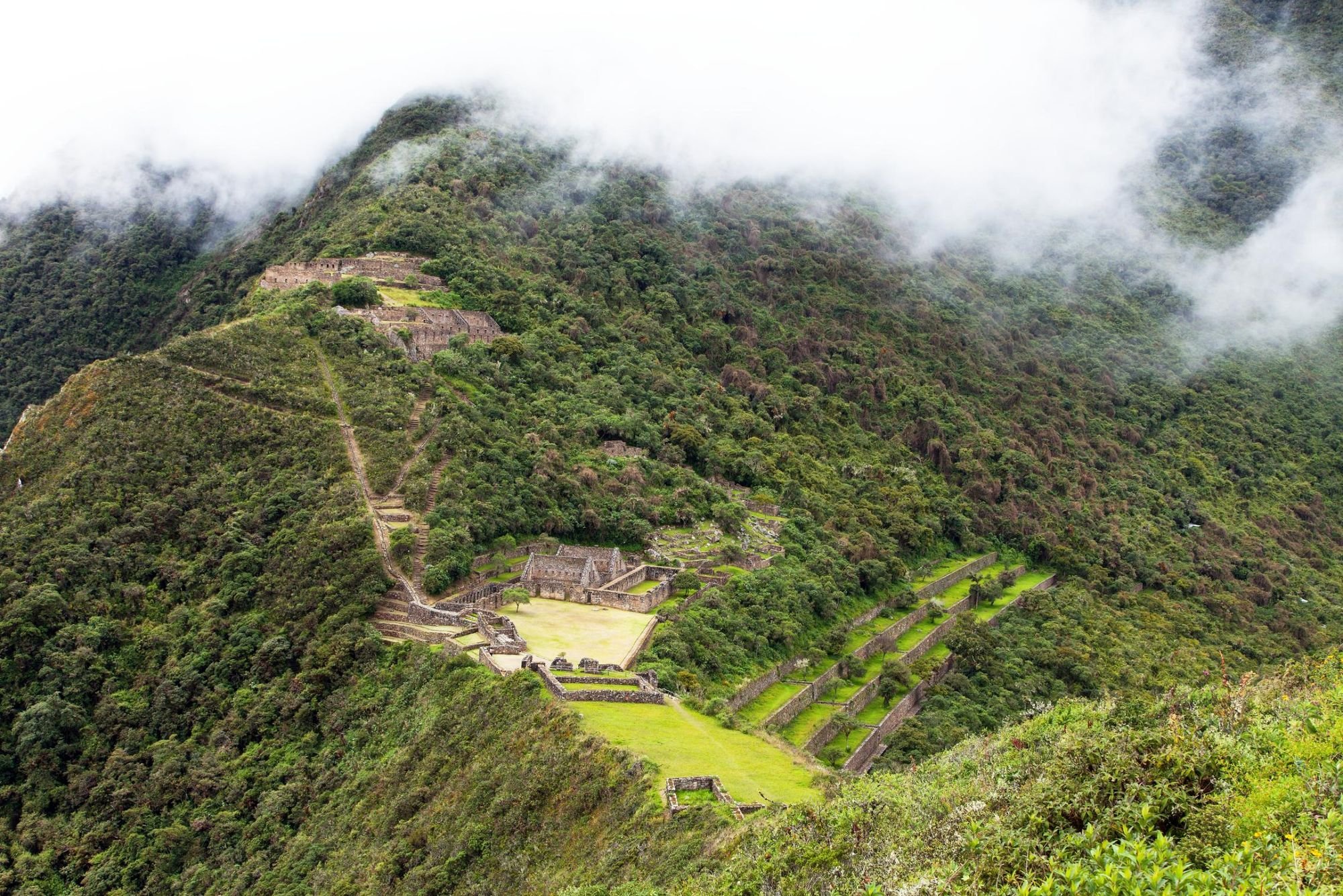
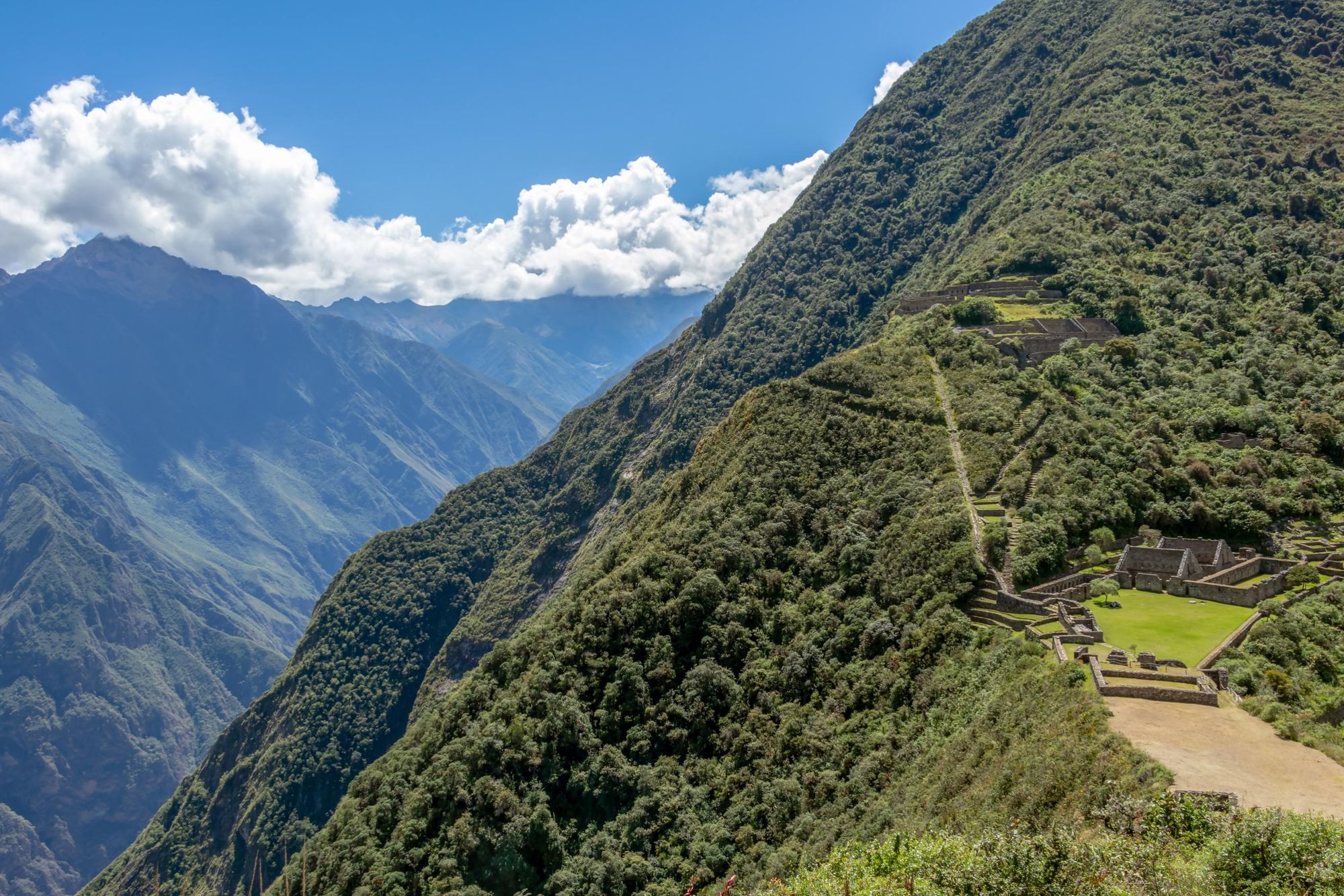
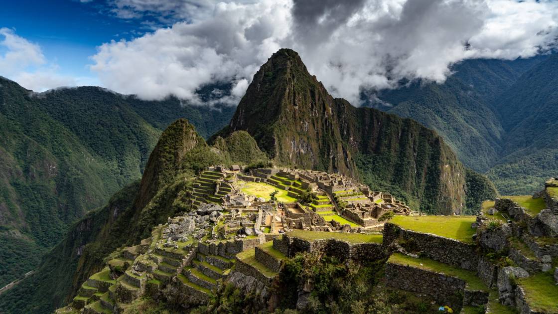
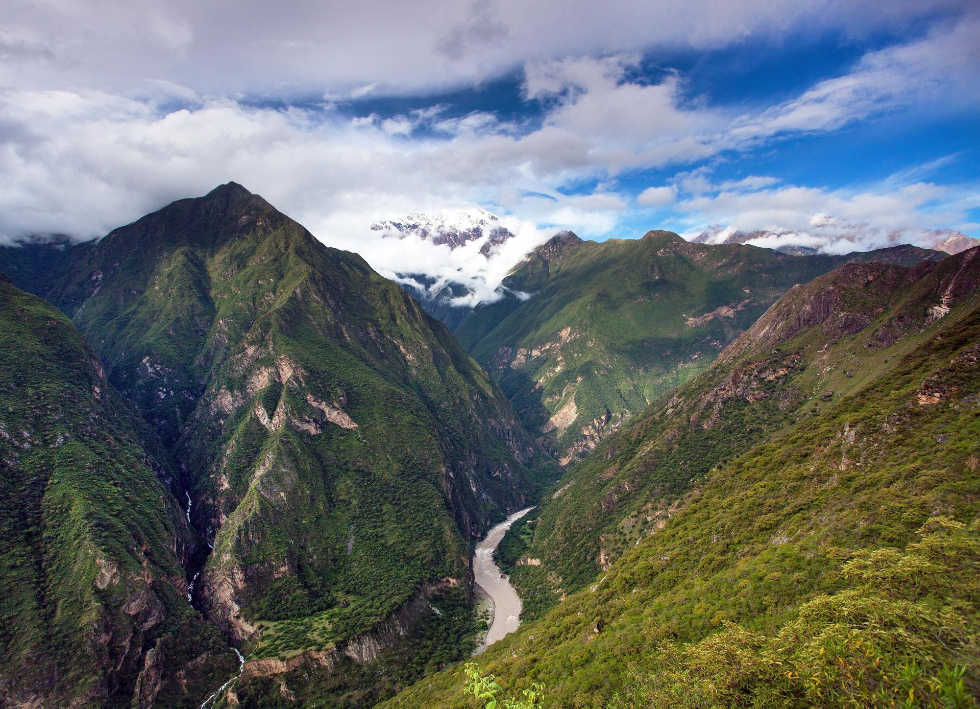
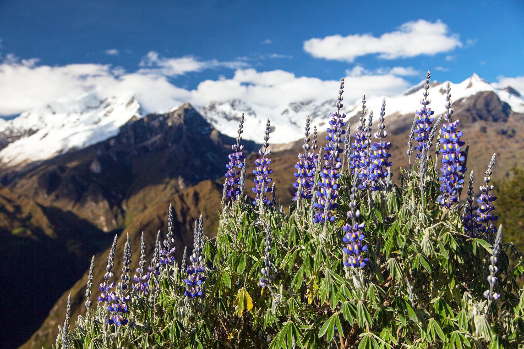
The ancient Inca citadel of Choquequirao - translating from Quechua as ‘Cradle of Gold’ - looks out over the Vilcabamba valley from the slopes of the snow-capped Mount Yanacocha in Peru. The site sits roughly 31 miles (50km) south of Machu Picchu, as the crow - or rather, the condor - flies, though those miles are punctuated by rising and falling mountains, rivers and valleys.
Locally, Choquequirao is known as the 'sacred sister' of Machu Picchu. Both Inca sites were built in the 15th century, on land which is considered to be the estate of Pachachuti, the legendary Inca monarch whose name - meaning “reformer of the world” - is an insight to his historical importance. The two are also architecturally similar; and both mountain sites are remarkably scenic.
There are usually around 10-20 people daily who visit Choquequirao. You get around 5,000 people visiting Machu Picchu every single day.
There is, however, one fact which separates Choquequirao and Machu Picchu.
“There are usually around 10-20 people daily who visit Choquequirao,” says Roxner Cardenas, a destination expert born in a small community outside of Machu Picchu, who has spent his life trekking in the area. “You get around 5,000 people visiting Machu Picchu every single day. Even during the high season, the most people you get visiting Choquequirao in one day is 50-60. No more.”
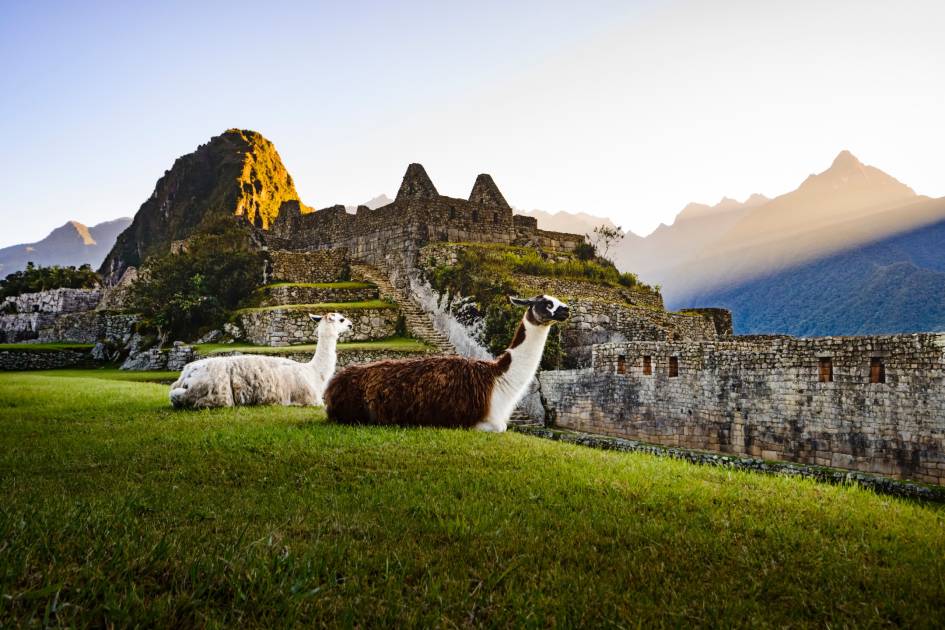
So, why is that? Few who venture to Peru do so without the desire to visit Machu Picchu. That’s understandable - it’s perhaps the most scenic architectural, archaeological site in the world, drenched in history, folklore and surrounded by jagged mountains. But perhaps the most exciting route to Machu Picchu - and the most exciting trek in Peru - is the route which combines that famous site with a trek to Choquequirao, also passing the Inca site of Llactapata en route.
An out-and-back to Choquequirao takes four-to-five days from the nearby town of Cachora. A thru-hike involving Choquequirao and finishing at Machu Picchu takes closer to nine days. It's a tough, demanding trail - but an unforgettable one.
“It’s the longest trek you can do here,” says Roxner. “It’s the hardest trek too. If you’re looking for a challenge, then this is perfect. The Choquequirao trek is designed for hikers who are looking for something new, and are looking for something a little more tranquil and less trodden than the Inca Trail or Salkantay Trek. It’s for hikers who are looking for something more remote, still visiting Machu Picchu at the end but seeing other Inca ruins first - without the crowds.
“When you reach Choquequirao, and when you’re on the trek, you're going to be alone. You'll have it almost to yourself. It's totally different to other treks here."
The History of Choquequirao: Then and Now
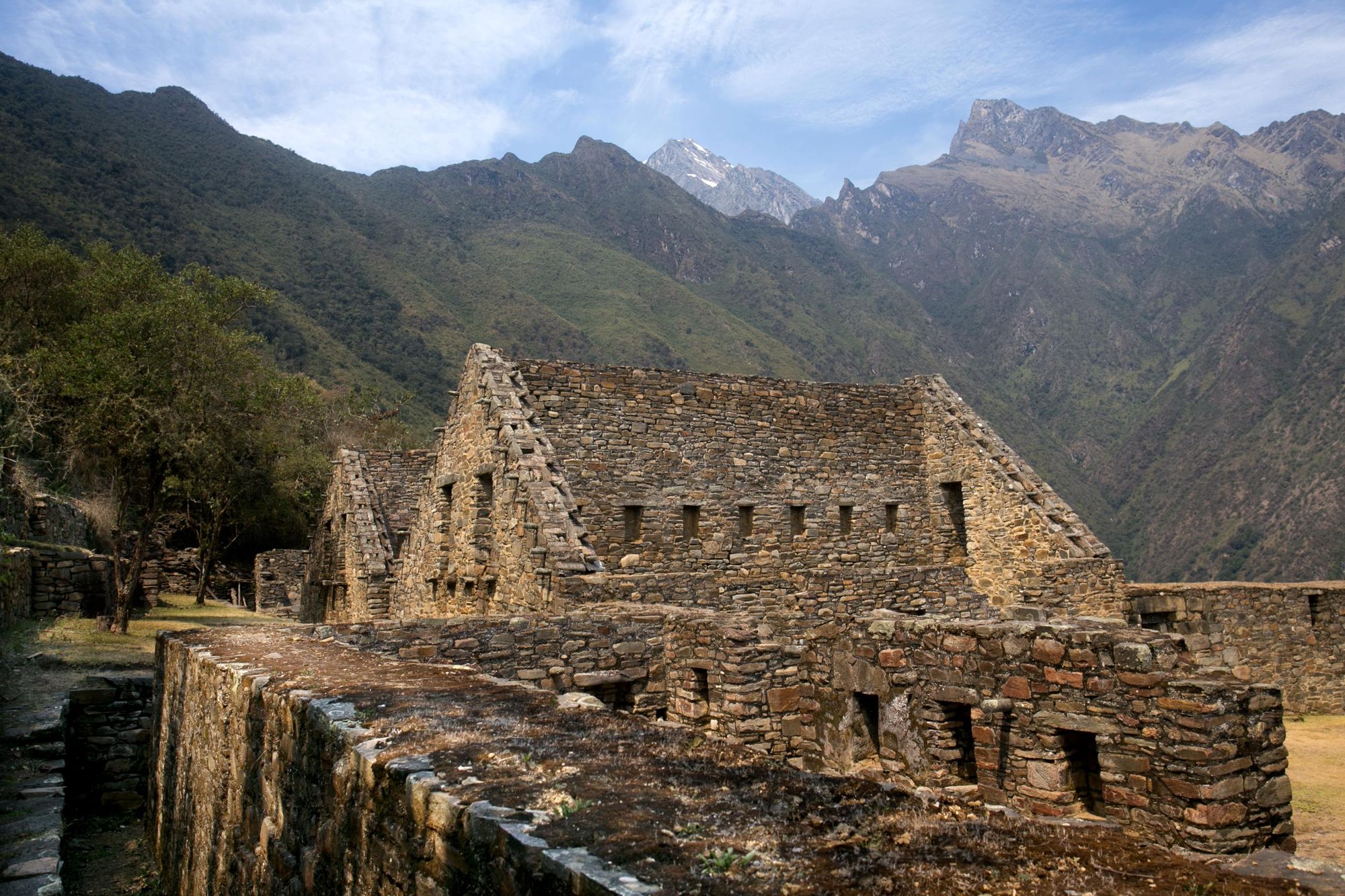
Choquequirao, much like Machu Picchu, was built during the height of the Inca empire, in the 15th century. It’s thought that the two sites were built roughly around the same time. “They say that Choquequirao is the sister of Machu Picchu,” says Roxner. “The construction and the architecture is pretty much the same as how you would see the buildings at Machu Picchu.”
The site of Choquequirao is part of the history of the Inca resistance.
It’s believed that Choquequirao was used as a gathering point for the Inca rebellion. “It’s where the Incas went to organise and gather their people in order to fight against the Spanish conquistadors,” Roxner says. “This is where the Incas went after the Conquistadors conquered Cusco City in 1533.
“The site of Choquequirao is part of the history of the Inca resistance.”
Indeed, the Spanish, led by Francisco Pizarro, took the Inca capital of Cusco on 15 November 1533, but Inca retaliation followed. In 1536, emperor Manco Inca Yupanqui had besieged a garrison in Cusco, and in vengeance, the armies of Pizarro attempted to crush the Manco Inca's forces in his hometown of Ollantaytambo in January 1537. While the Incas actually won this battle, Manco Inca decided that Ollantaytambo was too close to Cusco, and decided to retreat.
They began to move steadily west. “That's when they went to Choquequirao and Vilcabamba and all these areas,” says Roxner. “They were there until 1572 - so for more than 30 years, trying to re-organise their army, until finally the Spanish made their way in to kill them.”
The Conquistadors never actually discovered Choquequirao itself, though. Rather, the Spanish explorer Juan Arias Diaz came across it in 1710 - and even then, it was not immediately excavated. That didn’t happen until the 1970s, due to the challenging nature of the site. Not only is Choquequirao more remote than Machu Picchu, it’s also higher, sitting at a height of 3,050m above sea level, more than 600m higher than Machu Picchu, which sits at 2,430m.
Today, the site is well known amongst locals, but tourism is still in its infancy.
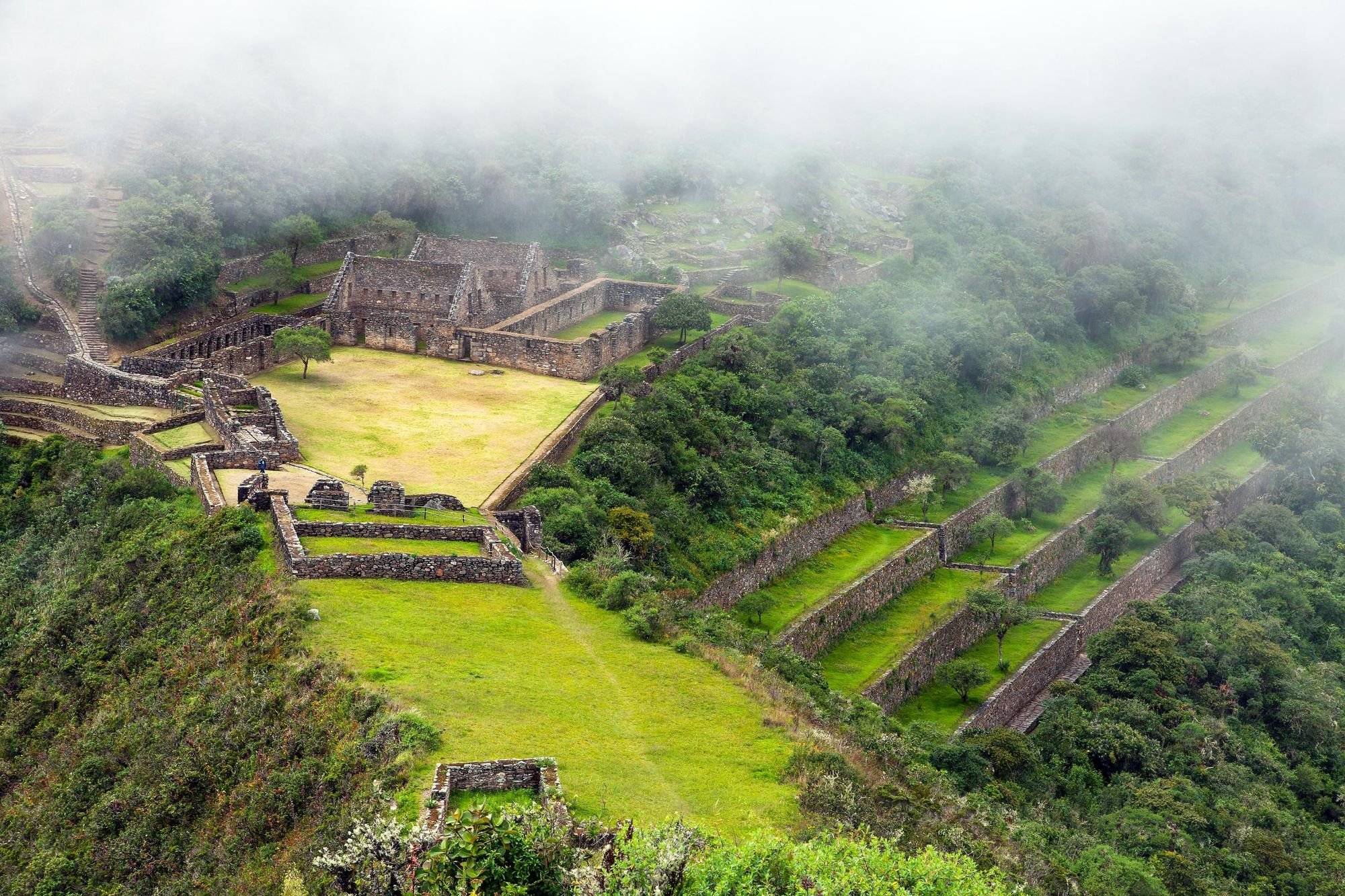
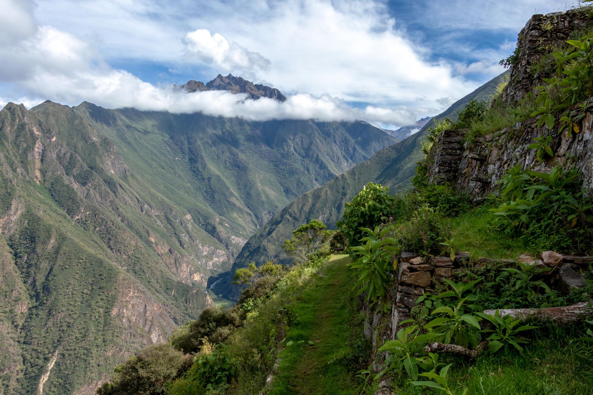
The excavated site at Choquequirao consists of several sectors. It was once “a political and religious centre well served by a complex system of aqueducts, canals and springs,” writes Dilwyn Jenkins in Peru. “Most of the buildings are set around the main ceremonial courtyard or plaza and are surrounded by well-preserved and stylish Inca agricultural terracing.”
Roxner adds: “Guests who visit feel like Indiana Jones. You feel like you're the ones re-discovering it. Some buildings have been restored but there are still so many covered by the jungle; so sometimes people find something new. People really feel like it was worth the effort on the hike to discover all of this.
A lot of Choquequirao is still hidden in the forest.
“A lot of visitors say that Choquequirao is more interesting than Machu Picchu, and one of the reasons for that is that in Choquequirao, you're able to walk wherever you want to go; whereas at Machu Picchu you have to follow certain restrictions and walkways around the city.”
Rough Guides write that Choquequirao feels “similar to what Hiram Bingham may have experienced at Machu Picchu when he stumbled on the site back in 1911.”
The Trek from Choquequirao to Machu Picchu
- Distance: 62 miles (100km)
- Start/Finish: Capuliyoc (2,915m)/Machu Picchu (2,430m)
The Choquequirao trek to Machu Picchu shouldn't be underestimated. It's tough.
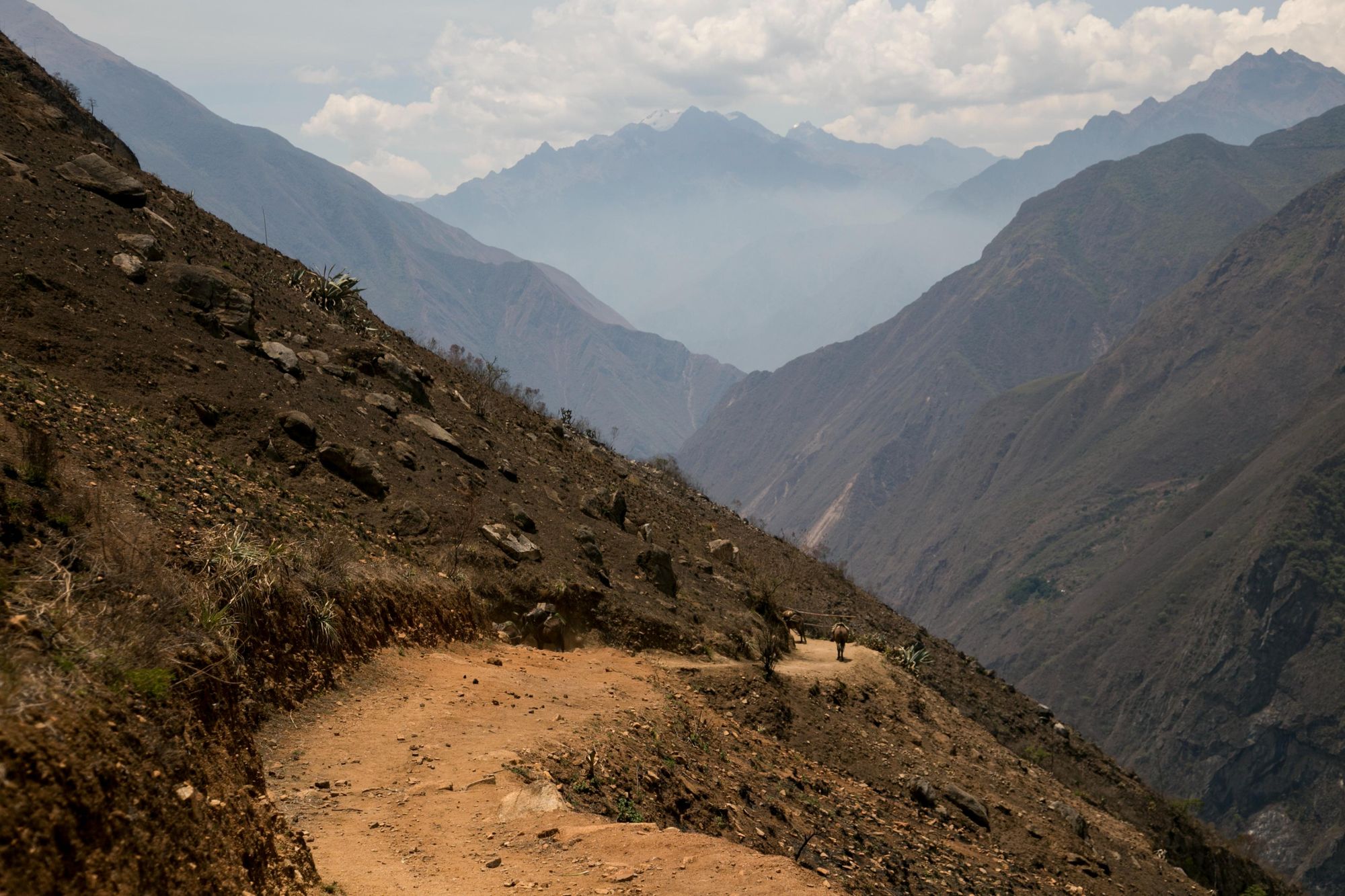
“A trekker should do a lot of training before coming to do this hike,” says Roxner. “What makes it so difficult is the variation in the terrain. You go from very high areas to very low areas. On day one, you start at a height of over 3,000m above sea level, then you drop down to the canyon, at around 1,400m.
"Later in the trek, you have to climb back up to over 3,000m, and then you have to go up to above 4,000m. So the climb is demanding - and it's very dry and very arid. But you are supported by your guide and porters, and you have horses along the way in case someone gets sick or if they are too tired to go on the uphills - because the uphills can be very steep.” The rewards of the route are vast, though.
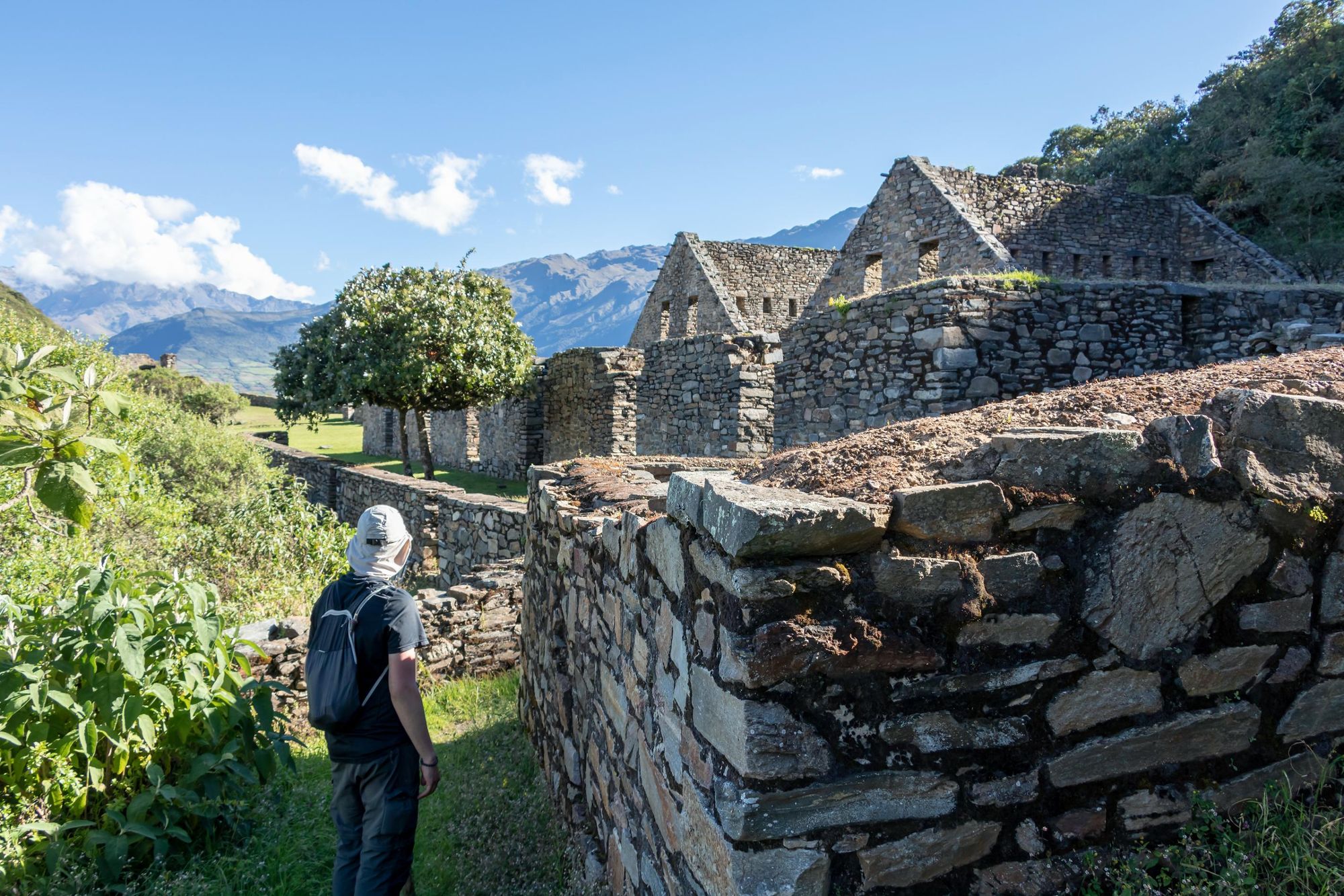
The whole thing is beautiful. You pass through Inca ruins you just wouldn't see in other places.
“You go through different ecosystems and you see different Inca sites along the way,” says Roxner. “It's not only hiking, either. We take one day to explore the city of Choquequirao when we arrive - and during that time you'll see around 50% of the city. A lot of it is still hidden in the forest.
“There are specific camps along the way to Choquequirao, run by locals, with really great views. At Pinchuyniyoc you can still camp on Inca terraces, and at Maizal you camp at around 3,000m with views of Choquequirao. It's a beautiful site, looking over the mountains, with great people. And beyond Choquequirao, on the route to Machu Picchu, you pass through cloud forest. The whole thing is beautiful. You pass through Inca ruins you just wouldn't see in other places.”
Day 1: Capuliyoc to Chiquisca (5 miles/8km)
The Andes open up in front of you when the road ends at Capuliyoc (2,195m) lookout, a short drive from Cachora; the gateway town to the Choquequirao hike. From here, you’ll head to the pass of Capuliyoc, where you’ll first see Choquequirao. Then it's 2,000m of descent to the Apurimac River. Heading into the canyon, you’ll hike past Cocamasana campsite to reach Chiquisca at 1,900m.
Day 2: Chiquisca to Choquequirao (8.5 miles/14km)
This is an 8-9 hour day of hiking, so leave Chiquisca early. You’ll begin by descending to the Apurimac River, and then climb out the other side of the canyon. Trekkers should take hydration seriously here, and carry several litres of water with them. The first respite on this tough climb comes at Santa Rosa Baja, where you can usually top up your water, around 1.8 miles (3km) and 700m up.
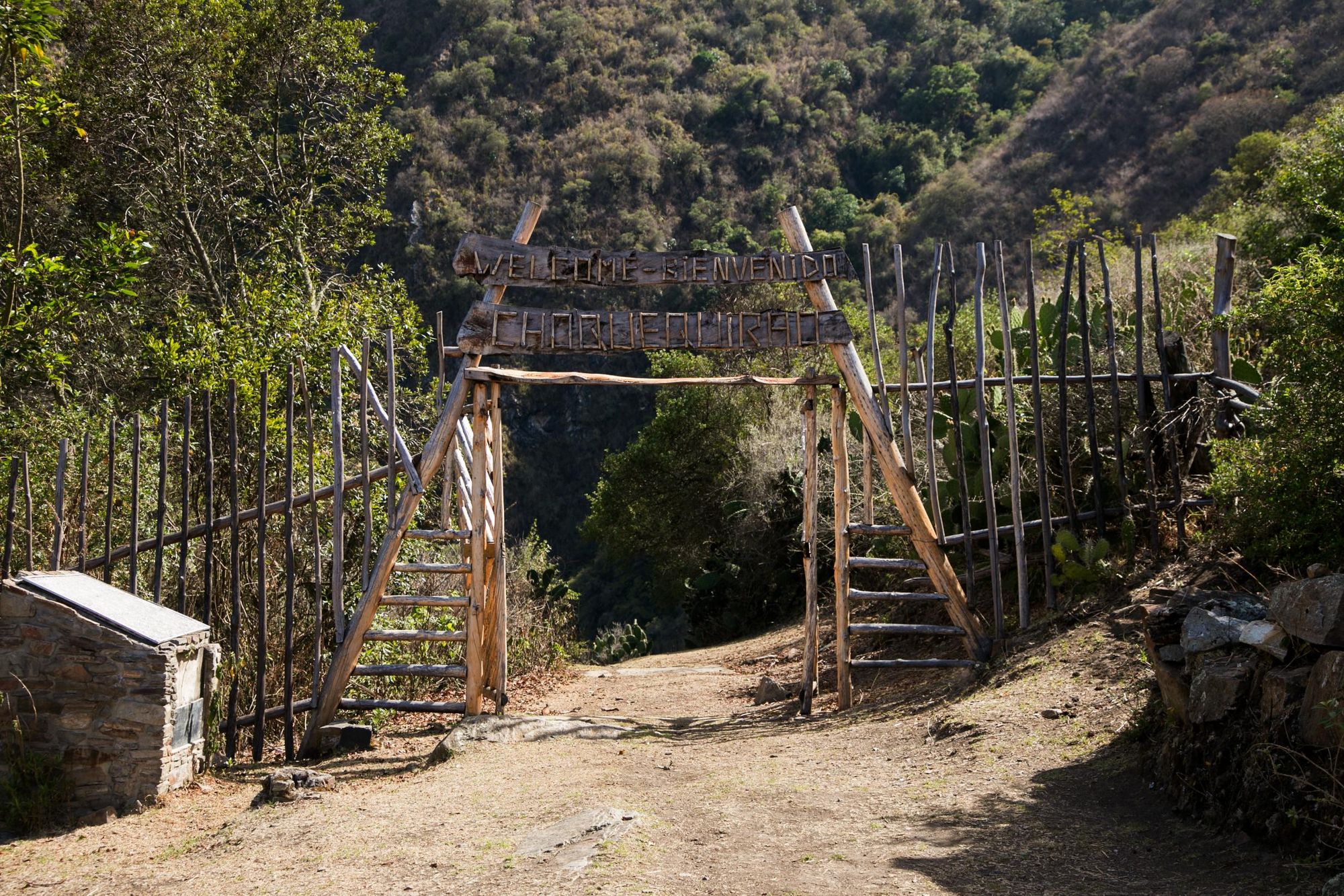
You’ll then face a tough ascent onwards to reach Maranpata, a fantastic site to camp, where you can stop for lunch. The bulk of the uphill is done at this point, and from here, it’s only 2.5 miles (4km) to Choquequirao.
Day 3: Choquequirao to Pinchuyniyoc (5 miles/8km)
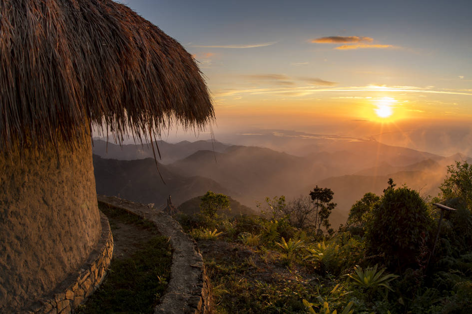
This is your day to explore Choquequirao; the remarkable archaeological site. You’ll have most of the day to explore the citadel, before climbing the Abra Choquequirao pass (3,318m) and descending to Pinchuyniyoc. Pitch your tent on old Incan terraces and watch the sun set.
Day 4: Pinchuyniyoc to Maizal (6.2 miles/10km)
After waking up to remarkable views out over the Andes (as above), it's a steep downhill trek to the Rio Blanco (1,990m). The second half of the day is quite the opposite; a steep and challenging climb on switchbacks, as you make your way to the small clearing of Maizal (3,000m), a mountainside campsite.
Day 5: Maizal to Yanama (7.5 miles/12km)
A demanding climb opens day five on the route. Parts of the hike will mercifully be shaded by cloud forest as you ascend to the Victoria Mines at 4,000m. Next it’s onto Abra San Juan (4,130m), where should keep your eyes open for Andean condors, and after lunch you descend down to the village of Yanama (3,600m).
Day 6: Yanama to Totora (8.5 miles/14km)
A gentle morning on the trek will see you pass waterfalls and remote homesteads as you climb the Yanama Pass, which at 4,627m, is the high point of the Choquequirao to Machu Picchu hike. On the other side of the mountain, though, it’s a long descent all the way to Totora (2,980m).
Day 7: Totora to Lucmabamba (8.5 miles/14km)
The trailhead for this stretch of the hike is actually at Colpapampa, usually reached by a short drive from Totora. You’ll then follow the Santa Teresa River through the rainforest, reaching a beautiful waterfall and camp at Lucmabamba. There’s a coffee plantation you can tour and you can ease the muscle ache with a well-earned soak at the Cocalmayo hot springs.
Day 8: Lucmabamba to Aguas Calientes via Llactapata (8 miles/13km)
A final stretch of rainforest will take you to the Llactapata Inca complex (2700m), from which you can see Machu Picchu on an opposite mountain in the distance. This complex has long been used as a rest stop and shrine en route to Machu Picchu - and it’s thought that even the Inca people used it for this purpose. From Llactapata, it’s a short train ride to Aguas Calientes; gateway to Machu Picchu.
Day 9: Aguas Calientes to Machu Picchu (6.2 miles/10km)
There are two ways to get to Machu Picchu from Aguas Calientes. You can either grab the bus, which takes 30 minutes and costs around 12 USB, or you can hike. If you do the latter, you’ll be climbing for around two hours, over 6 miles (10km).
The Direct Trek to Choquequirao
- Distance: 39.6 miles (64km)
- Start/Finish: Cachora (2,920m)
The quickest way to visit Choqueqirao is and out-and-back from Cachora in Apurimac, around 100 miles (160km) west of Cusco. From Cachora, the hike to Choquequirao is around 18 miles (30km) on the same demanding terrain as above. The route involves a lot of ascending and descending, so this is covered over a four-five day out-and-back. Tours leave on demand (and so, daily) from Cusco.
Day 1: Cachora - Chiquisca (10.5 miles/17km)
Leaving the central plaza in Cachora, this route will take you 12km to Capuliyoc on a bumpy road which has some signage for Choquequirao. From Capuliyoc onwards, the Salkantay range will open up before you. You’ll head to the pass of Capuliyoc, where you’ll get a sighting of Choquequirao, and then drop sharply down (thousands of metres) to the Apurimac River. Heading into the canyon for the option to camp at Cocamasana or further on, at Chiquisca.
Day 2: Chiquisca - Maranpata (6.8 miles/11km)
As above, this is a huge day of hiking, so leave Chiquisca early - with plenty of water - and descend to the Apurimac River, then cbegin the climb out the canyon. Staying hydrated is key here. The first respite comes at Santa Rosa Baja, where you can top up your water. You’ll then face a brutal ascent up to Maranpata, which is a fantastic place to pitch your tent, and the closest town to Choquequirao.
Day 3: Maranpata - Choquequirao - Chiquisca (11.8 miles/19km)
It’s a 2.5 mile (4km) walk from Maranpata to Choquequirao on a rolling gradient. Depending on how long you spend at Choquequirao, it may then be wise to stay for an extra night - either camping at Choquequirao or again at Maranpata. The four-day route here requires you to make the full descent back to Chiquisca. This would require an early start and careful planning.
Day 4: Chiquisca - Cachora (10.5 miles/17km)
Follow your footsteps from day one back to Cachora, completing the hike.
Choquequirao Cable Car Plans
There has long been talk of a cable car being built to run up Choquequirao. The route would be divided into two sections; the first starting in the village of Kiuñalla (2,975m) and running for 2 miles (3.5km) to the Pajonal station (2,476m), and the second running 1.2 miles (2km) from Pajonal to Choquequirao itself.
As you may imagine, there are mixed feeling around these plans. On one hand, they would make the site much more accessible, bringing more footfall, and so more income, to certain parts of the region. On the other hand, the cable car would remove the magic that comes with only being able to visit Choquequirao via a strenuous hike, and the site would also become more crowded.
"It may happen in the next three years," says Roxner. "Then you'll be able to visit Choquequirao in one or two days. It would be good for some locals and not so good for others. I wonder what will happen to those who have shops along the route, or those who work with horses, who will not get as much benefit from tourism."
Best Time of Year to Hike to Choquequirao
The climate around Cusco is divided into the rainy season and the dry season.
“The best time of year to hike this is from May through to October,” says Roxner. “This is because this is the dry season, which means it's really safe. The trail is pretty safe in general, but in the rainy season there might be some landslides, so it is not the best time to hike.”
Dry season days usually sit around 17°C and 19°C, getting colder at night (remember you’re at altitude). The temperatures at night can even drop below zero from June-August, which is Peru’s winter, and also peak season for hiking and cultural tourism. Spring starts in September.
Inspired? Check out our trek from Choquequirao to Machu Picchu!