


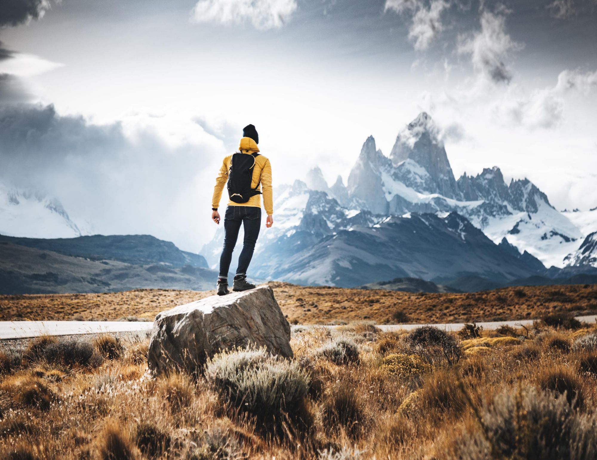
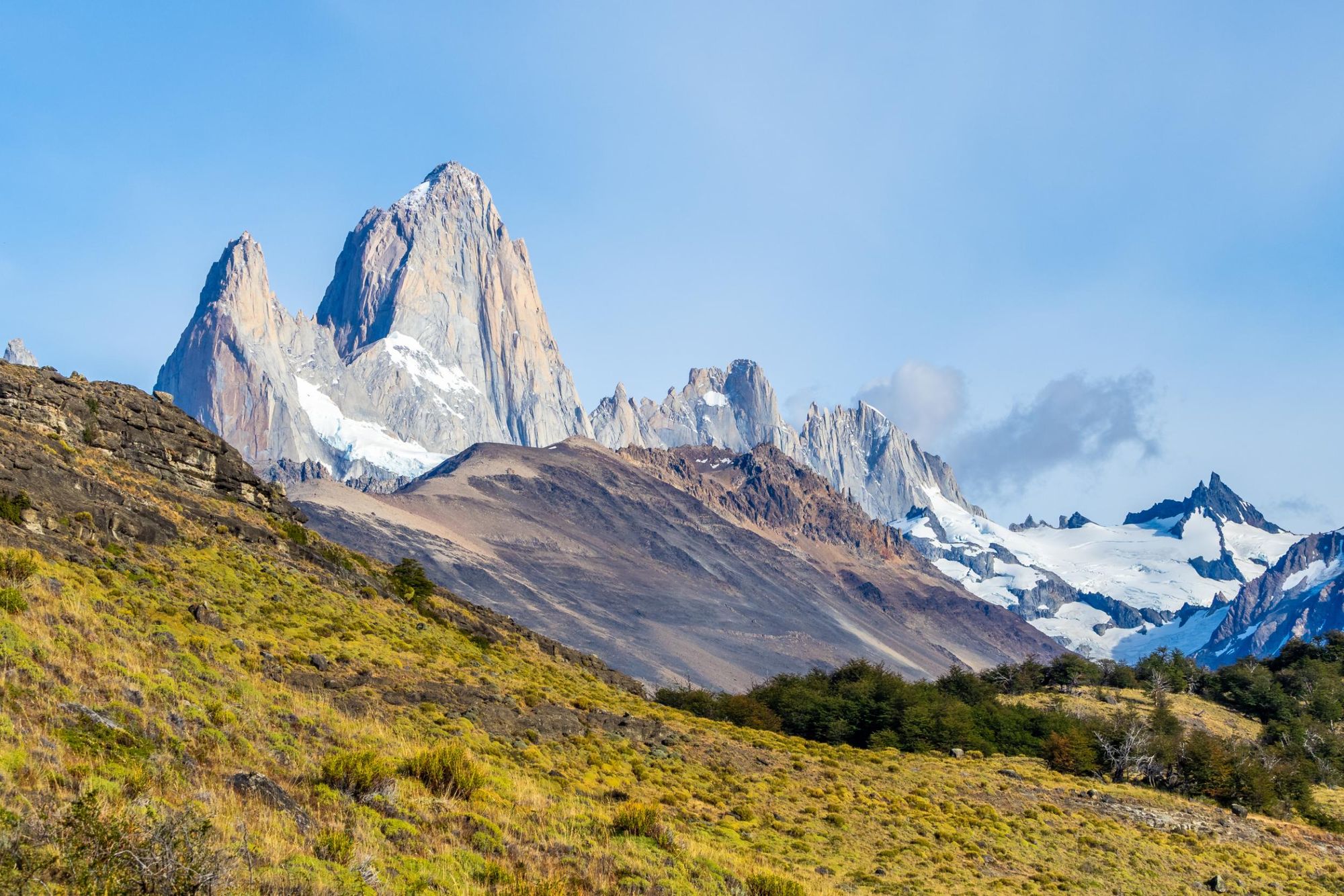
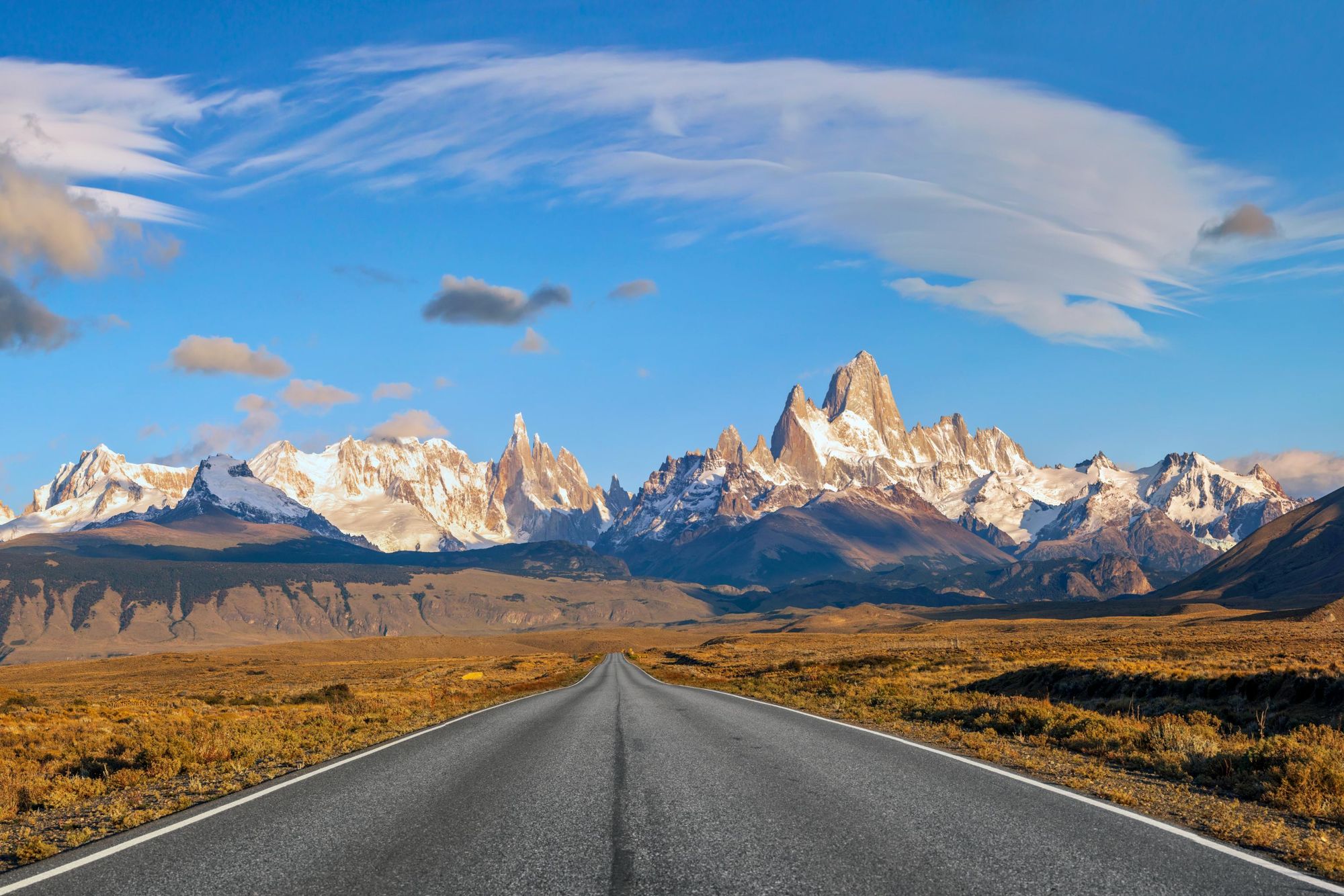
Los Glaciares National Park is a vast UNESCO-listed wilderness in Argentine Patagonia, set up to protect the Patagonian Ice Field, a mass of ice consisting of vast glaciers draining into turquoise lakes. It includes spiky granite mountains such as Cerro Fitz Roy (3,405m/11,171ft) and needle-like Cerro Torre (3,128m/10,262ft), which rise up above the ice.
Surrounding the glaciers you’ll find expanses of Patagonian grassland known as steppe, forests of lenga and ñire trees (both different species of beech), and rocky slopes of glacial moraine. Rivers thread through the rugged landscape, leading to gushing waterfalls.
Needless to say, it’s a dream destination for hikers, with numerous trails criss-crossing this rugged wilderness.
We call it the trekking capital of Argentina
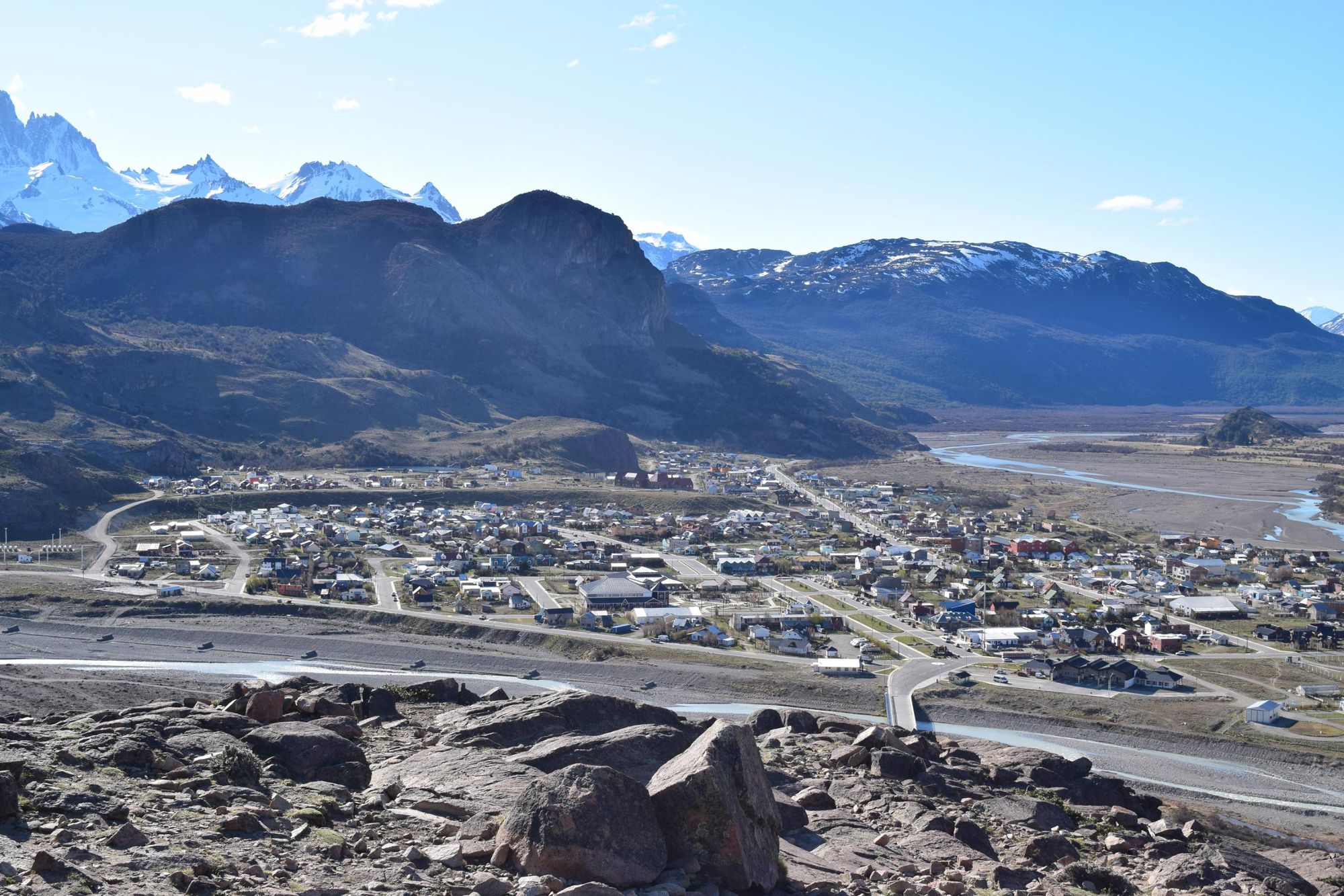
“In the north of the park is El Chaltén. El Chaltén is a town inside the national park. We call it the trekking capital of Argentina, because from the door of your hotel you can do hundreds of hikes,” says Agata West, who works in adventure travel and lives in Patagonia.
“We have these beautiful, famous hikes to see Mount Fitz Roy and Cerro Torre, which are the two iconic mountains here. But there are also quieter trails which immerse you in the landscape.”
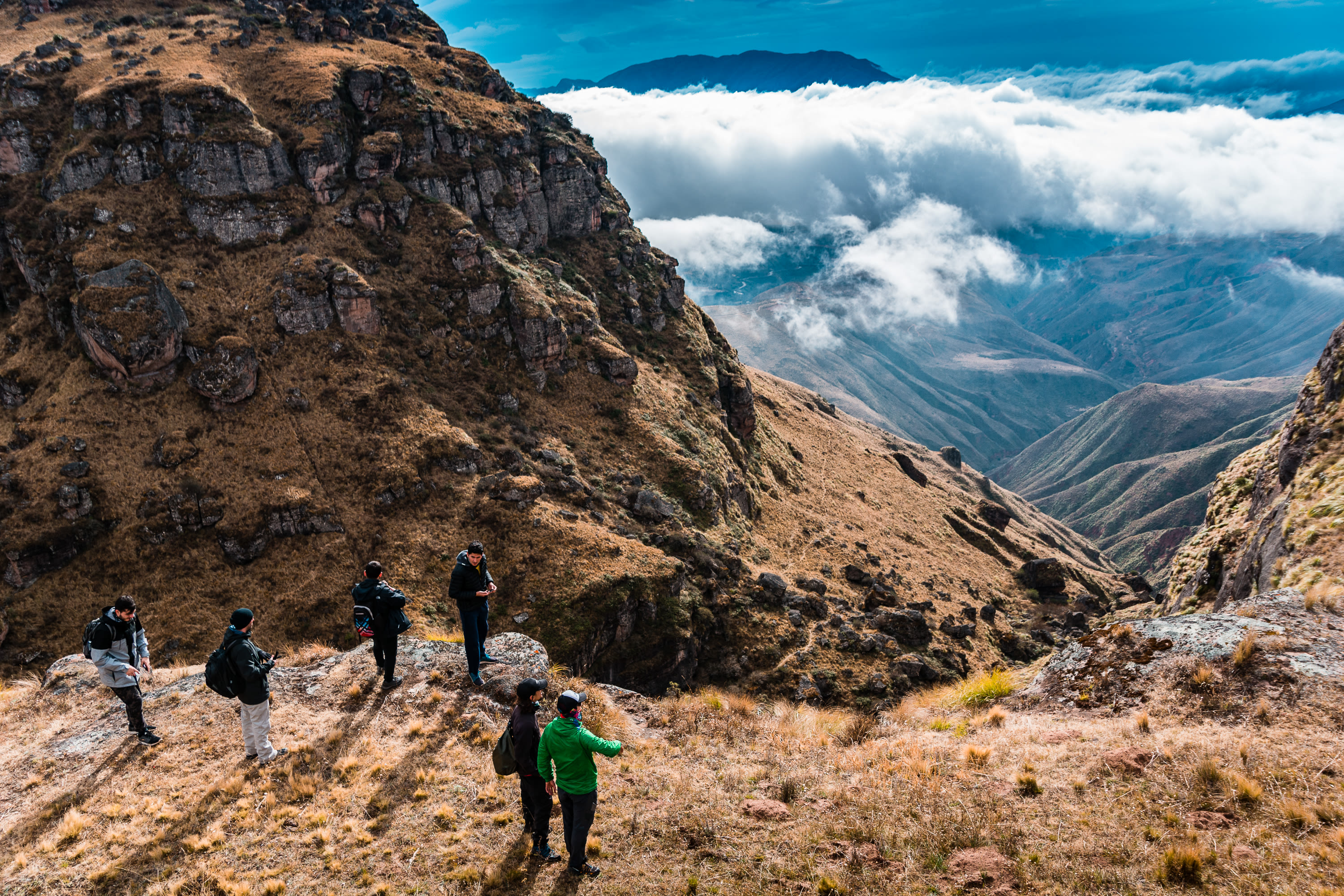
Agata has selected her five favourite day hikes in the northern section of the park, which cover a range of difficulty levels.
1. Cerro Torre
2. Laguna de Los Tres
3. Pliegue Tumbado
4. Mirador de los Cóndores
5. Chorrillo del Salto
Here are the five best hikes in Los Glaciares National Park, with brief route descriptions.
Read more: The Complete Guide to Los Glaciares National Park, Argentina
The Best Hiking Trails in Los Glaciares, Mapped
We've mapped the trailheads of our favourite hikes in Los Glaciares, taking you through steppe, glacial moraine and old growth forest.
1. Mirador del Torre
- Start/Finish: El Chaltén (out and back)
- Distance: 4.3 miles (7km)
- Walking time: 3-4 hours
- Difficulty: Moderate
- Best for: views of Cerro Torre
Follow a well-marked path that winds gently uphill through a dense lenga (southern beech) forest. As you climb, views open up over the Fitz Roy River canyon, carved deep into the rock. At the Margarita Viewpoint you have a panoramic view of Cerro Torre and Cerro Chaltén, while the Margarita waterfall is visible on the other side of the river.
After 90 minutes to two hours of walking, you’ll arrive at the Cerro Torre viewpoint – a sweeping natural balcony overlooking a valley etched by millennia of ice. From here, the iconic Cerro Torre and its jagged siblings loom on the horizon, framed by the outlines of ancient moraines. Return the way you came.
“This viewpoint is actually the halfway point on a longer hike to Laguna Torre, so you can keep walking if you want to go all the way,” Agata says.
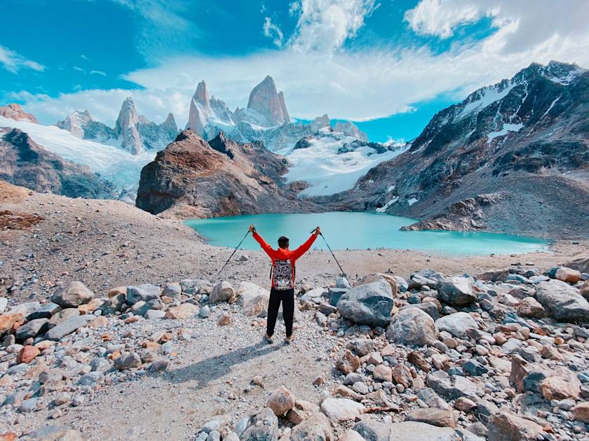
2. Laguna de Los Tres

- Start/Finish: El Chaltén (out and back)
- Distance: 15.5 miles (25km)
- Walking time: 8-9 hours
- Difficulty: Challenging
- Best for: views of Fitz Roy
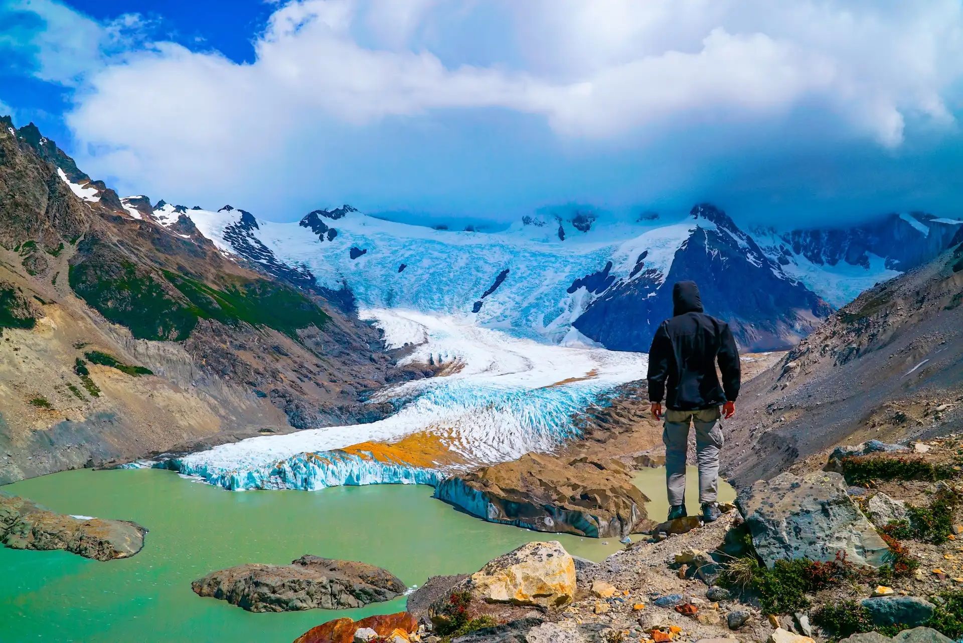
One of the most challenging day hikes takes you to Laguna de Los Tres, a glacial lake at the foot of Mount Fitz Roy, the most iconic peak in the park. Follow the trail through a forest of lenga trees. It climbs steeply up to a viewpoint of the gushing Río de las Vueltas.
From here, the trail follows the Del Salto Stream, entering the valley leading towards Mount Fitz Roy. You’ll pass through a forest of ñire trees (Antarctic beeches), emerging out onto a rocky viewpoint of the surrounding mountains and rivers. Continue along the trail, which follows the Del Salto Stream, before reaching its drainage point, the Laguna Madre e Hija.
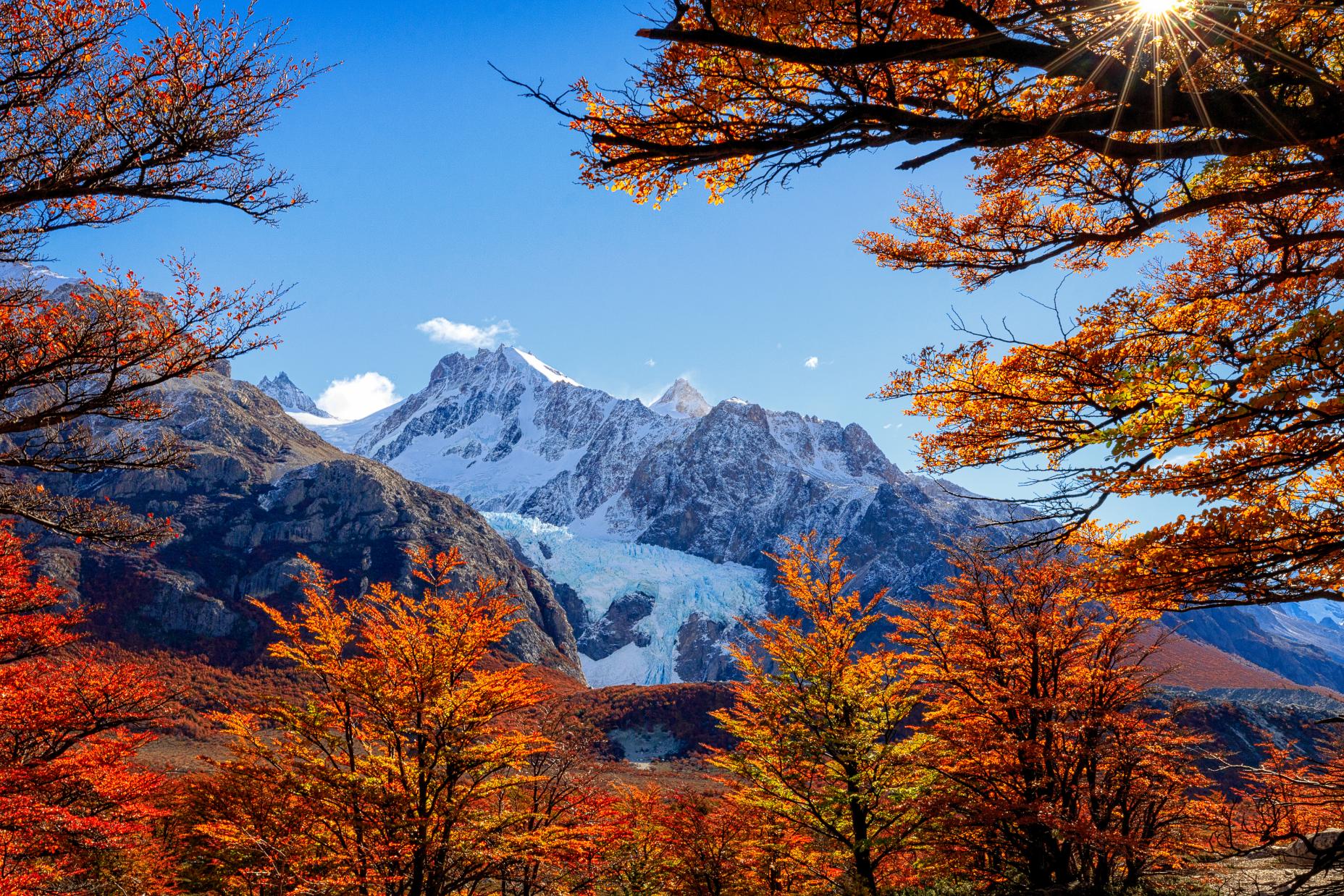
Now you’ll follow the larger Río Blanco upstream, and the first glaciers begin to appear, including Marconi and Eléctrico. You’ll reach the Piedras Blancas Glacier viewpoint, where a towering wall of ice tumbles down the mountainside in brilliant shades of blue – a great place to stop and take in the scenery.
Continue on through the forest to Poincenot Camp, where the skyline opens to reveal Fitz Roy and its surrounding spires – Saint-Exupéry, Poincenot, and Mermoz. Then comes the final push: a steep, rocky 400m (1,312ft) ascent up glacial moraine.
The path is beautiful and you have many viewpoints along the way
It’s a tough climb, which can take up to two hours, but cresting the ridge to see Laguna de los Tres – turquoise, windswept, and ringed by glaciers at the foot of Fitz Roy – is breathtaking. Skirt the lagoon and you’ll also have views of the adjacent Laguna Sucia. After relaxing a while, it’s back the way you came.
“It's a very hard day of trekking. But the good thing about this trail is you don't need to reach the end to see Fitz Roy,” Agata says. “The path is beautiful and you have many viewpoints along the way. You can hike to Piedras Blancas and then turn back, for example.”
3. Pliegue Tumbado
- Start/Finish: National Park Ceferino Fonzo Visitors’ Centre (out and back)
- Distance: 13 miles (20.9km)
- Walking time: 7-8 hours
- Difficulty: Challenging
- Best for: views of Fitz Roy and Cerro Torre
Agata recommends the Pliegue Tumbado trail as a lesser-known alternative to Laguna de Los Tres.
“You don't have much forest; if you have wind, you are very exposed,” she says. “The terrain is quite rocky, also all the time ascending. So it's challenging, but the advantage is you can get a view of the Fitz Roy Valley and the Cerro Torre Valley. It's the only point where you can see the two mountains, which is quite impressive.”
You can get a view of the Fitz Roy Valley and the Cerro Torre Valley. It's the only point where you can see the two mountains
From the visitors’ centre, follow the right hand path towards Pliegue Tumbado. You’ll be heading uphill for around 1,100m (3,610ft) in total. After around an hour you’ll cross Pampa De las Carretas, a grassy plain with views of the Andes to the north. Follow the trail into a forest.
Once you’ve reached an elevation of around 1,000m (3,281ft), the trees give way to bouldery scrubland. You’ll continue walking up an exposed scree slope to reach the Pliegue Tumbado viewpoint, which has a spectacular view of both Cerro Torre and Mount Fitz Roy.
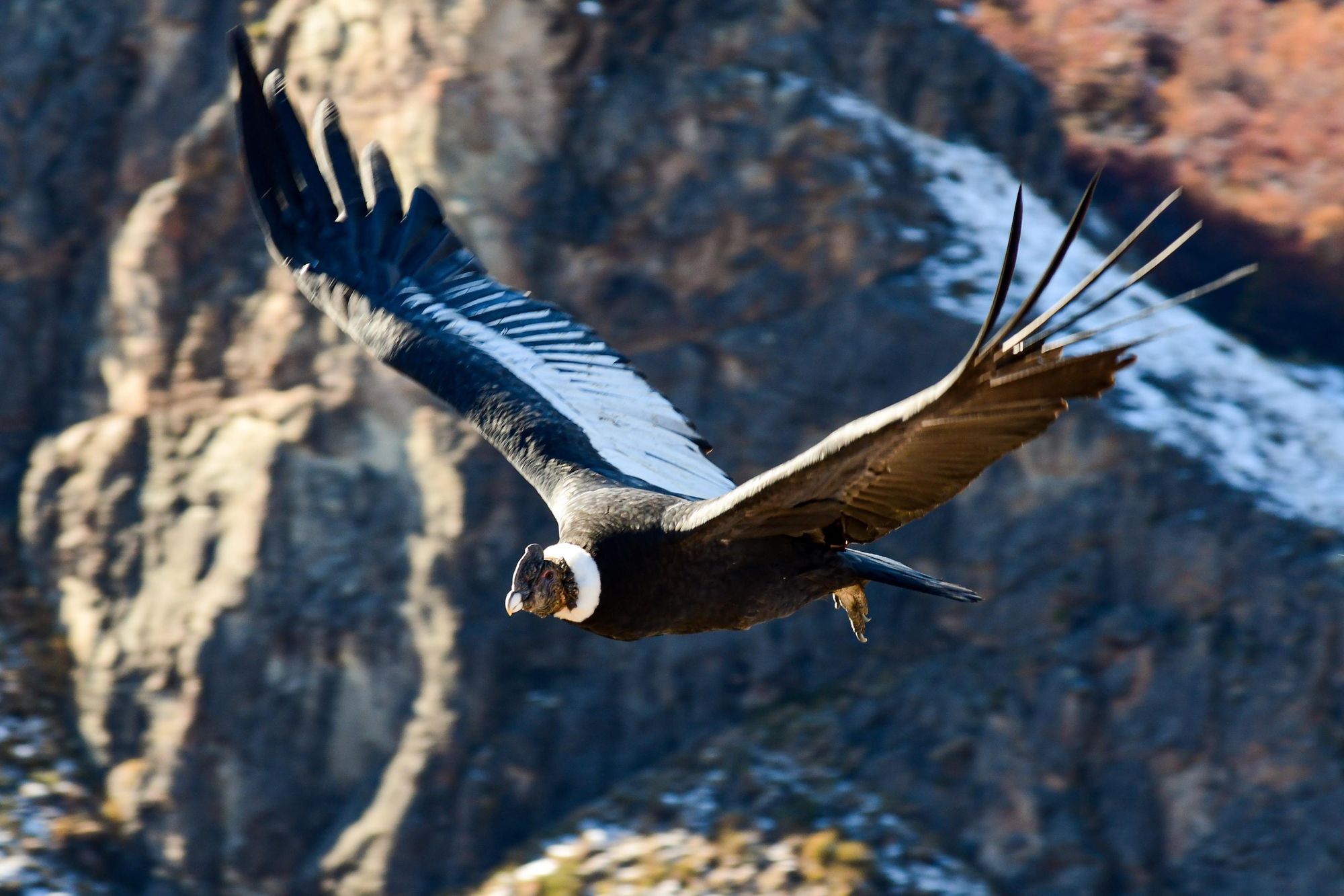
4. Mirador de los Cóndores
- Start/Finish: El Chaltén
- Distance: 3.7 miles (6km)
- Walking time: 2 hours
- Difficulty: easy
- Best for: condor spotting
An easy signposted hike to a viewpoint which is known as an observation point for condors, as it’s on their flight path between the De Las Vueltas and Fitz Roy river valleys. From El Chaltén, cross the Fitz Roy river and continue along the trail to the National Park Visitors’ Centre. From here, follow the left hand trail over grassland, climbing uphill to the Los Cóndores viewpoint.
The Andean condor is one of the largest flying birds in the world, and you have a great chance of spotting it from here. This is also a good place to watch the sun set over El Chaltén, and the majestic peaks that surround it.
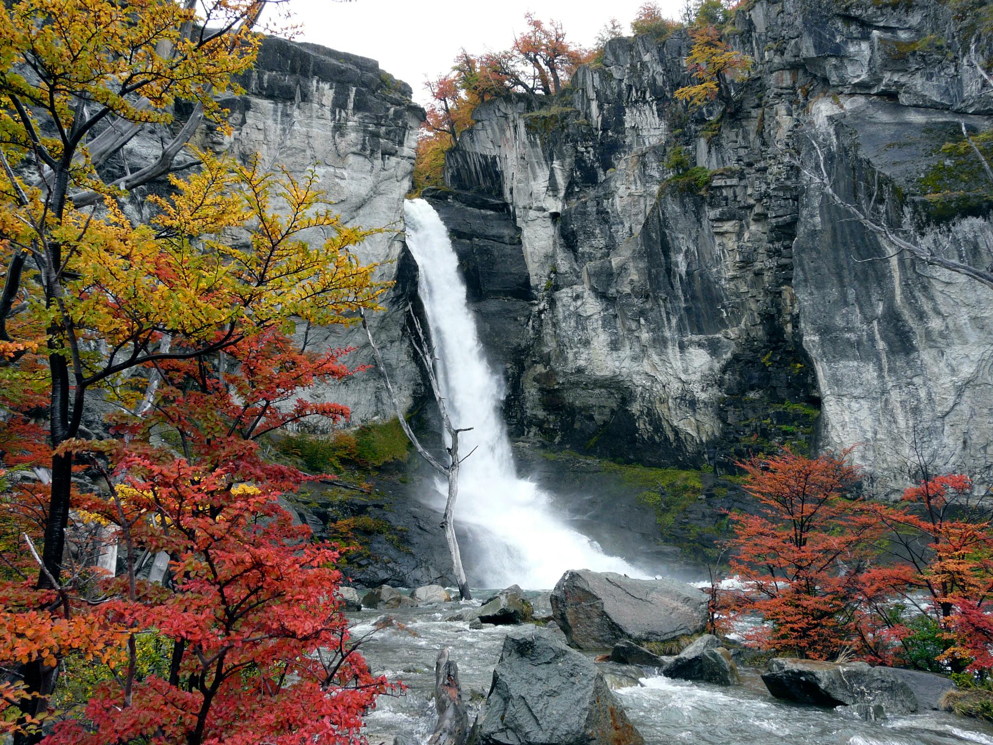
5. Chorrillo del Salto
- Start/Finish: El Chaltén (out and back)
- Distance: 4.3 miles (7km)
- Walking time: 3 hours
- Difficulty: easy
- Best for: waterfall views
The trail begins in El Chaltén, on the same trailhead as Laguna De los Tres. Take the trail to the right, climbing a hill and then descending to an unpaved road (leading to Lago del Desierto). Pass a bike trail on the right hand side (signposted ‘bicisenda’), then take the next track on the left. It leads you through ñire forest for around half an hour, before you reach a car park.
From here, take a flat, well-maintained path through the forest and lush meadows, where you’ll find the pretty Magellanic orchid. You’ll hear the distant sound of a waterfall through the trees, and soon you’ll reach the Chorrillo del Salto, which cascades down a rocky cliff to a shallow pool below.
When is the Best Time to Hike in Los Glaciares National Park?
The best time to hike in Los Glaciares National Park is October to April, which is from spring through summer and into early autumn in Patagonia. This period offers milder temperatures, long daylight hours, and the most reliable trail conditions.
December to February is peak season—busier but optimal for weather and access—while October-November and March-April offer fewer tourists but still favourable conditions.
April is my favourite month because autumn starts, so all the lenga and ñire leaves start turning yellow and orange
“April is my favourite month because autumn starts, so all the lenga and ñire leaves start turning yellow and orange,” Agata says.
Winter (May–September) in El Chaltén is cold and potentially snowy. Higher altitude trails such as Cerro Torre might be closed, but shorter hikes through the forest are magical this time of year.
Read more: When to Visit Patagonia: Seasonal Guide & Weather Tips
What Animals Live in Los Glaciares National Park?
Los Glaciares boasts a variety of wildlife species, including guanacos (a camelid species similar to llamas), a deer species known as huemul and the elusive puma. There are also over 100 bird species within the park including the Andean condor, flamingos, rheas, southern giant petrels and more.
Where to Stay in Los Glaciares National Park
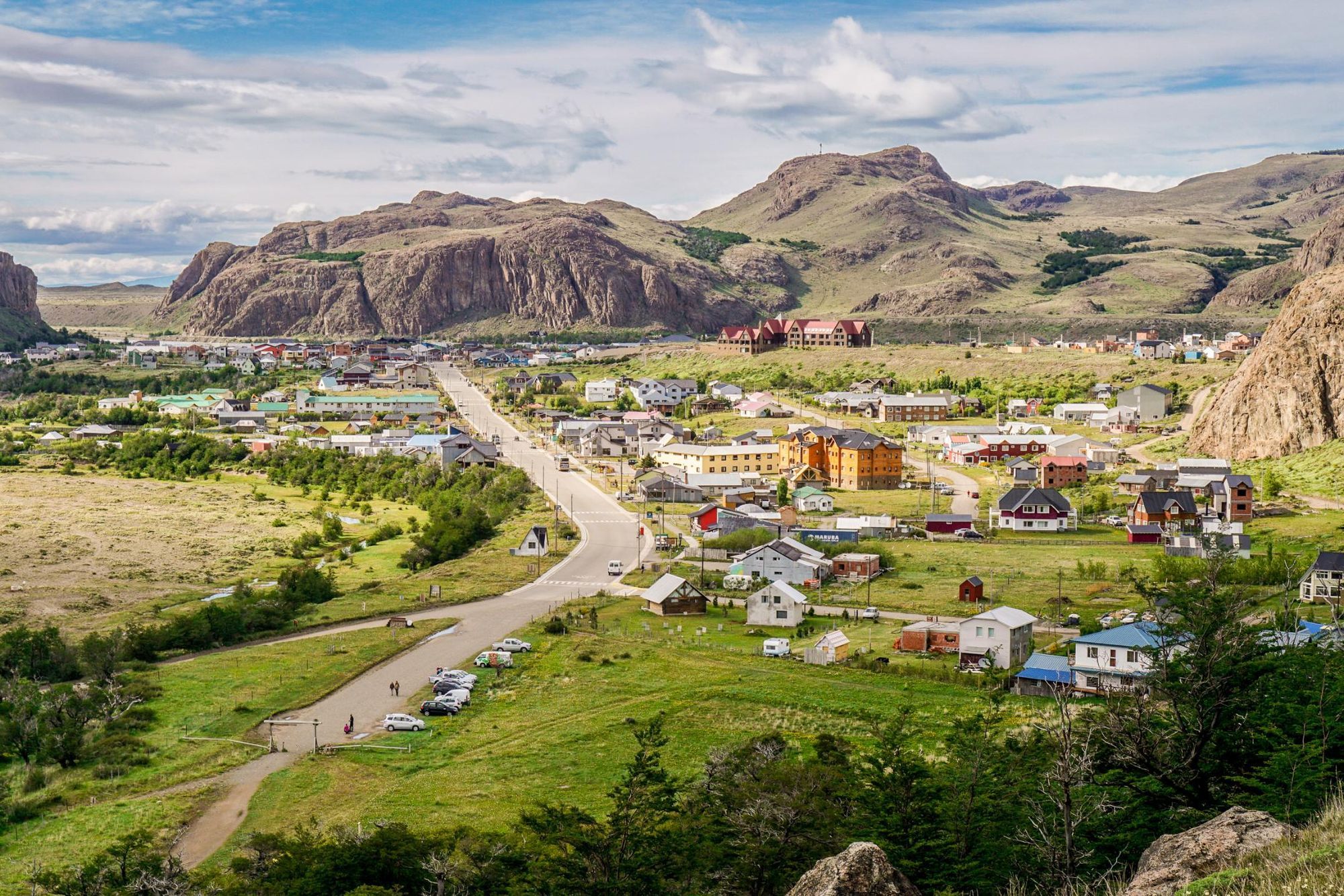
If you fancy hiking in Los Glaciares National Park, base yourself in the mountain town of El Chaltén.
“We call it the trekking capital of Argentina, because from the door of your hotel you can do hundreds of hikes,” says Agata.
There’s a range of accommodation in the town, from upmarket hotels to small guesthouses and backpacker hostels.
What to Eat in El Chaltén

If you’re hungry after a hike, The Asadores serves a five course tasting menu of Argentine specialities, such as stuffed pastries called empanadas and steak. Head to La Cervecería for homebrewed beer and hearty plates of pizza, pasta, empanadas and other pub grub.
“In El Chaltén there is a great gelateria, Domo Blanco. And I can also recommend the Alfajores from Los Chalteños,” says Agata. Alfajores are buttery biscuit sandwiches with a dulce de leche filling, popular in Argentina.
How to Get to (and Around) Los Glaciares National Park
Fly into Calafate Airport from Buenos Aires (three hours)—it’s next to the town of El Calafate, the gateway to the southern entrance of Los Glaciares National Park. From here you can access Perito Moreno Glacier by road, in a rental car or using private transfer. El Chaltén is accessible by road from El Calafate, a journey of around 136 miles (219km) which takes about three hours.
Inspired? Check out our Ultimate Adventure in Patagonia, featuring Laguna de Los Tres and Mirador del Torre.