


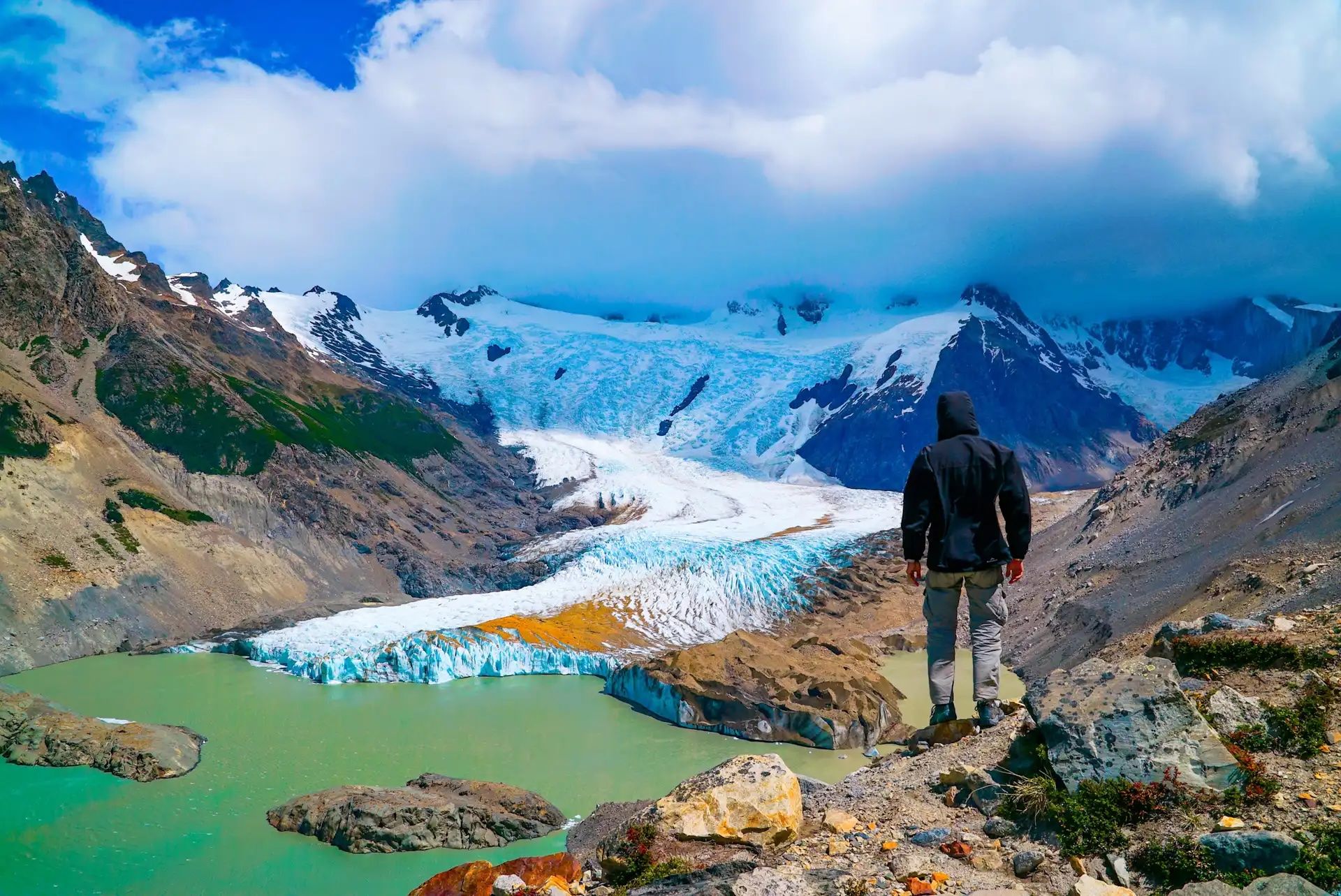
Los Glaciares National Park is a vast UNESCO-listed wilderness in Argentine Patagonia, where sharp granite peaks tower over turquoise lakes, and ancient glaciers cover the landscape. The most famous of these is the Perito Moreno Glacier, which juts out into Lago Argentino (the country’s largest lake), where icebergs calve thunderously into the water.
“The park protects the Patagonian Ice Field, which is a very big mass of ice with a lot of glaciers that we share with Chile,” says Agata West, who works in adventure travel and lives in Patagonia.
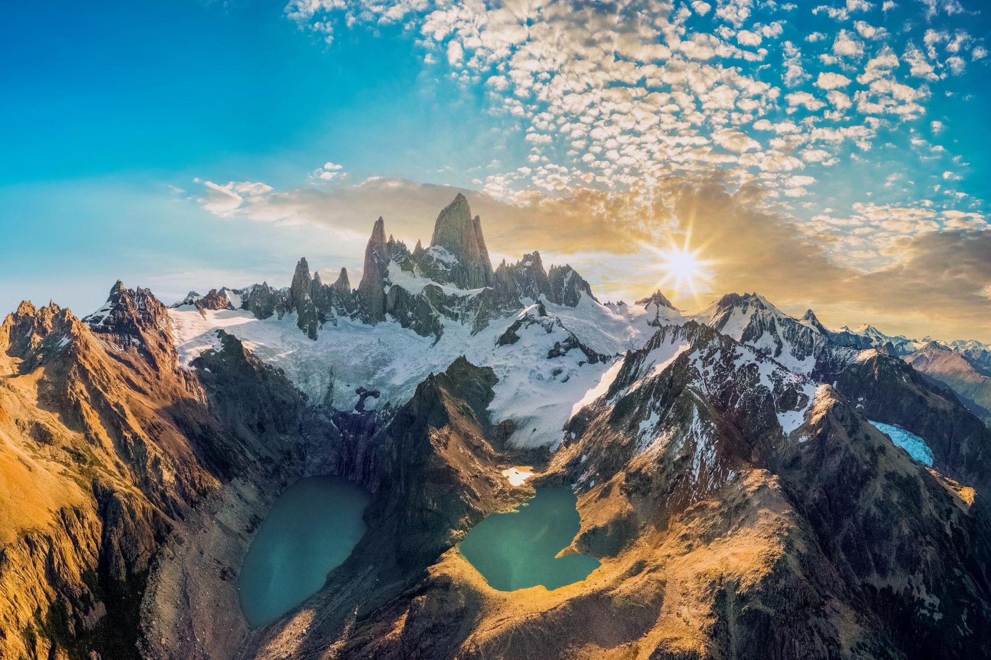
The Patagonian Ice Field also includes serrated mountains such as the spiky Cerro Fitz Roy (3,405m/11,171ft) and needle-like Cerro Torre (3,128m/10,262ft), which rise sharply upwards from the surrounding ice. Surrounding the ice you’ll find patches of old growth forest and swathes of Patagonian steppe, rocky shrub-studded plains unique to the region.
The park protects the Patagonian Ice Field, which is a very big mass of ice with a lot of glaciers that we share with Chile
“You have two main entrances to the national park. The north can be accessed from the small town of El Chaltén, which we call the trekking capital of Argentina, because from the door of your hotel you can do hundreds of hikes,” says Agata. “We have these beautiful, famous hikes to see Mount Fitz Roy and Cerro Torre.
“The closest town to the south entrance is El Calafate, which is where you can access the park’s highlight, Perito Moreno Glacier. So El Chaltén is where you go for trekking, and El Calafate is where you go to do glacier excursions.”
Planning a trip to Los Glaciares? Our handy guide will help you decide what activities to do, where to stay and when to go.
Table of Contents
Where is Los Glaciares National Park Located?
Los Glaciares National Park is in the southwest of Santa Cruz Province, within the Argentine section of Patagonia. It borders Chile to the west and is part of the Southern Patagonian Ice Field. It covers an area of 2,806 square miles (7,269 sq. km).
Iconic Sights and Landscapes in Los Glaciares
Perito Moreno Glacier
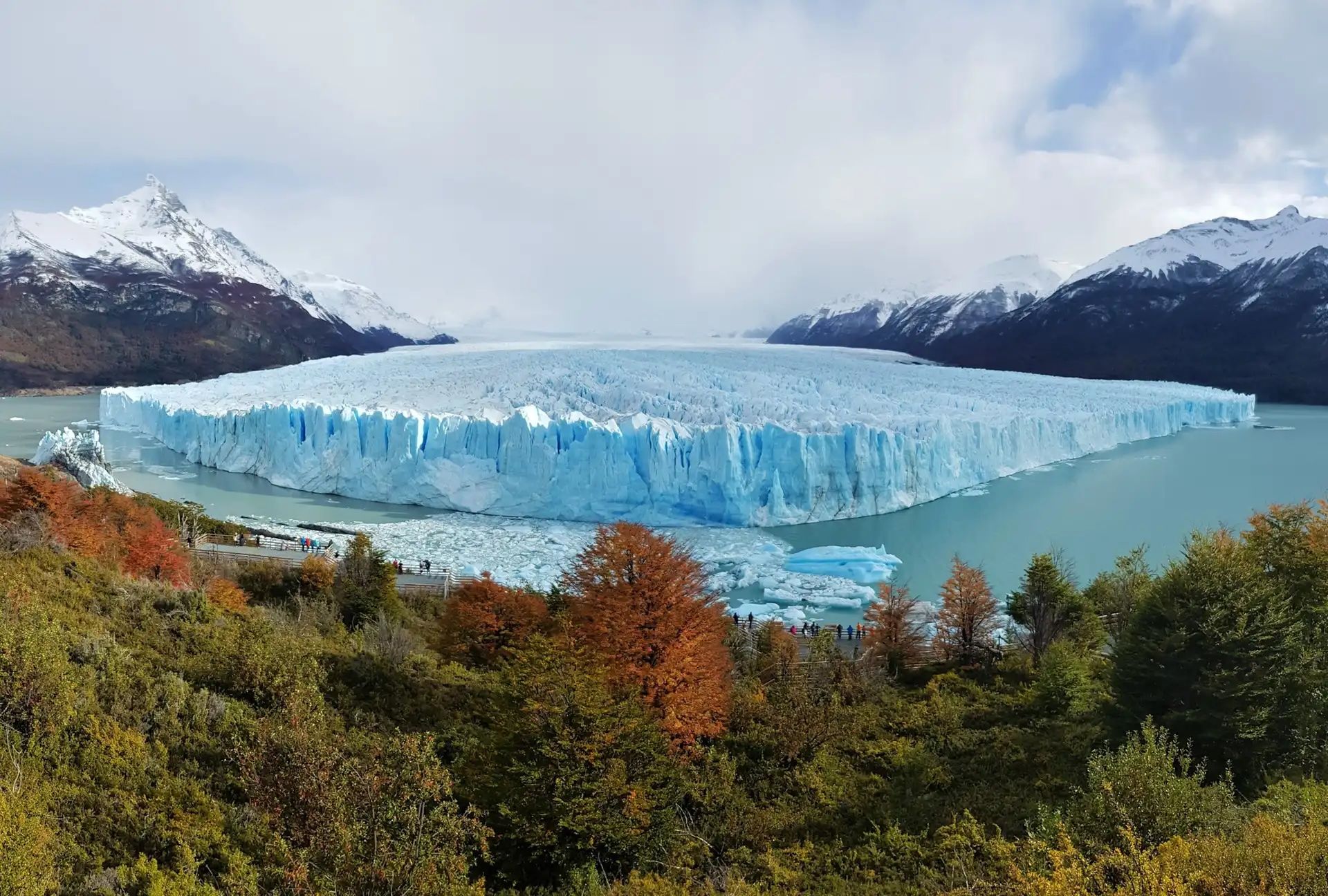
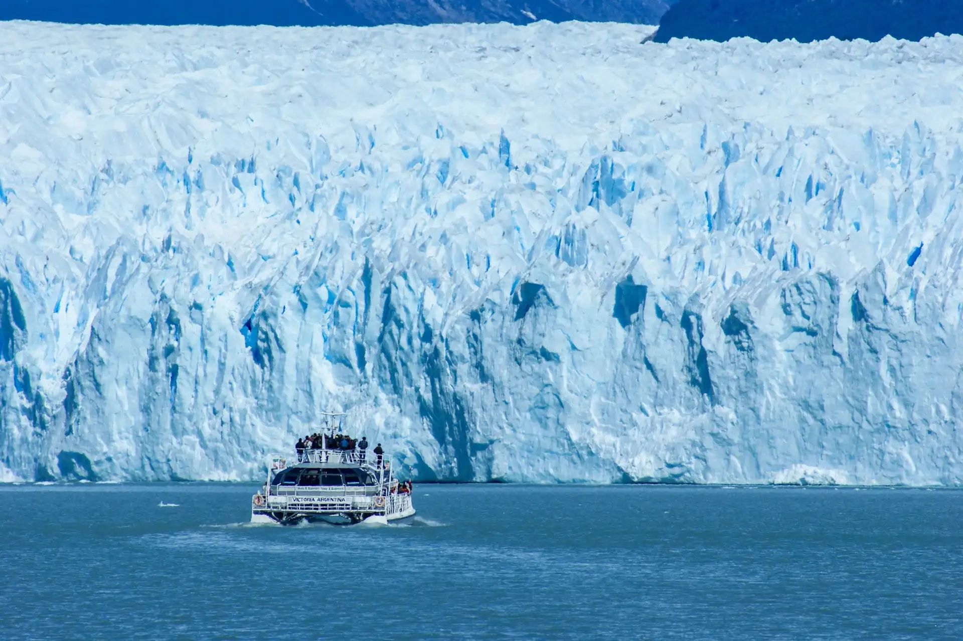
Perito Moreno Glacier is one of the highlights of Los Glaciares National Park—a glacier with an area of 155 square miles (250 sq. km), which flows into the vast Lago Argentino. It’s one of the reasons why Los Glaciares National Park received a UNESCO designation.
“The overwhelming beauty of the landscape is epitomised where the Perito Moreno Glacier meets Lake Argentino,” the UNESCO description reads. “The vast front of the slowly and constantly moving glacier, up to 60 metres (197ft) high, regularly calves bluish icebergs into the waters of Lake Argentino, an audiovisual spectacle attracting visitors from all over the world.”
Opposite the glacier there are around three miles (five km) of wooden boardwalks, with viewpoints overlooking the ice. Boat trips and glacier trekking allow you to get even closer to Perito Moreno.
Lago Argentino
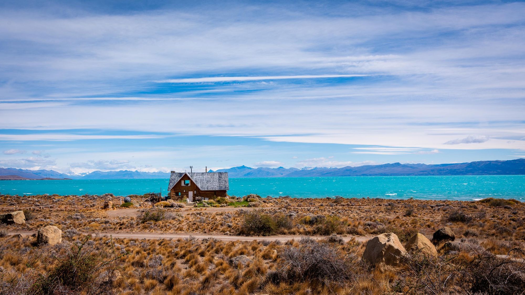
Lago Argentino is the largest freshwater lake in Argentina, spanning over 566 square miles (1,465 sq. km), and it forms the aquatic heart of Los Glaciares National Park. It’s fed by meltwater from the Perito Moreno, Upsala, Spegazzini and Onelli Glaciers.
Boat excursions across Lago Argentino provide a front-row seat to some of Patagonia’s most dramatic scenery, including icebergs, hidden coves, and towering glacier walls. It’s also a hub for birdlife, including black-necked swans and flamingos, the latter of which can be seen in Reserva Laguna Nimez near the town of El Calafate.
“El Calafate is located very close to Lago Argentino, and it’s very nice to go for a stroll along the lakeshore,” Agata says.
Mount Fitz Roy
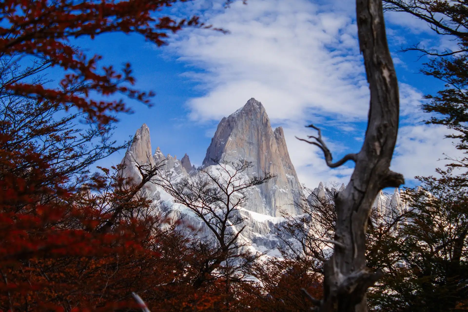
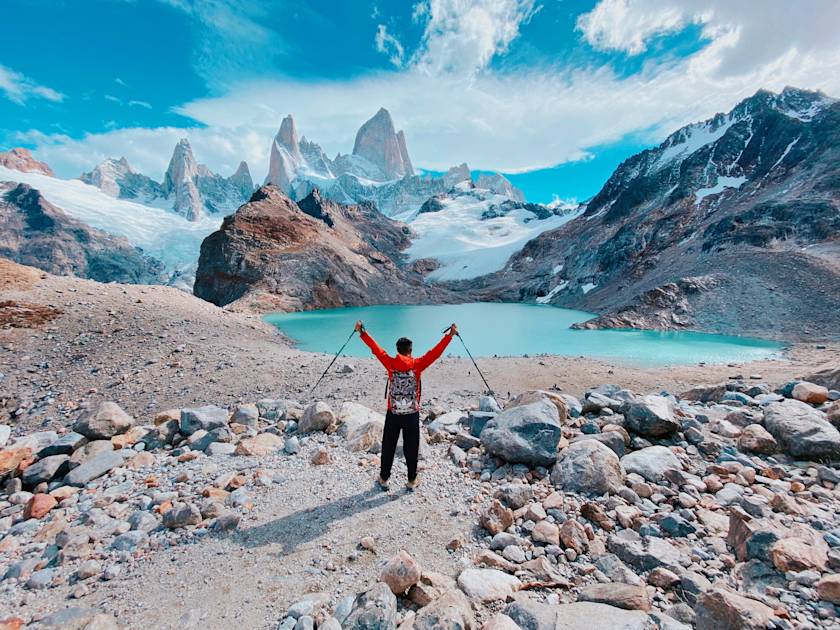
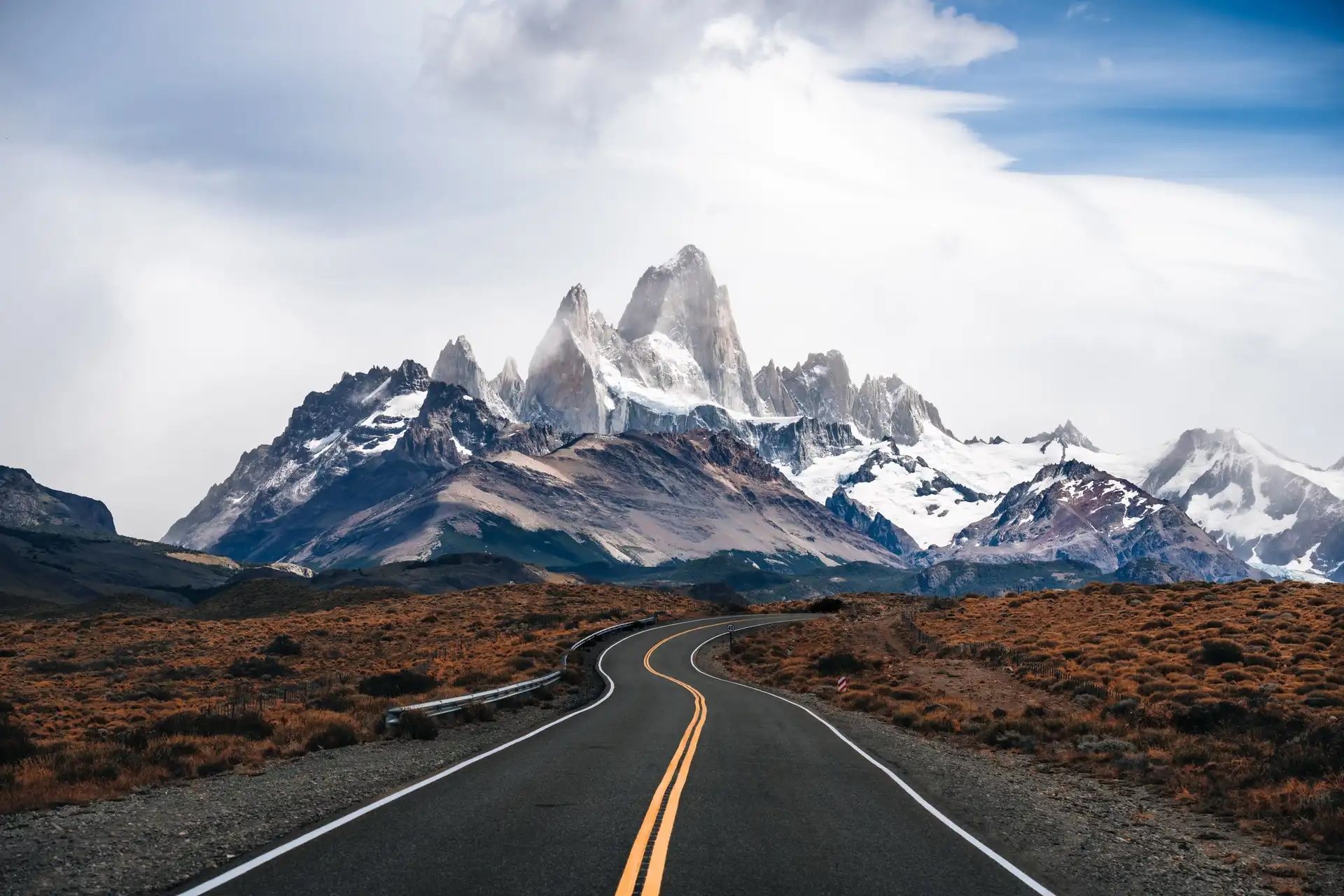
Mount Fitz Roy (also known as Cerro Fitz Roy) has a jagged granite summit which rises above the Patagonian steppe, reaching 3,405m (11,171ft) into the sky. It is one of Patagonia’s most recognisable landmarks, often cloaked in a crown of clouds. In fact, its sharp silhouette inspired the logo of the outdoor brand Patagonia.
First climbed in 1952, Mount Fitz Roy is popular with experienced mountaineers. For those without technical mountain climbing skills, hiking trails such as the Laguna de Los Tres hike offer excellent views of its jagged summit.
It’s beautiful when you descend to the lake and see Mount Fitz Roy in front of you
“It’s beautiful when you descend to the lake and see Mount Fitz Roy in front of you,” Agata says. “Of course, you need good weather because if not, Fitz Roy is covered by clouds.”
Cerro Torre
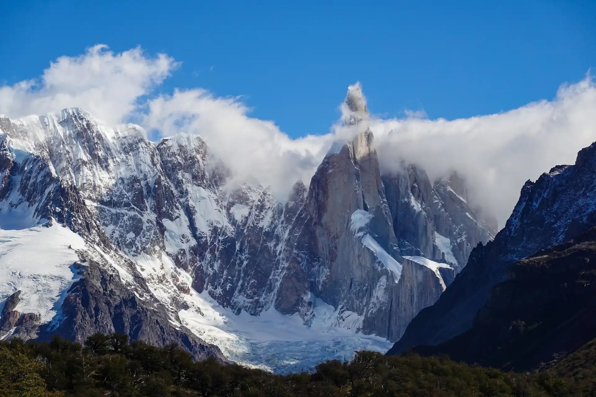
Cerro Torre is located near Fitz Roy, a sharp peak towering to 3,128m (10,262ft). Although it’s shorter than Fitz Roy, it’s the harder climb, with its vertical walls and ice-covered summit.
From the town of El Chaltén, there are numerous hiking trails offering views of this spectacular peak. The Laguna Torre hike is considered to have one of the best vantage points, taking you to a glacial lake with the peak reflected in its waters.
Adventure Activities
Hiking
There are plenty of opportunities for hiking in Los Glaciares National Park, from multi-day treks into the backcountry (a guide is recommended), to shorter half-day hikes which can be done independently.
Amongst the most popular walking spots are the Perito Moreno Glacier Walkways. These walkways are comprised of a 2.9 mile (4.7km) network of wooden boardwalks, stairs and well-maintained trails on the opposite shore of Perito Moreno Glacier, colour-coded according to difficulty level. You'll have excellent views of icebergs calving into the water below.
If you're looking for something more challenging, base yourself in El Chaltén. One of the most popular accessible from here is the Laguna de Los Tres Hike, also known as Sendero Fitz Roy. It's a 12.4 mile (20km) out-and-back route. The route takes you through the De Las Vueltas River Valley, up through groves of Antarctic beech trees (ñires) and across rocky moraine to the Laguna de Los Tres, a trio of glacial lakes where you have one of the best views of the iconic Mount Fitz Roy.
“The good thing about Laguna de Los Tres is that the route is beautiful and there are lots of viewpoints along the way. So you don’t have to complete the whole 20-kilometre-long hike if you don’t want to, or if the weather worsens,” Agata says.
Read more: 5 of the Best Hikes in Los Glaciares National Park
Glacier Trekking
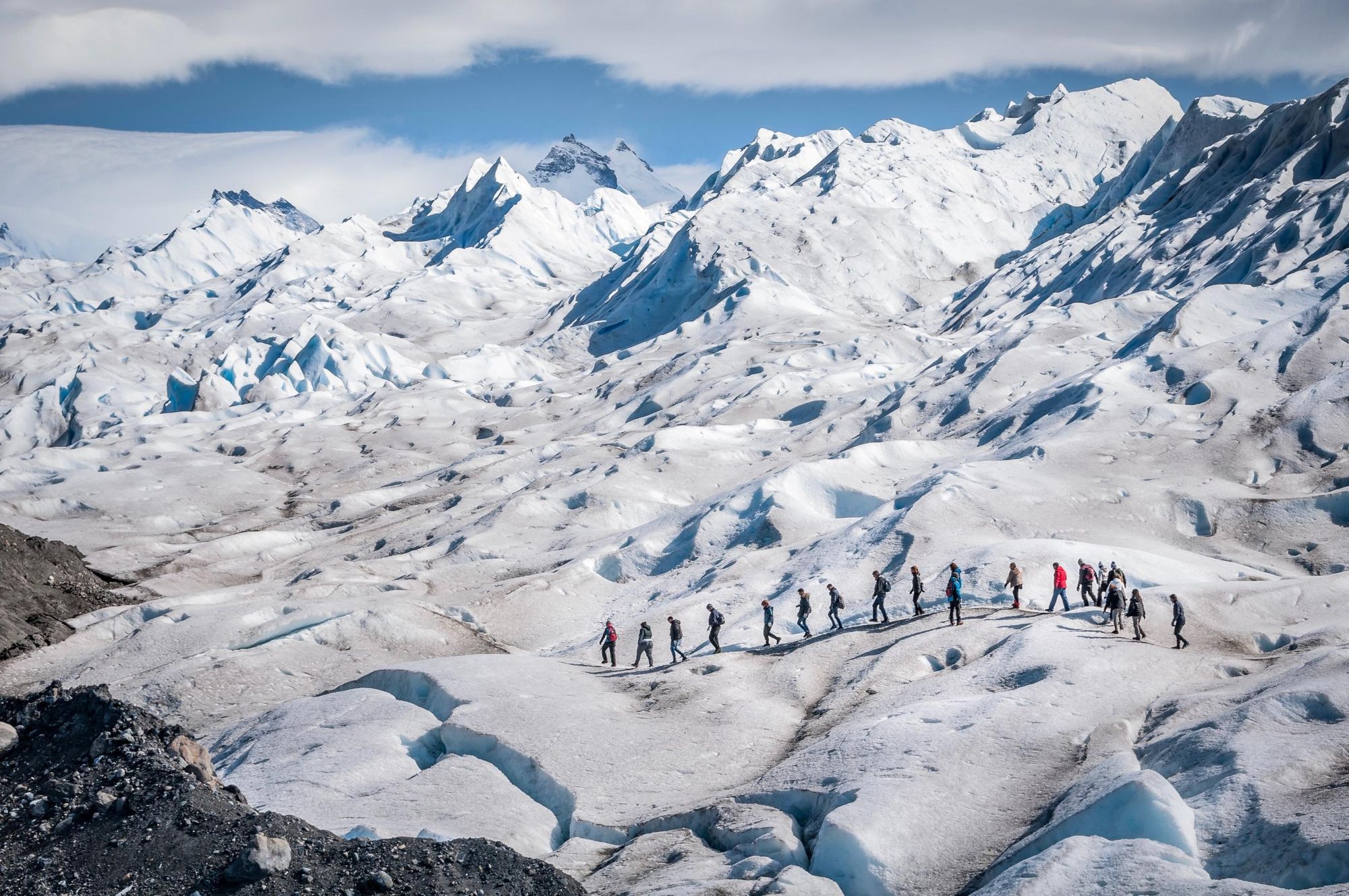
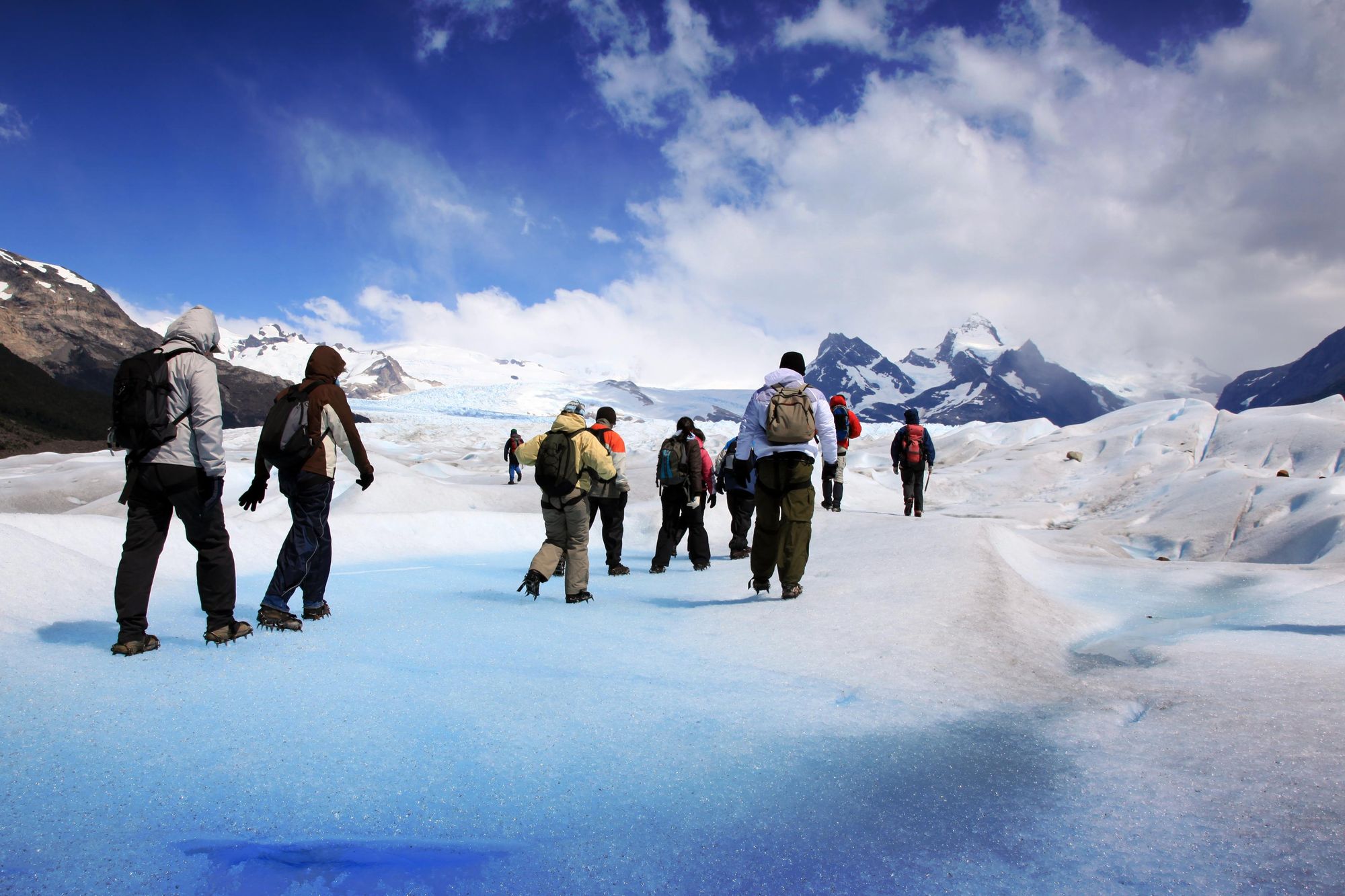
Perito Moreno Glacier offers opportunities for glacier trekking. There are two options: the ‘Minitrekking’ which lasts around 90 minutes, or the ‘Big Ice Tour’, where you’ll be on the ice for around three hours, and trek through the Andean forest next to the glacier for a further four. You’ll marvel at the glacier’s deep crevasses, brilliant ultramarine lagoons and subterranean ice caves.
Both hikes require you to wear cold weather clothing and crampons. You will also need to be accompanied by an experienced local guide.
Kayaking
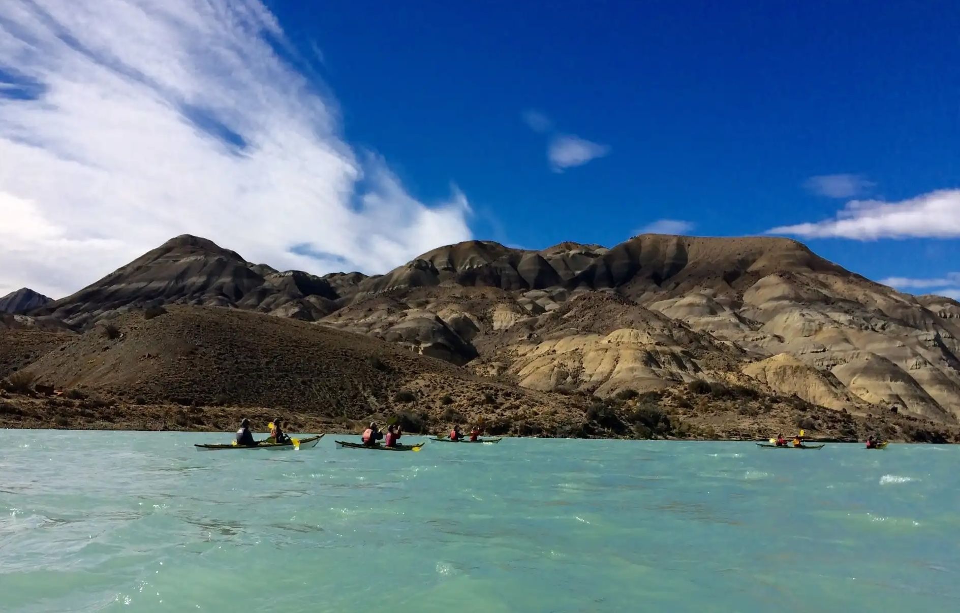
The glacier-fed rivers and lakes within the reserve, making Los Glaciares National Park an ideal spot for kayaking. Best-known is Lago Argentino, the largest freshwater lake in the country. Launch from Redonda Bay near El Calafate, and you can explore this vast body of water.
The Perito Moreno Glacier also juts out into Lago Argentino. There's a launch site near the Perito Moreno boardwalks, enabling you to paddle close to the vast northern face of this sublime glacier.
Another option is to paddle in the La Leona River, located in the eastern part of the park. The launch point is north of El Calafate. You'll follow the river southwards as it carves a path through the wild steppe. There'll be the opportunity to beach your kayaks and hike to the Cerro Los Hornos, a viewpoint studded with petrified trees and dinosaur fossils, surrounded by antediluvian folds of rock.
Boat Tours
Boat tours give you the opportunity to see the national park’s glaciers up close and personal. Excursions across Lago Argentino, the country’s largest lake, are particularly popular. Board a small boat near Perito Moreno glacier and sail close to its face. You can then head down the Canal de los Témpanos, a channel studded with the icebergs that have calved from the main glacier.
Full-day boat trips across Lago Argentino are also possible, exploring the Patagonian Ice Field as you visit the Spegazzini, Upsala and Perito Moreno Glaciers.
Wildlife Watching
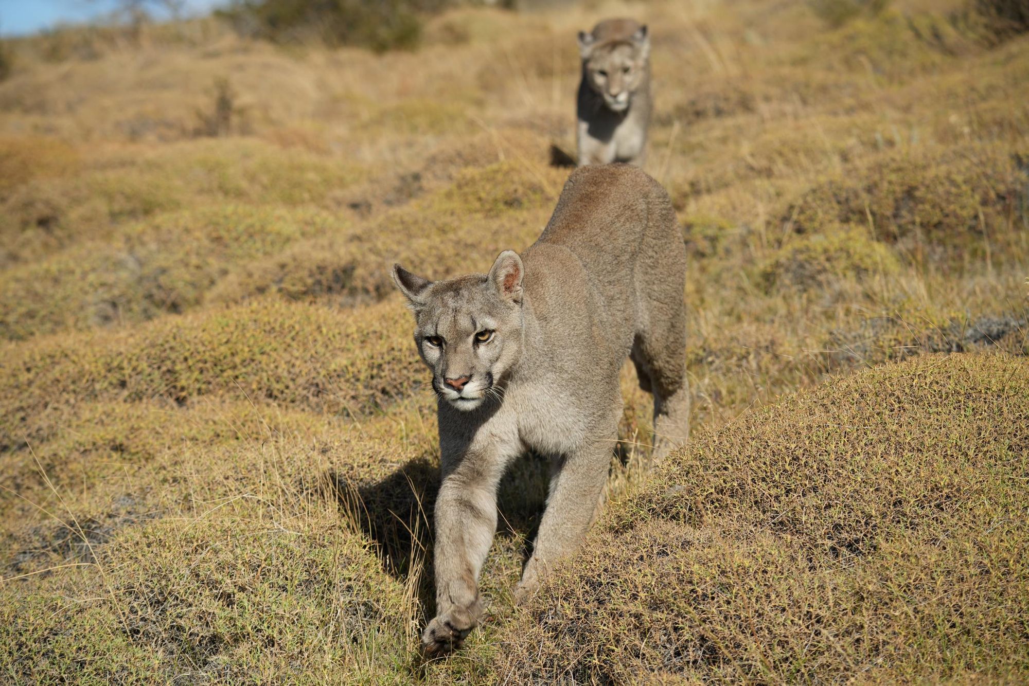
For Agata, the wildlife is one of the highlights of Los Glaciares national park.
“You can see a lot of guanacos, a lot of rheas and there are chances to see the puma, which is a beautiful animal,” she says. “I’ve seen pumas many times—I even saw a puma eat a guanaco, which was quite impressive.”
While it is possible to go on a dedicated wildlife watching tour, you’ll also see wildlife while doing other activities, such as kayaking or trekking—or simply driving across the steppe.
Where to Stay
Agata recommends splitting your time between El Chaltén in the north of the park, and El Calafate in the south. A few nights in each region will allow you to enjoy Los Glaciares’ main highlights.
El Chaltén
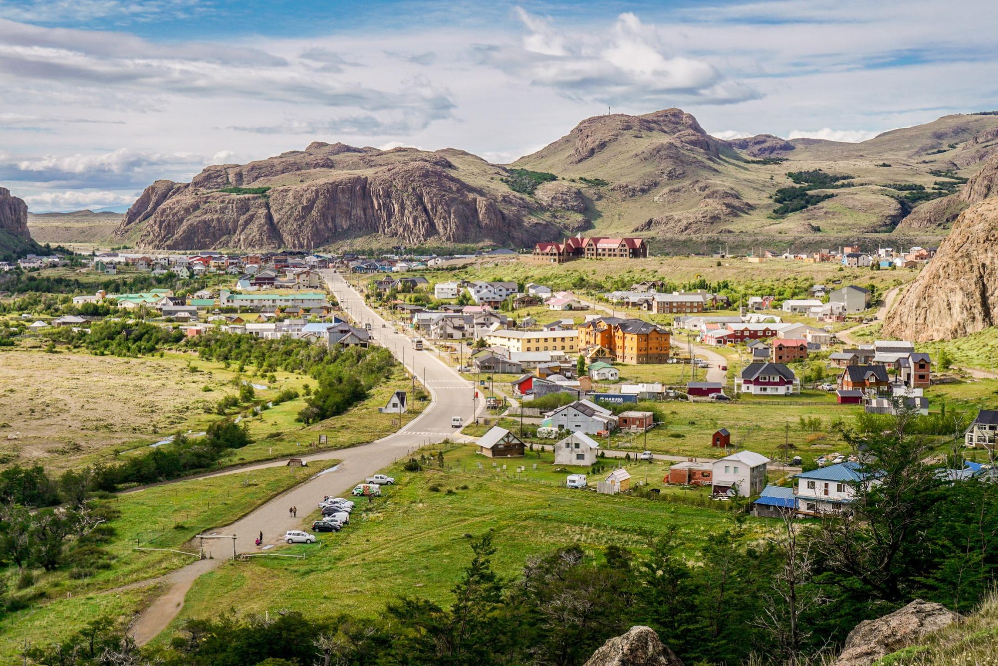
El Chaltén is a small town of around 3,000 inhabitants, situated in the northern part of Los Glaciares National Park. It’s known as the Trekking Capital of Argentina, and is surrounded by dramatic mountainscapes.
“It's nice because you can go from the door of your hotel to the main trails, and you’re also within walking distance to its bars and restaurants,’” Agata says. “It’s not a city like El Calafate, but has the spirit of a mountain town.”
El Calafate
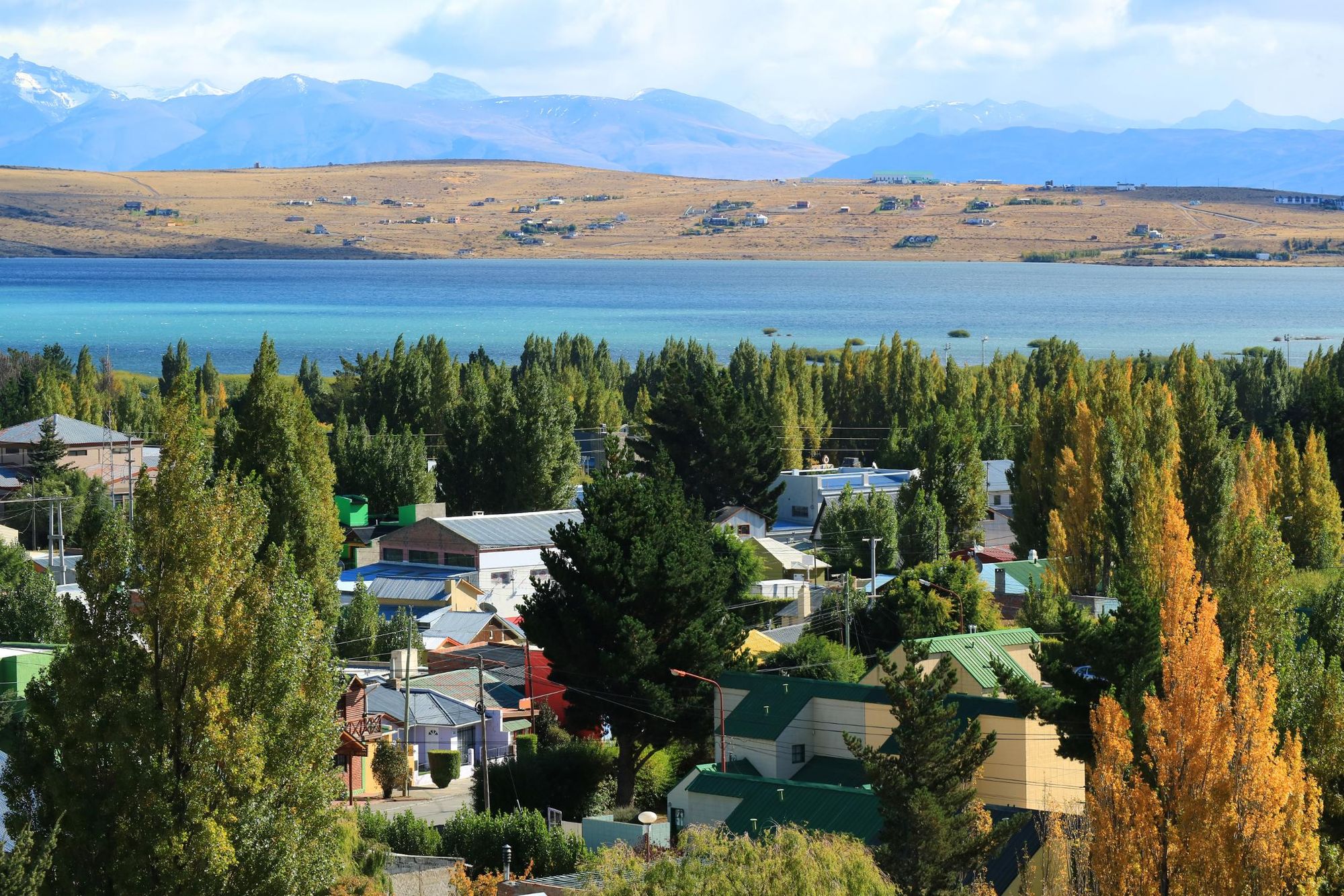
El Calafate is located 29.5 miles (47.5km) east of the southern entrance to Los Glaciares National Park, and is the gateway town for visiting Perito Moreno Glacier. It’s easy to arrange transportation into the park or a glacier trekking tour from here.
For dinner, I like Mi Rancho. It's a very traditional, cosy restaurant. And for going out to have a beer, I like Shackleton Solo
“There are 30,000 people living here, and it's more active during winter than El Chaltén, although it's not a winter destination because here we don't have snow,” Agata says.
“For dinner, I like Mi Rancho. It's a very traditional, cosy restaurant. And for going out to have a beer, I like Shackleton Solo. There are often DJs or live music there, and it has a view of the lake.”
Trip Planning Tips
Best Time to Visit Los Glaciares National Park
The best time to visit Los Glaciares National Park is between October and April (spring to autumn) in the Southern Hemisphere. January and February are peak season, offering the warmest temperatures, long daylight hours and accessible hiking trails. November and March provide fewer crowds but still good weather.
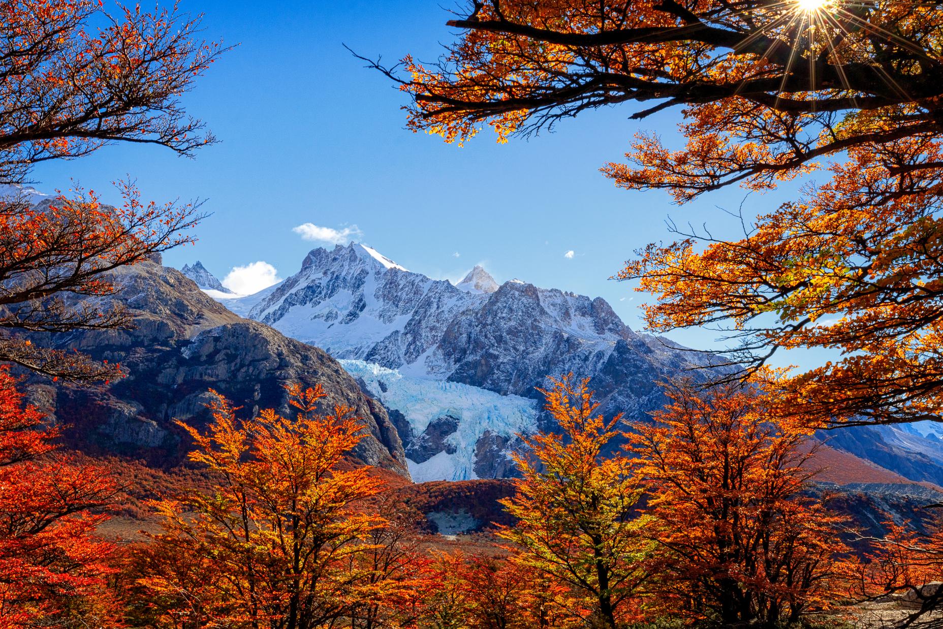
“April is my favourite month because autumn starts, so all the lenga and Ñirre leaves start turning yellow and orange. It's so beautiful. It's also the month where most of the famous photographers come here,” Agata says.
Read more: When to Visit Patagonia: Seasonal Guide & Weather Tips
How to Get to Los Glaciares National Park
- From El Calafate: The Perito Moreno Glacier sector is 50 miles (80km) west of El Calafate and can be reached by car, bus, or guided tour in about 1.5 hours.
- From El Chaltén: El Chaltén is 134 miles (215km) north of El Calafate via Route 40. Buses and private transfers connect the two towns in roughly 3 hours. El Chaltén serves as the main base for hiking in the northern section of the park.
What to Pack
When you visit Patagonia, whatever time of year, you need to be prepared for swift and sudden weather changes. Even in the warmer months, strong wind howls across the steppe. It’s important to dress in layers. We recommend bringing:
Clothes
- Down jacket
- Waterproof jacket
- Waterproof trousers
- Breathable wicking layers
- Thermals (merino best)
- Warm hat
- Gloves
- Buff or neckscarf
- Lightweight trousers/shorts/skirts
- Hiking boots (worn-in)
Other
- Universal travel plug adapter
- Insect repellent
- Suncream
- Personal first-aid kit (inc. blister treatment)
- Toilet kit (toilet paper, biodegradable bags to carry paper out to dispose of)
- Quick-dry towel
- Headtorch or torch
- Reusable water bottle(s)
For a full list, check out the ‘kitlist’ section of our Ultimate Adventure Through Patagonia.
Entrance Fees and Permits
As of 2025, the entrance fee for Los Glaciares National Park is 15,000 Argentine pesos for international visitors and lower for Argentine residents. Tickets are valid for one day and can be purchased at the park entrance. Most guided tours include the cost of permits.
Frequently Asked Questions
How big is Los Glaciares National Park?
Los Glaciares National Park covers about 2,806 square miles (7,269 sq. km) making it Argentina’s largest national park. Around half of its area is covered by glaciers.
What can you do in Los Glaciares National Park?
Visitors can hike world-class trails like Laguna de los Tres and Pliegue Tumbado, take guided ice treks on the Perito Moreno Glacier, enjoy boat tours on glacial lakes and spot wildlife such as condors and guanacos.
Los Glaciares National Park – how to get there from El Calafate?
From El Calafate, you can reach Los Glaciares National Park by bus, car, or guided tour. The Perito Moreno Glacier sector is about 50 miles (80km) west of town, while El Chaltén, the hiking hub, is 134 miles (215km) to the north via Route 40.
How big is Perito Moreno Glacier?
Perito Moreno Glacier is approximately 19 miles (30km) long, 3 miles (5km) wide, and up to 74m (240ft) high above the water surface, with a total ice depth of around 170 metres (558ft).
How many days do you need in Los Glaciares national park?
Most visitors spend 3 to 5 days in Los Glaciares National Park. This allows time to see the Perito Moreno Glacier, enjoy several hikes around El Chaltén, and take optional boat or ice trekking tours.
Feeling inspired? Visit Los Glaciares National Park with us on our Ultimate Adventure Through Patagonia.