

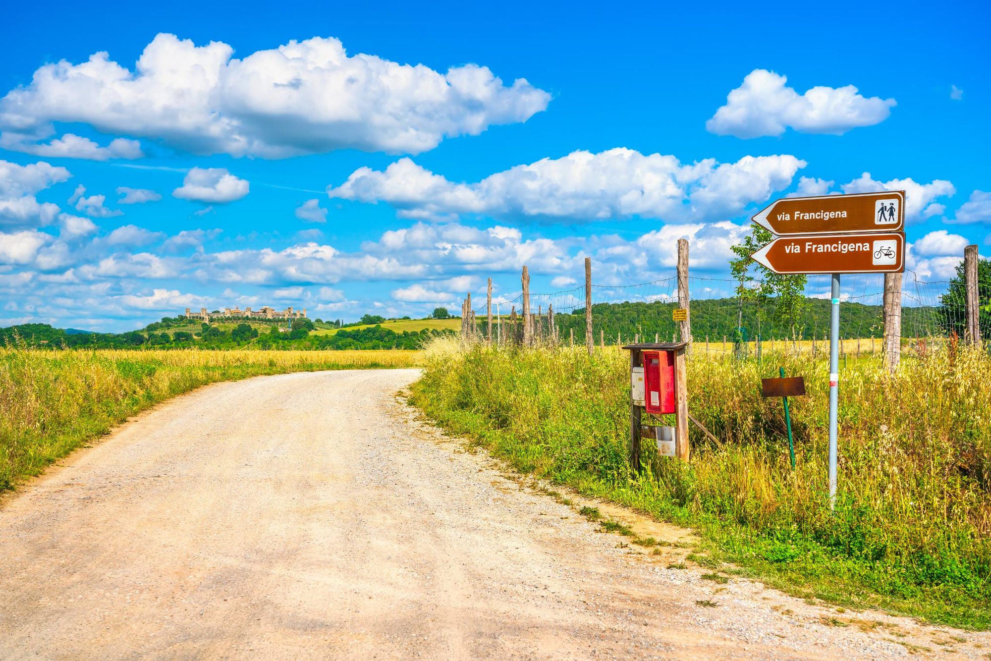
The Via Francigena is an ancient pilgrimage route stretching 2,000 miles (3,200km) from Canterbury in the UK, through France, Switzerland and Italy to Rome.
“In Italy, it runs from north to south through Valle d'Aosta, Piedmont, Lombardy, Liguria, Tuscany and Lazio,” explains destination expert Stefano Spinetti. “Only a few people today have time and money to walk all the way, so you have to choose a section. The Tuscan section is the most popular part of the Via Francigena.”
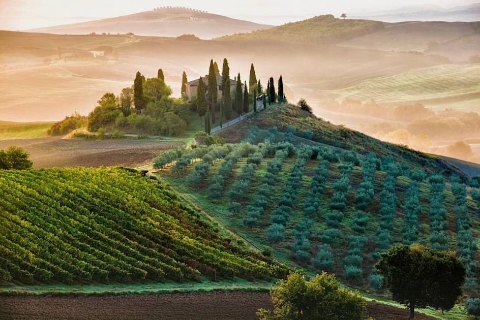
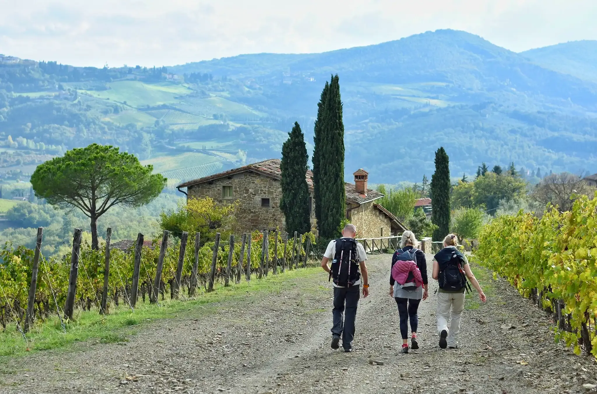
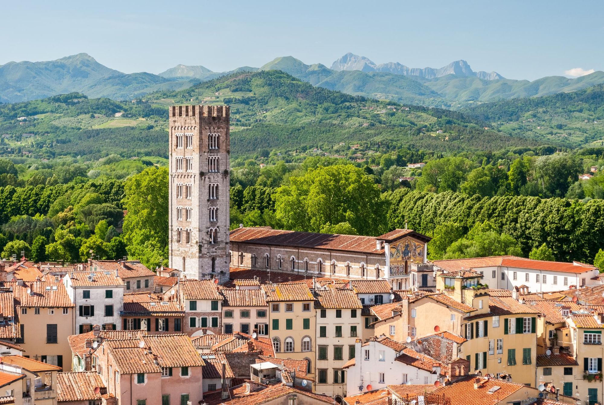
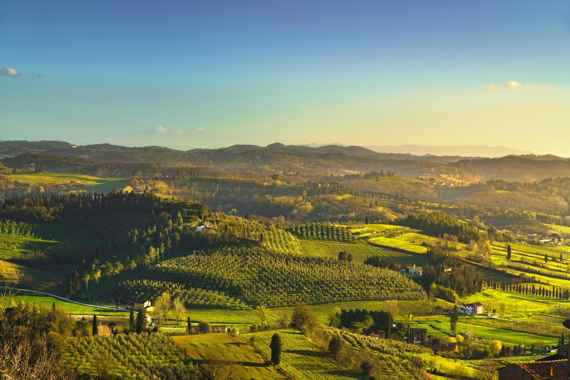
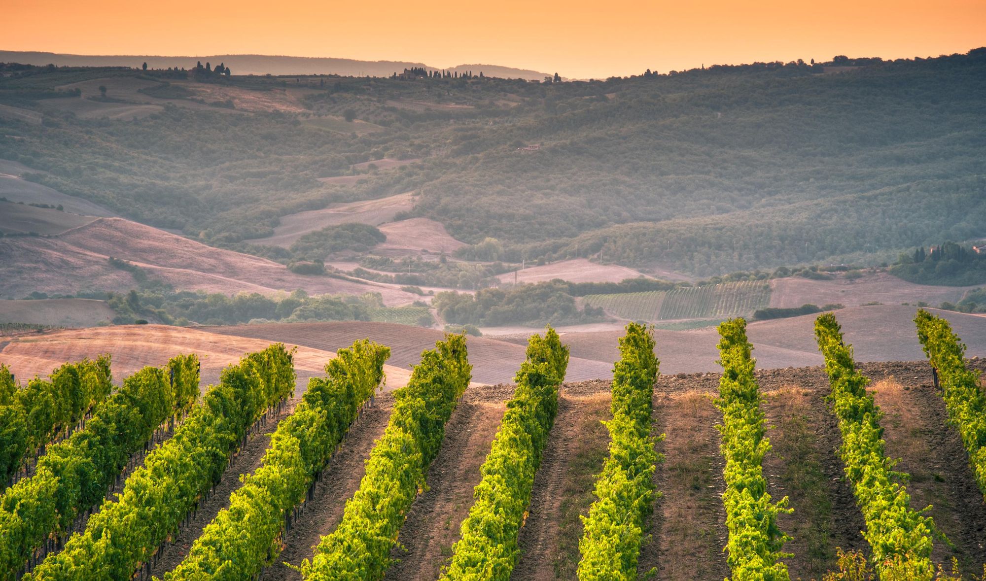
Covering approximately 134 miles (216km), the Tuscan section of the Via Francigena begins in the medieval city of Lucca and winds through a landscape of hills, olive groves and oak forests to the fortified hilltop town of Radicofani. You'll also pass through the vineyards of the Brunello di Montalcino DOCG—where the famed red wine, Brunello, is produced—a small wine-growing region surrounding the hilltop town of Montalcino.
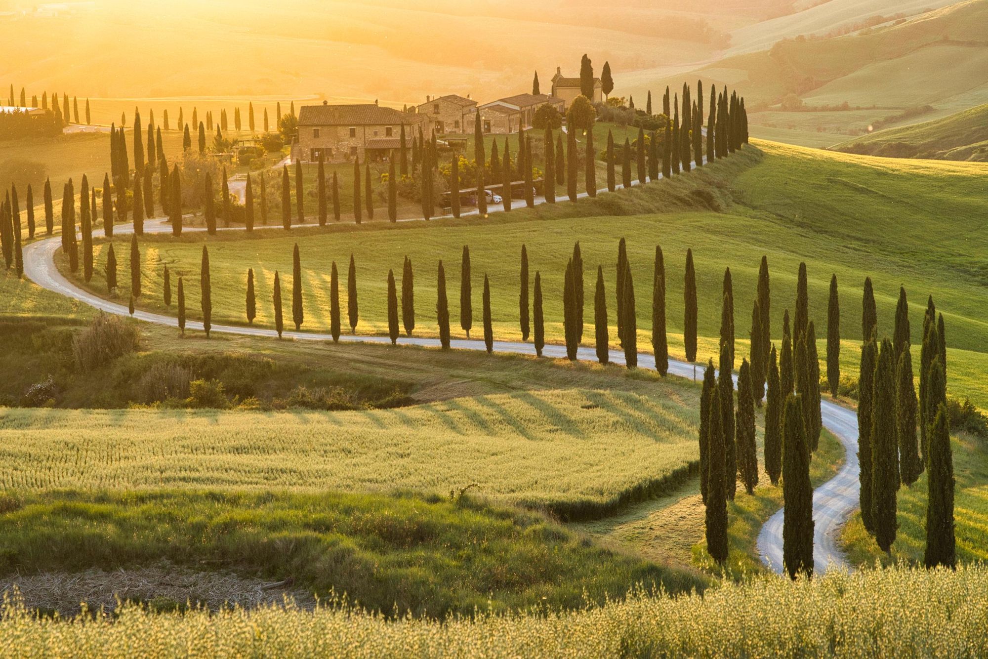
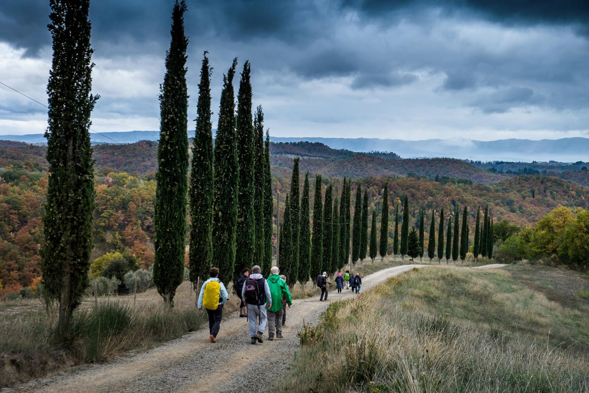
“The Tuscany of our imagination is gentle rolling hills with cypress trees lining the roads,” Stefano says. “But actually, it’s a very diverse region and you’ll find this type of landscape in two different areas: Chianti, which is the birthplace of a famous wine; and Val d’Orcia, near Siena.
This unique hue, often referred to as ‘sienna’, is highly prized by painters and lends a beautiful light to the landscape
“You’ll hike through Val d’Orcia on the Via Francigena. Here, you’ll find the hills and the cypress trees. The earth in this area is renowned for its distinctive colour—a blend of red, brown, and grey. This unique hue, often referred to as ‘sienna’, is highly prized by painters and lends a beautiful light to the landscape.”
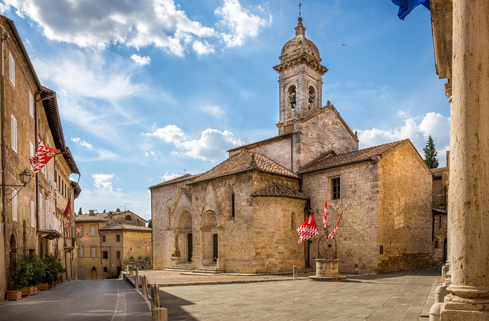
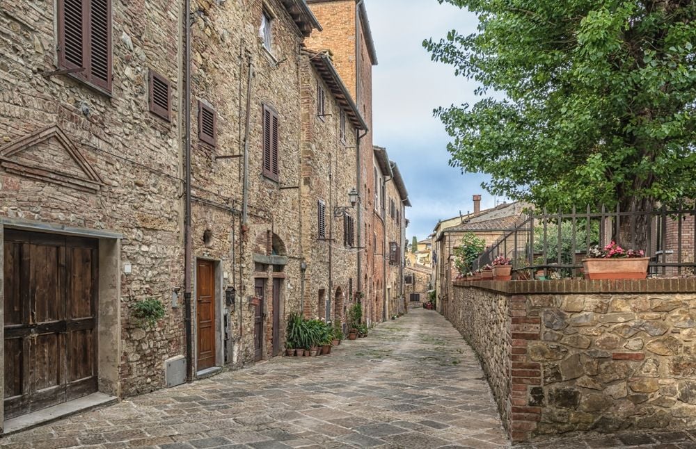
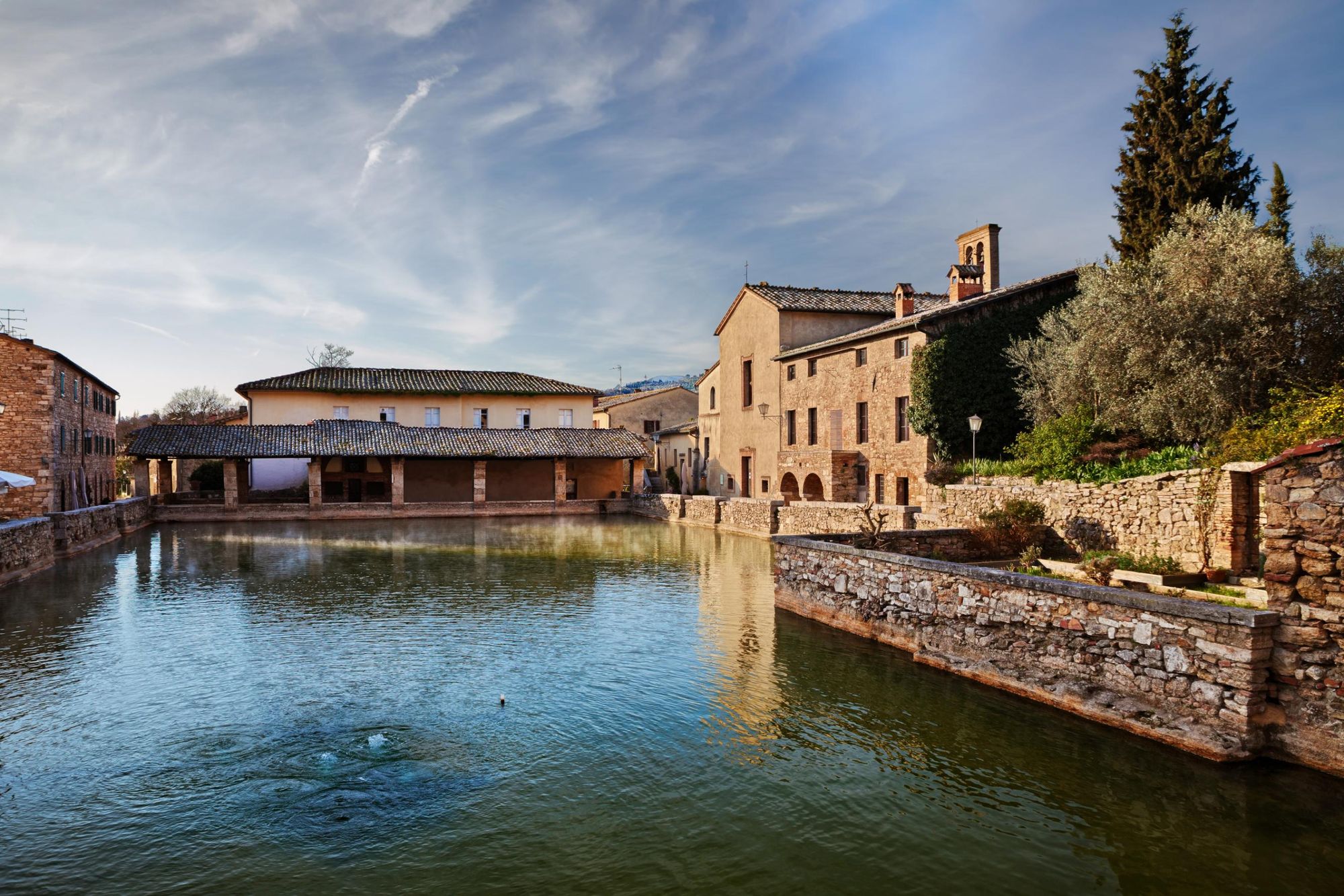
Nestled into this evocative landscape are a string of historic towns and villages. These include San Quirico d’Orcia with its beautiful Romanesque church, and the spa town of Bagno Vignoni, with a thermal swimming pool located in its Renaissance-era square.
“As you leave San Quirico you’ll see a huge mountain called Amiata, which used to be an active volcano 500,000 years ago. Thanks to this volcanic activity, there are several thermally heated hot springs in the area,” Stefano says. “You’ll find several of these located along the Via Francigena, including Bagno Vignoni and Gambassi Terme. Walkers can stop and restore themselves with a bath in the thermal water which is between 36 and 38 degrees celsius, like a hot bath.”
A History of the Via Francigena
The Via Francigena’s origins date back to the seventh century. A Germanic people known as the Lombards, vying for more Italian territory, used it to bypass enemy lands and reach Rome safely. However, it rapidly grew in popularity as a pilgrimage route, and began to be referred to as the "Via Francigena" (way of the Franks) during the 9th century.
During the medieval period, pilgrimage was considered a crucial act of spiritual purification. It was important for the spirit to have a goal and for many, that goal was Rome—the heart of Christianity. The pilgrimage along the Via Francigena was a deeply symbolic act as well as a physical journey, particularly for the wealthy.
"In the Gospel, Jesus Christ said it's easier for the poor to reach paradise than for the rich," Stefano says. “Before going to Rome, wealthy landowners had to leave behind every possession as a part of their purification. They gave these big estates to the church—that was the beginning of its wealth.
“Only about 25% of the pilgrims arrived in Rome. During the walk they died, they got ill, they got sick, they had to go back. It was very easy to die, because of the hygiene conditions and also because it wasn't safe to walk across so many countries—you could be assaulted or simply could disappear along the way.”
Many churches were built with the doorway facing towards Rome. That was how pilgrims found their way in a period when people couldn't read
Along the route, pilgrims would find essential services—hospitals, food, and shelter—offered by religious institutions and local communities. In fact, villages like San Quirico d’Orcia actually sprung up in service to the Via Francigena.
“Many churches were built with the doorway facing towards Rome,” Stefano says. “That was how pilgrims found their way in a period when people couldn't read; there was no way of putting signs saying ‘Rome that way’.”
Via Francigena Route Guide: The Tuscan Section
We’ve chosen to divide the 134-mile-long (216km) Tuscan section of the Via Francigena into nine stages. These are described in more detail in the Cicerone guidebook, Walking the Via Francigena Pilgrim Route - Part 3: Lucca to Rome. There are also cycling variants, for those who want to tackle the route on two wheels.
Stage 1: Lucca to Altopascio
- Distance: 11.4 miles (18.5km)
- Hiking time: 4-5 hours
Follow cobbled streets out of Lucca through Porta San Gervasio. You’ll hike through the suburban outskirts for several kilometres before reaching rural landscapes with flat, open fields and scattered farmhouses.
You’ll pass through several villages, including Capannori and Porcari, before reaching the town of Altopascio, known since medieval times for its famous Knights Hospitaller, which provided assistance to pilgrims along the Via Francigena.
“Don't think of it like today’s hospitals,” Stefano says. “A hospital was a place where the pilgrims could stay for a couple of days to recover from the long walk. They would be taken care of; washed and fed.”
Stage 2: Altopascio to San Miniato
- Distance: 18.3 miles (29.5km)
- Hiking time: 7-8 hours
Leaving Altopascio, the route continues along quiet lanes before joining the original Via Francigena road. After the town of Galleno you’ll enter the Cerbaie Forest, ancient woodland renowned for its biodiversity (you’ll find rare plants such as the drosera rotundifolia, a carnivorous plant dating back to the ice age).
The scenery changes again near Ponte a Cappiano, where you cross a restored medieval bridge spanning the Usciana Canal—a historic pilgrim crossing point. From here, the route follows the embankments of the Arno River, passing small hamlets like Fucecchio. After crossing the river near San Pierino, the trail begins to climb gently. You’ll then make a final ascent to San Miniato, which is perched on top of a ridge.
Stage 3: San Miniato to Gambassi Terme
- Distance: 14.8 miles (23.9km)
- Hiking time: 6-7 hours
Hike out of San Miniato towards the hamlet of Calenzano, where you can purchase provisions. Leave Calenzano and follow the signposted track through the woodland.
You’ll emerge into the Val d’Elsa, and will follow the path across hilly ridges, with panoramic views over its undulating fields, vineyards and woodlands. You’ll glimpse several hilltop castles, rural farmhouses and towns nestled into the landscape, eventually passing through the small town of Coiano.
From here, it’s a hilly ascent to Gambassi Terme, one of the thermal spa towns along the Via Francigena. Its baths are located amid the greenery of Benestare Park.
Stage 4: Gambassi Terme to San Gimignano
- Distance: 7.5 miles (13.7km)
- Hiking time: 4 hours
Walk out of Gambassi Terme along a wide gravel track, past vineyards and farmhouses. Follow cypress-lined roads to the village of Pancole. From Pancole, climb uphill to the village of Collemucioli, along a stretch of the original pilgrimage road from the Middle Ages.
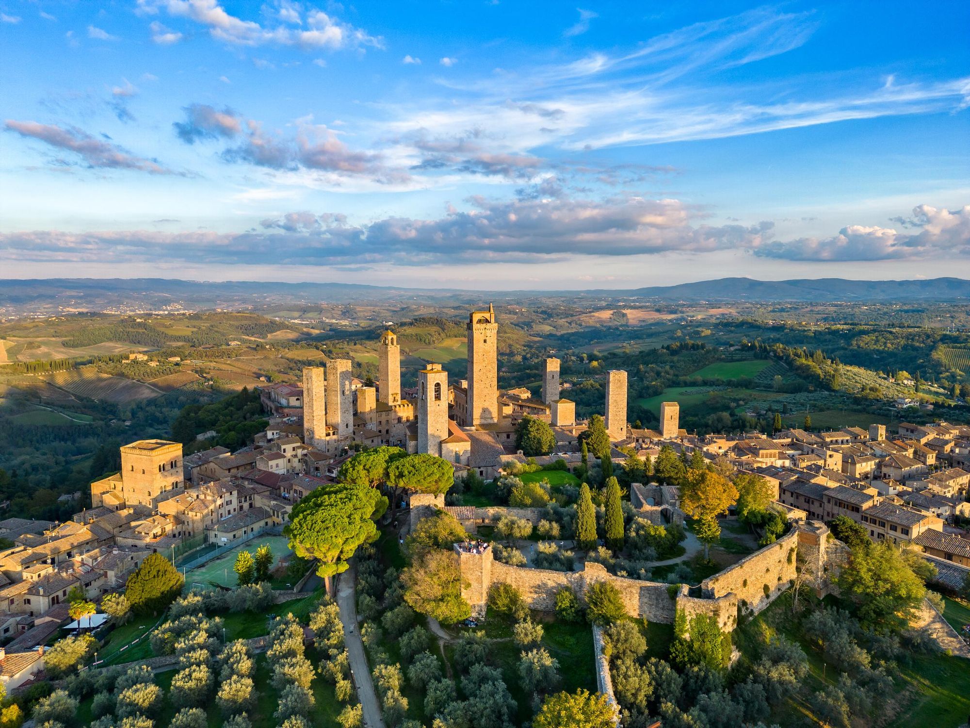
From here, you should be able to see the town of San Gimignano, known for its five medieval towers. Walk uphill towards it.
Stage 5: San Gimignano to Monteriggioni

- Distance: 17 miles (27.4km)
- Hiking time: 7-8 hours
For this stage, we recommend deviating from the official route through Quartaia, instead taking a shorter route through Colle d’Elsa (which is described in the Cicerone guide).
Take the Via San Giovanni down through the historic centre of town and out through the gate. Follow the road downhill, turning right onto a gravel road at a small shrine. You’ll hike through vineyards and small forests to Torrente Foci, a river which can be crossed on stepping stones.
Around 400m, the path divides, with a right turn for the official route. Take a left for the diversion and head uphill through forest towards the historic village of Colle di Val d’Elsa. Follow the Elsa River Trail through the town, where you’ll find a series of cascades and natural pools (perfect for swimming on a hot day).
After leaving Colle, cross the wooded hills towards Castel Petraia. The route then continues with gentle ups and downs through oak woods and olive groves before a final stretch leads you across open countryside to Monteriggioni.
Stage 6: Monteriggioni to Siena
- Distance: 12.8 miles (20.6km)
- Hiking time: 5-6 hours
Depart Monteriggioni by following a woodland path to the hamlet of Casella. Continue climbing up through the woods, passing two medieval towers, Castello della Chiocciola and La Torre della Signoria (the latter just before the town of La Villa).
Continue through the woodland towards an artificially dried lake bed, the Pian del Lago. Follow the route along the side of canals and open fields, where you’ll eventually find an obelisk marking the 18th century earthworks that drained the lake.
Climb uphill to a wooded ridge, descending to a small reservoir and then climbing uphill towards Siena. You’ll enter the city through Porta Camollia, and follow the Via Camollia into the old town.
Stage 7: Siena to Ponte d’Arbia
- Distance: 16 miles (25.9km)
- Hiking time: 7 hours
Exit the city through the Porta Romana, turning left and heading downhill along a quiet lane, the Strada di Certosa. Take the right fork through olive orchards and past the Church of San Pietro a Paterno. At the bottom of the hill turn onto a bike path which leads through the industrial zone of Isola d’Arbia, and then the town centre itself.
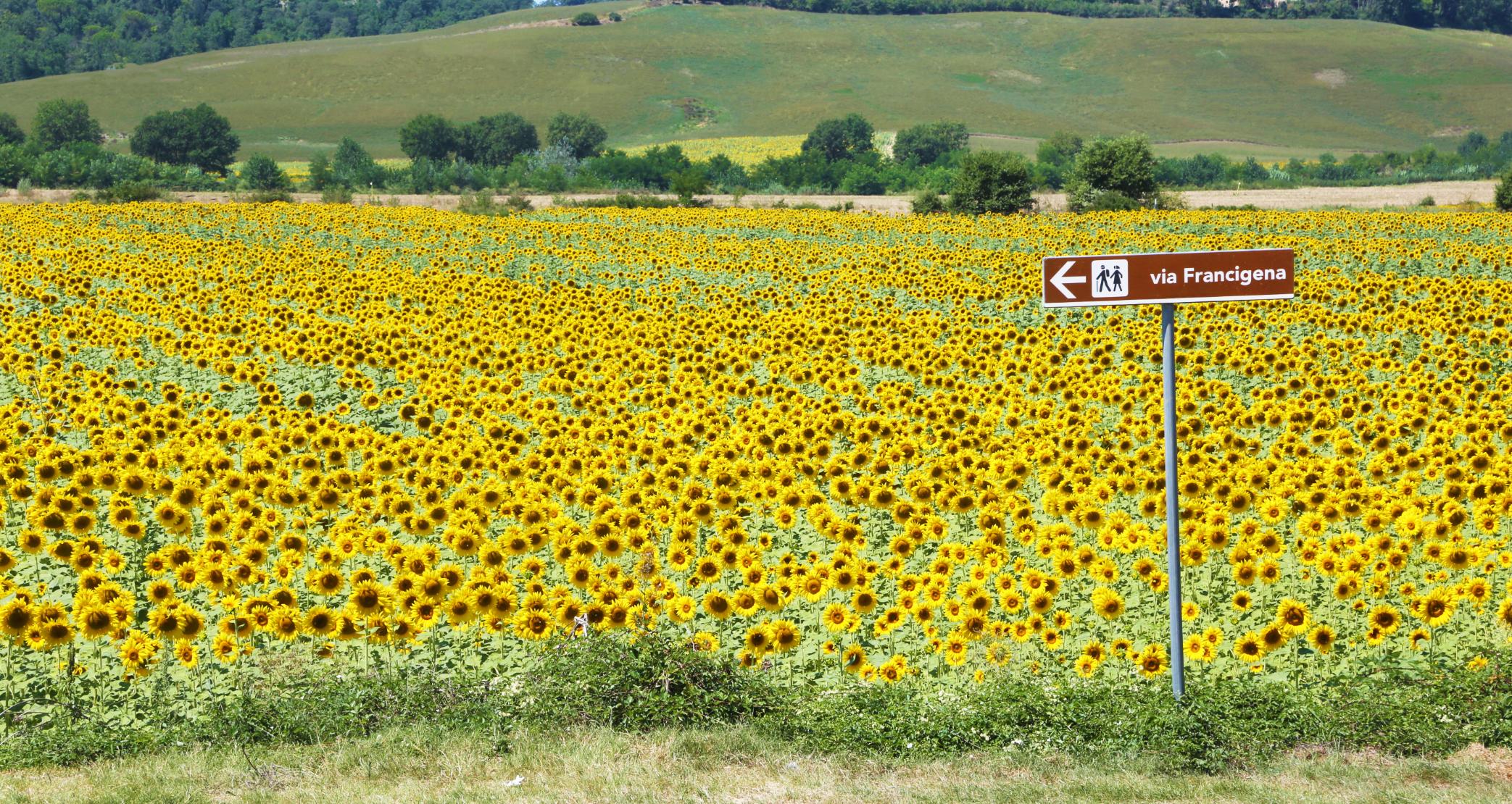
On the other side of Isola d’Arbia, follow a gravel path through the fields to Ponte e Tressa, a village situated at the confluence of two rivers. The path continues along grain fields past Grancia di Cuna, one of Tuscany’s best preserved fortified farms. It winds past fields of sunflowers towards the town of Ponte d’Arbia.
Stage 8: Ponte d’Arbia to San Quirico d’Orcia
- Distance: 16.2 miles (26.2km)
- Hiking time: 7-8 hours
Climb uphill to Buonconvento (which comes from the Larin ‘bonus conventus’, meaning ‘happy place’) — it’s an idyllic village of Renaissance homes. After hiking through the village, follow the Strada Provinciale del Brunello, a path surrounded by vineyards growing sangiovese grapes, used in Brunello wine.
“Brunello di Montalcino is considered the best and the most precious wine of the area—the king of red wines,” Stefano says.
Brunello di Montalcino is considered the best and the most precious wine of the area—the king of red wines
You’ll climb uphill to Montalcino, a town where you can enjoy a glass of the famous Brunello. But go easy; there’s still a few hours’ walk before reaching San Quirico.
From Montalcino, you’ll follow a gravel road along the cypress-lined ridgelines of the Val d’Orcia. You’ll arrive in the small village of Torrenieri and continue downhill. The town of San Quirico d’Orcia will be visible on a ridgeline ahead of you. You’ll begin a long climb up towards it along the Via Cassia.
Stage 9: San Quirico d’Orcia to Radicofani
- Distance: 20.4 miles
- Hiking time: 9-10 hours
This is one of the hardest stages of the route, firstly due to the length and secondly because of the 7.4 miles (12km) of uphill walking at the end. Break it down into two stages if you prefer, overnighting in the town of Gallina.
Leave San Quirico along the Via Garibaldi, emerging onto fields lined with pine and cypress trees. At a Y junction, follow the gravel road uphill to a viewpoint—you’ll catch sight of the fortress of Radicofani on a hilltop in the distance.
Descend to the Bagno Vignoni thermal spa town, where hikers have long been soothing their tired limbs. Afterwards, start the long, gradual climb towards Radicofani. The ascent is steady but relentless, up exposed gravel tracks. But the views of the Val d’Orcia, with its undulating hills and cypress-lined fields, are spectacular.
Shortly after crossing a bridge over Torrente Onzola, the path forks. The left hand trail takes you to the town of Gallina (0.8 miles/1.4km) for refreshments. Otherwise, continue along the Francigena to the historic Church of San Pellegrino. The path continues to climb uphill. As you near Radicofani, the impressive fortress looms above you. The final climb into town is steep but short, rewarding you with panoramic views over the Val d’Orcia.
When to Hike the Via Francigena?
The best time of year to hike the Tuscan section of the Via Francigena is during the spring (March to May) or autumn (September to October), according to Stefano.
“September and October, it's wonderful. All the vineyards and the foliage turn brown and red and yellow,” he says. “November and December are probably a little bit risky for the rain. January is too cold. But from February, you can start to have beautiful days. Then in spring it's exploding with 50 shades of green everywhere.
“The only months I would say you shouldn’t walk are July and August. It’s too hot; you would need to carry a lot of water with you.”
Inspired? Check out our Hike, E-Bike and Wine in Tuscany Adventure along the Via Francigena