


The Annapurna Circuit is one of the world’s great long distance treks. This iconic route winds around the Annapurna Massif in the Himalayas of Nepal, rising from lush, green rice paddies and foothills to reach the remote, lung-busting heights of the Thorong La Pass - which at 5,416m (17,769ft) is the high point of the trail - before dropping back down to follow the course of the Kali Gandaki, one of the world’s deepest gorges.
It’s this unique combination of a high altitude challenge and ecological variation that first drew me to the Annapurna Circuit. Along the way, you pass an overwhelming wealth of mountain culture and experience every ecosystem the Himalayan region has to offer. With the route becoming ever-more popular, road construction and development in the region is relentless, leading some to mourn the loss of serenity and remoteness that the trek first offered up in the 1970s and 80s.

Despite this, having walked the Annapurna circuit twice, first in 2022 and then again in 2023, I can categorically confirm that the trek continues to earn its right as one of the greatest on Earth. For anyone with a love of long-distance trekking and a fascination with the Himalayan region, the Annapurna Circuit remains the holy grail of adventures – one you simply cannot miss.
Annapurna Circuit: The Basics
We’re going to describe the route of the Annapurna Circuit in full in this article, but there are a few bits of information that it’s good to have first.
Where Does the Annapurna Circuit Start and End?
If you ask 10 different people about the start and end point of the Annapurna Circuit , you’ll likely get a different answer from each . The official starting point of the trek is Besisahar, the district headquarters of Lamjung District in Gandaki Province, with the official end in Nayapul, a small village in the Kaski district. In recent decades (much to the lament of old schoolers and purists), development and road encroachment has made it plausible to start and end the trek in a much shorter time frame.
The vast majority of trekkers will hike the route anticlockwise. This ensures that the daily altitude gain is slower, allowing your body to acclimatise more. In turn, this should make crossing the Thorong La Pass easier and safer.
How Long is the Annapurna Circuit?
The route distance is roughly 81 miles (131km). Depending on how fast or slow you push and where you start and end, it’ll take between 10 to 20 days to complete it.
How Difficult is the Annapurna Circuit?
The Annapurna Circuit can be considered a difficult long distance trek due to its length and elevation. The high point is reached as you pass over the impressive, remote mountain pass of Thorong La at 5,416m above sea level – a demanding task. The route should only be attempted by those with a good level of fitness and ability to handle multiple weeks of walking long distances.
Of course, if you can (and in my opinion you should) slow the trek down, you’ll give yourself the opportunity to acclimatise, walk at a more leisurely pace and spend more time exploring the various villages and regions along the route. This makes the trek easier.
What Permits do I Need for the Annapurna Circuit?
As is the case for the many other treks in Nepal, you’ll need both a TIMS (Trekkers' Information Management Systems) card and Park Entrance Permit. These can be purchased at the Nepal Tourism Board office in Kathmandu before you begin your trek, or as you enter the Annapurna Conservation Area (it’ll cost slightly more for the latter).
Where is the Annapurna Circuit?
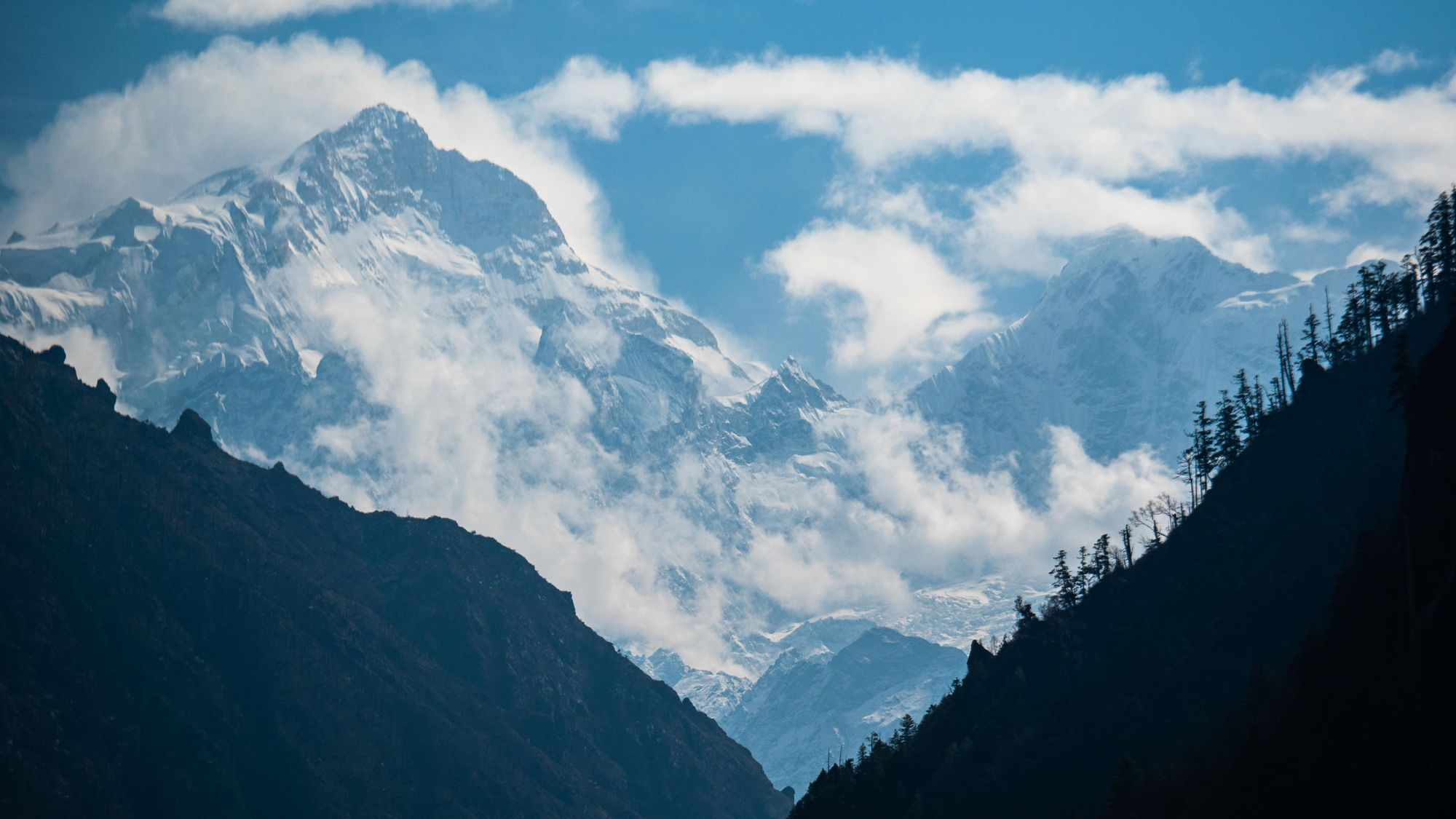
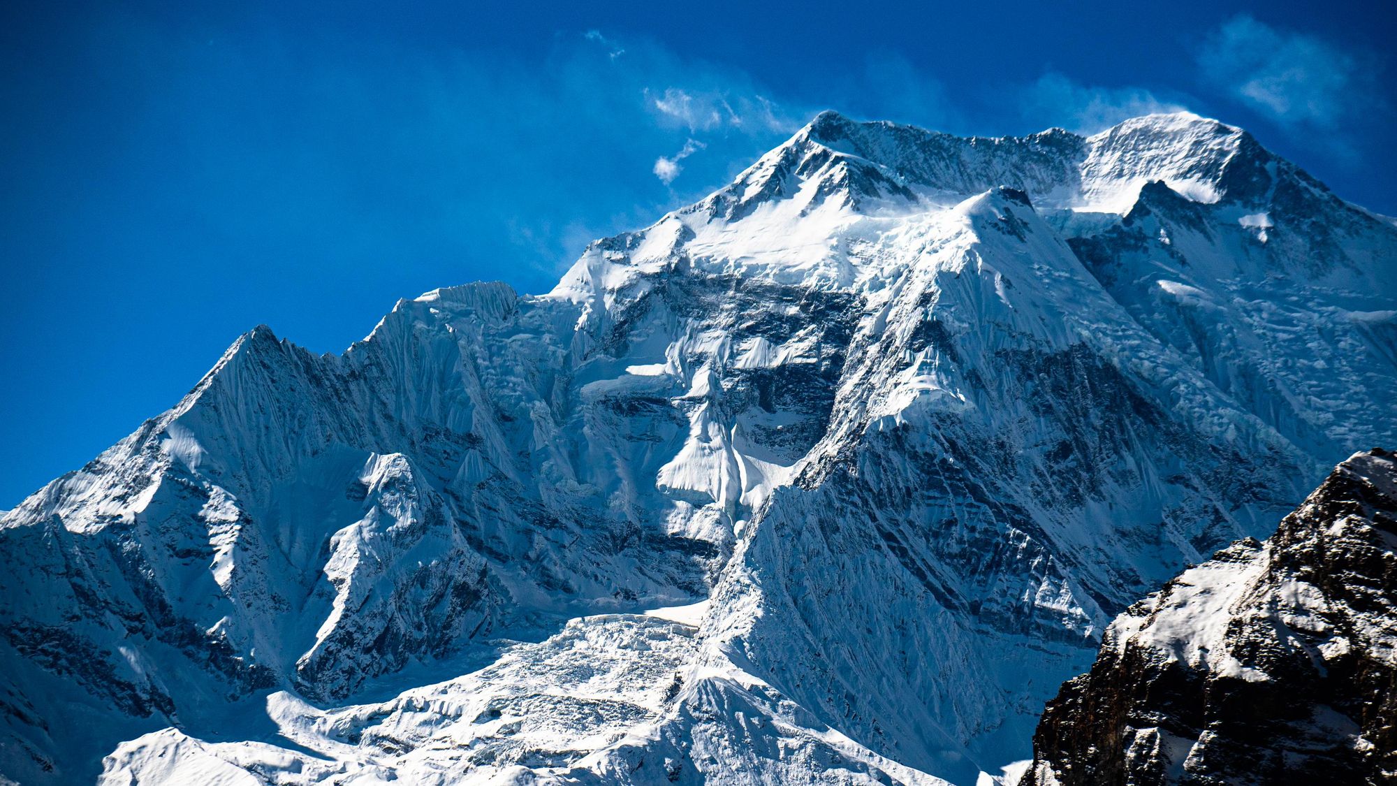
The Annapurna Circuit threads itself around the mighty Annapurna mountain range which can be found in Central Nepal on the northern border with Tibet. The range is home to some of the highest mountains in the world - the tallest of which is Annapurna I. At 8,091m (26,545ft), the mountain is the world’s 10th highest summit. To the south of the Annapurna Massif is Pokhara which is the closest major city, while Kathmandu is an 8 hour bus journey to the east.
The Day by Day Breakdown
Below is my day-by-day breakdown of the route, which I have walked twice – first in March 2022 and then the following year in March 2023. Because there are so many villages along the way, it’s worth noting that the route and itinerary may vary slightly depending on your schedule and your guide’s plan.
- Day 1: Ngadi to Jagat, 9 miles (14.5km), 6 hours
- Day 2: Jagat to Dharapani, 9.8 miles (15.7km), 7 hours
- Day 3: Dharapani to Chame, 10.2 miles (16.4km), 8 hours
- Day 4: Chame to Upper Pisang, 9 miles (14.5km), 6 hours
- Day 5: Upper Pisang to Manang, 12 miles (19.3km), 9 hours
- Day 6: Rest day in Manang to acclimatise
- Day 7: Manang to Yak Kharka, 6.2 miles (10km), 5 hours
- Day 8: Yak Kharka to Thorong Phedi, 4 miles (6.5km), 3 hours
- Day 9: Thorong Phedi to Muktinath via the Thorong La Pass, 10 miles (16km), 10 hours
- Day 10: Rest day in Muktinath
- Day 11: Muktinath to Kagbeni, 5.5 miles (8.8km), 3 hours
The Annapurna Circuit: Notes from the Trail
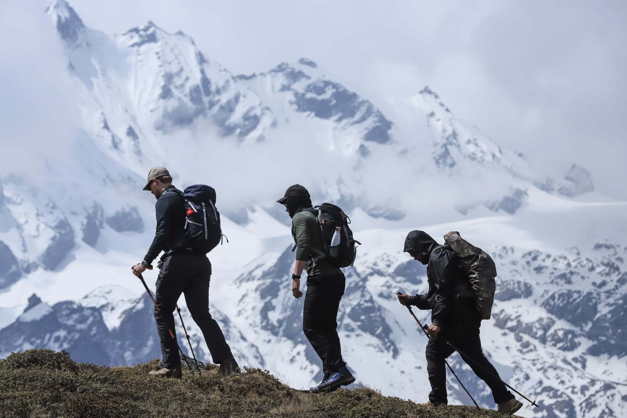
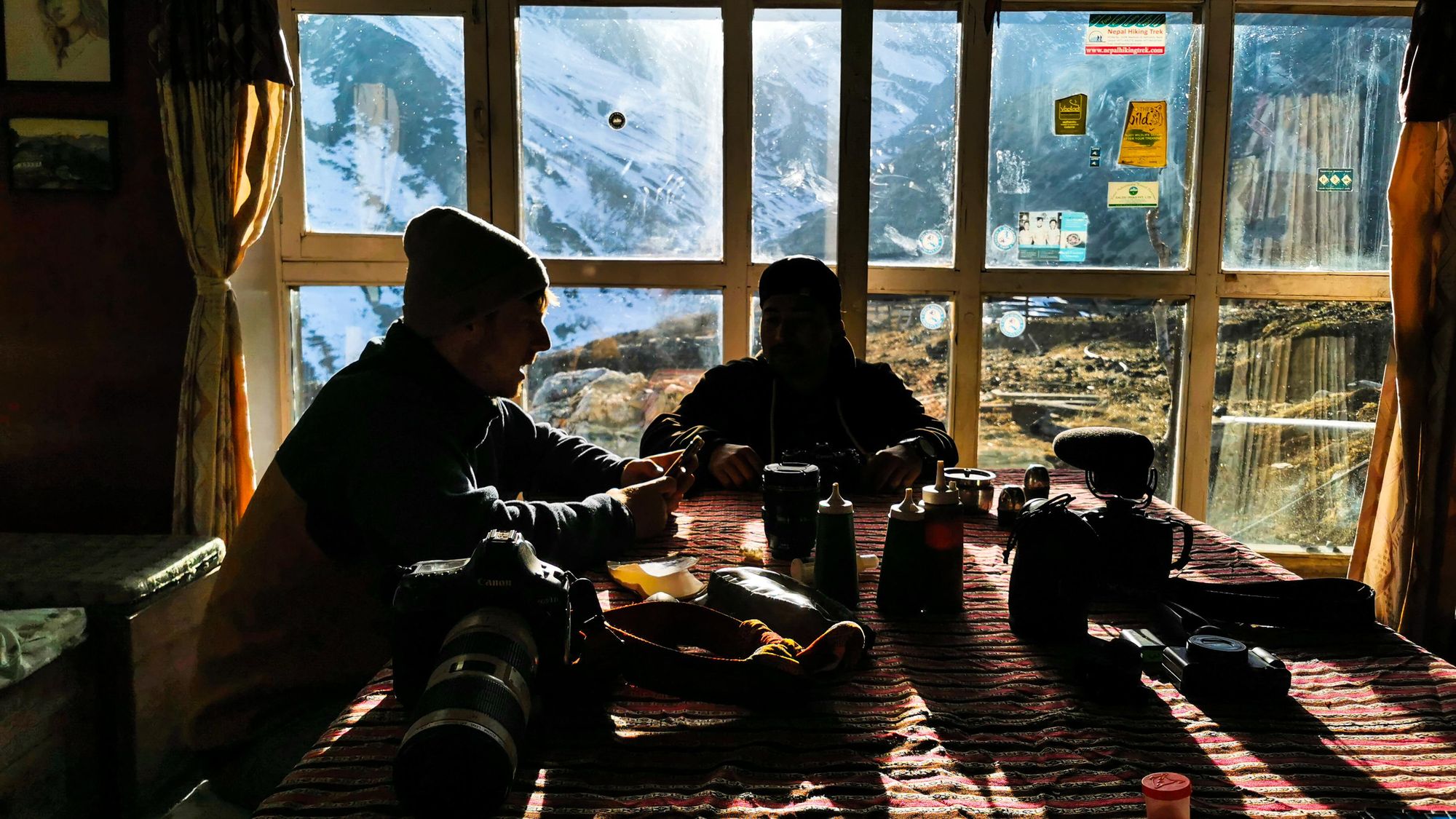
In 2022 I set off from Ngadi with my best friend Ben and our trusty mountain guide Deepak. In my mind, the circuit feels like it can be naturally broken down into different sections, depending on the elevation and consequently the type of habitat that you’re passing through.
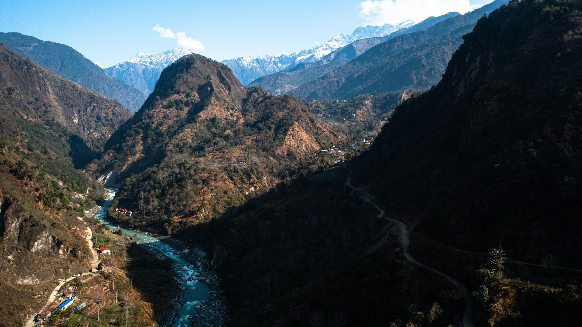
The first few days from Ngadi (1,000m/3,280ft) to Dharapani (1,860m/6,102ft) are all about feeling our way into the trek. Accompanied by the meditative roar of the River Marshyangdi and twittering birds, we wind our way through the verdant green rice terraces and serene forests of the Annapurna foothills. It’s here that my body adjusts to the rhythms and demands of consecutive days of long distance walking and I build a relationship with my gear. What’s the optimal tightness for this bag strap? Where’s the best place to carry my camera? Can I access my water in a more efficient way? The simple stuff that you can only figure out as you walk.
The idea that the famous Yr Wyddfa (1,085m/3,562ft) of Wales, also known as Snowdon, could be considered anything close to a mountain was laughable to our guide Deepak. Not even the summits around us, rising up to 5000m or more were true mountains - they were merely hills in the Nepali mind.
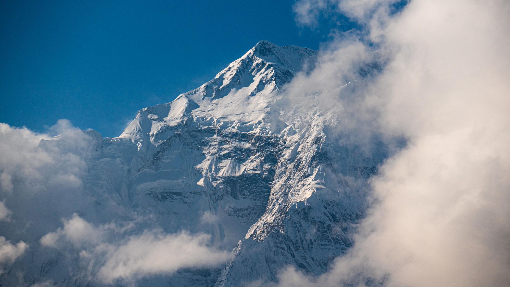
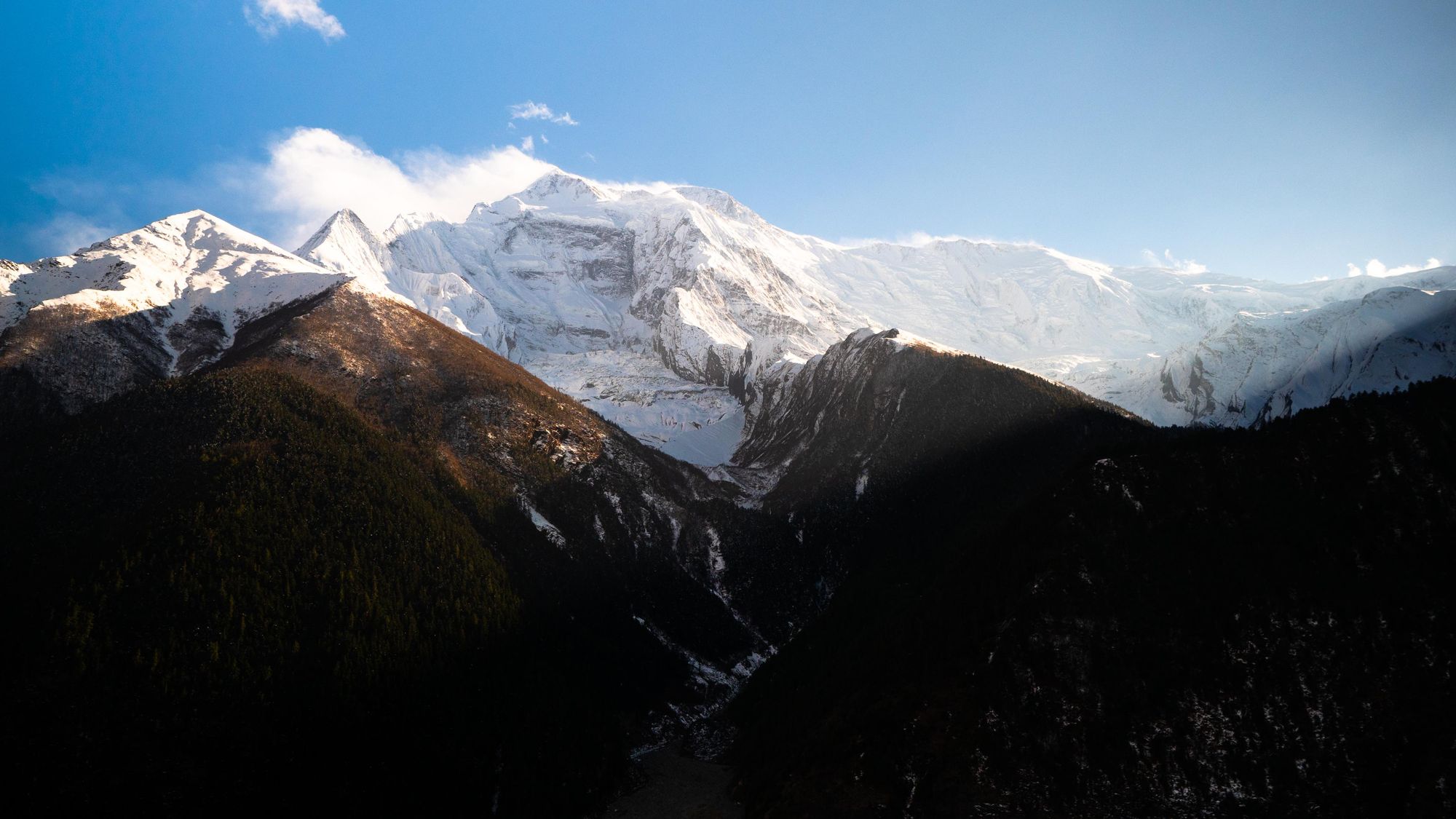
It’s from Dharapani onward that we encounter snow for the first time and get a glimpse of the “real” Himalaya, including Manaslu (8,163m) – the eighth highest mountain on Earth.
Towering peaks begin to close in on Chame (2,650m) which feels very much like a frontier town – a starting point for those more eager trekkers short on time and patience. We grab supplies of chocolate and invest in warm yak wool socks - which we’ll come to be thankful for later - before pushing onward, twisting up through the valley and being squeezed out at the top like toothpaste, yet again finding ourselves in another beautiful world at Upper Pisang (3,300m).
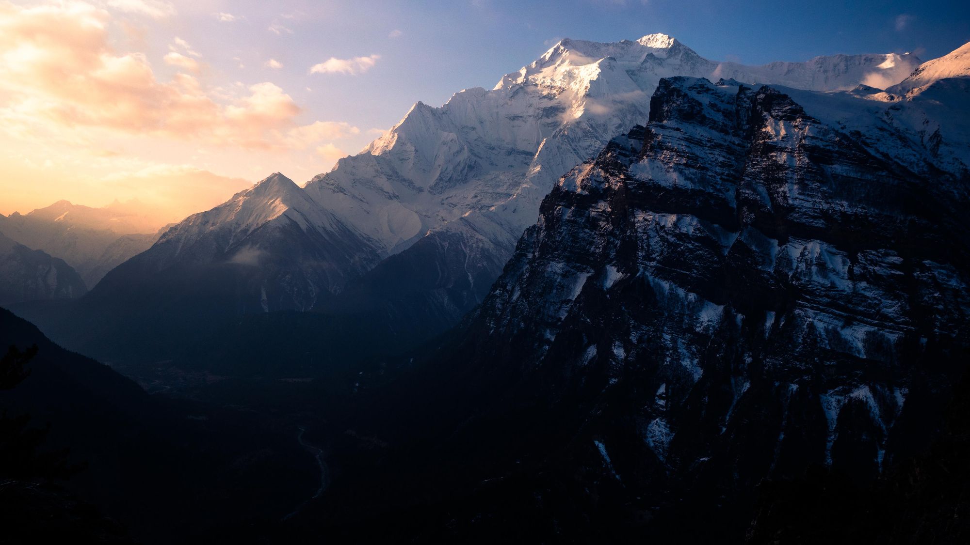
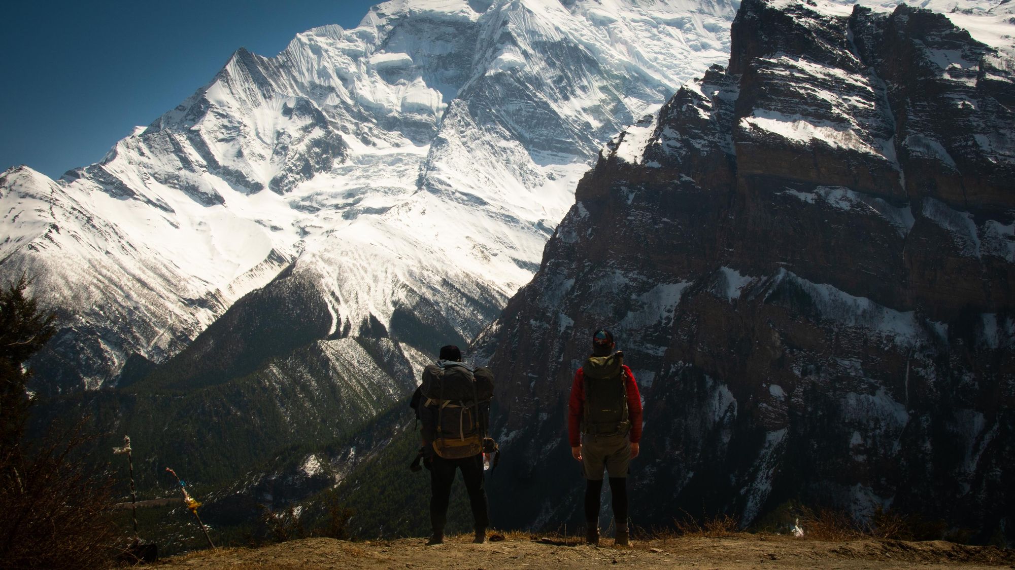
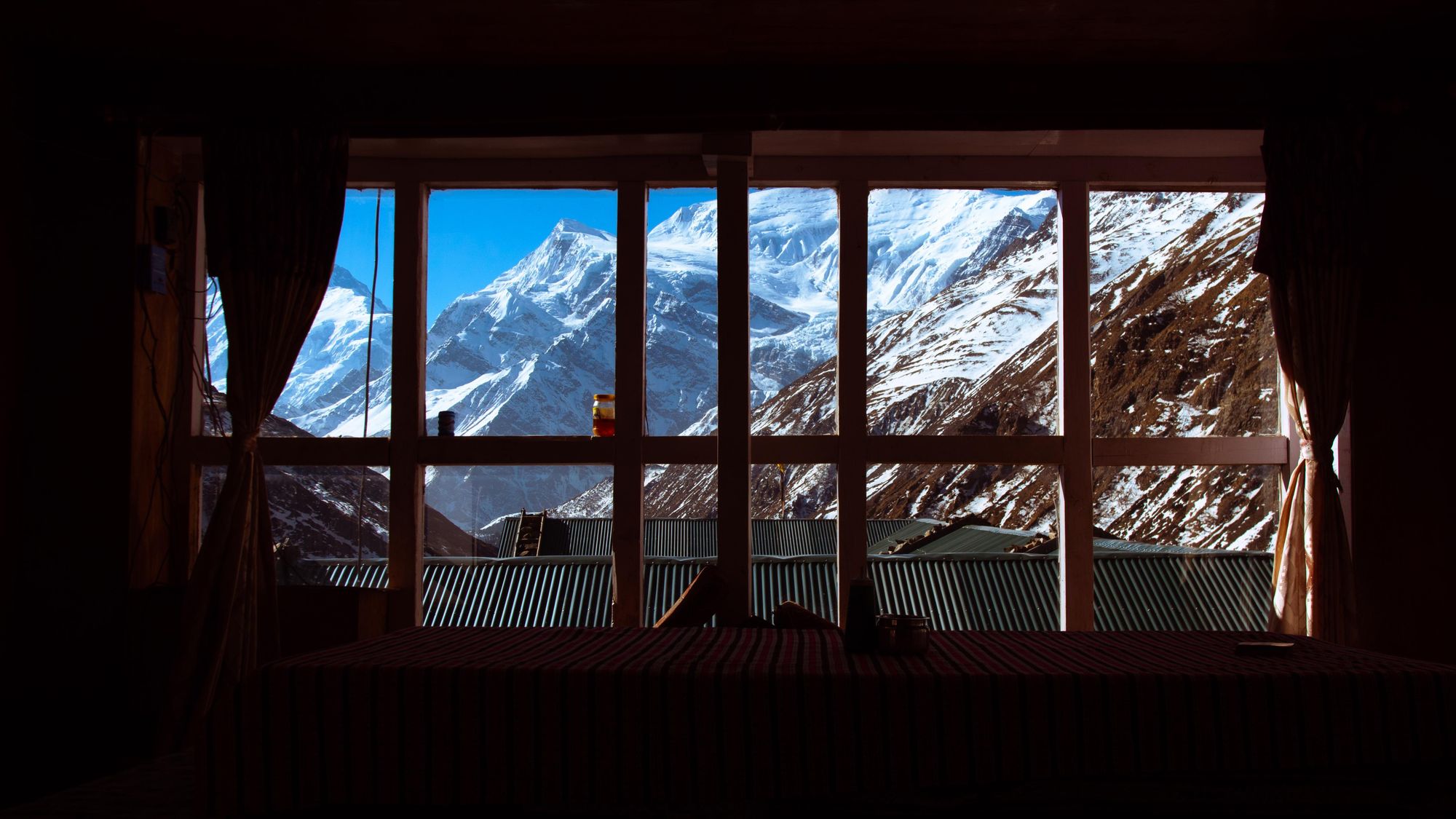
The view of Annapurna II (7,937m) out of the window of our room that evening is astonishing. I ponder how much you would pay for such a thing back in Europe. This breathtaking sight is a precursor for the following day.
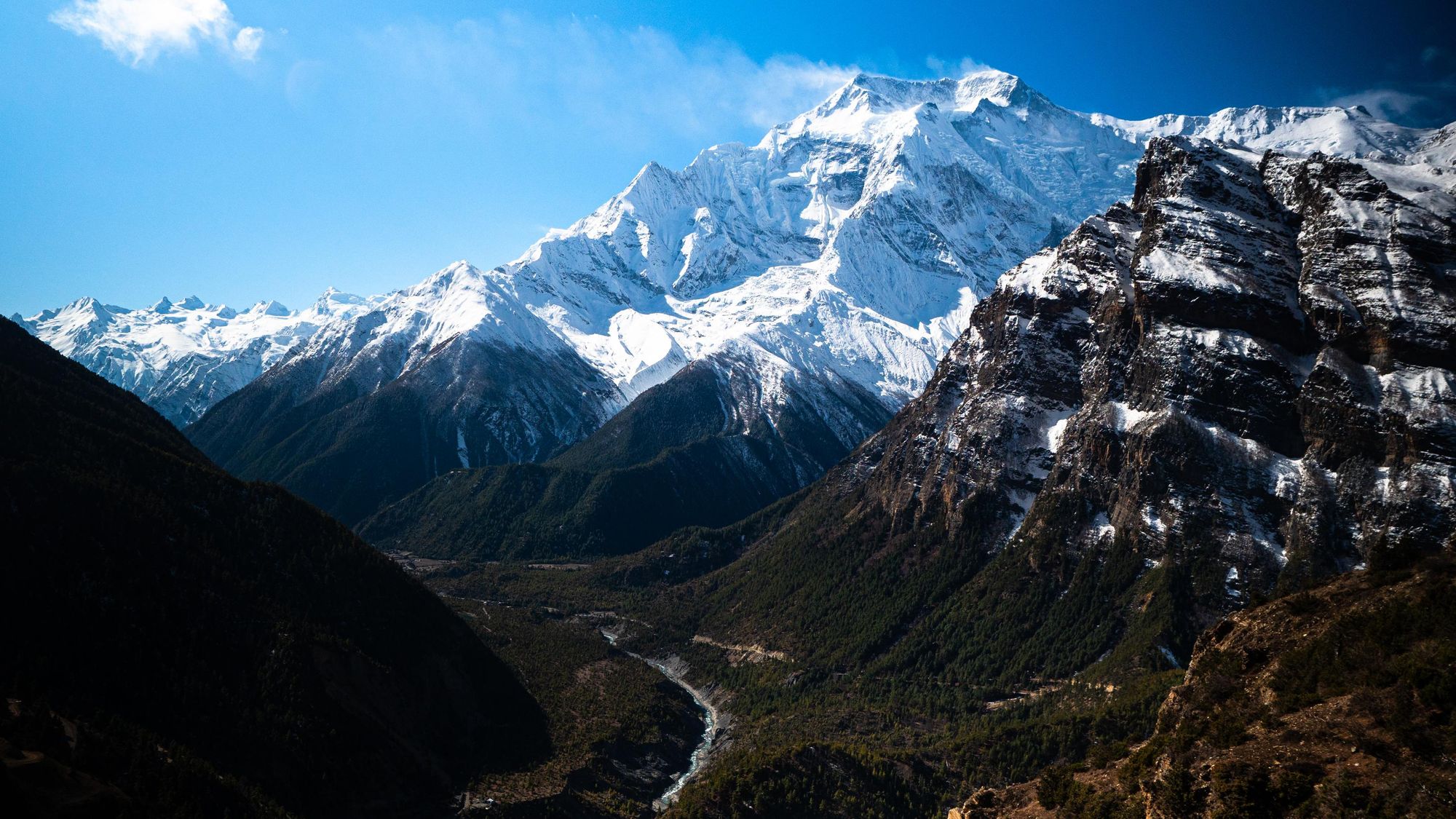
While it’s possible to walk to Manang - a town at 3,519m, surrounded by mountains, via the Lower Pisang route along the valley floor, please don’t do yourself such a disservice. The Upper Pisang route was perhaps my favourite day on the whole of the Annapurna Circuit – jaw-dropping views of quintessential, shimmering white Himalayan peaks accompany you the whole day. We take so long capturing photos and filming up here that we don’t arrive in Manang until 7pm – well after the sun has already set behind the Annapurna Massif.
Manang is another marker on the map – a place to rest for a day or two, allowing the body to acclimatise while exploring a dusty, arid mountain valley home to snow leopards and ancient Buddhist mysticism. It’s noticeably colder up here. Shorts and activewear t-shirts have now been swapped for warm fleeces, long trekking pants and warm, woolly hats.
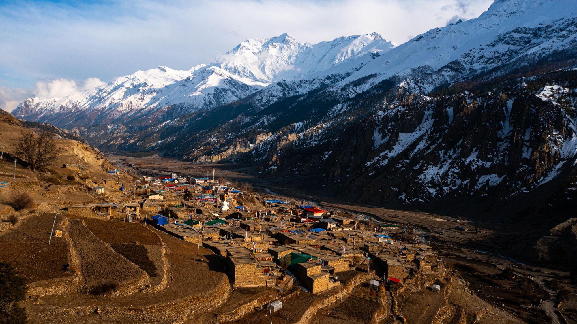
This is the end of the road for all the jeeps and vehicles that have been so relentless for the past week, ferrying up countless supplies and people. From here on out we will be in truly remote wilderness with no internet connection.
When we restart, we get back to ascending, further into the mountains. Pushing on upwards, I spin as many prayer wheels as I can while the air thins at an alarming rate. Consequently, the distances covered and elevation gained is now a little shorter than previously. We are playing a different game up here. Yak Kharka (4,020m) gifts us glorious views of both Annapurna III (7,555m) and IV (7,525m) while a herd of Yak are ushered back into the safety of their pen under deep blue twilight, protected from prying snow leopards by a pack of rowdy dogs.

The next day we aim for Thorong Phedi high camp (4,880m) but I begin to feel the dreaded symptoms of altitude sickness kicking in. My head feels light and dizzy, I’m finding it hard to breathe and every step forward is getting harder and harder. As if to underline the randomness of altitude sickness, my friend Ben bounds on like a spring lamb, completely unaffected by what I’m enduring.
We take a break at Thorong Phedi (4,540m) so I can take on as much garlic soup as possible (thought to help alleviate altitude sickness) before realising that the day is well and truly done. Whether I can make it over the high pass of the Circuit tomorrow hangs delicately in the balance. Altitude sickness is a serious issue, and I’m forced to leave it to the morning to decide.
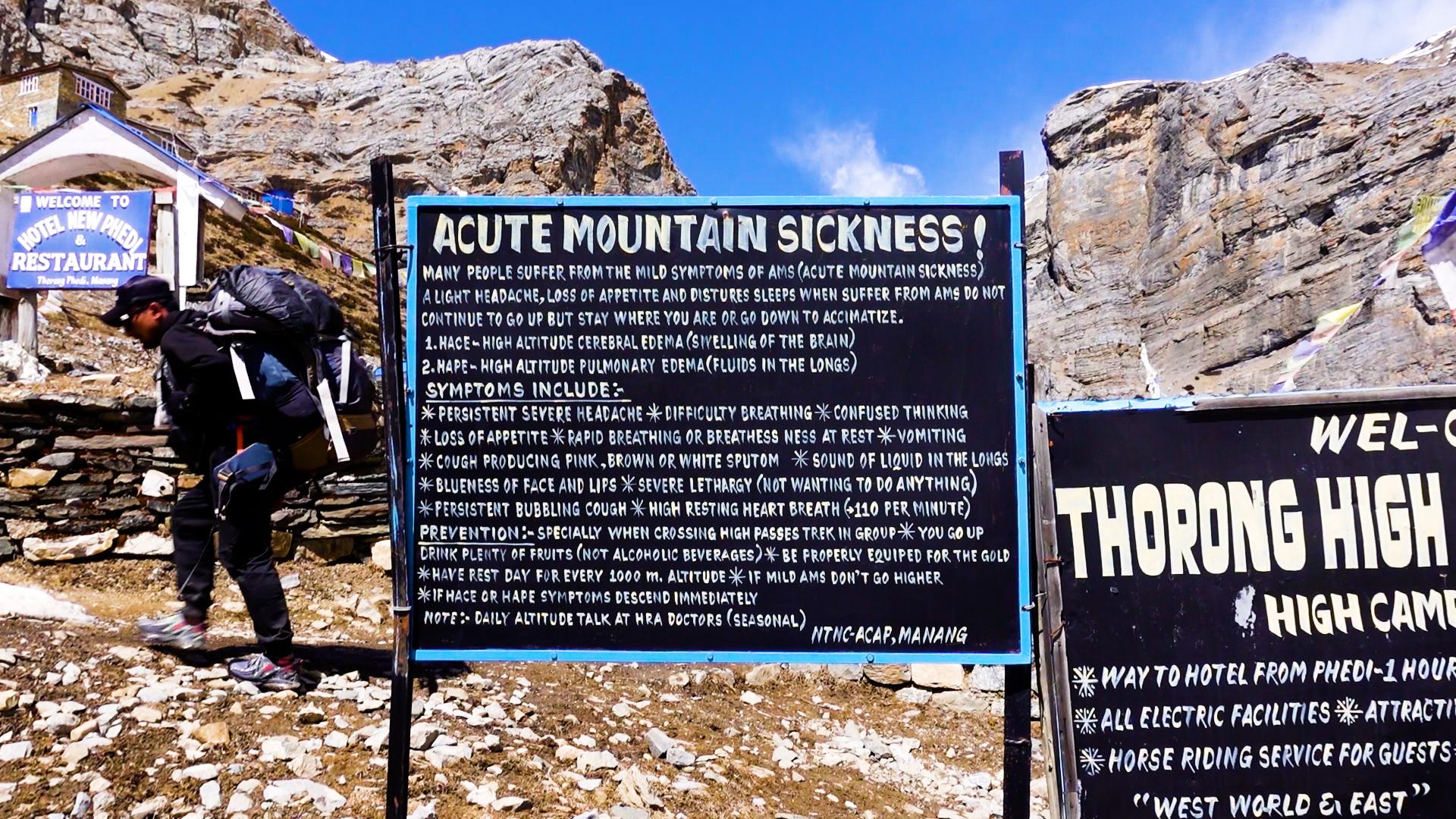
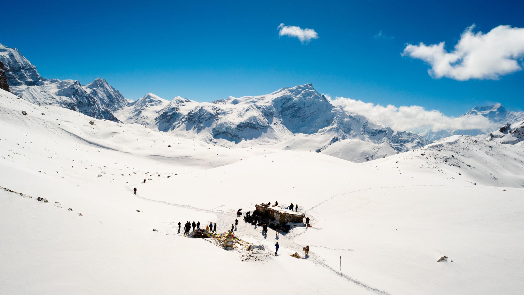
We rise at 3am, head torches flickering in the desperately cold dead of night. We trudge, zig-zagging the steep incline up to high camp – some 300 metres of elevation gain in one hour. Up here, we are well and truly in the Himalaya. Crampons are attached and we push on through the snow as the sun rises from behind glistening white pinnacles of ice and rock, basking us in golden warmth. It’s a truly incredible moment, and yet I feel terrible all at the same time.
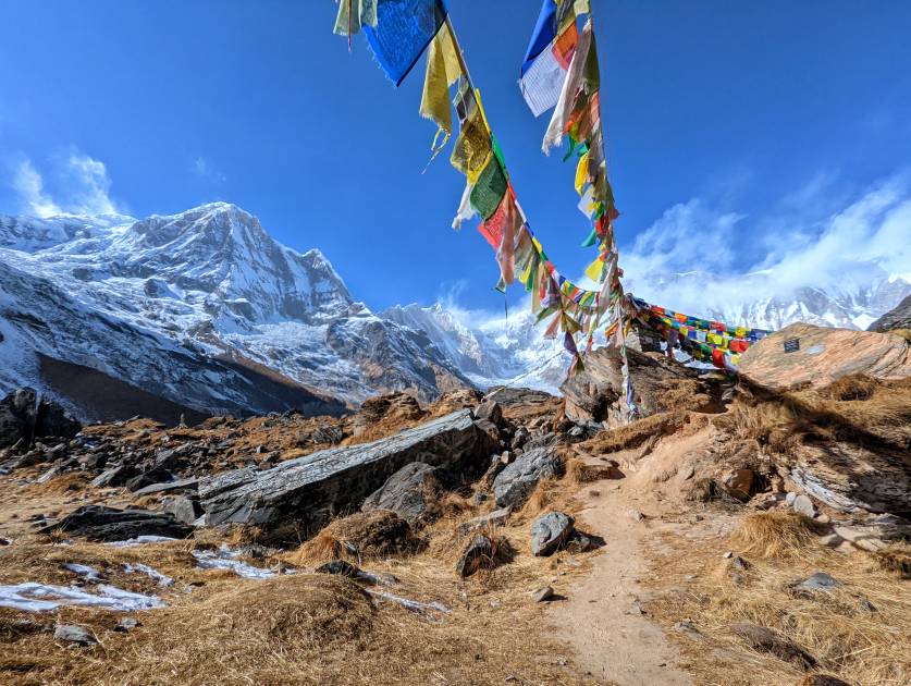
My head is pounding and I’ve lost my appetite completely. Even the smallest of steps forward is excruciatingly difficult. I wonder whether the game is up. Deepak, now somewhat flagging himself in this dangerously thin mountain air, attempts to reassure me. “It’s just over this next hill I think,” he breathes heavily. But the pass does not come. Time and time again we are met with false summits. I’ve reached empty, the lights on the dashboard all blinking red. And then, staggering past a small mound, I look up to find the blinking dashboard lights merged into the vibrant colours of prayer flags. They flutter in the wind, draped over a large plinth that reads “THORONG LA PASS. 5,416m. Congratulations for the success”.
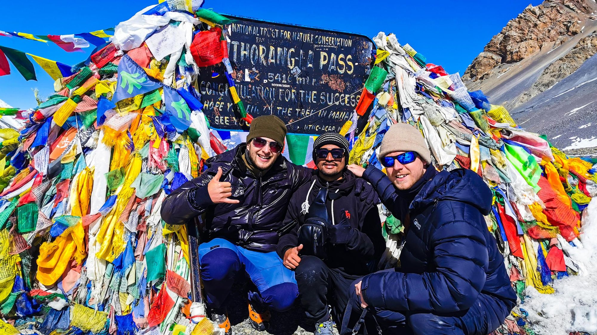
There are tears of joy and relief, hugs and whoops of laughter, hot coffees and quiet moments of reflection. And then we must move. The weather can turn at any moment, Deepak warns. It’s time to descend back down to Muktinath (3,710m) in a blur of ecstasy and disbelief. The oxygen returns with haste as the altitude drops and I drink it all in thick, like a delicious soup.
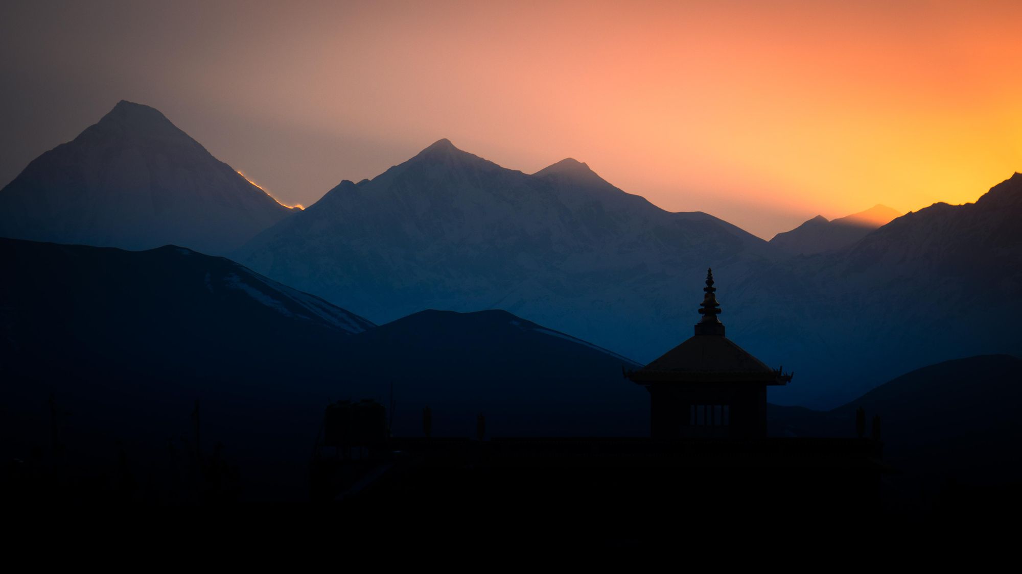
For the first time in days, we encounter civilisation and the outside world in the dry, dusty embrace of Muktinath.
Muktinath Temple (3,800m), which sits at the foot of this high pass, is one of the world’s highest temples. Sacred to both Hindus and Buddhists, it’s an essential destination for thousands of pilgrims – some of who have walked barefoot all the way from India. Deepak guides us around the busy site proudly (including a breathtakingly cold dip under 108 taps of fresh water).
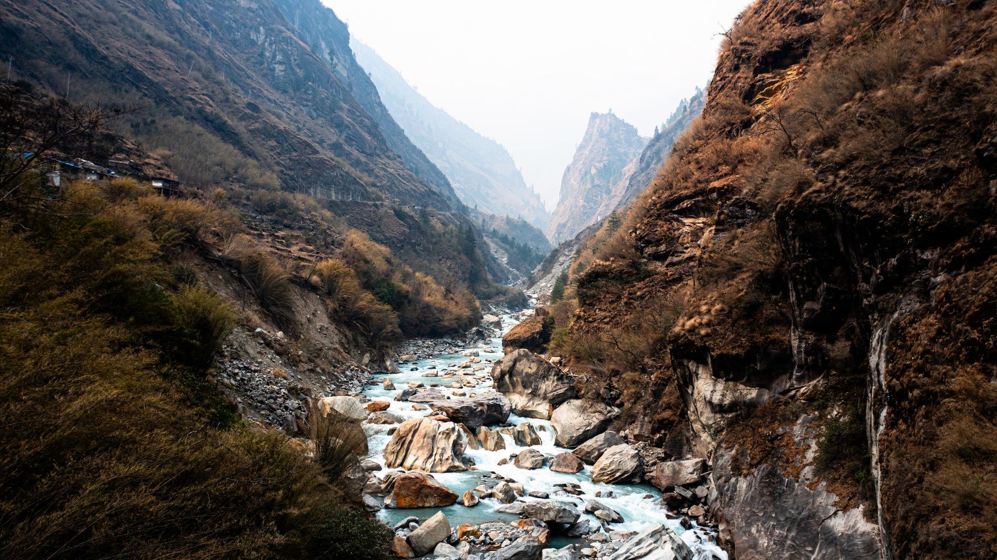
He utters his prayers and then we’re off again, descending down into what feels like the belly of the earth. In two days we’ve lost some 2,600m of elevation, now arriving in Kagbeni (2,804m) at the start of the Kali Gandaki gorge – the deepest gorge on earth.
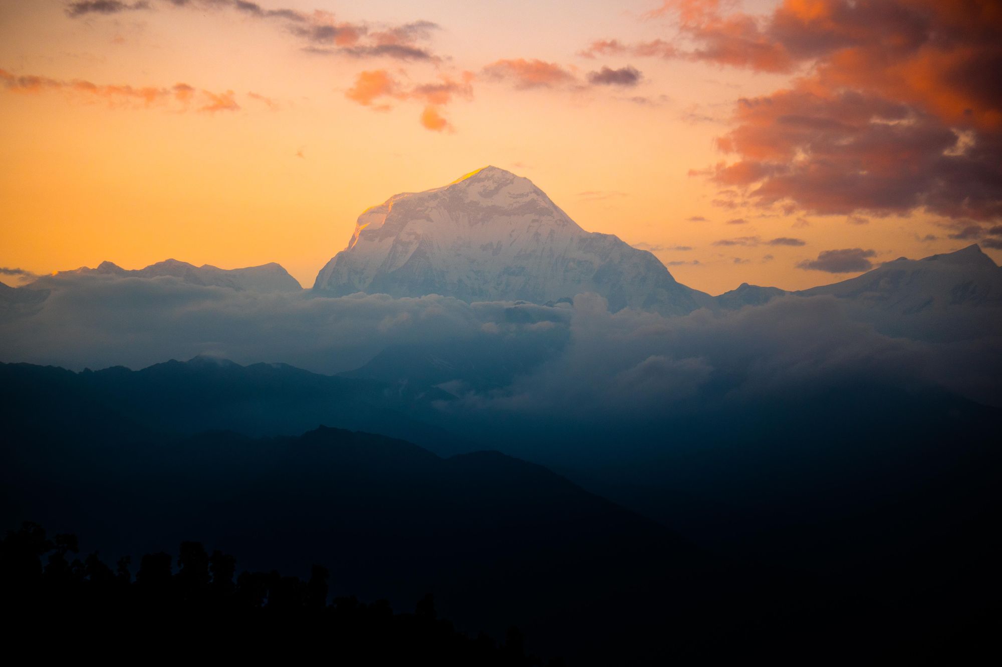
From here, opportunities abound. Some trekkers will continue the classic circuit, walking out toward Beni and beyond. Some, like us, catch a bus to Tatopani and continue on foot up to Ghorepani and Poon Hill, while others head straight for the welcoming comforts of Pokhara.
A Note on Altitude Sickness
In 2022 I really suffered from altitude sickness. Reaching the summit of Thorong La Pass was very much touch and go in the last hour. If it had been much further, I would’ve had to call it quits. In hindsight, I can see I was pushing too hard, too fast – a classic mistake.
On my return in 2023, I took the trek at a much slower pace. I broke some days into half days, allowing myself to sleep more regularly and for longer at various altitudes along the way, including a couple of days up above 4,000m, before coming back down to sleep at 3,500m and so on. As a consequence of this, I suffered absolutely no symptoms of altitude sickness when I crossed over the pass for the second time. In fact, I felt surprisingly fit and healthy!
This change in style is testament to the fact that the very best way to protect yourself from altitude sickness is to take things as slow as possible. If you have the luxury of time, make the most of exploring the many amazing towns and villages along the route. Give your body the proper opportunity to adapt and acclimatise. There is no real rush and in 2023 I got a lot more out of my experience, culturally speaking.
Accommodation: Where to Stay on the Annapurna Circuit
The Annapurna Circuit is second only to the Everest Base Camp Trek in terms of popularity, which means in peak months the route can be quite busy and teahouses fill up fast. Fortunately, to accommodate the many trekkers, there are plenty of teahouses available at just about every town and village along the route.
Depending on your budget and style of travel, you can sleep in a dormitory with others or secure your own private room, perhaps even with an ensuite. Hot showers aren’t a guarantee but should be easy enough to find everywhere up to Manang. The food options available are surprisingly generous given the remoteness of the region – testament to the road, perhaps. There’s plenty of western choices alongside Nepali classics but the menu doesn’t differ all that much from teahouse to teahouse.
If you’re cold at night, you can ask for extra blankets but when the teahouses are full there may not be enough to go around, so bring a sleeping bag with you just in case.
Here are my top picks that stood out along the way:
- The Royal Garden Hotel and Restaurant in Chame. This place is a cut above the rest in Chame. There was a great hot shower, and wood panelled rooms that felt really well built and cosy.
- Mandala Hotel and Organic Cafe in Upper Pisang. The owner Mina is incredibly kind and welcoming, as well as a great cook! She’ll make you feel right at home and those views of Annapurna II out the window…goodness me. I could live here, quite happily.
- Tilicho Hotel in Manang. At the moment in the trek when you’re craving a bit of luxury and the temperatures are dropping, the Tilicho Hotel feels like a gift from the gods. Yes, the prices are higher than anywhere else on the trek but you get what you pay for. The dining rooms are ridiculously warm and comforting and the food exceptional. Stay too long and you’re in danger of never leaving.
- Yac Donalds in Kagbeni. It’s a brilliantly creative name and the coveted Yak burger is the highlight on the menu – a delicious reward for finishing the trek. The rooms are really, really cosy too.
When is the Best Time to Walk the Annapurna Circuit?
As is the case for most of the trekking in Nepal, there are two windows of opportunity in the calendar year which are considered best for trekking the Annapurna Circuit. The first is from March to April in the spring, when the weather is more reliable and settled than the previous winter months, and the mountains are still covered in snow. The second period is in the autumn, from October to November. This is generally the most popular time of year to trek the circuit because the weather is stable with beautifully clear blue skies and there will be less snow on the mountains after the wet season. Temperatures also tend to be a little warmer than spring.
Attempting to trek the Annapurna Circuit during the winter months (December, January and February) is not advised. The weather is highly unpredictable and there can be a lot of whiteouts and blizzards at higher altitudes, making the way unpassable. Meanwhile, during the summer months of June, July and August, torrential downpours can cause huge landslides and flooding in the area, not to mention making it a rather miserable trekking experience.
Shoulder months such as May or September can be a good time to catch some great weather while experiencing the trek when it’s quieter.
Inspired? Check out our 16-night hike on the Annapurna Circuit now!