


The Brecon Beacons National Park in Wales covers 520 miles of glorious walking territory; moody mountains, wild moorland and plunging waterfalls. While its peaks might not reach the lofty heights of those in Snowdonia, you'll be sharing the trails with far fewer walkers. The fact that it has recently been designated as the first International Dark Sky Reserve in Wales adds to its appeal - you can enjoy a spot of stargazing after a day’s hike.
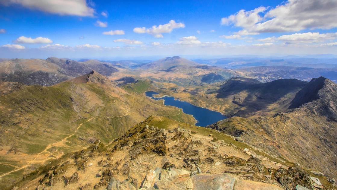
The centre of the park is dominated by the red sandstone Brecon Beacons; the highest is Pen y Fan, at 886m. Black Mountain in the west (not to be confused with the Black Mountains in the east) is a remote landscape of barren rocky mountains towering over glacial lakes. Forest Fawr is the hilly geopark between them.
We’ve selected some of our favourite walks within the Brecon Beacons National Park. They’re epic whole-day affairs that will take you up mountains, across steep ridges and around glacial lakes. Whilst many of them are signposted, we’d always recommend taking a map and compass. We’ve been hiking in the Welsh mountains when the mists roll in, and visibility drops. You need to know your way.
Now, it’s time to lace up your walking boots and get exploring…
1. Pen y Fan Horseshoe Route
Distance: 9.5 miles
Walking time: 4-5 hours
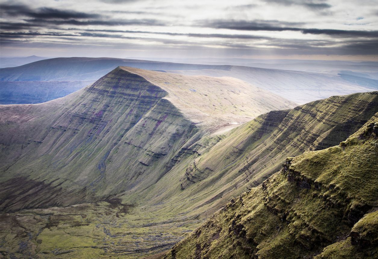
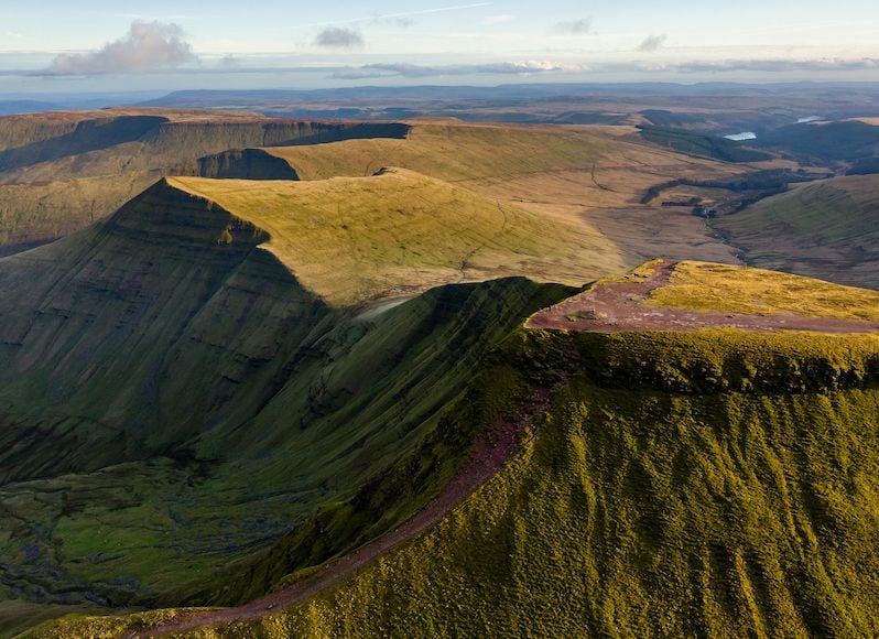
Pen y Fan, as the highest mountain in the Brecon Beacons, is the most popular to climb. Many walkers opt to park in the Pont ar Daf car park on the A470 for the gentlest ascent. But our suggestion is more challenging, offering up better views and fewer crowds.
The Pen y Fan Horseshoe route traces the ridge of a glacial valley and traverses four of its peaks: Corn Du; Pen y Fan; Cribyn and Fan y Big. Head north along the road from Taf Fechan car park until you reach the Lower Neuadd Reservoir. Make your way to the left; go through a gate and begin the steep climb onto the Graig Fan Ddu ridge. Follow it right to Corn Du. Here, the path forks - take the left to ascend the crest of Corn Du and continue on to Pen y Fan. Stop to appreciate the amazing views of the peaks and glacial moraines.
 Emily Woodhouse
Descend, steeply. You’ll reach a stone path that takes you down Craig Cwm Sere and up again towards the summit of Cribyn (watch out for boggy ground). You’ll descend onto the Gap Road, a track formerly used for horse drawn carriages. At this point you can make the ascent up Fan y Big or continue on until you reach the road you started from. Follow it back to the car park.
2. The Beacons Way
Distance: 99 miles
Walking time: 8 days
The Beacons Way is a multi-day hike that will introduce you to the diverse landscapes of the park. It takes you off the beaten track, along less travelled paths. Waymarking is limited - so map reading and navigation skills are required - and there will be some challenging ascents! But you’ll be rewarded with spectacular views.
The first day’s walk takes you from Abergavenny to Llanthony Priory, a 12th century ruin. You’ll climb two summits - The Skirrid and Hatterrall Hill - where you’ll join the Offa’s Dyke path for a couple of miles. Day two leads you across three dramatic ridges to the picturesque town of Crickhowell. The third day is less strenuous - a hilly walk to the village of Llangynidr. On the fourth day, you’ll be completing the Pen y Fan ridge walk, albeit from a different start point, and finishing at the Storey Arms.
On day five, you’ll be walking to the quieter area of the western Brecons, following the ridge of Craig y Fro through Ogof Ffynnon Ddu National Nature Reserve. The following day takes you through Black Mountain country, past Llyn y Fan Fawr, South Wales’ highest natural lake, and along the steep ridge of mountains around it. You’ll finish in Llanddeusant, the starting point for the next day’s hike to Carreg Cennen Castle, which is predominantly over open moorland.
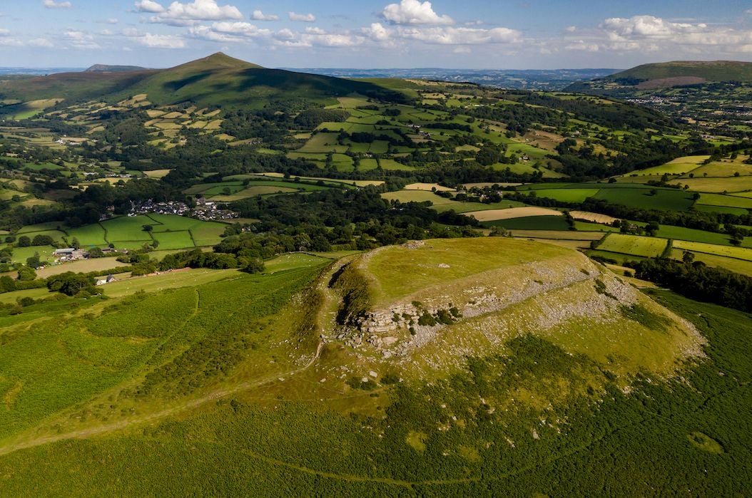
The final (and the easiest) day takes you through two iron age hill forts - the first, Garn Goch, offers panoramic views of the Towy Valley and the Brecon Beacons. It takes you down to the little village of Bethlehem (yes, really) before finishing at Llangadog Railway Station.
3. The Dragon’s Back Circular Walk
Distance: 7 miles
Walking time: 3-4 hours
On this walk you’ll ascend to the highest peak in the Black Mountains - Waun Fach (811m) by scrambling along the Dragon’s Back, a ridge said to resemble the shape of a sleeping dragon.
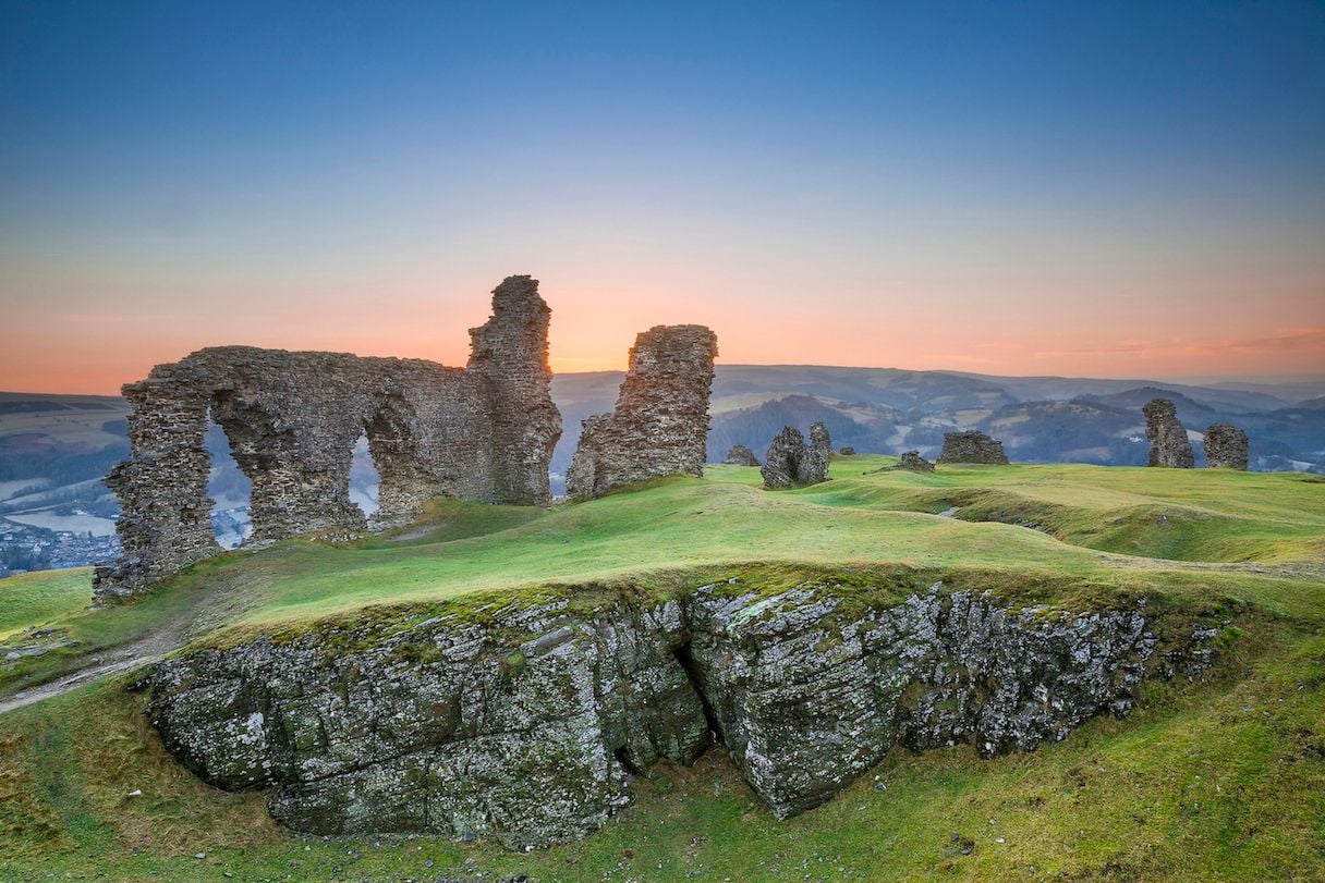
Begin in the village of Pengenffordd, where you’ll follow a small lane from the north east end of the car park, across a field and straight into an uphill ascent. You’ll pass the atmospheric Castell Dinas, a ruined Norman Castle, before hitting the peaks and troughs of Dragon’s Back. The end is demarcated with a stone cairn - from there you’ll need to navigate a section of bog before heading right up Pen y Manllwyn. Next, it’s south for your final climb up Waun Fach. You’ll be treated to a panorama of the park’s most well-known peaks, including Sugar Loaf to the south and Pen y Fan to the west.
The descent begins gently, then steepens as you head towards the saddle between Pen Trumau and Mynydd Llysiau. Turn right at the crossroads, and you’ll find yourself on a tarmac road. It’s another right, then left down a winding lane. As it climbs back up, keep an eye out for a bridleway - that’ll take you through a small forest and back to the car park.
4. The Waterfall Circuit
Distance: 9 miles
Walking time: 4-5hrs
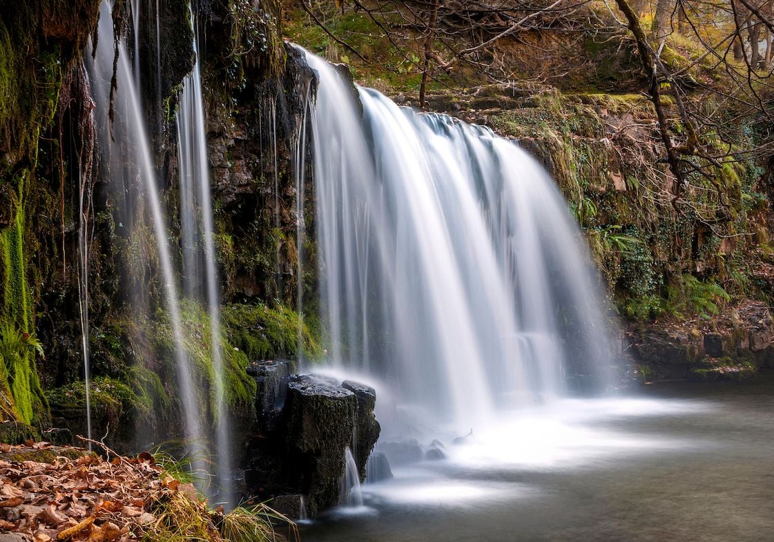
The Brecon Beacons National Park isn’t all about mountain scrambles - it’s also about waterfalls and ancient fairy kingdoms! This walk through ‘waterfall country’ incorporates the Elidir Trail - a route based on a 12th century legend of a young boy named Elidir who was shown a fairy kingdom on the River Neath. But because it’s only a few miles long, we added on a few extra waterfalls too!
Begin at Dinas Rock Car Park and follow the path along the River Mellte. You’re embarking on the Four Waterfalls Trail, which takes you on a marked route to Synchrhyd Falls followed by Sgwd yr Eira, a broad, misty cascade which you can walk behind, should you desire. Ascend steep steps and follow the red trail towards marker 25, then downhill to marker 30 for your third waterfall. Follow it upriver to marker 32 for the fourth.
Now for a scramble. Head alongside the falls until you see an un-signposted path above the waterfall. It follows the eastern bank, tracing the cliff face, for a couple of hundred metres and will lead to marker 15, and Sgwd Clun Gwyn waterfall. From there it’s upstream to marker 16, until you cross a wooden footbridge and head along the path downstream. A tramp through the woods and you’ll have finished the Four Falls Trail.
Connect to the Elidir Trail by following the road to the left. Take the first right to Pont Melin Fach car park. From here, the trail is easily waymarked. It traces the River Neath and takes you past four waterfalls, beginning with the dramatic Sgwd Ddwli Uchaf (Upper Gushing Falls). The trail finishes at the village of Pontneddfechan. You can stop here for refreshments (or a pint) before a short walk back along the River Melte to the car park.
5. Llyn y Fan Fach and Llyn y Fan Fawr Circular Walk
Distance: 9.3 miles
Walking time: 6 hours
This walk takes you through Black Mountain, tracing a high ridge around Llyn y Fan Fach, the highest glacial lake in the Brecon Beacons, and includes an ascent up its highest peak, Fan Brycheiniog (802m). This area of the park sees far fewer tourists, and offers up a dramatic landscape of glacially formed valleys, ridges and lakes.
The start and end point of the hike is the Llyn y Fan Fach Car park. Follow the gravel track along the River Sawdde until you reach the still waters of Llyn y Fan Fach. A path to the right takes you to the ridge path of Picws Du, and offers stunning views of the lake below. A descent and then you’re climbing back up to Fan Foel (781m). The trail heads south - you’ll see Llyn y Fan Fawr, one of Wales’ largest lakes - and up the highest peak, Fan Brycheiniog.
Descend towards the lake, and circle its eastern side. You’ll then walk back to Llyn y Fan Fach along the bottom of the ridges that you crossed earlier, until you reach the car park.
6. Crickhowell, Table Mountain and the Three Pens Circular Walk
Distance: 12.7 miles
Walking time: 6 hours
You can see flat-topped Table Mountain from the picturesque streets of Crickhowell, but this circular walk also includes a ridge with three summits - Pen Cerrig-calch, Pen Allt-mawr and Pen Twn Glas.
Walk up the steeply sloping Pregge Lane, and after around 200 metres you’ll see a signpost for the Table Mountain footpath. It crosses fields and a wooded valley before heading out to a pasture that’ll lead you to the summit, and views of the Usk Valley spread out below. As you descend the summit, follow the path northwards through the ferns, towards your first ridge summit, Pen Cerrig-calch. There’s a clear path along the ridge to the next two ‘Pens’.
Descend Pen Twyn Glas in an easterly direction, walking in the rough direction of Sugar Loaf Mountain. Follow a permissive footpath until you join the Beacons Way, which you can follow back to Crickhowell. This pretty town is known as a foodie hotspot - there are several different pubs for your post-walk feast!
7. Vale of Ewyas Horseshoe Walk
Distance: 10.7 miles
Walking time: 8-9 hours
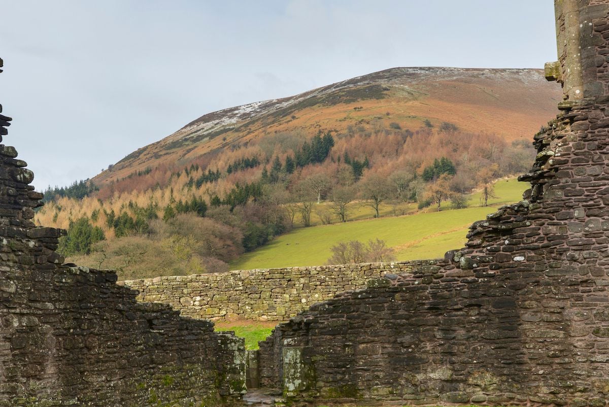
This challenging, full-day hike takes you through the secluded, steep-sided Vale of Ewyas in the Black Mountains in the east of the park. The start and end point is the car park at Llanthony Priory, a dramatic ruin that inspired artists such as J W Turner.
Leave the car park, follow a dirt track past the adjacent farm and proceed through a gate signposted for Hatterall Ridge. The trail ascends steeply up to a broad ridge, which offers up views of the priory and the Ewyas Valley. You’ll cross Twyn Lech, the ridge’s highest point (703m) - the path descends before heading up to the steep summit of Hay Bluff. Stop to take in the view of the surrounding hills and mountains.
Continue along the horseshoe in a south westerly direction, descending into the Gospel Pass Valley. There’s a gentle climb up Twmpa, also known crudely as Lord Hereford’s Knob, before you head up Rhos Dirion (713m). From here, follow the path along a broad ridge - it narrows significantly as you summit Chwarel y Fan (679m). You should be able to spy the waters of Grwyne Fawr Reservoir, and the Mynydd Du forest.
Descend, via the lower summit of Bal Mawr until you reach a marker for the Beacons Way. From here, hang a left, then veer right, following the Cwm Bwchel stream into the valley. By now, you should see Llanthony Priory below you. Follow the signs back to the car park.
Inspired? Why not check out our trekking and hiking holidays in the United Kingdom?