


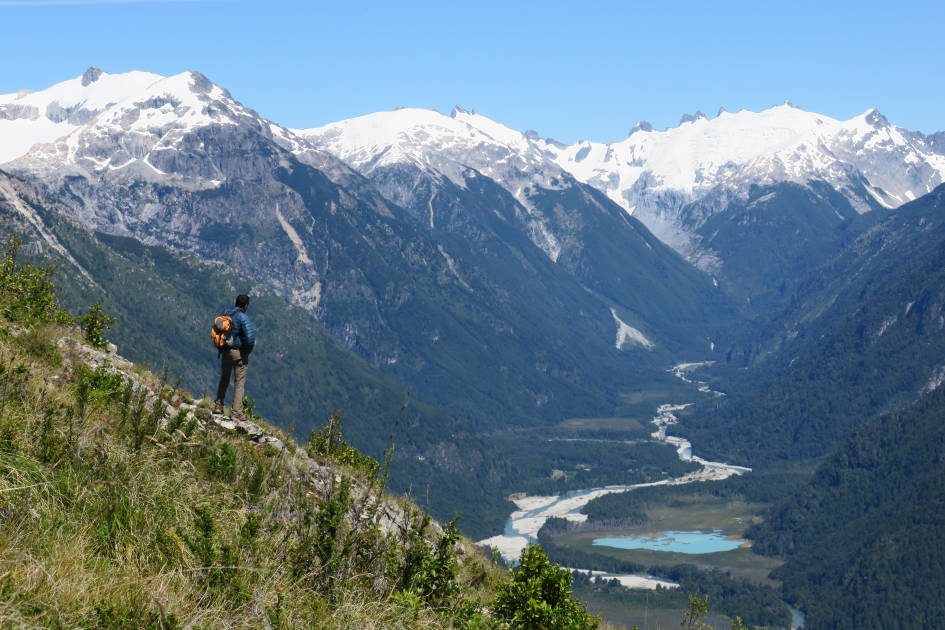
The Altiplano is the high tableland which stretches across South America. A dramatic landscape of geographical extremes, it's where occasional rural, remote villages are dwarfed by snow-capped peaks and far-stretching salt flats. It’s a place of hot springs, clear blue lakes, canyons and alien rock formations, sculpted by the harsh winds and backdropped by the highest active volcanoes in the world - often exceeding 6,000m. Most of the Altiplano sits within Bolivia, but the plateau also extends into Chile, Argentina, and Peru, while further adventure awaits in the Atacama - the world's driest desert - to the south.
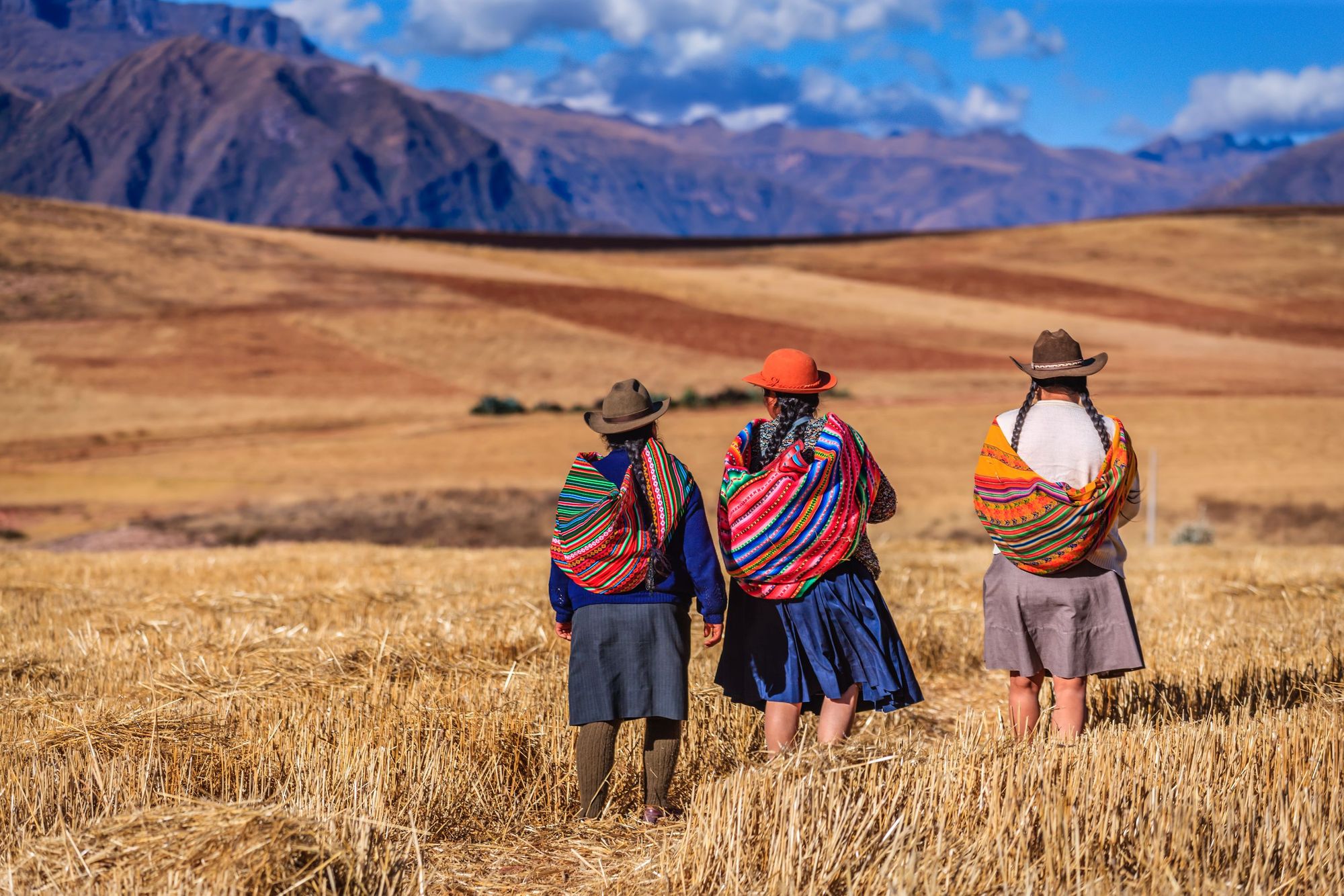
The best hikes in the Altiplano take in the might of this scenery, weaving through or up it on winding mountain trails. We’ve also taken into consideration routes which showcase the culture of the Altiplano. The area has been inhabited by indigenous communities, including the Aymara, Quechua, Uros and Qulla people, for millennia, with a rich culture of agriculture (growing papaya, potato, maize, alfalfa, oregano and more) and ritual traditions. Well known globally are the cholitas (young Bolivian women) who since the 1920s have worn bowler hats along with their glamorous, brightly-coloured Aymara Chola dress and boots.
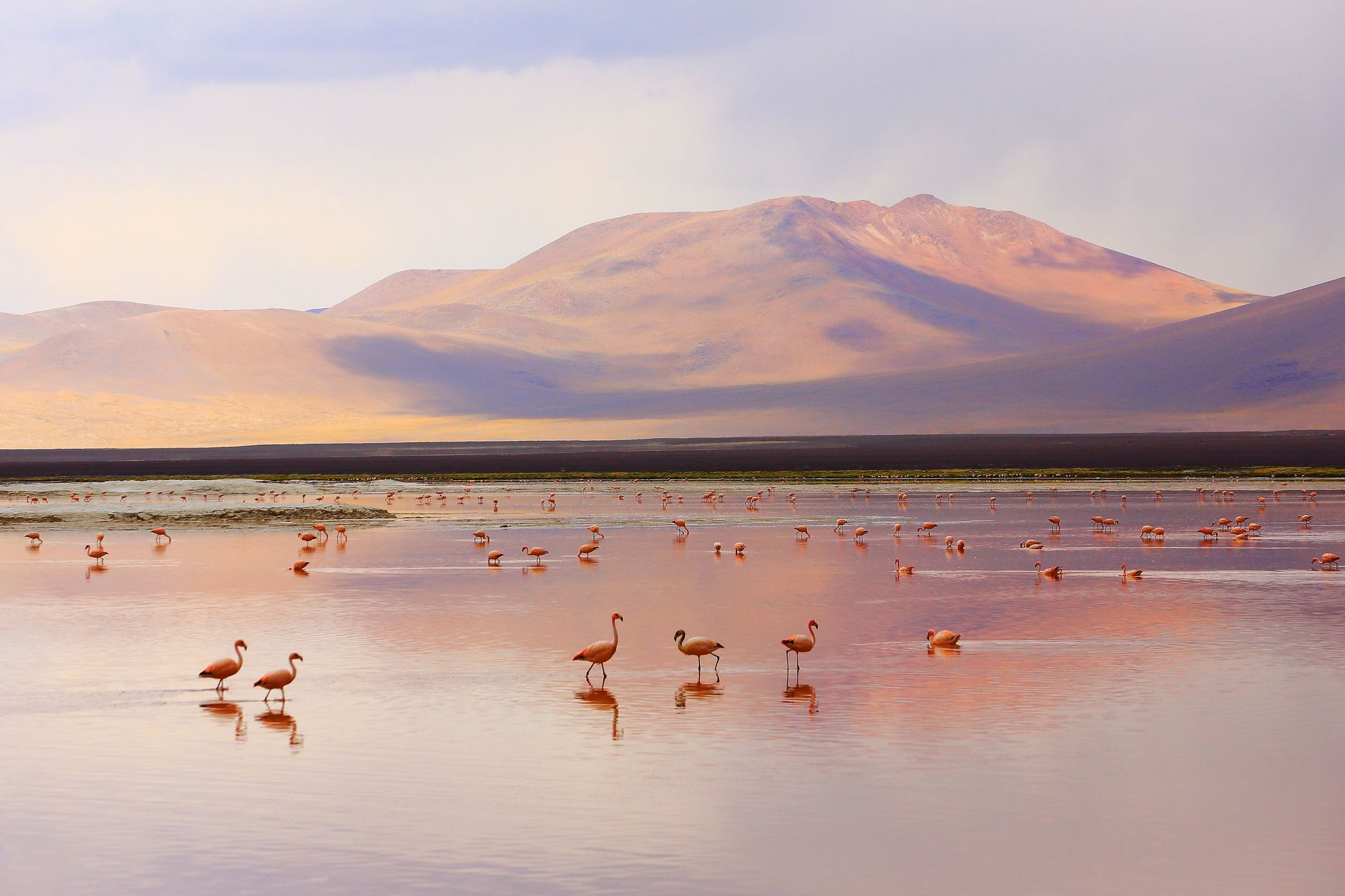
Owing to its unique geography - the average elevation of the Altiplano exceeding 3,700m - this plateau is also a place with a particularly unique ecosystem. Three of the five species of flamingo (Andean, puna and Chilean) can be found here, and there are are herds of closely-related llamas, alpacas, guanacos and vicuña, as well as critically-endangered huemul deer and viscachas, an adorable squirrel-rabbit hybrid. Elsewhere, pumas scour the landscape, targeting those lamoids or foxes for their next meal, while condors circle above in the skies.
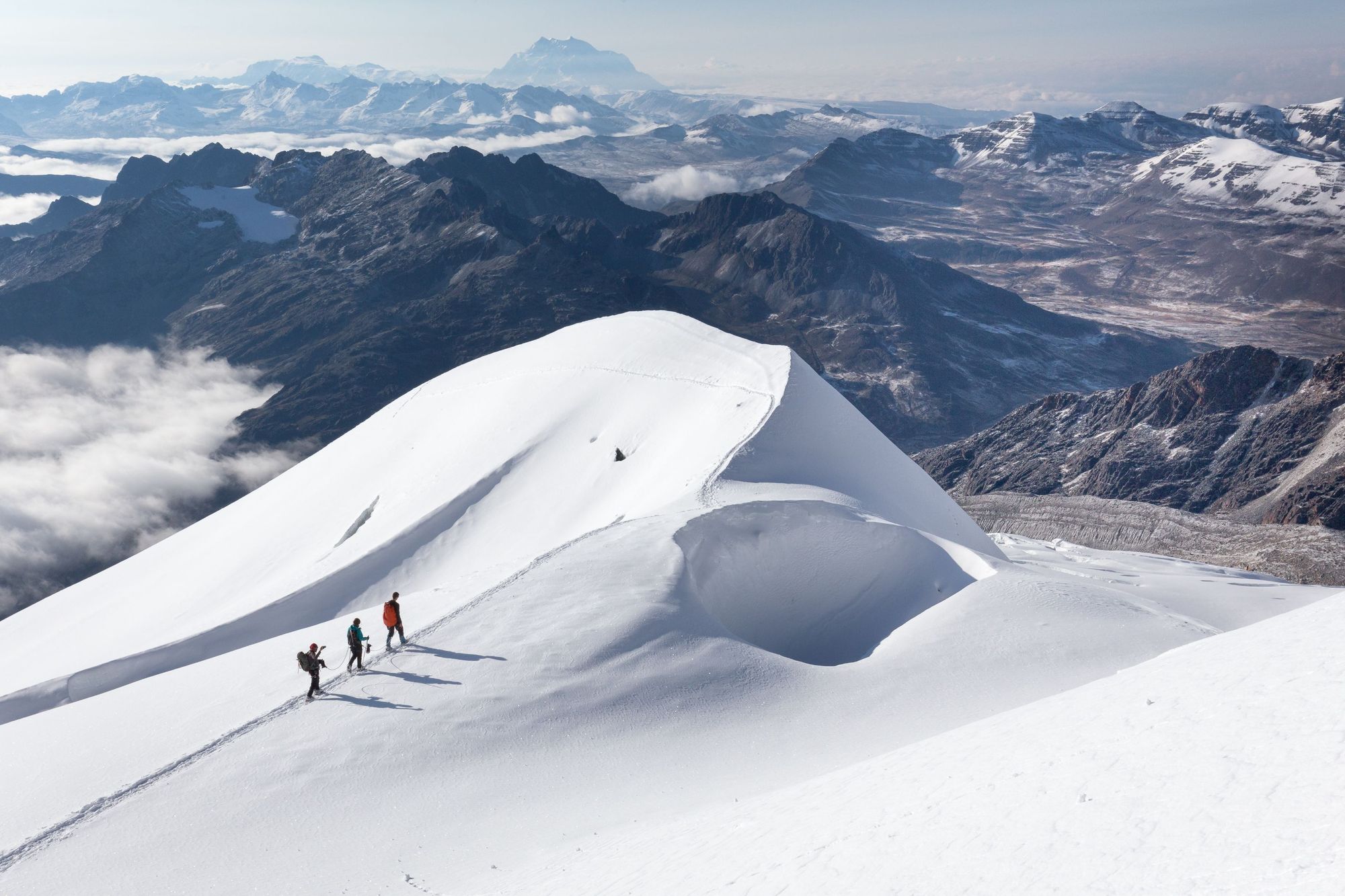
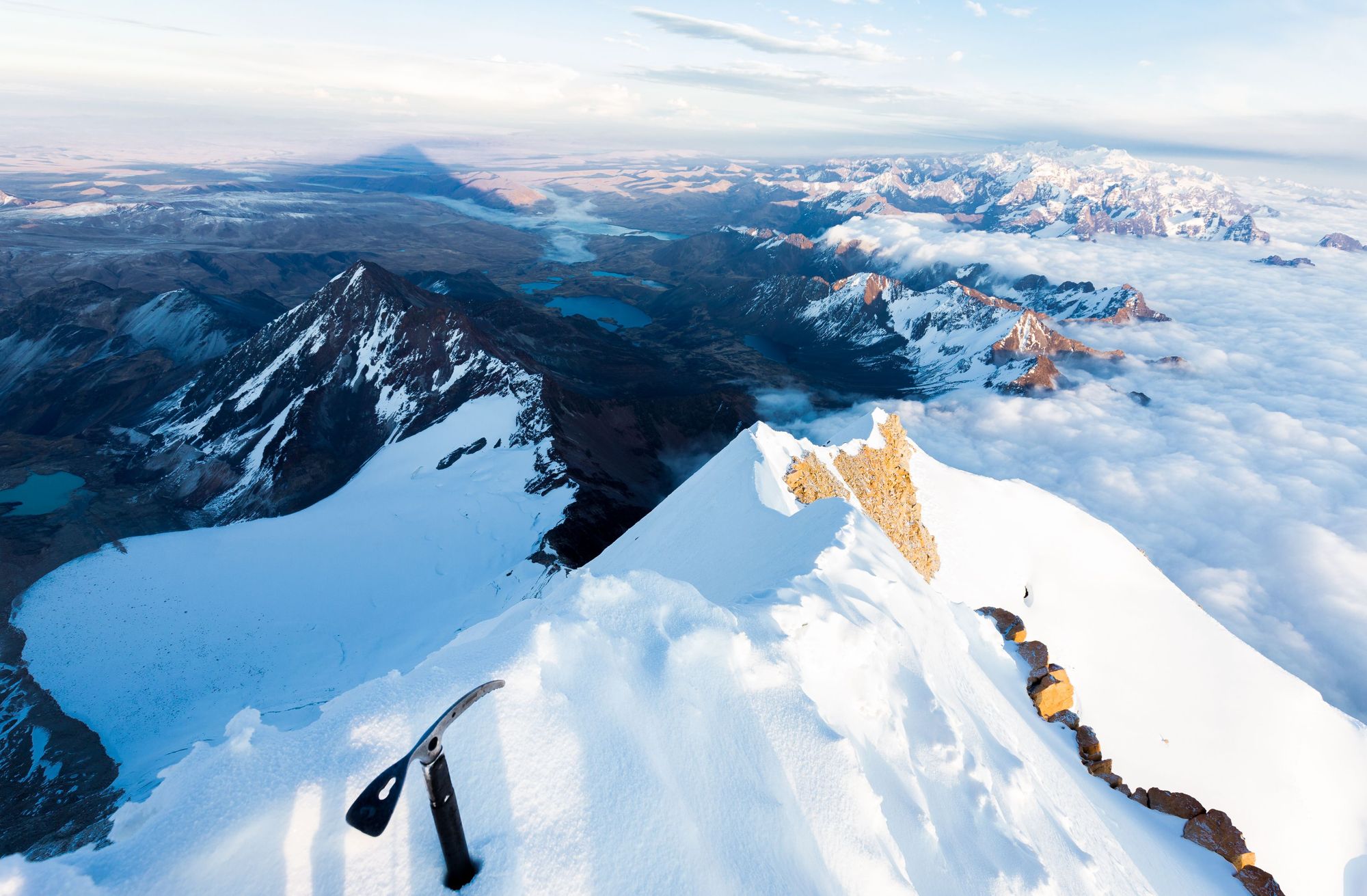
There are few mountains in the world as high as Huayna Potosi that can be climbed on such a straightforward route.
In our view, the best hikes in the Altiplano should highlight as much of the above as possible, or provide a magnificent example of one, giving you the chance to immerse yourself in the culture, beauty or ecosystem of this ancient landscape.
It’s important to note that the route descriptions listed below are only short summaries, designed to inspire and introduce but not to serve any navigational purpose. They are not intended to guide you on the trails and further research and a local guide will be required if you want to safely walk any of these routes.
Altitude and Acclimatisation in the Altiplano
As mentioned, the average elevation of the Altiplano is over 3,700 metres, and the plateau is home to the world’s highest volcanoes - notably the 6,887m Ojos del Salado and the 6,723m Llullaillaco. So if you’re hiking in the Altiplano, expect to spend time at altitude. That means that acclimatisation is highly encouraged before hiking in the area. While altitude impacts everyone differently, the longer you can acclimatise, regardless of past experience, the better.
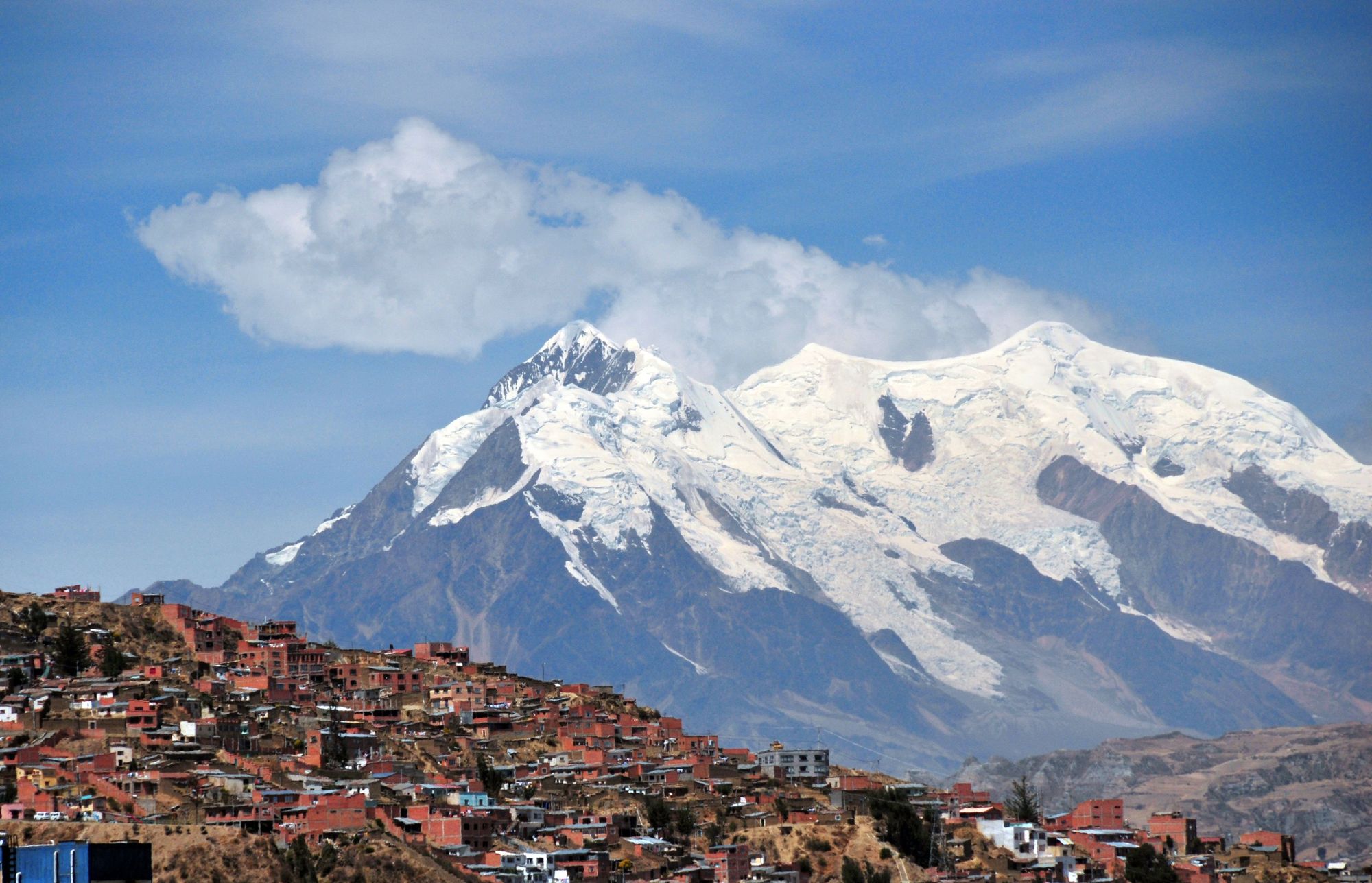
Remember that if you’re coming from La Paz, you’ll already be acclimatising, as with an altitude of around 3,650m, it's the highest capital city in the world.
Acclimatisation can be the difference between a successful adventure and a potentially dangerous situation. Hiking with an expert local guide will help you get the best out of your hike, and keep you safe, as a good mountain guide should be knowledgeable about altitude and able to identify its impacts.
5 of the Best Hikes in the Altiplano
The best hikes in the Altiplano, or anywhere in the world, will always be subjective. What we've aimed to do here is pick out five which provide a bit of variety - scaling mountains, touring islands and visiting the famous salt flats.
1. Climb Huayna Potosi (6,088m)
Distance: 8-10 miles
Time to climb: 3 days
Country: Bolivia
Best for: Altitude Summit baggers
As far as 6000m peaks go, this is an extremely accessible one. There are few mountains in the world as high as Huayna Potosi that can be climbed on such a straightforward route, with relative ease.
For starters, Huayna Potosi is just 15 miles north of Bolivia’s bustling capital city of La Paz. Beyond that, while no mountain climb should be considered easy, especially at this sort of altitude, this isn’t a peak that requires mountaineering or technical experience to summit. And when you do reach the top, you’ll have remarkable views which reach from La Paz, El Alto and the Cordillera Real all the way out to the Amazon Basin and of course, back out over the Altiplano.
A typical itinerary for climbing Huayna Potosi includes a three-day programme. The first day is usually an acclimatisation hike - on a site like Paso Zongo (4,700m) or Glacier Viejo (4,850m) - where you can learn and practice some basic winter climbing skills, scaling small snow and ice walls, and get used to walking in crampons and using ice axes to progress on a trail. Then a night in a refuge.
On day two, the hike up Huayna Potosi begins, ending at high camp at Refugio Alto Poca, at the base of the glacier, at 5,200m. This is a simple and scenic hike.
Day three is the long summit day, encompassing 9-14 hours of hiking on the mountain. Be prepared to set off as early as 1am. The route will first take you through a glacier, before ascending a couple of tricky steep sections - roped up and led by a guide, ideally - before reaching a magnificent, exposed ridgeline around the 6,000m mark, which will then take you to the summit.
The views from the summit, and relative accessibility of such a high peak, make this climb one of the most popular hikes in South America.
2. Salinas Grandes Salt Flats and the Cuesta de Lipán Mountain Road
Distance: 15-18 miles
Time to hike: 8 hours
Country: Argentina
Best for: A highlight reel of the Altiplano.
On your drive to the Salinas Grandes salt flats, the third largest salt flats in the world, you’d be wise to stop off at Quebrada del Toro. It’s a beautiful gorge known as the gateway to the Andes, which runs alongside the Tren a las Nubes line - a railway which connects the northwest of Argentina to the Andes mountains, peaking at 4,220m and making it the fifth highest railway in the world.
It’s backdropped by the rainbow-coloured Serranías del Hornocal mountains. The Quebrada de Humahuaca, was declared a World Heritage Site in 2003, as it’s also home to pre-Incan ruins.
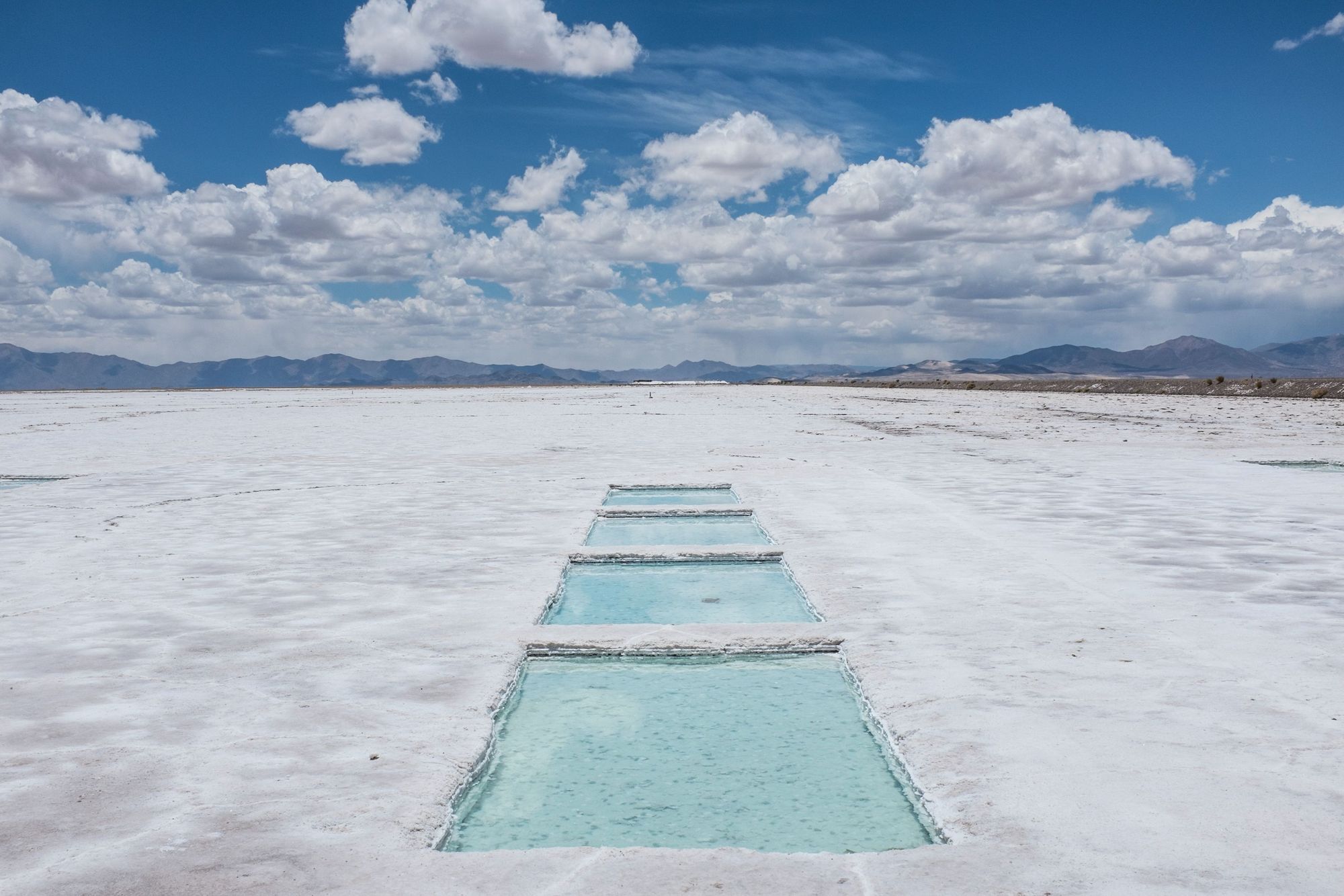
You’ll also pass the archaeological site of Santa Rosa de Tastil, part of the Qhapac Ñan Andean Road System and a UNESCO World Heritage Site - “Constructed by the Incas over several centuries and partly based on pre-Inca infrastructure, the network reached its maximum expansion in the 15th century,” write UNESCO, “when it spread across the length and breadth of the Andes.” Walk around the site and have lunch with the local community, the custodians of this area, before continuing up into the Altiplano to discover the incredible Salinas Grandes salt flats, which extend out over 212 km2.
The salt flats are broken up by little turquoise pools of water, cut in to the flat surface to allow water to rise, softening the salt for harvest. And yes, you can take as many funny, forced perspective photographs as your heart desires.
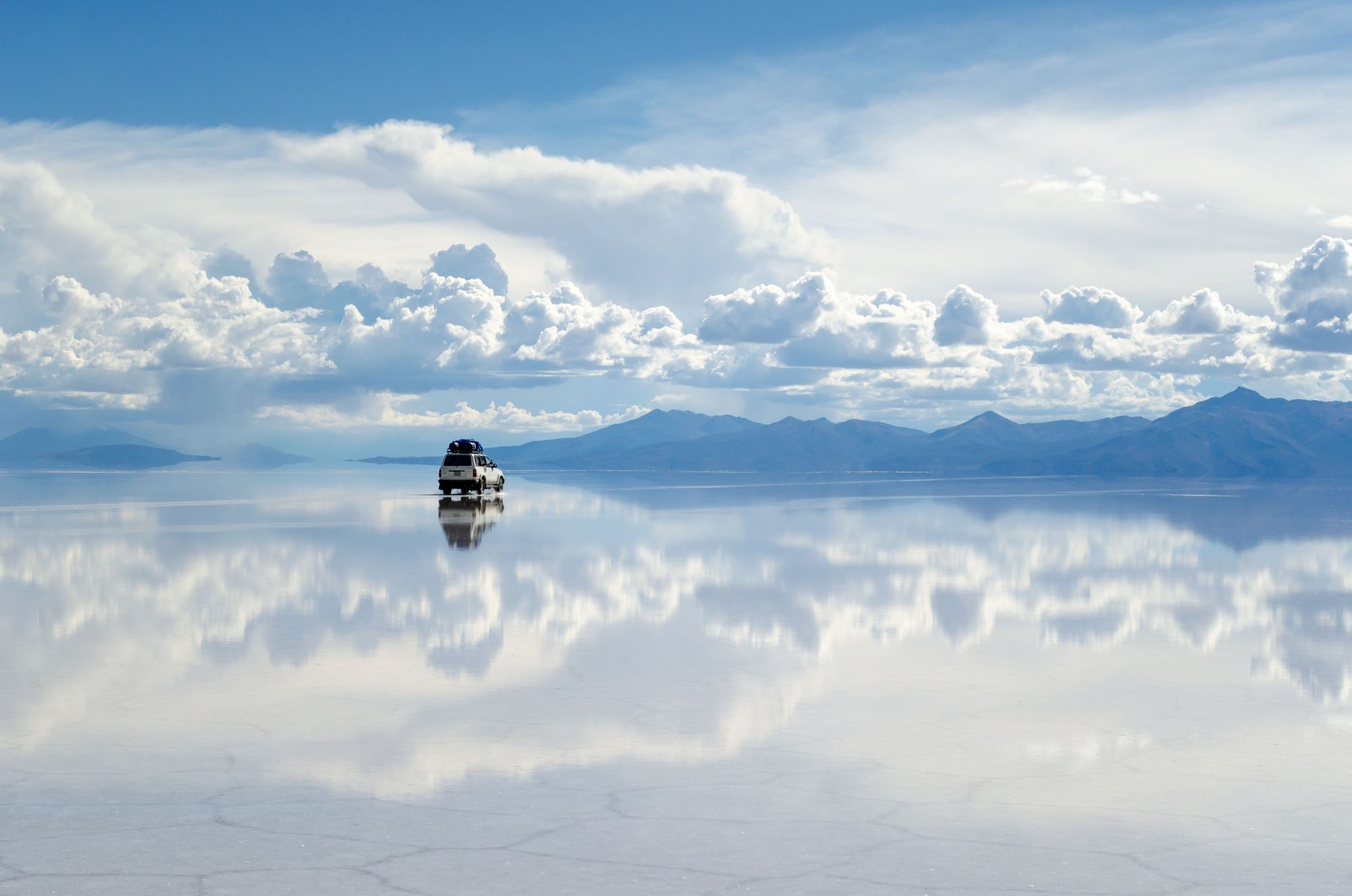
Of course, the Salar de Uyuni salt flats are the most famous in the Altiplano and are the largest in the world, but we’ve opted for Salinas Grandes here because they’re easier to reach for most itineraries. They’re a day-tour from Salta or if you’re heading through Argentina to the Atacama in Chile, they’re on the way.
After visiting, you can descend down the Cuesta de Lipán mountain road to the small town of Tilcara, a small, sleepy town. It’s backdropped by the rainbow-coloured Serranías del Hornocal mountains. The wider region, Quebrada de Humahuaca, was declared a World Heritage Site in 2003, as it’s also home to pre-Incan ruins, with habitation here dating back over 10,000 years.
3. Isla del Sol Loop (Lake Titicaca)
Distance: 11.5 miles
Time to hike: 5-6 hours (though ideally spend the night!)
Country: Bolivia/Peru
Best for: Those looking for a change of scenery after visiting Machu Picchu.
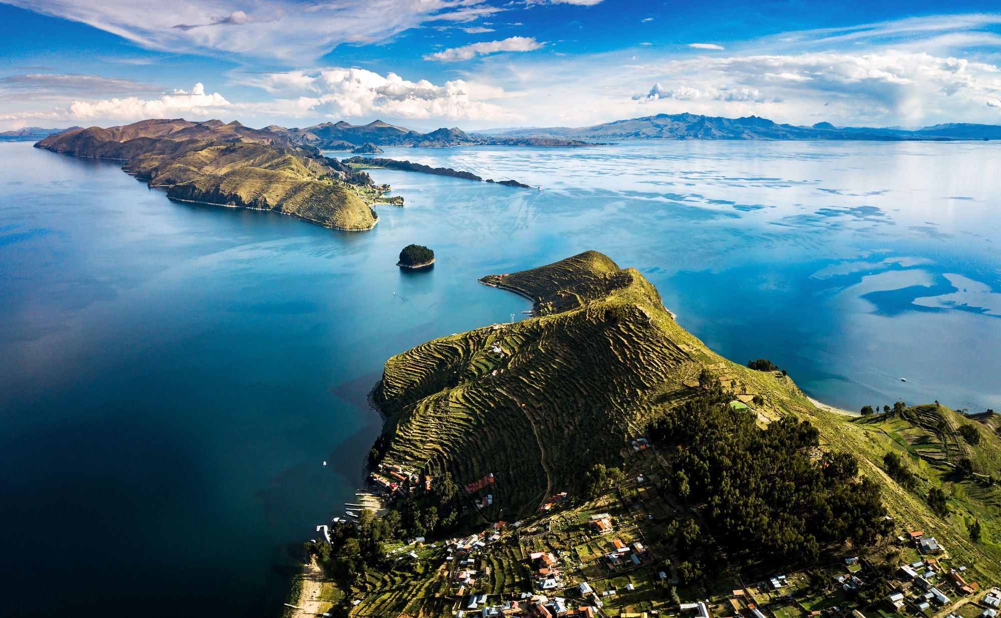
Lake Titicaca sits on the border of Bolivia and Peru and in the beliefs of the indigenous Andean people, this sacred lake was the birthplace of Viracocha, the Inca god who created the earth and everything on it.
Titicaca is the largest lake in South America. The water is deep, lined by rugged mountains and dotted with islands - one of which is Isla del Sol, where the Inca legends run deep. It’s on the Bolivian side of the border, but can be reached easily by boat from Puno, in Peru or Copacabana in Bolivia.
The island itself is rocky and rugged, with an abundance of eucalyptus trees and no paved roads at all. It’s dotted with Inca ruins, including a labyrinth believed to once have been a holy complex, and you can wander around them freely as you explore the island. The walking trails on the island are well-established, with great lake views. They take you to the sites - passing the 206 stone steps built by the Incas to the southern town of Yumani, and the dramatic Rock of the Puma (or Titi Kharka) which gave the island its name.
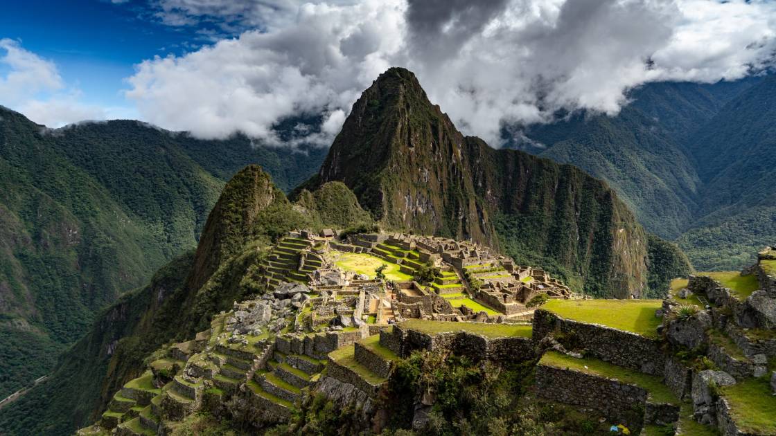
You’ll need local currency to pay village taxes as you walk around the island. This trip is a great add-on for any hikers looking for an add-on after Machu Picchu.
4. Climb Chacaltaya (5,395m) and the Valley of the Moon
Distance:
Time to hike: 9-10 hours (for the day trip)
Country: Bolivia
Best for: An epic day-trip from La Paz
If Huayna Potosi is the 6,000m beast best to climb from La Paz, then Chacaltaya is the perfect day-hike to do beforehand to get yourself ready.
This entire climb is up above 4,500m, so altitude will play a factor here, and you should make sure you are probably acclimatised. But that said, this is a very short walk, with the peak accessible in a 30-minute hike from an old ski lodge you can reach by car, which was once home to the world's highest ski resort.
After getting picked up in La Paz, you’ll drive through El Alto and onto the Altiplano. You can drive right up to the refuge here, at 5,100 metres. Then the climb - in its shortest form - is simply a few hundred metres up to the peak. This is a great test of how you’re able to perform at altitude, and also a rare chance to reach a height of 5,395m without mountaineering gear, or much hiking.
From the summit, you can see over to Huayna Potosi, and also to Illimani, the 6,438m beast which marks the high point of Bolivia and the Cordillera Real. There are various options to extend your hike if you want a bigger day out.
Various tour operators will combine this trip with a tour of the Valley of the Moon, a sprawling field of rugged, rocky spikes forged by erosion from the wind.
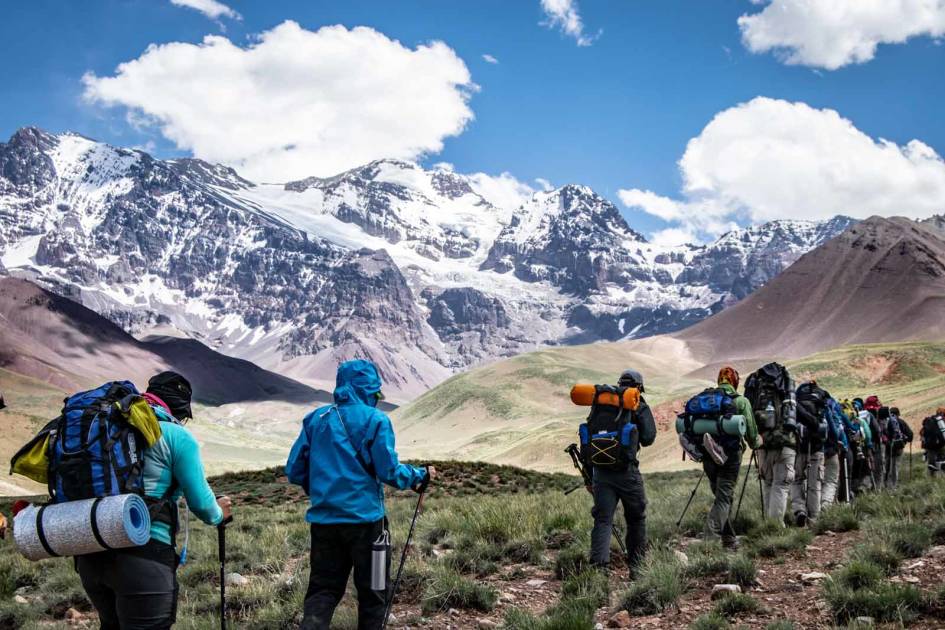
5. The Altiplano Traverse
Distance: 372 miles
Time to hike: 16 days
Country: Bolivia
Best for: The ultimate Altiplano experience
This enormous hiking route was created by Cam Honan, a long-distance Australian hiker, back in 2017. It takes in every site you can imagine in the Bolivian Altiplano - from the salt flats to the volcanoes to the geothermal fields.
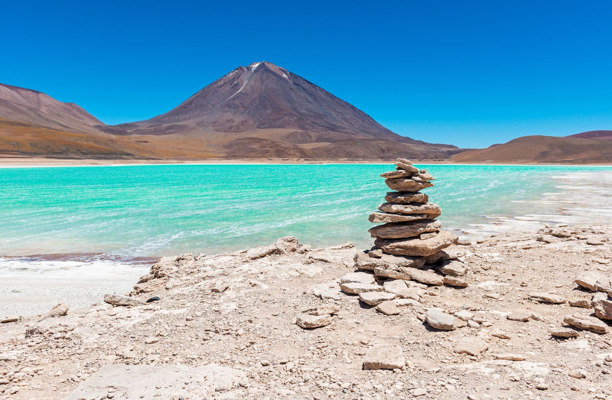
The route begins in the salt mining town of Coipasa, before crossing the tranquil Salar de Coipasa (the fifth largest salt flats in the world). The route then goes on to and over the 5,321m Volcan Tunupa peak and Volcan Licancabur (5,916m), providing amazing views of the turquoise water of Lagunas Verde. It then heads to Laguna Hedionda and Sol de Manana geothermal fields, through small towns and communities, on endless dusty, cactus-lined walking trails.
Needless to say, this route takes extreme planning and research, as well as previous hiking and camping experience. In order to walk the route, you’ll need to be an experienced navigator, and be able to manage resources (namely water and food) to get you through, as well as be comfortable being self-sufficient. Honan has broken the hike down into two stages and provided an excellent, detailed breakdown of each stage on his website The Hiking Life.
Best Time to Visit the Altiplano
The peak season in Bolivia, and La Paz, runs from May to October. This is winter, with the shoulder seasons (when things are a bit cheaper and less crowded) being at the start and end of that period, in April-May and October. These is a great time to visit as the weather is still reliable, but it won't be so busy. The hiking trails and peaks are safer and more enjoyable in the dry season too, due to the clear skies and sunny days, and animals are more likely to be sighted.
Leave it until November and the rain will start to come in, and trail visibility can be poor. In the extremes of the rainy season, huge areas can become flooded in Bolivia, making it tough to move around the country too. This isn’t such a problem in the Altiplano, but it can still close roads in the area, and it can impact your travel to the highlands. Trails are also muddier and white outs more likely.
Whenever you visit the Altiplano, though, just remember that you’re visiting an area of extreme altitude, and as such, the weather can change quickly and drastically - especially in the mountains. The nights will be a lot colder the higher you get - especially in the middle of the year, from June-August.
How do you get to the Altiplano?
Bolivia’s capital city of La Paz has an international airport, as does Cusco in Peru. These cities are also well served by bus from around South America, and there is a particularly scenic train route - the Andean Explorer - between Cusco and Puno. You should have an expert guide for exploring the Altiplano. Guides and local companies offering excursions to the Altiplano are numerous in the cities surrounding the area, so from the cities, you won’t struggle to book your outing.
Inspired? Explore our adventure holidays in Argentina, Peru and Chile!