


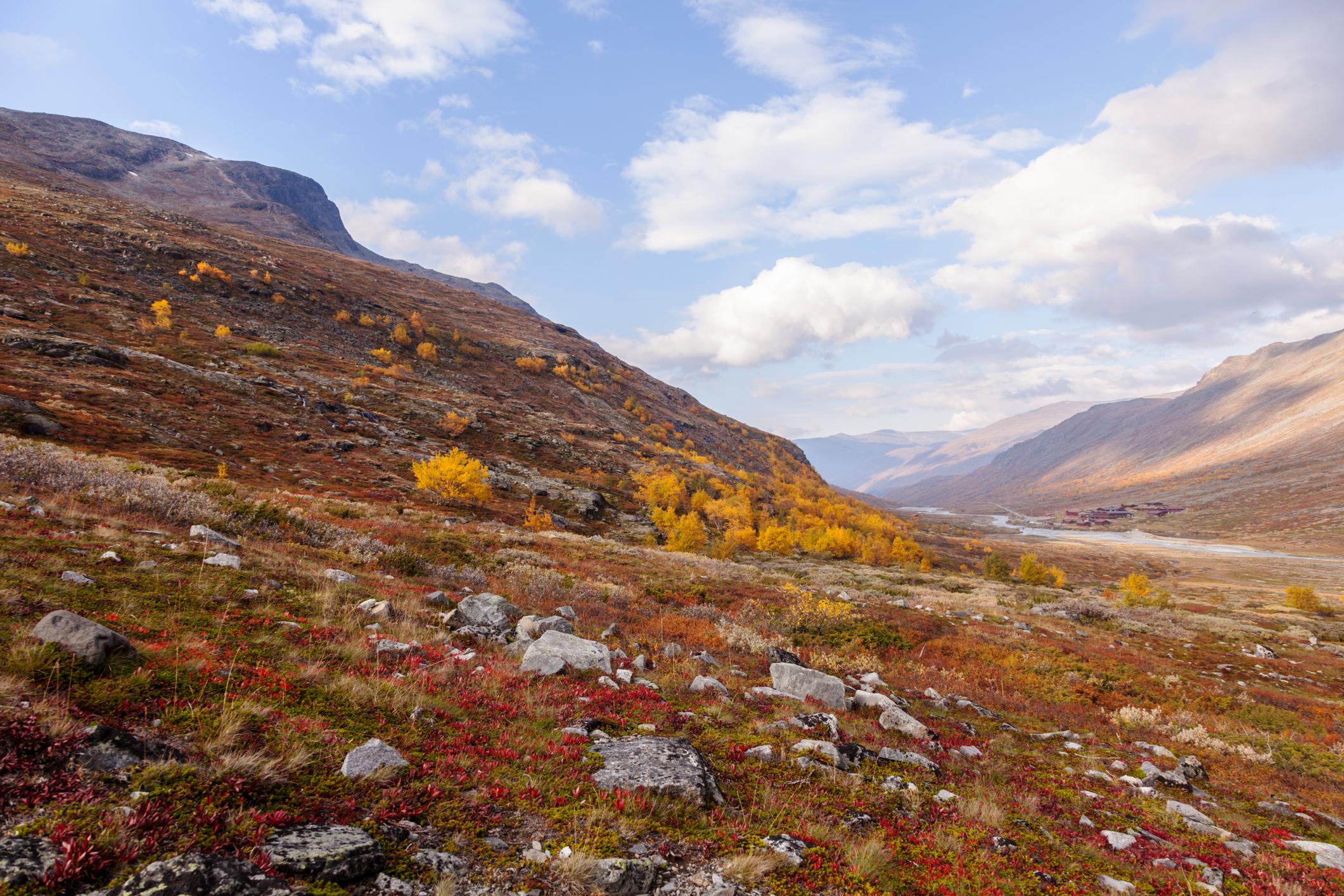
At 2,469m-high (8,100ft), Galdhøpiggen is not only the tallest mountain in Norway - it’s also the highest peak in Scandinavia. It’s located in the majestic Jotunheimen mountain range, which translates as ‘Land of the Giants’ and occupies an important place in Norse mythology. Jotunheimen certainly lives up to its name, with more than 250 peaks rising higher than 1,900m (6,233ft), and a landscape littered with boulders that look as if they’ve been carelessly scattered by a giant hand.
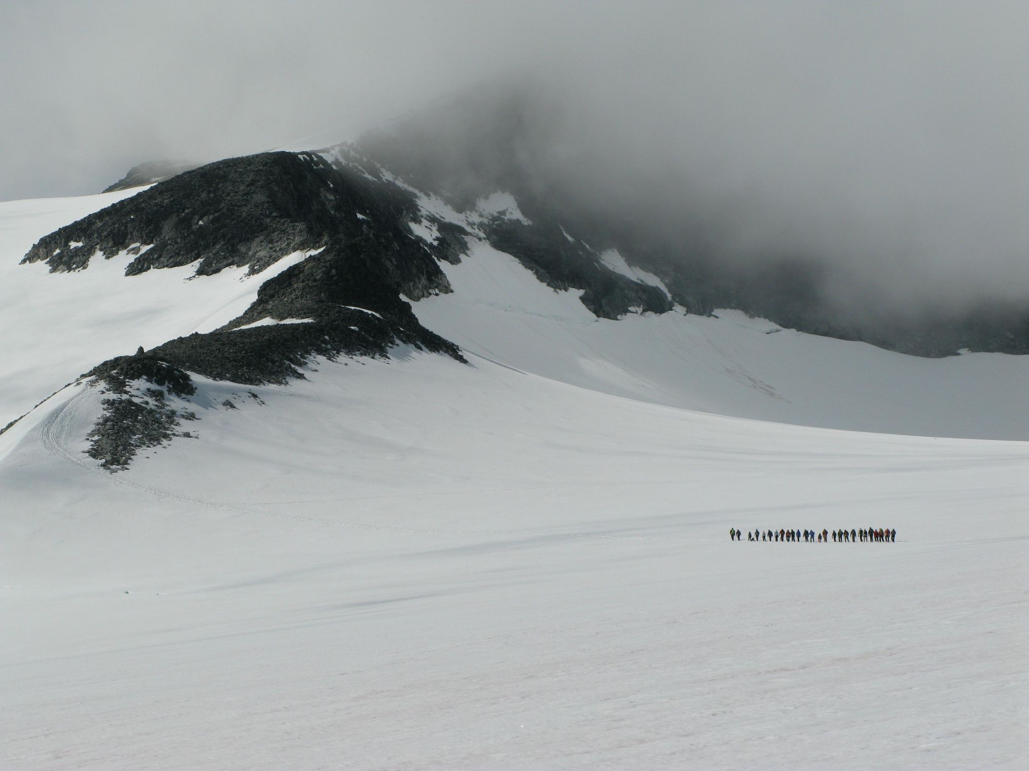
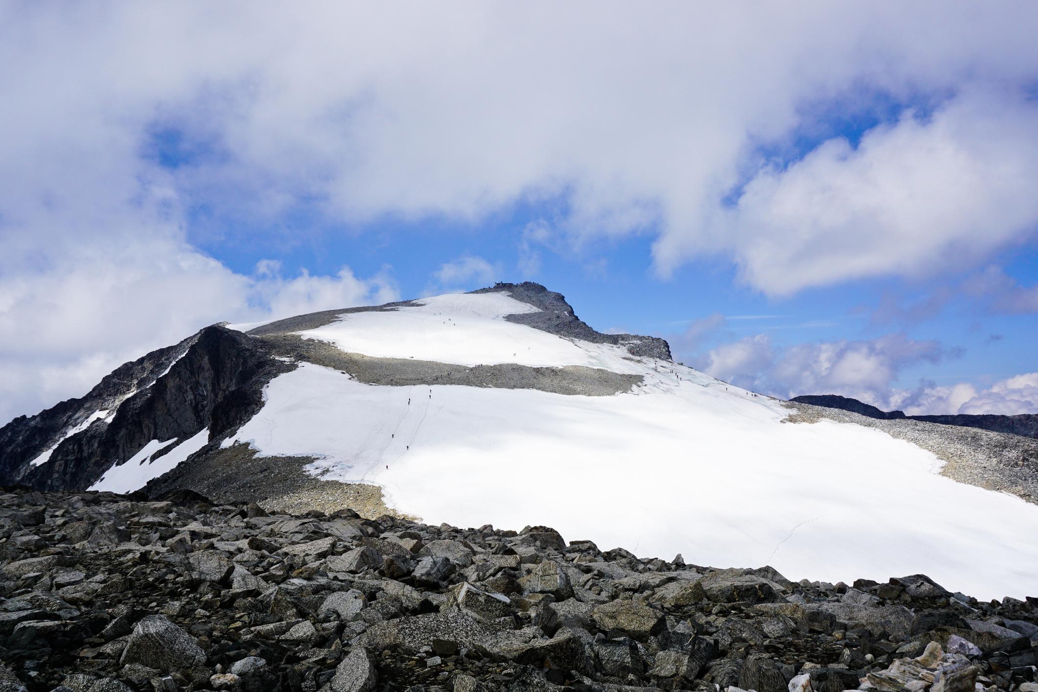
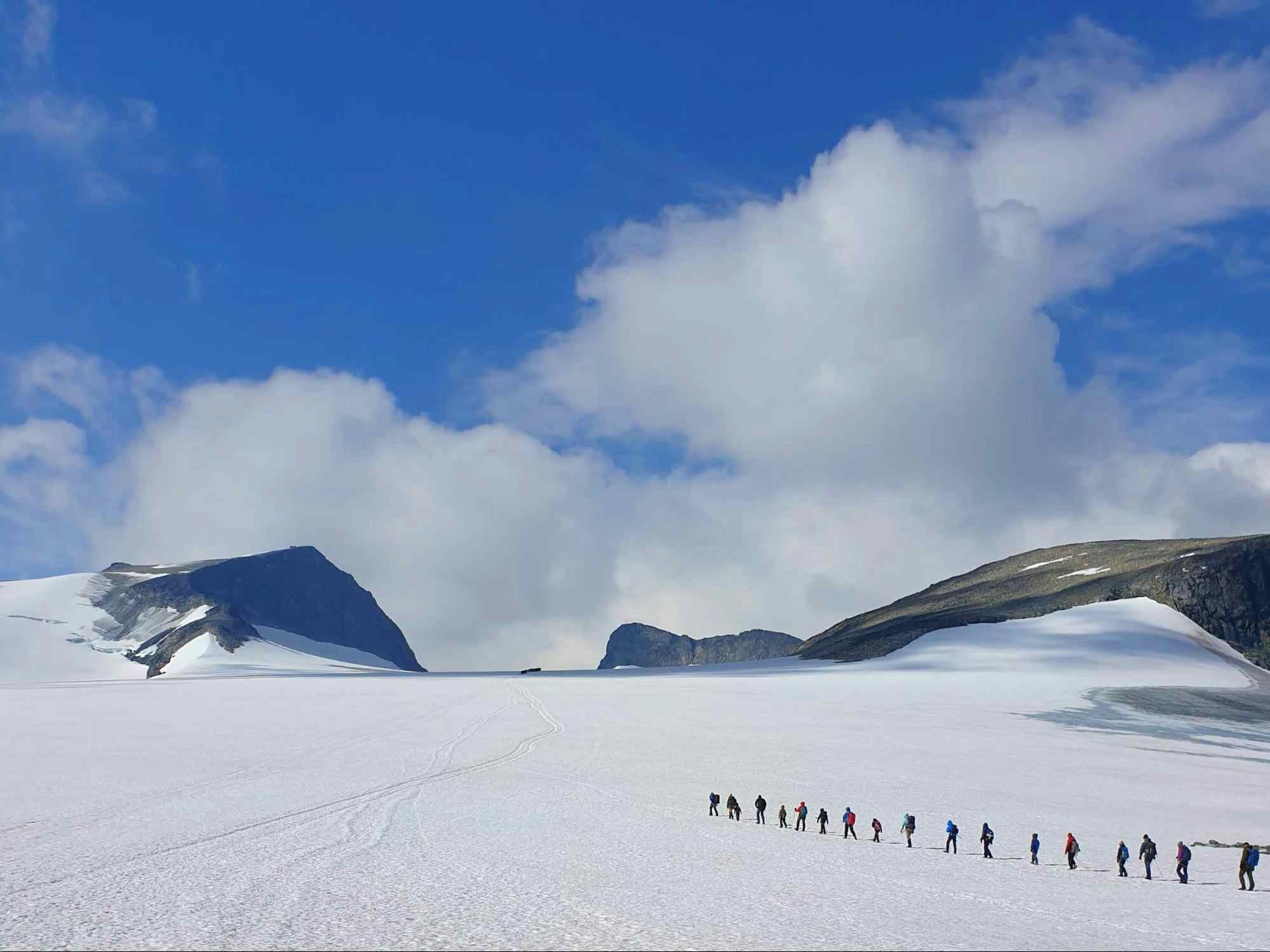
Galdhøpiggen dominates the landscape, with a curved ridgeline up to the summit. Much of its dark rocky surface is covered in a glacier, Styggebreen, a name which translates as “ugly glacier”. But ‘stygg’ also means dangerous in the local dialect - the glacier has deep crevasses, which are hidden under a blanket of snow; a guide will be necessary to help you navigate it.

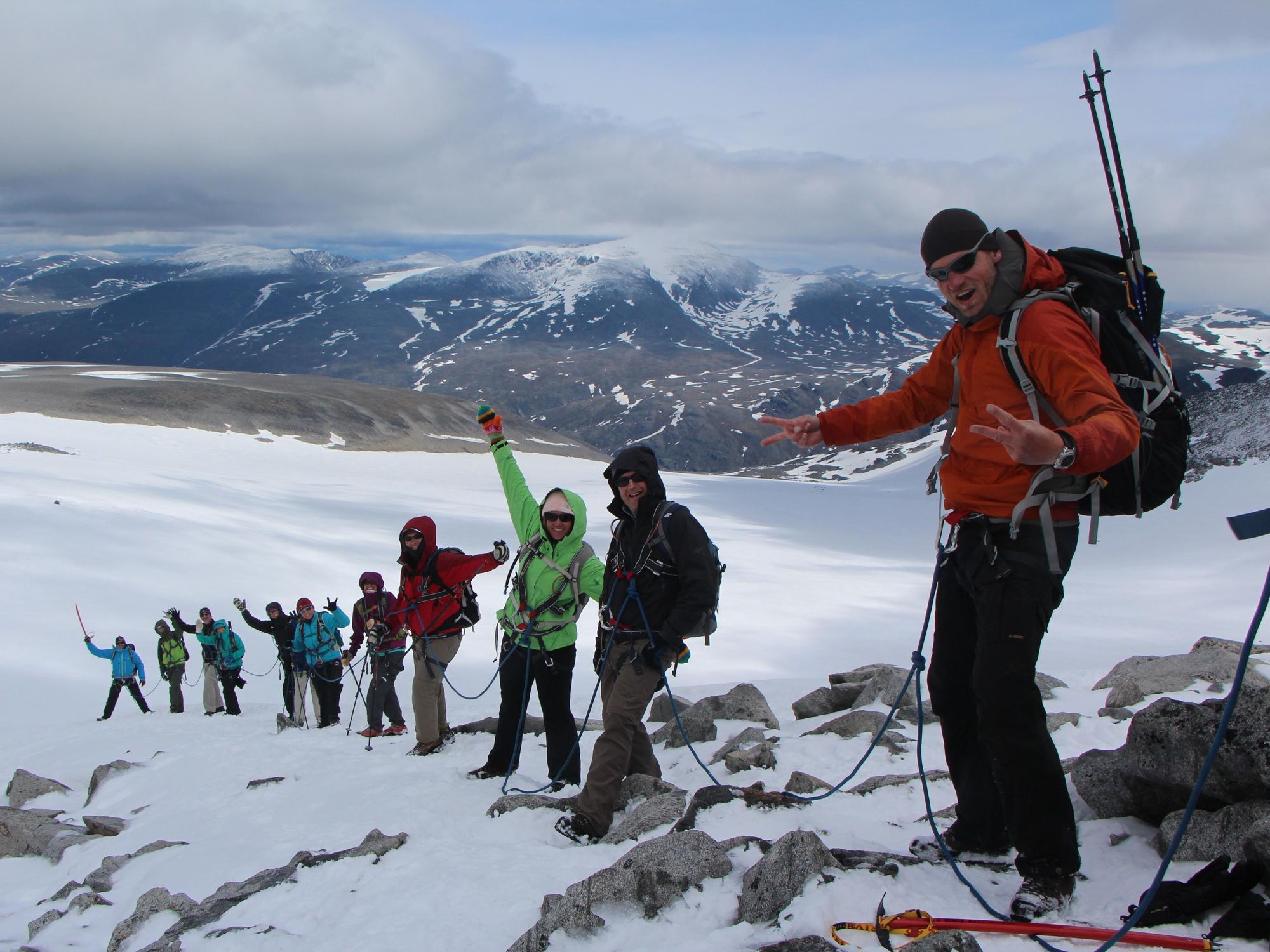
Reaching the summit requires a careful traverse of Styggebreen (for which a guide is required) and a scramble over bare rock. It’s a challenging day hike with a big pay off - a view of the ancient snowcapped Jotunheimen peaks, valleys and glacial lakes.
Here’s our guide to climbing Galdhøpiggen, which includes two route options and answers some FAQs relating to kit list, accommodation and logistics.
Where is Galdhøpiggen Located?
Galdhøpiggen is located in the Jotunheimen mountain range. The mountains form part of Jotunheimen National Park, located in Lom, a municipality in the south east of Norway. The closest settlements are the villages of Galdbygde and Slåligrende, which lie a few miles north of Galdhøpiggen along the closest road, Scenic Route Sognefjellet (Road 55), which runs through the national park.
Climbing Galdhøpiggen: The Routes
There are two hiking routes up to the top of Galdhøpiggen. The most popular, from Spiterstulen mountain hut, is a longer hike with around 1,300 metres (4,265ft) of ascent. An alternative route, encompassing around 650 metres (2,132ft) of ascent, begins at Juvvasshytta mountain hut, and crosses the Styggebreen Glacier. This intrepid route requires the use of ropes, crampons and a trained guide. We’ve outlined both options below.
It’s important to note that these route descriptions are only short summaries, designed to inspire but not to serve any navigational purpose. They are not intended to guide you on the route - further mapping and planning will be required to safely walk any of the trails featured.
Spiterstulen to Galdhøpiggen
- Distance: 8 miles (13km)
- Walking time: 6-8 hours
- Elevation gain: 1,300m (4,265ft)
This is the longer route up Galdhøpiggen, and also the steepest - you’ll be tackling 1,300 metres of ascent over a single day. However, it’s the most popular of the two main routes since it doesn’t involve a glacier crossing (and can therefore be hiked independently).
The hike begins near Spiterstulen hut, located at 1,100m/3,609ft. You’ll follow a marked trail through Alpine tundra, an environment of cotton grass tussocks, stunted trees and summer flowers, threaded with small streams. It’s fairly relentless uphill hiking, so take some breaks to enjoy the view. As you climb higher, the tundra is replaced with bare gravel, carpeted in patches of snow - the amount of snow increases as you climb higher.
The trail takes you along a rocky ridge and up two smaller ‘false summits’, Svellnose (2,272m/7,454ft) and Keilhaustopp (2355m/7,726ft). Eventually, however, you’ll reach the summit itself - it’s a steep hike up snow-covered rocks and boulders to the top. Enjoy the panoramic view of the Jotunheimen Mountains and glaciers - you’ve earned it. There’s even a small refreshment kiosk, open during peak times, where you can get refreshments before the long trek back down.
Juvvasshytta to Galdhøpiggen
- Distance: 7.4 miles (12km)
- Walking time: 7 hours
- Elevation gain: 650m (2,132ft)
This out-and-back hike approaches Galdhøpiggen from the north, and begins at the Juvvasshytta hut, located at an elevation of 1,850m (6,069ft). It might have less ascent than the Spiterstulen route (around 650m/2,132ft), but that doesn’t necessarily mean it’s less challenging. This is because it involves a crossing of the Stygebreen glacier, which requires a guide.
The first mile or so of the hike follows a trail from Juvvasshytta that winds gently uphill across rocky terrain. After around an hour of hiking, you’ll reach the edge of Stygebreen Glacier. Your guides will divide you into small groups - you’ll put on your harnesses and be roped together. In certain weather conditions, you might also need crampons. You’ll move slowly, being careful of crevasses covered with a layer of snow.
After around an hour, you’ll reach Piggura - the ridge leading to the summit. For this you’ll be unroped and be able to continue onwards to the top. This is the hardest, and steepest part of the climb, made even more difficult by the loose scree underfoot. At times, you might have to use your hands to scramble to the top.
After enjoying the view, and a refreshment break, you’ll return the way you came, although it is also possible to descend via the Spiterstulen route if you’d prefer a point to point hike.
FAQs
What are the starting points and paths for climbing Galdhøpiggen?
To climb Galdhøpiggen you can either start at Spiterstulen mountain hut and follow a marked hiking trail through alpine tundra, or begin at Juvvasshytta mountain hut and cross the Styggebreen glacier to the summit.
Should I climb Galdhøpiggen with a guide?
You need a guide if you take the Juvasshytta route, because it crosses the Styggebreen glacier and requires roping up for safety. If you hike from Spiterstulen, there’s no glacier crossing. Many people climb this way independently, but if you’re not confident in mountain environments, a guide is recommended.
How many routes are there up Galdhøpiggen?
There are two main routes to the summit of Galdhøpiggen, starting from either the Spiterstulen mountain hut or the Juvasshytta mountain hut. The route from Spiterstulen is a longer trek but does not require any technical skills. Conversely, the Juvasshytta route is shorter, but it involves a mandatory glacier crossing.
How far in advance should I secure my spot for Galdhøpiggen guided climbs?
For guided climbs of Galdhøpiggen (via Juvasshytta and the glacier), it’s wise to book as early as possible, especially for peak summer (June–September), because spots are limited and pre-booking is required. Demand is high and you often need a minimum group size, so booking ahead increases your chances the trip runs. If you already know your travel dates, try to secure a spot several weeks to months in advance, especially in July and August. If you are climbing Galdhøpiggen as part of a multi-day Norway trip, all logistics will be arranged for you.
How hard is climbing Galdhøpiggen?
Climbing Galdhøpiggen is achievable for experienced hikers. You don’t need technical mountaineering skills, but you will need a good level of fitness - especially for the Spiterstulen route, which involves 1,300 metres of ascent. You’ll be walking over boulders and scrambling over scree.
If you take the Juvvasshytta route, you’ll be traversing a glacier. This will require use of ropes and harnesses. Your guide will give you important safety advice and techniques for glacier walking, which helps mitigate both the difficulty and the risk.
Where to Stay on Galdhøpiggen
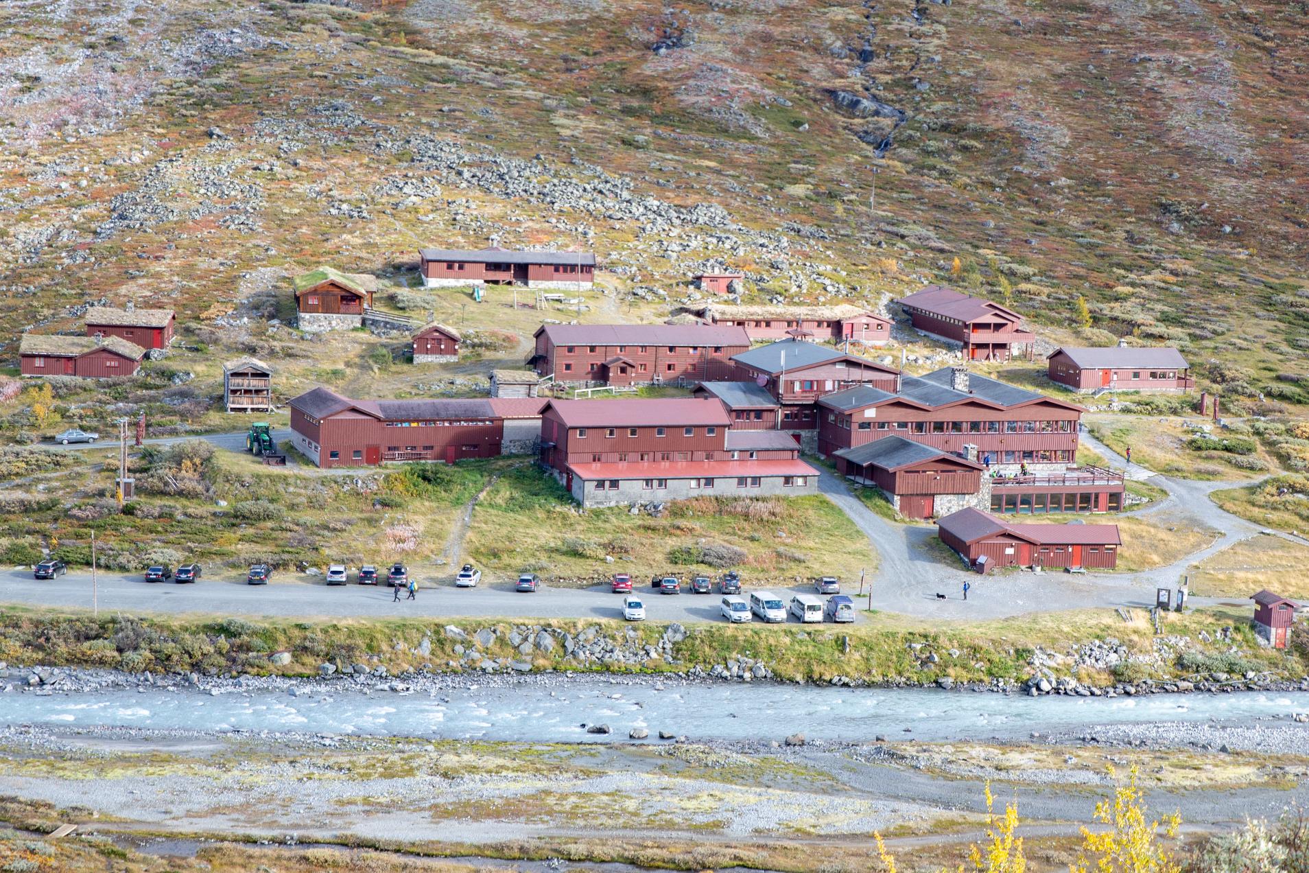
If you’re climbing Galdhøpiggen, the most obvious accommodation choices are the mountain huts at the two trailheads - Juvvasshytta and Spiterstulen. Both offer a range of accommodation options, from a bunk in a dormitory to private doubles with bathrooms. It’s also possible to camp at both huts. Facilities are clean and comfortable, with hot showers available. Each hut has a bar and dining area - hearty Norwegian cuisine is served for dinner, as well as a substantial breakfast.
Juvvasshytta and Spiterstulen are not open year round. Juvvasshytta is open from mid-May to mid-September, and Spiterstulen is open from mid-March to early May (for the winter ski season), then mid-May to mid-September.
There is also a wide range of accommodation options within the wider Jotunheimen National Park. You’ll find everything from campsites to farm stays; mountain huts to more upmarket hotels. Check individual websites for opening times.
It’s also worth noting that, this being Norway, wild camping is permitted so long as you adhere to ‘leave no trace’ principles.
What to Pack for Climbing Galdhøpiggen
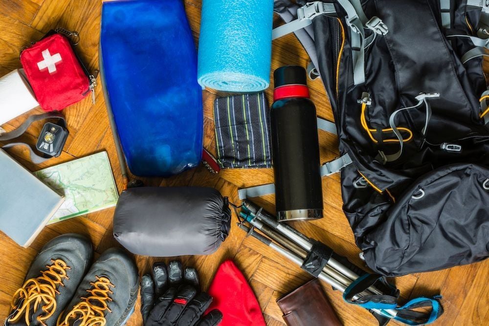
Even during the summer months, you can expect ‘winter weather’ - snow, rain and wind. It’s important to pack warm clothes and waterproof clothing. We’d recommend bringing:
- Waterproof, windproof jacket with hood
- Waterproof trousers
- Warm jacket
- Long trousers
- Fleece
- Base layers
- Worn-in waterproof hiking boots
- Gloves
- Beanie
- Sunhat
For a full packing list, check out the Kitlist section of our Ultimate Norwegian Fjords Adventure.
When is the Best Time of Year to Hike Galdhøpiggen?
Galdhøpiggen can be hiked year round, but conditions can be inclement - with wind, rain, fog and snowstorms. We’d recommend climbing Galdhøpiggen during the summer months, from June to September. This is when the weather is most settled, although you’ll still find snow on the trails, and the glacier is there year-round. This is also when the closest hut accommodation is open.
Another option is to hike during the colder months of March to May. At this time of year, you’ll need to use touring skis. Spiterstulen is open during these months - it organises ski tours up Galdhøpiggen.
How to Get to Galdhøpiggen
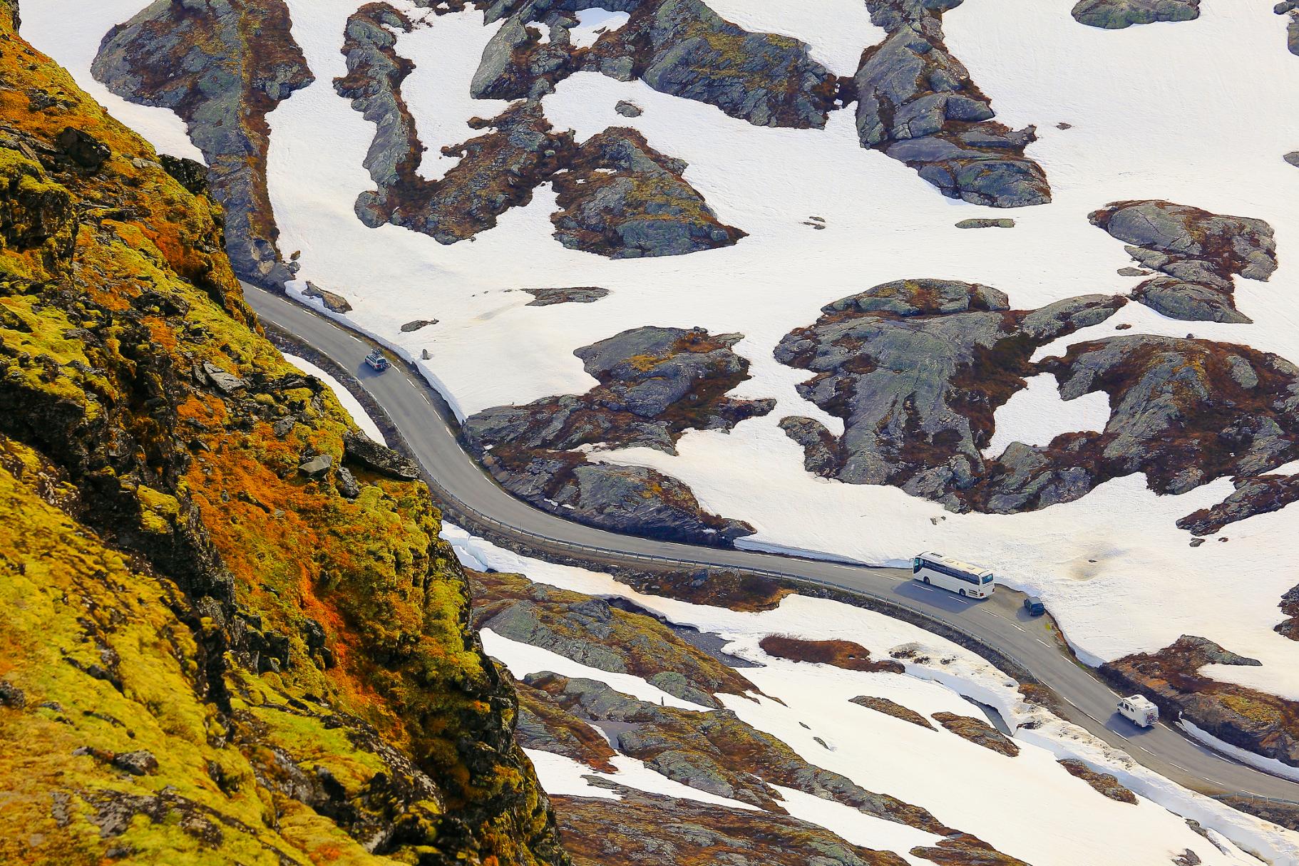
Most people will reach Galdhøpiggen by car. It can be accessed via Scenic Route Sognefjellet (Road 55), which begins in the town of Lom and winds through meadows and past fjords to the mountains.
To reach the trailhead at Spiterstulen you’ll need to drive for 11 miles down an unpaved private toll road - the last few miles of road are closed by barrier in the months that the mountain lodge is closed. To reach Juvasshytta, take Galdhøpiggen road, which turns off from Road 55 into the mountains.
You can also use public transport to reach Galdhøpiggen during the summer months - the Fjellruter buses run from late June until September. To reach Juvasshytta take the 202 Bus from Lom, and for Spitersulen take the 201 Bus (also from Lom) - they both run twice a day.
Inspired? Check out our Ultimate Norwegian Fjords Adventure, which includes a guided ascent of Galdhøpiggen via Styggebreen.