

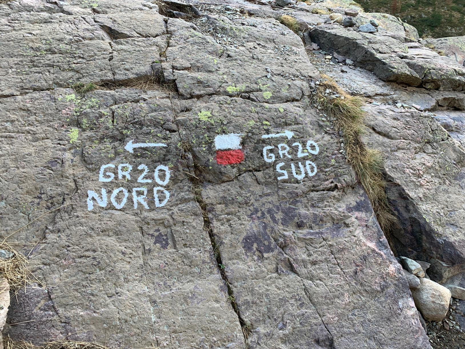
The GR20 is often described as Europe’s toughest long-distance hiking trail—and for good reason. Stretching across the rugged spine of Corsica for roughly 112 miles (180km), it winds through jagged granite peaks, windswept plateaus, dense forests and remote mountain villages. The route tends to be broken into 16 stages, each taking a full day to complete, and requires experience, stamina and a love of wild alpine landscapes.
But not everyone has the time (or the knees) for the entire trek. Fortunately, the GR20 can be split into two distinct halves: the northern section (stages one to nine), known for its high alpine landscapes and technical terrain; and the southern section (stages 10 to 16) known for more forgiving gradients and a wider diversity of landscapes. Both offer unforgettable adventures, but they deliver very different experiences.
So, should you tackle the tough and technical GR20 North, or opt for the more accessible and no less rewarding GR20 South? This guide takes a closer look at both, helping you decide which section of the GR20 is best for you.
Read more: Europe’s Toughest Trek: GR20 Corsica 16‑Stage Guide
GR20 North
The GR20 North runs from the town of Calenzana to Vizzavona, a distance of 60.9 miles (98km). It's this section of the trail that leads to the GR20's designation as 'Europe's toughest trek', and we'd recommend it for experienced hikers only.
Terrain
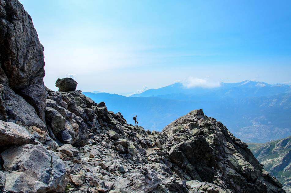
On the northern section of the route, you’ll be spending the majority of the time in high alpine terrain. Expect plenty of steep, unremitting climbs up rocky mountainsides—with around 1,000m (3,281ft) of ascent on many of the stages. You’ll traverse exposed ridges and navigate awkward gullies, scramble up to stony summits and across boulder fields. The steep, bare Spasimata Slabs are particularly hairy.
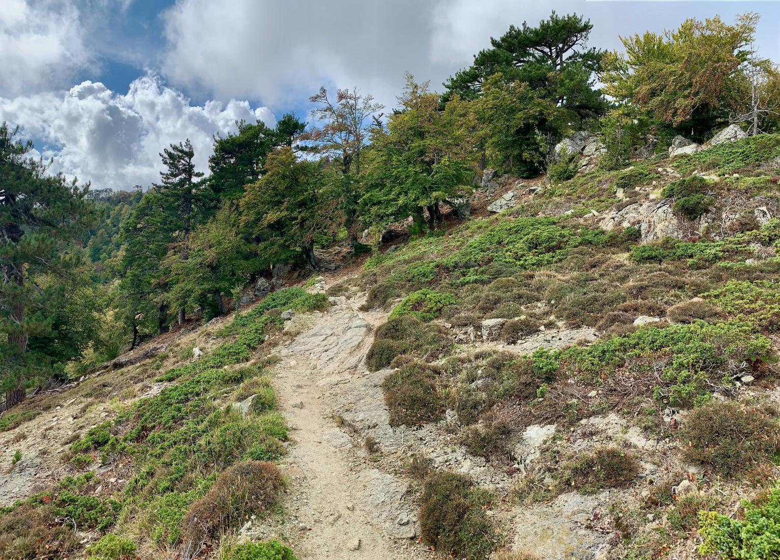
However, there are some gentler areas within the landscape. You’ll pass through forests, areas of maquis (fragrant shrubland) and cross the flat, grassy plain of Pianu di Campotile. Pick the lower level variants and you’ll be hiking along the valley floor, passing through shady woodland threaded with small streams.
Difficulty Level
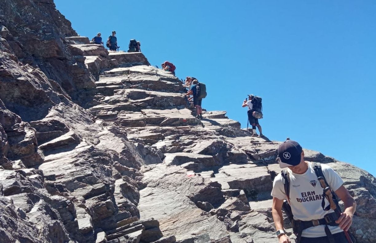
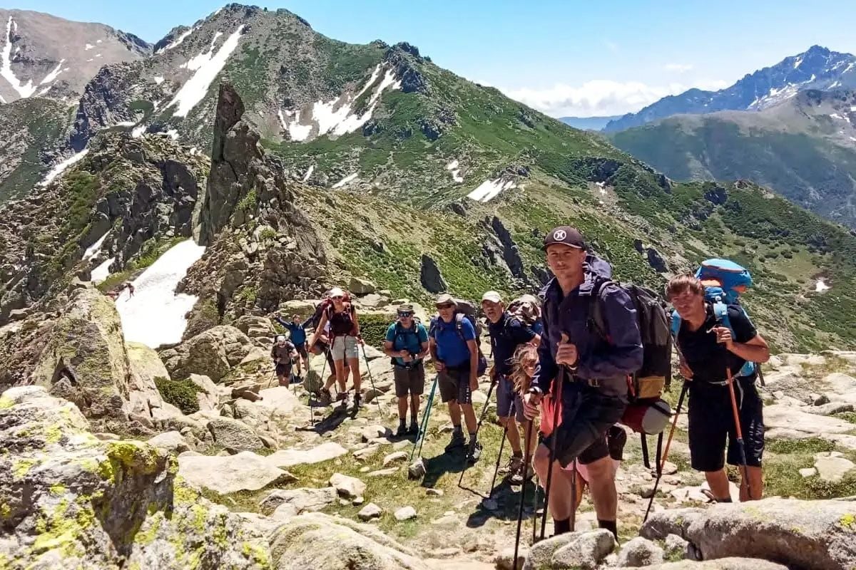
We rate the northern section of the GR20 as ‘tough’ - which is our highest grading. You’ll be trekking for around eight hours a day across uneven terrain, including loose scree and boulders. Some sections have fixed chains and scrambling is required in others, meaning you need a good head for heights. It is considered more difficult than other long-distance hiking routes such as the Tour du Mont Blanc, Mount Kilimanjaro and the Inca Trail.
One of the most difficult sections of the route is crossing the Spasimata Slabs on the third stage of the route. These smooth slabs have fixed cables to help you navigate them, but get slippery when wet. Another difficult section is traversing the exposed rocky ridge from Pointe des Eboulis to Bocca Crucetta, the highest part of the GR20. The final 1,500m (4,920ft) descent down a steep rocky gully to Vizzavona is also hard on the knees.
Scenic Highlights
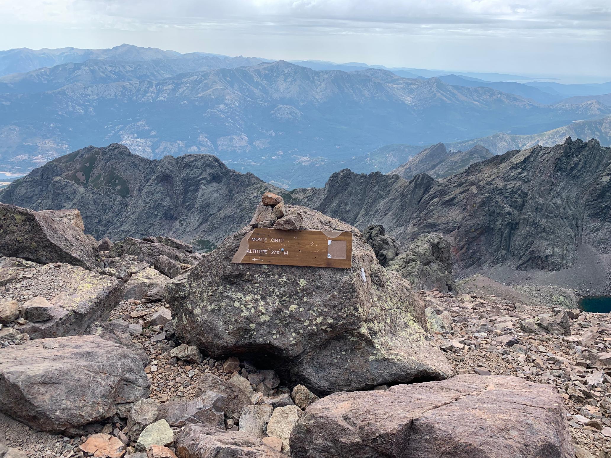
The northern section of the GR20 has some spectacular mountain views over ‘the Granite Island’. The Bocca Piccaia (1,950m/6,400ft) viewpoint looks down into the Ladroncellu Valley, with views of rock towers and pinnacles. Pointe des Eboulis 2,607m (8,553ft), the highest point on the main route, is surrounded by craggy summits, ridges and gullies. To your right is Monte Cinto, the highest mountain in Corsica at 2,706m (8,878ft).
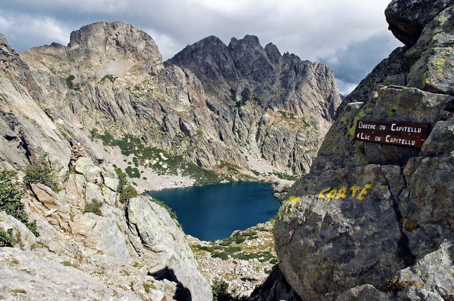
The sixth stage of the route takes you past Lac du Ninu, which is surrounded by lush pasture and encircled by rocky peaks. Another awe-inspiring sight is the aerial view of Lac de Capitellu and Lac du Melo, two deep blue lakes in crater-like rocky hollows, with Monte Ritondu (2,622m/8,602ft) rising behind them.
Refuges & Logistics
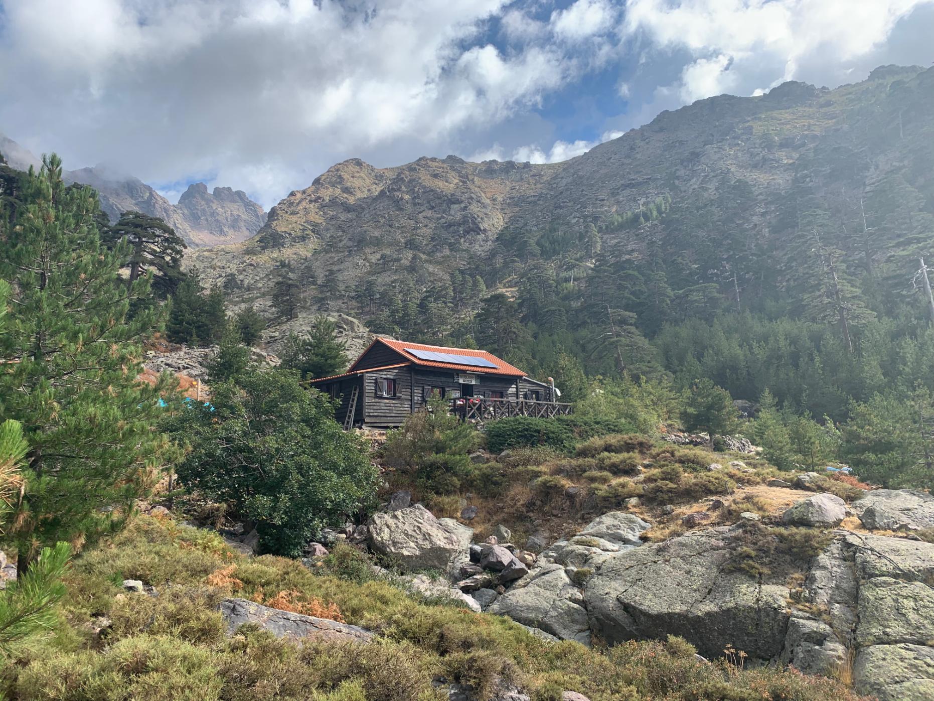
The northern section of the GR20 takes you through remote mountain terrain, so you will often need to carry all the food and water you need for a day of hiking with you. Stream water is available at lower altitudes, but does need to be treated.
Most of the stages end at mountain refuges, where you can get a meal and a bed for the night. The exceptions are the Ascu Stagnu ski station, at the end of stage three, and the village of Vizzavona—both offer a more varied range of restaurants and accommodation.
Ascu Stagnu is connected by road to the small village of Asco, so it’s a good point to start or leave the route. From Refuge de l’Onda at the end of stage eight, you can hike down the valley to Vizzavona and skip the difficult ninth stage.
GR20 South
The GR20 South runs from Vizzavona to Conca, a distance of 68.9 miles (111km). It's considered an easier section than the GR20 north, but shouldn't be underestimated.
Terrain
The terrain on the southern section of the GR20 is gentler than the north. But it does have its fair share of mountains—the highest of which is Alcudina at 2,134m (7,001ft)—which you can take a detour to climb.
Expect some steep and rugged ascents, but the gradients tend to be gentler here. You’ll be walking on narrow paths, dirt roads and forest tracks across a diverse range of landscapes: rugged maquis, forested slopes and boulder-strewn scrubland.
Difficulty Level

The southern section of the GR20 is less difficult than the north, but it’s still a route for experienced hikers. You’ll still be spending entire days on the trail, which ascends and descends rocky mountainsides (albeit at a slightly lower altitude than the northern section).
Stage 13, from Refuge de Usciolu to Refuge de Matalza, is arguably the most difficult, taking you along a rocky ridge of sloping slabs. After reaching the ridge’s rugged crest, Arête a Monda, you’ll need to squeeze between narrow gullies and boulders.
If you want to challenge yourself, there are several high level variants. For example, on Stage 15 you can climb from Refuge d’Asinau up to the rocky buttress of the Aiguilles de Bavella (1,218m/3,996ft). There are several chains to aid your ascent, but you will be scrambling in places.
Scenic Highlights
You’ll be charmed by the village of Cozzano, which is nestled on a hilltop and surrounded by forested mountains. One of the most dramatic sights is the granite pinnacles and ridges leading to the Aiguilles de Bavella, as you walk from Refuge d’Asinau to the village of Bavella.
You can also glimpse the Mediterranean on the southern section of the GR20. Sea views are particularly good on the final descent towards Conca.
Refuges & Logistics
Accommodation on the southern section tends to be in refugios (which offer meals and dormitory accommodation) or rustic stone cabins known as bergeries. You’ll often find several along a stage—they also make for good pit stops. Bergerie de Croci, en route to Refuge d’Asinau (Stage 14) sells hearty meals, homemade jam and home-cured charcuterie.
You can leave the route at stage 12, walking three miles (5km) from Refuge d’Usciolu to the village of Cozzano. It offers a range of accommodation, as well as a bus service to Ajaccio. Village de Bavella, your final destination on Stage 15, is also connected by road to Ajaccio.
Water is more readily available along this section of the route (there are more rivers and a greater number of refreshment stops). However, we’d always recommend you carry enough with you for the day.
Should I Hike the GR20 North or South?
Whether to hike the GR20 North or South depends on your experience level and preferences. Choose the northern section if you're an expert hiker who wants to challenge yourself. You'll tackle technical terrain including rocky mountain summits, exposed ridges and stony gullies—some of which requires scrambling experience.
Choose the southern section if you're less experienced. You'll be hiking through woodland, up bouldery slopes and across rivers. There's still an element of challenge, with around 700m (2,296ft) of ascent each day, and several stony ridges to navigate.
Of course, there's nothing to stop you from hiking the entire 16 stage route from north to south, if you can't decide between the two.
Sample Itineraries
5 Days on the GR20 North Section
Begin your hike in Vizzavona, the official halfway point of the route (accessible by train and bus from Ajaccio), and over four days hike north along the trail to the ski station of Ascu-Stagnu. On the fifth day, follow the GR20 towards the Refuge de Carozzu. Shortly before the refuge, follow the Mare e Monti trail downhill towards the town of Bonifatu, which is connected by road to Calvi.
5 Days on the GR20 South Section
Once again, begin at Vizzavona. This time, you’ll follow the GR20 south to Refuge d’Usciolu (Stages 10 to 12). You’ll then walk a variant of the trail which conflates Stages 13 and 14 into a single day’s hike—following the crest of the Arête a Monda downhill and across the Plateau du Cuscione towards the Refuge d’Asinau. On the fifth day, you’ll rejoin the official GR20 route to hike Stage 15 to the town of Bavella.
6 Days Combining Both Sections
Begin your hike at the Bergeries de Grotelle, which is connected by road to Corte. Climb a rough and bouldery path uphill to Bocca a Soglia, where you’ll join Stage seven of the GR20—continue along steep and stony slopes to Refuge de Petra Piana. Hike stages eight and nine of the route to reach Vizzavona.
You’ll then begin hiking on the southern section of the GR20. Complete stages 10 and 11 of the route. On the sixth and final day, strike out along the trail towards Refuge d’Usciolu—from here, follow a steep path for three miles (5km) down through woodland to the village of Cozzano.
FAQs
Do I have to hike the GR20 in one go?
You do not have to hike the GR20 all in one go. Certain destinations along the route are accessible by road, making it possible to leave or join the GR20. Vizzavona, considered to represent the dividing line between the northern and southern sections, is a particularly popular start or end point for hikers.
In which direction should I hike the GR20?
Traditionally, hikers tend to walk from north to south, thereby completing the most difficult sections of the GR20 first. However, it’s also possible to walk from south to north, which will allow you to gradually acclimatise and build up stamina.
Which is the hardest section of the GR20?
The northern section of the GR20 is the hardest. Stages three and four are considered two of the most difficult, taking you across the slippery Spasimata Slabs and across a rocky ridge that represents the highest point of the route respectively.
Do I need mountaineering experience for the northern section of the GR20?
You do not need technical mountain climbing experience to hike the GR20, but you do need to have experience of scrambling and multi-day hikes in the mountains. The terrain is steep, rocky and unforgiving. We would always recommend travelling with a guide.
Inspired? Check out our Gr20 North Trek, led by experienced local guides.