

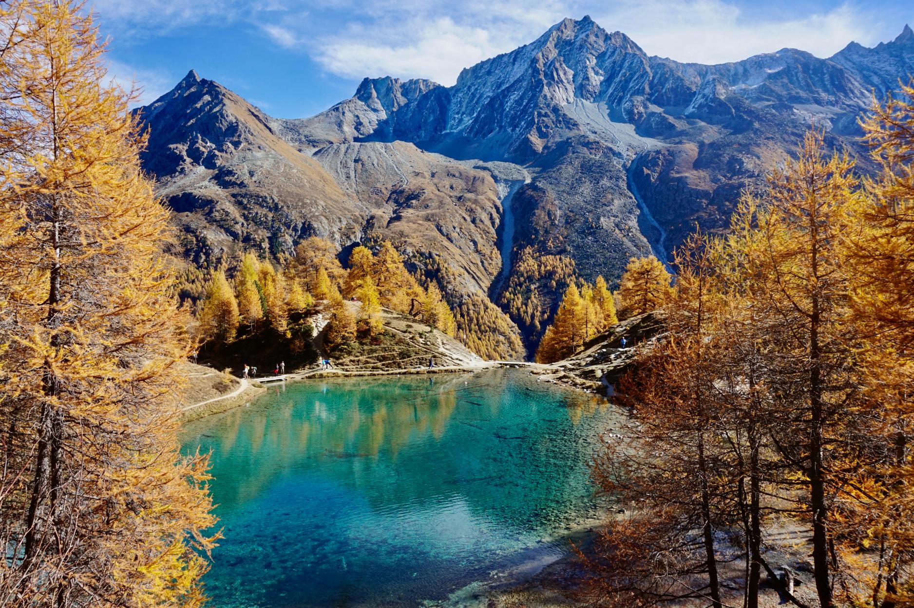
The Walker’s Haute Route is one of the most iconic long-distance treks in the Alps, linking the mountain towns of Chamonix in France and Zermatt in Switzerland. The 137-mile (220km) trail takes hikers through an array of alpine landscapes including high mountain passes, sparse boulder fields and pastoral valleys. You’ll be treated to spectacular views of some of the Alps most famed peaks, including the distinctive pointed Matterhorn (4,478 metres/14,692 ft) and Mont Blanc (4,805m/15,764 ft).
“It's pretty special because it goes into quite high altitude terrain. You're often walking at elevations close to 3,000 metres, really close to the edge of glaciers.” says Grant Fulton, an International Mountain Leader living in Chamonix.
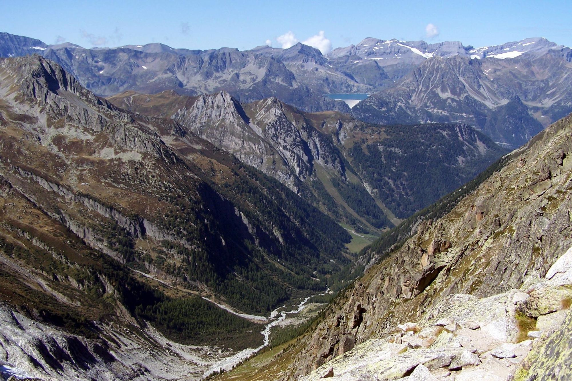
“I really like what’s probably the hardest section of hiking, between Verbier and Cabane de Prafleuri. You go into this area called the Grand Desert, which is as the name suggests, very barren mountain scenery. There's often no one else there. It's a great place to see ibex.
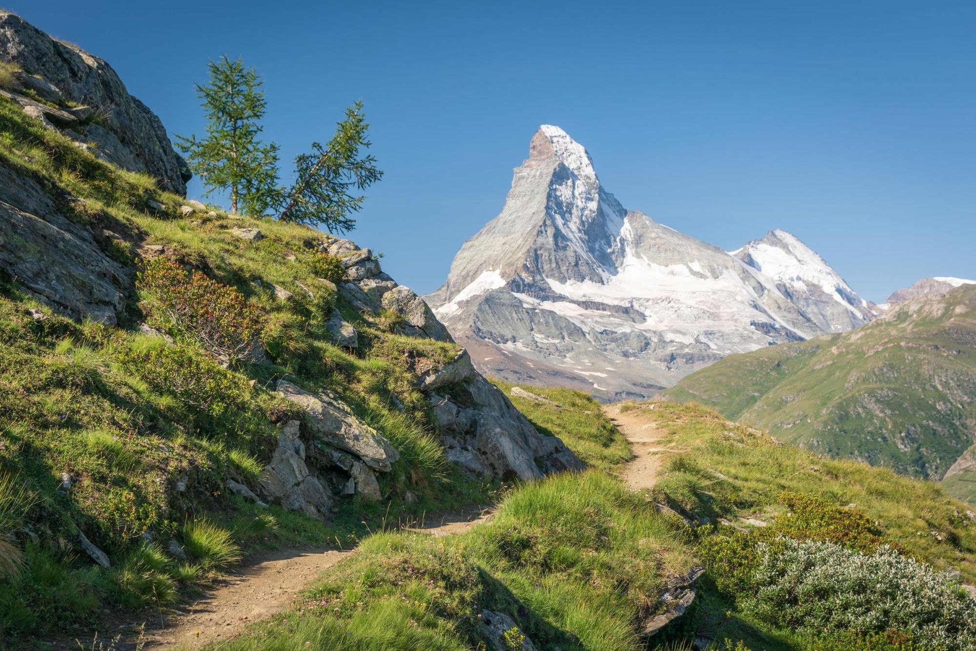
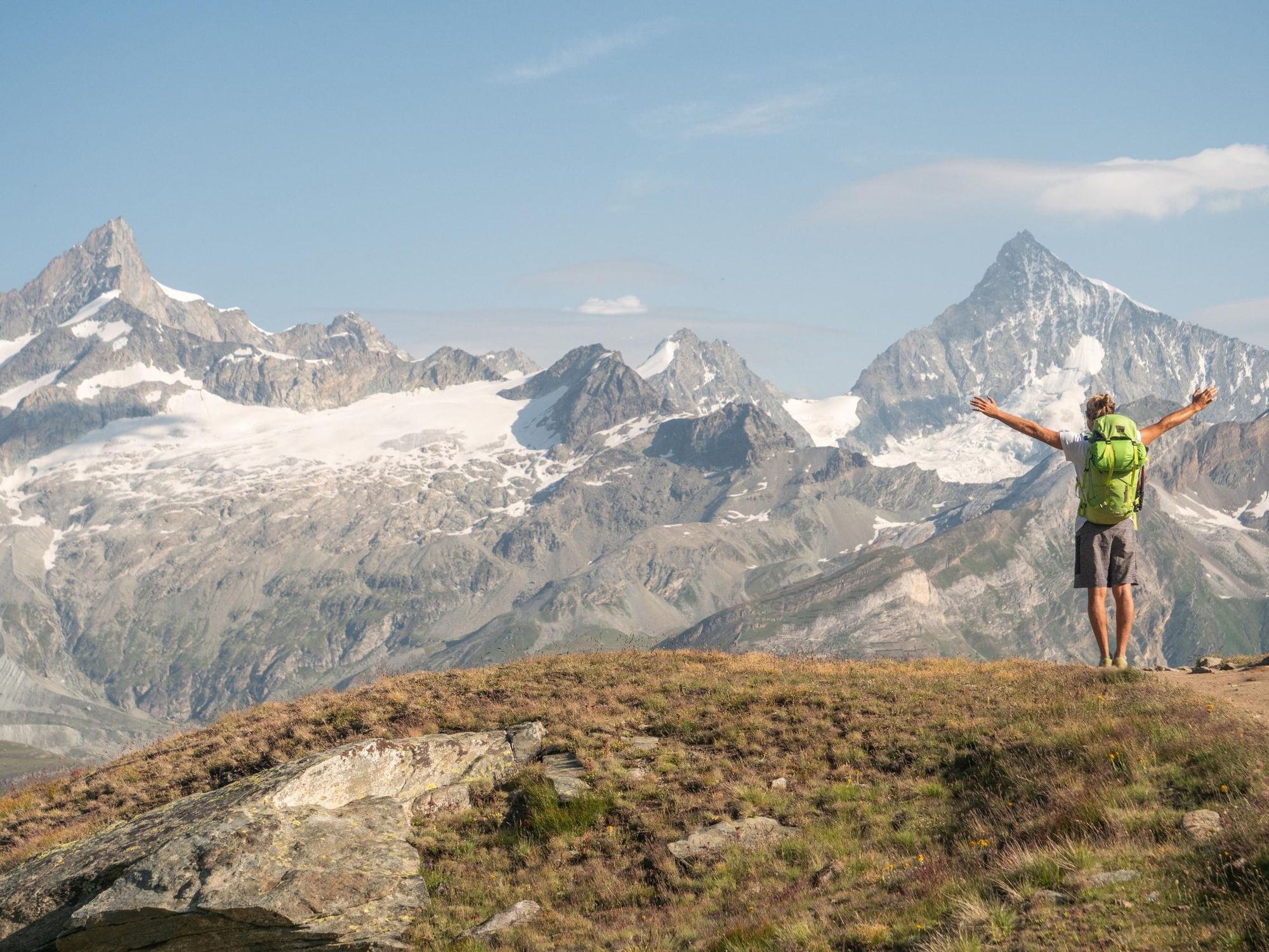
You turn a corner and you have that classic view of the Matterhorn straight in front of you
"My next favourite part is on the last day as you're walking towards Zermatt on the Europaweg, this balcony trail that traverses towards Zermatt. You turn a corner and you have that classic view of the Matterhorn straight in front of you.”
The Haute Route, however, isn’t for the inexperienced. It typically takes between 11-14 days to complete, and involves a total elevation gain of around 15,200m (49,867 ft). While you won’t need technical skills, you’ll experience some steep climbs, rocky and exposed terrain, and will need to do a bit of route-finding.
Our guide to hiking the Walker’s Haute Route will give you an insight into the route (and several of its variants), difficulty level, what to pack and where to stay.

Haute Route: Map & Basics
- Distance: 132-137 miles (213-220 km)
- Hiking time: 11-14 days
- Elevation gain: 14,000-15,200m (45,932 ft - 49,869 ft)
- Highest point: 2,987m (9,800 ft)
The Walker’s Haute Route
The Walker’s Haute Route is a point-to-point hike, beginning in Chamonix and ending in Zermatt. The first few stages follow the path of the Tour du Mont Blanc (TMB), deviating once you reach Verbier. Here, we’ve broken the Haute Route down into 12 stages, but if your time is limited, Grant recommends skipping the first day’s hike, and beginning from Argentière.
“It’s just a couple of hours of hiking. People do it if they arrive in Chamonix later in the morning and have half a day. But we start at 8:30am so we just skip that stage,” he says.
There are several variants along the route. We’ve listed the most significant ones.
Stage 1: Chamonix to Argentière
- Distance: 5.5 miles (9km)
- Hiking time: 2-3 hours
- Ascent: 300m (984 ft)
A short stage to get you warmed up before the harder days to follow. Head up the valley along the road leading out of Chamonix. Take a path that leads through woodlands and across the River Arveyron. As you walk towards Argentière, you’ll have several glimpses of the towering Mont Blanc massif.
Stage 2: Argentière to Trient
- Distance: 8.6 miles (14km)
- Hiking time: 5 hours
- Ascent: 670m (2,198 ft)
You’ll begin the day’s hike with a climb up to the Col de Balme, and then a long descent into the town of Trient.
“It's a good climb but it's quite easy terrain,” Grant says. “At the top, there's some little concrete posts and stones to mark out where the border with Switzerland is. There’s a lovely refuge just inside the Swiss side.
“Then it's just a cruisey descent down the other side. It’s very green and idyllic—there's quite often a shepherd up there with his sheep on the mountain. Then you descend through pine forest into Trient which is very pretty; there’s a huge glacier hanging over the village.”
Stage 3: Trient to Champex-lac
- Distance: 9.3 miles (15km)
- Hiking time: 7 hours
- Ascent: 1,400m (4,593 ft)
This is one of the tougher days along the route, with roughly a 1,400m climb from Trient up to the Fenêtre d'Arpette.
“The last section is pretty steep and rocky, so you might have to use your hands and scramble a little bit on some sections,” says Grant.
The last section is pretty steep and rocky, so you might have to use your hands and scramble a little bit
“You're doing it the opposite direction to most people on the TMB, so you don't see a lot of people on the way down. The descent can be a little tough. At the top you have to go through a boulder field; it's sometimes a bit tricky route-finding through this big field of blocks.
“Then you go down to the Val d’Arpette, a small quiet valley with a small refuge where you can have a beer. Then it's 40 minutes to Champex-lac, where we spend the night.”
Variant: The Bovine Route
For those who can’t face the long scramble up to the top of the Fenêtre d'Arpette, there’s an easier alternative: the Bovine Route, which is a section of the Tour du Mont Blanc.
“It’s just as scenic but a lot less technical,” Grant says. “It's at lower altitude. You only go up to 2,000 metres and you do this really nice climb in the forest. Then you pop out into a lovely alpine meadow. The descent down into Champex-lac is a little bit rocky but a lot easier than the Fenêtre d'Arpette. It's a nicer route for a rainy day because it's in the forest and is quite sheltered.”
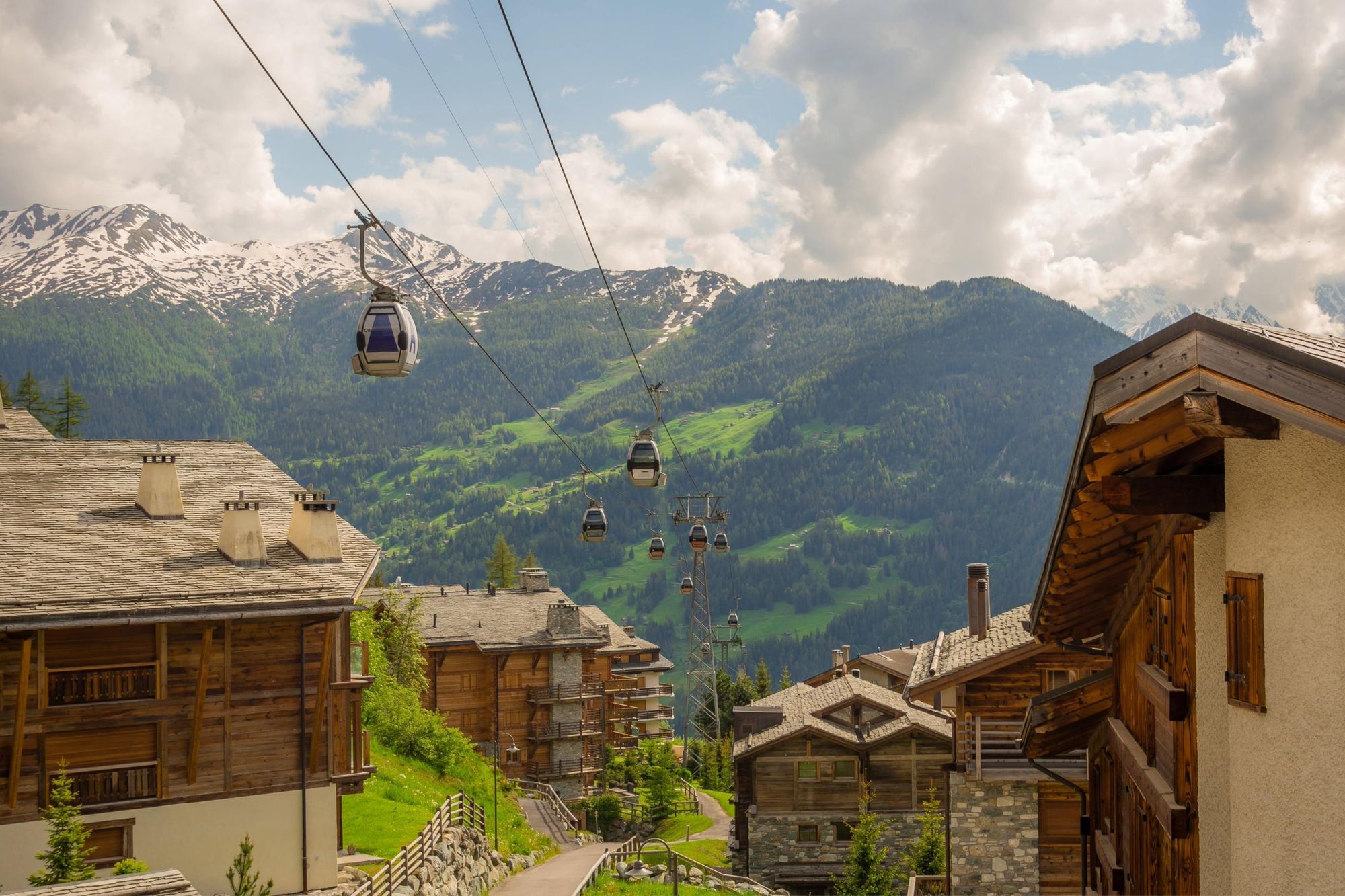
Stage 4: Champex-lac to Verbier
- Distance: 11.8 miles (19km)
- Hiking time: 4-5 hours
- Ascent: 884m (2,900 ft)
From Champex, follow farmers' tracks north along the west side of the valley, eventually descending toward the village of Sembrancher, located at the bottom of the valley along the Dranse River. Follow the river upstream, passing a pond and climbing a small hill to reach Le Châble.
Some hikers choose to catch the cable car to Verbier. Those who don’t will make a 762m (2,500 ft) ascent to Verbier, along farm access tracks and dirt roads that zigzag upwards.
Should you want to shorten your hike, Grant recommends skipping this stage, and getting a taxi to Verbier (which is connected to Champex-lac by road).
Stage 5: Verbier to Cabane de Prafleuri
- Distance: 9.3 miles (15km)
- Hiking time: 6 hours
- Ascent: 1,290m (4,232 ft)
Catch the gondola from Verbier a short distance to the mountain of La Chaux. From here, you’ll continue climbing uphill along a rugged trail. You’ll head over the Col de la Chaux, a rocky pass located at an altitude of 2,940m (9,645 ft).
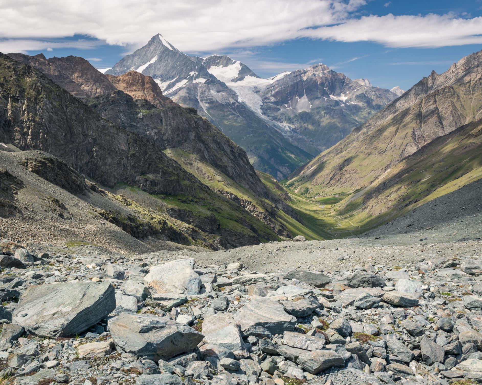
You end up at the Grand Desert, which is this big moonscape of shattered rock and old glaciers
“You end up at the Grand Desert, which is this big moonscape of shattered rock and old glaciers. Sometimes there's some exciting river crossings,” Grant says. “You hike a few kilometres across this big barren plateau. The waymarkings are just paint on rocks here, so you need to take care if the weather’s bad or visibility is poor. It's easy to wander off track in places where it's particularly rocky and there's no footpath.
“Towards the end it gets a bit more technical, with some large rocks to climb over, until you get to the Col de Prafleuri. Once you get there you're looking down onto the refuge for the night.”
Variant: Sentier de Chamois
To save yourself a steep climb, you can instead take the Sentier de Chamois, a longer route with a gentler incline.
“The terrain is a bit easier, but you’re essentially hiking two sides of a triangle,” Grant says. “From the path, you have really nice views of the Grand Combine, which is a 4,309m-high peak slap bang in front of you.”
The Sentier de Chamois rejoins the route at the Grand Desert.
Stage 6: Cabane de Prafleuri to Arolla
- Distance: 10.5 miles (17km)
- Hiking time: 6 hours
- Ascent: 600m (1,986.5 ft)
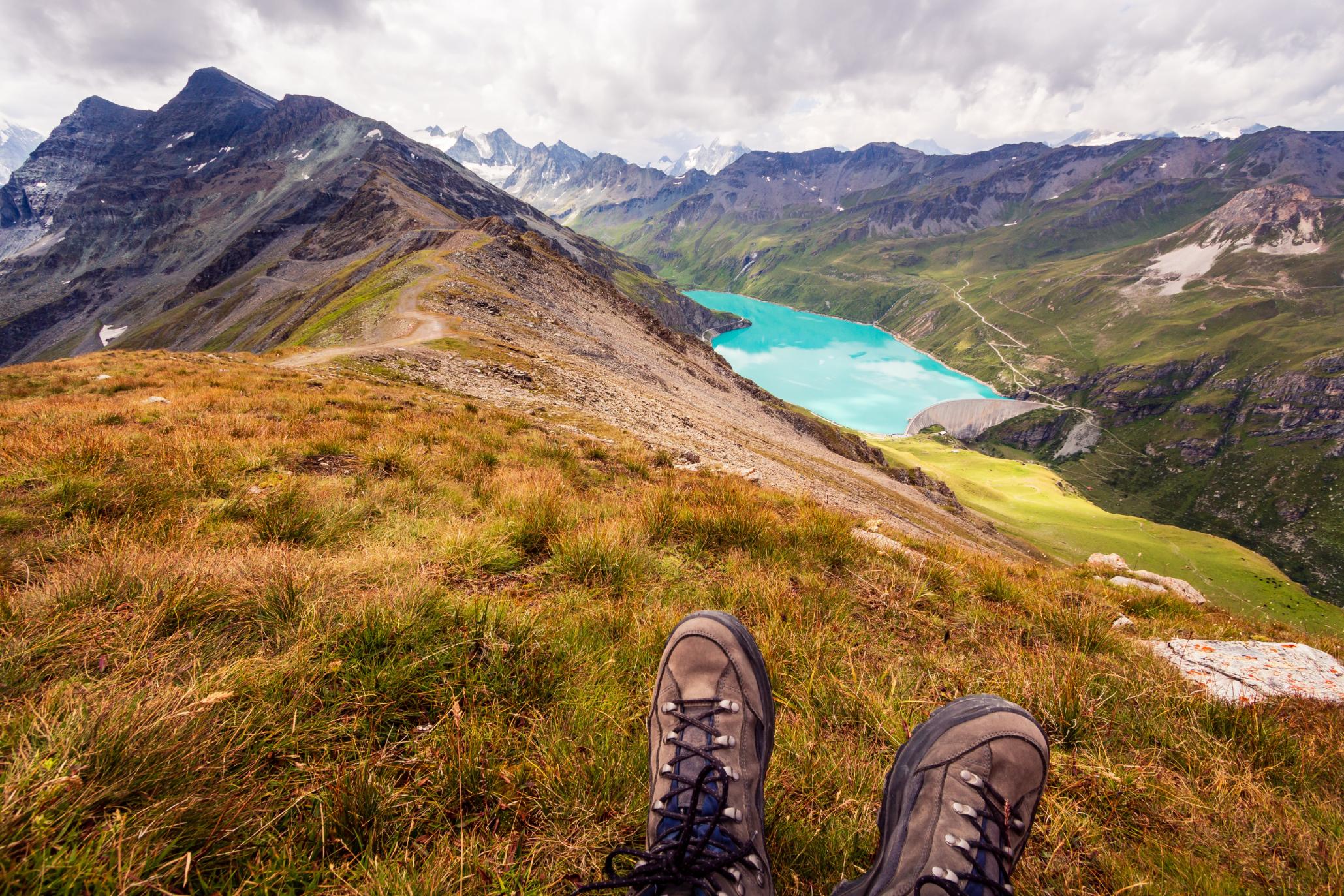
A short, steep climb takes you up from Prafleuri to Lac des Dix, a milky blue glacial lake behind a hydroelectric dam. From here, follow a path up old glacial moraine towards a refuge named Cabane des Dix. The path cuts off below the refuge and heads up to a high rocky pass, the Pas de Chèvres. Here you have two options, both next to each other: climbing steel ladders over the Pas de Chèvres, or climbing over the Col de Riedmatten.
“There’s no ladders on the Riedmatten: it used to be dangerous, with a lot of loose rocks,” Grant says. “But in the last few years it's changed. There's a really good new path over the Riedmatten and then the ladders over the Pas de Chèvres have become quite dangerous due to the permafrost melting; one of them started slipping off the mountain. So everyone now does the Col de Riedmatten, which is a lot safer than it used to be.”
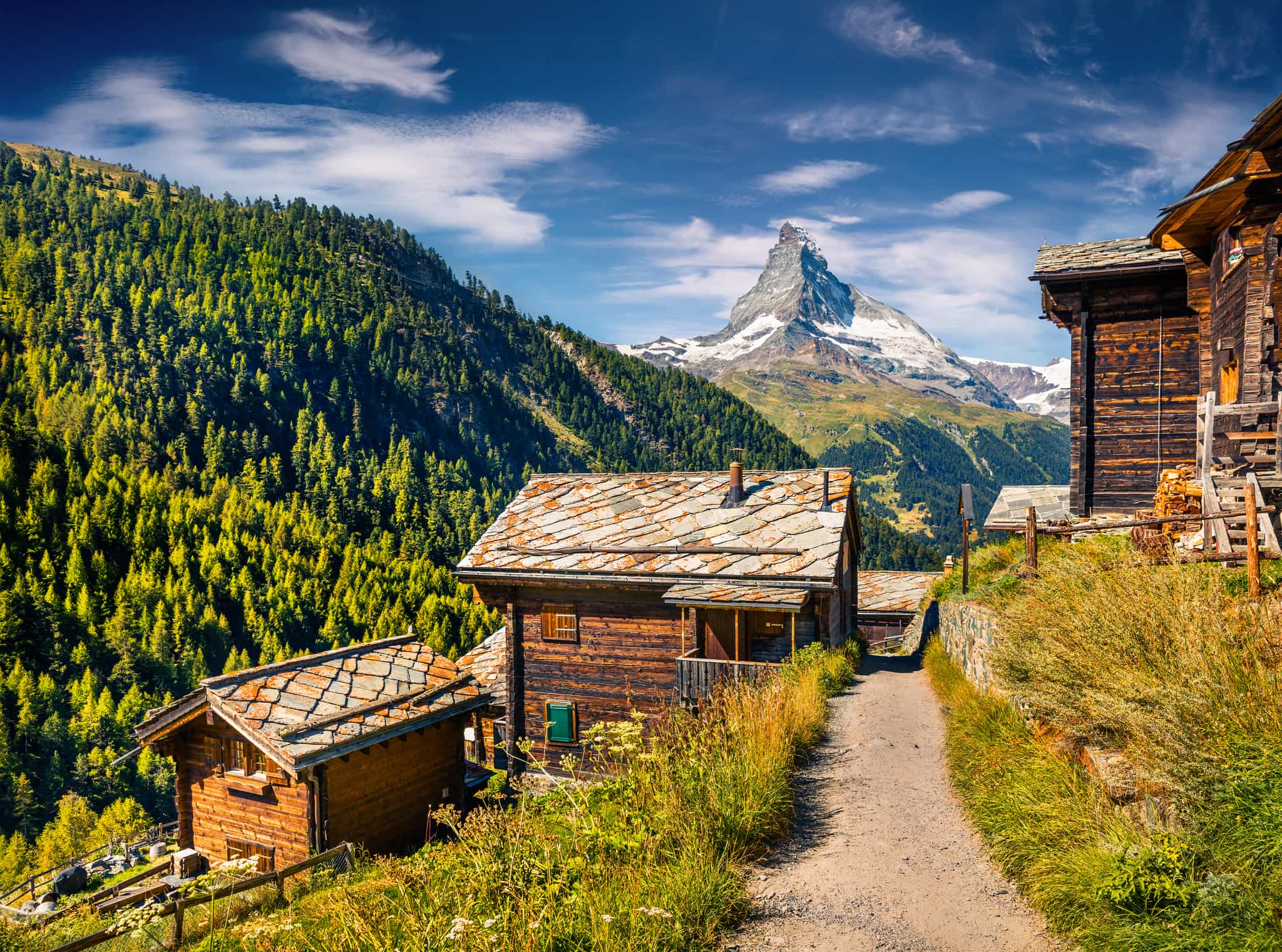
After ascending the col, you’ll make your way downhill towards the town of Arolla, getting your first glimpse of the distinctive peaked summit of the Matterhorn.
Stage 7: Arolla to La Sage
- Distance: 7.4 miles (12km)
- Hiking time: 4-5 hours
- Ascent: 450m (1,476 ft)
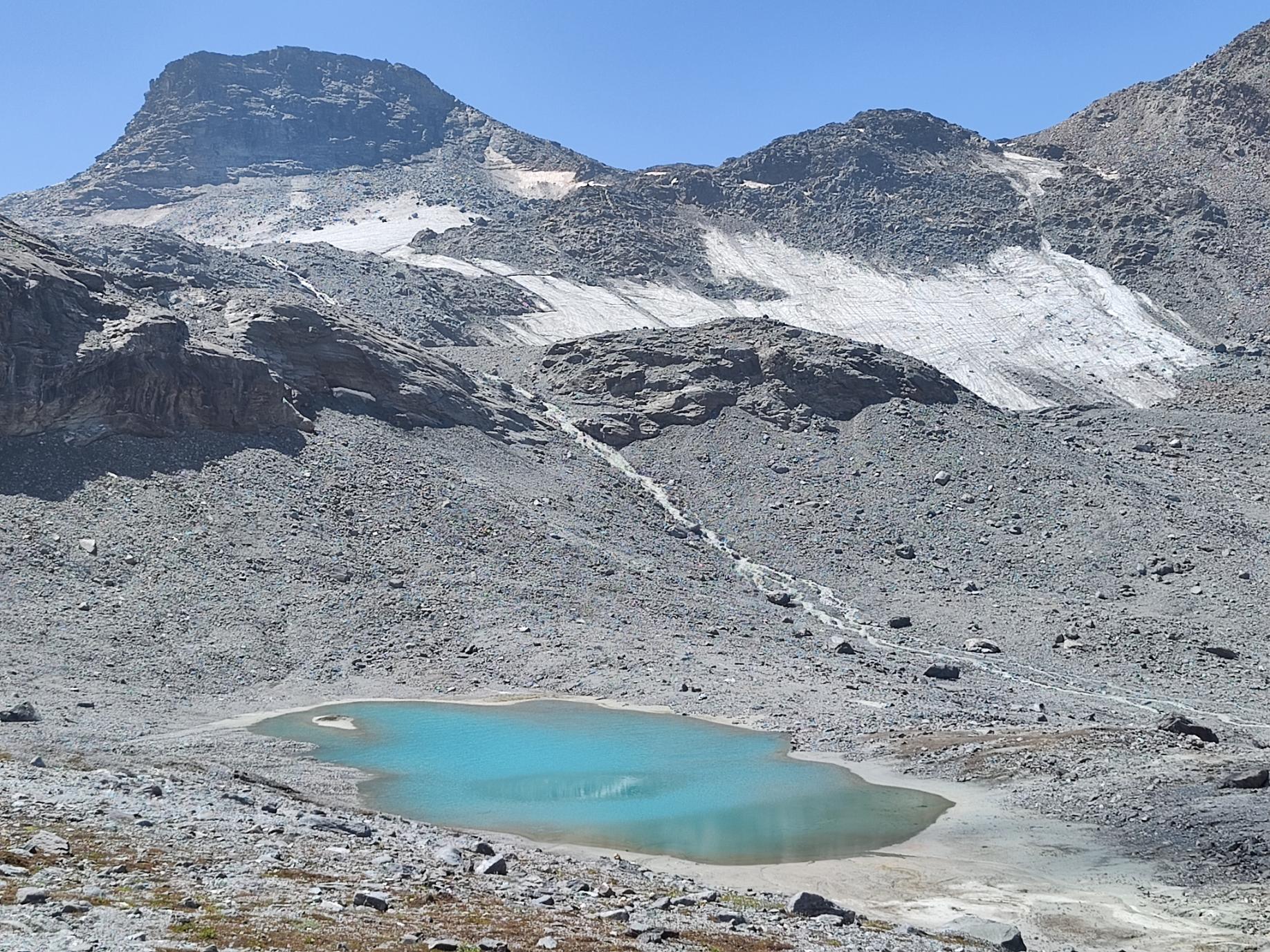
Sandwiched between two strenuous hiking days, today’s route is much gentler. You’ll hike mostly downhill, before a short climb uphill to Lac Bleu, so-named for its brilliant blue colour.
“If you're very brave you can have a swim there,” Grant says. “Somebody usually goes in it and it's absolutely freezing.”
From Lac Blue, follow the route through villages and farmland, where you’ll see the famous black cows (Reines d’Hérens). You’ll reach the pretty village of Les Haudéres around lunchtime—it’s a short walk to La Sage from here.
Stage 8: La Sage to Zinal
- Distance: 11.1 miles (18km)
- Hiking time: 7-8 hours
- Ascent: 1,800m (5,905 ft)
Today’s hike is one of the toughest you’ll encounter, with 1,800m (5,905 ft) of uphill climbing.
“On paper it looks terrifying. There's a really huge climb to start the day, but actually the trails are all quite smooth; you're climbing up these long grassy slopes,” Grant says.
On paper it looks terrifying. There's a really huge climb to start the day, but actually the trails are all quite smooth
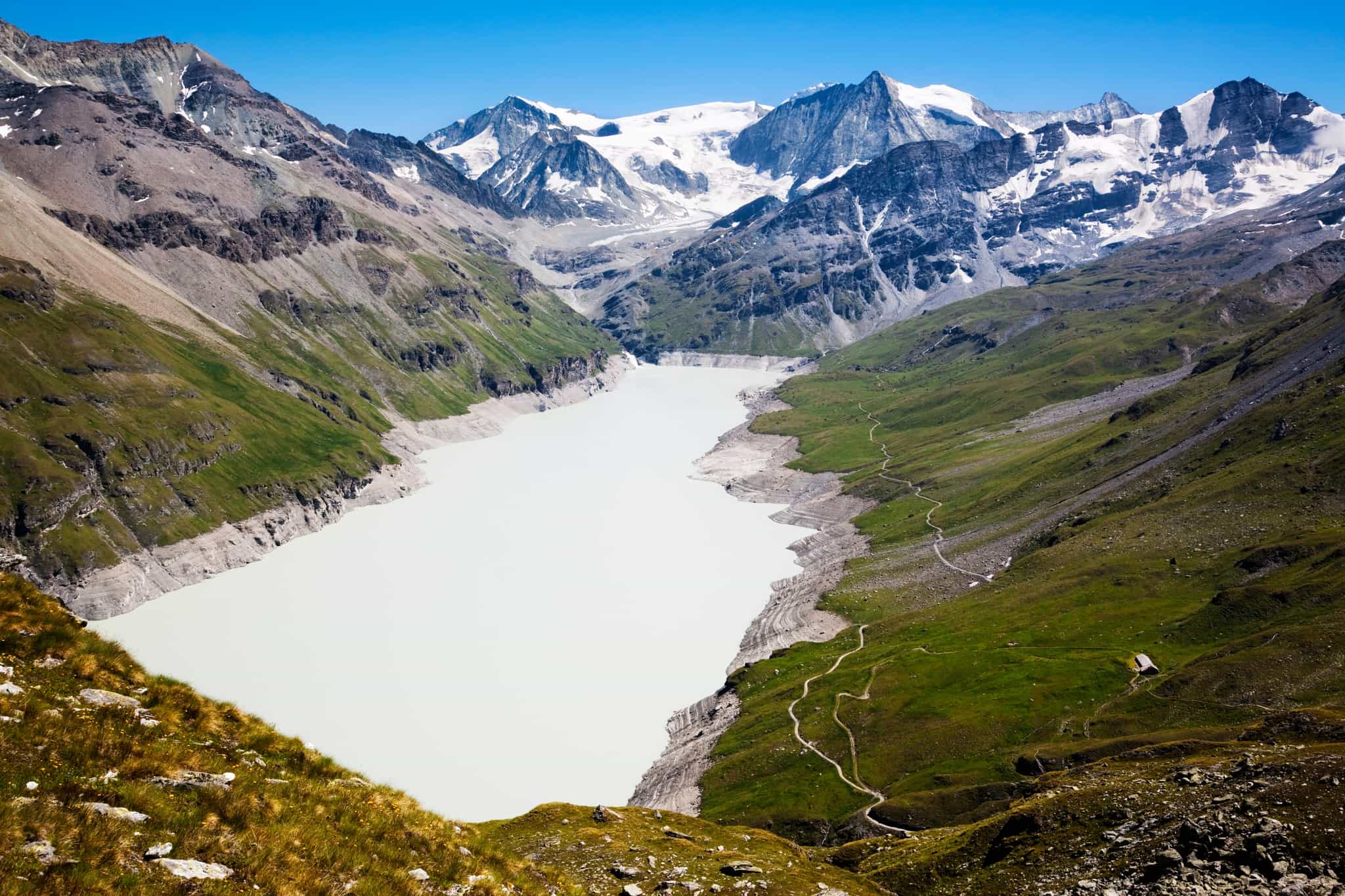
“The first big climb is up to the Col de Torrent, which is one of the higher passes at 2,916 metres. From Col de Torrent, you’ll continue to a hydroelectric dam and Lac Moiry. From here, it’s a short climb to the Col de Sorebois.
“You can cheat a little bit and hop on some ski lifts down to Zinal or do a pretty long descent,” Grant says. “It's a bit of a knee-breaker downhill to Zinal. It's not technical. It's just long and hot. Usually half the people hop on the lift.”
Stage 9: Zinal to Gruben
- Distance: 10.5 miles (17km)
- Hiking time: 7 hours
- Ascent: 1,200m (4,000 ft)
You’ll climb out of Zinal through larch forests, following a balcony trail above the valley to Forcletta Pass.
“That's an interesting point on the route because that is the point where you have to change language: you go from French-speaking Switzerland to German-speaking Switzerland,” Grant says.

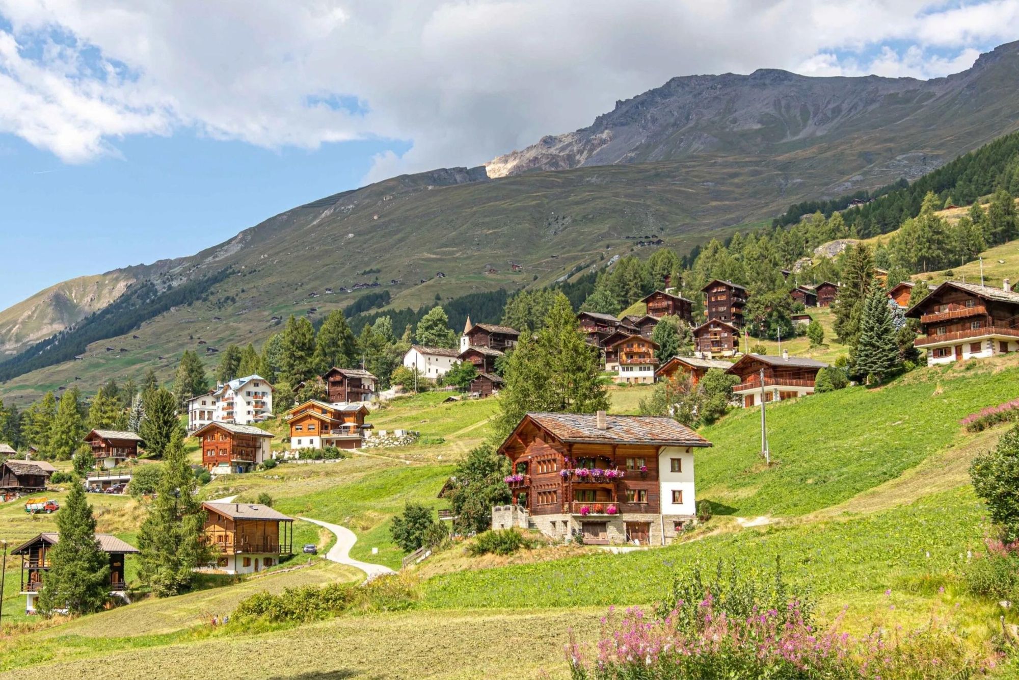
From the pass, you’ll descend the valley to Gruben, a small German-speaking village.
“The whole valley is closed for the winter. The road gets snowed over and so the village is only open in the summertime. So it's really really remote. No phone signal, no shops, nothing,” Grant says.
Stage 10: Gruben to St. Niklaus
- Distance: 8.6 miles (14km)
- Hiking time: 6 hours
- Ascent: 1,120m (3,674 ft)
Your day begins with an uphill climb towards the Augstbord Pass, and a descent into the Augstbordtal.
“You have really cool views on this day. As you look away from Zermatt, you can see all of the Bernese Oberland, these 4,000m peaks in the middle of Switzerland,” Grant says.
You’ve got huge 4,000m high peaks rising up on each side. You’re surrounded by glaciers
“Then, as you come round into the Zermatt Valley (also called Mattertal), you’ve got huge 4,000m high peaks rising up on each side. You’re surrounded by glaciers.”
“Descend to a village called Jungen, perched on a cliff at the top of the valley. People live there all year round, but the only access to the village is by a tiny little four person cable car that zips up and down to the valley floor. Most of the time we'll hop in the cable car, rather than walk down into the valley, as people are normally pretty tired.”
Once in the valley, continue on to the small town of St. Niklaus, where you can spend the night.
Stage 11: St. Niklaus to Europahütte
- Distance: 9.3 miles (15km)
- Hiking time: 5-6 hours
- Ascent: 1,310m (4,297 ft)
Your penultimate day takes you from the town of St. Niklaus to the Europahütte mountain refuge along a famous trail known as the Europaweg.
“It’s this incredible path that's just been dug out of the side of a cliff. It's got tunnels and bridges and all sorts,” Grant says. “But the first section was too unstable and the Swiss government closed it. Now we have a nice walk along the valley and skip the closed section. Then quite a steep climb up onto the Europaweg, with little sections of staircase and a steep winding path.
“It can be quite tough, but then you pop out on this stunning balcony trail and spend the rest of the day traversing it, with views of this huge valley that you've climbed up. You can see the huge glaciated faces of the Weisshorn, one of the biggest peaks in Switzerland at 4,505 metres. Then we end up at the Europahütte.”
Stage 12: Europahütte to Zermatt
- Distance: 9.9 miles (16km)
- Hiking time: 7 hours
- Ascent: 1,110m (3,461 ft)
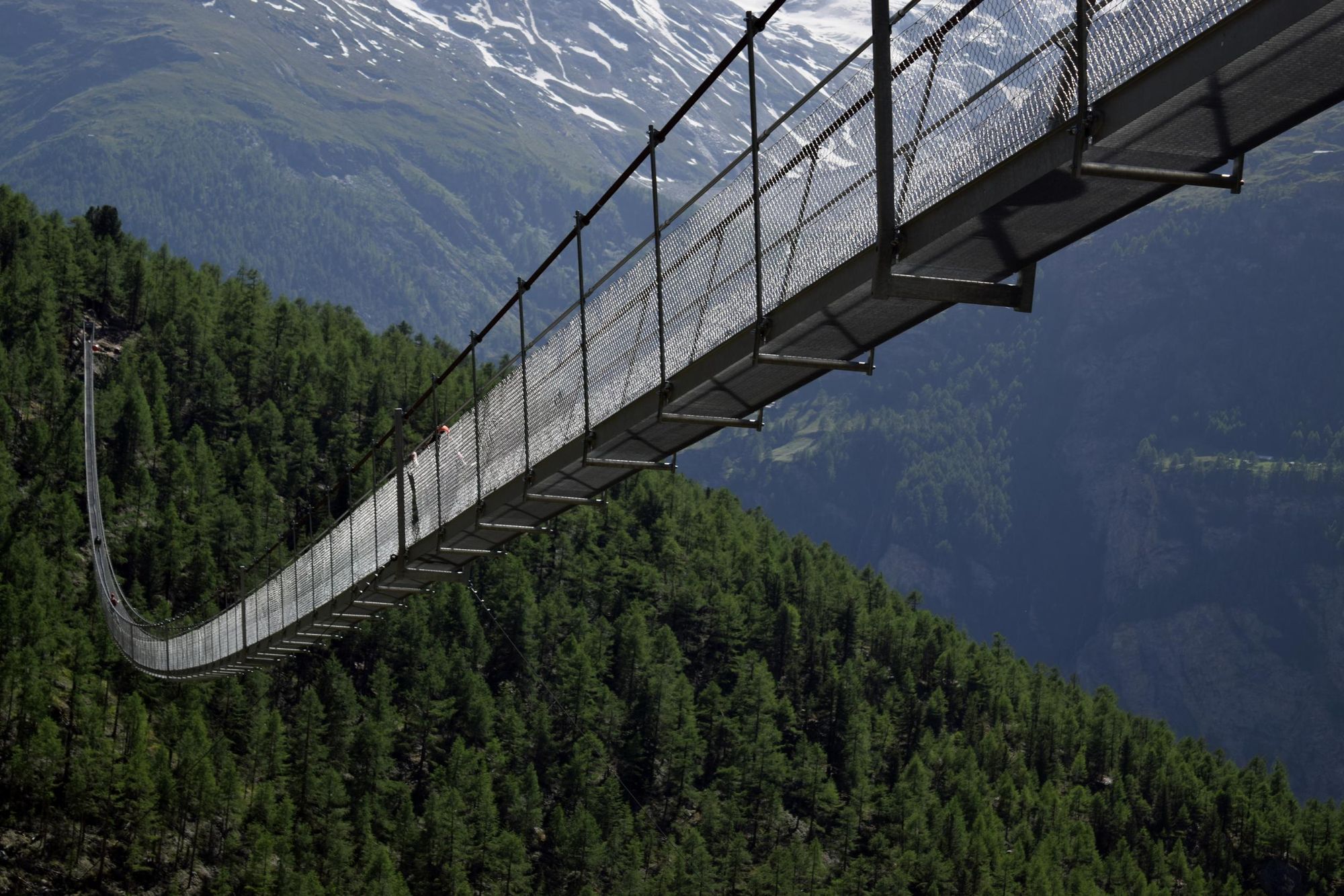
Your final day of walking doesn’t disappoint. Just after heading out of the Europahütte, you’ll cross the Charles Kuonen Bridge—the world’s longest suspension bridge at 500m (1,640 ft).
“It dangles over a gorge. Sometimes you can look down and you see chamois and ibex running around below you. It wobbles as you walk across, so it can be a little bit unnerving,” Grant says.
It wobbles as you walk across, so it can be a little bit unnerving
From here, you’ll continue along the Europaweg to Zermatt. This section is a balcony trail along the top of the valley with breathtaking views of mountains such as the iconic Matterhorn. You’ll end the day with a gradual, easy descent into Zermatt where you can celebrate the end of your walk.
The Walker’s Haute Route: 7 Day Variant
If you only have a limited amount of annual leave, it’s possible to put together a shorter variant of the Walker’s Haute Route by doing the following:
- Begin the route at Verbier instead of Chamonix, skipping the busier sections of the trail which follow the same route as the Tour du Mont Blanc. If you’ve done the latter trail already, you’ll be repeating yourself.
- Skip stage seven by catching a 25 minute bus from Arolla to Les Haudéres, walking to La Sage and then beginning stage eight.
- Stage 11 and Stage 12 can be combined into one, as it’s possible to hike from St. Niklaus to Zermatt in a day. To do so, you’ll avoid taking the Europaweg up to the Europahütte, instead continuing along the hiking path through the Mattertal. It traces the path of the Matter Vispa River, passing through the towns of Randa and Tasch before reaching Zermatt.
How Hard is the Haute Route?
We’ve graded the Walker’s Haute Route as ‘tough’, our highest difficulty rating. Not only does it involve multiple days of hiking, but you’ll frequently have more than 1,000m+ (3,280 ft) of elevation gain and descent during the day. The terrain is more rugged and less frequently travelled than the Tour du Mont Blanc, and the trek takes place at a higher elevation.
“You work for it. It's a bit tougher than the TMB. The terrain and the trails aren't quite as easy. There's a lot of quite rocky terrain, especially in the first half,” Grant says. “Another difficulty is you have to carry everything you need with you, so it’s really important to have a trial run with your backpack before hitting the trail.”
According to Grant, the Haute Route tends to attract experienced hikers. However, if it’s been a while since your last multi-day hike, it’s definitely worth getting a couple of practice ones in—particularly in a mountain environment, if you can.
Where to Stay on the Haute Route
Accommodation along the Haute Route includes mountain refuges on the high trails, and small hotels and guest houses in the villages you pass through. Advance reservations are essential during peak trekking season from July to September.
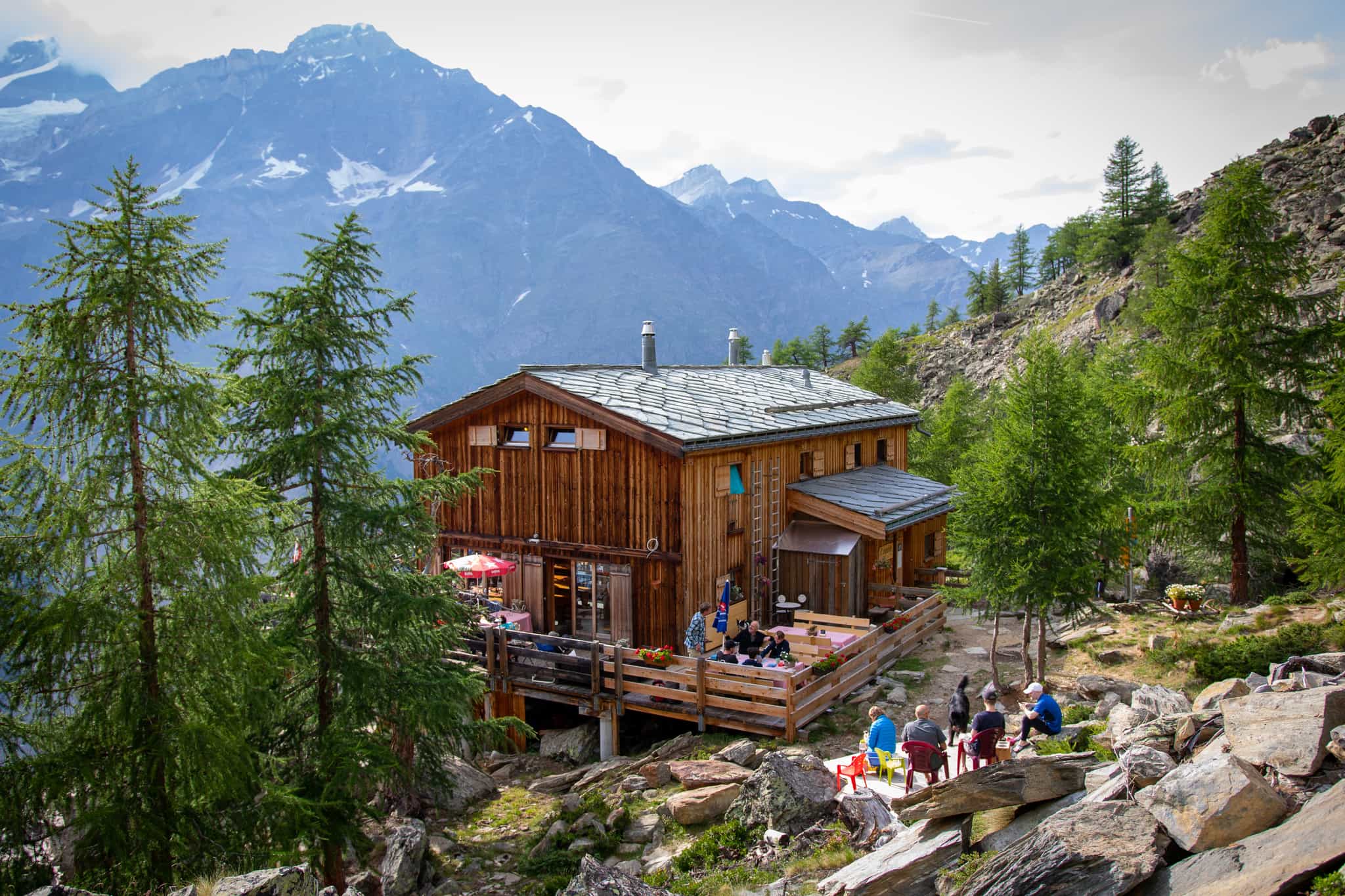
Mountain refuges (known as “cabane” in French-speaking Switzerland and “hütte” in German-speaking Switzerland) are basic, dormitory-style bunkhouses serving hearty multi-course dinners—often with superlative views.
“One of my favourites is the Cabane Prafleuri,” Grant says. “It was originally built for people who were digging tunnels for the hydroelectric dam, then they've just turned it into a refuge. So it's in a very odd place—this really barren little valley—but it's really quiet. Then usually at dinner time, there's a lot of ibex who come down. The refuge owners put salt licks on the rocks for them.
“I also like the Europahütte, which is a tiny refuge perched on the edge of a cliff. It's probably got the best beer garden in the world, with incredible mountain views.”
If you want a break from bunkhouse-style accommodation, you can stay in more upmarket hotels in the larger towns and villages along the route, such as Verbier, Zinal and Zermatt.
Can You Camp on the Haute Route?
Camping on the Haute Route is generally not allowed due to environmental regulations and protected alpine zones. Wild camping and bivouacking is prohibited in most areas between Chamonix and Zermatt. Designated campsites exist near some of the villages along the route, but most trekkers rely on mountain huts and refuges for overnight stays.
What to Pack for the Haute Route
It’s important to pack light, as you’ll be carrying everything you need with you.
“You can wash some little bits along the way so you don't have to carry 10-days worth of clothes,” Grant says. “In the Alps it’s quite easy to get clean water. Usually the maximum you ever need to carry is 2 litres of water as there’s always places to fill up.”
Essential bits of kit include:
- 30-50L backpack with waist belt (plus a rain cover)
- Sleeping bag liner (cotton or silk). A mandatory requirement at the mountain refuges.
- Sunglasses and sunscreen (SPF 50+ recommended due to altitude)
- 2L water bottle(s)
- Toiletries and personal first aid items
- Towel
- Plug adaptor and/or battery pack to charge electrical devices
- Waterproof jacket (with hood) and trousers
- Primaloft or down jacket
- Fleece or merino pullover
- Synthetic or merino wool base layers
- Warm hat and gloves (really important in mixed weather conditions)
- Sunhat or cap
- Synthetic shirts and trousers (zip-off preferable) for hiking
- 2+ pairs of hiking socks, wool or synthetic
- Sturdy hiking boots or shoes (worn in)
- Comfortable light shoes for around the refuge
For a full list, check out the Kitlist section of our Haute Route trek
When is the Best Time of Year to Walk the Haute Route?
The best time of year to walk the Haute Route is from mid-July to mid-September. During this period, snow has usually melted from high passes, and mountain huts are open for trekkers. Weather conditions are more stable, and trails are generally clear. Early July and late September carry higher risks of snow and poor weather.
Inspired? Come and Trek the Haute Route from Chamonix to Zermatt with us, or check out our Trek the Haute Route in a Week variant.