


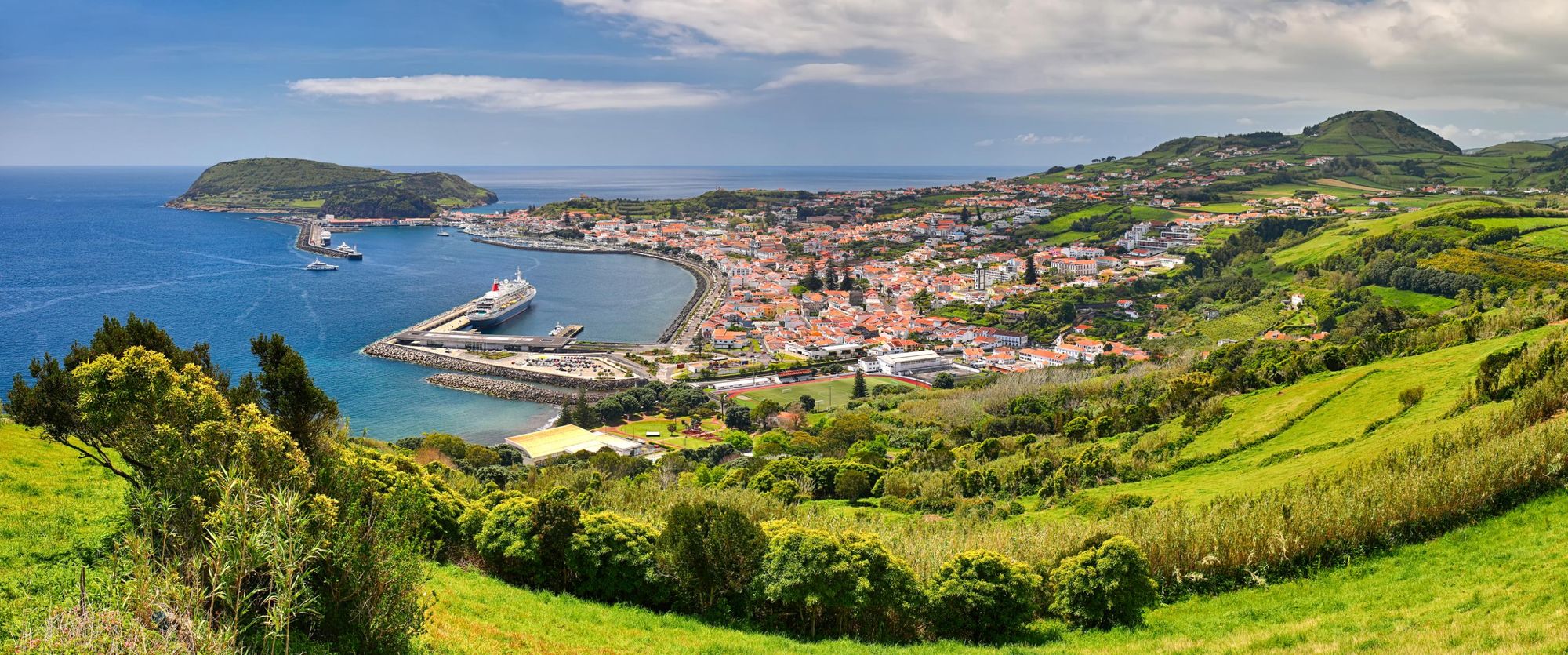
Hiking in the Azores means walking amongst volcanic foothills, lush orchards, ancient forests and along dramatic coastline. This is the European Union's most remote frontier - and while the hiking trails here are well-mapped, this cluster of nine islands, isolated in the Atlantic Ocean between Lisbon and New York, remains off the radar of most travellers.
The islands are an autonomous region of Portugal, and they boast everything from deep craters to lush, green, high-rising cliffs. Unlike Madeira, another idyllic Portuguese island, the Azores does not have such an extensive history of tourism. But with that comes a tranquillity that matches the secluded location.
This is the European Union's most remote frontier...
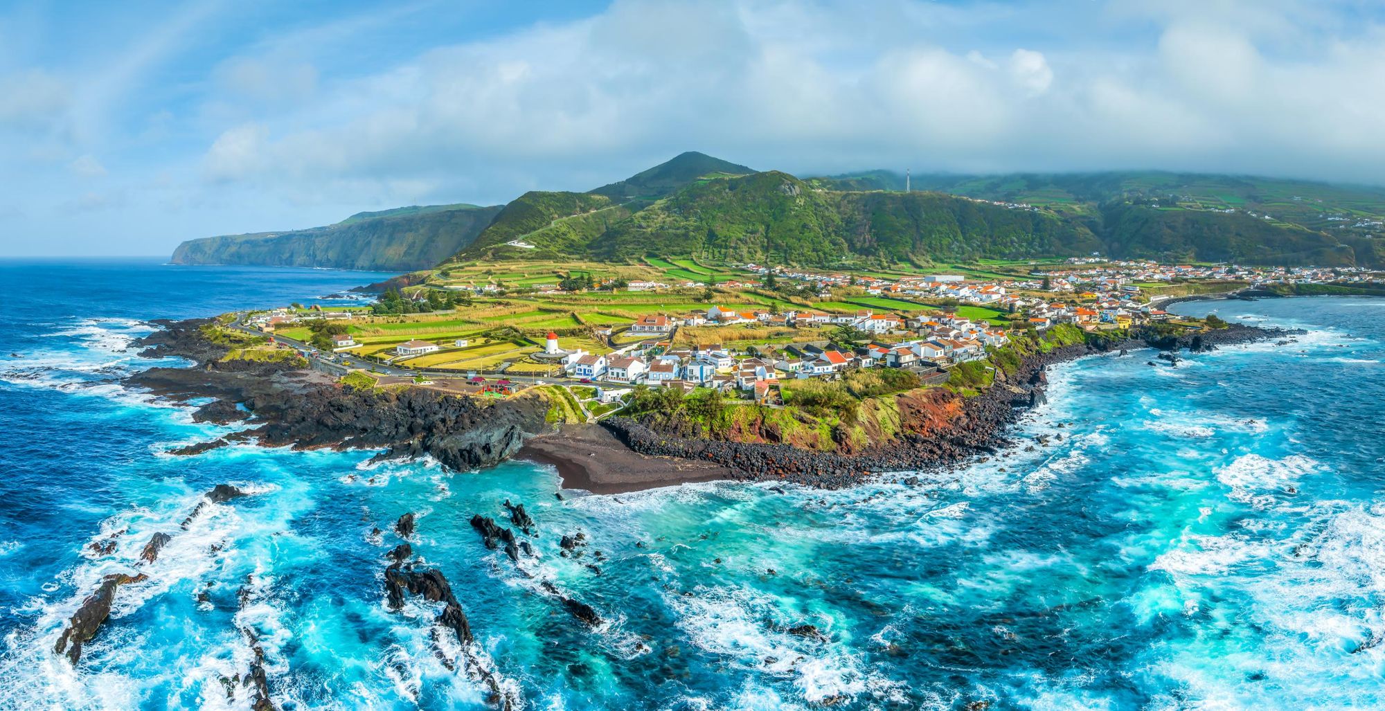
The islands here were only settled in the 15th century, and each has developed at a different pace since. They have differing geography and vegetation, differing customs, populations and harbours. In the towns, cars coast from A to B, while in the backcountry, people riding horses and pony-drawn carts are no rare sight.
The nine islands themselves are Corvo and Flores to the west; Faial, Graciosa, Pico, São Jorge and Terceira in the centre; and São Miguel and Santa Maria in the east. São Miguel is the largest and most populous island, and it's also home to the archipelago's largest city Ponta Delgada, but each of the islands has its own charm, and the range of scenery makes them perfect for hopping and hiking.
What’s more, each island has waymarked, well-developed hiking routes and fantastic online resources promoting those routes. But how to choose between them all? When selecting this list of the best hikes in the Azores, our primary aim was to capture the variation of flora that exists across the nine islands.

Here are the 10 routes which we've selected as the best hikes in the Azores:
- Pico da Vara, São Miguel
- The Caldeirão Trail, Corvo
- The Agrião Trail, São Miguel
- The Norte Pequeno Trail, Sao Jorge
- Pico Mountain, Pico
- Faial Coast-to-Coast, Faial
- The Great Route of Santa Maria, Santa Maria
- The Great Tour of Flores, Flores
- The Subida ao Cume Trail, Graciosa
- Malha Grande to Biscoitos, Terceira
Of course, this guide is designed to inspire, but not to help you navigate on the trails themselves. Make sure you get more detailed route information for any hike you do decide to take on before setting off on the route - and go prepared. Crucially, trails can open and close with the seasons, and/or for maintenance. Do double check the trail you're heading out to walk is open and safe before you go.
The Best Hikes in the Azores: Mapped
Here you can see the distribution of the 10 hikes we've selected as the best in the Azores. They are sprinkled around the different islands, with two in São Miguel.
10 of the Best Hikes in the Azores
1. Pico da Vara, São Miguel
- Start/Finish: Atalhada, São Miguel, out-and-back
- Distance: 8.7 miles (14km)
- Walking time: 3hrs
- Difficulty: Challenging
- Best for: Sensational views over all of São Miguel
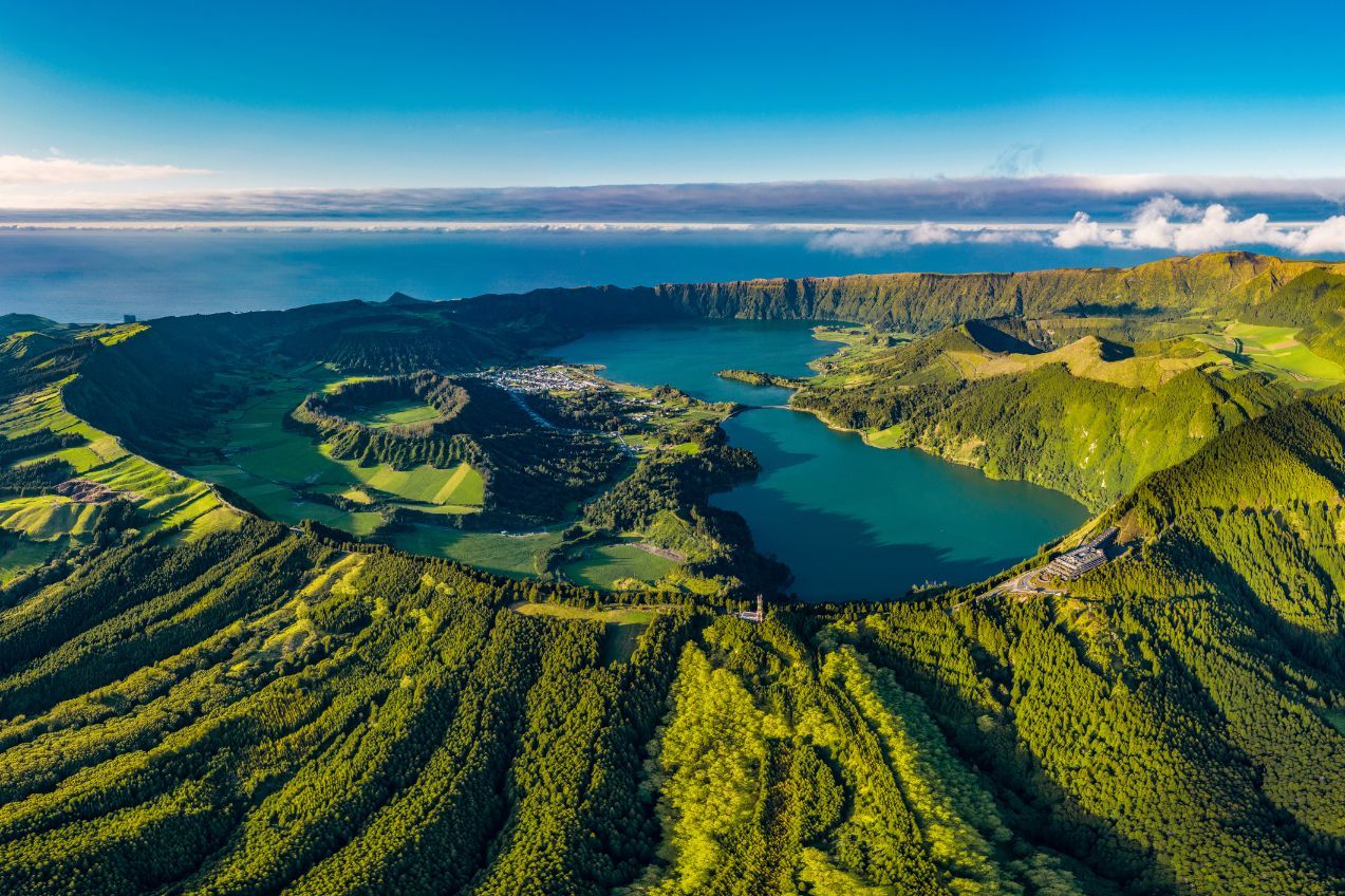
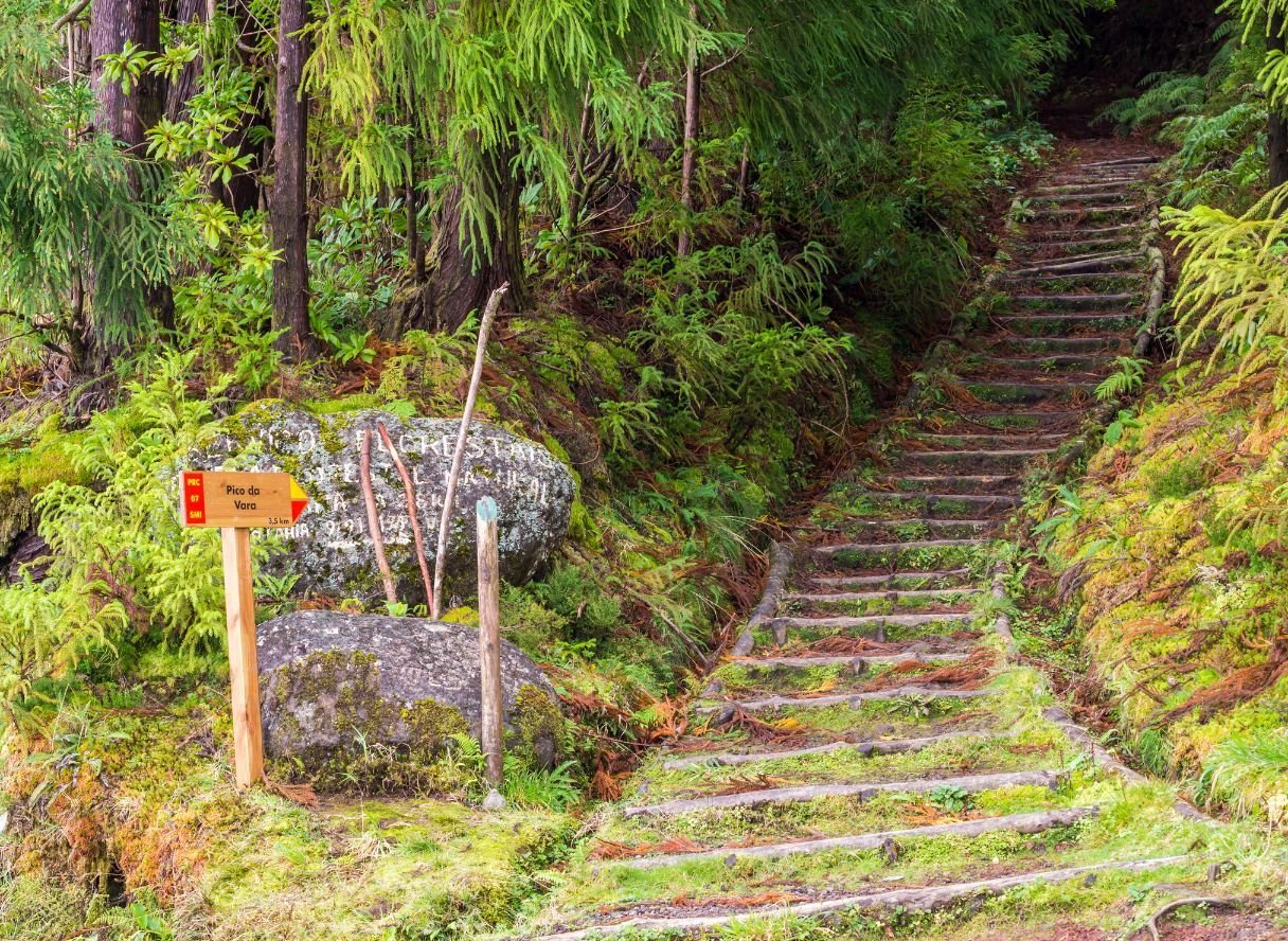
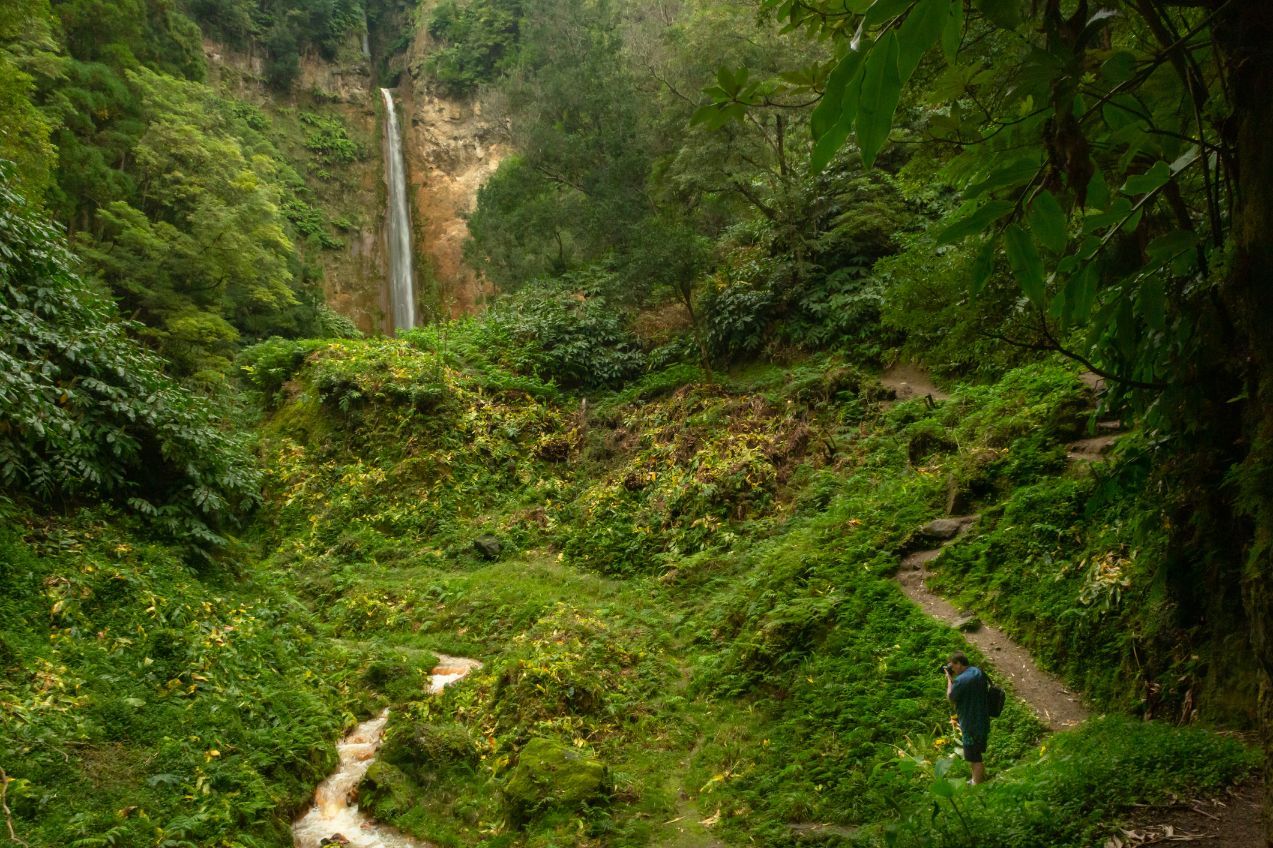
Pico da Vara is the highest point on São Miguel, standing at 1,103, (3,618ft) tall. It’s also the centrepiece of the protected Nature Reserve of Pico da Vara; an area put in place to protect the native laurisilva forest, and which is home to critically endangered animals including the endemic Azores bullfinch.
The reserve has a whole host of rich botanical landscapes, and this hike will give you beautiful views of a lot of it. The elevation is around 480m (1,574ft) in total, with the trail beginning near Algarvia, in the north east of São Miguel.
This trail is one that was historically used for coal and livestock. It will take you through cedar woodland, open grasslands, and provide fantastic coastal views.
From the top of the island you’ll be able to look back over the valley of Povoação, the majestic crater of Furnas Volcano and the volcanic massifs of Fogo and Sete Cidades. Trust us, that view is just as remarkable as it sounds.
To climb this trail, you have to first register with the Environment Services of São Miguel. This is a quick process and you should have the permission quickly.
2. Hike the Caldeirão Trail, Corvo
- Start/Finish: Caldeirão Viewpoint, Corvo, circular
- Distance: 3 miles (4.8km)
- Walking time: 2hrs 30 mins
- Difficulty: Moderate
- Best for: Feeling like you've left planet Earth
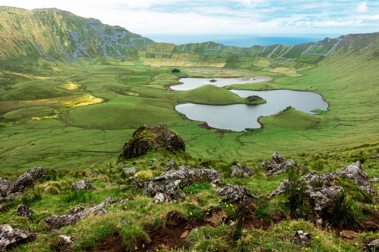
This is an otherworldly trail on Corvo - an extinct volcanic island which is the smallest of the Azores islands. The hike will bring you out to the stunning collapsed crater of Caldeirão and see you descend 150m (492ft) to the edge of the watery pools below. You complete a circular there, then climb back out.
Local legend has it that from the starting viewpoint, the crater lake is a visual representation of the nine islands of the Azores. It’s certainly something special. Descend on trails dominated by peat moss, likely meeting some cattle, horses and goats, and then walk down to hike past the wetlands and lakes.
This is an otherworldly trail on Corvo - an extinct volcanic island which is the smallest of the Azores islands.
Depending on the rain, the level of the water can shift massively, so check the levels before you hike. This is a special geosite for the Azores, and put bluntly, there are few other places in the world where you see and hike terrain like this.
Those after a serious hike can combine this circular with the 10.3km Cara do Indio, another trail which links into the crater walk, but beware, it's a big old hike. We should also note that Corvo isn’t exactly the easiest island to get to, but there are flights and boats from nearby Flores. More on Flores later.
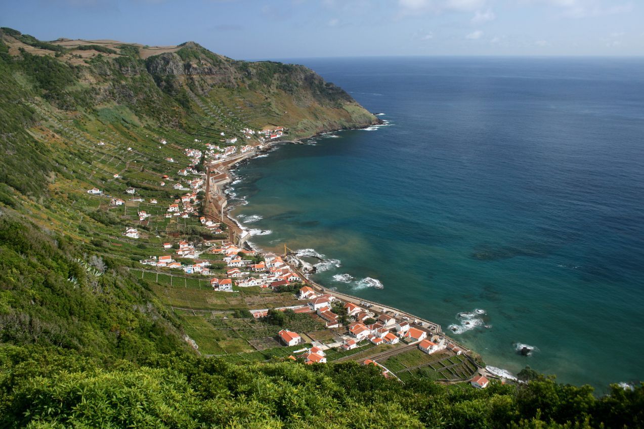
3. Hike the Agrião Trail, São Miguel
- Start/Finish: Povoação/Ribeira Quente, São Miguel, point-to-point
- Distance: 4.7 miles (7.6km)
- Walking time: 3hrs
- Difficulty: Moderate
- Best for: A family trail with a panoramic pay-off
A beauty of a through-hike with remarkable coastal views, the Trilho do Agrião, or Agrião Trail, will take you 4.7 miles (7.6km) and about three hours from Povoação to Ribeira Quente, passing by Lomba do Cavaleiro on the island of São Miguel. You'll start off on the beach of Povoaçãom heading over the centennial bridge and soon head down a dirt track to the creek of Agrião. The viewpoint at Ponta do Garajau provides fantastic views of Santa Maria and the Chapel of Santa Rita.
Grab a drink and toast your hike in quaint little village of Ribeira Quente. This is on the opposite side of the island to the Pico da Vara hike (from point one), so it’ll be all new coastlines for you even if you've been to the peak. This isn’t an enormous hike, so it’s one of the best hikes in the Azores for those looking for a family trail, but without sacrificing much in terms of views.
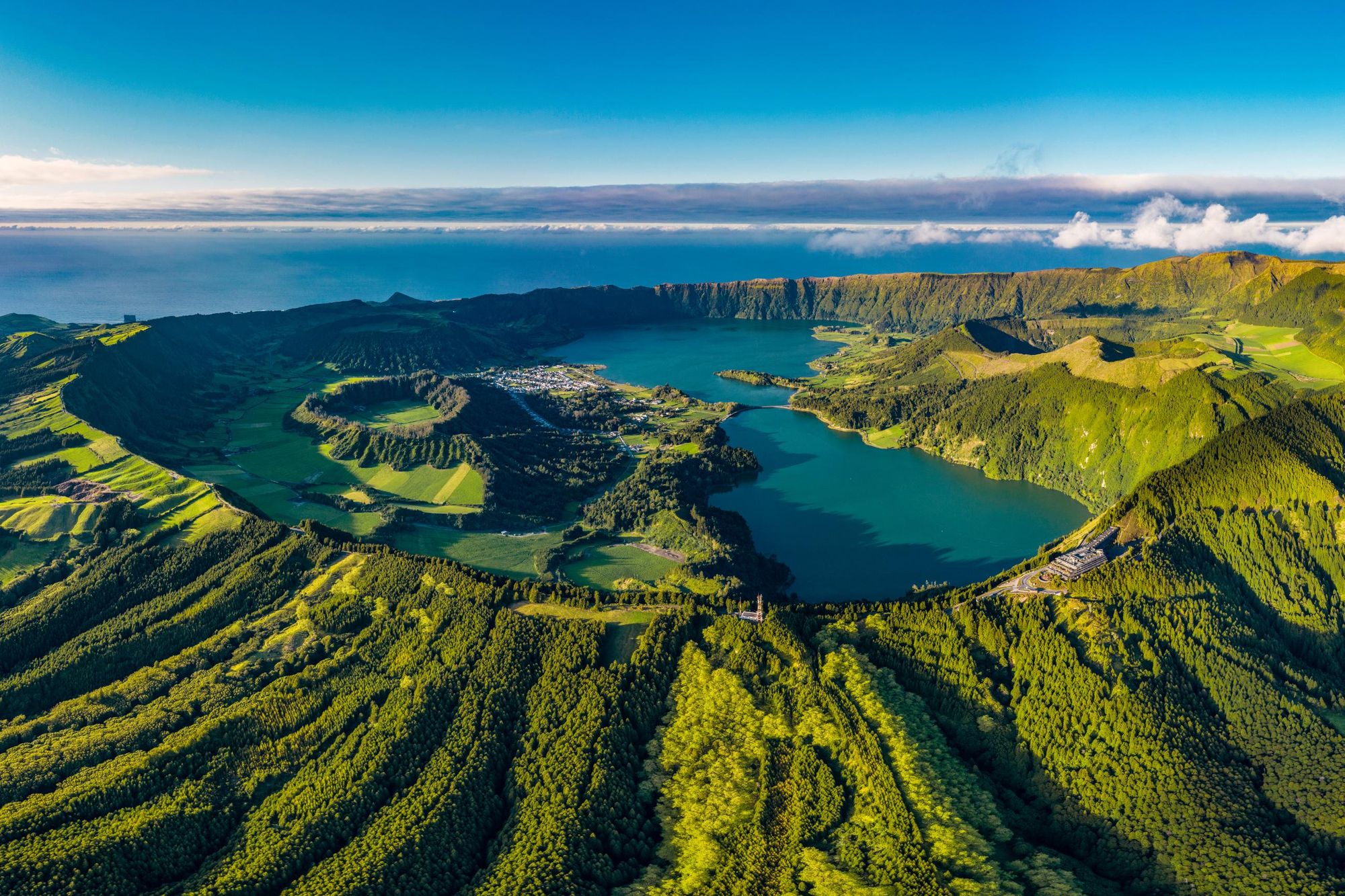
If you want to add on more miles, we’d highly recommend heading to the Ribeira Quente waterfall, or the beautiful Lagoa das Furnas, a popular crater lake just 20 minutes away. It's also a site of hot springs and geysers. The circular trail around the Lagoa das Furnas starts near Largo das Três Bicas. It's around 5.5 miles (9km), but it’s a super simple walk, and the lake and forest views really are beautiful.
4. Hike the Norte Pequeno Trail, São Jorge
- Start/Finish: Norte Pequeno, São Jorge, circular
- Distance: 6.7 miles (10.8km)
- Walking time: 3hrs
- Difficulty: Moderate
- Best for: A coastal circular
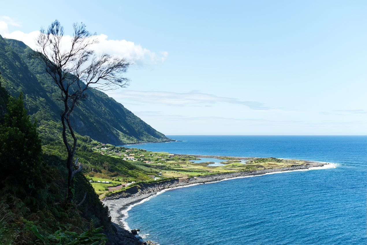
São Jorge is a narrow island with incredibly dramatic scenery, and this circular route on the north coast shows you the best of it - beaches, coastlines, and mountain views.
Starting on the outskirts of the Parish Council of Norte Pequeno, you’ll head into the village and then onto the sea. The route mixes wide open, gravel, gradual paths and narrower, steeper dirt paths, where you’re in amongst the lush vegetation.
You’ll pass the Chapel of Santa Filomena and get postcard-perfect coastal views out to both Fajã das Pontas and Fajã do Mero, both on the very edge of the Atlantic. There's a lot of dip in this trail, starting high, falling all the way down to near sea level (a descent of around 450m/1,476ft) and then climbing back up to altitude. That means the terrain and the views both keep changing.
Update: This trail is currently temporarily closed and unavailable to hikers. See the Visit Azores alert page for the latest information on trail status.
5. The Pico Mountain Trail, Pico
- Start/Finish: Casa da Montanha, Pico, out-and-back
- Distance: 4.7 miles (7.6km)
- Walking time: 7-9 hours
- Difficulty: Challenging
- Best for: The ultimate Azores summit
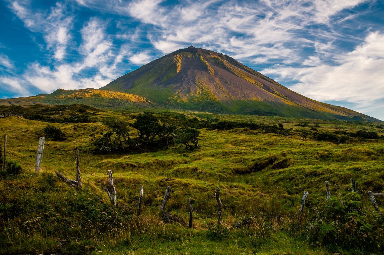
Pico is one of the Central Group islands of the Azores which is dominated by, and shares a name with, its central peak - Mount Pico. It's 2,351m (7,713ft) high, making it the highest peak in all Portuguese territory. Hiking in the Azores doesn’t get much more hardcore than this - but the effort is worth it to reach the roof of Portugal.
It's 2,351m high, making it the highest peak in all Portuguese territory.
Before beginning your hike, all climbers will check-in with Casa da Montanha, at 1,200m (3,937ft), where you will be given a GPS tracker to hold on to. This is great as it means you’re tracked and kept safe, but it’s certainly not a bad idea to also get a local guide to ensure you don't get lost in the first place. The trail is marked. There are 47 numbered poles - but trail markings won't help you find shelter (the weather can turn quickly) and they won't provide you with on-trail tales either.
You'll trek over volcanic rocks and bright moss, and climb steeply uphill to the crater of Pico. To summit, you need to hike up the even steeper Piquinho, but from there, you can look out to Faial and São Jorge and beyond. This is an all-day effort, particularly if you get the bad luck of the rain and clouds coming in. While it may not often be technical, it’s certainly a long old slog.
6. Hike Faial from Coast to Coast, Faial
- Start/Finish: Ribeirinha/Vulcão dos Capelinhos, Faial
- Distance: 22.8 miles (36.8km)
- Walking time: 2 days (or one long day!)
- Difficulty: Challenging
- Best for: A huge day out on a jaw-dropping island
Some of the best hikes in the Azores are pretty darn difficult. This fits that bill.
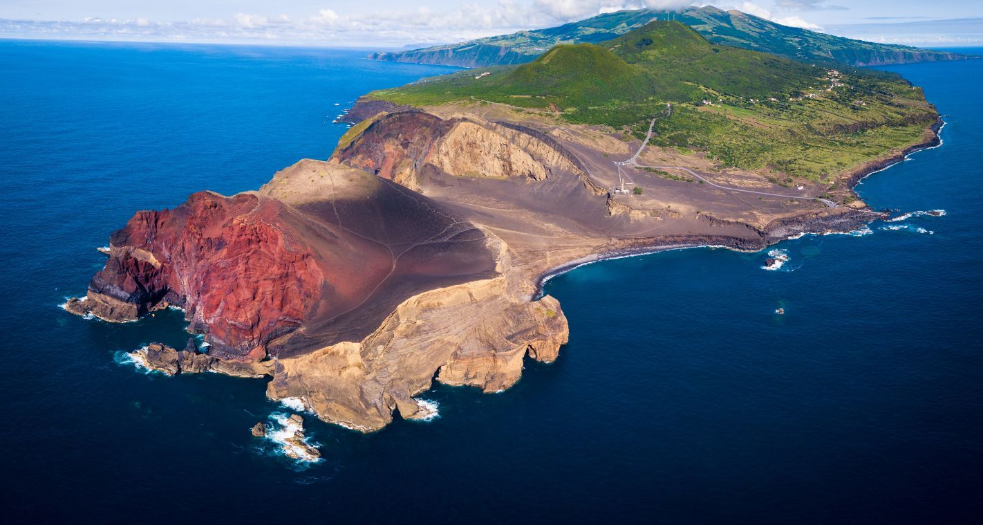
The 22.8 miles (36.8km) coast to coast hike across Faial is nothing short of remarkable. There's a reason the locals say that the trail takes you back to the very formation of the island. Beginning on the eastern point, you’ll follow one of the transversal fault lines of the Mid-Atlantic Ridge. One of the scars of the Atlantic itself, this fault line dates back to the last great continental separation; a defining moment not just for Faial or the Azores, but for our world as we know it today.
You’ll peak around 900m (2,952ft), at the breathtaking Caldeirão of Faial; the crater of a dormant volcano which stretches 2,000m (6,561ft) in diameter and down 400m (1,312ft) in depth.
The locals say that the trail takes you back to the very formation of the island...
Once the descent begins, you can expect to pass bushy green, vibrant vegetation until, well... that greenery stops. It happens bluntly and the contrast in landscape is stark. All the greenery around you will disappear altogether as you enter the moon desert of Capelinhos Volcano on the western side of the island. This gives the hike a fell of moving between worlds. This is a truly special hike.
7. The Great Route of Santa Maria, Santa Maria
- Start/Finish: Fortress of São Brás/Vila do Porto, Santa Maria
- Distance: 48.5 miles (78km)
- Walking time: 4 days
- Difficulty: Challenging
- Best for: Covering an entire island on one trail
If the 36km of the Faial coast to coast hike seemed a bit much, then… sorry, best skip over this one too. We simply had to include this island-spanning beauty on our list of the best hikes in the Azores. This time, we’re back in the Eastern Group, but not in São Miguel. Rather, we’re 55 miles south east, on the island of Santa Maria - and this hike takes us round the entire island
Naturally, at 78km, this is a multi-day hike. It’s usually broken down into four stages, each of which are around the 20km mark, with accommodation options dotted around the island (and wild camping unfortunately forbidden).
Section one runs from the Fortress of São Brás and Vila do Porto to the rural area of Cardal. Highlights include an ancient ascent passage connecting the Chapel of Nossa Senhora dos Remédios to the village of Santo Espírito.
Stage two is from Cardal to Norte on the east coast of the island, following the old regional road towards Ponta do Castelo and the viewpoint of Tia Raulinha. You'll see the waterfall of Aveiro, natural pools of Maia and enjoy beautiful views over the Bay of São Lourenço.
On day three, travelling from Norte to Bananeiras, you'll move inland and pass the Cai’Água waterfall. You'll later reach Pico Alto - a spot with an abundance of endemic flora, and the high point of the island at 587m.
The final stages close the loop and bring you back to Vila do Porto via 23.5km on the west coast through Raposa Bay, vineyards and sites of volcanic interest. You'll get amazing views of Ponta do Pinheiro and Cré bay, find a statue of Cristóvão Colombo in the village of Ponta dos Frades and eventually follow a dirt road back to your starting point, finishing a truly amazing adventure.
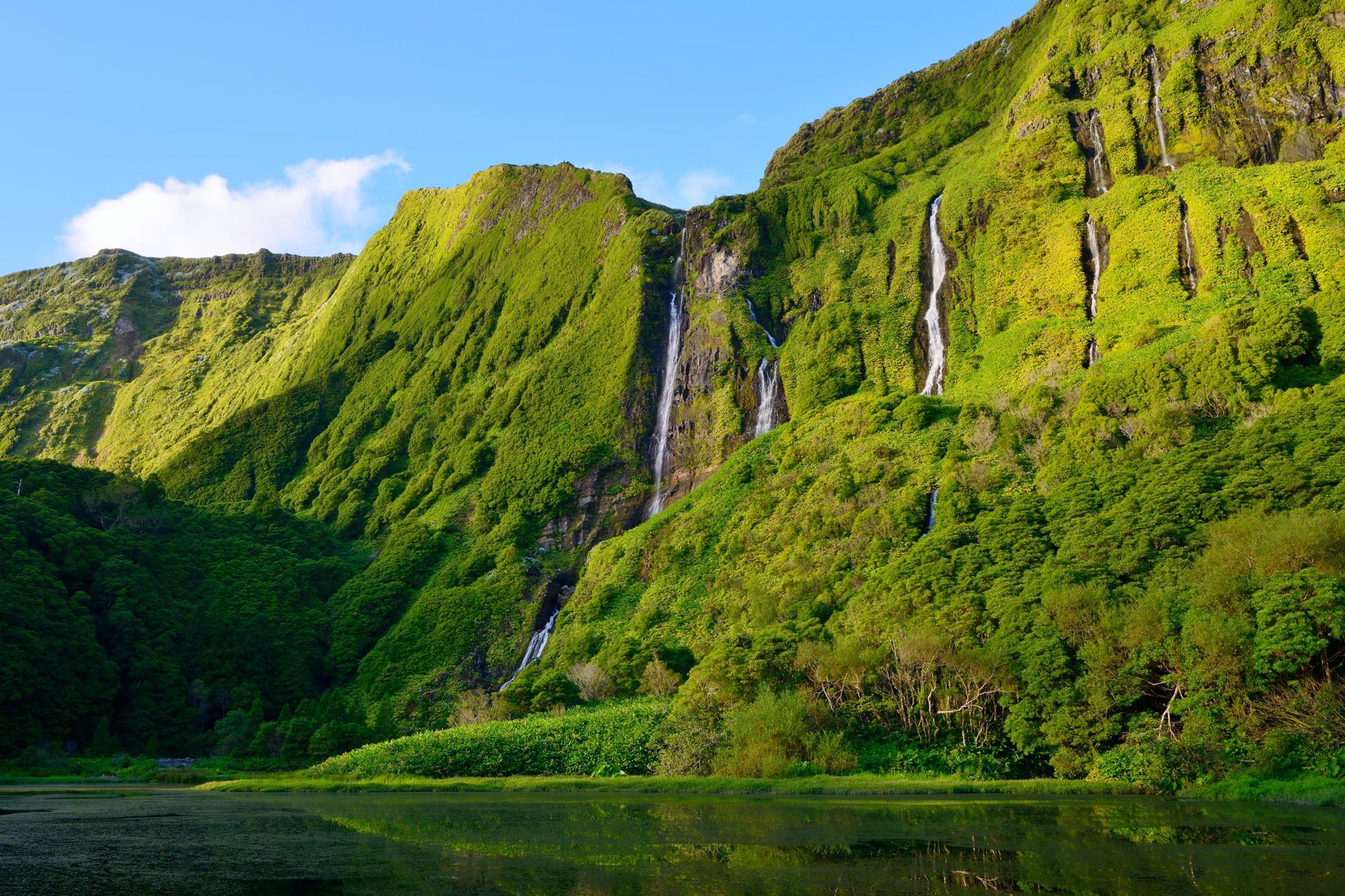
8. The Great Tour of Flores, Flores
- Start/Finish: Santa Cruz das Flores/Lajedo
- Distance: 29.2 miles (47km)
- Walking time: 2 days
- Difficulty: Moderate to Challenging
- Best for: A multi-day coastal immersion
This long-distance route on Flores, known locally as the GR1, is split into two days and will take you anti-clockwise around roughly two-thirds of the island of Flores - sticking near to the coast for most of the journey.
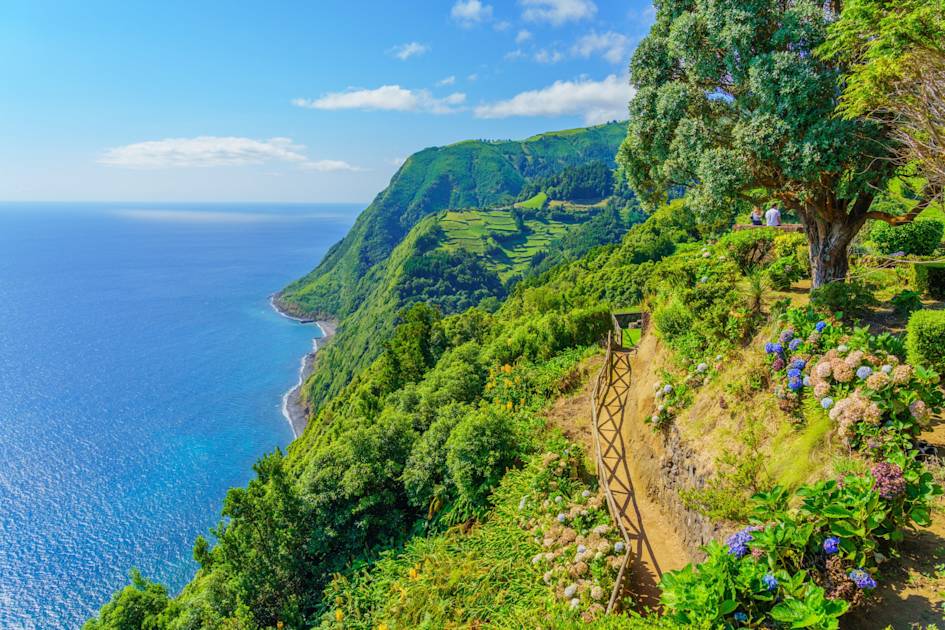
Day one takes you from Santa Cruz to Ponta Delgada over the course of eight hours, and around 13 miles (21km). The day will take you through long, deep valleys, past flowing streams and then moving along the northeast coast. This is a rugged area, with cliffs aplenty, nesting seabirds and a lot of coves and islets.
Poço da Alagoinha is particularly notable - a fall which plummets down a crack in an otherwise perfectly green cliff face...
The day ends at Ponta Delgada, a rural civil parish with accomodation and campsites, and the second day then runs 16.2 miles (26km), taking you to Lajedo, passing near Fajã Grande, a small township separated from the centre of the island by a 300m fossil cliff. Huge waterfalls run down the slopes here. Poço da Alagoinha is particularly notable - a fall which plummets down a crack in an otherwise perfectly green cliff face, and fills up an idyllic lagoon at the bottom.
The finish point at Lajedo, in the southwest of Flores, was one of the first settlements on the island - camouflaged amongst the rocky outcrops of the terrain and protected from North Atlantic pirates by ridgelines.
9. The Subida ao Cume Trail, Graciosa
- Start/Finish: Luz, circular
- Distance: 6 miles (9.7km)
- Walking time: 3hrs 30 mins
- Difficulty: Challenging
- Best for: A summit day hike, with geological prowess
Graciosa is the second smallest island of the Azores, but though it's small, it is also mighty. Here, you'll also find those characteristics which characterise so much of these islands - volcanic landscapes, beautiful greenery and sublime coastal views. The Subdia ao Cume (PRC05 GRA) trail is one of the tougher day hikes on the island, taking you on a circular from the civil parish of Luz to the summit of Pico Timão (405m/1,328ft), which is the highest point on Graciosa Island.
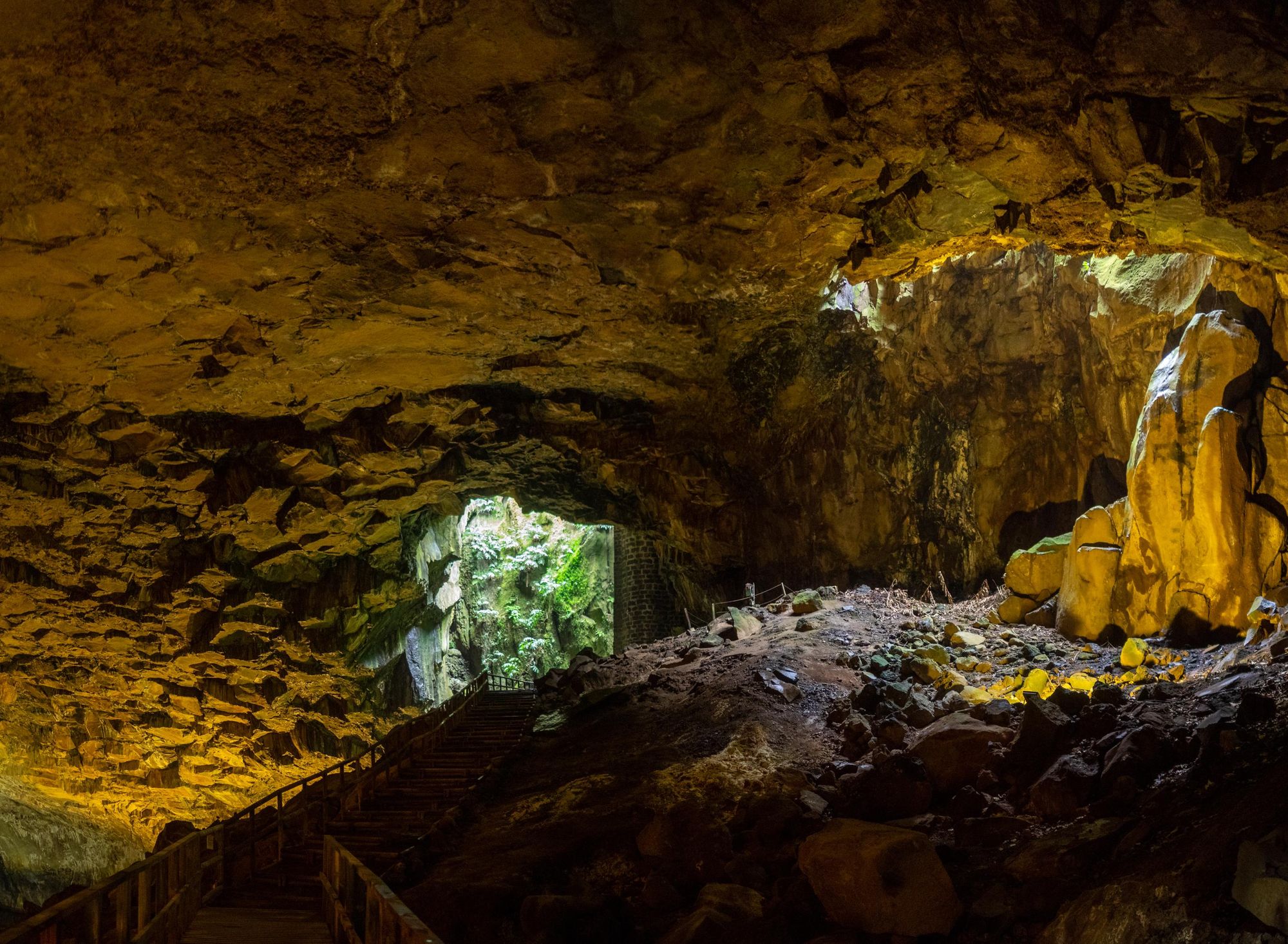
Leaving the Nossa Senhora da Luz church, the route largely takes place in the Caldeira da Graciosa forests. You'll climb up to the ridge of the Caldeira, which is a depression of volcanic origin on top of the smallest stratovolcano in the Azores.
The trail then surrounds this ridge, taking in the highest point on the island and looking into the caldera. There's a Visitor Centre down there too, as a rather famous cave, Furna do Enxofre, is situated beneath. This is a lava case, the main feature of which is a perfect, dome-shaped roof.
The route continues on a different path, not doubling back but taking in a lot of the same cedar forests, as well as green heather, laurel and candleberry myrtle.
10. Malha Grande to Biscoitos, Terceira
- Start/Finish: Malha Grande/Biscoitos, point-to-point
- Distance: 8.8 miles (14.2km)
- Walking time: 3hr 30 mins
- Difficulty: Moderate
- Best for: Combining a forest hike and a coastal swim
This is a lovely day out, taking you from the interior of Terceira right to the coast.
You'll start on a dirt track in Malha Grande and walk through an area rife with endemic vegetation (white flowers, lush green trees). You'll pass farming roads and come to the Rocha do Chambre viewpoint, where you can see teh caldera of the Pico Alto volcano, and you'll reach the trail high point of 704m.
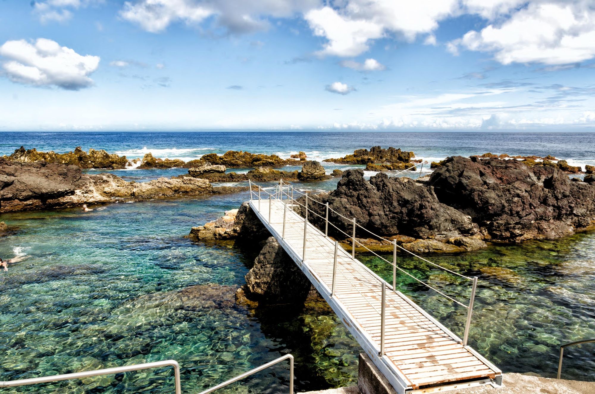
The descent will take you towards the Vale do Azinhal (a valley) and then through a lava tube called Gruta dos Balcões, the result of the last terrestrial erupton on the island, which was in 1761. You'll walk through forest paths and rocky outcrops sculpted by lava and then woodland, roads and orchards will take you down to the bay of Baía das Pombas. The route ends nearby, at Biscoitos, where you'll find some beautiful natural pools, popular with visitors. The pools were formed by ancient volcanic eruptions, with solidified lava which has then been eroded by the sea. They were adapted to turn them into swimming pools back in 1969.
When is the Best Time to Hike in the Azores?
The summer months in the Azores run from April to early October. This is the ideal time to go for whale watching, for sailing and indeed, provides very good conditions for hiking. The inter-island ferry service should also be running at its fullest during this period, and the temperatures are lovely - around 14°C to 25°C.
The hedgerows will be out in June and July, and the native species of the Azores also thrive in this time period (as well as in the wider May-September months). You are unlikely to escape the rain altogether when you're hiking in the Azores, but in summer, you'll be warmer if it does comes.
July and August are high, peak season, so things are a bit busier at this time of year. On that note, we should highlight that the Azores is really a year-round hiking destination. Even in winter, things don't get too chilly (12°C-18°C) and in March and April, when spring is bringing the flora back out and the wildlife is emerging, it can be a wonderful time to visit. Likewise, Autumn runs from October almost into December here, and there are still warm days to be found.
What Animals Live in the Azores?
The Azores sit in the middle of the Atlantic Ocean and so it will be no surprise that most of the interest wildlife is either aerial or marine.
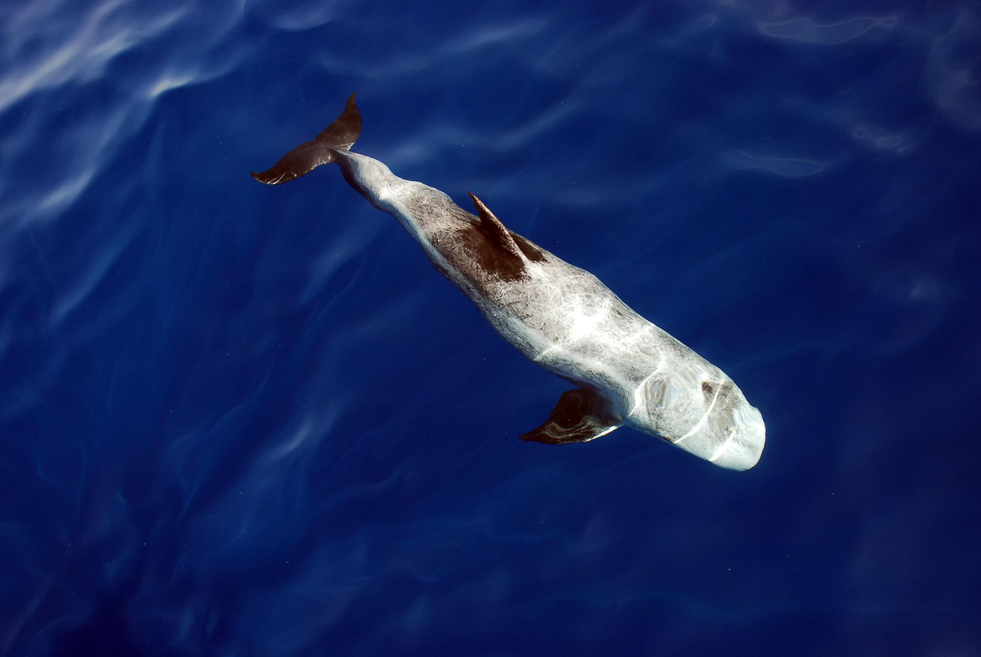
In terms of mammals, there are dolphins of all sorts - bottlenose, common, Risso's, spotted and striped. There are an abundance of whales, from sperm whales to pilot whales, Cuvier's beaked whales and false killer whales. Loggerhead turtles, hammerhead sharks and flying fish all swim through these waters - as are white marlin, sailfish, spearfish, swordfish and huge tuna.
In terms of bird life, the Azores bullfinch, found in the east of São Miguel, is endemic, and there are petrels, gulls, shearwaters, goldcrests and so much more.
Where to Stay in the Azores?
As you can imagine, across the nine islands of the Azores, you have an extensive range of incredibly varied accomodation. This ranges from lavish resorts and boutique hotels to simpler family-run businesses and a range of rural options.
You get agro-turismo here, meaning private houses which are part of a farm, which can be rented out. Other styles of rural accomodation include Turismo de Habitação; usually a large manor house or similar, with some sort of architectural or artistic interest, representing a specific time period. And Turismo Rural, which siply means accomodation in the typical regional style of architecture.
There are also scenic campsites, of course. You can also wild camp responsibly.
What to Eat in the Azores?
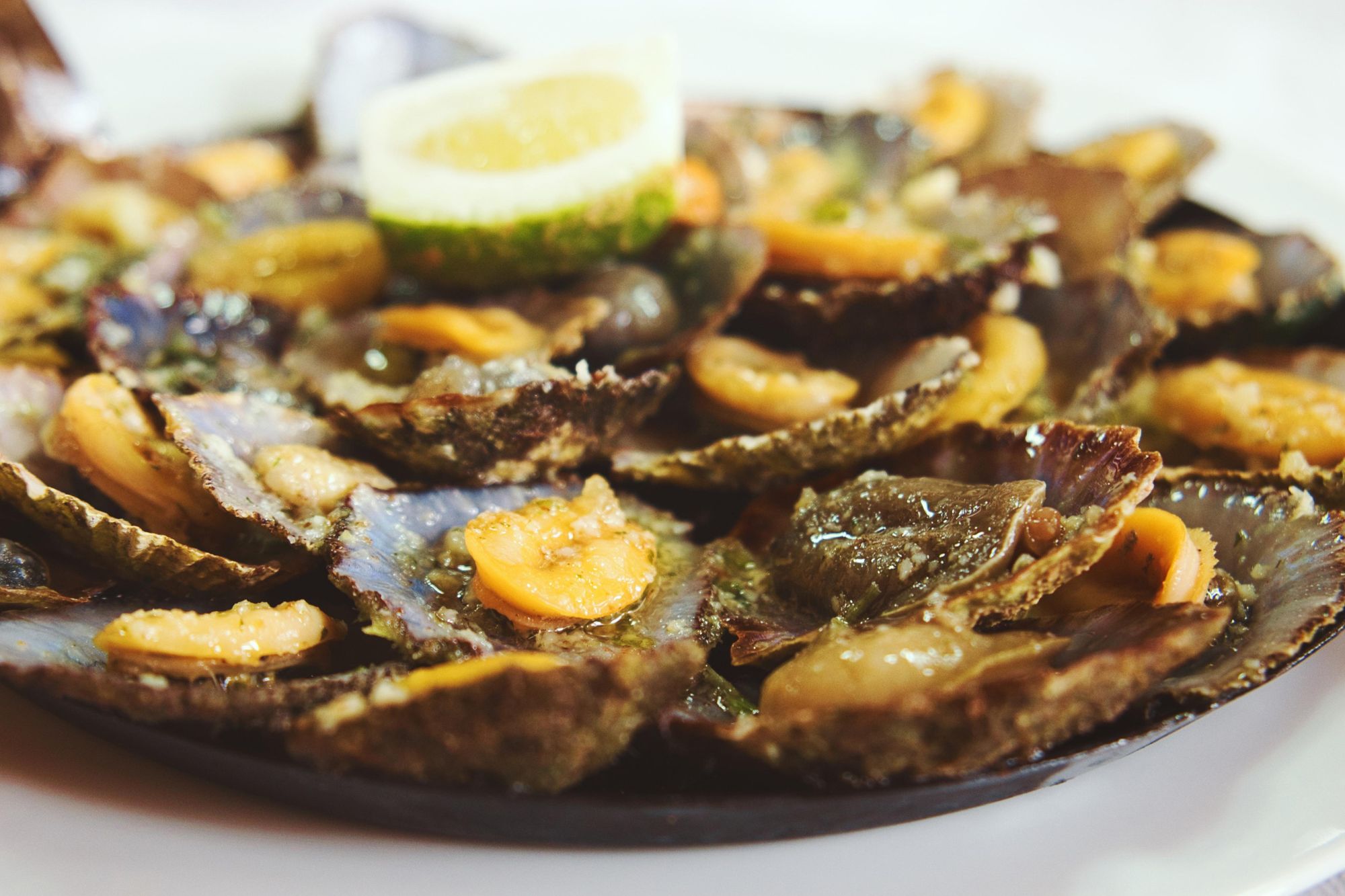
The Azores is all about sea food. Lapas dos Açores (limpets) are the most popular form of shellfish served. They're similar to clams or mussels but are a little chewier. They're best when eaten as soon as possible after harvesting. Fried chicharros (Atlantic hose mackerel) are often served tapas-style. You'll also see a lot of different variations of seafood stew as you move around the islands.
Elsewhere, Bolos Lêvedos is a type of bread which is best dipped in garlic butter. The best ones are baked in a Furnas - a volcanic spring town on São Miguel.
Eat the cheese from São Jorge island when you get a chance. It's a little squishy and is usually matured for a good while, then served as an appetiser.
How to Get to (and Around) the Azores?
By plane: Most visitors heading to the Azores fly into Ponta Delgada on São Miguel or Lajes on Terceira. Sata Azores Airlines is the main airline of the Azores and runs internal flights between the islands. See their flight map of the Azores.
By boat: The ferry service is more affordable than flying, but takes a lot longer and is limited. The benefits are that you're in a very nice part of the world - so you can look out for sea birds, whales and more as you travel. Popular ferries include the short, 35-minute journey between Pico and Faial and the four-hour journey between São Miguel and Santa Maria. See Atlanticoline for more.
By bus: Buses serve the islands of the major towns in larger islands, but these buses are neither frequent nor reliable. Car rental is advised.
Inspired? Check out our range of adventure holidays in Portugal, and other hiking and trekking adventures in good places with good people.