


The Kumano Kodo is an 190-mile (370km) network of pilgrimage trails, consisting of five interconnected routes which run through the Kumano region of Japan, on the mountainous Kii Peninsula, south of Osaka.
The name translates literally to English as the ‘old roads to Kumano’ and the trails have been in use for over 1000 years. They are the only pilgrimage routes in the world with a UNESCO World Heritage designation, other than the famous Camino de Santiago, which runs from from Porto in Portugal to Santiago de Compostela in Spain. The Kumano Kodo trails connect the three grand shrines of Kumano - which are Kumano Hongu Taisha, Kumano Hayatama Taisha and Kumano Nachi Taisha, and are collectively known as the Kumano Sanzan.
“Imagine a journey in a remote, ancient and spiritual region of Japan. Hiking through an endless sea of mountains; tree-covered, with hidden valleys, waterfalls and traditional rural villages,” Kat Davies writes in the Cicerone guide Japan’s Kumano Kodo Pilgrimage.
“After a day of invigorating walking, you’ve soaked in the steaming-hot onsen, dressed in a yukata and enjoyed a delicious meal of the freshest local produce in the company of strangers soon to be friends, before falling into a deep sleep on your futon.”
Accommodation on the Kumano Kodo is in traditional inns and tea houses, many of which are located in onsens (the villages that grow up around natural hot springs). Public transport is excellent, making it easy to get to trailheads or travel to different stages on the trail. Because of this, hiking the Kumano Kodo is very much a 'pick your own adventure'. You could link together three separate trails and hike the route over several weeks, or if time is limited you could choose a stage from your favourite trail and hike it over a day.
Do you want to follow in the footsteps of ancient pilgrims? In this guide, we’ll be delving into the history of this fascinating route, as well as giving you an insight into what a present-day walker can expect, with a focus on the popular Nakahechi trail.
“A Procession of Ants”: The History of Kumano Kodo
The Kumano Kodo trails have been walked for thousands of years by pilgrims visiting the Kumano shrines. The first visitors to the region would have been practitioners of Shintoism, Japan's indigenous religion (which predates Buddhism). In Shintoism, followers worship Kami - gods or spirits numbering into the millions, which are believed to inhabit many natural places, from waterfalls to rivers, mountains to animals and trees.
The Kumano region was considered particularly sacred, inhabited by many gods. The Kumano Hongu Taisha shrine is devoted to Izanagi-Okami, one of the earliest Japanese goddesses, who is said to have created Japan. When Buddhism entered Japan in the sixth century, it integrated with Shintoism to form a syncretic religion (Shinbutsu-shugo), in which the Kumano shrines were important sites, enshrining Shinto gods and Buddhist deities.
Imagine a journey in a remote, ancient and spiritual region of Japan. Hiking through an endless sea of mountains
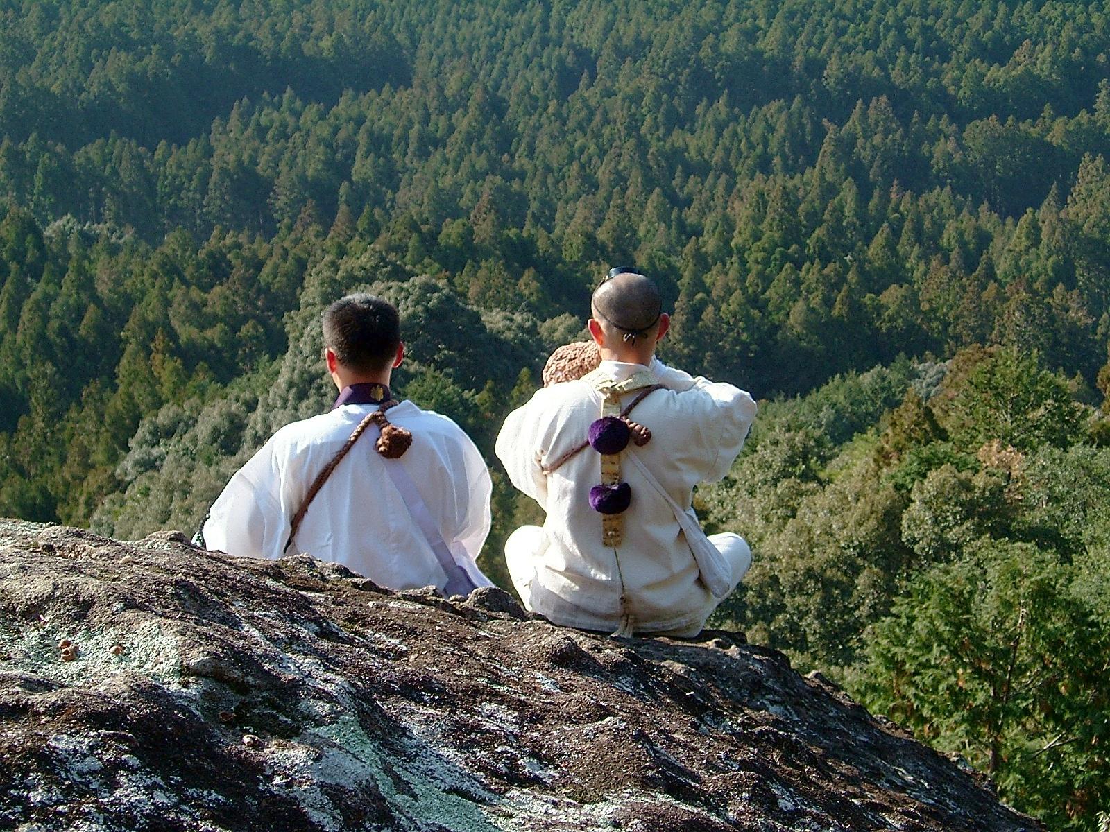
The next pilgrims to visit the region were Shugendo ascetics - a syncretic religious group which developed in the seventh century - known as yamabushi (which translates to ‘one who bows down in the mountains’). They believed they could attain spiritual and supernatural power through making their way through mountain ranges while conducting religious rites. The more difficult the journey, the greater the spiritual reward. It was En no Gyōja, the founder of Shugendo, who developed what is known today as the Omine Okugakemichi Route, the most challenging of the Kumano Kodo.
But it was pilgrims from Imperial and noble families who really popularised the Kumano Kodo, beginning with the emperor Uda in 907. Between then and 1281 there were more than 100 imperial pilgrimages, many of which took what is now known as the Nakahechi route through the mountains. They travelled in large processions, attended by yamabushi who helped them perform purification rituals on strenuous, weeks-long pilgrimages through the mountains. The goal was to be spiritually reborn in the “Pure Land” of Kumano.
The Kumano Kodo was conceived as a test of mind, body and spirit. The difficulty, the isolation and the hardship were important parts of the pilgrimage.
In 1192, imperial rule was replaced with seven centuries of military rule; noble pilgrims were replaced by Samurai warriors. By the mid 14th century, however, the Kumano Kodo had become popular with all sections of society. The number of pilgrims was often compared to a ‘procession of ants’ by those witnessing it.
However, by the Meiji period (1868-1912), pilgrimages declined due to religious instability in the country. Shintoism and Buddhism were formally separated, while Shugendo was banned. During the Shrine Consolidation Policy of 1906, thousands of temples were destroyed and forests cut down, while complexes containing both Shinto and Buddhist elements were separated - all Buddhist statues and icons were forcibly removed from Kumano Hongo Taisha, for example.
During a period of recovery after World War Two, forests were replanted with cedar and cypress (due to a demand for timber). Interest in the Kumano shrines began to revive, but improvements in infrastructure meant many people visited them via road or railway. The ancient trails became overgrown from disuse.
It wasn’t until the 1990s that people became interested in walking the Kumano Kodo through the mountains again. The trails were cleared and began to be trodden by contemporary pilgrims and hikers. In 2004, when the Kumano Kodo gained its UNESCO designation, the number of hikers along them increased dramatically. You’ll now find all sorts of people on the trail, from foreign tourists to modern-day yamabushi, clad in white robes.
The Routes of the Kumano Kodo
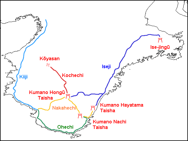
The Kumano Kodo today consists of five different, interconnected trails, as the basic map of the Kumano Kodo above shows. They are the Nakahechi, Kohechi, Iseji, Ohechi and Omine Okugakemichi trails. Below you’ll find short descriptions of the latter four, but first, here's a more detailed itinerary breakdown of the Nakahechi trail, which is the most popular of the pilgrimage routes to follow.
The Nakahechi Route
Distance: 41 miles/66.5km
Best for: seeing all three of the Kumano Sanzan
This was the route used by old imperial pilgrims, and is therefore also known as the ‘Imperial Route’. It links the three Kumano Sanzan, and is therefore the most popular route, well waymarked and with excellent infrastructure and facilities, including transport to and from the trail.
The trail consists of four stages, but a rest day in Hongu is recommended after stage two. Many pilgrims take a boat tour along the Kumano-gawa River to visit Kumano Hayatama Taisha on this day. The stages are:
Stage 1: Takijiri-oji to Tsugizakura-oji (11 miles/18km)
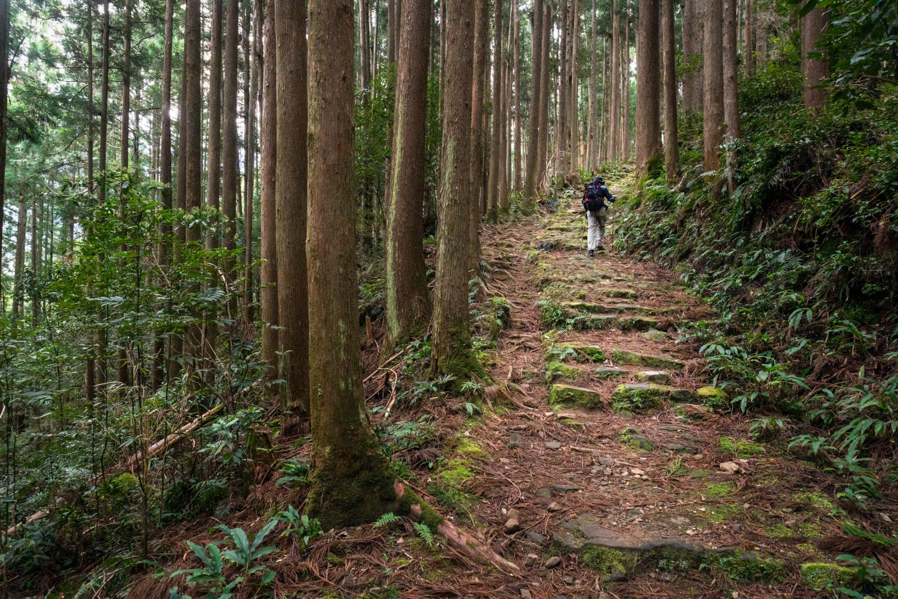
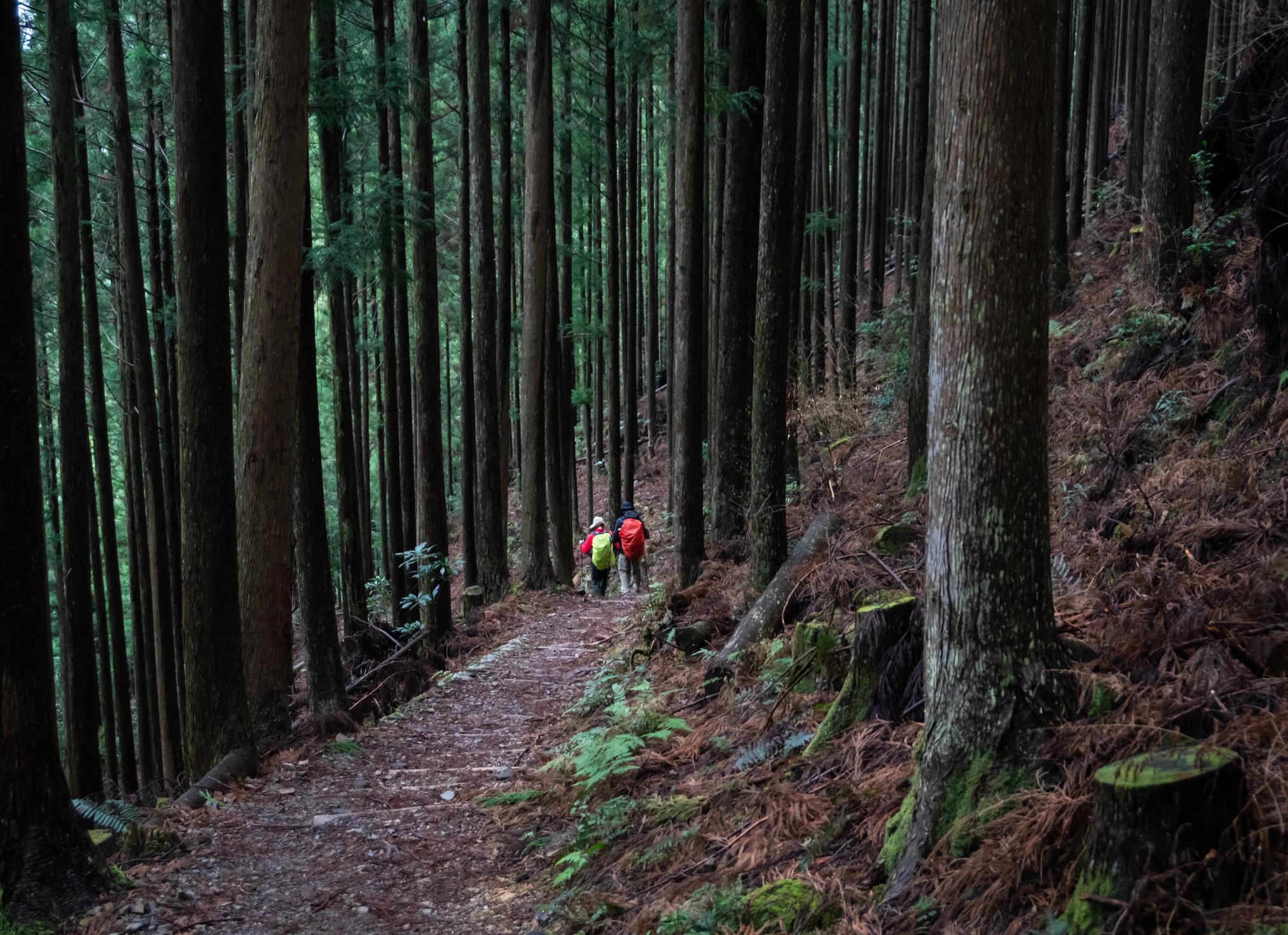
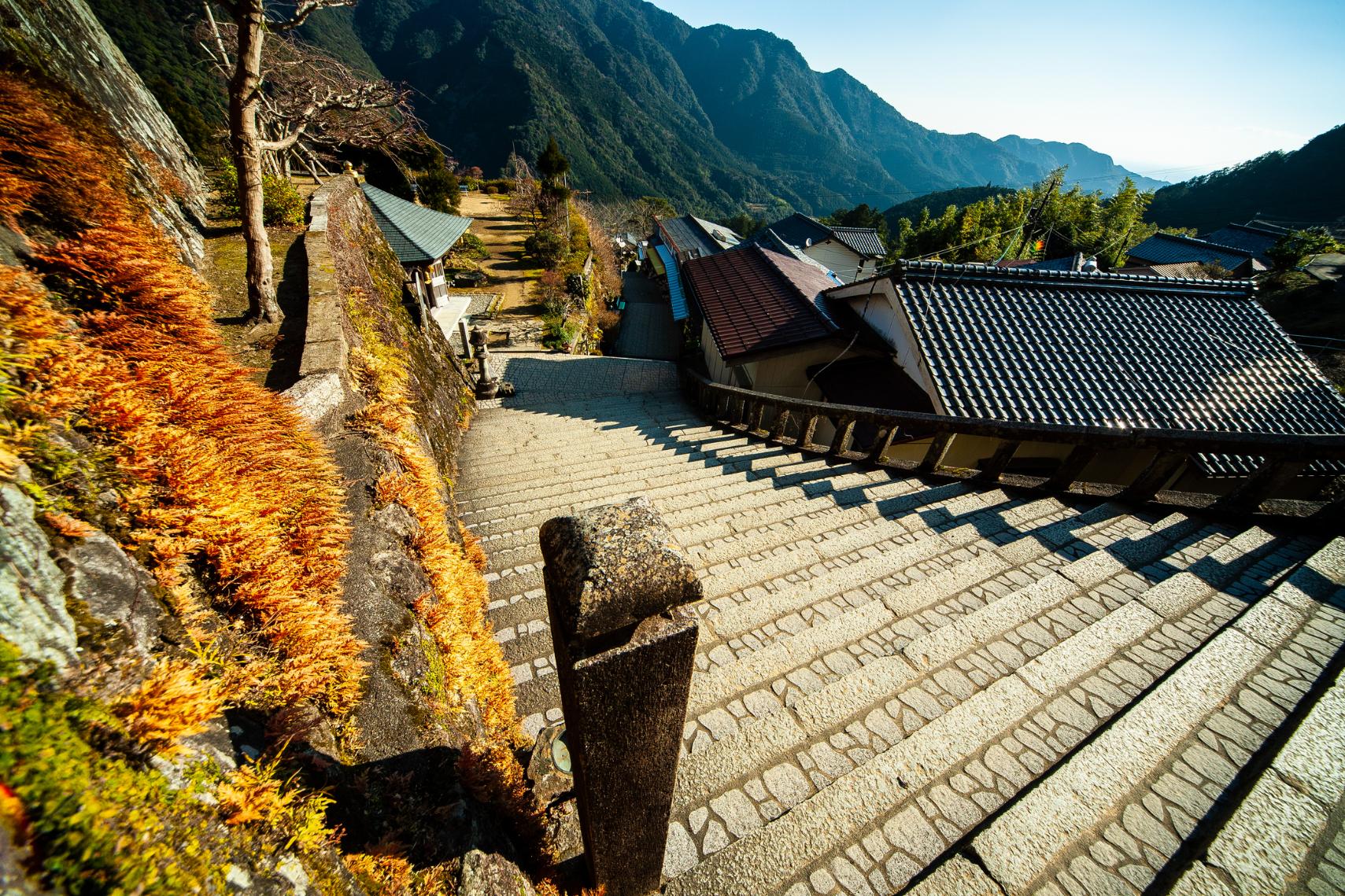
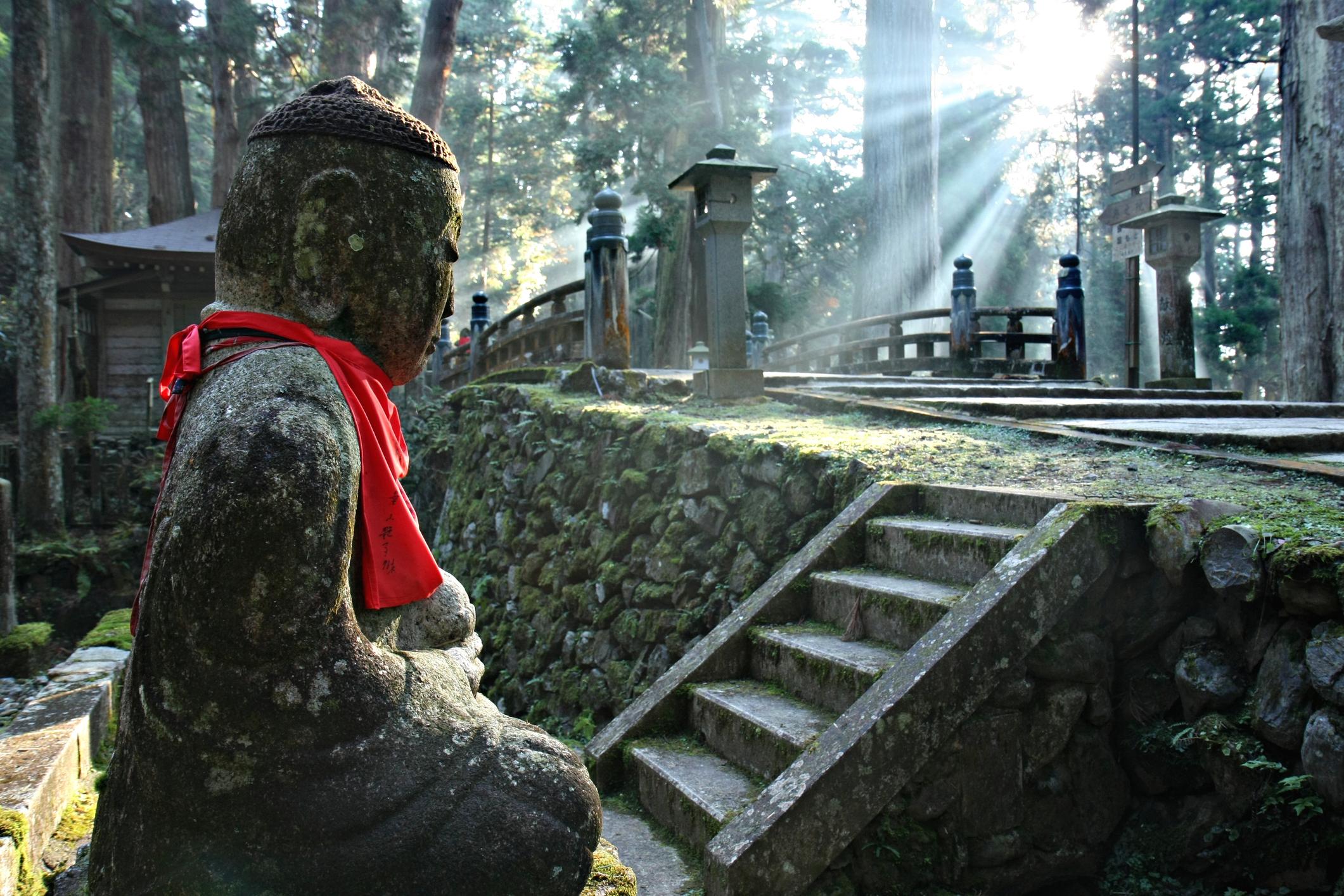
The trek begins at the Takijiri-oji shrine beside the Tonda River and follows a mountain trail up through the forest. At Takahara village, you’ll have a view of the surrounding mountain ranges. You’ll continue on to the town of Chikatsuyu, before descending to the Tsugizakura-Oji Shrine, which is at the top of three flights of stairs flanked with huge trees.
Stage 2: Tsugizakura-oji to Kumano Hongu Taisha (13 miles/21km)
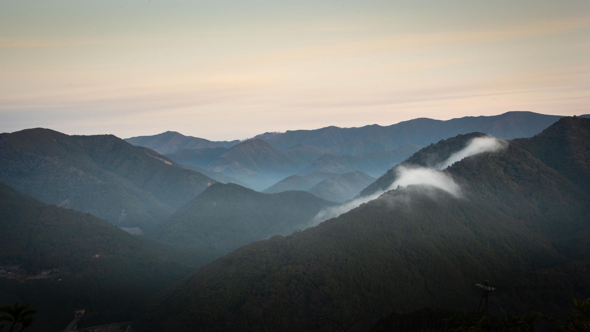
At Tsugizakura-oji the trail follows the old highway to Kobiro-toge pass. From here, the trail ascends and descends repeatedly, as you pass through the forest-carpeted mountains. Eventually you’ll reach Hosshinmon-oji, a subsidiary shrine known as an oji, known as the “gate of awakening of the aspiration to enlightenment”.
From here, the trail winds through Hosshinmon Village to Mizunomi-oji, where it enters the forest. You’ll walk through it to Fushiogami settlement, which has tea plantations, terraced fields and mountain views. This is where pilgrims would pray after catching their first glimpse of the grand shrine in the valley below. From here, you’ll descend through the forest to reach Kumano Hongu Taisha, where the day’s hike ends.
Stage 3: Hongu Area to Koguchi (8 miles/13km)
Hike upwards through cedar and cypress forest to the Sakura-toge Pass. From here you’ll climb Hyakken-gura Peak, where you’ll be greeted with panoramic views of the surrounding mountains. From this high point you’ll descend into the adjacent valley, and stop for the day in the small mountain village of Koguchi.
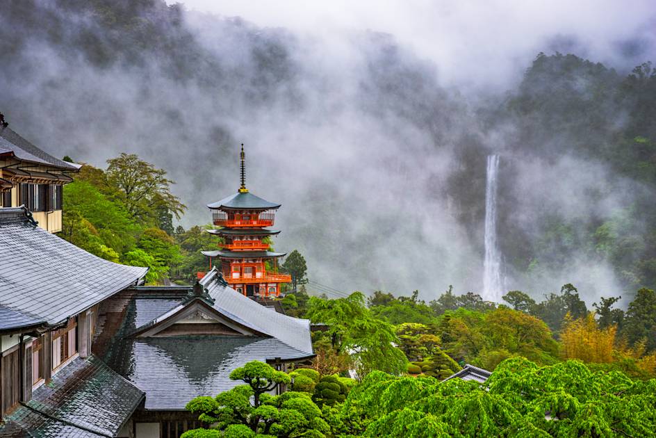
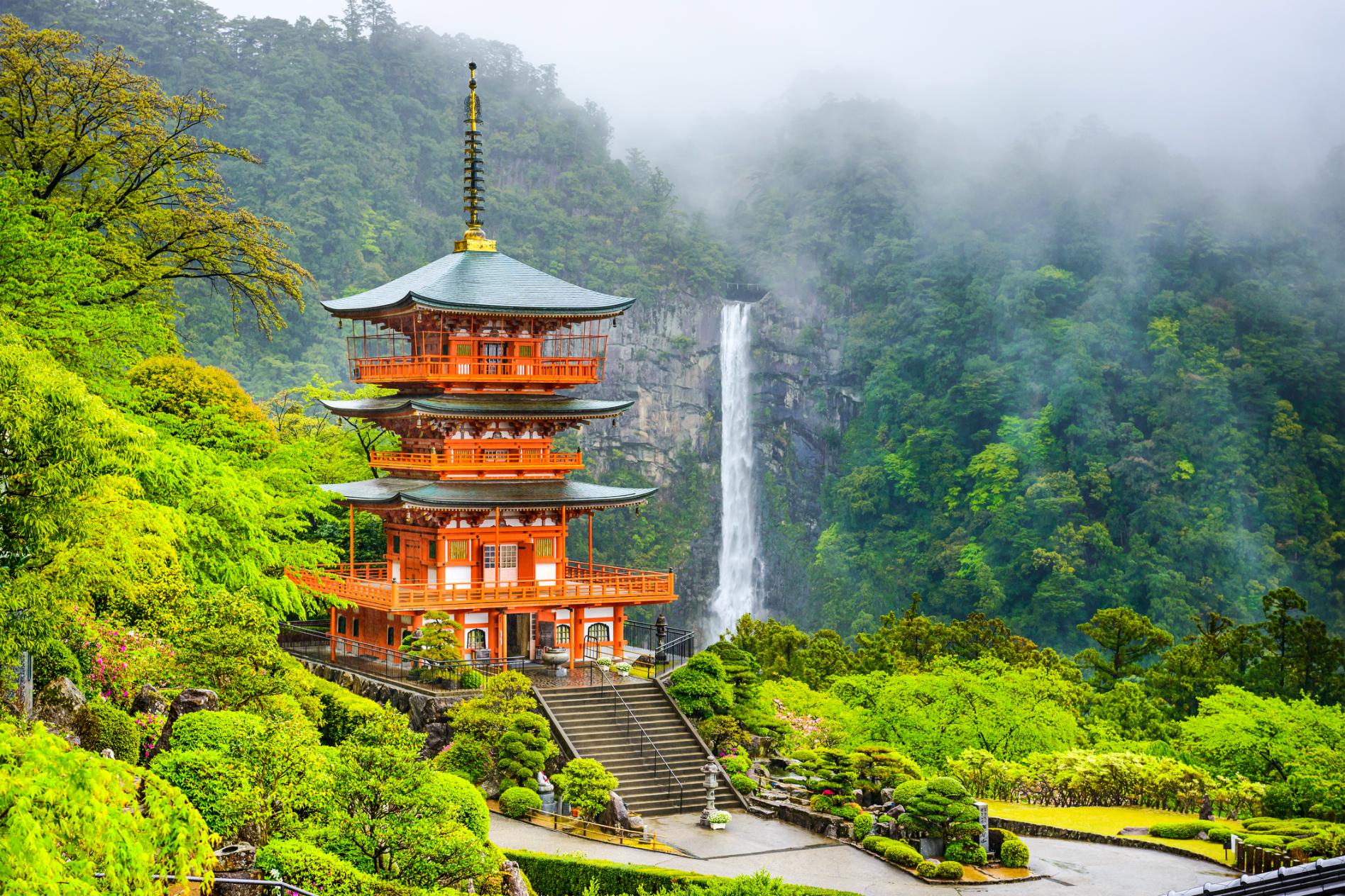
Stage 4: Koguchi to Kumano Nachi Taisha (9 miles/14.5km)
A challenging day, beginning with around two hours of ascent up uneven paths bisected with tree roots and lots of stone steps. However, you’ll be hiking through scenic forest, which clears when you reach the top of Funami-toge Pass. From here you’ll be able to see the remains of Funami-jaya teahouse, views of the Pacific Ocean and the fishing village of Katsuura below.
Continue downhill until you reach the Nachisan Sanctuary, where you’ll reach the Kumano Nachi Taisha and Nachi Falls, Japan’s largest waterfall with a drop of 133 metres. This is where your hike ends.
The Kohechi Route
Distance: 39 miles/63km
Best for: isolated mountain hiking
This route was created in the 14th century as a transportation and pilgrimage route - it’s the shortest way connecting Koyasan (a sacred mountain) and Kumano Hongu Taisha. It’s a challenging, remote route up steep mountain passes, with four over 1000 metres high. The path is often closed from around December to March due to snowfall.
Due to the remote nature of the trail, you’ll find fewer facilities. However, it has been divided into four stages which each end in a small village where you’ll find accommodation. The first stage finishes at Totsukawa Onsen, where there are some relaxing hot springs. Finishing at Hongu, hikers can always continue their journey along the Nakahechi or Iseji route.
The Iseji Route
Distance: 105.6 miles/170km
Best for: those with the time to take the scenic route
The Iseji route traces the east coast of the Kii Penisula, connecting the Shinto shrine of Ise-jingu (dedicated to the sun goddess Amaterasu) with the Kumano Sanzan. The length of the trail - which takes from seven to 10 days to hike - means it isn’t as popular as the Nakahechi Route. But if you have the time, we’d highly recommend it, as the changing landscapes and quiet trail conditions make for a brilliant long distance hike.
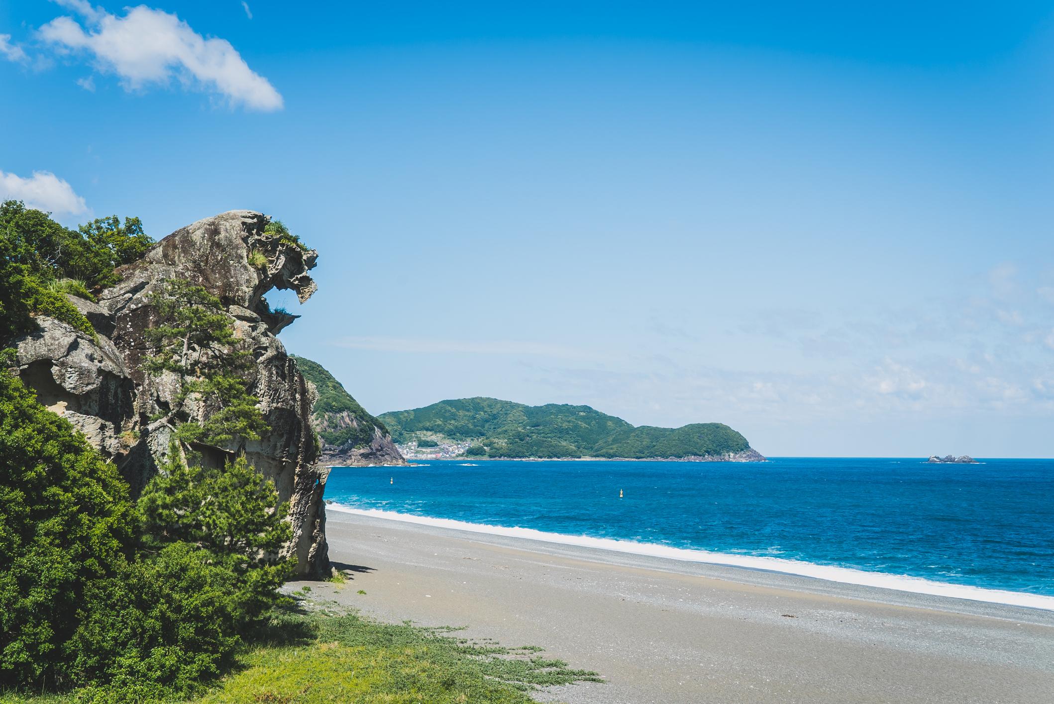
The northern section of the route leads you through the Miya-gawa river plain, past small villages and sections of forest. You’ll head over a small mountain pass (Meki-toge) before following the Miya-gawa River upstream through a river valley, where you’ll also find tea plantations and rice paddies. The central section is more mountainous, with a series of major mountain passes descending to unspoilt coastal villages. The coastline consists of dramatic rocky inlets with scenic beaches and small offshore islands.
As you draw close to Kumano City, the southern section splits into two trails. The main coastal route, Hamakaido, leads you down a long gravel beach to Kumano Hayatama Taisha; and the inland route, Hongudo, leads you inland through the mountains to Kumano Hongu Taisha via the steep terraced rice paddies of Maruyama Senmaida.
The Ohechi Route
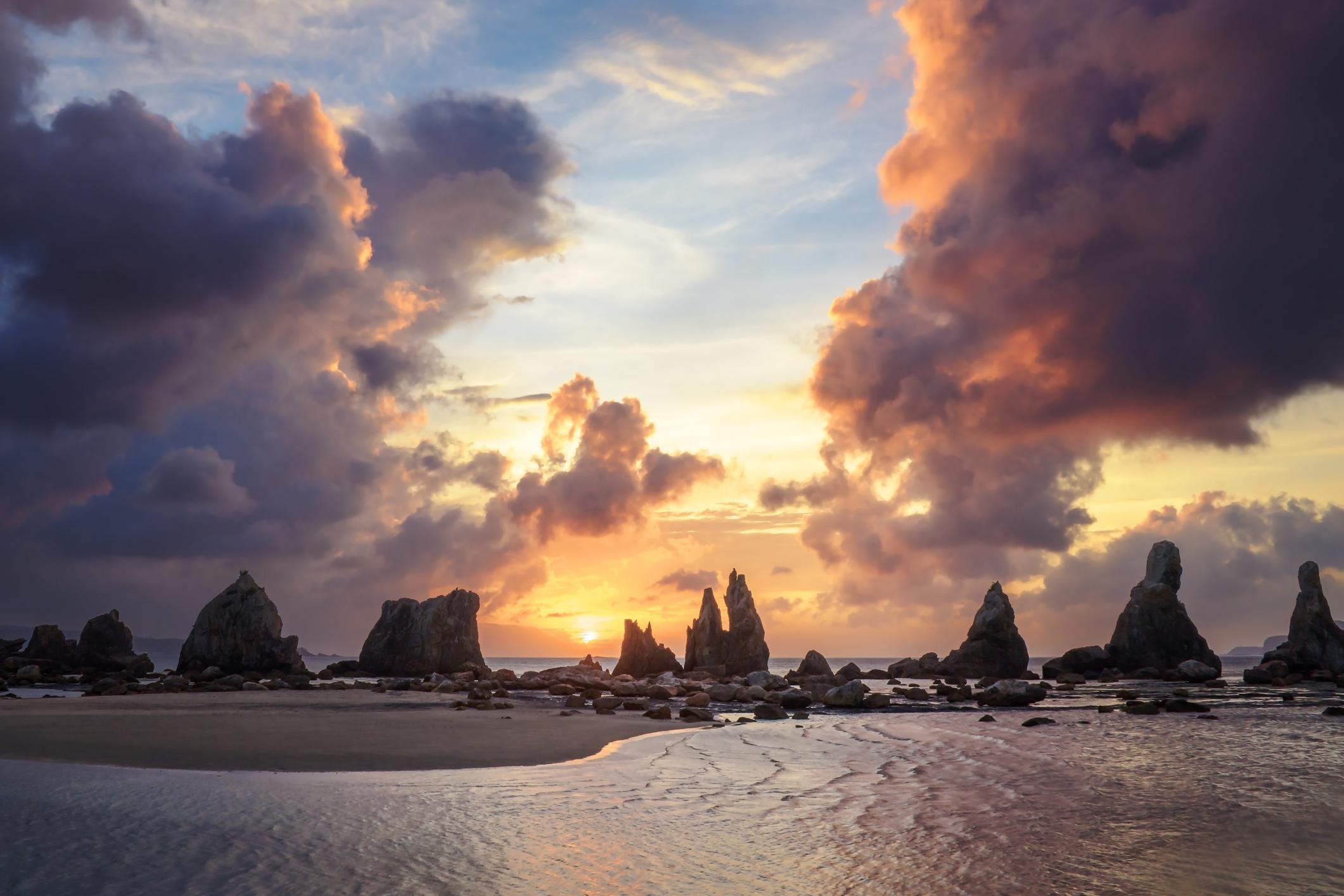
Distance: 57 miles/92km
Best for: Spectacular sea views
The Ohechi Route runs along the southwest coast of the Kii Peninsula, beginning in the seaside Tanabe and ending at Mirozu Station, just shy of Kumano Nachi Taisha. It was developed in the 15th century and became particularly popular with writers and artists, who drew inspiration from the sea views. It can be walked over three to four days.
At the start of Ohechi, you’ll walk along paved roads and past rice paddies. These soon give way to forests with panoramic views, and you’ll end up walking along the shoreline. On the way you’ll climb three mountain passes, and you’ll also find small shrines dedicated to sacred areas of the landscape.
The Omine Okugakemichi Route
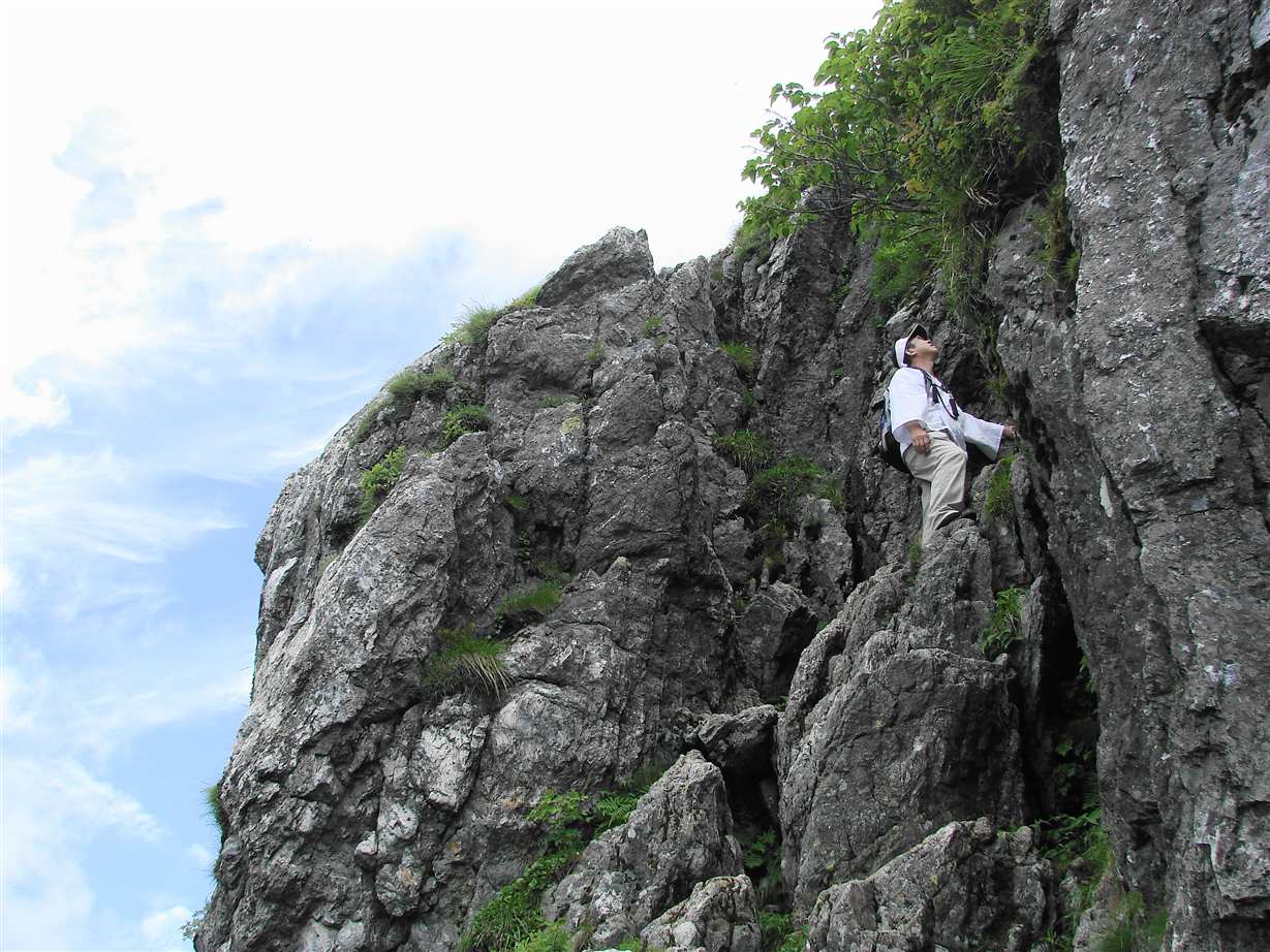
Distance: 60 miles/95km
Best for: those wanting the toughest Kumano Kodo experience
The Omine Okugakemichi leads from Yoshino directly south through the mountains to the Kumano Sanzan, and was the route used by the Yamabushi on their spiritual pilgrimages.
The route travels along a mountainous ridgeline, undulating between 1,000 to 2,000 metres. In places, you’ll find ropes and chains to help with difficult stretches - this is not one for the faint of heart. The route passes across Mount Omine (1,719), a sacred site for men only - women must circumnavigate it.
Which Kumano Kodo Route Should I Walk?
Which pilgrim trail to take depends largely on your fitness level, the amount of time you have to spare and your interest level. We’d recommend first timers to the Kumano Kodo - with a good level of fitness - take the Nakahechi route. Not only will you enjoy spectacular mountain and forest scenery, you’ll also get the opportunity to visit the three Kumano Sanzan, the Shinto shrines that the trails have been developed to connect.
Inspired? Walk the Nakahechi Trail with us on our Ultimate Adventure Through Japan.