


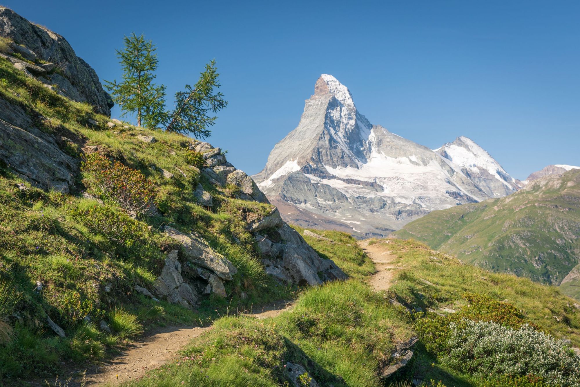
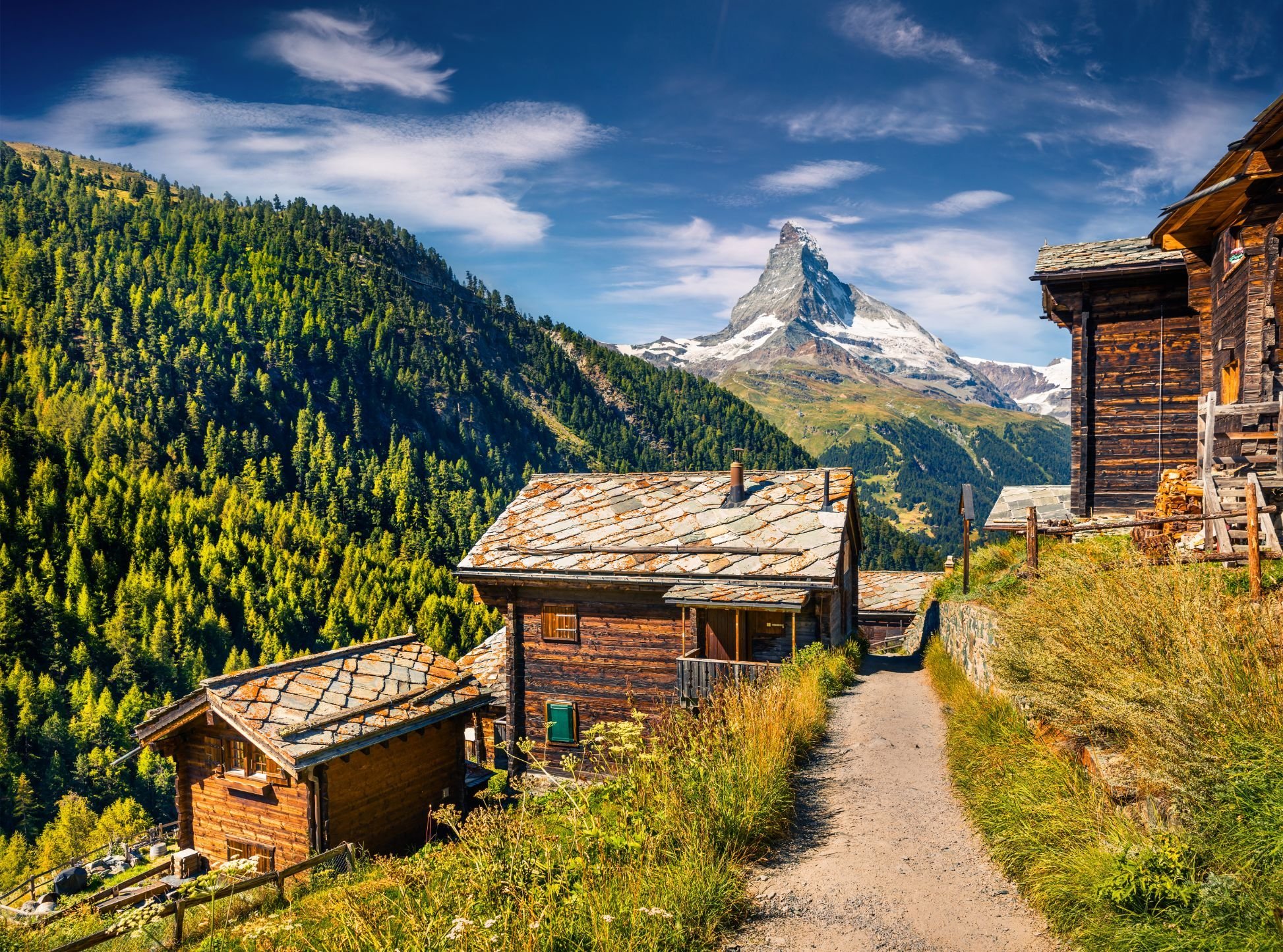
There are few mountain spines or summits quite so recognisable as the mighty Matterhorn, which sits 4,478m high, on the border of Italy and Switzerland. The mountain, known as Cervino on the Italian side of the border, curves upwards from the surrounding peaks; the razor-sharp ridgeline leading up to the crooked peak, which looks almost like it's been bent in the wind.
The Matterhorn was first climbed by Edward Whymper on 14 July 1865, but for many, more appealing than scaling the mountain itself is taking the famous 93-mile (150km) route around it. Known as the Tour of the Matterhorn, or The Matterhorn Circuit, the route is one of the world's great long-distance hikes.
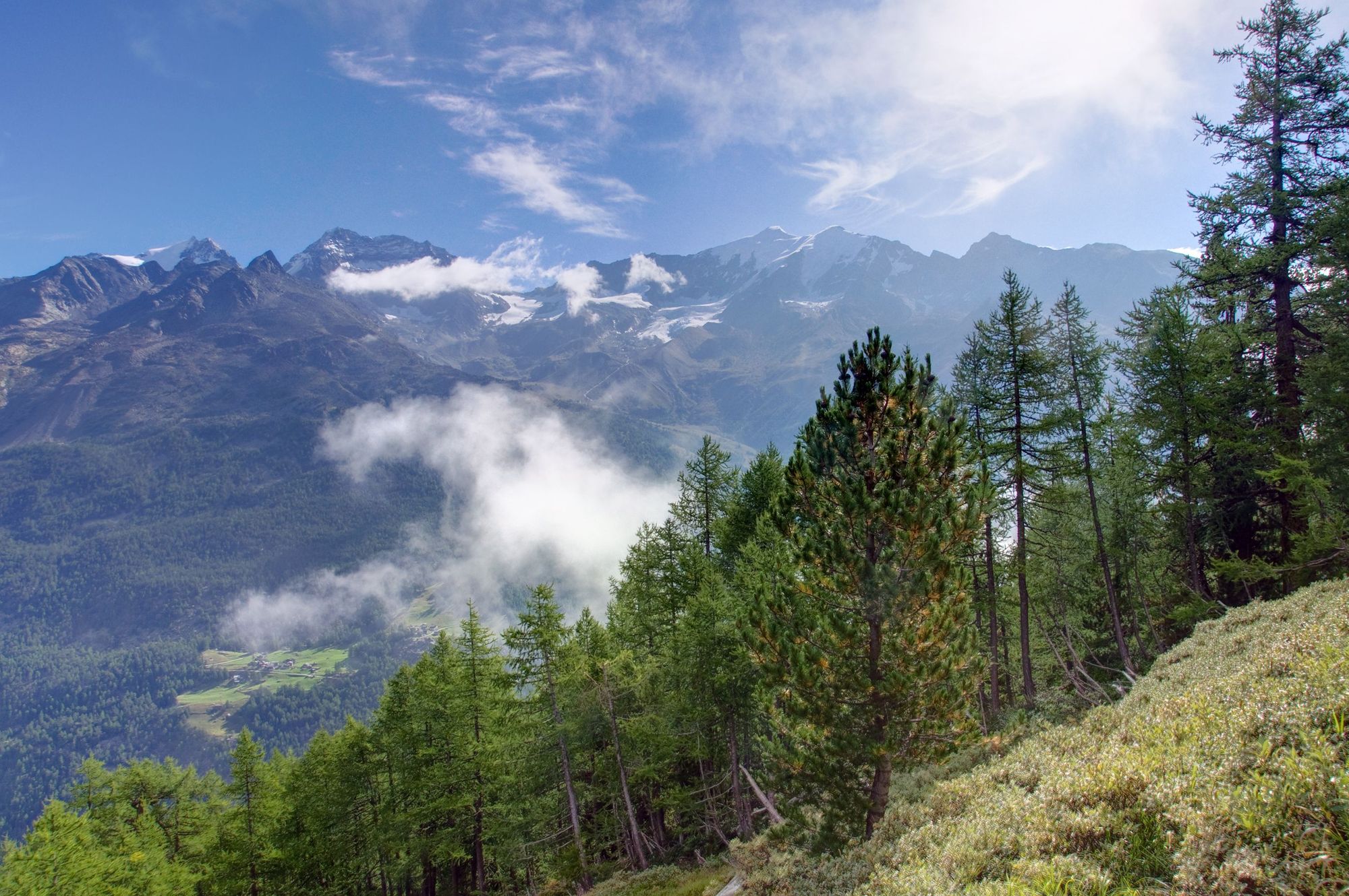
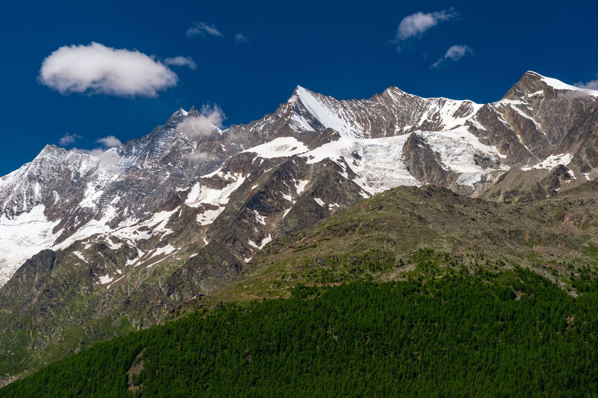
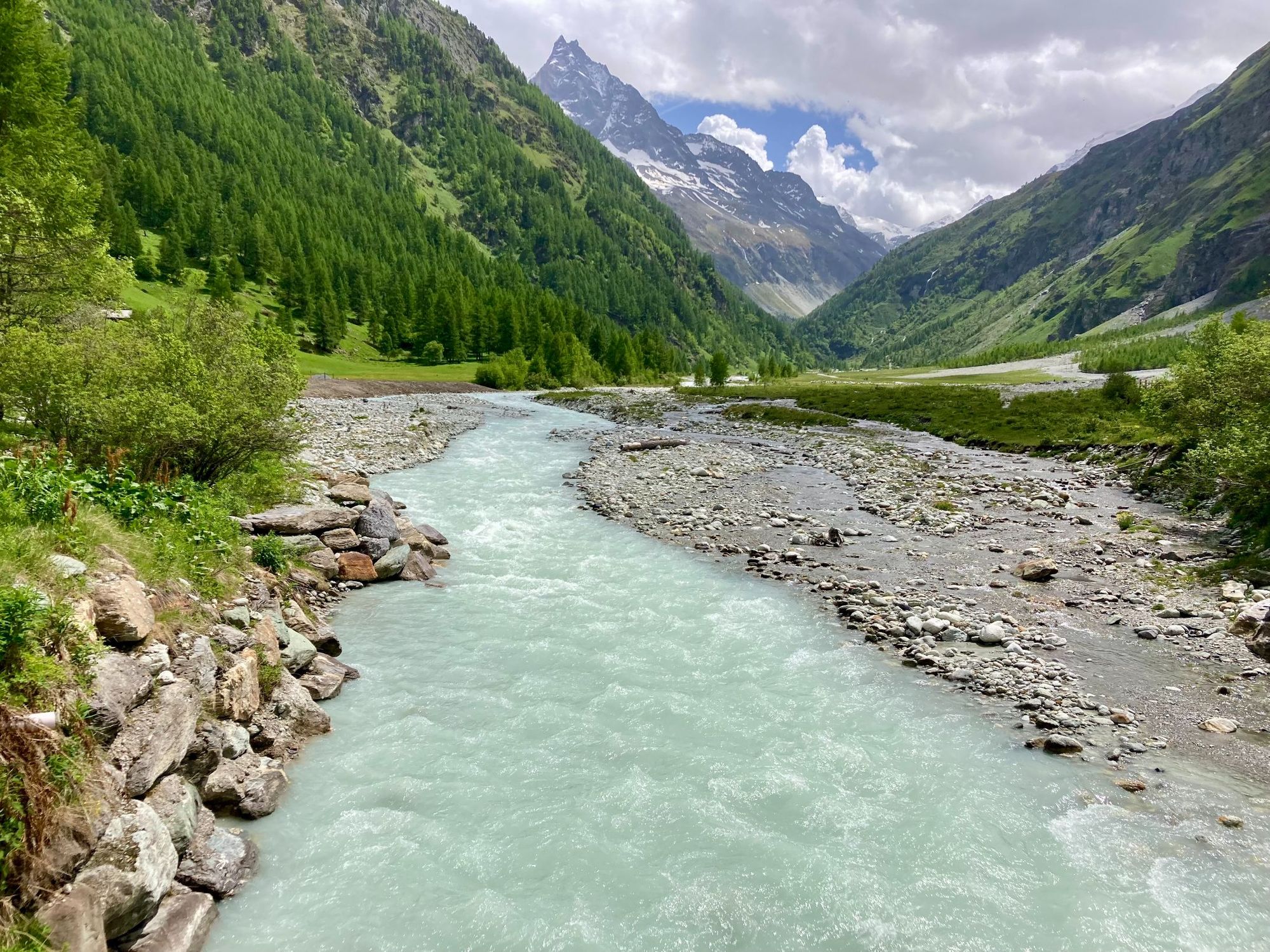
This demanding walking route takes walkers to exposed, high mountain paths, down deep, green valleys, across alpine pastureland and glaciers and past glimmering turquoise mountain lakes, all the while circling the Matterhorn, and providing the best views in the world of the mountain. A bonus of hiking in the Swiss Alps is that exceptional refuges are dotted all around, too.
Here’s our guide to walking the Tour of the Matterhorn circuit, including a route summary.
It’s important to note that these route descriptions are only short summaries, designed to inspire but not to serve any navigational purpose. They are not intended to guide you on the route and further mapping and planning (or a local guide!) will be required to safely walk the circuit.
Switzerland: The Basics
Please note that part of the Tour of the Matterhorn takes place in Italy, but the bulk of this route is in Switzerland, with which the Matterhorn is synonymous.
- Currency? Euro.
- Language? Swiss-German and French.
- Plug adapter? Europlug (Type C & J).
- Do I tip? 10% or as appropriate, if satisfied.
- Average beer price? £5.78.
- Nearest adventure? Trek the Matterhorn Circuit.
Tour of the Matterhorn: The Route in 9 Stages
- Distance: approx. 93 miles / 150km
- Duration: 9-11 days / approx. 61 hours of hiking
- Start Point: Randa (1,439m)
- End Point: Zermatt (1,620m)
- Ascent: 10,353m
- Descent: 10,143m
- Difficulty: Challenging
There are a few different ways to walk the Tour of the Matterhorn. The most important thing is that you pick a pace which suits you.
Here, we've broken the route down into nine stages, but it's also normal to walk the Matterhorn Circuit over 10-11 days - especially if you're not keen on taking any cable cars to start or end days (as this nine-stage route recommends).
Several sections of the Tour of the Matterhorn are shared with other long-distance routes, like the Walker's Haute Route or the Tour of Monte Rosa. As a result, if you do walk the trail, you'll likely meet others out walking some of the stages listed below in reverse, as they make their way over to Zermatt.
Stage 1: Zermatt to Europahütte
- Distance: 13 miles/21km
- Duration: 7 hours
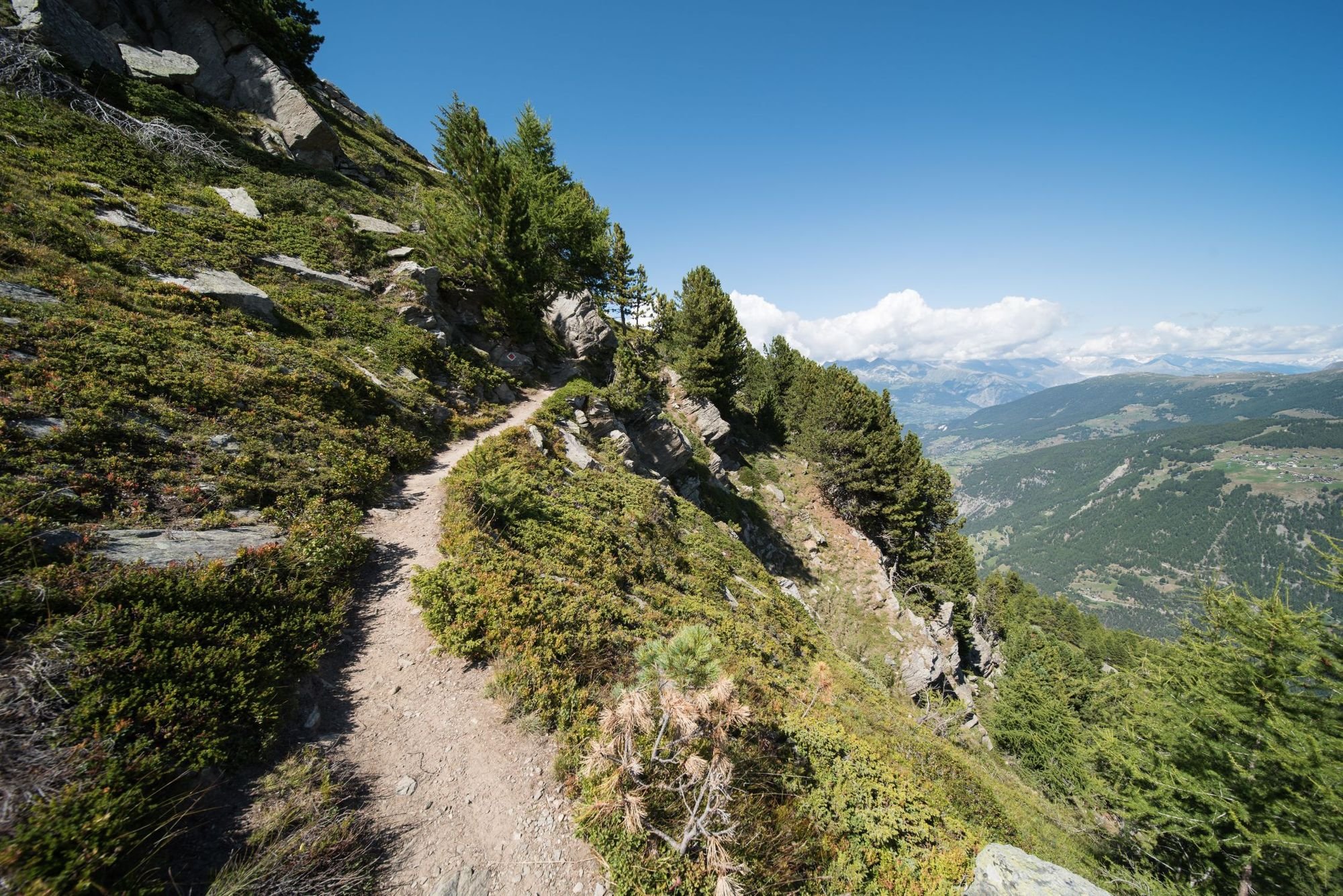
There are a couple of options for starting the Tour of the Matterhorn. Some people begin the Matterhorn Circuit by walking from Randa (just up the road from Zermatt) to Topali, then head onto Jungu and Gruben, where they join the route below. This option, though, is the most scenic. You’ll begin the route on The Europa Trail (signposted as the Europaweg), widely considered to be one of the most beautiful trails in the Alps. You’ll walk from Zermatt in the direction of the Bernese Alps, with the Bietschhorn (3,934m) ahead and the Matterhorn behind.
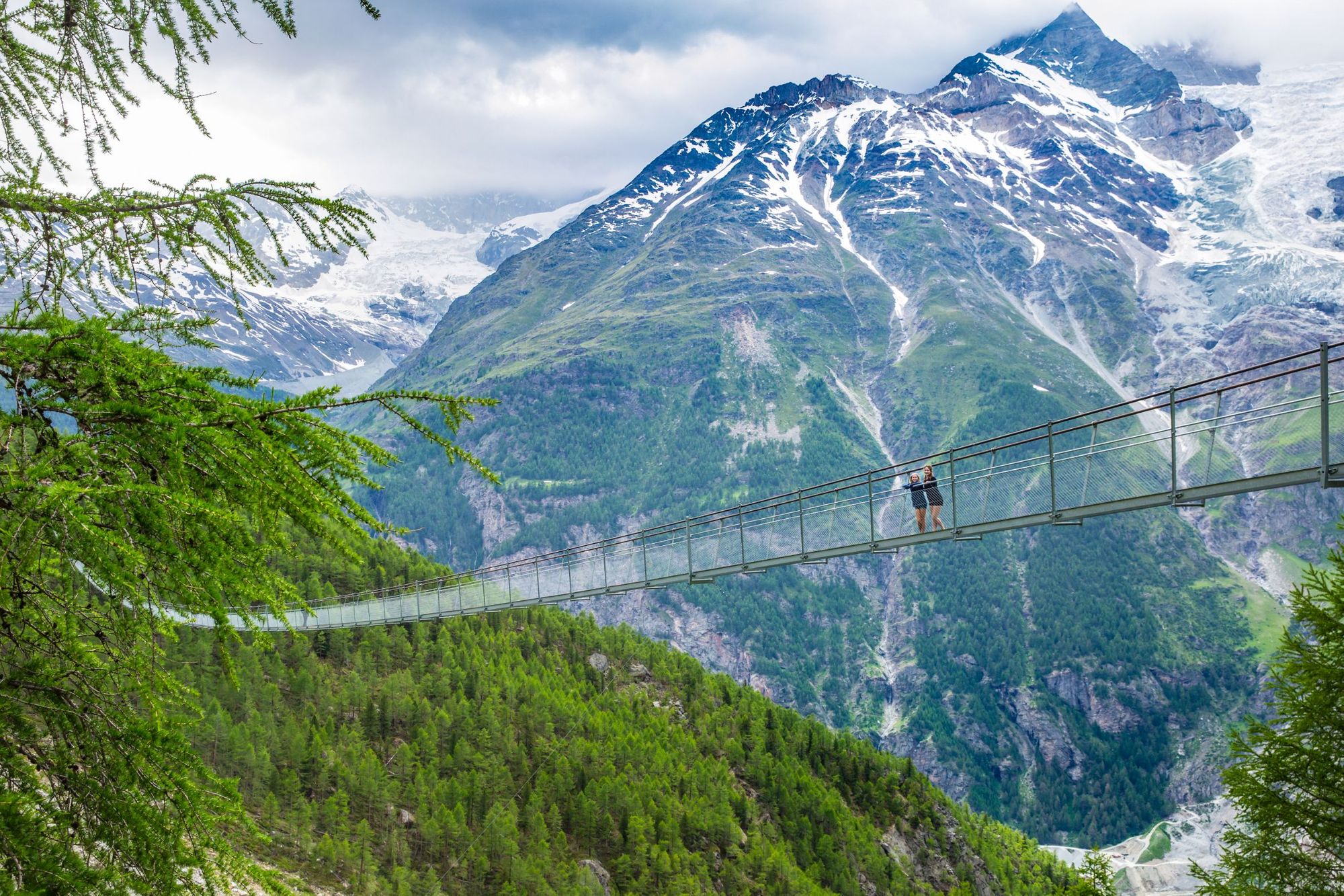
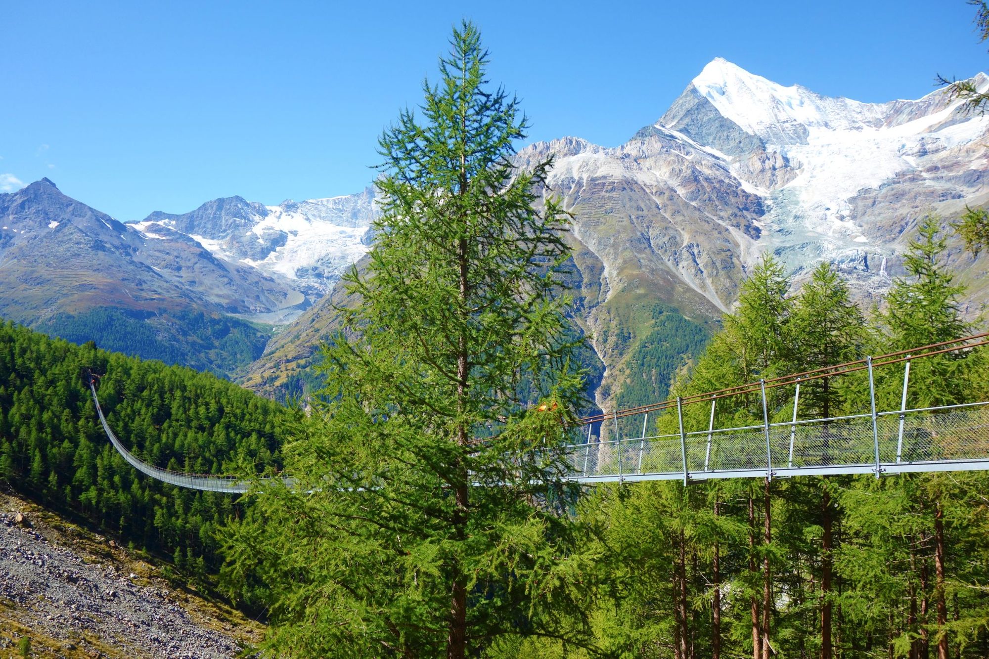
A clear highlight of this section comes after the picturesque hamlet of Täschalp, when you’ll cross the Charles Kuonen Suspension Bridge - the longest pedestrian suspension bridge in the Alps. It’s half a kilometre long, so stick your head for heights on. If you want a headstart on this route, you can take the funicular from Zermatt to Sunnegga and hike to Europahütte from there, or instead hike to the Europahütte from Grächen, looking onto the Matterhorn.
Stage 2: Europahütte to St. Niklaus
- Distance: 8 miles/13km
- Duration: 6 hours
The Europahütte is a beautiful place to stay. It’s a modern mountain hut with views out over the Matteral Valley, a mixture of hikers working their way along either The Europa Trail, The Tour of the Matterhorn or the Walker’s Haute Route. Leaving here, day two will see you descend from the refuge, first steeply down to Herbriggen through the first and then gently through small towns to St. Nicklaus - home to a mountain guide dynasty which dates back to the early 19th century. A previous version of this trail ran between Grat and Galenberg, but that route is now permanently closed due to rockfall.
Stage 3: St Niklaus to Gruben
- Distance: 10 miles/16km
- Duration: 7 hours
This day can be easily shortened by starting with a cable car from St. Niklaus to Jungen. It’s a good idea to do so too, unless you’re feeling like an absolute completionist. It’ll save you two hours, and you’ve got a big take of hiking coming up - including a 1700m climb to the Augstbordpass (2,894m). Before that, there are some spectacular lookout points - notably the Twära viewpoint, for a great view into the Mattertal Valley, and out to Nadelhorn (4,327m), Lenzpitze (4,294m) and Dom (4,545m). Then it’s a day of making ground to get to Gruben.
Stage 4: Gruben to Zinal
- Distance: 12 miles/19km
- Duration: 8 hours
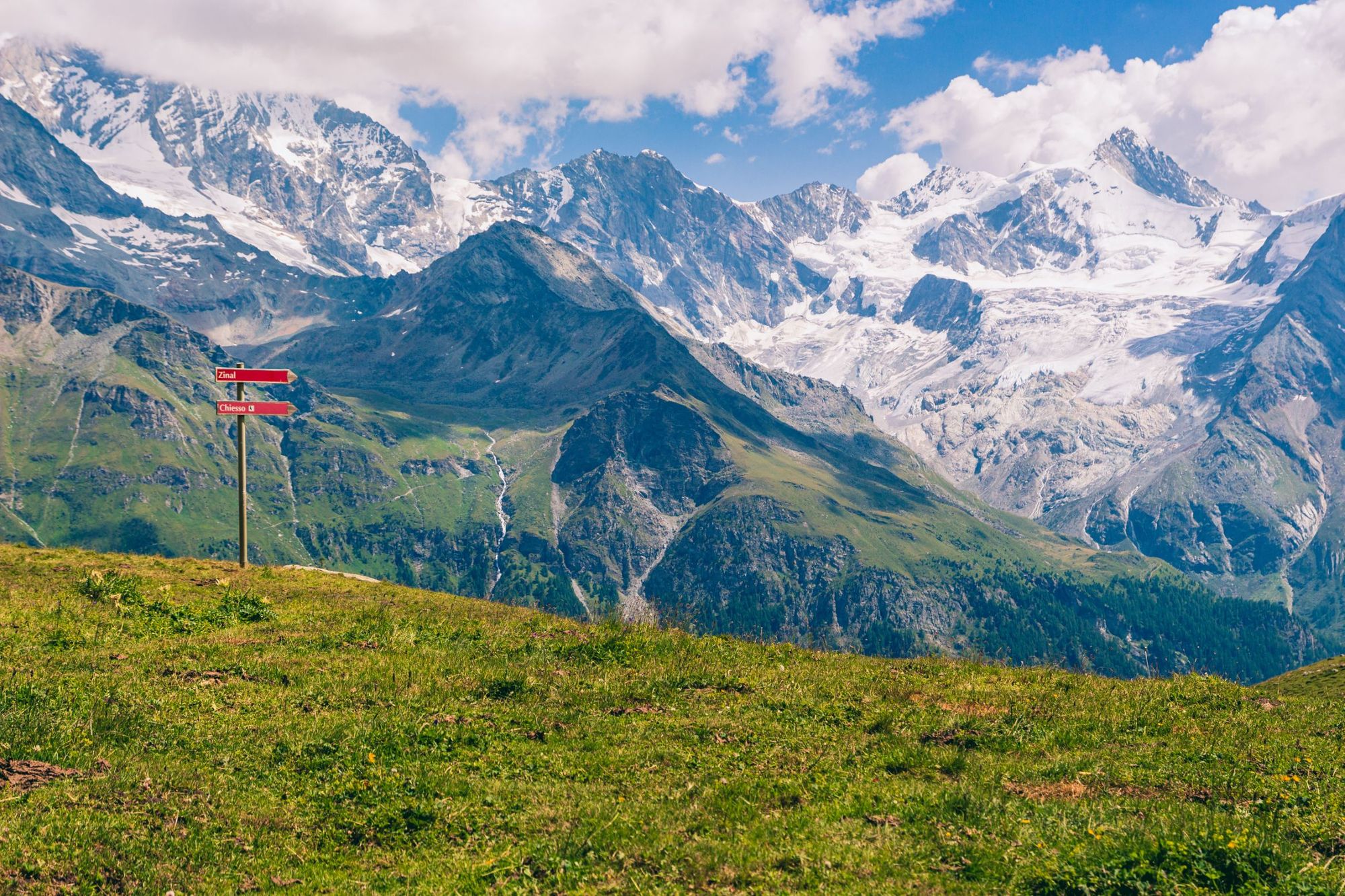
This is a big day on the mountain, starting with some uphill trekking, and travelling along the Meidpass, a mountain pass bridging the valleys of Val d'Anniviers and Türtman. You’ll be looking out over Türtmantal for the start of the day, and a skyline of pointy peaks. Grab lunch at Hotel Weisshorn before joining a sublime high-mountain route with big mountain views to Zinal.
Stage 5: Zinal to Les Haudères
- Distance: 9 miles/15km
- Duration: 8 hours (after cable car)
This is a long day out, so it’s best to start by taking the Zinal-Sorebois-Espace Weisshorn gondola from Zinal to Sorebois to start the day (and avoid 800m of ascent). From here, you can ascend Col de Sorebois (2,896m) then walk down to the glacial blue of Lac de Moiry, crossing the Moiry dam before ascending Col de Torrent (2,919m). Then it’s down to Les Haudères. This is a tough day out, even with the cable car starting point. Note that the stage can be broken up into two by staying the night in Barrage de Moiry, proceeding to Les Haudères the next day.
Stage 6: Les Haudères to Arolla
- Distance: 5.5 miles/9km
- Duration: 3 hours 30 minutes
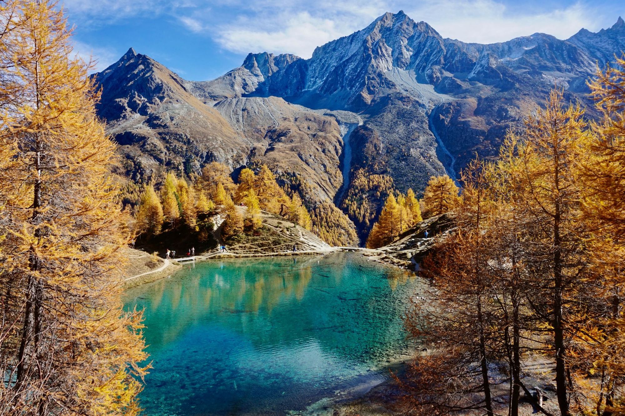
After an epic start to the Tour of the Matterhorn, you’ll reach perhaps one of the shortest and simplest stages. It’s a pleasant stroll past a picturesque mountain lake and over rolling hills and meadows to reach Les Haudères. A bus does connect Les Haudères and Arolla, so if you are after a mid-hike rest day, this is a good place to take it, and ride the bus between the two spots instead.
Stage 7: Arolla - Prarayer
- Distance: 10.5 miles/17km
- Duration: 9 hours
If the walk into Arolla is one of the easiest days on the tour, then the walk out is certainly one of the most challenging. This will be your first experience of crossing a glacier - the Haut Glacier d’Arolla - on the Matterhorn Circuit, and so, an ice axe, crampons and the knowledge of how to use both properly, are crucial. When there is snow on the glacier, roping up is also crucial for safety, as you don’t know what lies below. You’ll walk the glacier over to the Collon Pass (3,069m), on the Swiss-Italian border, and then descend down the Italian side for the night.
Stage 8: Prarayer - Breuil-Cervinia
- Distance: 10 miles/16km
- Duration: 8 hours 30 minutes
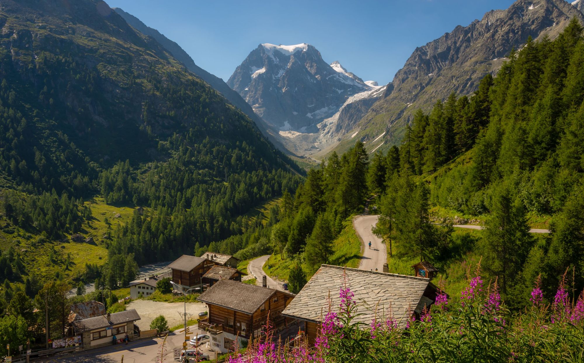
Rifugio Prarayer sits near the lake of Place Moulin, which has water as blue as Canada’s famous Lake Louise. From here, you’ll head up to Colle di Valcournera (3,073m) on a tough hike with great views of Mont Dragon and the Grande Lago. This is a tough opening to the day, with over 1000m of ascent, but 30 minutes after the mountain you’ll reach the Rifugio Perucca-Vuillermoz, at 2,909m, where you can take a break. The descent to Breuil-Cervinia from here takes around four hours, descending 900m along the way.
Stage 9: Breuil-Cervinia - Zermatt
- Distance: Dependent on cable cars taken.
- Duration: 1 day
Your final day will take you between the two towns most associated with the Matterhorn - or Cervino, as they call it on the Italian side. Breuil-Cervinia is a picture perfect mountain town, where traditional old chalets sit directly beneath the Matterhorn. If you’re going to get back to Zermatt in one day - the alternative being to stay overnight at Refuge du Théodule - you’ll want to start with the cable car to Plan Maison, to save a morning of over 1000m in ascent.
The hiking is superb, with huge panoramas of the Matterhorn, dwarfing the other mountains. You’ll then descend from the Theodul Pass (3,295m) to the Gandegg Hut, via the Theodul Glacier. This hut was built in 1888 and sits between the Breithorn and Matterhorn. Stay the night, grab a cable car down to Zermatt, or walk the final four hours of the Matterhorn Circuit.
Tour of the Matterhorn: A 4-Day Circuit on the Trail
Not everyone has the time (or energy) for a nine-stage, 150km epic across the Swiss Alps, but it is possible to bite off just a part of the trail, and get the best of the scenery. To do this, we’d recommend heading straight from Zermatt or Grächen up to the Europahütte, and then from there, heading on to the Täschhütte refuge. You can then summit the 3,313m Pfulwe before heading back down to Zermatt, staring at the beautiful Matterhorn. Below, we’ve listed a four-day itinerary for such a trip. Think of it as a mini take of the Tour of the Matterhorn circuit.
Stage 1: Grächen to Europahütte
- Distance: 4 miles/17km
- Duration: 7 hours
A steep route up to the fantastic Europahütte, through forests and with big valley views, arriving at the famous hut, where you can eat dinner above 2000m and look out for ibex on the rocks.
Stage 2: Europahut to Täschhütte
- Distance: 7.5 miles/12km
- Duration: 7 hours
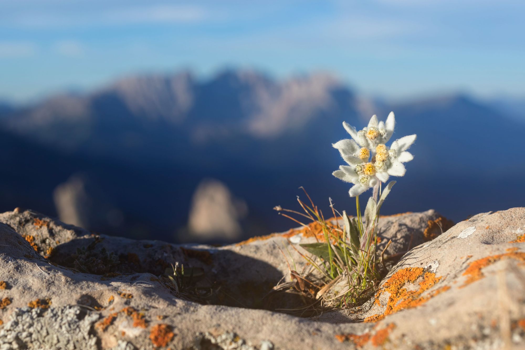
Cross the stunning Charles Kuonen suspension bridge and continue on the Europaweg, one of the world’s most beautiful trails. Rather than head directly down to Zermatt, join the Edelweiss Trail - named for the alpine flower - and earn a sunset beer overlooking the the iconic Weisshorn (4,506m) and Zinalrothorn (4,221m) at the Täschhütte mountain refuge.
Stage 3: Täschhütte to Zermatt, via Pfulwe
- Distance: 10 miles/16km
- Duration: 9 hours
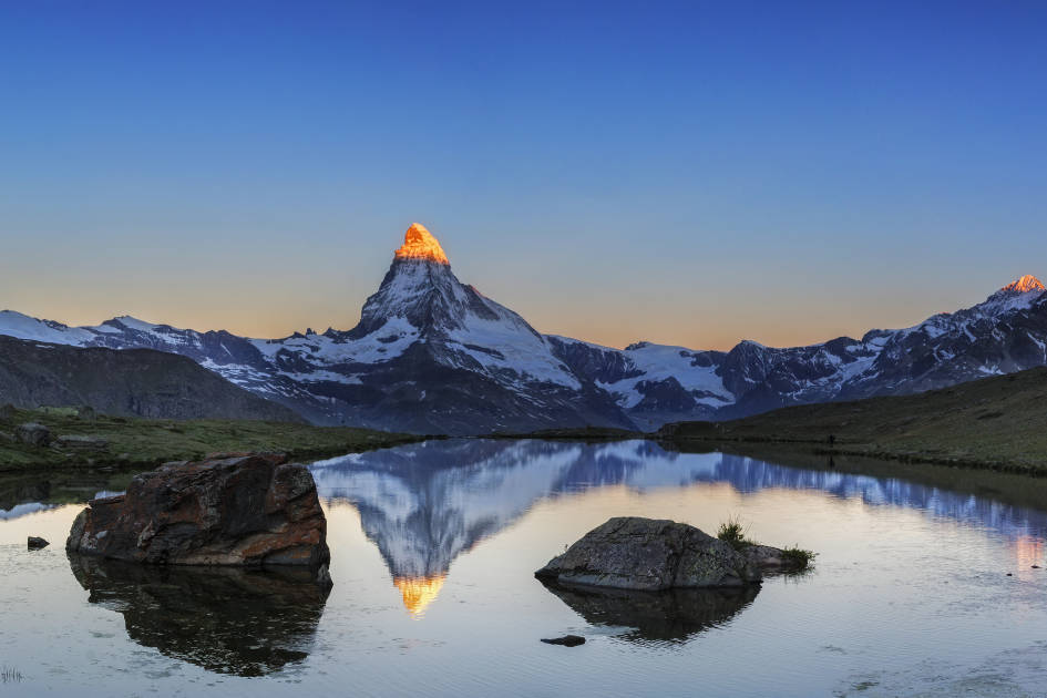
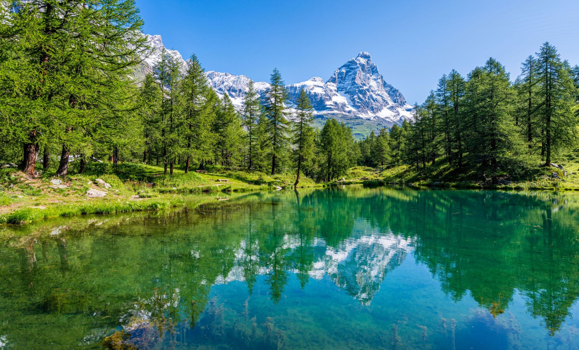
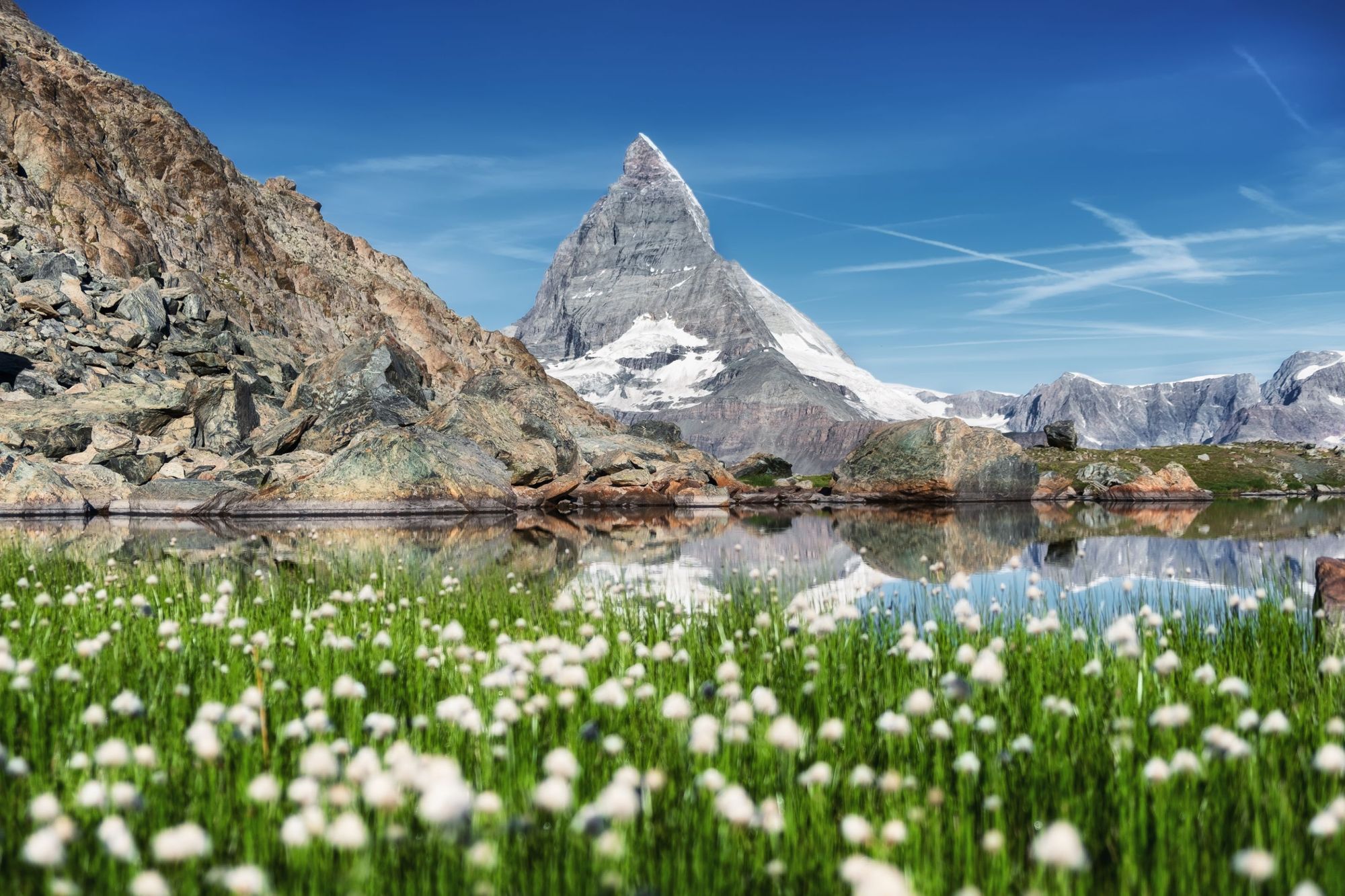
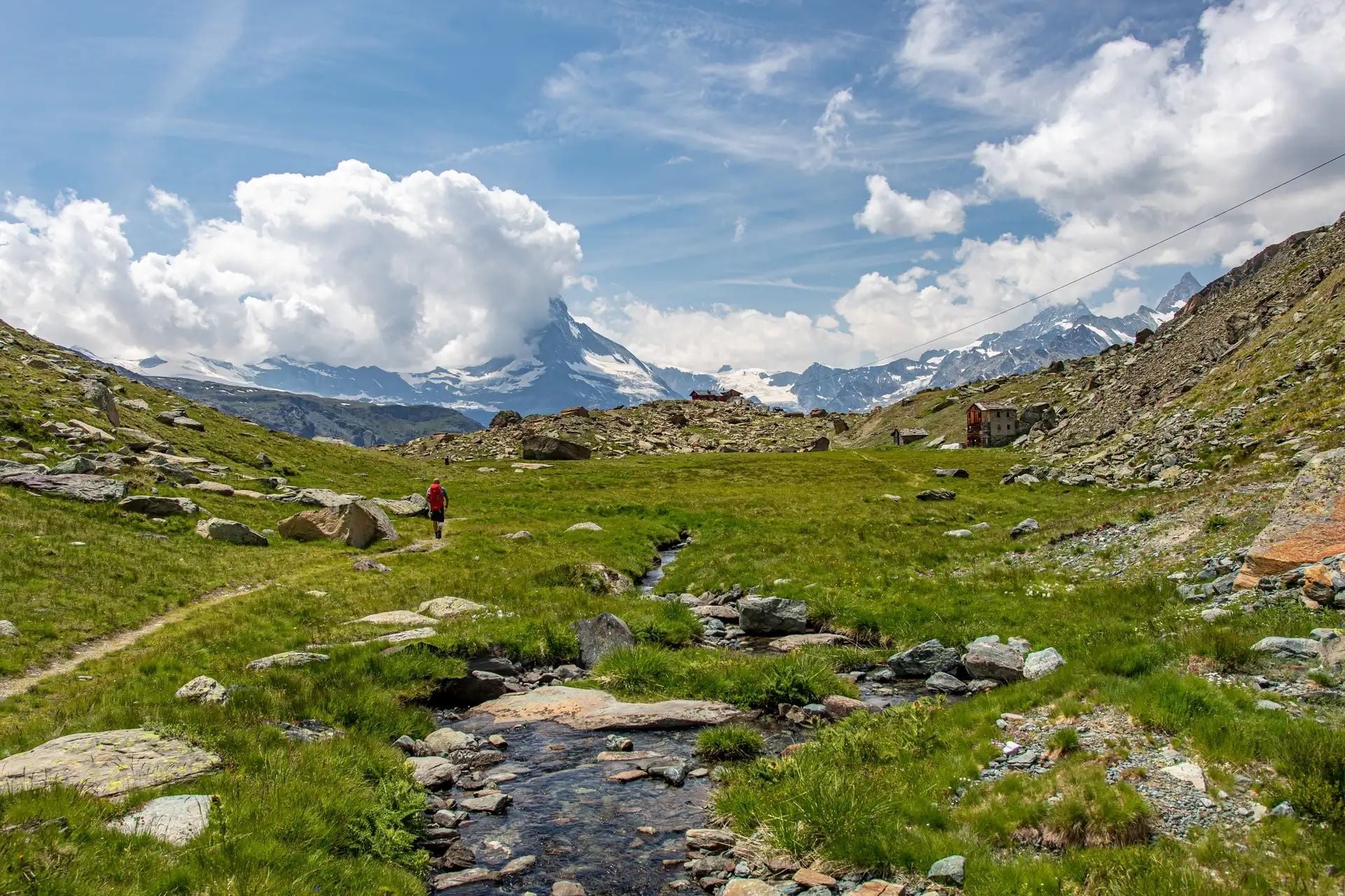
Watch the sun rise over the surrounding glaciers and 4,000m peaks of Switzerland, then join the Täschalp Path and walk through the Pfulwe Pass around 3,100m, climbing to the top of Pfulwe (3,313m) for one of the best views in the Alps - featuring the Matterhorn and Monte Rosa, the highest mountain in Switzerland. Descend to Zermatt via the Fluealp, passing Stellisee Lake - the famous lake pictured above, on which the Matterhorn reflects off the glimmering water.
Stage 4: Out-and-back on the Edelweiss Trail
- Distance: 5 miles/8km
- Duration: 4 hours
Take a day walk on the Edelweiss Trail from Zermatt, taking in the mountain air one last time - and spotting the famous furry flowers lining the trails.
FAQs
How does the Matterhorn Circuit compare to the Tour du Mont Blanc or Haute Route?
The Matterhorn Circuit, Tour du Mont Blanc (TMB), and Haute Route all offer classic Alpine trekking but differ in feel and difficulty. The Matterhorn Circuit is the quietest and most rugged, offering remote trails and constant views of the Matterhorn. The Tour du Mont Blanc is the most accessible and sociable, with well-marked paths and good amenities amidst iconic alpine scenery. The Haute Route is the most challenging, crossing high, rocky passes between Chamonix and Zermatt for a bigger, more demanding alpine experience.
What countries and landscapes do you pass through on the Matterhorn Circuit?
The Matterhorn Circuit crosses Switzerland and Italy, weaving through alpine meadows, glacial valleys, high mountain passes and traditional mountain villages. The landscape is dominated by the distinctive peaked silhouette of the Matterhorn (4,478m/14,692ft).
What are my accommodation options on the Matterhorn Circuit — mountain huts vs hotels vs camping?
Accommodation on the Matterhorn Circuit includes remote mountain huts, village hotels and limited camping. Most trekkers stay in alpine huts or locally-run hotels offering meals and rustic comfort. Wild camping is restricted in Switzerland and Italy.
What’s included in a Matterhorn Circuit trekking holiday (huts, meals, luggage transfer)?
A Matterhorn Circuit trekking holiday typically includes accommodation in mountain huts or hotels, all meals during the trek, and luggage transfers between locations. Most packages also include a local guide, group support, and transfer logistics, ensuring a supported and comfortable alpine experience.
Can I book a shorter “highlights” section of the Matterhorn Circuit if I’m short on time?
Yes, you can trek the Matterhorn Circuit over a weekend on a guided small group trip with Much Better Adventures. It’s ideal for trekkers with limited time.
When is Best to Walk the Tour of the Matterhorn?
Both Zermatt and Breuil-Cervinia are world-renowned ski resorts come winter time, so if it’s hiking you’re after, you’re going to need to visit in the summer season. The walking season is typically between June and October, with July being the optimal month for ensuring the high peaks are free of snow. That said, now more than ever, the climate is unpredictable, so check weather forecasts and prepare appropriately for whatever weather before you go hiking.
Inspired? Trek the Matterhorn Circuit on our three-night, four-day adventure!