

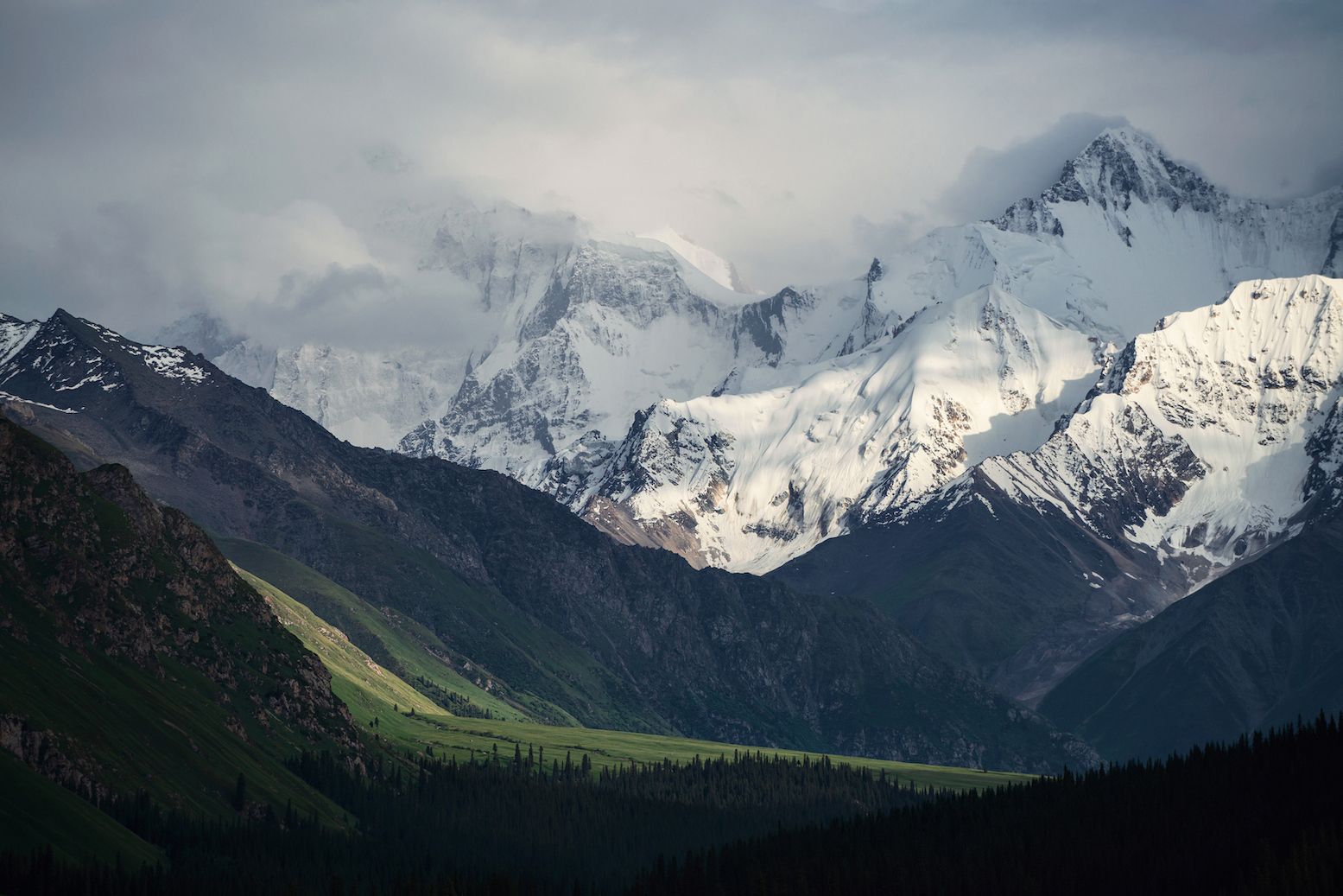
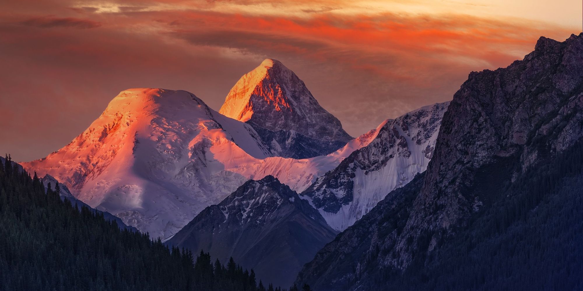
It’s easy to see why the Central Asian country of Kyrgyzstan (pronounced kur-gi-stan) is a trekker’s paradise. It has vast swathes of untrammelled wilderness; wide plains, alpine meadows, glacial lakes and thousands of soaring mountains. These include the Tian Shan, which translates to ‘Celestial Mountains’ - a vast system of mountain ranges that stretches for around 1,500 miles across the border between China and Kyrgyzstan (and bisects Turkistan).
In Kyrgyzstan, the central Tian Shan is the highest part of the range, including the sky-piercing Peak Pobeda (7,439m/24,406ft) and Khan Tengri (7,010m/22,998ft) - the latter is the world’s most northerly 7000m mountain. Meanwhile, the Turfan Depression in the eastern Tian Shan is the lowest point in Central Asia, at 154m (505ft) below sea level. Also in the east lies Issyk Kul, a glacial lake, while to the west are steep ridges such as the Chatkal Mountains. Thousands of miles of barely explored hiking trails wind across this remote, untouched landscape - Tian Shan trekking is all about getting off the beaten track, as our favourite hikes there show.
- The Ala-Köl Trek (via Altyn Arashan Hot Springs)
- Issyk Kul to the Arabel Syrt (via the Jukku Valley)
- Sary-Chelek Lake Trek
- Bulak-Ashuu Lakes Trek
- Khan Tengri Base Camp Trek
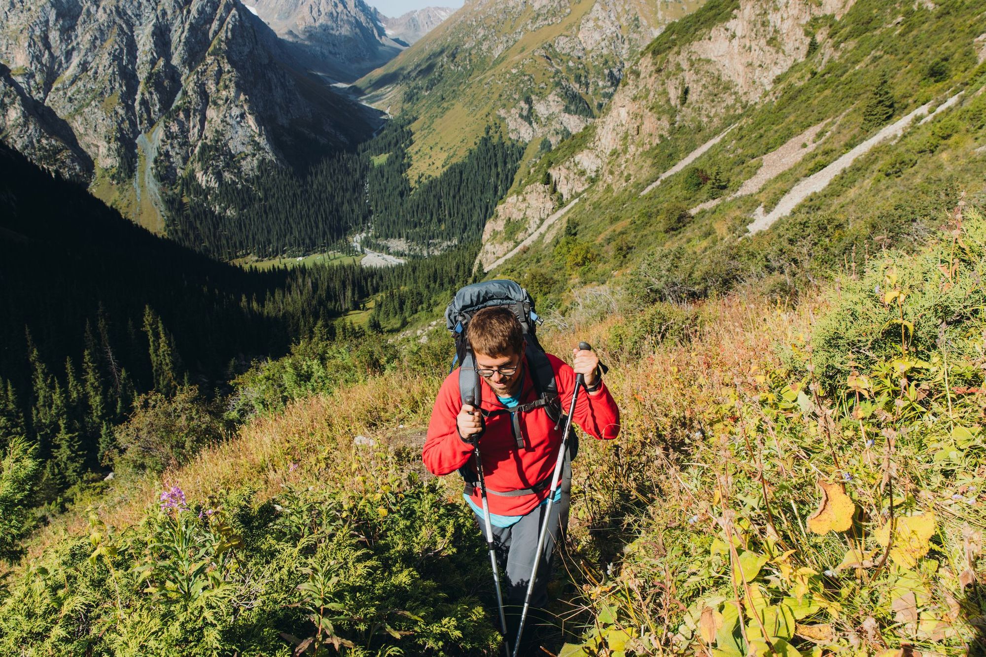
The hikes that we have selected will introduce you to the diversity of this landscape, taking you across its meadows, glaciers and up mountain passes. The navigation summaries are designed to inspire, rather than as a substitute for a map. Due to their off-the-beaten track nature, we’d always recommend hiring an experienced local guide.
A Note on High Altitude in the Tian Shan
Most hikes on this list take place at high altitude (defined as an elevation over 2500m/8,202ft) - at this elevation the air contains less oxygen, meaning you’ll get breathless far more quickly and have to stop for frequent breaks.
At these elevations, you could be at risk of altitude sickness, which has symptoms such as nausea, fatigue or (more seriously) disorientation and balance problems. The latter necessitates an immediate descent to lower altitudes. It’s worth pointing out that some people experience no symptoms of altitude sickness. However, being aware of its risks makes you more able to mitigate them.
 Dr Jane Wilson-Howarth
To protect against altitude sickness, it’s important to give yourself time to acclimatise - we’d always recommend arriving at the walk start point the day before - and to take ascents slowly.
The Best Kyrgyzstan Treks, Mapped
These are the starting points for five of the best treks in Kyrgyzstan. The majority of them begin near Issyk Kul, the country's largest lake and a popular natural attraction.
5 of the Best Multi-Day Treks in Kyrgyzstan’s Tian Shan Mountains
1. The Ala-Köl Trek (via Altyn Arashan Hot Springs)
- Start/Finish: Ala-Köl Nature Reserve Entrance/Ak-Suu (point to point)
- Distance: 28 miles (45km)
- Walking time: 3-4 days
- Difficulty: Challenging
- Best for: High altitude lakes and hot springs
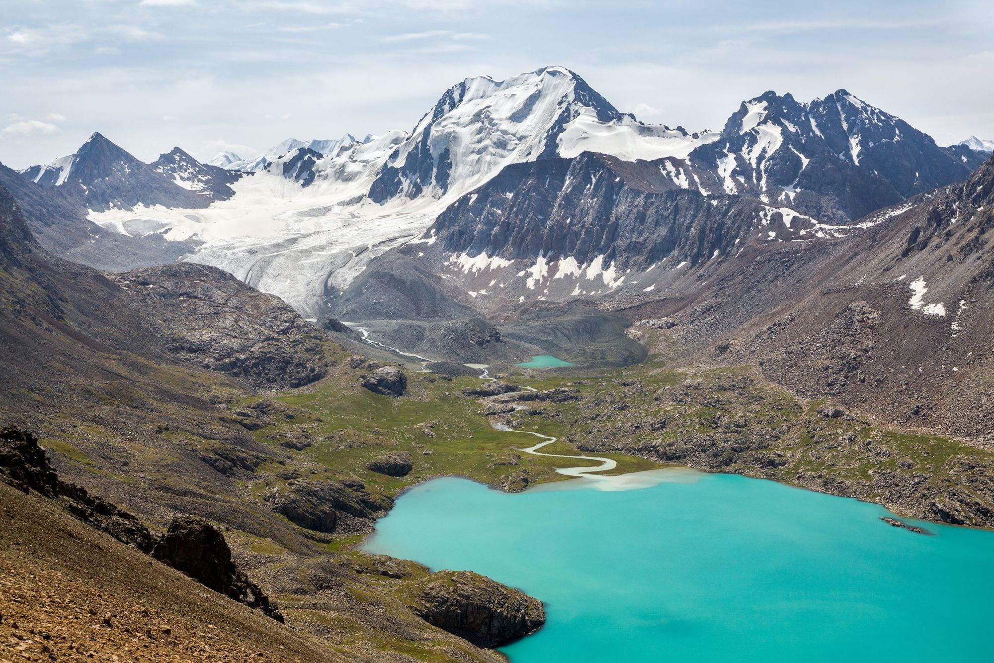
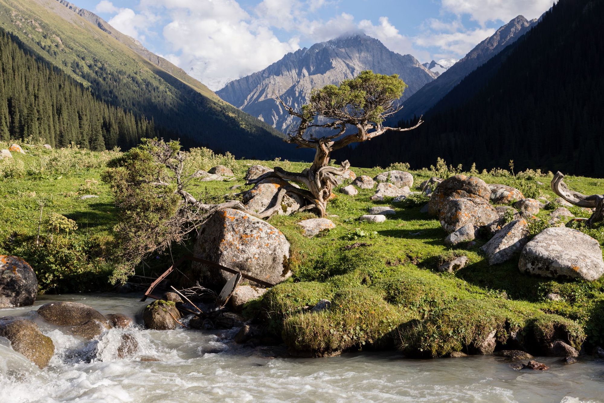
This is one of Kyrgyzstan’s most popular treks, and for good reason - it's one of the most accessible passes in the Tian Shan Mountains, providing spectacular scenery and access to natural hot springs. The ‘high point’ of the trip is Ala-Köl, a glacial lake with a vibrant turquoise hue, surrounded by a dark spine of snow-capped peaks.
If you’d like time to acclimatise, we’d recommend trekking the route over four days, rather than the usual three. This will, however, mean that you need to carry your own tent with you, as well as a sleeping bag. You can hire porters in Karakol to carry your luggage (between 10-15kg is the commonly accepted amount) if you’re worried about having to walk with a lot of equipment.
The ‘high point’ of the trip is Ala-Köl, a glacial lake with a vibrant turquoise hue, surrounded by a dark spine of snow-capped peaks
To reach the start point of the trail, you’ll need to take marshrutka 101 (a shared minibus taxi) from the town of Karakol - ask to be dropped at the Ala-Köl nature reserve. The first day is an easy hike on a path that follows the Karakol river valley, eventually crossing it via a bridge. As you walk, you’ll see alpine mountains on either side of you, and perhaps even catch sight of some herds of wild horses.
On the second day, you’ll be hiking up a steep path towards Ala-Köl. You’ll pass a log cabin in a clearing, which is a good place for a pit stop. After that, the path to the lake becomes even steeper - you’ll be scrambling over slippery boulders and scree - but the climb is worth it when you’re rewarded with a gorgeous view of the lake. Pitch your tent here (or follow the signs to Ak-Sai Camp).
On day three keep climbing up the Ala-Köl pass, which reaches a height of 3,900m (12,795ft). Pause at the top of the pass to appreciate the panoramic views of the Terskey Alatau mountain range. Descend the other side and walk through the verdant grasslands of Keldeke Gorge, crossing the river to reach the Altyn-Arashan valley. Keep hiking down through the valley, crossing several smaller streams, until you reach a couple of guest houses and a yurt camp. Each guest house has their own individual hot springs - book yourself a slot to soothe those tired muscles.
On your final day, you’ll be trekking along a path that follows a fast-flowing river, surrounded by pine forests. It’s a relatively easy hike of around 10 miles to Ak-Suu village, where you can catch a marshrutka back to Karakol.
2. Issyk Kul to the Arabel Syrt via the Jukku Valley
- Start/Finish: Barskoon/Arabel Syrt (point to point)
- Distance: 63.4 miles (102km)
- Walking time: 6 days
- Difficulty: Challenging
- Best for: Going off the beaten track
This week-long trek takes you truly off the beaten path, through jailoos (summer pastures), valleys and passes rarely visited by tourists. It starts, however, at a popular tourist destination - the southern shores of Issyk Kul, the second largest mountain lake in the world. It’s a 4-5 hour car journey from the nearby city of Bishkek, so we recommend staying at a guest house by the lake before setting out.
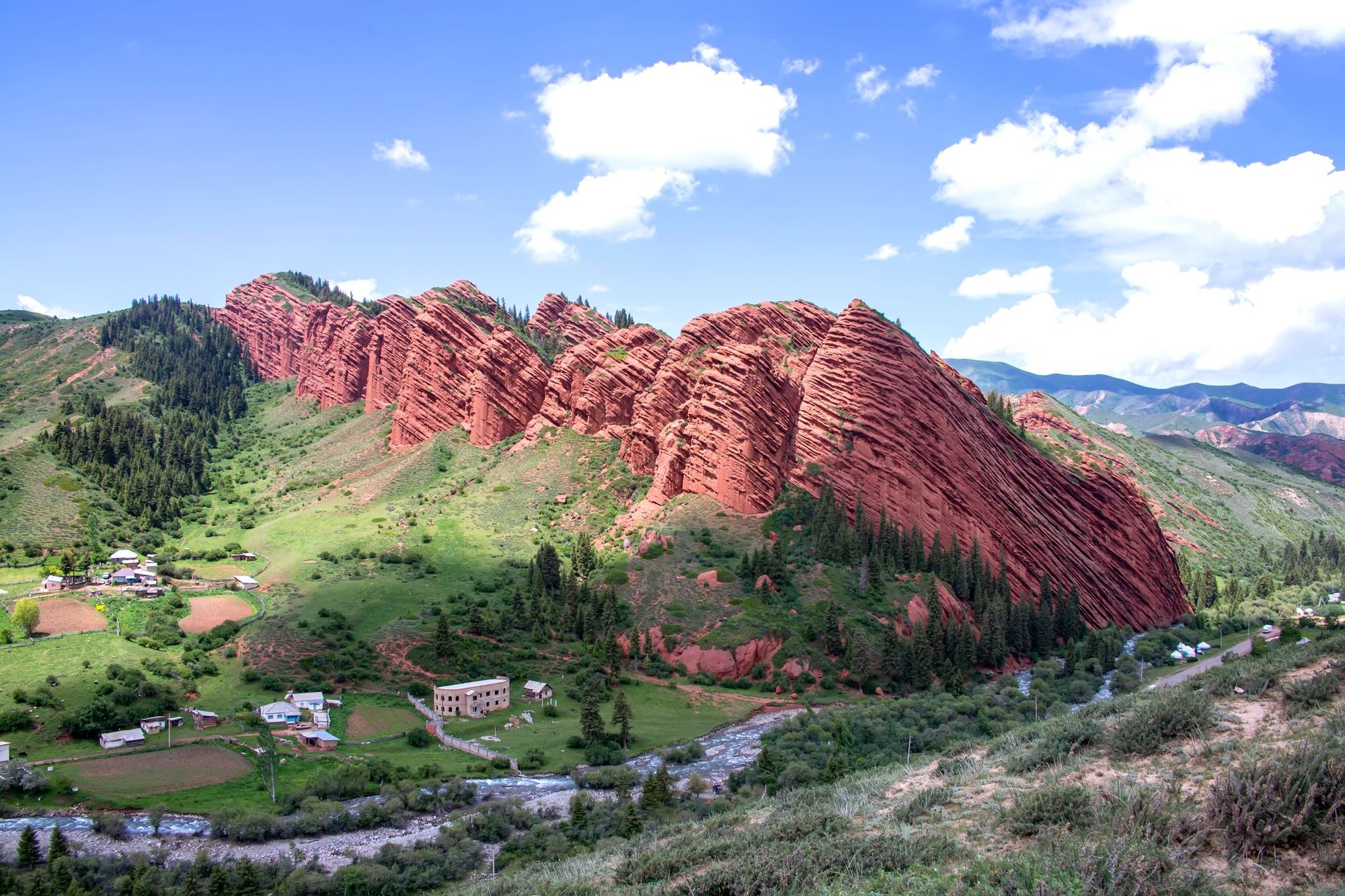
On day one, you’ll cross pasturelands to Jety Oguz (the ‘Seven Bulls’), seven majestic sandstone cliffs overhanging a picturesque village. The second day is a hike across the jailoos, where you’ll meet Kyrgyz farmers living nomadically in yurts (and stay in one yourself). The third day will take you up through the Jukkuchak Valley, stopping for a swim in some natural hot springs.
On day four you’ll reach Jukku Valley, foothills carpeted with Tian Shan pine trees. As you climb the landscape will change, becoming sparser and stonier. Day five is a climb up the Jukku Pass, a steep climb with an altitude of 3,800m (12,467ft)- the views are incredible. You’ll be camping at an elevation of 3715m (12,188ft), which will get cold!

The final day of your trek will involve a descent, and then crossing the elevated flatlands (‘syrt’) of Arabel, which are dotted with glassy lakes and surrounded by glaciers. This remote area is a wildlife haven - look out for ibex, bearded vultures and perhaps even wolves! You’ll be picked up at the end of the trail and transported to Tamga, a village on the shores of Issyk Kul.
3. Sary-Chelek Lake Trek
- Start/Finish: Aflatun /Arkyt-Sai River (point to point)
- Distance: 47.2 miles (75.9km)
- Walking time: 5-6 days
- Difficulty: Challenging
- Best for: Gorge hikes and wild swims
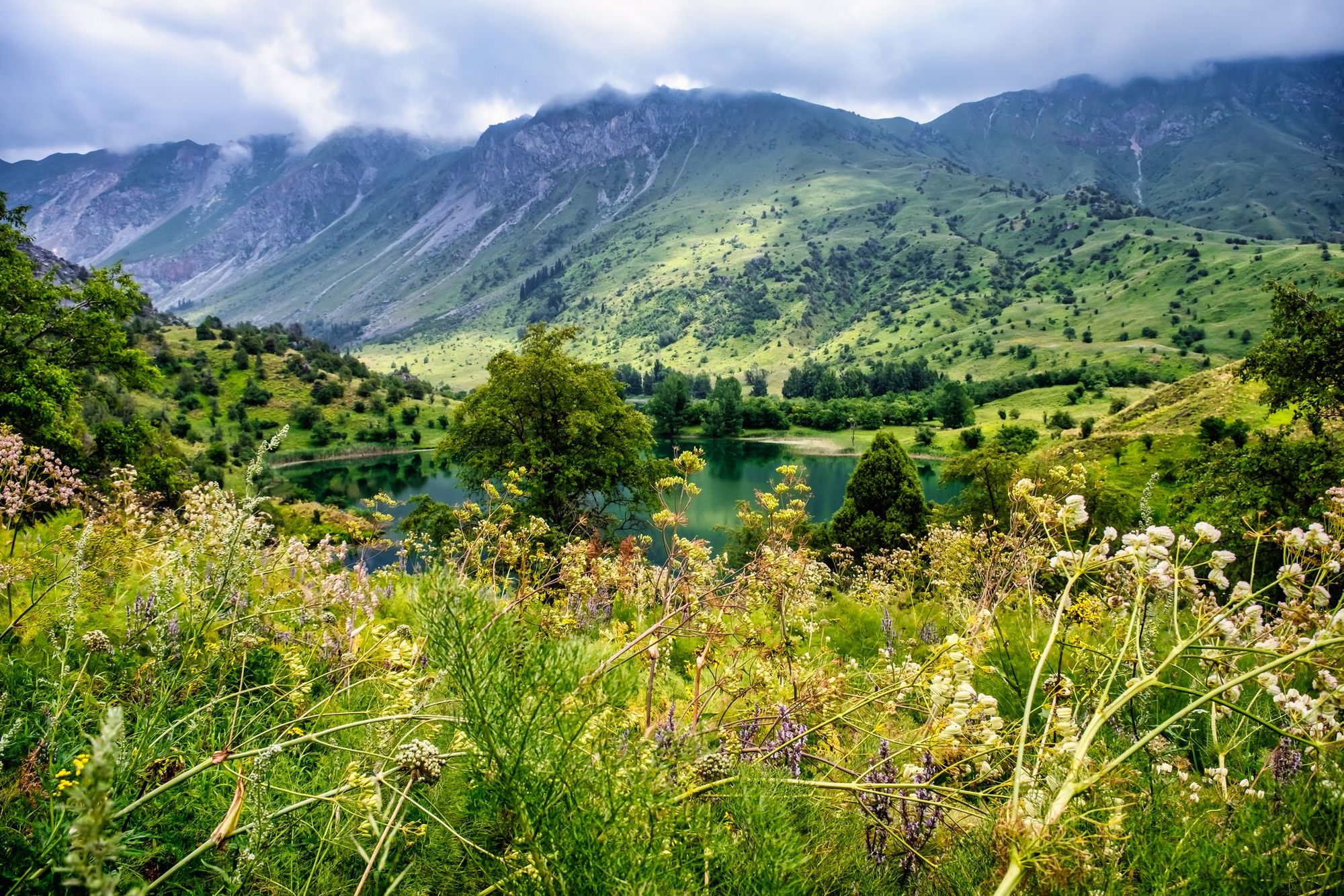
On this trek you’ll hike through the Talas mountains to Sary-Chelek Biosphere Reserve in the Chatkal Range of the western Tian Shan. Protected by the surrounding peaks, the region has a warm, humid microclimate that allows for verdant forests and meadows to flourish.
The hike begins in Aflatun village, around 4hr 30mins drive from the historic city of Osh (which has an international airport). You’ll camp at the confluence of the Aflatun and Utur Rivers. On the first day of hiking you’ll be following the path alongside the Aflatun River, then heading up the Uyalma Gorge, which is surrounded by steep limestone walls. Camp on the banks of the river. On the second day you’ll cross two passes, Kuldambes (2750m/9,022ft) and Ashuu (2,551m/8,369ft). and you’ll descend slowly to Lake Sary Chelek, a beautiful alpine lake surrounded by forested mountains - you’ll be camping on its banks.
Protected by the surrounding peaks, the region has a warm, humid microclimate that allows for verdant forests and meadows to flourish
After admiring the lake, follow the path of the Sary Chelek River upstream through a gorge. From here you’ll cross Makmal Pass before descending to Kyzyl Suu River. Its name means ‘red water’, thanks to the clay that stains the water.
The next day will involve a hike along the Kara Suu river (meaning ‘black water’) to Lake Karakamysh, which offers up a view of the Min Teke Mountains. In summer, it might even be warm enough for a swim! The fifth day involves a trek up the Kuturma pass at 2,446 m (8,024ft) and a descent to lake Iri Kol. The final day’s hike will involve looping back to the southern part of Lake Sary Chelek and continuing onto the Arkyt-Sai River, where you’ll be picked up and transferred to Osh.
4. Bulak-Ashuu Lakes Trek
- Start/Finish: Jyrgalan (circuit)
- Distance: 27.3 miles (42.9km)
- Walking time: 3 days
- Difficulty: Moderate
- Best for: High pastures and rocky peaks
This trek takes place in the Jyrgalan Valley , a little-known region in the heart of the Tian Shan mountains which is just opening up to adventure tourism. The Bulak-Ashuu Lakes Trek has only been done by a handful of adventurous travellers - it’s truly off the beaten path. We’d recommend going with a local guide to help you navigate the trail, as it’s not always clearly waymarked.
The starting point for the trek is the village of Jyrgalan (reachable on marshrutka 331 from Karakol). Head south from the village, cross over the river on a bridge, then head up a steep dirt track to a plateau. From here you’ll be following a rarely used jeep road through the verdant Jyrgalan Valley, passing isolated yurts, herders and their sheep. After a few miles, the track forks - you’ll take the left hand one to Terim-Tor Valley, following the river. The trail will gain altitude and the valley will get narrower. Eventually it opens up to a green meadow surrounded by snow-capped peaks. Camp here tonight.
It’s just under four miles up a zig-zagging path from the campsite to Bulak-Ashuu Lakes, two lakes of striking blue glacial water surrounded by serrated rocky peaks. Once you’ve enjoyed the view, you’ll descend along the same pass and then cross the river. You’ll follow animal trails until you reach the high pass over Terim-Tor Valley (3,521m/11,551ft) - this point offers you an amazing view of the Tian Shan mountains.
It’s just under four miles up a zig-zagging path from the campsite to Bulak-Ashuu Lakes, two lakes of striking blue glacial water surrounded by serrated rocky peaks
Descend into the peaceful Cholok-Tor Valley to set up camp. The next day you’ll be following the river down through the valley, crossing the river on three occasions - the third is the deepest and might require you to ford the river. Eventually this river converges with Jyrgalan River, and can be followed to Eki Chat Jailoo (the high pasture you passed on the first day). From there, you can rejoin the jeep road that heads back to the village.
5. Khan Tengri Base Camp Trek
- Start/Finish: At-Jailoo Base Camp/ Khan Tengri Base Camp
- Distance: 44.7 miles (71.9km)
- Walking time: 7-8 days
- Difficulty: Tough
- Best for: Huge mountain views
Khan Tengri translates as ‘Lord of the Skies’ and this towering, pyramid-shaped peak really demands attention. It’s also called Kan-Tau - meaning 'Blood Mountain' - by locals, a reference to the red colour it turns at sunset. At an elevation of 7,010m (22,998ft), an ascent of the peak is suitable for only the most experienced mountain climbers. However, a trek up to base camp will offer up fantastic views of this dramatic mountain. Embark on such an expedition only with trained expert guides!
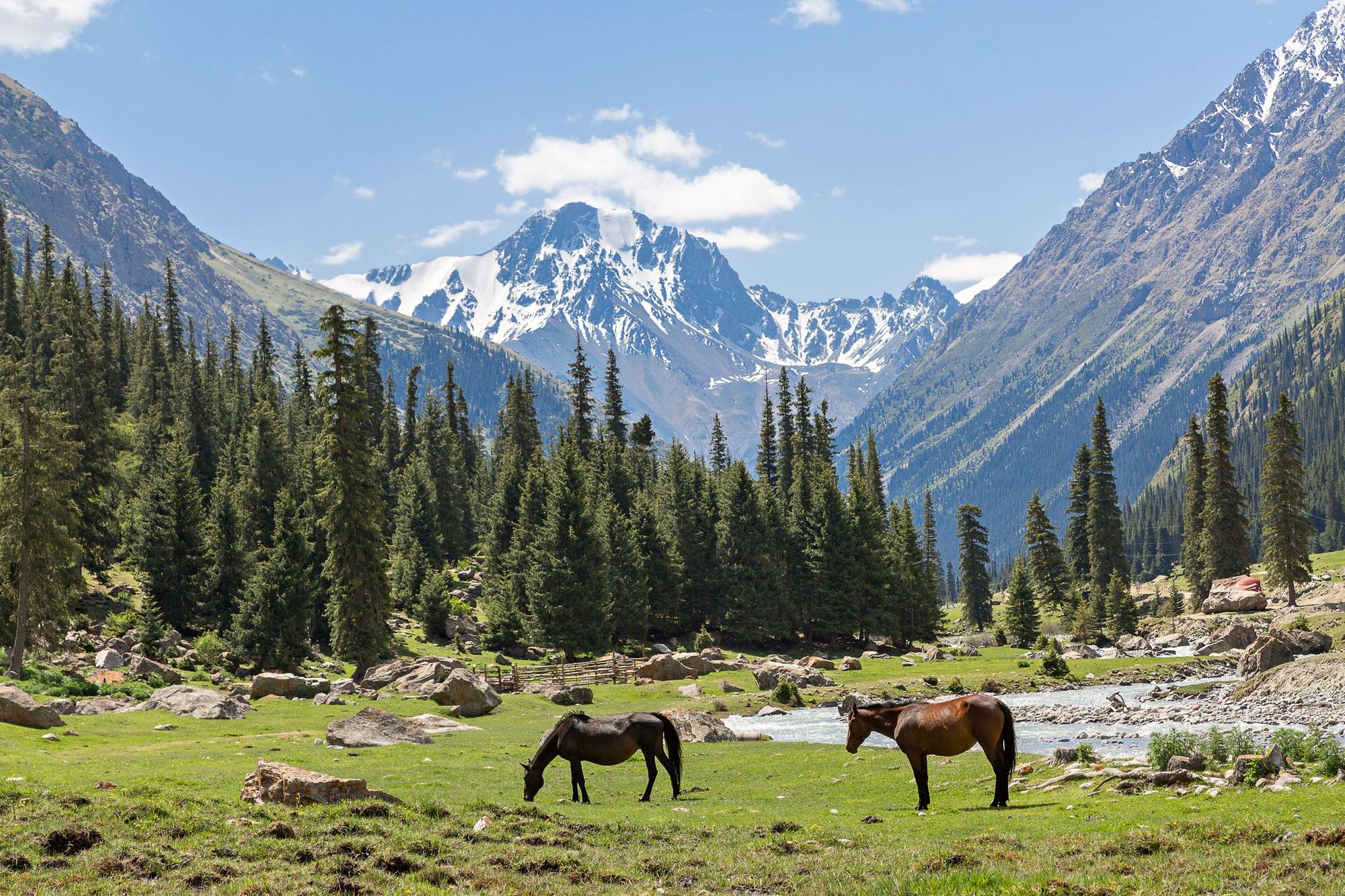
The start of the trek is At Jailoo Base Camp, a six hour drive from Karakol - you'll pass the Maida-Adyr checkpoint just before. Arrive the day before and set out early along the Inylchek River, towards the beginning of the vast Inylchek glacier. You’ll be walking along it on the second day, following steep trails upwards. Tonight you’ll camp at an altitude of 3,100m (10,170ft). The next day you’ll continue along the glacier - the terrain is predominantly moraine, but you’ll see more patches of ice when you reach Merzbacher Glade, a grassy meadow where you can camp. The next day’s trek takes you across to Mertzbacher Lake, on the north side of the glacier.
From Merzbacher Lake you’ll ascend Komsomolsky Glacier, passing a landscape of snow, multi-coloured rocks and ice, crossing rivers and crevices. On day six you’ll follow a natural highway of red jasper up to Diky Glacier (3,900m/12,795ft) - from this camp you have a view of some of the highest peaks of Tian Shan, including Khan Tengri. Day 7 will take you up to South Inylchek Base Camp (4,100m/13,451ft), right into the heart of Central Tian Shan.
We’d recommend passing a day at Base Camp to hike the area and enjoy the panoramic views, before getting a helicopter flight off the mountains. The flight is offered as part of organised hiking tours to South Inylchek - we wouldn't recommend trekking independently - although be aware that bad weather might delay it.
When is the Best Time to Go Hiking in Kyrgyzstan?
The best time to go hiking in Kyrgyzstan is in the summer season, between June and August. This is when you’ll have the highest chance of good weather, and also when seasonal yurt stays are available. During the winter, many of these trails will be buried under snow, and the roads leading to them could be inaccessible.
However, even during summer the weather in the mountains can be notoriously unpredictable. You can expect sunshine, rain and snow - sometimes all in a single day! Make sure you’re prepared for all eventualities with warm, waterproof clothing.
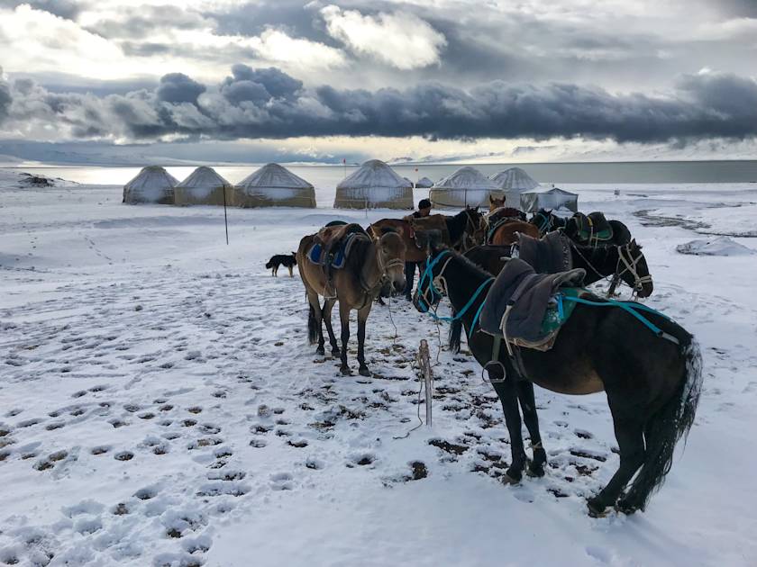
If you’re looking for a unique winter hiking experience in Kyrgyzstan, you could also visit the lower reaches of Tian Shan during the winter months (November to February). Kyrgyzstan experiences cold and dry winters, with temperatures dropping as low as -20°C in the mountains. But you’ll be able to hike in pristine snowscapes, warming up in cosy yurts and hot springs after.
What Animals Live in Kyrgyzstan’s Tian Shan?
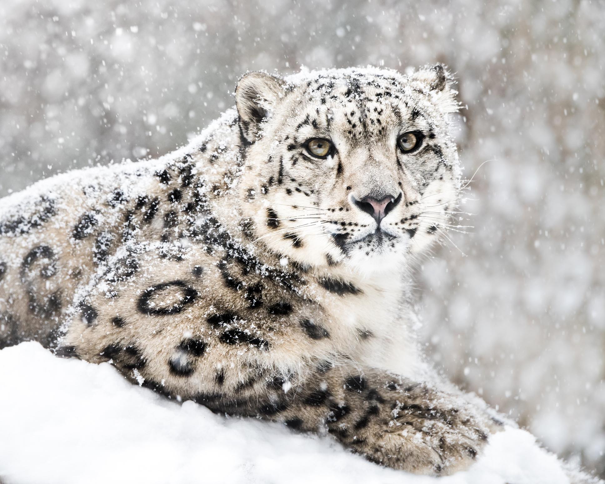
There’s a wide variety of wildlife living in the diverse habitats of Tian Shan, from its desert steppes and alpine meadows to its rocky peaks. One of the most iconic is the elusive snow leopard - they live above the treeline and are rarely seen by travellers. The Eurasian wolf and Tien Shan brown bear also call the forest and alpine meadows their home.
You’ll find Marco Polo sheep and Siberian Ibex grazing in the high-altitude grasslands, while golden eagles soar on thermals high above.
Where to Stay in Kyrgyzstan’s Tian Shan
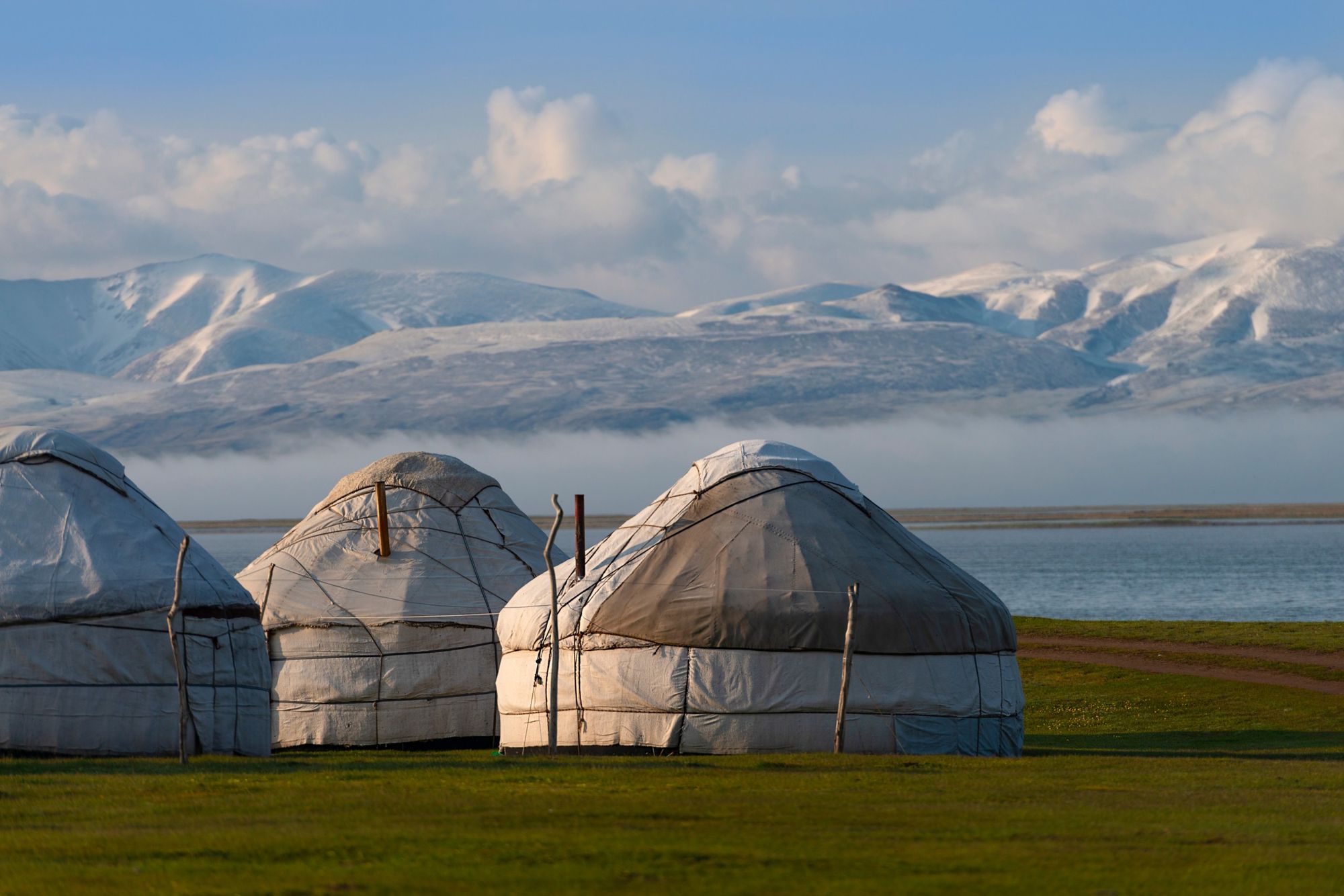
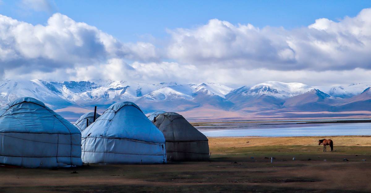
There are several options for trekkers in Tian Shan: local family-run guest houses in the larger villages; wild camping when out in the wilderness; or a stay at a traditional yurt campsite. Yurts - round tents supported by latticed wooden walls - have been used by nomadic Kyrgz families for thousands of years, and are a unique accommodation option for travellers. You’ll have a chance to try Kyrgyz home-cooked dishes and perhaps even listen to traditional music.
What to Eat in Kyrgyzstan
Traditional Kyrgyz food has been influenced by the nation’s nomadic lifestyle - it’s rich in meat and dairy products, and many cooking techniques are based on the long-term preservation of food. The national dish is ‘beshbarmak’, horsemeat or mutton boiled in broth and served over homemade noodles.
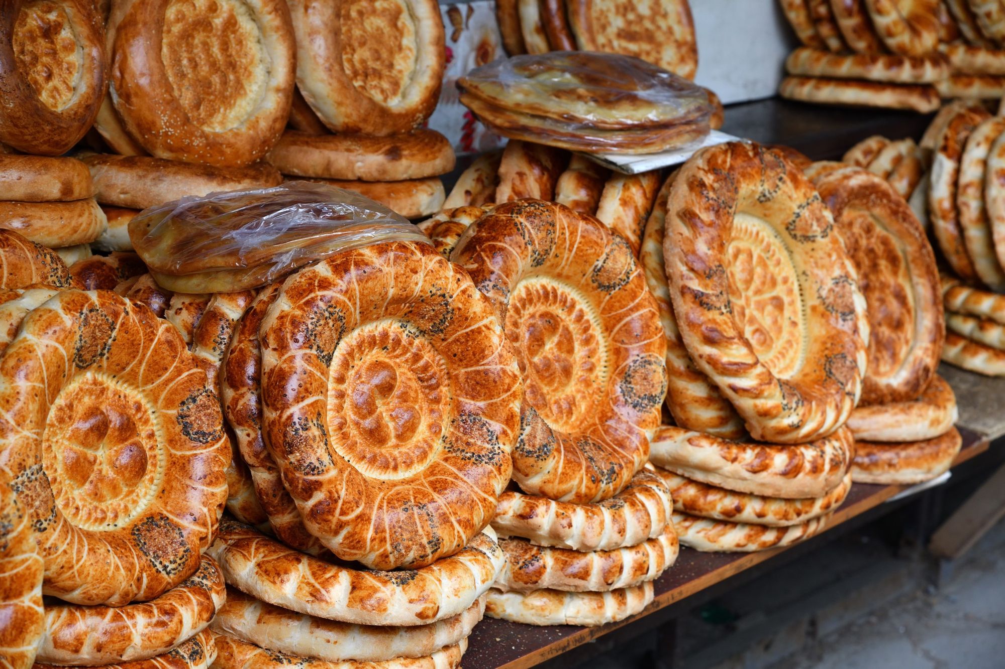
In the Tian Shan area, Ashlan Fu, a spicy noodle soup served with egg and diced vegetables, is very popular. Various meat-stuffed dumplings are popular throughout the country, as is lepyoshka, a circular yeasted bread cooked in a tandyr oven.
How to Get to (and Around) Kyrgyzstan’s Tian Shan
By Plane: The most common way for international travellers to reach the Tian Shan is by flying into Manas International Airport (FRU) in Bishkek, the capital of Kyrgyzstan. There are direct flights from Asia and the Middle East. Travellers from America and the UK are best off transferring via hubs such as Istanbul or Dubai.
By Bus/ Minibus: Public transport is limited in Kyrgyzstan, but you can get a shared taxi, bus or minibus (matrsuka) to Karakol, a town on the eastern end of Lake Issyk-Kul - and the gateway to the Tian Shan. This journey takes about 6-7 hours by road.
By Car: Due to limited transportation options, hiring a car might be your best option if you want to reach remote villages and trailheads. In the colder months, especially, we’d recommend hiring a 4x4 to better navigate the mountain roads.
Inspired? Why not check out our adventures in Kyrgyzstan?