


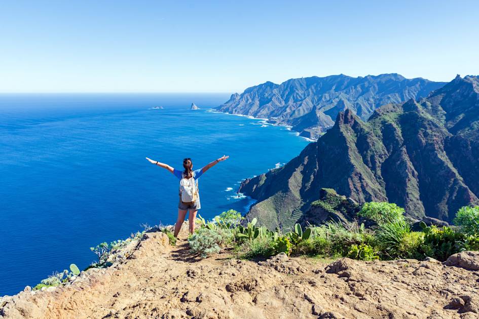
Nestled in the Atlantic Ocean, the Canary Islands are a Spanish archipelago made up of seven main islands: Tenerife, Fuerteventura, Gran Canaria, Lanzarote, La Palma, La Gomera, and El Hierro. Located closer to the northwest African coast than to mainland Spain, the archipelago is famed for its subtropical climate and year-round sunshine. But there's more to the Canary Islands than just sunbathing on the beach—they are a haven for hikers, offering an extensive network of trails that weave through the archipelago.
The Canary Islands' allure as a hiking destination lies in their diverse landscapes, which range from lush rainforests and towering peaks to volcanic beaches. Approximately 40% of the islands’ landmass are designated as protected areas, preserving their unique natural beauty. Highlights include the rare laurisilva forests of Garajonay National Park, Teide National Park surrounding the 3,718m-high (12,198ft) Mount Teide on Tenerife, and the Risco Caído volcanic region of Gran Canaria—all of which are UNESCO World Heritage Sites.
Gran Canaria is known as a ‘continent in miniature’, due to its variations of terrain, from its lush green forest to rocky hinterlands and sand dunes in the south. "I’ve lived in a lot of places in the world and Gran Canaria feels like you're travelling even though you’re staying on one island," says destination expert Rachael Hollwey.
Equally, little-known trails through otherworldly volcanic landscapes await on Tenerife and Lanzarote, two islands better known for flop and fry tourism. Meanwhile, on the quieter islands of La Gomera, La Palma and El Hierro, hikes through peaceful forests and up rocky outcrops await.
We’ve selected these 10 trails as the best hikes in the Canary Islands:
- El Pico de Las Nieves, Gran Canaria
- Mount Teide Trek, Tenerife
- Roque Nublo Circular Hike, Gran Canaria
- Gran Ruta 18 to Garajonay, La Gomera
- Cruz del Carmen to Mirador de Aguaide Circular Hike, Tenerife
- Caldera Blanca Hike, Lanzarote
- Playa Quemada to Playa Blanca, Lanzarote
- El Sabinar Circuit, El Hierro
- GR131, La Palma
- Pico de la Zarza, Fuerteventura
It’s important to note that the routes described below are only short summaries, designed to inspire but not to serve any navigational purpose. They are not intended to guide you on the route and further mapping and planning (or a local guide!) will be required if you want to safely walk any of the trails featured.
Here’s our guide to the best walks in the Canary Islands, when to visit and where to stay.
10 of the Best Hikes in the Canary Islands, Mapped
This map shows the start points for all the hikes listed in this guide, organised into difficulty level. You'll see that the majority of them are challenging - by this we mean you’ll be pleasantly tired at the end of the day, but it’s nothing an experienced hiker with a good level of fitness can’t handle.
10 of the Best Hikes in the Canary Islands
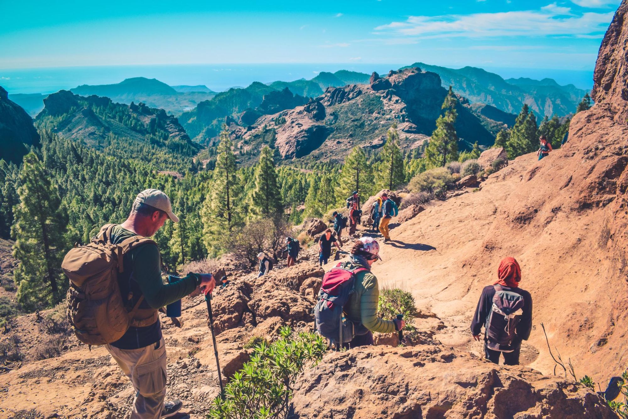
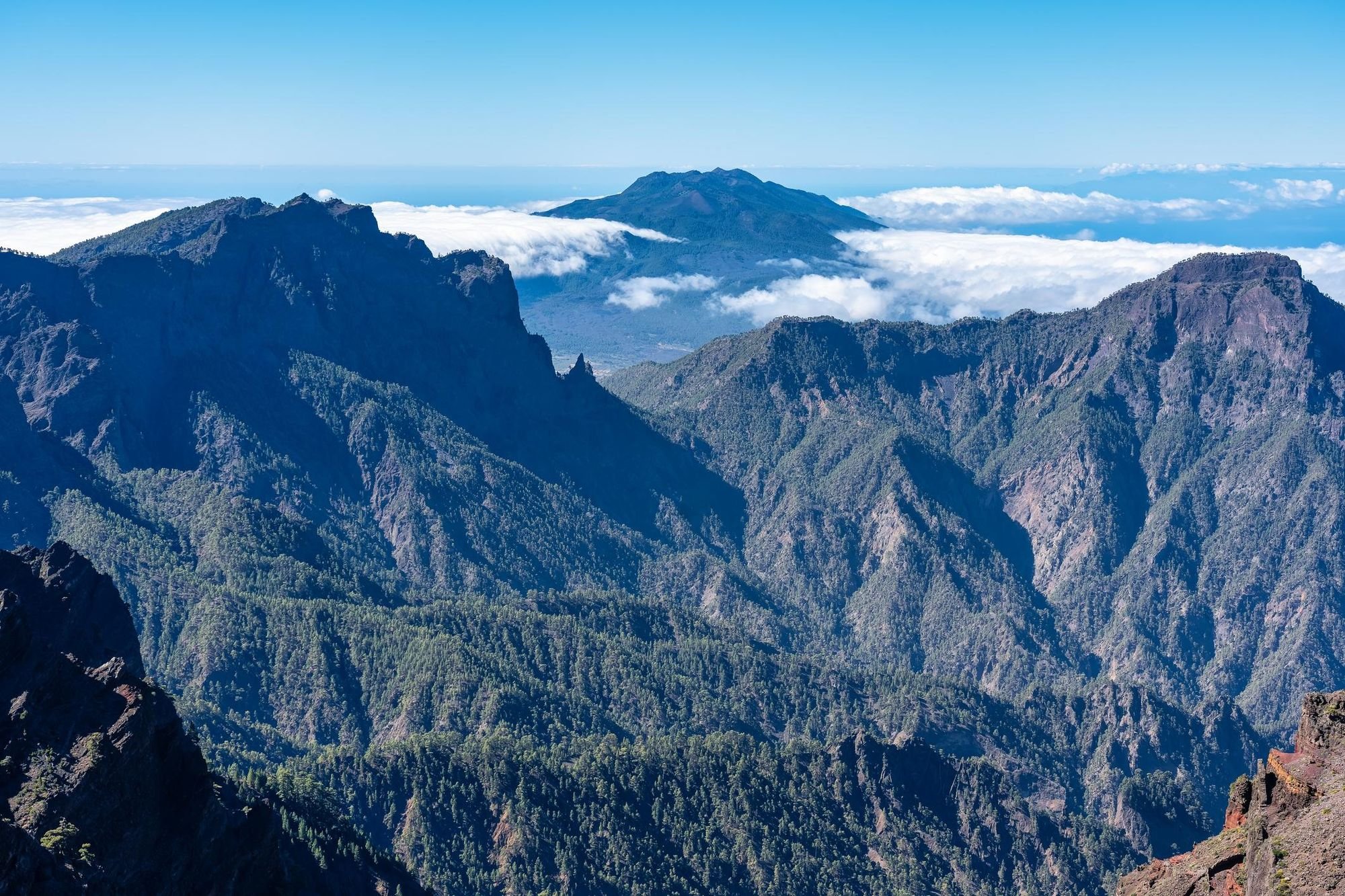
1. Pico de Las Nieves, Gran Canaria
- Start/Finish: Barranco de Guayadeque/Pico de las Nieves (point to point)
- Distance: 13.4 miles (21km)
- Walking time: 9-10 hours
- Difficulty: Challenging
- Best for: Gorges and pine forests
Gran Canaria is known for being a continent in miniature, because of its plethora of habitats - black sand beaches, volcanic mountain ranges and verdant forests. On this intrepid day hike you’ll be climbing to Pico de las Nieves (1,950m) - not to be confused with Pico de la Nieve on La Palma.
You’ll begin the day by hiking through Barranco de Guahadeque, an ancient volcanic gorge. Pre-Hispanic mummies, pottery and more have been found in its caves - the steep walls make for an atmospheric trek.
After the gorge you’ll trek up through pine forest and climb a mountain pass before heading to the summit of Pico de las Nieves. This will give you a spectacular view over the island - just a few kilometres away is the large, thumb-shaped Roque Nublo.
This being a point to point hike, you’ll need to arrange transportation from the car park near Pico de las Nieves, or a stay at a nearby campsite or guesthouse.
2. Mount Teide Trek, Tenerife

- Start/Finish: Montaña Blanca (out-and-back)
- Distance: 11.6 miles (18.7km)
- Walking time: 14 hours
- Difficulty: Challenging
- Best for: Climbing to the highest point in Spain
Mount Teide, located in Tenerife’s Teide National Park, is one of the highest volcanoes in the world, towering at 3,718m (10,426 ft). You will encounter an otherworldly landscape of rock formations, craters and rivers of petrified lava all under the impressive shadow of Mount Teide, as you hike a marked trail up the burnt slopes.
Due to the sensitive volcanic environment on Monte Teide, the National Park limits the number of people who can climb to the summit of the crater daily. You will need to apply for a free permit to climb to the peak, you can do this through the Teide National Park website. Once you have filled out the form, print the permit and take it along with your ID to present at the beginning of the trail. Be sure to be prepared for the higher altitude, changing temperatures and spectacular views.
There are a few ways you can access Mount Teide. You can take the cable car to the base station and then strike out for the summit. However, we recommend hiking up its slopes, starting at Montaña Blanca. It’s a four hour hike to the mountain refuge of Altavista, with an elevation gain from 1,367m to 3,260m. You can continue on to the summit - up a steeper path - which takes around three hours - on the same day. However, we recommend staying at the refuge overnight and reaching the summit in time for sunrise. This is an out and back hike, but you can shorten it by catching the cable car back down the mountain.
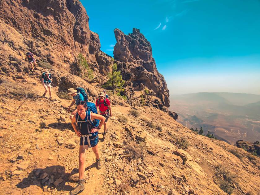
3. Roque Nublo Circular Hike, Gran Canaria

- Start/Finish: Cruz de Tejeda (loop)
- Distance: 11.8 miles (19km)
- Walking time: 7 hours
- Difficulty: Challenging
- Best for: Exploring Gran Canaria’s rocky hinterland
This circular hike begins in Cruz de Tejeda, a village historically known as a crossroads for travellers. The first part of the trail takes you down a dirt trail and quiet roads to the village of Tejeda, an alternate start point. From here, you walk to Tejeda’s most well-known viewpoint, Plaza Mirador del Ayuntamiento, where you can see the Tejeda Caldera with Roque Nublo visible in the background.
The hike then continues along a trail winding through volcanic rock formations, with an uphill trek of about three hours. Along the way, you'll encounter small cave houses and scenic views of both Roque Bentayga and Pico de las Nieves.
After a few hours, the path levels out and takes you through a dense pine forest before emerging back onto rocky terrain - the caldera of an ancient volcanic eruption. As you approach Roque Nublo, the landscape reveals various rock formations, including ‘The Friar’, and mystical Roque Bentayga in the distance. The final incline leads to a rocky plateau where you can enjoy panoramic views of the caldera and take a break for lunch.
The hike concludes with a return to Tejeda, either by retracing your steps or taking a different route through the La Culata Tejeda hiking area, where you'll pass through unspoiled Canarian villages and more cave houses.
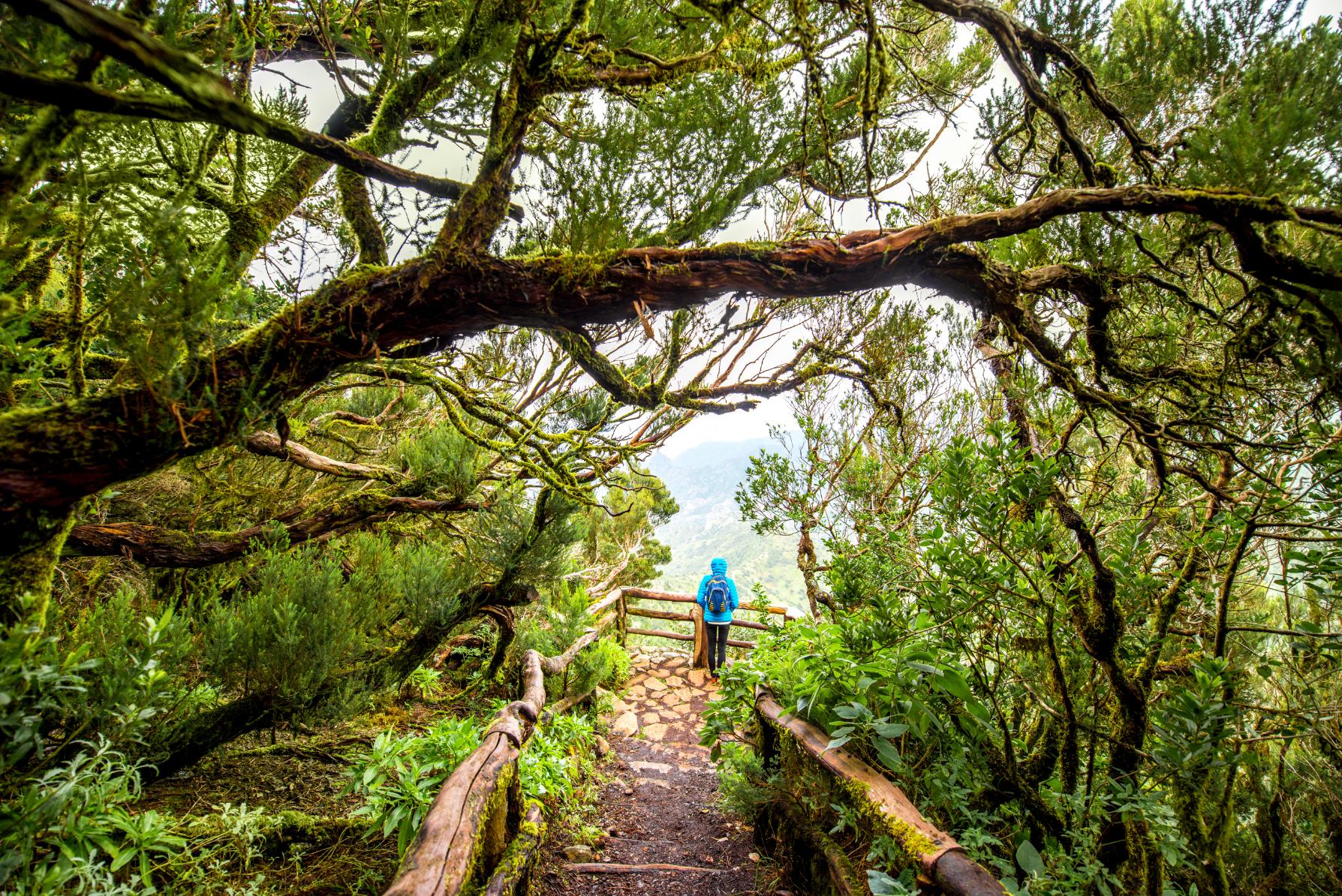
4. Gran Ruta 18 to Garajonay, La Gomera
- Start/Finish: Pajarito (loop)
- Distance: 10.2 miles (16.5km)
- Walking time: 7-8 hours
- Difficulty: Moderate
- Best for: Exploring La Gomera’s diverse landscapes
This trek takes place in Garajonay National Park, designated a UNESCO site due to its well preserved laurel forests, a lush environment often surrounded by a sea of fog. A circular day hike will take you around this fascinating environment.
The walk (waymarked as trail 18) starts at Pajarito, where there’s a bus stop and car park. It starts with a short but demanding ascent up to Alto de Garajonay, the highest peak in the park at 1,529m (5,016ft). You’ll have panoramic views over La Gomera, and on a clear day you might even be able to see the islands of La Palma and El Hierro.
After enjoying the views, you’ll descend through a cobbled forest track towards Alto del Contadero. From here, you’ll hike downhill through the Barranco del Cedro, a lush ravine following the Cedro River through ancient laurisilva forest. After a few miles you’ll reach the village of El Cedro - an alternative start point to the trek. Continue descending to the viewpoint of Chorro del Cedro, a high waterfall.
It’s now time to climb back up to the starting point through the natural park, following a quiet road part of the way. There are spectacular views of Los Roques - ancient volcanic rock outcrops jutting from the forest - and the ravines and gorges of the island as you hike.
5. Cruz del Carmen to Mirador de Aguaide Circular Hike, Tenerife

- Start/Finish: Cruz del Carmen (loop)
- Distance: 7.8 miles
- Walking time: 4-5 hours
- Difficulty: Moderate
- Best for: Exploring the Anaga Mountains Biosphere
A circular hike through the Anaga Rural Park, a UNESCO Biosphere Reserve renowned for its biodiversity and pristine landscapes; dense forests, sharp peaks, and deep ravines.
Starting at Cruz del Carmen restaurant, you’ll hike for a few kilometres through dense forest. Emerge the other side for views of mountains with terraced fields, and Roque de Taborno in the background. Expect spectacular views as you continue hiking through the Anaga Mountains. You’ll soon reach the mountain village of Chinamada, with its houses built into the hillside - you can stop here for a meal and refreshments.
A short walk from the village is the Mirador de Aguaide, a viewpoint offering breathtaking panoramas of the surrounding mountains and the pounding Atlantic Ocean. After admiring the view, head back from Chinamada into the forest, where you can follow an alternative trail back to Cruz del Carmen.
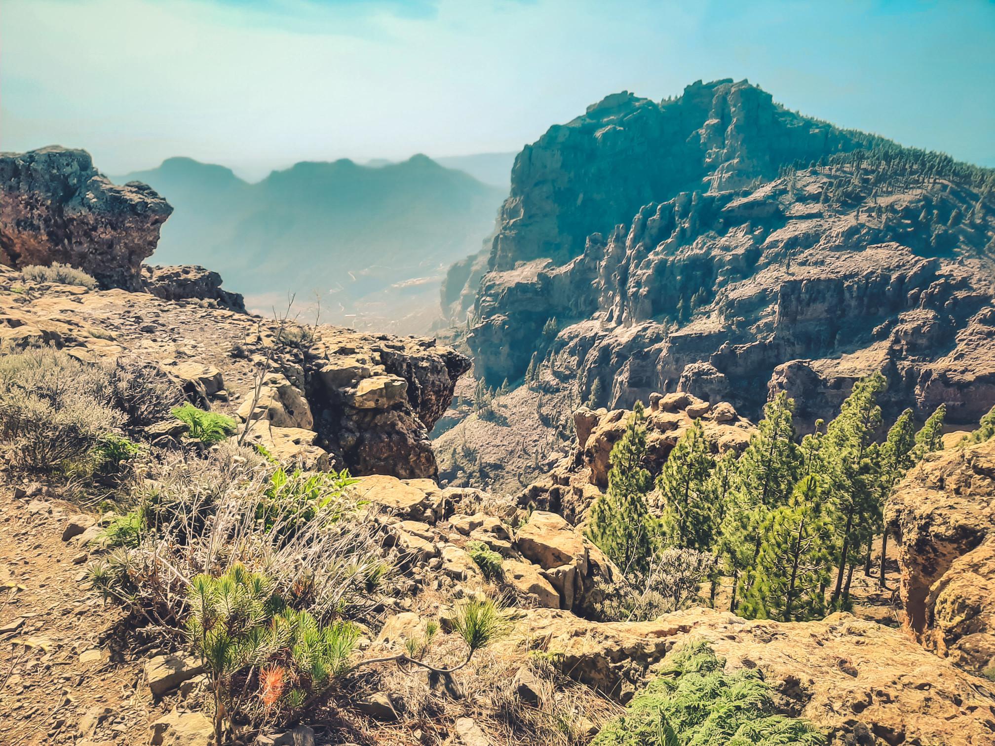
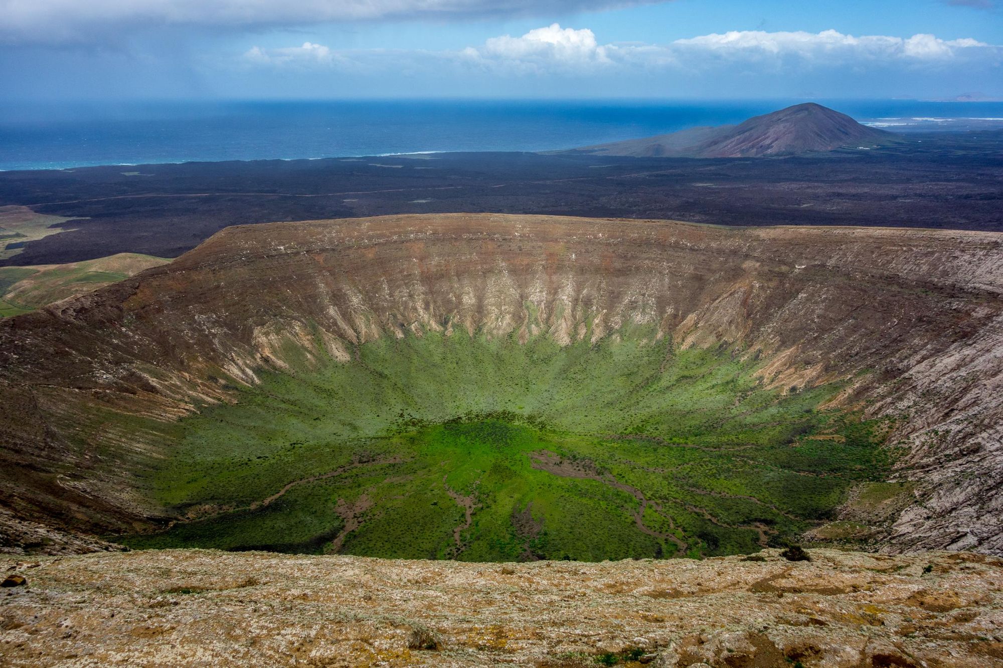
6. Caldera Blanca Hike, Lanzarote
- Start/Finish: Mancha Blanca (out-and-back)
- Distance: 5.7 miles (9.3km)
- Walking time: 3 hours
- Difficulty: Moderate
- Best for: Circling the caldera of a volcano
This out-and-back trail starts in the village of Mancha Blanca and leads to the impressive Caldera Blanca, a large volcanic crater. The route is characterised by its stark, volcanic landscape, and involves roughly 400m (1,312ft) of ascent.
You’ll follow a marked path from the trailhead near Mancha Blanca across an ossified lava field, the caldera in front of you. The footpath will take you diagonally up the slopes of the caldera and onto its rim - the trail leads all the way around the ridge, with a cairn to show the highest point. From the top you can see all the way to the ocean, and across this striking volcanic landscape.
Although only a short hike, we’ve graded it as ‘moderate’ rather than ‘easy’, as there’s no shade along the route, and the volcanic terrain can be uneven.
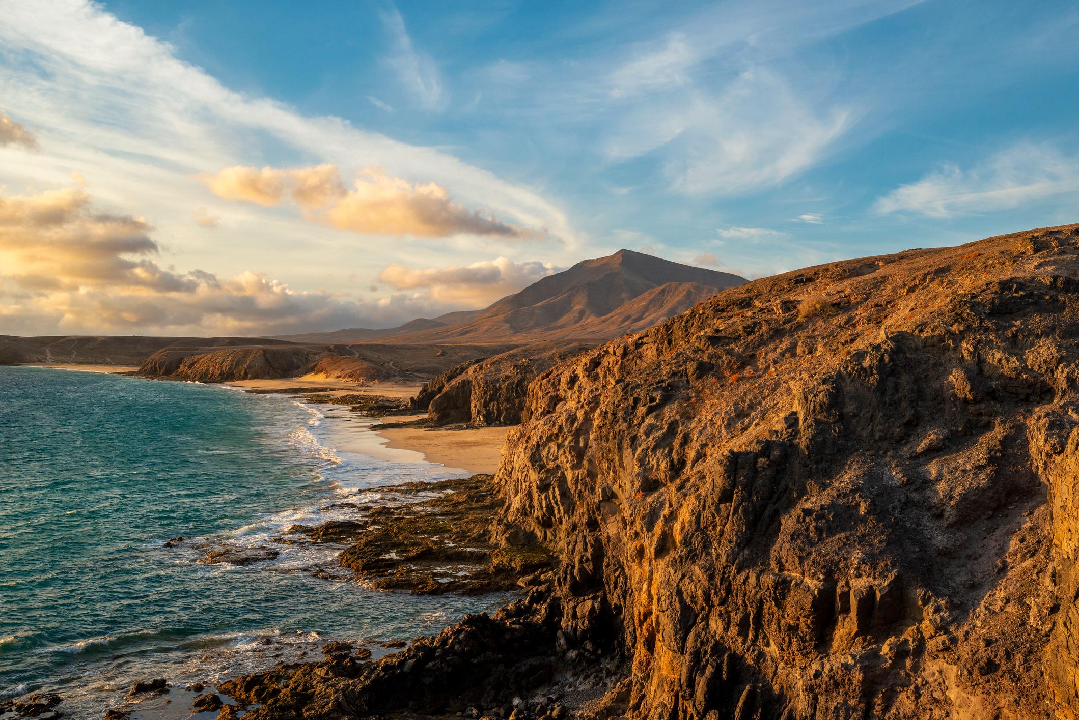
7. Playa Quemada to Playa Blanca, Lanzarote
- Start/Finish: Playa Quemada/ Playa Blanca (point to point)
- Distance: 11.6 miles (18.7km)
- Walking time: 4-5 hours
- Difficulty: Moderate
- Best for: Stunning coastal views
A hike along Lanzarote’s spectacular southern coastline, which takes you through the Los Ajaches volcanic area, where the gleaming blue ocean contrasts with the dark lava. Beginning in Playa Quemada, you’ll hike out of town and follow a zig zagging trail up a volcanic slope towards Playa del Pozo, a small black sand beach. Continuing, you’ll pass the Flecha de Los Ajaches, 100m-long arrow etched into the rock. Descend to the Barranco de la Casita and you’ll find a secret garden of cacti and rocks, nestled into the base of the cliff.
From here, you’ll climb up a set of hills past the coves of Los Dises and into the Barranco de los, a V-shaped ravine. Then you’ll travel inland towards Monumento Natural de los Ajaches, a volcanic area of ridges and mountains, the sparse terrain coloured ochre, white and rust orange. Continue through this region, passing through barrancos and past beaches, until you reach the turquoise coves and high cliffs of Papagayo Beach. From here, it’s just a short walk along the coast to the more built up Playa Blanca.
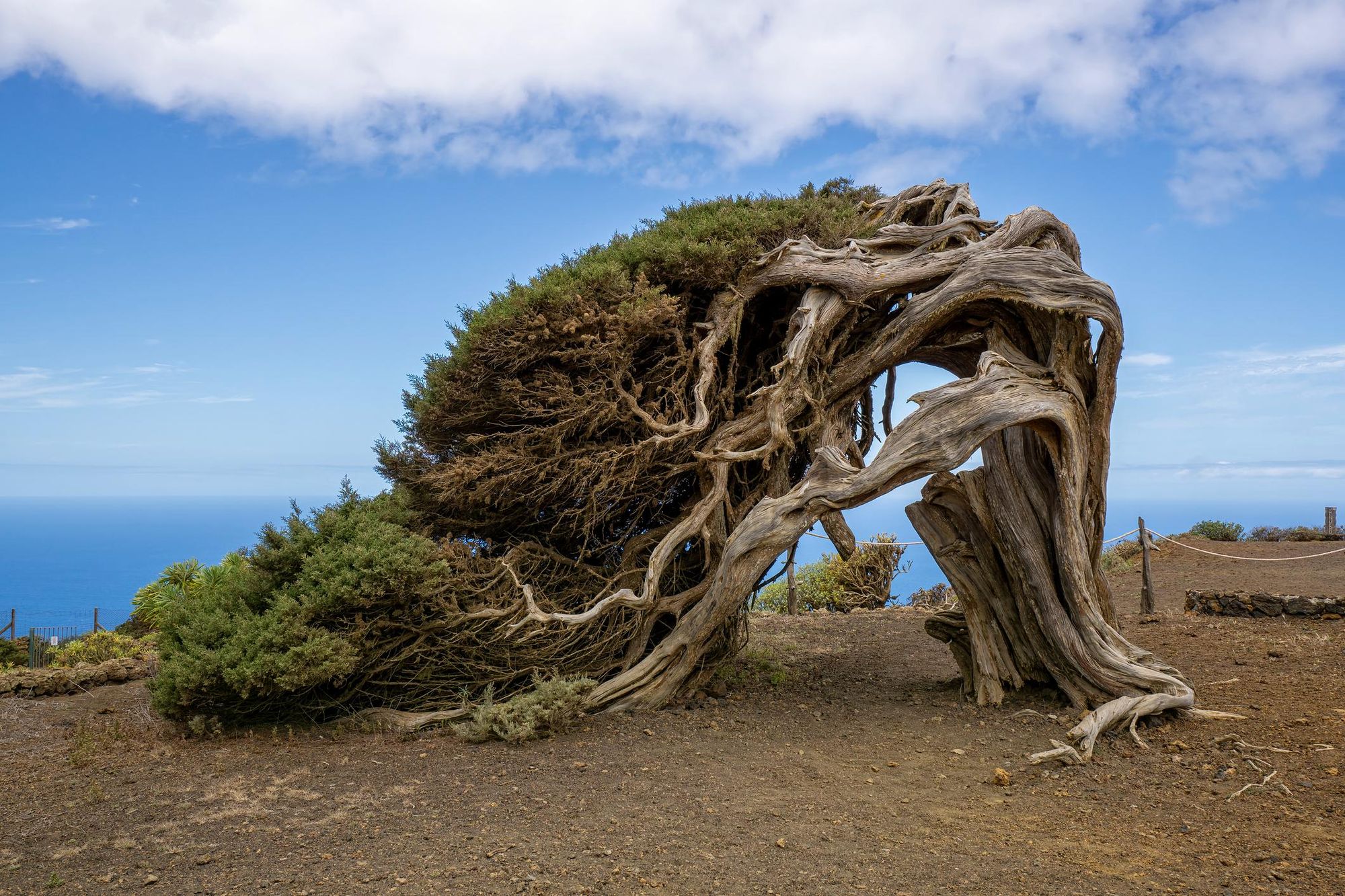
8. El Sabinar Circuit, El Hierro
- Start/Finish: Santuario Virgen de los Reyes (loop)
- Distance: 5.7 miles (9.1km)
- Walking time: 2-3 hours
- Difficulty: Easy
- Best for: Fairytale forests
A picturesque circuit hike along El Hierro’s PR-EH9 trail. It begins at a small church - Santuario Virgen de los Reyes - and continuing along the trail to the Piedra de los Regidores, a square stone. Here the path divides - follow it uphill to reach the Mirador de Bascos, a viewpoint with panoramic ocean views.
On your return you’ll pass through the enchanting La Dehesa, a spruce forest with trees blown by the wind into extraordinary shapes. The most famous is El Sabinar, with its dramatically curved trunk - it’s a symbol of the island. Continue on through the forest and you’ll return to Santuaria Virgen de los Reyes. It’s an easy, but scenic hike, with little in the way of ascent and descent.
9. GR131, La Palma
- Start/Finish: Tazacorte/Fuencaliente lighthouse
- Distance: 40.3 miles (65km)
- Walking time: 3-4 days
- Difficulty: Challenging
- Best for: A multi-day hike on the Canary Islands
The G131 is a long distance hiking trail that runs coast to coast across each of the 7 Canary Islands for 348 miles (560km). The G131 on La Palma, known as ‘El Baston’, runs inland from the port of Tazacorte and down the volcanic ‘spine’ of the island to its southern tip - a route of around 40 miles (65km).
The route can be divided into three or four stages, and walked over the same amount of days, depending on your preferences. You’ll begin with a steep and continuous ascent from sea level to the edge of a volcanic crater, passing El Time, a popular viewpoint, before reaching the campsite near Roque Palmero.
The second stage traverses the crater rim, undulating gently past Roque de los Muchachos and ending at Rifugio Punta de los Roques, a well-equipped mountain hut (and one of the few accommodation options en route). The penultimate stage takes you through pine forest to El Pilar rest area makes for a good campsite. After this, the final stage is a descent through volcanic landscapes to the lighthouse at Fuencaliente.
This multi-day hike introduces you to the beaches, forests and volcanoes of La Palma, taking you truly off the beaten path. You can find guesthouses to stay at, or you can apply for a permit to wild camp along the route.
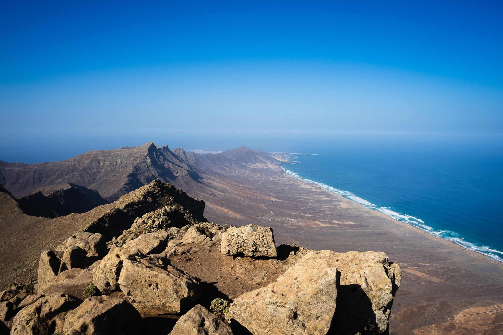
10. Pico de la Zarza, Fuerteventura
- Start/Finish: Parking Pico de la Zarza (out-and-back)
- Distance: 7.9 miles (12.7km)
- Walking time: 5-6 hours
- Difficulty: Moderate
- Best for: A coastal peak with a darn good view
This well-trodden track will take you up to the top of Pico de la Zarza, an 807m (2,647ft) mountain which is the highest point of Furteventura Island.
You'll follow a wide gravel path, passing through the burned, brown colour scheme typical of this part of the island. Listen out for goats as you go. Things get steeper as you ascend. Passing through a green gate, you'll continue up to the summit. It's likely you'll encounter some people around here, as this trail is pretty popular.
If it's a clear day, the view from the peak is remarkable, looking out over the Cofete coastline, at the water lapping up on the shore, and the giving a great view of the slope of the island.
Be aware that there are dangerous ridges and a sheer cliff at the summit, so be careful when you're up there. This trail also has no shade - so it can get hot - and the peak may well be shrouded in clouds, making navigation tricky.
When is the Best Time to Hike in the Canary Islands?
The Canary Islands are a year-round hiking destination, thanks to a stable, sub-tropical climate. In fact, they’re often cited as having one of the best climates in the world, with over 3,000 hours of sunshine a year. Winters are mild, with temperatures averaging between 18°C - 22°C - although it gets cooler once the sun goes down, and you might experience some infrequent rain. The summer months are warmer, with an average temperature of 26°C across the islands - the trade winds blowing across the islands mean it never becomes unbearably hot.
That being said, we think the best seasons for hiking in the Canary Islands are the shoulder seasons of spring and autumn. In spring (March to May) the temperature typically ranges from 18°C to 25°C, and the landscapes are greener after the winter rains. In Autumn, temperatures range from 20°C to 26°C, and sea temperatures are still warm from summer. In both seasons you’ll avoid the influx of summer tourists, and the peak Christmas period, when people visit in search of winter sun.
What Animals Live on the Canary Islands?
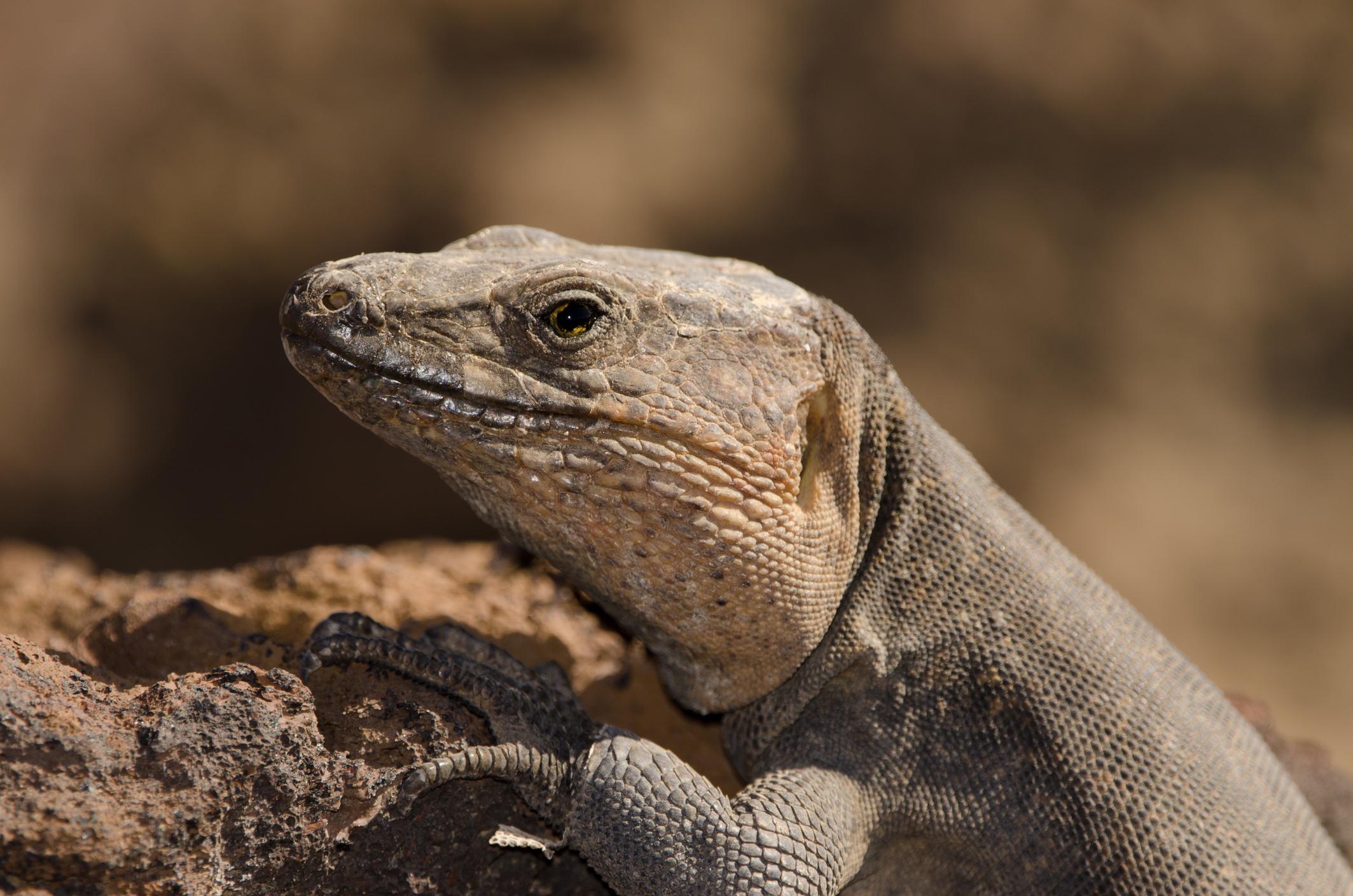
There are 17,107 types of land animals and 7,150 marine species living on the Canary Islands, according to the Canarian Biodiversity Data Bank. Just over a quarter of these are endemic species, and include the Canary shrew, the Gran Canaria giant lizard and the blue chaffinch.
The ocean surrounding the islands is rich in marine life. The Canary Islands are a popular spot for whale and dolphin watching tours, as they’re one of the few places where it’s possible to see cetaceans year-round. Keep an eye out for bottlenose dolphins, pilot whales and rarer blue whales amongst others.
Where to Stay in the Canary Islands?

Considering there are seven Canary Islands, the answers to this question are almost endless. However, we have a few recommendations for hikers looking to steer clear of the ‘fly and flop’ resorts the islands are known for. On Tenerife, we recommend basing yourself in Los Silos, an unspoilt town in the rugged northwest of the island. You’re within a 30 minute drive of the Teno Mountains and some spectacular beaches; and within an hour of Mount Teide.
For hiking in Gran Canaria, we recommend staying inland within the Nublo Rural Park, a 26,000 hectare UNESCO biosphere reserve which encompasses pine forests, verdant barrancos (gorges) and volcanic rock formations such as Roque Nublo.
Wherever you choose to stay, keep an eye out for sustainable and locally-run accommodation, where profits will be circulated within the local community, rather than abroad. There are plenty of options.
What to Eat in the Canary Islands?

The food on the Canary Islands is distinct from Spanish tapas (although sharing food is common), situated as they are at the crossroads between Europe and Africa. Canarian dishes you’ll find across all the islands include conejo en salmorejo (marinated rabbit stew), gofio escaldado - a savoury porridge of toasted flour and fish broth - and papas arrugadas, wrinkled potatoes cooked in salt water and served with mojo, a pepper sauce.
There are also dishes and ingredients which originate from specific islands, such as almogrote from La Gomera - a paste of hard cheese and peppers - and Quesadilla herreña, a cheesecake flavoured with lemon and cinnamon from El Hierro.
To try Canarian food, head to local tavernas off the tourist trail, or to a guachinche - traditional restaurants where locally produced wine is served alongside traditional dishes.
How to Get to the Canary Islands?
By plane: There are eight airports in the Canary Islands - one on each island, and two on Tenerife. La Gomera Airport and El Hierro Airport only have domestic flights to other Canarian airports, but the other six are international. The two largest airports on the archipelago are Gran Canaria Airport and Tenerife South Airport (Reina Sofía Airport), both of which fly to 28 countries across Europe and Africa. From Tenerife South you can also fly to New York.
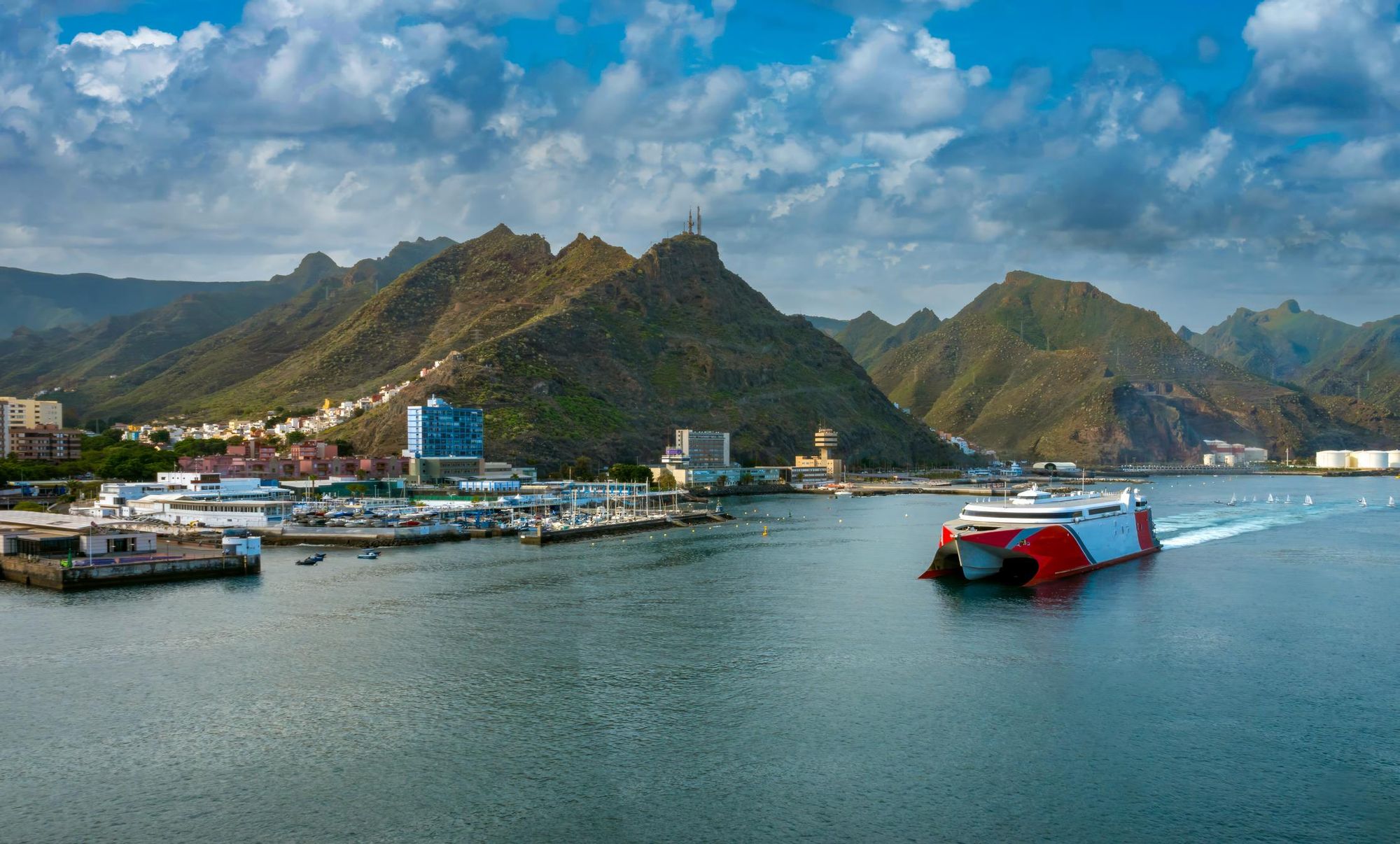
By ferry: It’s possible to reach Tenerife, Lanzarote and Gran Canaria by ferry from the Spanish ports of Cadiz and Huelva. Considering all of these journeys take in excess of 24 hours, most people opt for flights. However, ferries are often used to hop between the different Canary Islands, especially La Gomera and El Hierro, which don’t have their own international airports. The ferry from Tenerife to La Gomera runs up to five times daily, and takes roughly an hour; while the ferry from Tenerife to El Hierro takes around two and a half hours.
Read More:
- Hiking the Secret Hinterlands of Gran Canaria
- A Guide to Hiking Roque Nublo, Gran Canaria's Enigmatic Monolith
- It's Time to Rediscover Mallorca - But Not as you Know it
Inspired? Check out our adventures in Spain and the Canary Islands, including our Hike the Volcanic Island of Gran Canaria.