


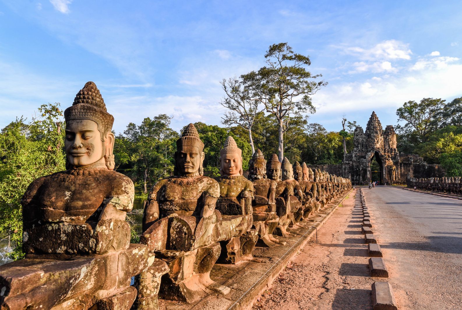
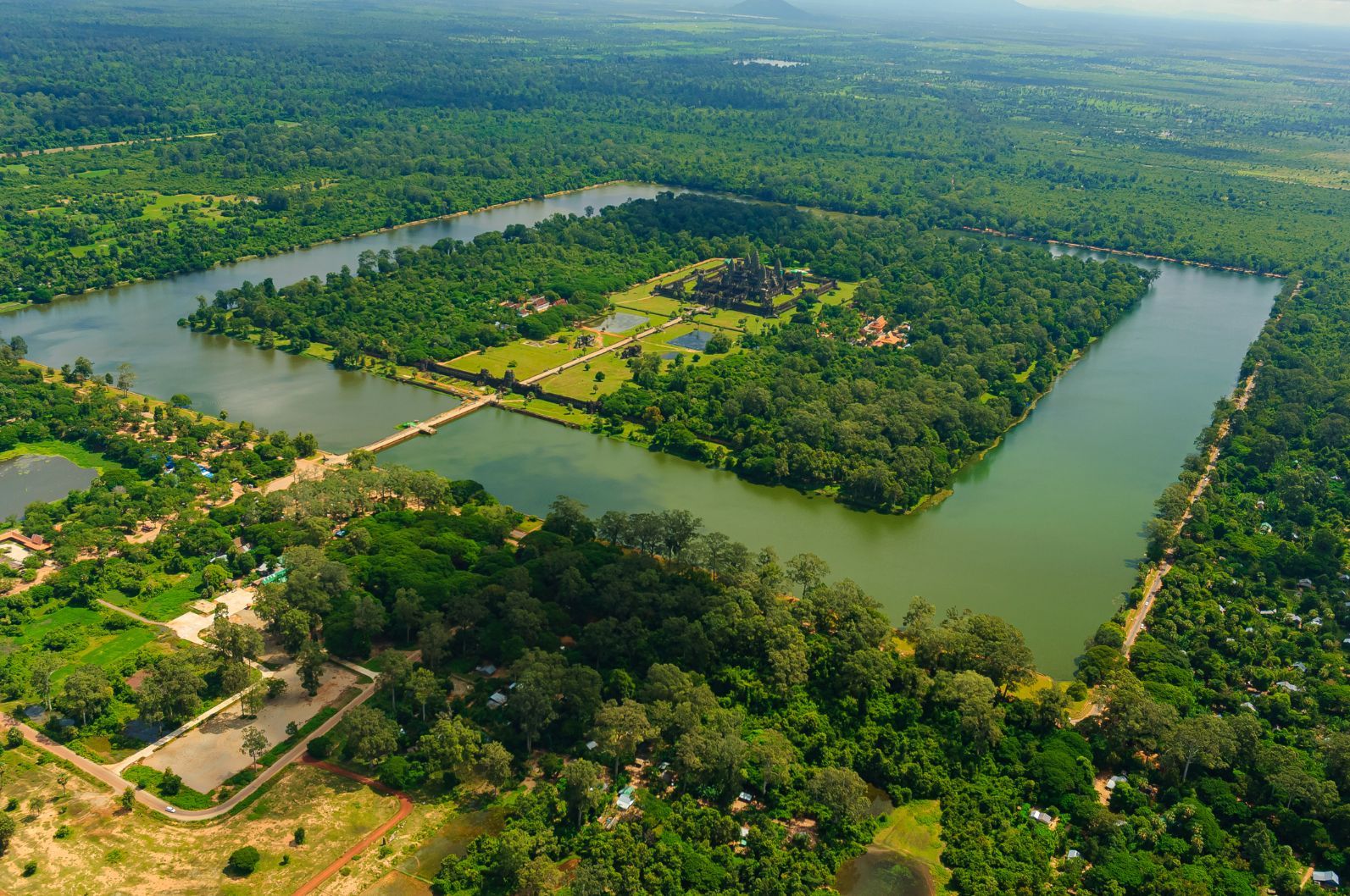
There are seven entrances to Angkor Wat, the legendary temple at the centre of the ancient city of Angkor in Cambodia, once the mediaeval metropolis of the Khmer Empire. The main entrance to the World Heritage Site is known as the Western Gopura. It takes you across the enormous moat that surrounds Angkor Wat, measuring 6km in length and 200m wide.
The Western Gopura is almost as grand as the temple itself, the bridge being lined with intricate statues, and leading to a remarkable entry arch.
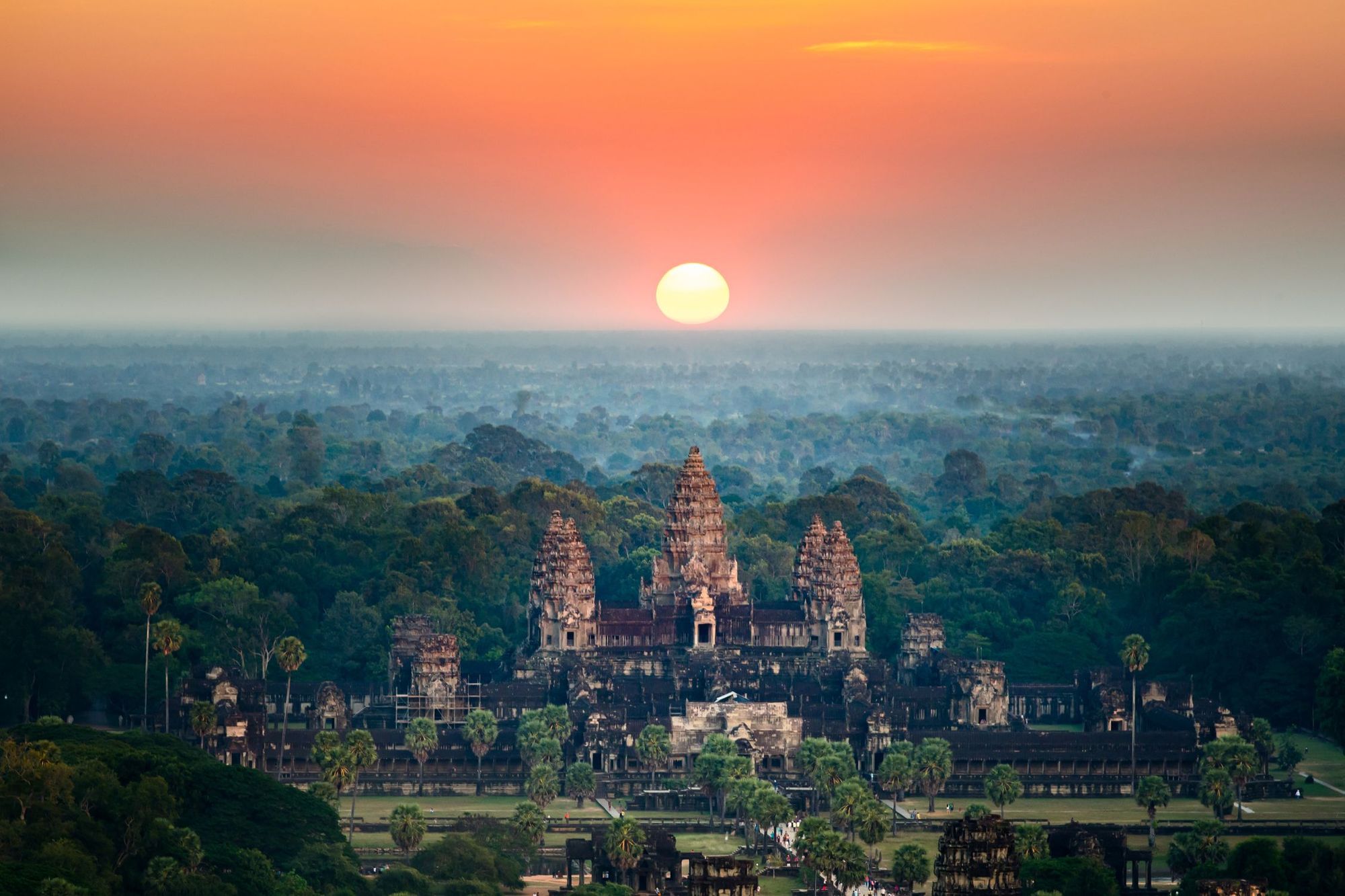
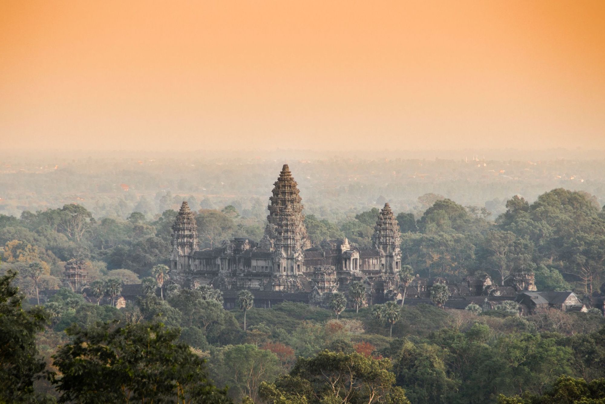
As you enter Angkor Wat, you’ll find yourself looking at what remains today the largest religious monument in the world - three times the size of the Vatican City. The five large towers of the monument immediately draw your gaze. They’re shaped like lotus buds, the symbol for beauty, fertility, prosperity, spirituality and eternity in Hinduism, which was the ruling religion of the Khmer Empire at the time of Angkor Wat’s construction, in the first half of the 12th century.

The temple is perfectly symmetrical, and covers an area of 2km squared. It was built as a Hindu temple by 300,000 workers, ordered by King Suryavarman II.
The temple was an effigy to Hindu cosmology, though it was later converted to a Buddhist temple, when King Jayavarman VII came to power in the late 12th century and introduced Mahayana Buddhism to the Khmer people.
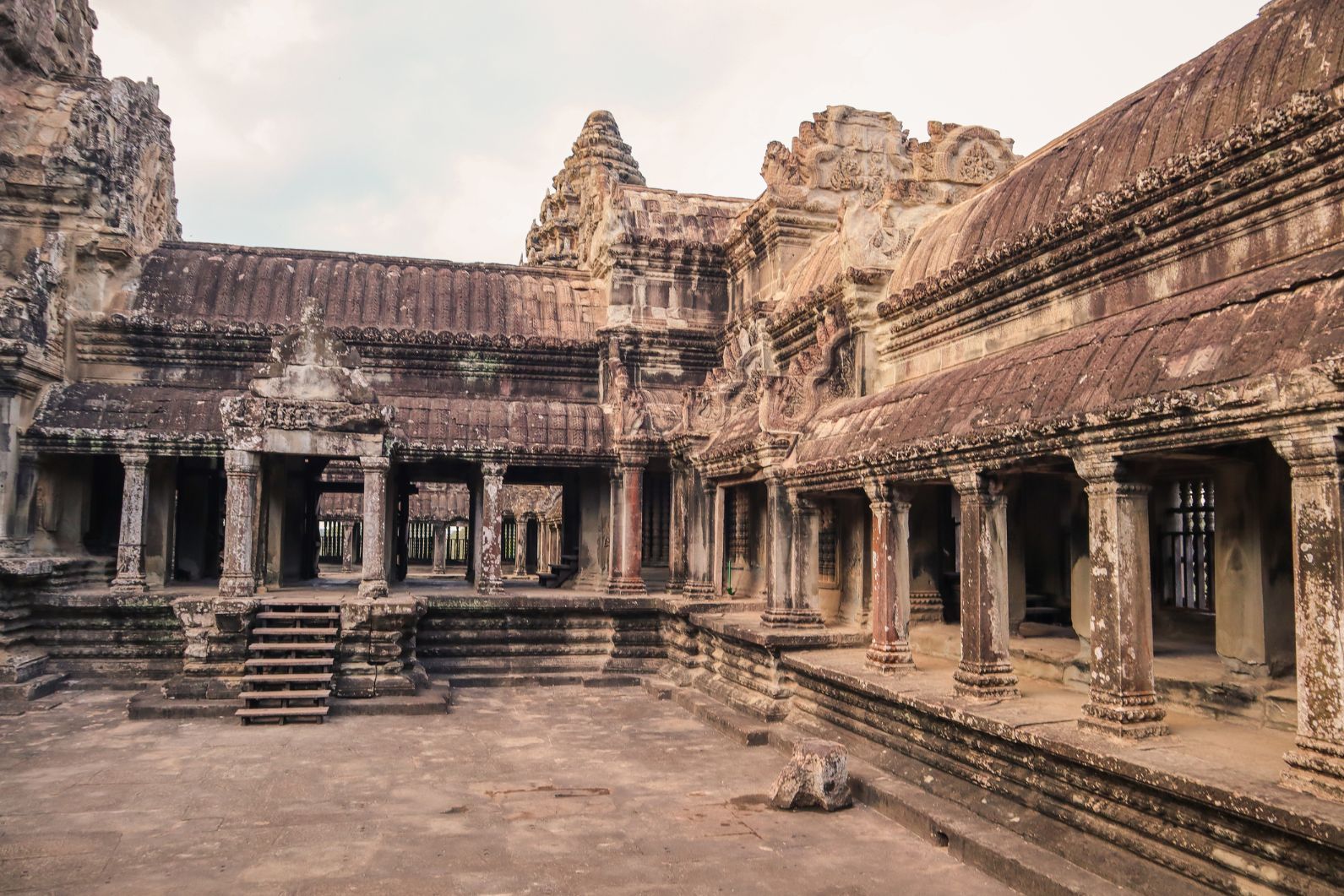
The temple was built in just under 40 years, which is quite remarkable when it’s considered that at the same time, the Normans in Europe were commonly spending over a century making their intricate cathedrals. The bas-reliefs of Angkor Wat feature nearly 2,000 celestial dancers from Hindu mythology carved into them - with 2km of engravings in total, each of which are unique.
The temple was built using laterite, a breeze block-style building core, then piling tightly-packed sandstone on top. It was the result of pioneering mathematics, artistry and engineering. This temple was the symbol of the great city of Angkor - and a representation of the wealth and power of the Khmer Empire.
Angkor was the largest city built in human history before the industrial revolution...
At the height of its power, almost 750,000 people lived in Angkor. The city built in the ninth century grew larger than modern-day Los Angeles. It thrived at a time when Europe was still emerging from the Dark Ages - and the city of London was home to only 18,000 people. Angkor was the largest city built in human history before the industrial revolution, and Angkor Wat is at its centre.
The city thrived for six centuries, then as Europe was entering the Renaissance, Angkor mysteriously disappeared. Today, the stone temples that the kings built for their Gods are all that remain. To understand why the metropolis fell, it’s important to first understand how it became such an unprecedented power.
It’s believed that the Khmer Empire began in the Kulen Hills, a vibrant area 40km from Angkor Wat, 300 years before the temple itself would be built. The first temple of the Khmer Empire has been traced to a mountain top called Mahendraparvata, which was Khmer’s first capital city.
Discoveries like this have only been possible in the last couple of decades, however. From 1975-1979, Cambodia was a totalitarian state, ruled by the Communist Party of Cambodia, or Khmer Rouge, and the dictator Pol Pot. More than half a million people died under his rule, and after the 70s, the Kulen Hills became one of the last retreats of the Khmer Rouge. Tourists would’ve been kidnapped or killed if they visited. The area remains heavily mined today.
Angkor itself was built around 1000 years ago. Archaeologists have been studying it for over 150 years, but there have been an array of recent breakthroughs thanks to new laser technology called LiDar. It allows archaeologists to scan the area from the air, picking out ruins and city structures which otherwise would’ve taken decades to map from the ground.
LiDar has shown a network of canals, roads and even more hidden temples are dotted around the forests of Angkor. It’s now been proven that a metropolis existed here, with thousands of houses, monasteries and palaces organised into blocks and clustered around ponds, and around Angkor Wat.
Angkor was a hierarchical civilisation built on forced labour. There were schools, monasteries, markets and a system of taxing through temples. Poorer families built houses with less expensive and less durable materials like thatch, which explains why there are no remnants of such dwellings left.
Like the Mayans, the Khmer calendar was based on the cycles of the heavens, and Angkor Wat is covered in depictions of Hindu cosmology. Twice a year, tourists can still witness the celestial event where the capstone of the ceremonial chamber aligns with the sun, shining a beam of light into the chamber. Kings of the Khmer Empire used this alignment to claim their divine right, and to show the people that they were, as they claimed, not only kings, but part-God.
What allowed Angkor to grow from a forest dwelling to a sprawling metropolis was not the temples, though. They were the result of that growth. What allowed Angkor to thrive was its engineering, and in particular, the Khmer Empire’s ingenious system of water management.
A metre and a half of rain falls in Cambodia during the monsoon, from May to November. But that is nearly 90% of the annual total rainfall in the country. After that, the dry season comes, and with it temperatures as hot as 40°C. The rice fields outside Angkor were the pulse of the city, and they depended on a secure water supply. So, the people of Angkor decided to take on the environment, and rather than adapt to the dry and wet, control the water.
The Khmer people built two huge reservoirs known as Barays. The West Baray is the largest hand-dug reservoir on the planet, capable of holding up to 48-million cubic metres of water. To the naked eye, it's simply an enormous lake. These reservoirs would feed into a canal system that ran around the city, and which could distribute water to both the city and rice fields in the dry season.
This secured a reliable food supply for Angkor, which meant Kings could concentrate on other things - temple building, trade and expansion. The Khmer people were the road-builders in Asia at the time, creating a full 11,000km of road in total. Their kingdom grew to encompass almost all of Southeast Asia.
Those reservoirs are still used to irrigate fields today during the dry season, and the main river that runs through Angkor is still a canal. But it would be the same water system that allowed Angkor to thrive which would prove its downfall.
The emptying of Angkor has dumfounded historians for decades, but thanks to LiDar, and new techniques which make it possible to judge ancient weather patterns from the rings of old trees (without killing those trees), they have been able to paint a picture of what went wrong. Previous speculation that the collapse of Angkor was due to an attack by the Thai Kingdom of Ayutthaya seems false.
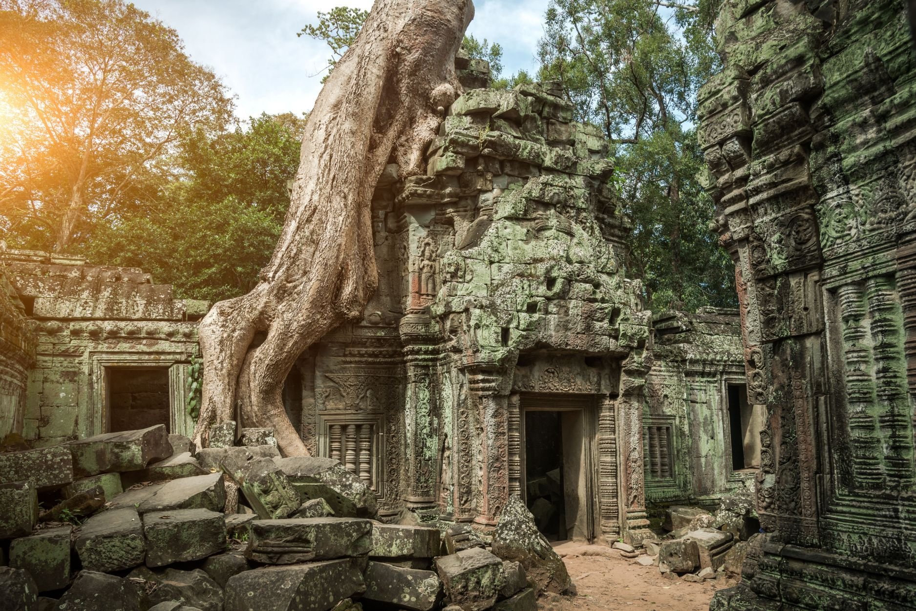
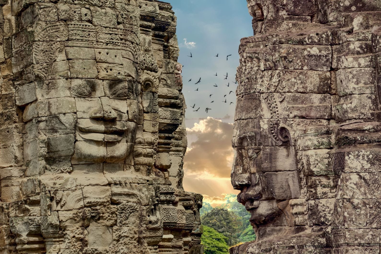
The trees have collapsed many of the temples, but Angkor Wat remains...
Archaeology suggests that by the mid 1200s, the people of Angkor had stopped maintaining their water management system. There was then a terrible drought of around three decades in the 14th century, followed by an extreme period of wet. It’s believed that this climate fluctuation collapsed the water system, overflowing the canals, flooding Angkor and causing the Khmer administration to abandon the city and establish Phnom Penh, Cambodia’s modern day capital.
After this, Angkor was lost to all but locals for the best part of 400 years. The city returned to the jungle. When French explorers journeyed into that jungle in 1860, they found the stunning temples of the Khmer Empire, hidden amongst the trees. Today, the city of Angkor is worth an estimated two billion dollars per year to Cambodia in tourism - nearly 20% of Cambodia's entire economy - and there's even a depiction of Angkor Wat in the centre of the Cambodian flag.
The trees have collapsed many of the temples, but Angkor Wat remains. It still faces threats, namely from water in the stones, the growth of pigeon guano, and from tourists who touch the carvings, eroding them over time. Even now, much of Angkor remains a mystery, and it remains humbling to visit Angkor - the ancient jungle town which became the the world’s mighty mediaeval metropolis.
Inspired? Check out our Ultimate Adventure Through Cambodia and Vietnam.