


The Batongguan Historic Trail is a 94.4 mile (152km) point-to-point hiking trail which crosses Taiwan’s dramatic Central Mountain Range, and is usually walked in eight stages. It begins in the indigenous village of Dongpu, a quiet mountain settlement best known for its hot springs. From there, it passes through forests of towering Taiwan red cypress and Japanese cedar into a high mountain environment. You’ll travel eastwards, eventually finishing the hike near the township of Yuli, on the east coast.
- Start point: Dongpu
- End point: Shanfeng Trailhead
- Length: 94.4 miles (152km)
- Stages: 8
- Altitude: 460m-3,327m
- Best for: Hikers with experience of wilderness camping
Although the majority of the Batongguan Historic Trail is located between an elevation of 2,000m (6,562ft) and 3,000m (9,843ft), there aren’t many summit climbs involved.
“There are peaks that you can climb as side trips, but the trail isn't designed to go from peak A to peak B to peak C,” explains Daniel Rios, a destination expert who recently hiked the trail. “It was built with that way in mind to make it as easy as possible.
“The Batongguan Historic Trail was initially created by the Japanese between 1919 and 1920, during their occupation of Taiwan. Japan wanted to exploit Taiwan's lumber and gold and natural resources. They had to kick the indigenous off their land and make sure that they stayed off. The whole purpose of the trail was to set up police stations and have Japanese officers monitoring and controlling the Taiwanese aboriginals. They wanted to make these police stations as easy to get to as possible, so they didn't want super high elevation changes.”
As you hike, you’ll see traces of this historical occupation in the landscape, including the remains of police stations, garrisons with artillery cannons and hand-built stone walls. However, although the trail might have been created to form the most convenient route between these remote police stations, it mustn’t be considered an easy hike – especially the central section of the trail, which reaches the highest elevation along the route.
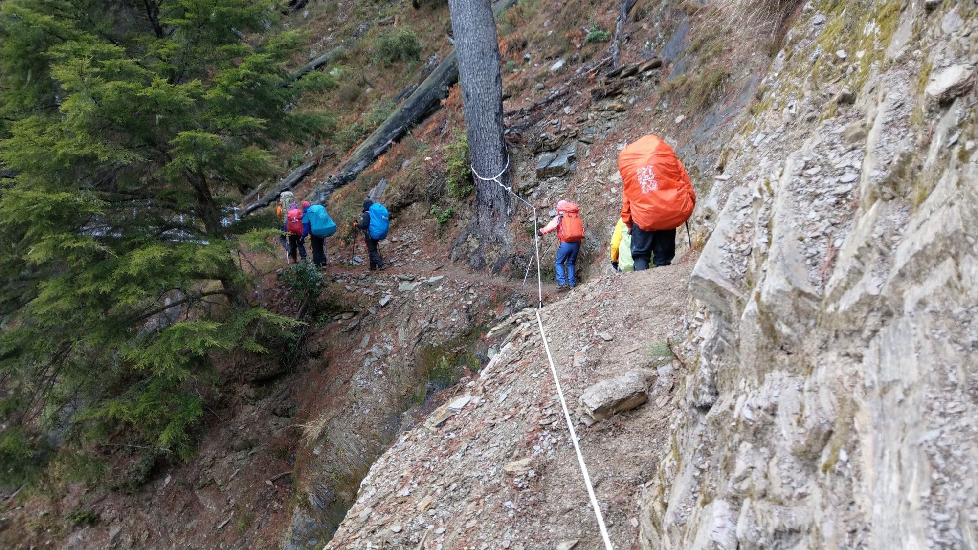
“The route is known for being susceptible to landslides, so it's quite precarious,” Daniel says. “There are sections where the whole trail has just been washed out. They'll put ropes up and things like that, but it can still be dangerous to cross.”
You have to be totally self-sufficient for the whole hike
Another challenge is the limited amenities along the trail, especially in the central section, where you won’t find any shops or accommodation.
“You’ve got to take everything. The amenities in the mountains of Taiwan are very primitive. Unless you're hiring a porter, you have to be totally self-sufficient for the whole hike. Which includes carrying water, a week’s worth of food, a tent and everything else you need on your back,” Daniel says.
According to Daniel, the trail can be broken down into three rough sections; the west section, the central section, and the east section. The latter is also known as the Walami Trail, and is the most developed section of the hike.
The west section of the trail begins in Dongpu, where you’ll follow a forest road up past Sansheng Temple, which narrows as you climb upwards. You’ll cross the vertiginous Fuzi Cliff, which drops sharply down to the Chenyoulan River. This area of the trail is susceptible to landslides, and so you’ll find chains and ropes in sections.
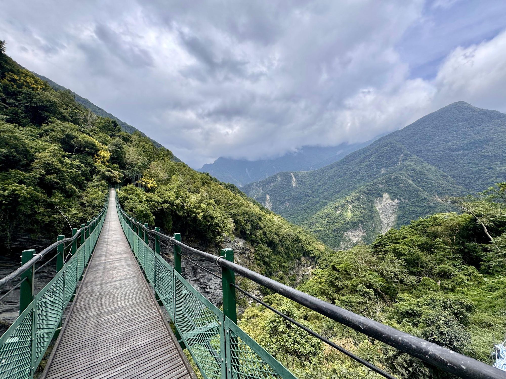
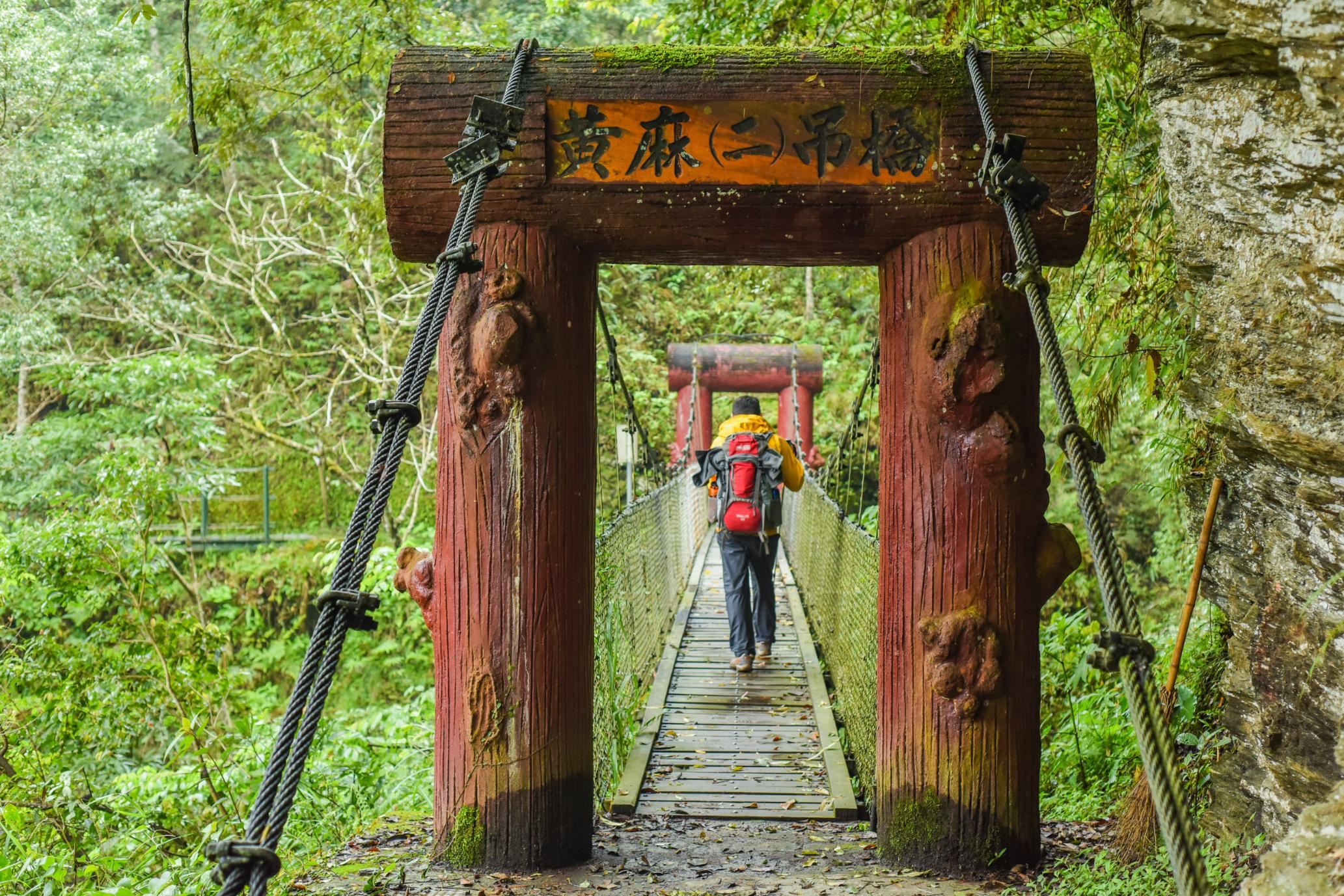
After a few hours of hiking you’ll cross a narrow suspension bridge over Yunlong Waterfall, a 70m (659 ft) cascade. The scenery around here is beautiful, with sweeping views over forested hillsides. You'll finish the day at Lele Cabin, one of the few places to stay along the route.
The second stage of the trek takes you deeper into the mountains, ending at Banaiyike Campground. On the way you’ll pass Batongguan, a forested peak towering at 2,800m (9,186ft), with the remnants of a soldiers’ camp nearby.
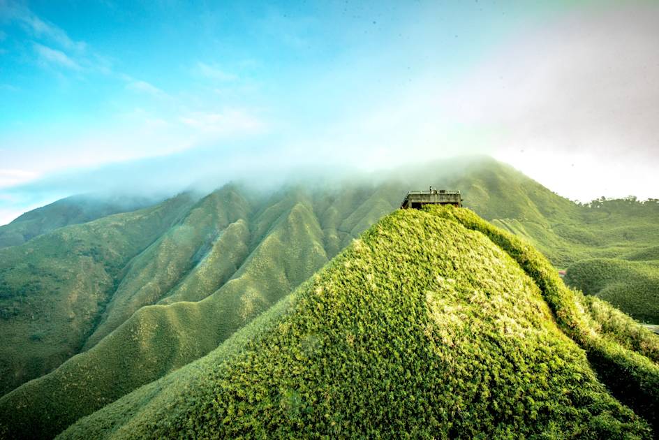
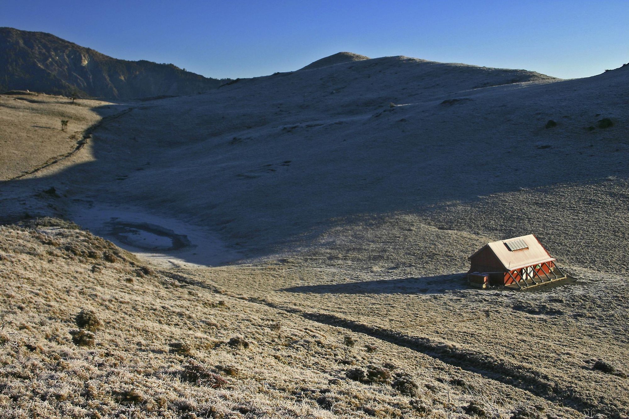
By the third stage, you’ll have climbed up to an elevation of 3,120m (10,236ft), and will hike through the Dashuiku and Jianshan Special Scenic Area, high altitude grassland surrounded by mountains.
It's very wild. You're more likely to see animals; you're way out there in the middle of nowhere
You’ll also pass Dashuiku Lake, an alpine pond situated at 3,280m (10,761 ft), which is situated next to an old police station, built to monitor the movements of the Bunan tribe. This area marks the transition from the western section of the trail to the central section – the latter of which is Daniel’s favourite.
“It’s the most interesting part, just because it's where fewer people go. It's not very well maintained. It's very wild. You're more likely to see animals; you're way out there in the middle of nowhere,” he says. “You’ll cross prairie grassland and then head into pine forest.”
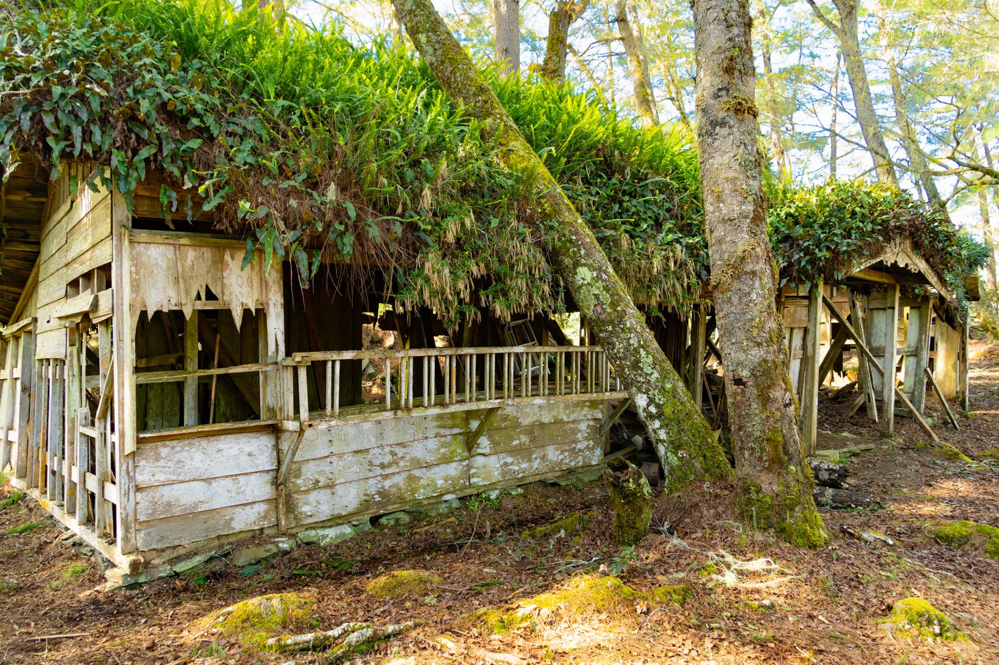
The central section comprises narrow portions of trail, exposed cliffs and wayfinding can be difficult – it’s not suitable for beginners. You’ll pass the ruins of the Tomas Police Station, terraces surrounded by stone walls, old sake bottles and ceramic insulators where telephone wires once ran.
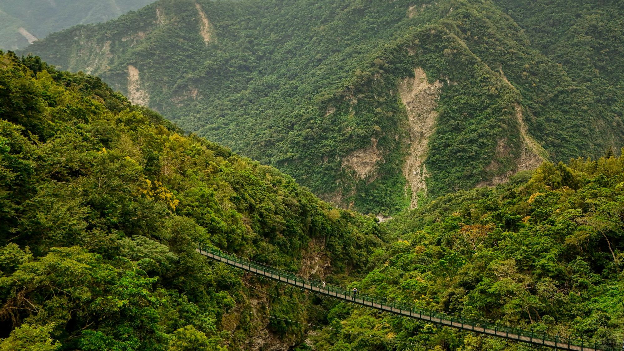
Continuing on, you’ll cross a river and pick up the trail again to cross over the Yisila Suspension Bridge, which runs adjacent to the original Japanese bridge, now hanging on by one steel cable. After this, you’ll cross a sheer cliff face, on what is one of the most challenging sections of the trail. This fifth stage concludes at Dafen Cabin, located next to the ruins of a police station, school and ammunition depot.
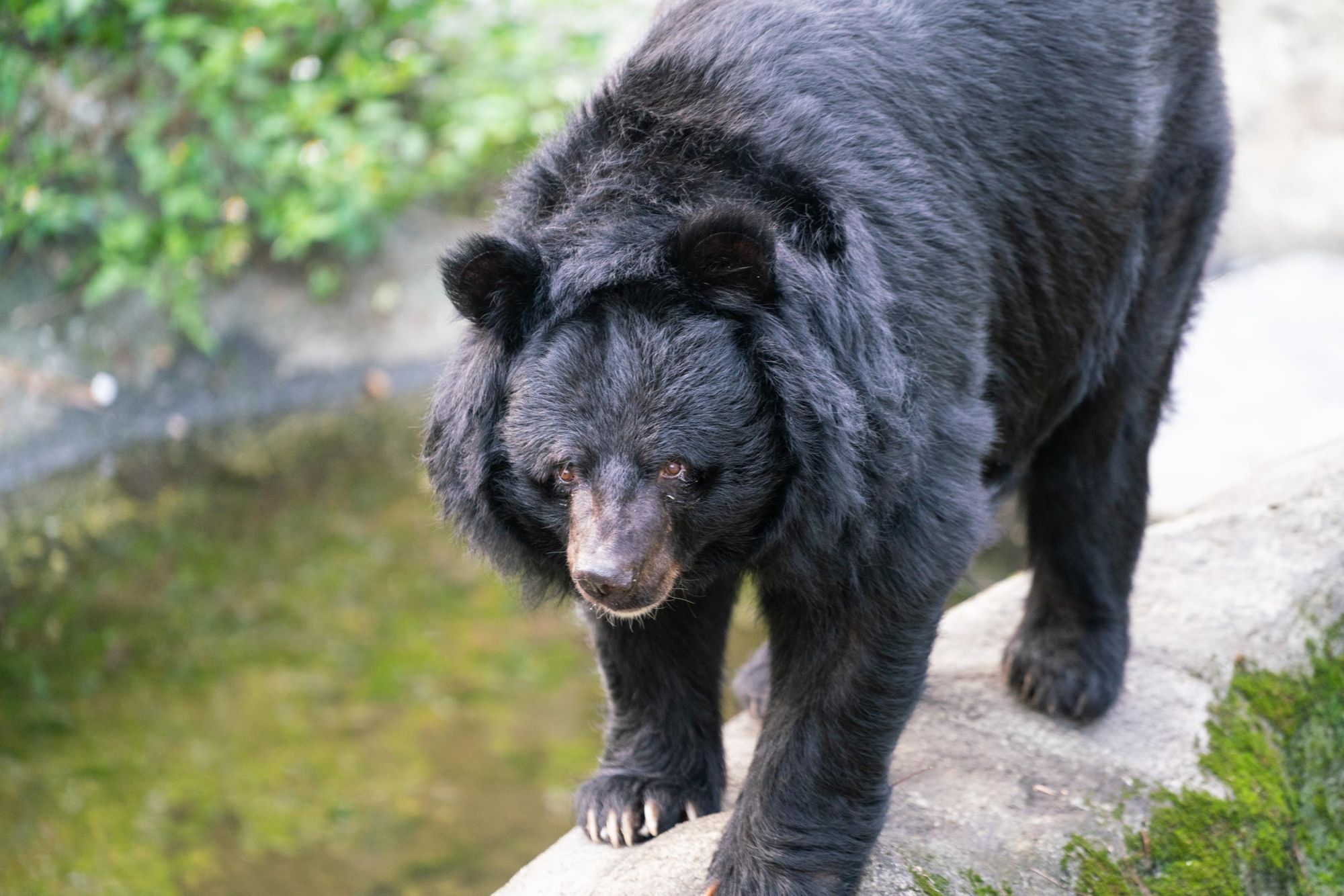
“Dafen is very hard to get to,” Daniel says. “It's primarily used by hikers, but it's also used by scientists who want to study the endangered Taiwan black bear: the Batongguan Trail is one of the best places to see them.”
As you leave Dafen, at the beginning of the sixth stage, you’ll descend from the central mountains to the trail’s east section.
“When you get down to lower elevations in the east, it becomes much more jungly and humid. There's a lot more leeches; you don't see those on the middle or west part,” Daniel says. “But on the east side of the trail, you’ll pass at least a dozen former Japanese police stations within about 30 kilometres. You don't see as many on any other trail in Taiwan.”
The eighth and final stage of the Batongguan Historic Trail is also known as the Walami Trail, an 8.4 mile (13.6km) route that starts at Walami Cabin and ends at the Shanfeng trailhead. This section of the trail is the best maintained, and you’ll see other day hikers along the route. You’ll descend from an altitude of 1,060m (3,478 ft) to 465m (1,526 ft) through dense jungle, where you might see wildlife such as monkeys, colourful butterflies and the Taiwan blue pheasant.
The last part of the Walami Trail sees you hike through the Huangma River Valley, where you’ll cross a series of suspension bridges over clear rivers. The trail ends just after you pass the Shanfeng Waterfall and cross the Shanfeng Suspension Bridge.
From Daniel’s perspective, the three things that make the Batongguan Historic Trail one of the top hikes in Taiwan are the remoteness of its central section, its natural beauty and its cultural significance.
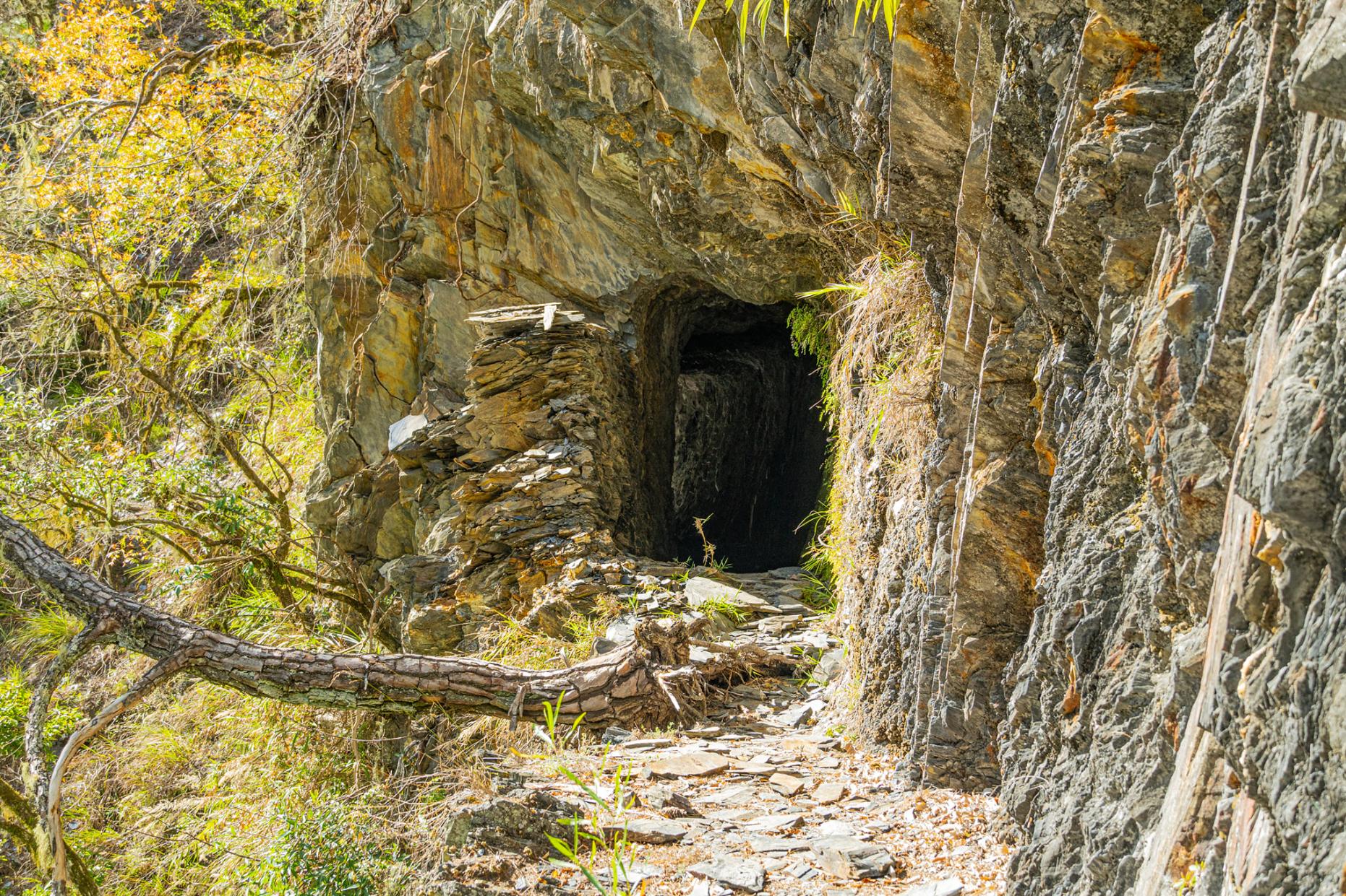
“For me, the most important thing to know about the trail itself is its historical significance as it relates to the Japanese controlling the indigenous Taiwanese,” he says. “It's the only place in Taiwan where you can see a giant piece of artillery on a trail, and a human-made stone tunnel, carved out by the Japanese.
“On the east side of the trail, there's a couple of obelisk monuments that are dedicated to Japanese police officers who were murdered by the tribes. You’ll also get to explore Dongpu Village, which is home to the Bunun people, and Yuli, inhabited by the Posko. It’s pretty interesting, learning about the differences between the tribes and seeing those monuments.”
Nobody really knows about Taiwan or what it has to offer. And it has a lot to offer.
Daniel’s enthusiasm for the Batongguan Trail extends to Taiwan in general, which he says is an under-the-radar destination for hiking and adventure travel enthusiasts. It has 286 mountains over 3,000m (9,800 ft) – he’s climbed the highest 100 of them. There are also numerous other hiking trails, including the Tamsui-Kavalan Trails, a network of historic hiking trails extending from the lush mountains of northwest Taiwan to the coast.
“Taiwan is a really underrated outdoor spot,” he says. “Everybody who comes to Asia wants to go to the Philippines or Thailand for the beaches, Japan for the culture, but nobody really knows about Taiwan or what it has to offer. And it has a lot to offer. It's just a matter of getting the word out there.”
Inspired? Hike the Walami Trail with us on our Ultimate Adventure Through Taiwan.