


The Cairngorms National Park is the largest national park in the United Kingdom - twice the size of the Lake District - and as such, it’s where you’ll find many of the best hikes in the UK.
The park is home to a quarter of Scotland’s native forest, a quarter of all rare and endangered species in the UK, and amazingly, one-third of the UK’s land above 600m. 55 of Scotland’s 282 Munros can be found in the Cairngorms, and it’s not just mountain ascents and dramatic ridgelines either (though there are plenty of those). The lochs, forests and wildlife mean that there are plenty of lower-level, accessible walks in the Cairngorms that really are beautiful too.
Perhaps the biggest proponent of the Cairngorms was Nan Shepherd, who immortalised the mountains in The Living Mountain. Shepherd wrote of “water so clear [it] cannot be imagined,” and of the high plateaus, where “the streams themselves, their cataracts and rocky beds, the corries, the whole wild enchantment, like a work of art is perpetually new when one returns to it.”
Here, we’ve listed eight of the best hikes in the Cairngorms. They are hikes which we love, and which aim to show off just some of what the Cairngorms have to offer, from long-distance walks up the UK's highest mountains to gentle forest walks that are more focused on culture, nature and wildlife.
You’ll see Coire an Lochain and the summit of Braeriach. There’s a poetic beauty in reaching Sgòr an Lochain Uaine, known as Angel’s Peak, so soon after climbing Devil’s Point.
Important
Quite a few of these hikes are demanding, challenging routes.
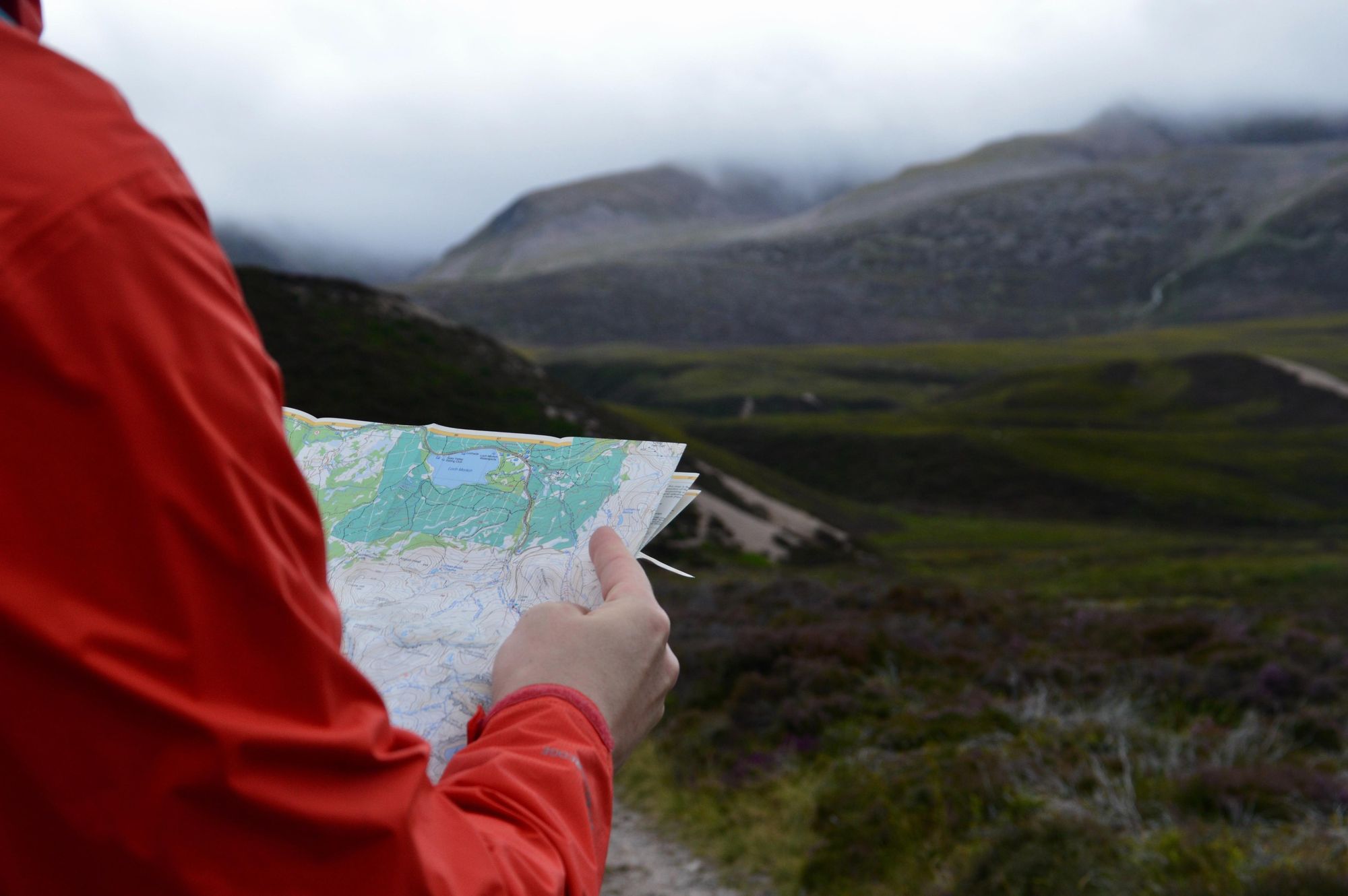
The mountains can be a dangerous place. It’s important you have the appropriate gear for the hike you’ll be taking, and for the time of year. Winter hiking in particular demands extreme navigational competence, extra gear like crampons and ice axes - and the knowledge of how use them. Our route descriptions are intended to spark interest. Further mapping will be required to walk the routes.
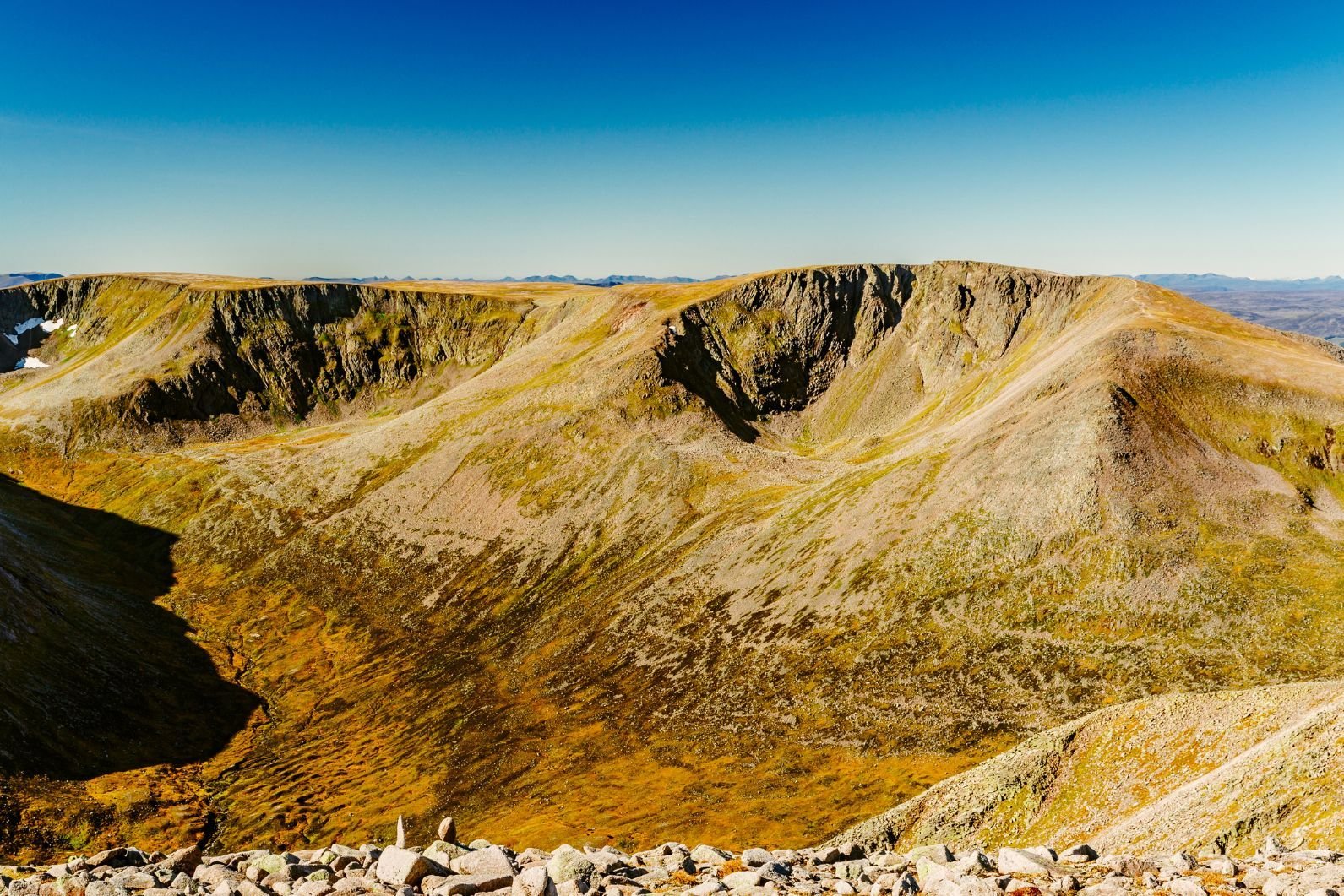
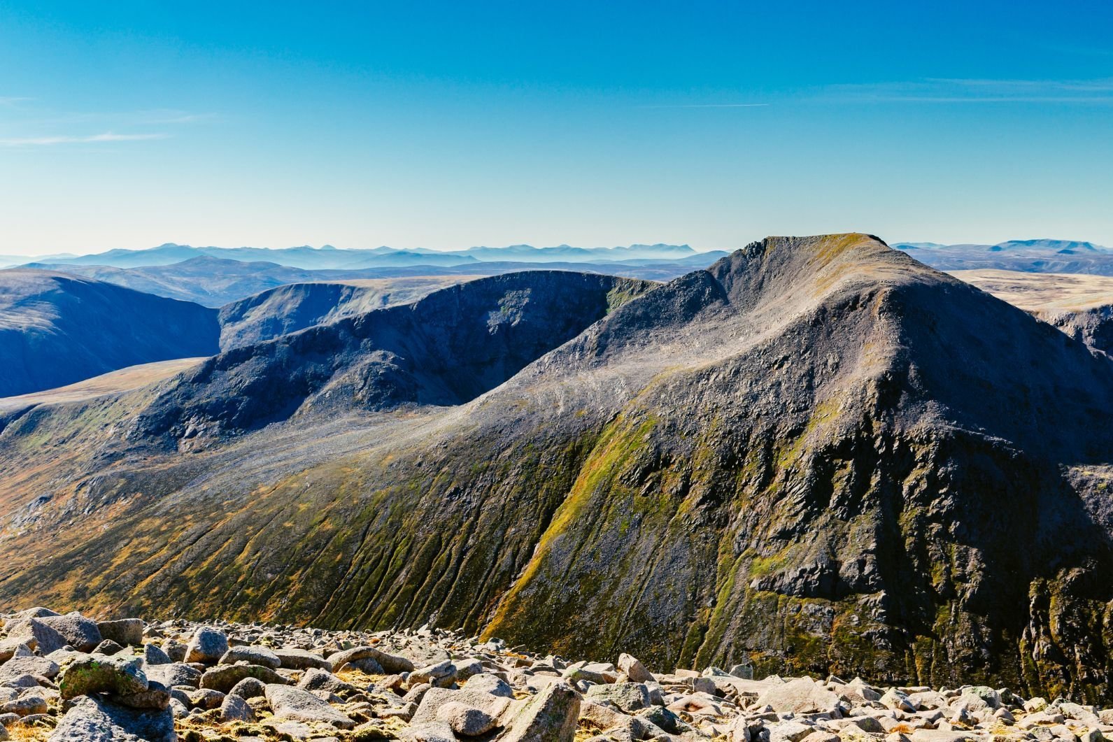
1. Cairn Toul – Braeriach traverse
Distance: 22.25 miles.
Walking time: 2 days (with an overnight at Corrour bothy).
This is a beautiful but demanding route which allows you to take in the remarkable Garbh Choire corrie - one of the largest corries in Scotland - and to go up a stunning summit ridge. You’ll climb four Munros - The Devil’s Point (1,004m), Cairn Toul (1,291m), Sgòr an Lochain Uaine (1,258m) and Braeriach (1,296m), the UK’s third highest peak. You’ll get hard-earned views over the Cairngorms and Ben Macdui, which at 1,309m is the UK’s second highest peak.
The walk is doable in one long day of hiking, but better enjoyed if you split the route up with a stay at Corrour bothy, which is conveniently on the route. There are cliffs along the trail, and combined with the fact that it’s very exposed, the walk can be perilous in poor visibility. Make sure that you know your route, you are comfortable mapping, and that you prioritise safety on your hike.
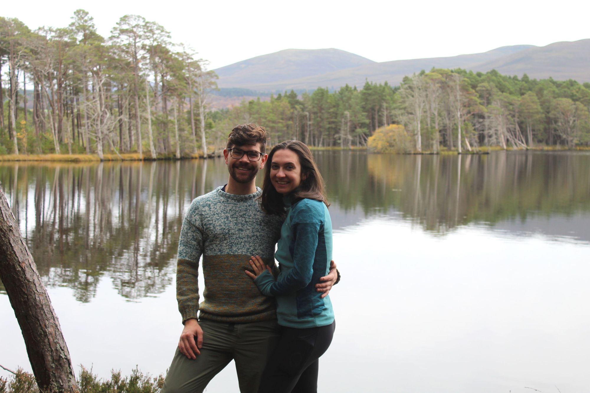
 Stuart Kenny
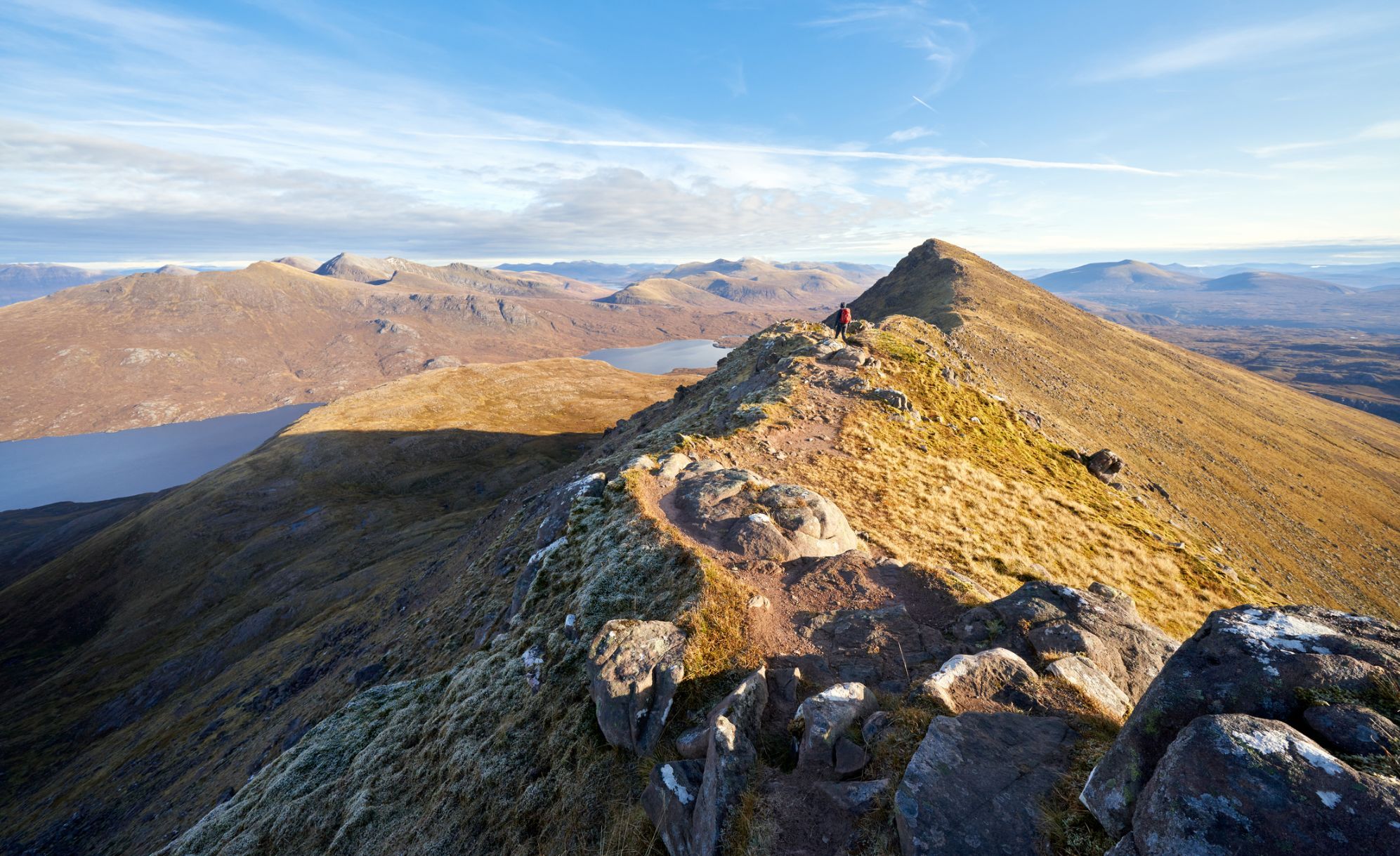
Starting in the Sugarbowl car park, below the Cairngorm Mountain resort road, you’ll walk to the rocky, scramble-y terrain of the Chalamain Gap. Take your time here. It’s tricky to navigate. The terrain becomes more passable as you reach the ice-age slopes of Lairig Ghru, between Lurcher’s Crag and Sròn na Lairig. You’ll soon get your first view of Cairn Toul, pass the Pools of Dee and continue past the slopes of Ben Macdui - the UK’s second highest mountain.
The walk from the Sugarbowl car park to Corrour bothy is two-to-four hours long. From here, it’s onwards up to the Devil’s Point. It looks incredibly formidable, but isn’t too tricky a climb. It’s then over to Stob Coire an t-Saighdeir, then around a corrie and up to Cairn Toul. You’ll see Coire an Lochain and the summit of Braeriach. There’s a poetic beauty in reaching Sgòr an Lochain Uaine, better known as Angel’s Peak, so soon after climbing Devil’s Point.
You’ll then continue on the high-mountain plateau over to Braeriach, and the high point of the route, at 1296m. You’ll be able to look out all the way to Speyside, and back across the mountains you’ve just traversed. The descent heads north along the ridge, and you’ll rejoin your ascent route at the Lairig Ghru. From there, it’s back on the same route to the car park.
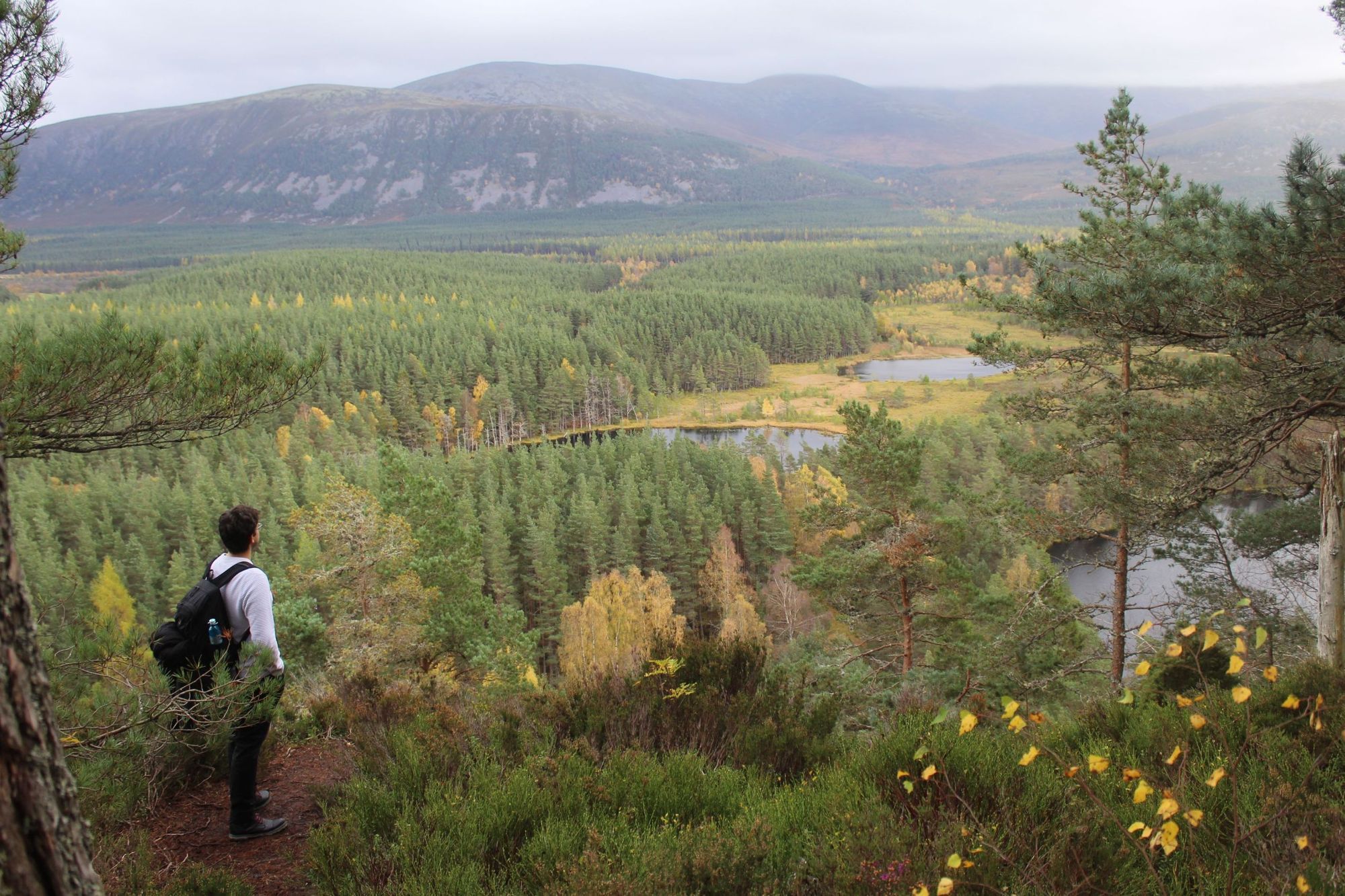
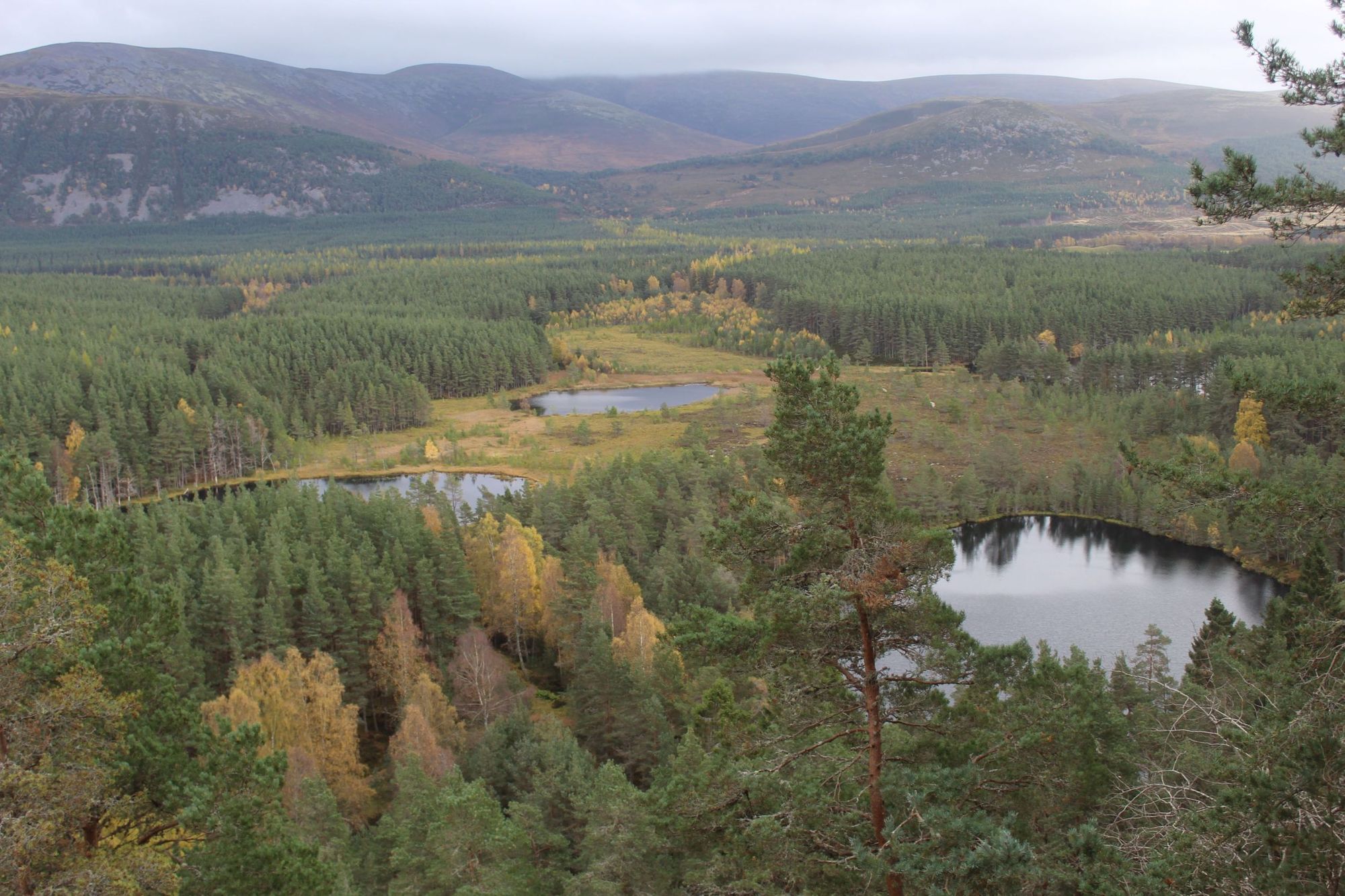
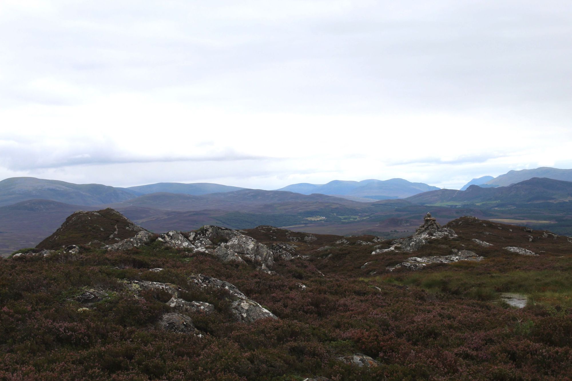
2. Uath Lochans and Farleitter Crag
Distance: 4 miles.
Walking time: Approx 2hrs.
At the Uath Lochans you can access beautiful Highland scenery which still holds an air of secrecy - and a well-waymarked walking route.
Driving slowly along the Balnespick Road, you’ll need to pay attention to catch the Forestry Commission sign for the lochans. When you step out of the car, you’ll already be next to one of the eponymous bodies of water, and you’ll immediately get the sense of how special this area is. Tall pine trees guard beautiful ponds, and are backdropped by the hills above Glen Feshie.
There are two walking routes from this car park. The first is the Uath Lochans Trail, which is one-and-a-half miles and waymarked by white posts, and the second is the Farleitter Crag Trail, which is two-and-a-half miles and waymarked by red posts. Combine the two for an excellent two-to-three hour walk which is accessible for friends and family, regardless of experience.
We like to take the Farleitter Crag Trail first. At the edge of the largest lochan, and after taking a moment to appreciate the view, you’ll turn right into the tall pine forest, and continue on the trail. Keep an eye open for red squirrels. We’ve lost hours here watching them scramble around the trees. It’s likely that you’ll also see a lot of mushrooms (some edible) at the side of the trail.
Continue on up a pleasant ascent and you’ll reach a huge boulder and bench looking out over Strathspey. Then it’s on to the postcard-perfect image you can see above, looking out over three lochans and the forest. It’s a hard spot to leave. Descending back to the floor of the area, you’ll join the Uath Lochans trail, switching to white waymarkers. This is a lovely walk around the water, finishing on a boardwalk through the marsh, and leading back to the car park.
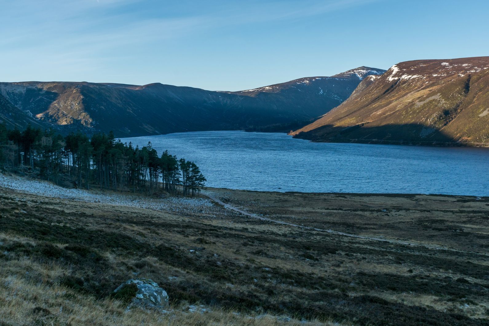
3. Lochnagar and Loch Muick circular
Distance: 14 miles.
Walking time: Approx 8hrs.
Lochnager (1,155m), also known as Beinn Chìochan, is a funny old mountain. When the Scottish Parliament were drawing up the boundaries for the Cairngorm National Park, they included it, despite the fact that it’s on the wrong side of the River Dee. The manner in which the mountain looks and rises - from river through forest to heather and rocky crag - is akin to the Cairngorms, though.
This is a great (but long!) hike for those who are tying a visit to Balmoral into a hiking holiday in the Cairngorms. Right at Balmoral, you’ve got the famous cairn hike, where you can follow an easy route to see the stone pyramid of Prince Albert’s memorial cairn. More intrepid is this Lochnager and Loch Muick circular.
Starting at the Spittal of Glenmuick (a half-hour drive from Balmoral), you’ll turn right and join the Lochnagar path. You’ll cross a river and reach the driveway for Allt-na-giubhsaich, a cottage used by Queen Victoria and Prince Albert when they wanted to escape the formalities of Balmoral. Carrying on, you’ll pass the Clais Rathadan ravine, and descend Glen Gelder before heading to Lochnagar.
You’ll climb up to a gap between Meikle Pap and Cuidhe Crom, and eventually find yourself on a summit plateau. The edge of the corrie is marked by cairns - be careful not to fall. You’ll continue on to Cac Carn Mor, taking in a beautiful view of the corrie below, and then reach the true summit of Cac Carn Beag. On a particularly clear day, you’ll be able to see all the way to the Pentland Hills in Edinburgh and the Cheviot range, which forms the border with England.
Remaining highlights include the Glas Allt Falls, the main waterfall of which has a drop of 70ft, and the return walk to the Spittal of Glenmuick along Loch Muick.
4. Kingussie to Newtonmore
Distance: 4.5 miles.
Walking time: Approx 2hrs.
Kingussie will always hold a special place in my heart, after early camping trips near Loch Gynack and hikes in the mountains beyond. It’s often overlooked, courtesy of being so close to Aviemore, but it really is a beautiful little area. One particularly nice circular walk takes you up the 487m Creag Beagh just behind Kingussie, and then along Loch Gynack and back to the village. It’s a hike that’s accessible for all ability levels, and should only take a couple of hours.
On the south-west side of this hill is Cluny’s Cave, where Bonnie Prince Charlie, and the clan chief Ewen Macpherson, hid after the battle of Culloden.
The way up Creag Beagh is well signposted. You’ll head out of town on an uphill and go through a metal gate, where you’ll enter the forest. Creag Beagh might not be the biggest hill, but the climb is a steep and stoney one. Reach the top and you’ll find several summit cairns, and a rugged summit plateau. You’ll also get great views out to the Cairngorm summits and over the Spey valley.
On the south-west side of this hill is Cluny’s Cave. It's a famous spot in Scottish history - it’s where Bonnie Prince Charlie and the clan chief Ewen Macpherson hid out after the battle of Culloden. You can actually go up one side of Creag Beagh and then down the other, on a steep staircase, but our route instead chooses to return down the same side, and go round Loch Gynack. After a scenic walk around the water, it’s a gentle descent back down to Kingussie.
The route could also be extended by including the Wildcat Trail in Newtonmore.
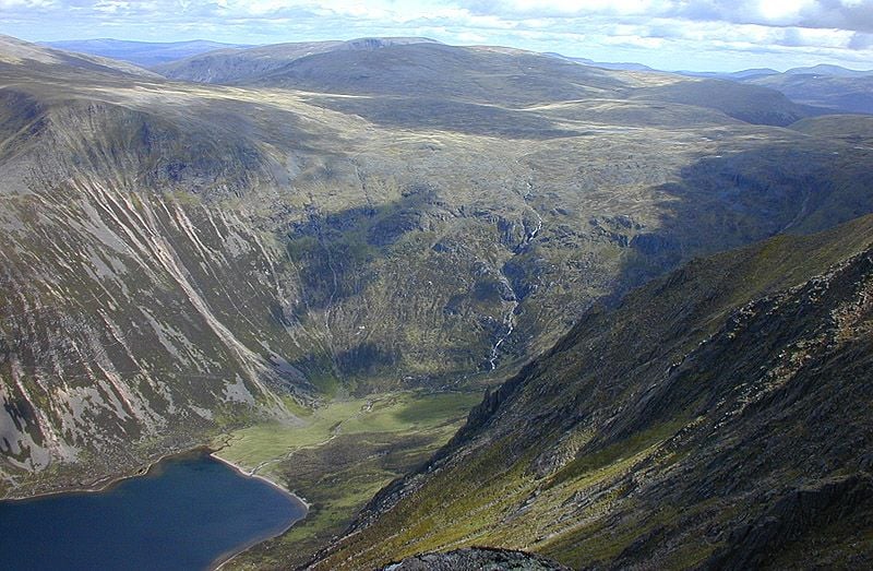
5. Ben Macdui and Derry Cairngorm
Distance: 18 miles.
Walking time: Approx 10hrs.
This is a long but beautiful day of hiking to reach Ben Macdui and the Cairngorm roof of 1,309m. It’s the second highest mountain in the UK. Starting at the Linn of Dee car park, you’ll walk through forests to reach the track heading up Glen Lui. You’ll walk through the pine woods around Derry Lodge and continue on to Glen Luibeg. You’ll be taking the Sròn Riach route.
You’ll be on this route for quite a while, steadily climbing. When you reach the cairn on Coire Sputan Dearg, you’ve hit the Macdui plateau. There’s an old stone shelter up here, but don’t bank on using it. It’s missing a roof, having originally been built in the 1840s and then left to the elements.
After reaching the summit, you’ll descend on the pony track that Queen Victoria used when she climbed the mountain in the 1800s. Continuing on to the ridge of Derry Cairngorm (1,155m), you’ll find yourself on the climb again, and navigating boulders. From the top, you can look back over to Ben Macdui, and over Deeside.
You’ll descend on a path that passes scenic crags. You'll then hit familiar territory at the Derry Lodge, where you can continue on back to the car park.
6. Lower Glen Feshie and the Frank Bruce Sculpture Trail

Distance: 3 miles.
Walking time: Approx 2hrs.
This is by some distance the shortest and most accessible walk on our list of hikes in the Cairngorms. The Frank Bruce Sculpture Trail is also wheelchair accessible - and it has a fascinating story to tell.
The route starts from a Forestry carpark, with signposts directing you to the sculpture trail and Feshiebridge. In the forests just beyond that car park you'll find the stone and wood sculptures of Frank Bruce (1931-2009), a man who left school at the age of just 13 to work in a sawmill, and eventually became a self-taught, award-winning sculptor.
Stuart Kenny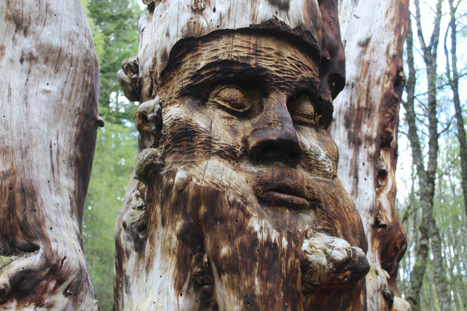
Bruce’s works offer philosophical and socio-political commentary on the human form, and as Bruce intended, many of his wooden sculptures are now beginning to rot, and have been laid down to slowly return to the earth they came from. One particularly emphatic sculpture shows a workman figure facing a belted knight. "The belted knight looks with disdain," said Bruce, but "Both figures have symbols of mortality on their heads indicating we all return to the same dust."
The Frank Bruce Sculpture Trail is a stunning, atmospheric, open-air art gallery. It’s a small loop, and when you’ve completed it, you can continue on through the car park to walk along the River Feshie, with dramatic views of the forests rising up the hills beyond. This is a unique walk with a healthy dose of culture. If you’d like to make it more of a day out, bring lunch, and then combine this stroll with our Uath Lochans walk listed in point two, which is just a 10 minute drive away.
Update: The Frank Bruce Sculpture Trail is currently closed to the public.
7. Sgòr Gaoith walk
Distance: 9 miles.
Walking time: Approx 7hrs.
Climbing Sgòr Gaoith (1,118m) from Glen Feshie is a big day out. You’ll go through pine forests to reach rugged, exposed slopes and a summit with views more dramatic than many higher mountains. Starting at the car park by Allt Ruadh bridge, head through the tree plantation and out into the more wild area of pinewood. As the path rises, you get great views over Badenoch and the Munros of the Monadhliath.
You’ll soon trade those pinewoods for a significantly more rugged environment - ascending steep slopes to reach the beautiful plateau and eventually the summit. The drop off the edge of the crags goes right down to Loch Einich, a remote loch with the feel of a Norwegian fjord. Braeriach is beyond.
Retrace your steps back to Glen Feshie, with one more Munro bagged.
8. Loch Garten and Surrounding Woods
Distance: 6 miles.
Walking time: Approx 2hrs.
There are many great loch walks in the Cairngorms, the most popular of which are those around Loch Morlich, Loch an Eilein and Loch Garten. We’ve opted for the latter - mostly due to the added attraction of the birds of prey you might spot.
Parking in the Garten Woods car park, follow the marked red trail into the Garten pinewoods - home to red squirrels, rare capercaillies and an abundance of bird life. The path is obvious, and will lead you first to Loch Mallachie - a beautiful forest loch. Wonder along, past plenty of potential lunch spots, and you’ll come to Loch Garten itself. It’s well worth a small detour to head up to the osprey centre here. This is a RSPB reserve, and as well as being able to view an osprey camera in the centre, there’s also now a white-tailed sea eagle camera which you can watch, monitoring the nest of a nearby eagle. The camera is new for 2022.
Ospreys have been nesting at Loch Garten since the 1950s, and they come to the area each spring to breed. It’s an absolutely excellent site for birdwatchers, with an abundance of other wildlife in the area too.
On your return, join the Speyside Way, and walk through beautiful forest, passing small lochans full of dragon and damselflies, and passing an abundance of flora.
Cairngorms FAQs
How do you get to the Cairngorms National Park in Scotland?
Travellers can reach Cairngorms National Park by train, car, or bus. The closest major rail hubs are Aviemore, Kingussie and Blair Atholl, with direct services from Inverness, Edinburgh and Glasgow. Drivers can access the park via the A9 trunk road, while long-distance buses also serve key towns like Braemar and Ballater.
Where is the Best Place to Stay in the Cairngorms?
The best place to stay in the Cairngorms depends on your interests. Aviemore is ideal for easy access to trails, outdoor gear shops and amenities. Braemar and Ballater are great for hiking the eastern Cairngorms, while Kingussie and Grantown-on-Spey offer a quieter experience with good trail connections.
Are there midges in the Cairngorms?
Yes, midges are present in the Cairngorms, particularly in summer months from late May to early September. These biting insects are most active in still, damp conditions at dawn and dusk. Wearing insect repellent and using head nets or midge hoods can help reduce discomfort on the trail.
What are some of the most challenging mountain hikes in the Cairngorms?
The most challenging hikes in the Cairngorms include the summits of Ben Macdui, Cairn Gorm, and the Cairn Toul–Braeriach high plateau traverse. These routes involve long distances, significant elevation, exposed alpine terrain and require strong navigation skills and mountain experience.
Is there Snow in the Cairngorms?
Yes, snow is common in the Cairngorms during winter and can linger into late spring on high peaks. The mountains often receive the UK’s deepest snowpack, especially on plateaus like Ben Macdui and Cairn Gorm. Snowfall can occur even in early autumn or late spring, making weather awareness essential for hikers year-round. Check the weather forecast before heading out.
What kinds of wildlife might I encounter while hiking in the Cairngorms?
Hikers in the Cairngorms may see red squirrels, golden eagles, capercaillie, ptarmigans and snow buntings, while rarer species such as Scottish wildcats and ospreys may also be present. The park contains some of the UK’s most important wildlife habitats and supports a high level of biodiversity.
Are there overnight shelters or huts on Cairngorm hikes?
Yes. Hikers can use bothies or simple mountain shelters maintained by organisations such as the Mountain Bothies Association. There are also paid huts and refuges for multi‑day routes, particularly on traverses like Cairn Toul–Braeriach that require overnight stays. Wild camping is also permitted in the Cairngorms National Park, as long as you do so responsibly and follow regulations.
Inspired? Check out our range of Scotland adventure holidays now!