


The best hikes in the UK will, of course, differ depending on who you ask - but what every answer should have in common is extraordinary beauty. Sure, Britain and northern Ireland may not have the highest mountains in the world, but there is some tremendous scenery – from the rugged wonders of Snowdonia to the famous beauty of the Scottish Highlands. The best uk hikes show that off.
Every hiker will have their favourite hiking trails in the UK, often for personal reasons. But, if you’re looking for some famous trails to see the country, then these are our picks of the best walks around the United Kingdom - the classics.
Hiking in England can take you to scenic coastlines, historic routes and sprawling natural parks. Hiking in Wales offers dramatic mountains, and rocky cliffs by the coast, while hiking in Scotland can mean anything from exploring an island off the west coast of the country to climbing the highest mountains in the United Kingdom. We've also included one route in Northern Ireland - a sublime two-day walk on the Causeway Coast, where Atlantic beauty meets geological wonders.
We've covered a wide variety of areas, making sure to hit favourites like the Isle of Skye, the Lake District and the Yorkshire Dales, as well as heading over the water to the beautiful Causeway Coast in Northern Ireland. From beautiful Scottish islands to the southernmost tip of England, there’s everything from gentle jaunts to hardcore hikes to choose from. With this list, that's what we've aimed to do - compile a list that has a little bit of everything, across the British Isles, to suit a variety of abilities and interests. The best walks in the UK have it all.
These aren’t mere walks in the park – they are classic, adventurous hikes that will create some serious memories. Here are 15 of the best hikes in the UK:
- Hadrian's Wall Path (England)
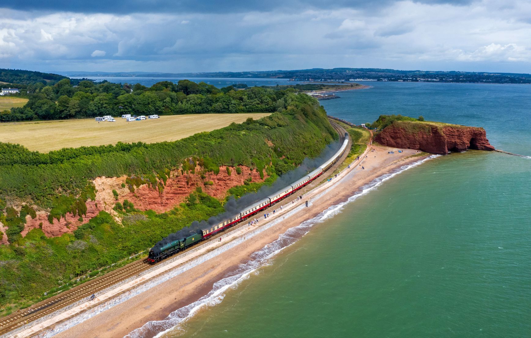
- South West Coast Path (England)
- The Quiraing (Scotland)
- The Rum Cuillin Traverse (Scotland)
- South Downs Way (England)
- Scafell Pike (England)
- Aberglaslyn Gorge (Wales)
- Coast to Coast (England)
- West Highland Way (Scotland)
- Causeway Coast (Northern Ireland)
- Yorkshire Three Peaks (England)
- Kinder Scout (England)
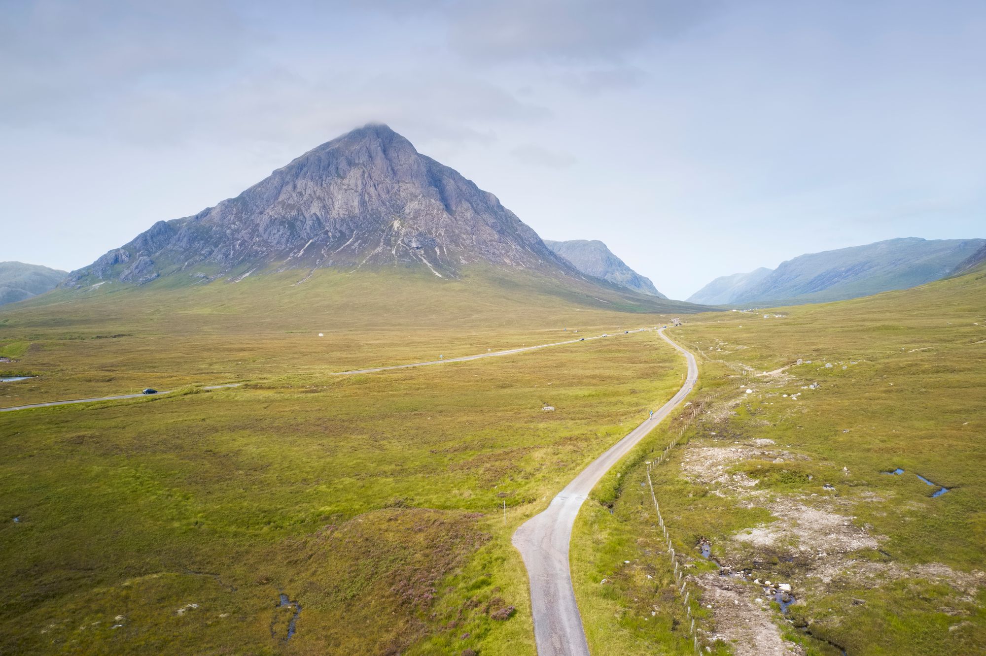
- Ben Nevis (Scotland)
- Loch Avon and Cairn Gorm (Scotland)
- Pen y Fan Horseshoe (Wales)
The Best Hikes in the UK, Mapped
Here, we've mapped the trailheads for the best hikes in the UK, which take you from the Cairngorms in Scotland to the south coast of England.
The 15 Best Hikes in the UK
1. Hadrian’s Wall Path (Chollerford to Birdoswald Fort), Northumberland and Cumbria
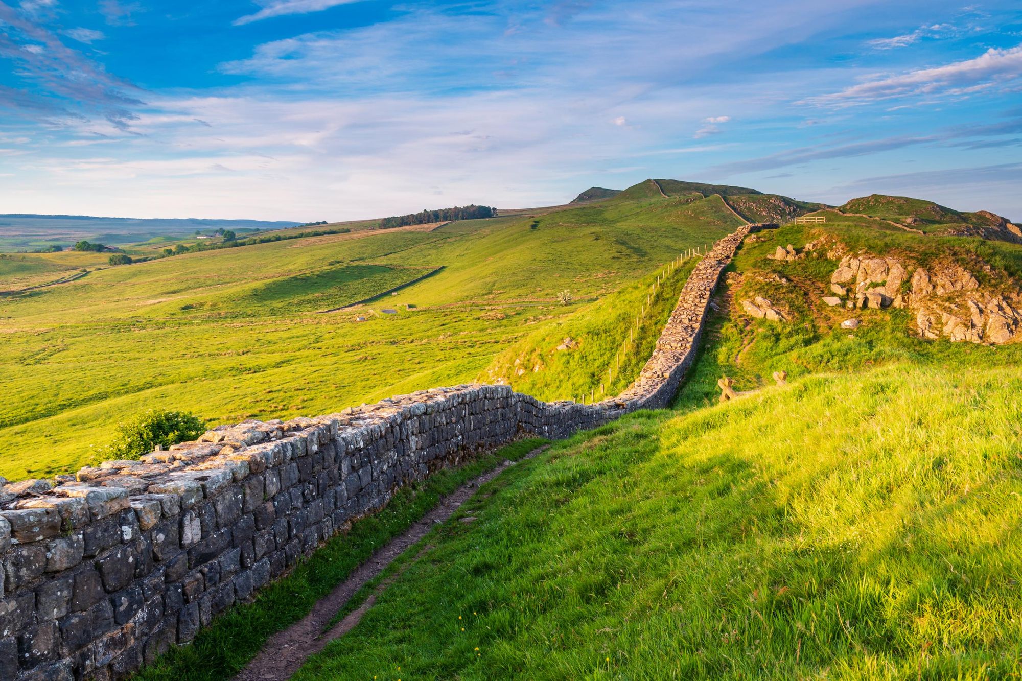
- Start/Finish: Wallsend/ Bowness-on-Sollway (point to point)
- Distance: 84 mile (135 km)
- Walking time: 6-8 days
- Difficulty: Moderate
- Best for: Ancient history
Spanning 73 miles in northern England, this enormous wall is one of Britain’s most spectacular ancient monuments. Hadrian’s Wall was named after the Roman emperor who ordered it built (between AD 122 and 128). Its original purpose was to separate the Romans from the “barbarian” Scottish Picts. Today it is a UNESCO World Heritage site. The 84-mile path running alongside it is dotted with ancient settlements, forts and fascinating museums.
One of the best sections to walk is the 20-mile stretch between Chollerford (near Hexham station) to Birdoswald Fort (east of Carlisle). This is the highest section of the Wall, offering magnificent views of the Lake District and Pennines. Better still, it can be done over a weekend. Don’t miss the interactive History of the Wall exhibition at the Roman Army Museum at Carvoran.
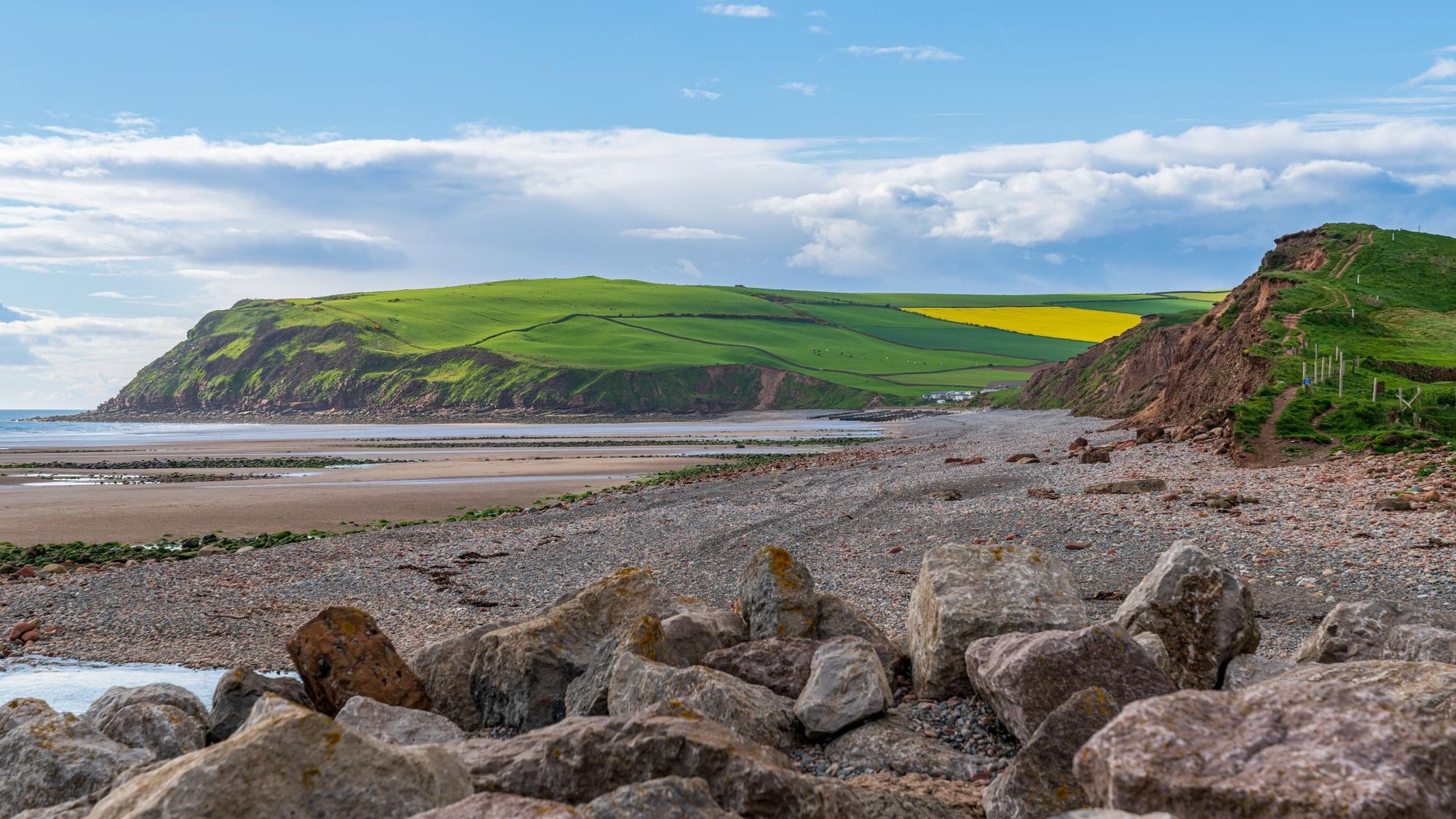
2. South West Coast Path (The Lizard), Cornwall
- Start/Finish: Minehead/ Poole Harbour (point to point)
- Distance: 630 miles (1,014km)
- Walking time: 7-8 weeks
- Difficulty: Challenging
- Best for: 7-8 weeks
The South West Coast Path is one of the best multi-day hikes in the UK. It twists and turns its way for 630 miles along spectacular coastline, from Minehead in Somerset to Poole Harbour in Dorset. The path gets busy in summer, but you can still find hidden coves to stop for a refreshing dip. There are some excellent circular and day hikes along the path as well.
Cornwall is home to plenty of secluded beaches. If you’re lucky you can have the sea all to yourself, even in peak season. Walk four miles around the rugged tip of The Lizard, the mainland’s most southerly point. Continue to the turquoise water and pale sand of Housel Bay – quieter than most beaches even in summer. The walk offers magnificent sea views and the chance to see everything from wildflowers to dolphins playing in the water below.
3. The Quiraing, Isle of Skye
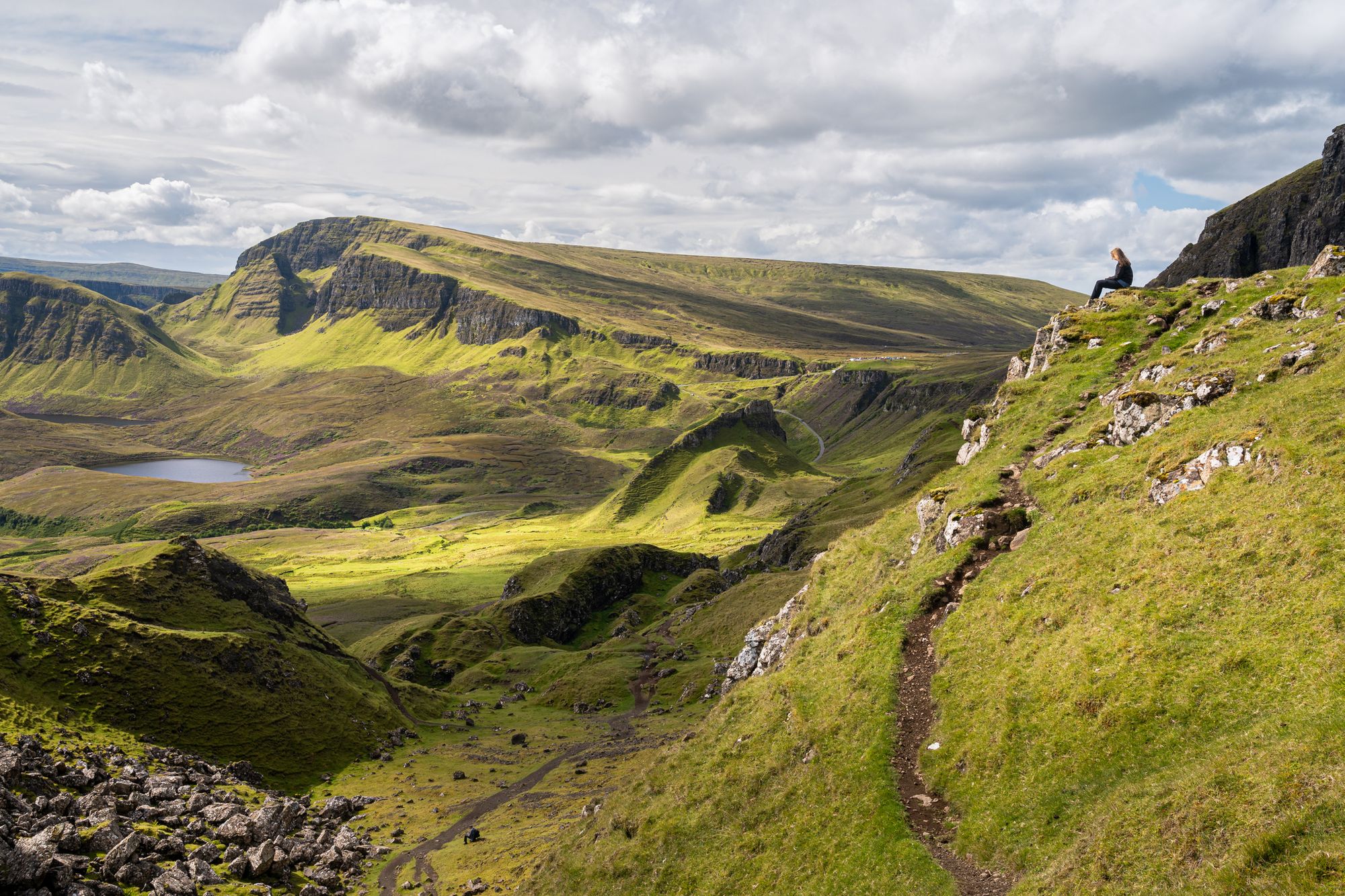
- Start/Finish: Staffin (circuit)
- Distance: 4 miles (6.4km)
- Walking time: 2-3 hours
- Difficulty: Moderate
- Best for: Wild island scenery
Quiraing is a landslip in the wild terrain of northern Skye. The bizarre but beautiful rock formations make it popular with everyone, from geologists to photographers. But the best way to appreciate its convoluted landscape is to hike it. Handily, there’s a great four-mile loop that involves a fair bit of climbing, but with views that make the effort worthwhile.
The trail starts at either of the villages of Staffin or Uig, and takes in startling vistas of the islands of Raasay and Rona. You can look down on the people below from the top of a cliff. Afterwards, refuel with Scottish chowder and homemade treacle bread at Staffin’s Columba Centre.
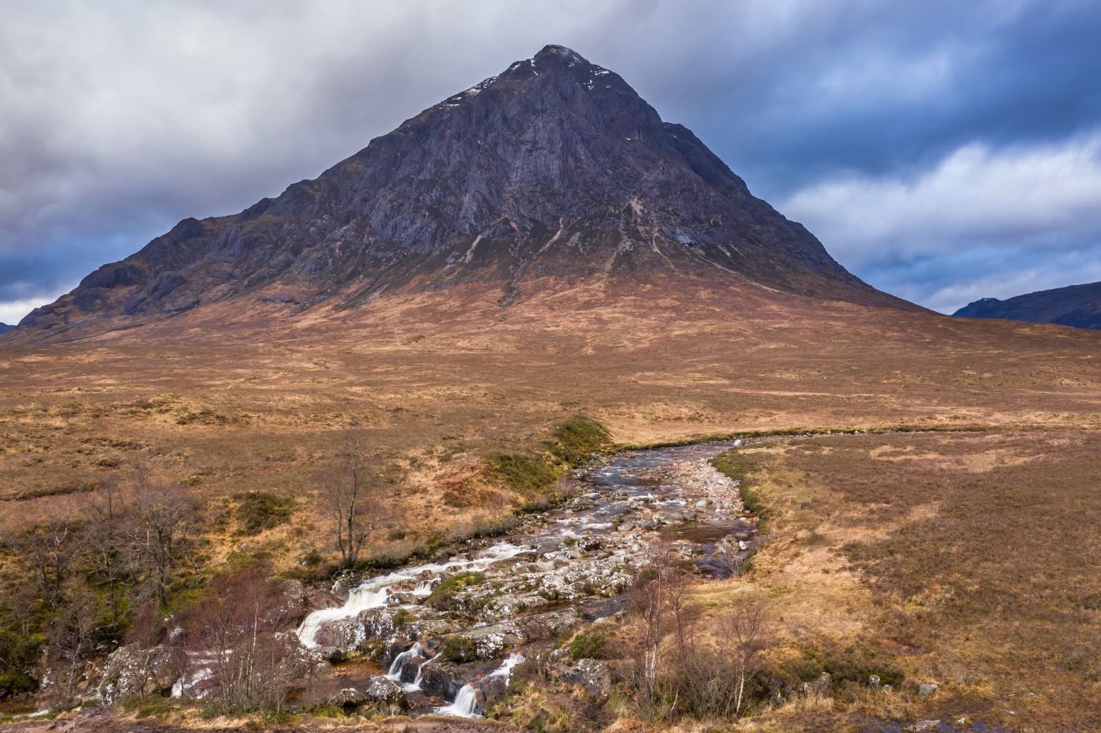
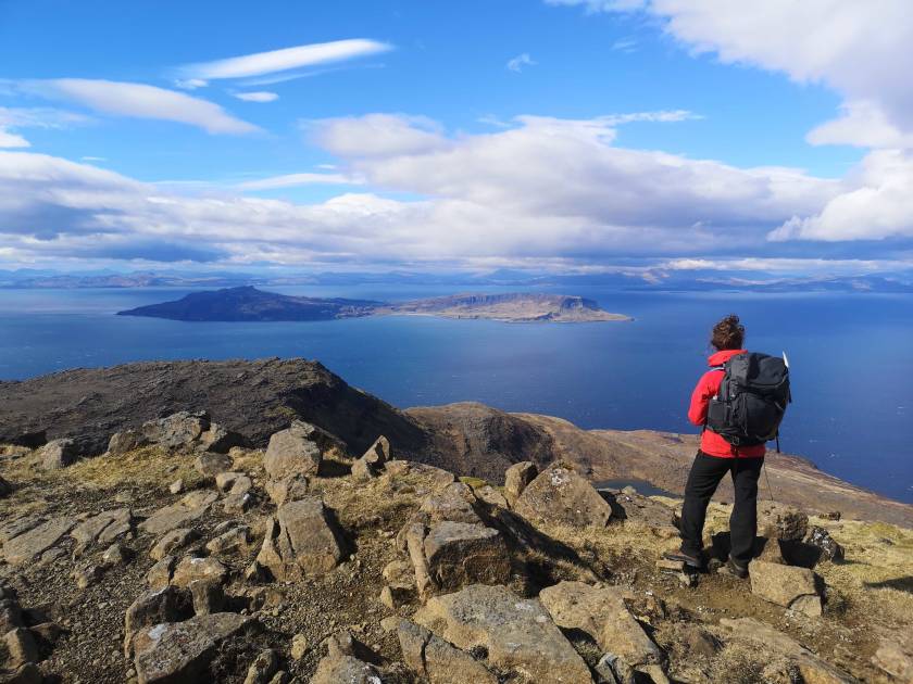
4. The Cuillin Traverse, Rum
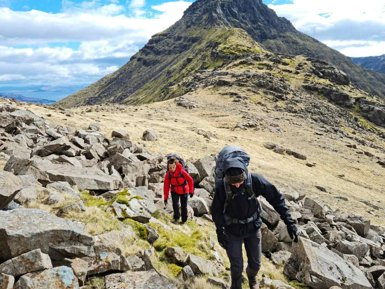
- Start/Finish: Glen Brittle/Sligachan (point to point)
- Distance: 8 miles (13km)
- Walking time: 7-8 hours
- Difficulty: Challenging
- Best for: Rocky summit scrambles and wild ocean views
The Isle of Rum sits off the west coast of Scotland. It is the biggest of the Small Isles and is particularly notable for the immense mountains in the south of the island, which are made of the same rock as those on Skye, but don't have the crowds. This is a real expedition - a full traverse of the Rum Cuillin. You’ll take in six peaks with lung-busting climbs, exposed ridges and summit scrambles including to the high point of the island at the top of Askival (812m). You'll be rewarded with 360-degree views back along the Rùm Cuillin, across to the Outer Hebrides and over to the famous Black Cuillin mountains on the Isle of Skye.
After high-fives on the top of Askival, you'll scramble back down the boulder-strewn peak, along a ridge, up and over Hallival (722m) and down into Kinloch - the only hamlet on the island and home to 29 people, for a well-deserved beer (though note, you'll have to buy it from the General Store - there's no pub here)!
The Isle of Rum is a Dark Sky Sanctuary, so be sure to head back out at night to look upwards. On a clear night, it's easy to see the Milky Way.
5. South Downs Way, Hampshire to East Sussex
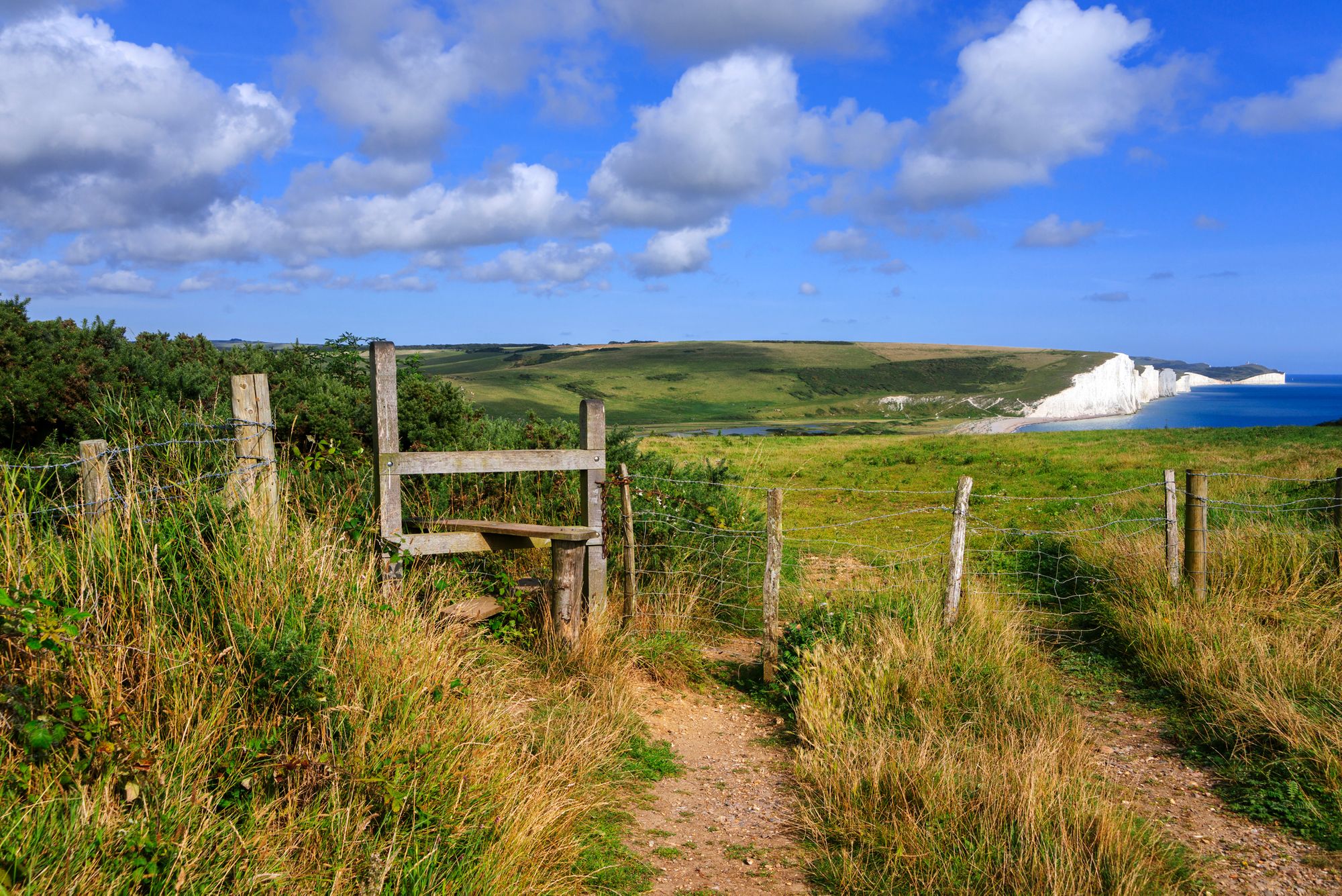
- Start/Finish: Winchester City Mill/ Eastbourne
- Distance: 100 miles (160km)
- Walking time: 9 days
- Difficulty: Moderate
- Best for: Quintessentially British countryside
With wildlife, white cliffs and watering holes along the way, the 100-mile South Downs Way is a quintessentially British walk. That’s how it’s earned its place on our list of the best hikes in the UK! It’s also on our list of best hikes in London. Which makes sense, if it’s on this one. The route begins in Winchester, the first capital of England, and traverses pretty countryside until you reach the rippling chalk cliffs at Eastbourne. It takes around eight days to hike the entire easy-to-follow route. The hike is best done from west to east, or it can be split into short sections. Just make sure you stay well away from the edges when traversing the cliffs, well away! There are frequent landslips, and no fence.
Highlights along the way include the Seven Sisters Country Park, the Amberley Working Museum and Devil’s Dyke. It is also dotted with some great pubs, such as the Bull at Ditchling, which is a good spot to rest weary feet.
6. Scafell Pike, Lake District
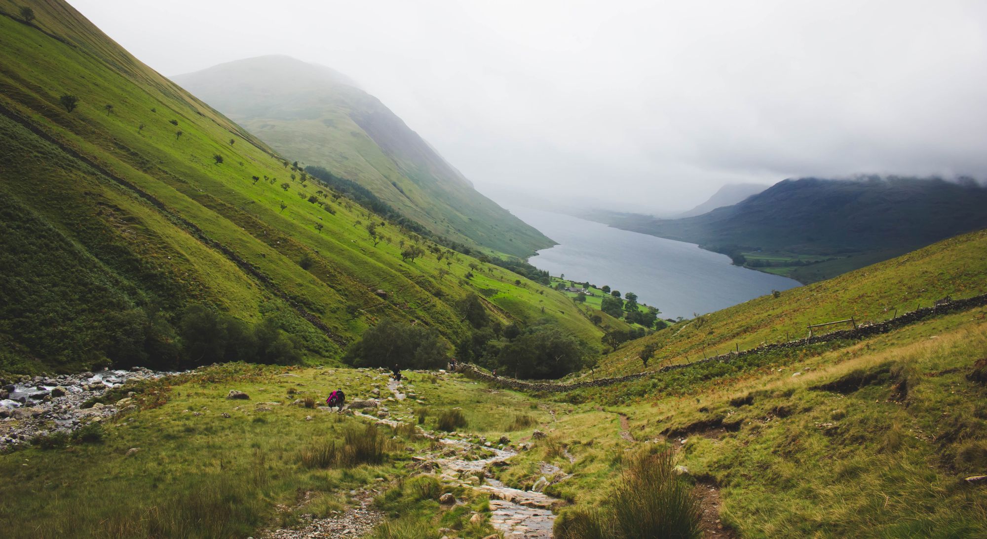
- Start/Finish: Wasdale (out and back)
- Distance: 5.3 miles (8.6km)
- Walking time: 4-5 hours
- Difficulty: Moderate
- Best for: Beginner mountain ascents
There are several ways to reach Scafell Pike, the tallest mountain in England and one of the best mountains to climb in the UK. In fact, we’ve got our own dedicated guide on the several different routes up Scafell Pike. So maybe it’s a bit cheeky to include it as a best hike in the UK. But whichever way you go up, reaching that summit is an incredible feeling. You’ll be standing on top of England.
 Stuart Kenny
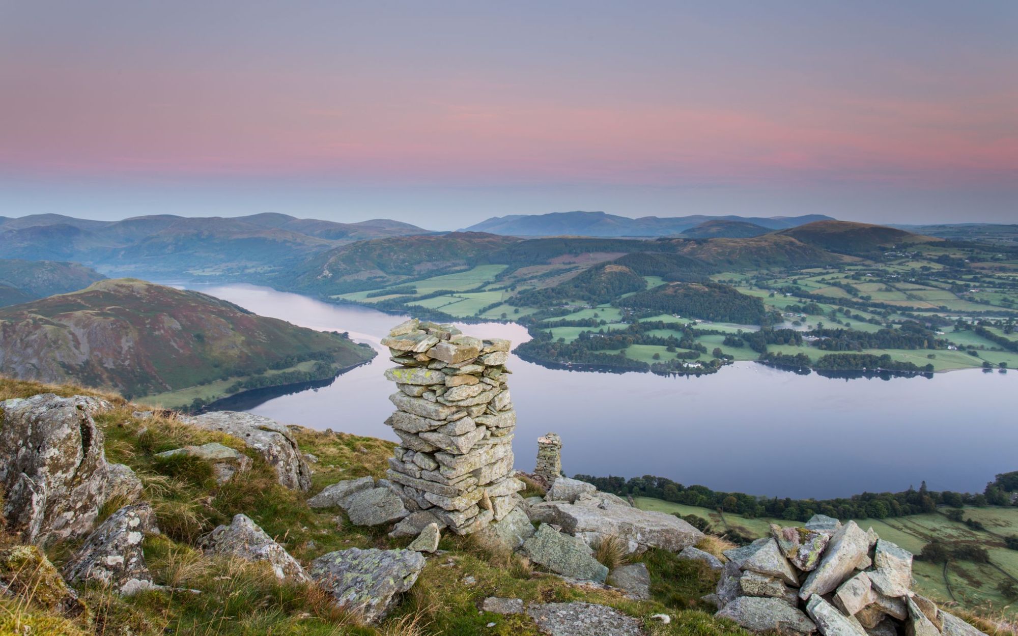
There’s usually a crowd of walkers leaving Wasdale, in the western part of the Lake District, heading for the shortest route to the top. But there’s a lesser-known way to reach the 977 metre-high summit. If you don’t want to follow a line of other people, start from the more scenic and less crowded north side, beginning in Seathwaite (or Borrowdale for a longer hike). Known as the “Corridor Route”, this nine-mile trail winds through the valley beneath rocky walls and crossing ravines before you reach Scafell Pike’s summit boulder field.
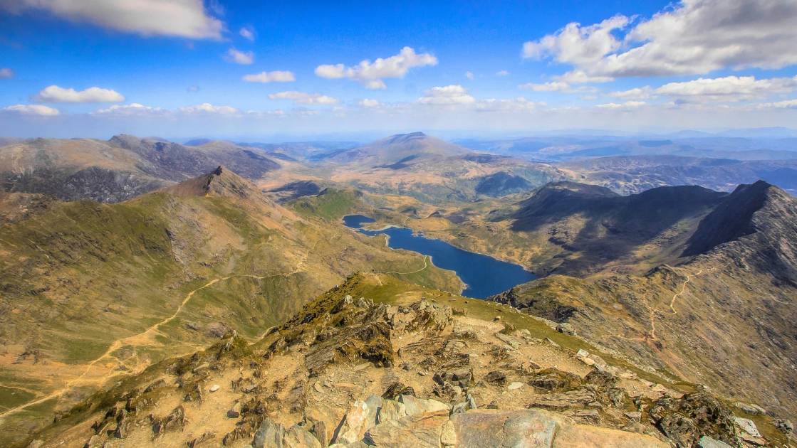
7. Aberglaslyn Gorge and Cwm Bychan, Snowdonia
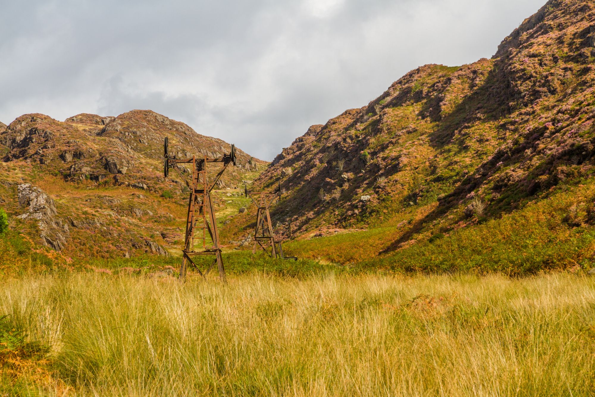
- Start/Finish: Beddgelert (circular)
- Distance: 5.7 miles (9km)
- Walking time: 4-5 hours
- Difficulty: Moderate
- Best for: Exploring Snowdonia National Park
This is a circular six mile walk, starting and ending at the little footbridge at Beddgelert. It takes in some of Snowdonia’s (Eryri's) most stunning scenery, from the placid waters of Llyn Dinas to the spectacular Aberglaslyn Gorge with the turbulent Glaslyn River raging alongside the path. You’ll pass the rusting pulley systems of the old copper mine working of Sygun and Cwm Bychan.
Plus, you will get a broad view of Yr Aran, Lliwedd, Siabod and Snowdon (Yr Wyddfa) on your descent – if the weather’s fair. Back in Beddgelert, celebrate your completed walk with a pint of real ale at the Tanronnen Inn.
8. Coast to Coast, Cumbria to North Yorkshire
- Start/Finish: St Bee’s Head/ Robin Hood Bay (point to point)
- Distance: 192 miles (309km)
- Walking time: 14-16 days
- Difficulty: Challenging
- Best for: three national parks in one route
This 192-mile walking route runs from one coast of England to the other. It was devised by British fellwalker and writer Alfred Wainwright in 1973, most famous for his Lake District guides. He put a tab behind the bar in Whitby for people who completed his walk. Needless to say, this is long used up.
The trail picks its way from St Bees Head on the Irish Sea to Robin Hood’s Bay on the North Sea. Along the way, you will cross the Lake District, the Yorkshire Dales and the North York Moors. Three national parks in one walking route! You also watch the geology change as you walk, switching from red sandstone at St Bees to green slate at Honister. Other highlights include the pretty Lakeland village of Grasmere with its Wordsworth Museum and the 12th century Shap Abbey.
9. West Highland Way, Glasgow to the Highlands
- Start/Finish: Milngavie/ Fort William (point to point)
- Distance: 96 miles (154km)
- Walking time: 7-9 days
- Difficulty: Moderate
- Best for: Iconic Scottish scenery
There’s a reason this is one of the best long distance walks in the UK and one of UK’s most popular walking routes. The beauty of the West Highland Way is off the scale. It runs from Milngavie, north of Glasgow, to Fort William in the Scottish Highlands. The whole route is a momentous 96 miles and takes in the country’s biggest loch (Lomond) and grandest moor (Rannoch).
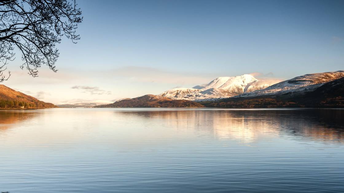
Most walkers take around a week to walk it, though you can do it in shorter sections, too. One of the toughest – but most rewarding – sections is from Kingshouse to Fort William, 22 miles culminating in long slog towards Ben Nevis, dominating the skyline in front of you. If you’re interested in just doing certain sections, or checking out other treks in the area, have a look at our guides to hiking in Glasgow and Scotland.
10. Causeway Coast Way, County Antrim
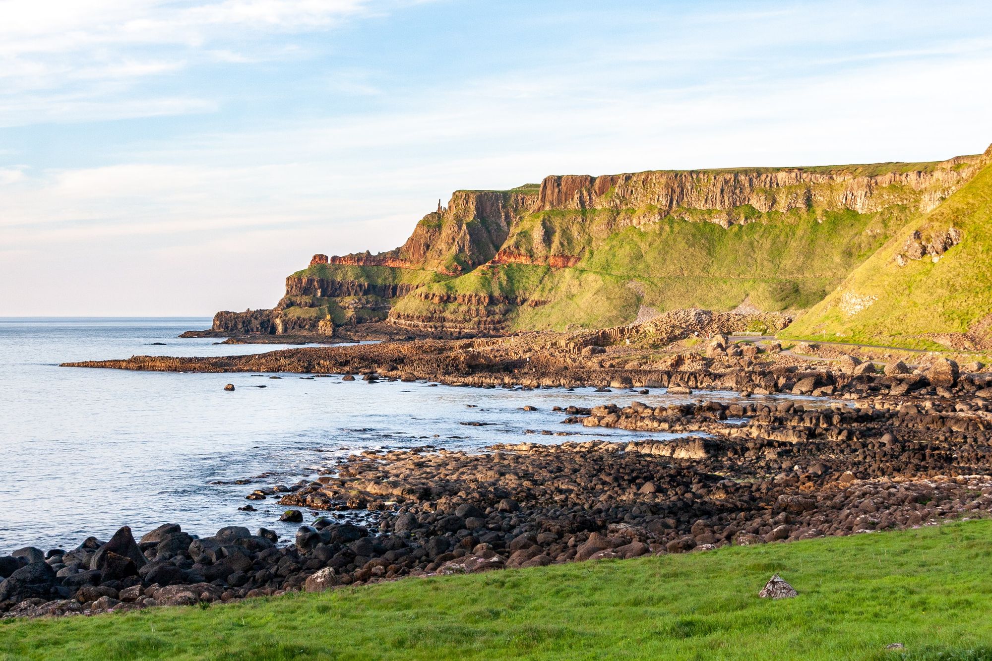
- Start/Finish: Portstewart/ Ballycastle (point to point)
- Distance: 33 miles (53km)
- Walking time: 2-3 days
- Difficulty: Moderate
- Best for: Rugged clifftop scenery
This dramatic, sea-sprayed walk has some of the finest cliff scenery in Europe. You will see sweeping vistas of the Giant’s Causeway with its ancient basalt columns, said to be the remains of a causeway built by a mythical Irish giant. The 33-mile trail from Portstewart to Ballycastle runs through the seaside towns of Coleraine, Portstewart and Portrush, and passes the famous Irish whiskey distillery at Bushmills – perfect for a pitstop. The terrain ranges from grassy cliff edge paths to causeway stone, mottled with lichens, plus some stiles.
11. Yorkshire Three Peaks Challenge, Yorkshire
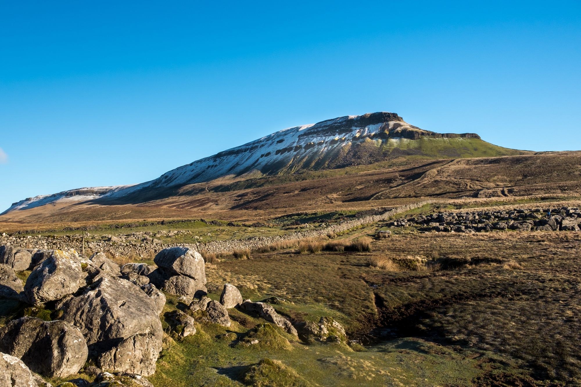
- Start/Finish: Horton-in-Ribblesdale
- Distance: 23 miles (37km)
- Walking time: 1-2 days
- Difficulty: Challenging
- Best for: Exploring the Yorkshire Dales
The Yorkshire Dales are home to some of the best walking in the UK. Ticking off the area’s three highest mountains is a great achievement that can be done in just one day. The Yorkshire Three Peaks Challenge is no mean feat – it involves hiking a 24-mile loop with more than 1,600m of climbing as you go up and over Pen-y-Ghent, Whernside and Ingleborough in under 12 hours.
There are spectacular views from all three hills and fascinating geology, too, such as Pen-y-Ghent’s two distinct sills – the lower is limestone, the upper gritstone. If you’re keen for a challenge but are time poor, this is the walk for you.
12. Kinder Scout Plateau Circuit, Peak District
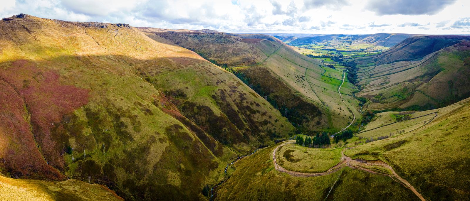
- Start/Finish: Edale Train Station
- Distance: 16.8 miles (27km)
- Walking time: 7-9 hours
- Difficulty: Challenging
- Best for: A historic circuit of the Peak District
Kinder Scout is renowned for its 1932 mass trespass, which highlighted the lack of legal access for hikers to open countryside. This large plateau, surrounded by steep cliffs, allowed multiple groups to converge from different directions. This protest significantly influenced the creation of the National Parks Act and the Countryside Right of Way Act.
From the train station, head up the hill and turn onto the Pennine Way. Follow the markers through fields and Upper Booth village until you reach the open moorland and Jacob's Ladder path, a steep, well-used route paved in the 1700s by local farmer Jacob Marshall. Upon reaching the plateau, turn right towards Kinder Low's trig point, keeping the steep edge to your left. Pass Edale Rocks and Pym Chair, and beware of the peat bogs. The most impressive water to exit the plateau is definitely Kinder Downfall. The waterfall drops almost 100 feet into a rock amphitheatre.
Continue along the Pennine Way around the plateau’s edge, until the northwest corner. You'll be treated to staggering panoramic views, including unusual gritstone formations, weathered into bulbous crags and boulders. Descend down Grindsbrook Clough and hike back into Edale.
13. Ben Nevis Ascent, Fort William
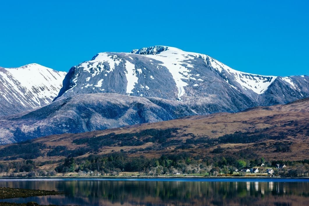
- Start/Finish: Glen Nevis Youth Hostel (out and back)
- Distance: 8 miles (13km)
- Walking time: 6-7 hours
- Difficulty: Challenging
- Best for: Climbing the UK’s highest mountain
This is the most commonly used route up Ben Nevis, the highest mountain in Scotland at 1345m (4,413 ft) - many of the others involve scrambling or climbing. But just because it’s the easiest, that doesn’t make it easy; you’ll be ascending and descending around 1,300m (4,265ft) across a single day.
Begin your hike from Glen Nevis Youth Hostel by crossing the road and a wooden bridge over the River Nevis. The path is wide, well-made, and clearly marked. Follow it up to where it meets the contouring path from Achintee House, turn right and continue curving around and climbing the hill. The path becomes narrower and more rocky here, and you'll have passed your last signpost, entering true mountain terrain. Continue up the gully and around the sweeping bend, where you should see a lochan (a Scottish tarn) to your left as the path curves around the top of the gully and ascends Ben Nevis.

You'll cross some small streams before encountering a series of zig-zags on the path. Despite the relentless uphill climb, you’ll eventually approach a plateau. Though still uphill, this section feels comparatively flat. Follow the line of cairns up to the summit. The top trig point and observatory are just to the left of the last cairn - on clear days, you can enjoy views across the Scottish Highlands. The best route for descending is likely to retrace your steps.
14. Loch Avon & Cairn Gorm, The Cairngorms
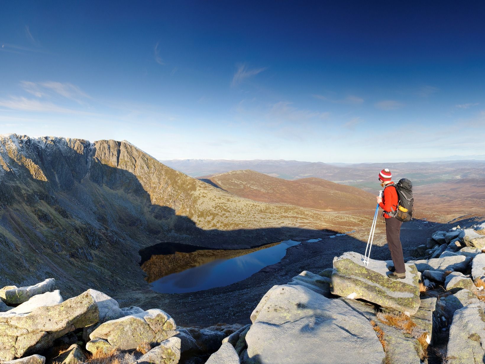
- Start/Finish: Glen Shee Ski Centre
- Distance: 9 miles (14.6 km)
- Walking time: 8-9 hours
- Difficulty: Challenging
- Best for: Cairngorms explorations
A circular hike taking you up onto Cairn Gorm (1,245m/4,084ft), the highest Munro in the spectacularly wild Cairngorms National Park in Scotland. Park at the Glen Shee Ski Centre, 11 miles east of Aviemore. Head southeast on the vehicle access road to Shieling Station, until you see a path on the right hand side. Follow it along the ridge of Fiacaill a' Choire Chais, keeping the rocks to your right. Descend southeast, following a faint track alongside the Allt Coire Raiberirt River towards Loch Avon, (also known as Loch A’an), tucked in between two dramatic ridges.
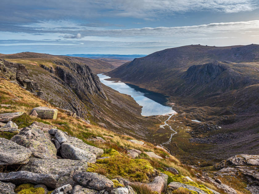
From the loch, turn right along the path, which traces the edge of the loch. Cross a footbridge and continue along the lower slopes until you reach a ford. After crossing it, locate the path opposite the river. It takes you towards The Saddle and up the east face of Cairn Gorm. Climb to the summit, following a line of cairns. From the top you’ll have panoramic views of the vast expanse of the Cairngorms, and Loch Avon. Follow the cairns off the summit towards Ptarmigan Station. Cross the first ski tow, turn left, and keep the tow to your right. The path turns left again, well-marked with cairns, leading sharply downhill. Continue back to the ski centre.
15. Pen y Fan Horseshoe Route
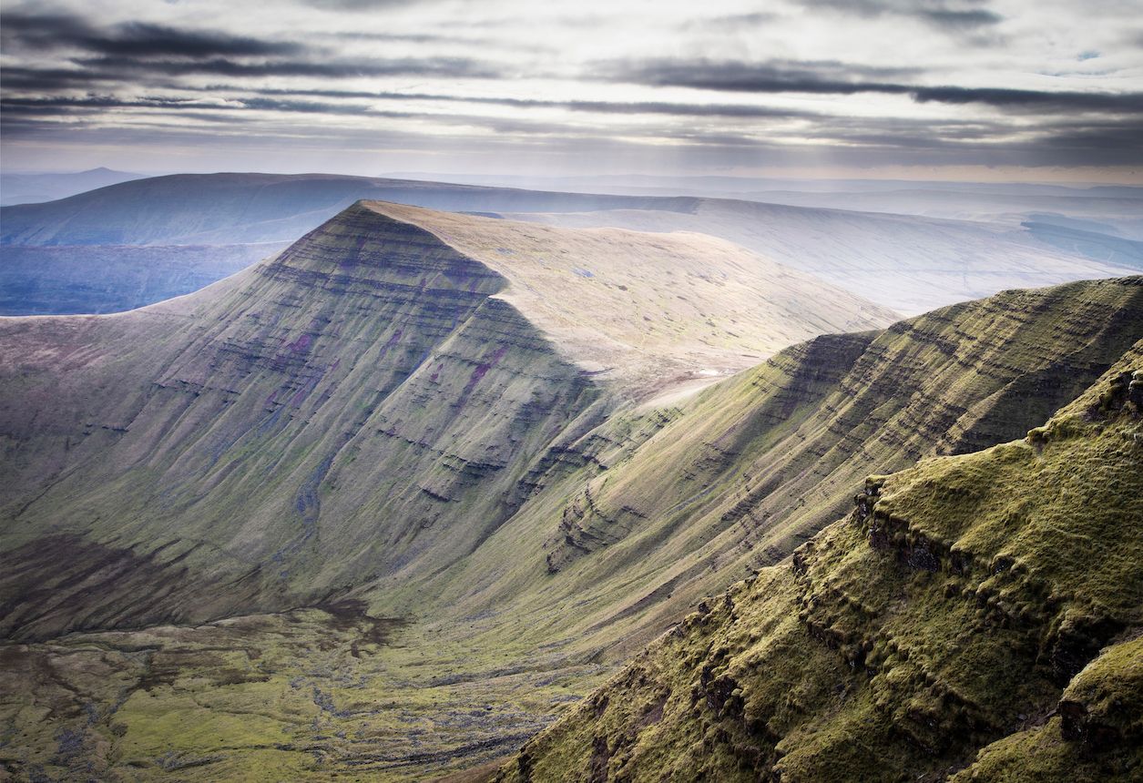
- Start/Finish: Taf Fechan Car Park (circular)
- Distance: 9.5 miles (15.2km)
- Walking time: 4-5 hours
- Difficulty: Moderate
- Best for: Panoramic views of the Brecon Beacons
Pen y Fan (886m/2,900ft) is the highest mountain in the Brecon Beacons National Park of Wales, making it one of the more popular climbs. Many walkers opt to park in the Pont ar Daf car park on the A470 for the gentlest ascent. But we recommend a more challenging circular route, offering up better views and fewer crowds.
The Pen y Fan Horseshoe route traces the ridge of a glacial valley across four of its peaks: Corn Du; Pen y Fan; Cribyn and Fan y Big. Head north along the road from Taf Fechan car park until you reach the calm waters of Lower Neuadd Reservoir. Go left through a gate and begin the steep climb onto the Graig Fan Ddu ridge. Follow it right to Corn Du. Here, the path forks - take the left to ascend the crest of Corn Du and continue on to Pen y Fan. Stop to appreciate the amazing views of the surrounding hills and glacially carved valleys.
Descend towards a stone path that takes you down Craig Cwm Sere and up towards the summit of Cribyn. You’ll descend onto the Gap Road, a former carriage track. At this point you can make the ascent up Fan y Big or continue on until you reach the road you started from. Follow it back to the car park.
When is the Best Time to Go Hiking in the UK?
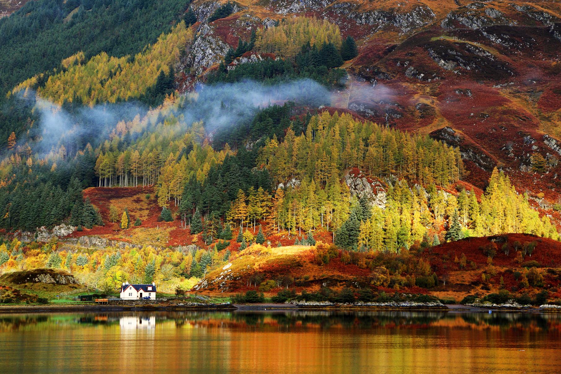
You can hike year-round in the United Kingdom, especially if you’re not worried about being rained or snowed on. However, hiking season in highland areas - such as the Cairngorms in Scotland - is between March and November, as during winter months there is heavy snowfall, meaning you need technical experience for mountain ascents. There are, however, plenty of lowland hikes you can do during the winter months, such as the South West Coastal Path.
Popular hiking routes will get busy during the summer months of July and August, but you have the best chance of sunny weather - and the long days of sunlight mean you can cover good distances. Our personal preference is for hiking in May, when the weather is beginning to warm up, or September, once the summer crowds disappear.
Of course, weather in the UK can be notoriously unpredictable - read, rainy - so make sure you pack for all conditions, whatever time of year you visit.
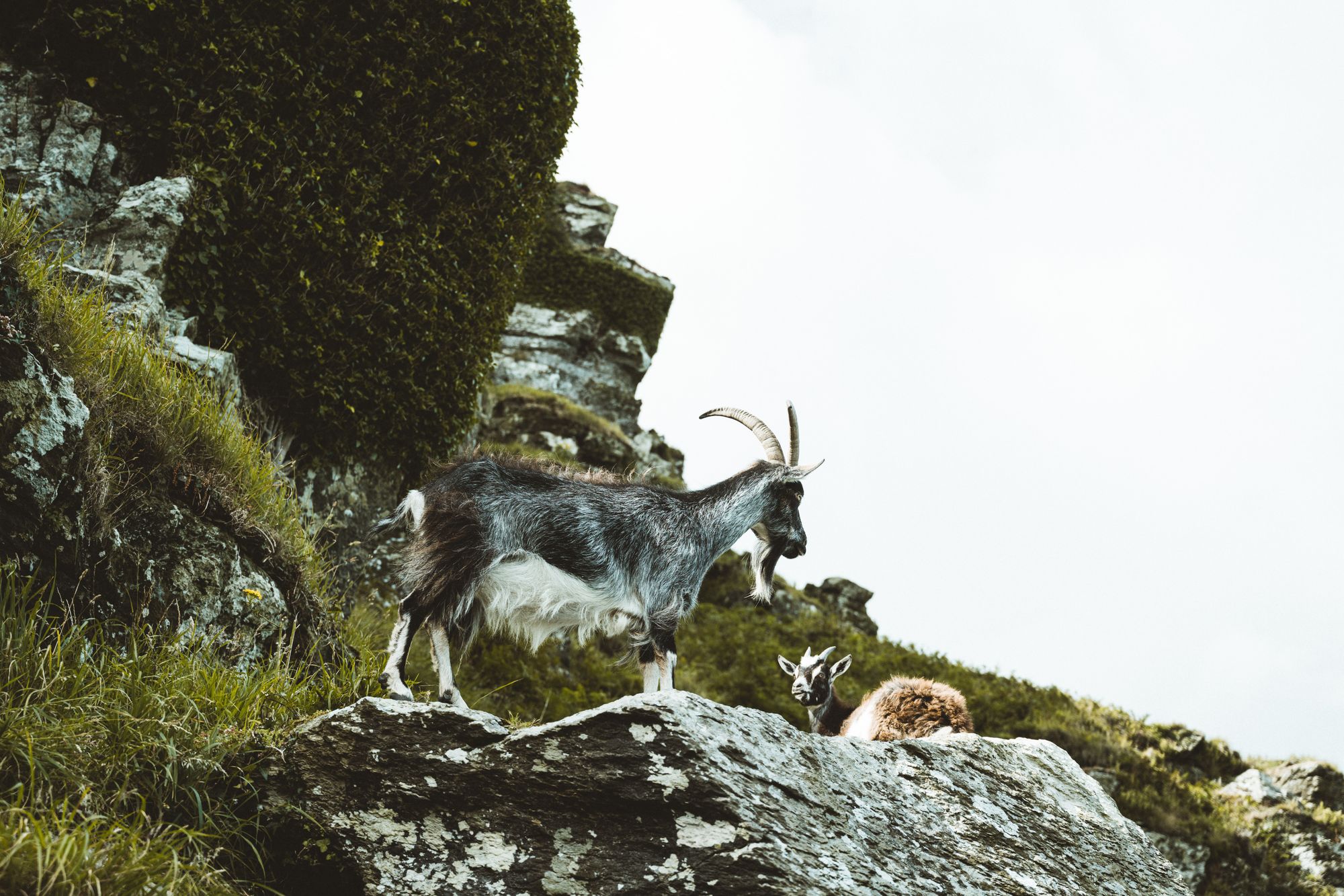
What Animals Live in the UK?
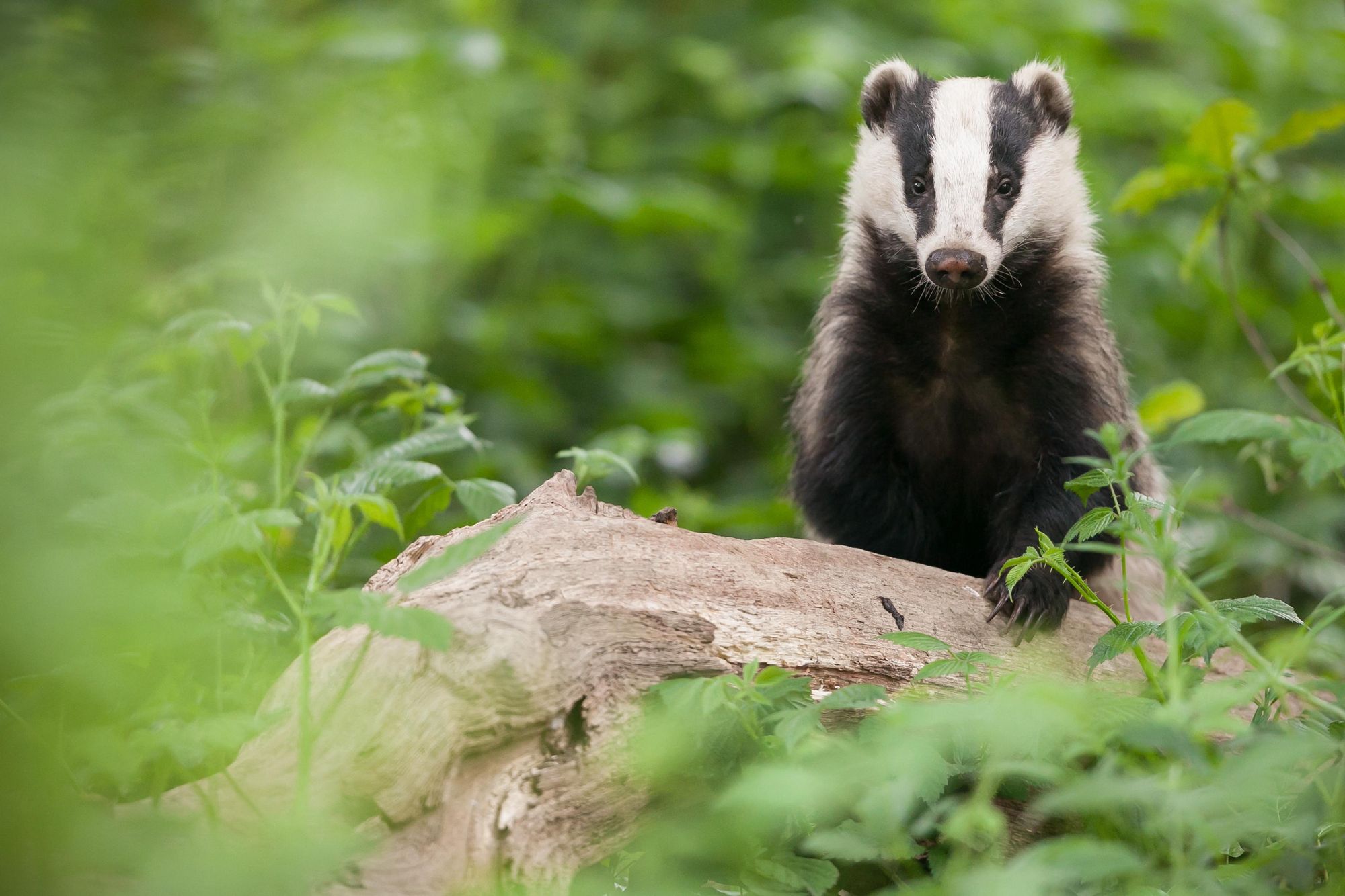
The UK is home to a variety of wildlife species. Foxes, badgers and rabbits make their homes in the fields and woodlands, alongside a variety of different deer species. Red breasted robins nest in hedgerows, while you might see electric blue kingfishers diving into rivers.
There is also a lot of wildlife along the UK’s islands and coastlines. Travel to Norfolk to see vast colonies of grey seals, or head to Scotland’s Isle of Skye in search of puffins and sea eagles. Minke whale can be seen off the west coast of Scotland between May to October.
Where to Stay in the UK?
You’ll find a wide range of accommodation in the UK, ranging from luxury hotels to campsites. Make sure you take the time to look out for locally owned accommodation, as you’ll be helping out the local economy, plus will get some excellent tips on nearby hikes and activities.
If you’re on a budget, check out the UK’s network of hostels, Hostelling Scotland and YHA (for England and Wales), which provide dormitory accommodation in a variety of scenic locales. We particularly recommend Skiddaw Bunkhouse, located in the heart of the Lake District and accessible only on foot or by mountain bike. Scotland is also known for its bothies - unoccupied rustic accommodation in remote areas, that’s free to use. Check out the Mountain Bothies Association for a full list.
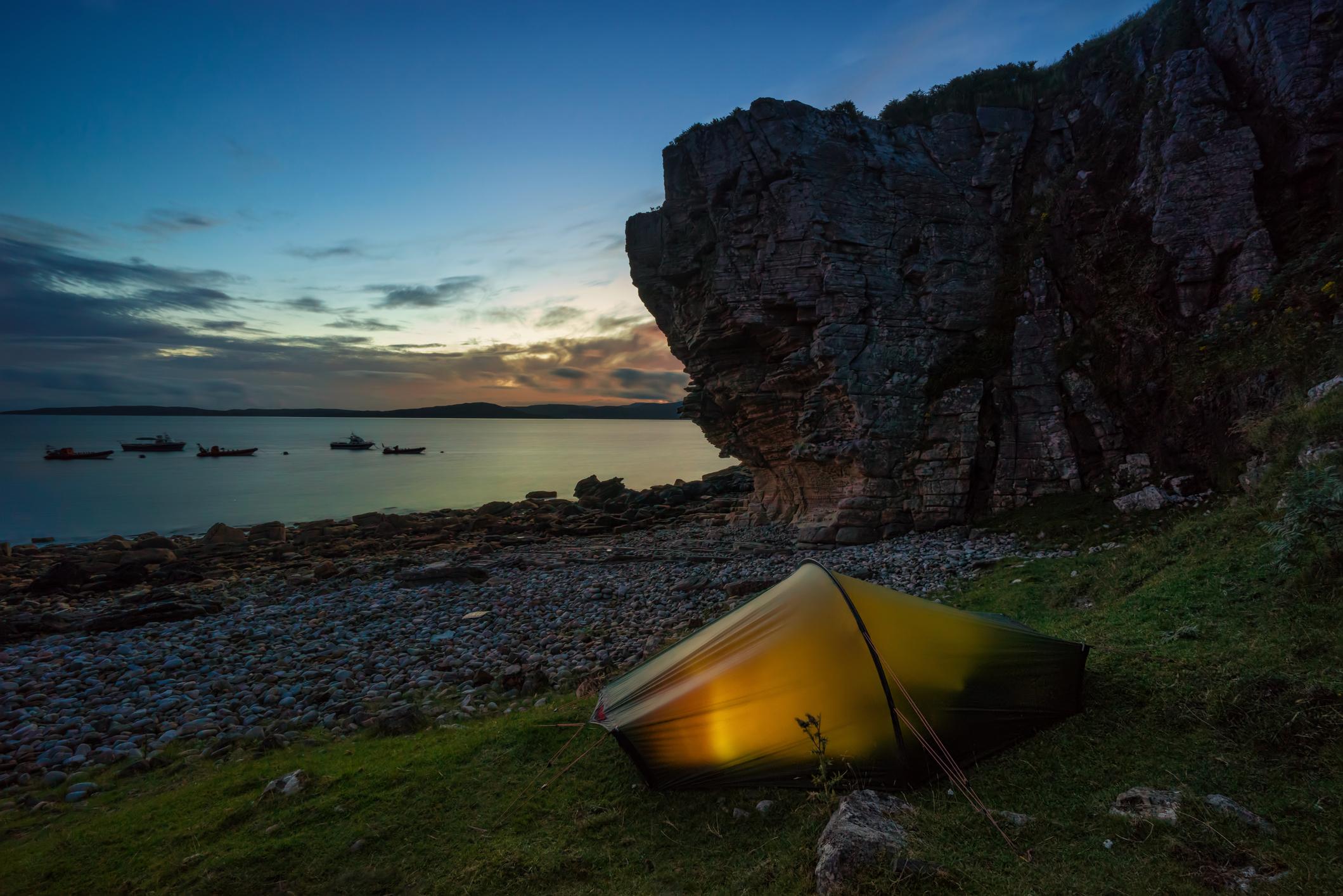
Wild camping is permissible in Scotland, but not in the rest of the UK. However, Wild With Consent lists ‘wildish’ locations you can camp with permission from landowners (you’ll have to book and pay), and Pitchup also lists a variety of camping spots for booking.
On cycling and hiking trips, we often stay in B&Bs; rooms in a family-run hotel or house where you’re provided with a bed for the night and a filling breakfast. Our favourite is Dorset House, in Lyme Regis, for its exceptional breakfast and proximity to the coast.
What to Eat in the UK
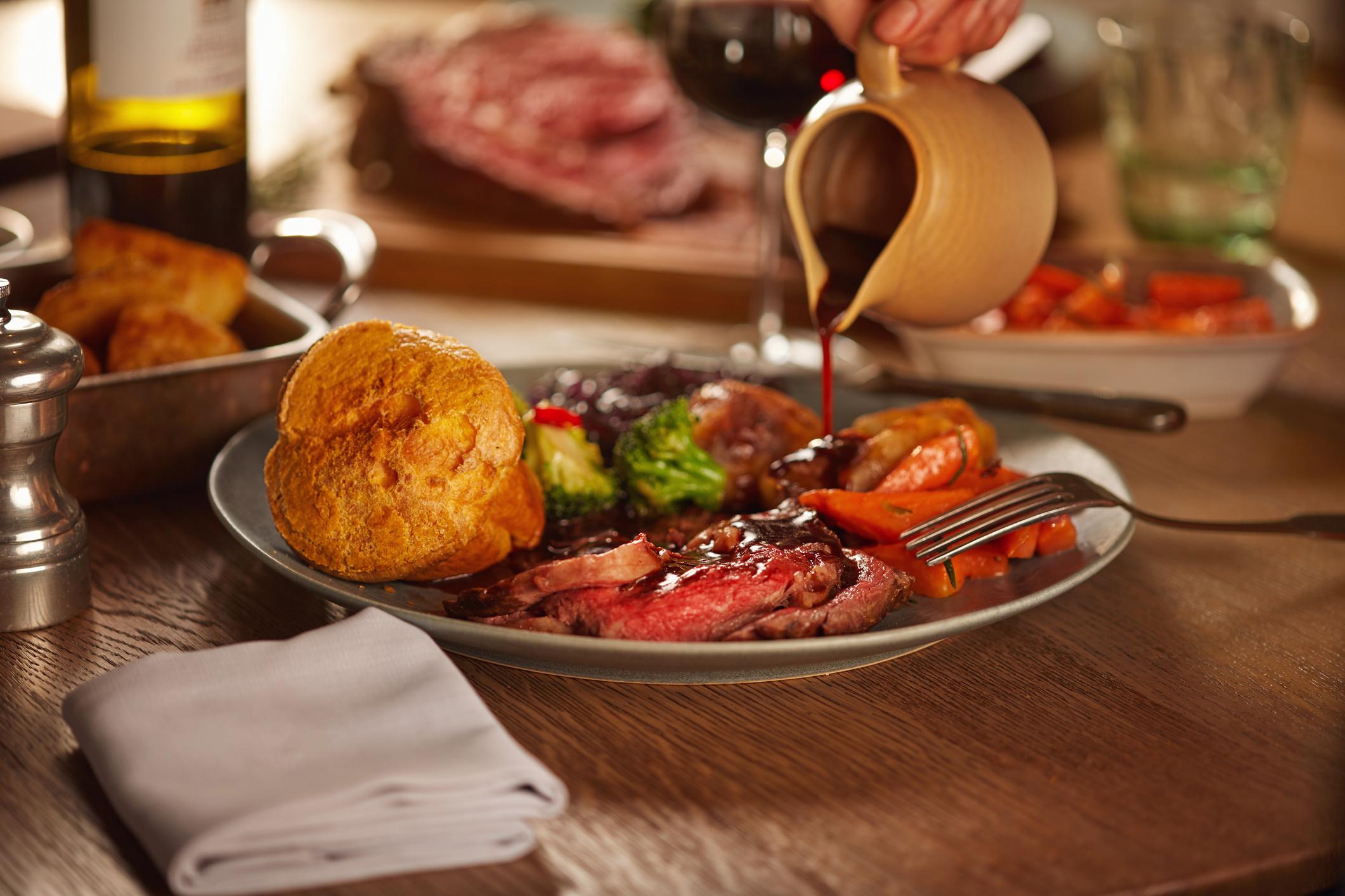
The UK’s national dish is chicken tikka masala, a curry said to have been invented for British palates in Glasgow in the 1970s (it’s a mild version of butter chicken) - and this is reflective of Britain’s long love affair with Indian food. However, Britain is better known for its Sunday lunches, where roast meat, gravy and roasted potatoes are served along with seasonal vegetables, and for its crispy battered fish and chips, both of which really hit the spot after a long walk.
Britain has a strong, proud tradition of artisan cheesemaking. Try Cornish yarg, a hard sheep’s cheese wrapped in nettles, or stilton, a pungent blue cheese which originates in the counties of Derbyshire, Leicestershire and Nottinghamshire. The country also has a strong baking tradition - sticky toffee pudding, a moist sponge doused in warm butterscotch sauce, is delicious. And let’s not forget the booze. Britain has an excellent craft beer and gin scene, and Scotland is renowned for its whisky.
How to Get to (and Around) the UK
By train: You can travel to London, UK, via the Eurostar train from Paris. The Eurostar also runs between London and Amsterdam. For travelling within the UK, there’s an
extensive rail network, with stations positioned within national parks such as the Lake District and Peak District. Visit Trainline to plan your journey (you can also download the app to purchase cheaper ‘splitsave’ tickets).
By plane: Most international travellers visiting the UK tend to fly into one of London’s largest airports, London Gatwick or London Heathrow - there are also good links between Europe and London Stansted Airport. If you’re interested in visiting the Lake District or Peak District, we recommend flying into Manchester Airport; for visiting Scotland, fly into Edinburgh Airport.
By bus: The UK has a good, affordable network of local bus routes, and also coaches for long distance travel between destinations. We recommend checking out National Express for coaches and Traveline for public transport on local buses.
Read more:
- Climbing the Rùm Cuillin, on Scotland's Forbidden Isle
- Hiking in Scotland: 26 of the Best Hikes in the Country
- The Tallest Mountain in England and How to Climb it
Inspired? Check out our full range of adventure holidays in the UK now!