


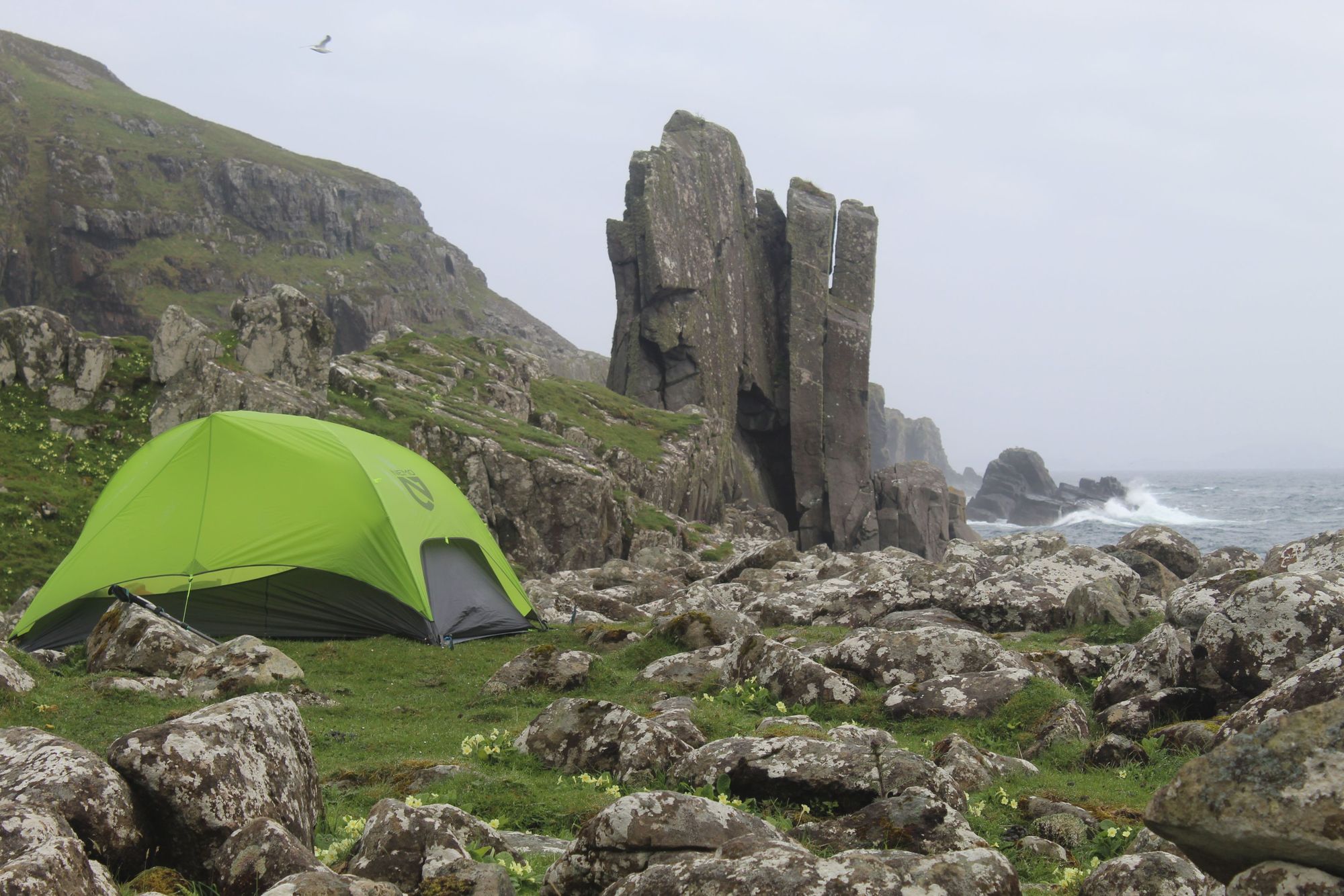

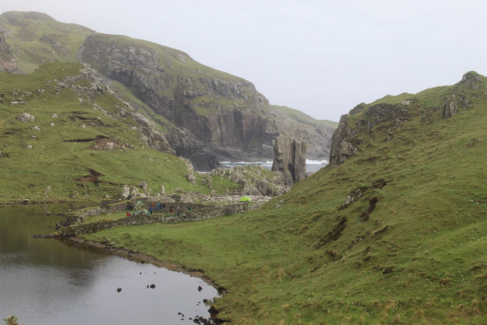
A minke whale lies dead, washed up on the boulder beach before us. It’s a soul-stirring sight, with the wanton waves of the Atlantic crashing against the rocks behind and the Papadil sea stack - a splayed stone tower; a sublime piece of natural architecture - standing guard of this wild coast.
On either side of the beach climb curving green slopes, and tall cliff faces.
When fully grown, a minke whale can reach 11 metres long and weigh 50 tonnes. They filter the ocean as they hoover up crustaceans and plankton. Tourists take boat tours, equip metre-long camera lenses and sacrifice hours just to glimpse the fin of such a mighty marine mammal - and here’s a tragic sight; the remains of one in full view, hurt, perhaps, by a boat and washed in by the tide.
We’re on Rùm for a four-night expedition, wild camping our way around the island...
The sight is both sobering and saddening, and yet it doesn’t seem out of place here on Rùm, an island off the west coast of Scotland known as ‘nature’s island’.
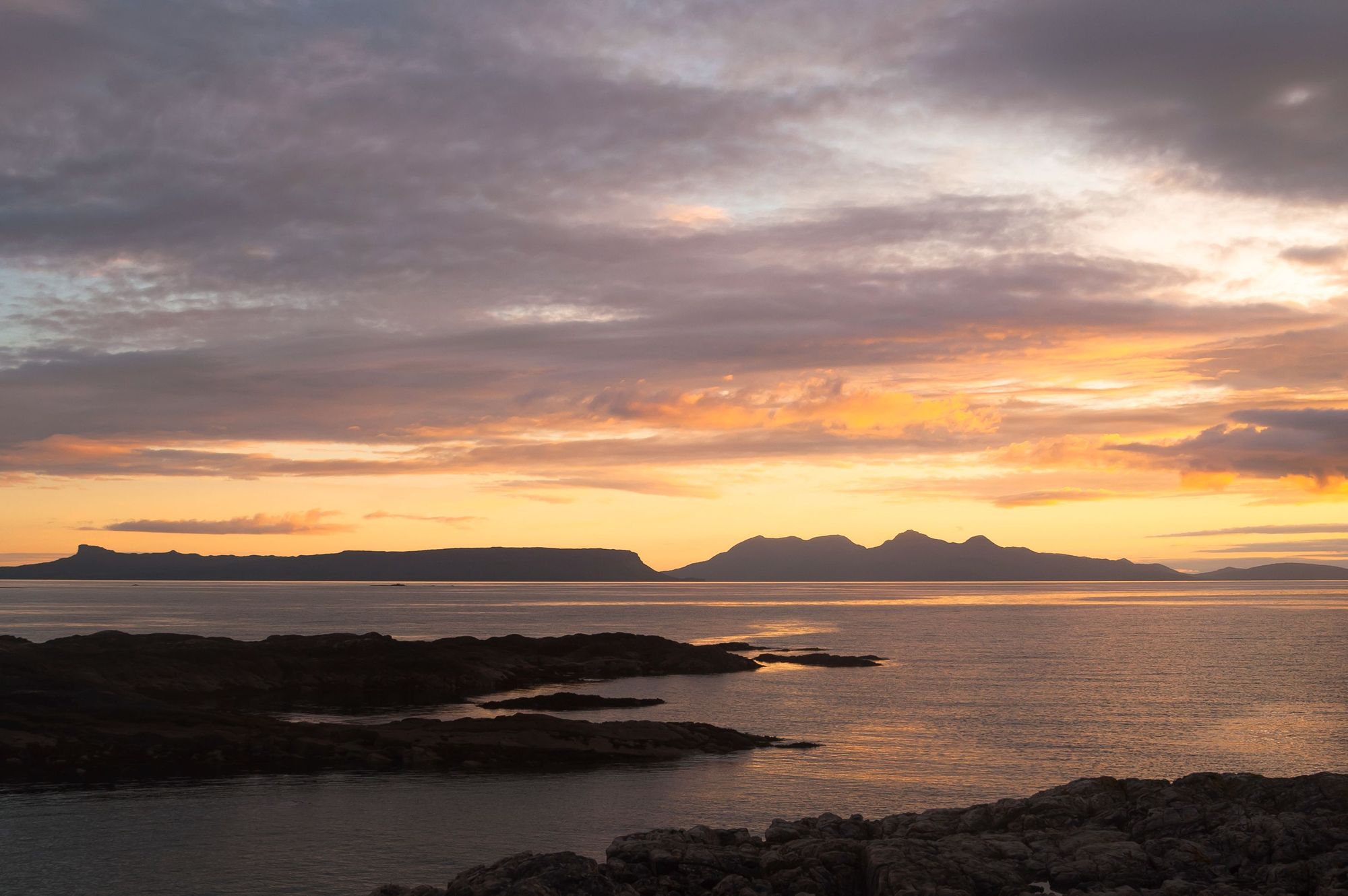
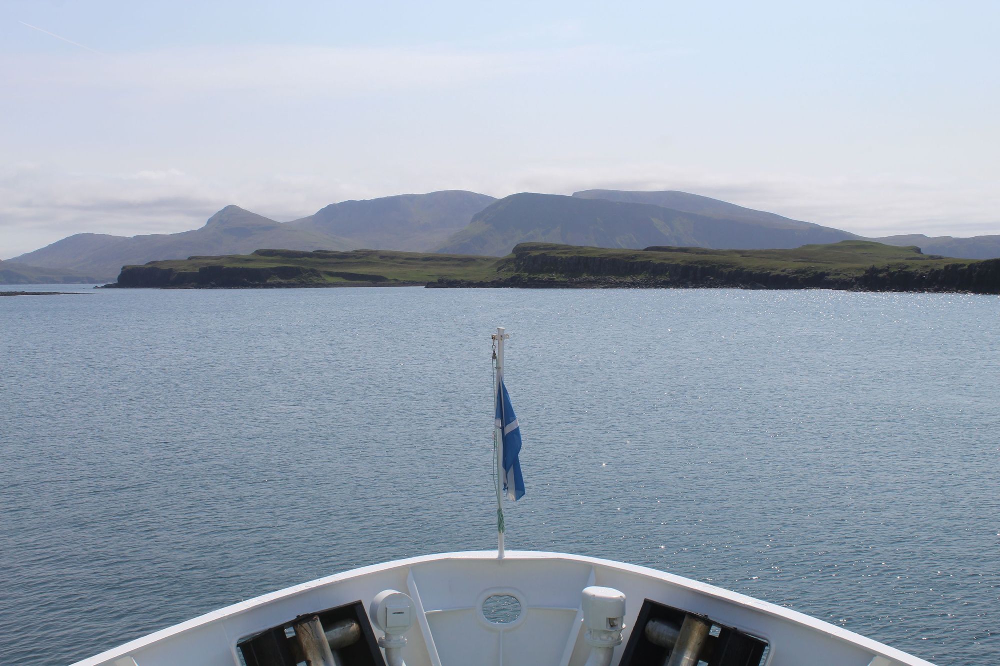
We’d arrived in Kinloch, the only village on Rùm, on the two hour ferry from Mallaig the day previous. The views on board could stop the heart of a romantic; the golden sand beaches and turquoise water of Arisaig behind, and the islands of Rùm and Eigg, separated only by a sliver of water, in front. From afar, Eigg takes the shape of a common dolphin; the highest hill on the island, the curving 393m Sgùrr, giving its gentle skyline a dorsal fin. Rùm, in contrast, is all mountains - a squiggly shadow which grows ever more rugged on approach.
We’re on Rùm for a four-night expedition, wild camping our way around the island with the ultimate aim of climbing the Rùm Cuillin and summiting Askival. The highest mountain on the island, it soars from sea level to 812m in height.
“The terrain is challenging,” says Jeannie Sherwood, a guide based in Skye, with a wealth of experience climbing on Rùm. “If you do the entire ridge on the easiest line, it’s still a grade two scramble. There are harder lines too, similar to the Cuillin on Skye, which is the ultimate alpine ridge in the UK - so it can be a good way to prepare for climbing the Cuillin. But Skye is rammed with people, and the beauty of Rùm is that it’s remote. It doesn’t get many visitors. There are no roads. It's a beautiful wilderness, and you have most of it to yourself.”
Indeed, only around 30 people live on Rùm. When our ferry arrives, tourists from the boat double the island's population. But Rùm wasn’t always so empty.
At 104.6 km², the island is by far the biggest of the Small Isles, a collection of four islands - Eigg, Muck, Rùm and Canna - in the Inner Hebrides. Carbon dating of hazelnut shells has shown that Rùm was inhabited from as early as 7700 BC, making it one of the earliest-known sites of human occupation in all of Scotland.
It later had a period of early Christianity, disturbed when Vikings arrived in 833 AD and gave the peaks their evocative Norse names - Askival (spear mountain), Hallival (ledge mountain), Ainshval (stronghold mountain), to name but a few.
The island was handed back to Scotland in the Treaty of Perth in 1266, and though the population grew, peaking at around 450 in the 18th century, it was emptied when the Highland Clearances swept through the Highlands and islands.
In 1826 and 1827, the natives of Rùm were shipped off to Nova Scotia to be replaced by 8,000 blackface sheep. The price of mutton and wool then crashed in 1839, bankrupting the farmer, and leaving Rùm ultimately empty.
It's a beautiful wilderness, and you have most of it to yourself.
The island became a shooting estate after that. John Bullough bought it in 1888, and his son Sir George Bullough changed the name of the island to ‘Rhum’ - supposedly because he (or his teetotal wife) didn’t like the boozy implications of being called the ‘Laird of Rum’. Sir George would also build a mausoleum in Harris, on the west of the island, as well as the even more extravagant Kinloch Castle near the port - built with sandstone imported 182 miles from Annan.
Sir George was an eccentric. Labourers working on Kinloch Castle - which boasted an alligator pond - were paid an extra shilling to wear kilts, and smokers got an extra two pence a day, with the idea being they’d keep the midges away.
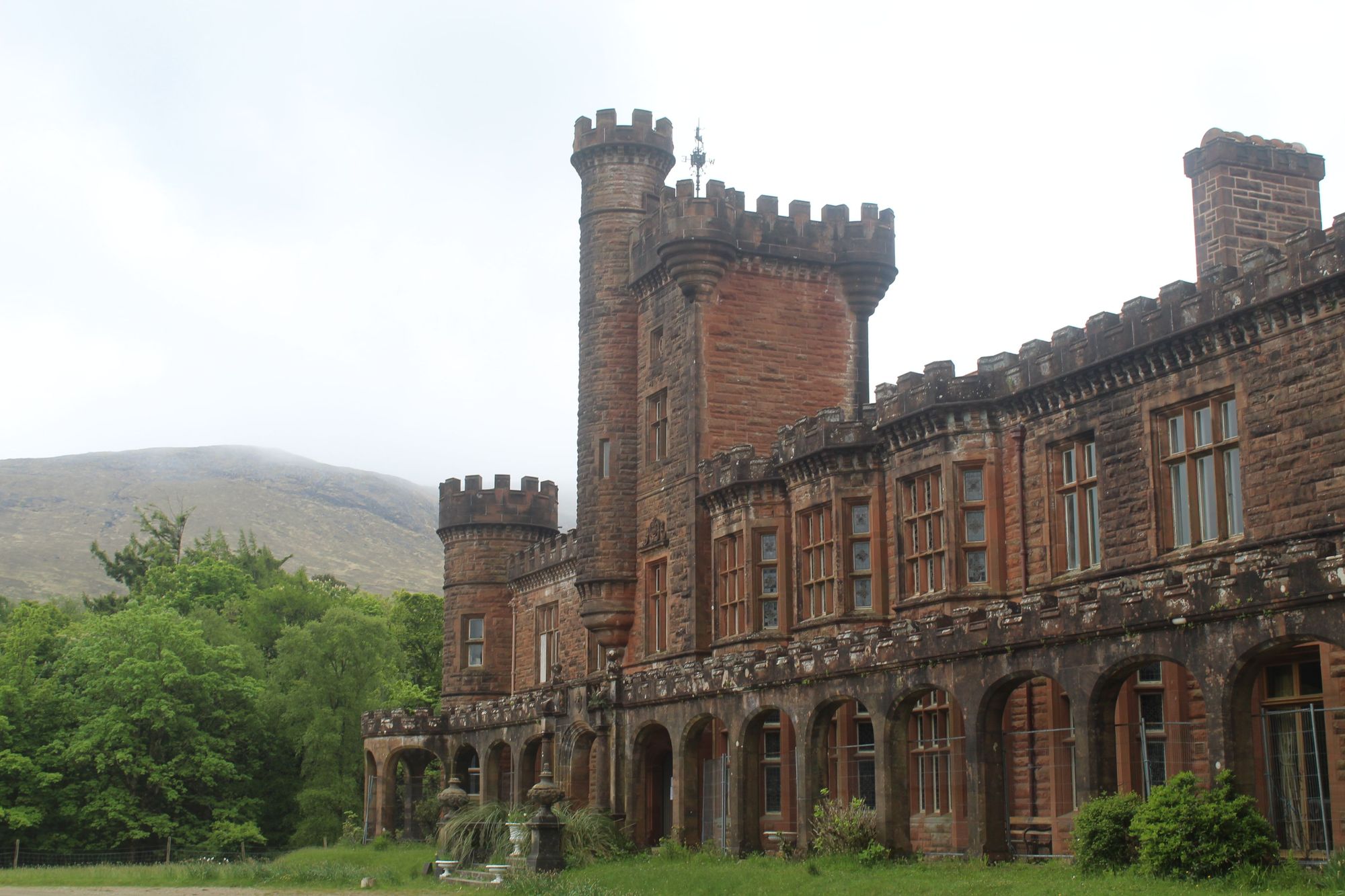
Today, the Edwardian castle is in need of expensive structural repairs and risks becoming a white elephant, but it remains a fascinating building - a relic of a bygone era. When the last of the Bulloughs left, Sir George’s widow, Kinloch Castle wasn't emptied. Gaze in the windows and you can see taxidermy eagles and bearskin rugs, oakwood dining tables and century-old portraits.

During this period, from 1845 onwards, Rùm gained the notorious title of being “the Forbidden Isle” owing to the fact that guests were discouraged from visiting. And even after the island was sold to the Nature Conservancy Council in 1957, access was heavily restricted. They took advantage of the lack of people to use Rùm as a study site for deer, and it’s largely been a nature reserve ever since.
Those who do live on the island usually don’t find it easy.
“It feels very isolated,” says Jeannie, who spent one winter living on Rùm, while volunteering for Scottish National Heritage (now NatureScot) who run the island. “You're relying on the boats to come in with deliveries for the shop, but the weather is very harsh in winter, so a lot of the deliveries don't make it. You can go days without any deliveries, and you have to make do.”
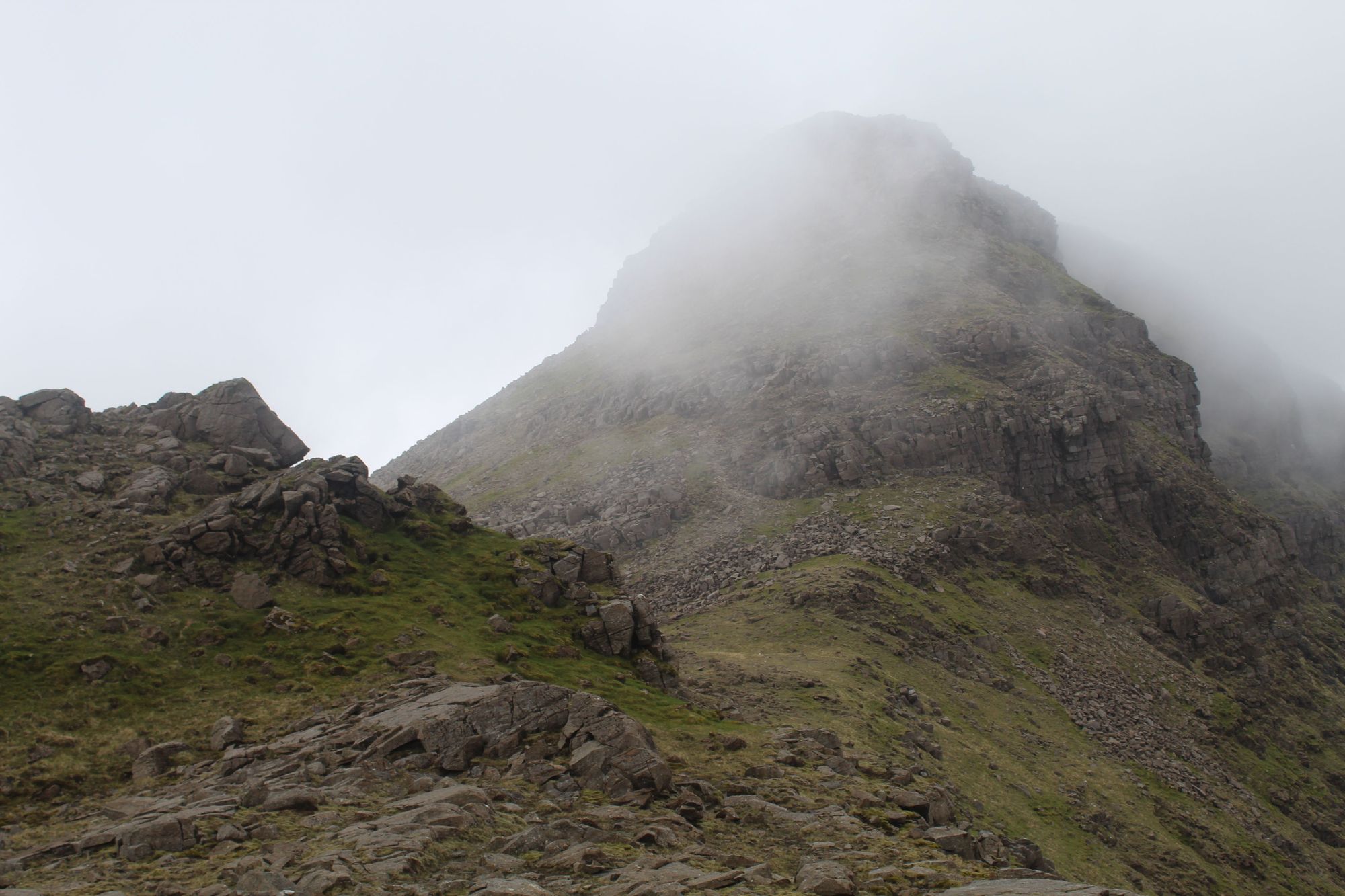
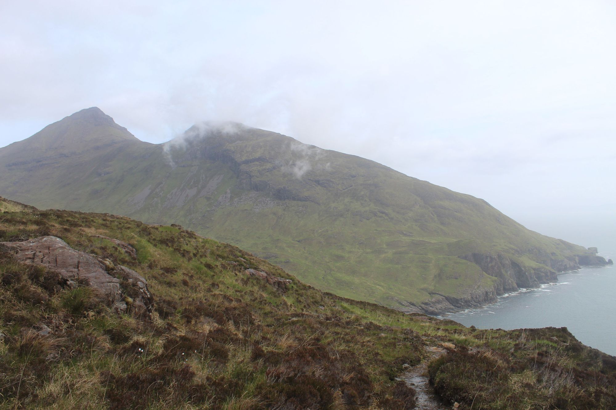
Rounding a corner, the spearhead peak of Askival comes into view for the first time, connected to the lower Beinn nan Stac by a deep saddle.
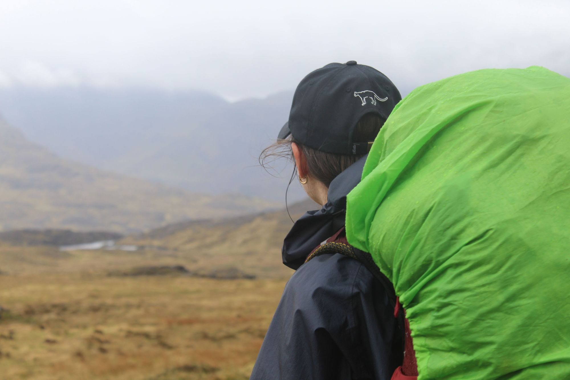
We leave Kinloch Castle in the sunshine, walking out into an entirely treeless landscape of moody heather and rolling hills. There’s only one shop on Rùm, in Kinloch, so we’ve got heavy packs - carrying not just our tents and sleeping bags for our expedition, but everything we'll need to sustain ourselves for four days.
The clouds soon move down to block the mountain tops, but thankfully by the time the heavens open, it’s only a few more miles to our camping spot at Harris.
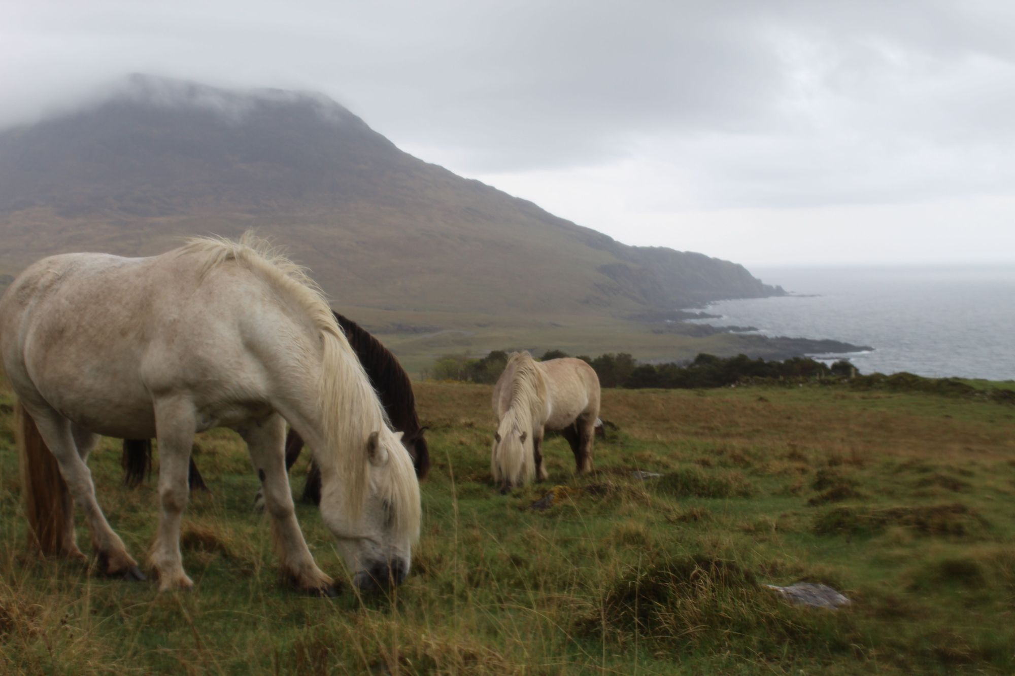
The Bulloughs' mausoleum comes into view as we descend. A pillared Greek temple on a wild Scottish coastline, it's a fascinating feature, if entirely out of place. Highland ponies and cattle graze on the fields above us, and as we pitch our tents, a herd of goats bound down a nearby rock face. It’s not uncommon to see such animals in Scotland - but it is uncommon to see them in the wild.
Before the clearances there was a settlement here; hundreds who would’ve woken in and worked this fierce greenery. Then they were gone - and Harris was left in silence.
Rain drops gently on our tents overnight, and when we wake, the clouds have covered the 528m peak of Ruinsival nearby. After consultation with our guides, we decide to go round rather than over the mountain, on the lower coastal route. There aren’t many trails on Rùm, so we carve our own on damp grass, through the mist. Our views don’t clear until we descend to camp two. Then picturesque Papadil comes into sight. First, the loch to the left and the remnants of an old stone settlement, then the stack - and the sobering sight of the beached whale.
The island really does feel wild outside of Kinloch. It’s a rare place where the wildlife still seems unpredictable, and landscapes can still truly surprise.
The sun breaks out as we light our campfire, and we spot an eagle of some sort flying overhead. Sea eagles were successfully reintroduced to Rùm in the 1970s, though most of the huge birds have moved to neighbouring islands now.
There’s no pitter-patter of rain tonight; just the roar of the ocean, crashing on the rocks.
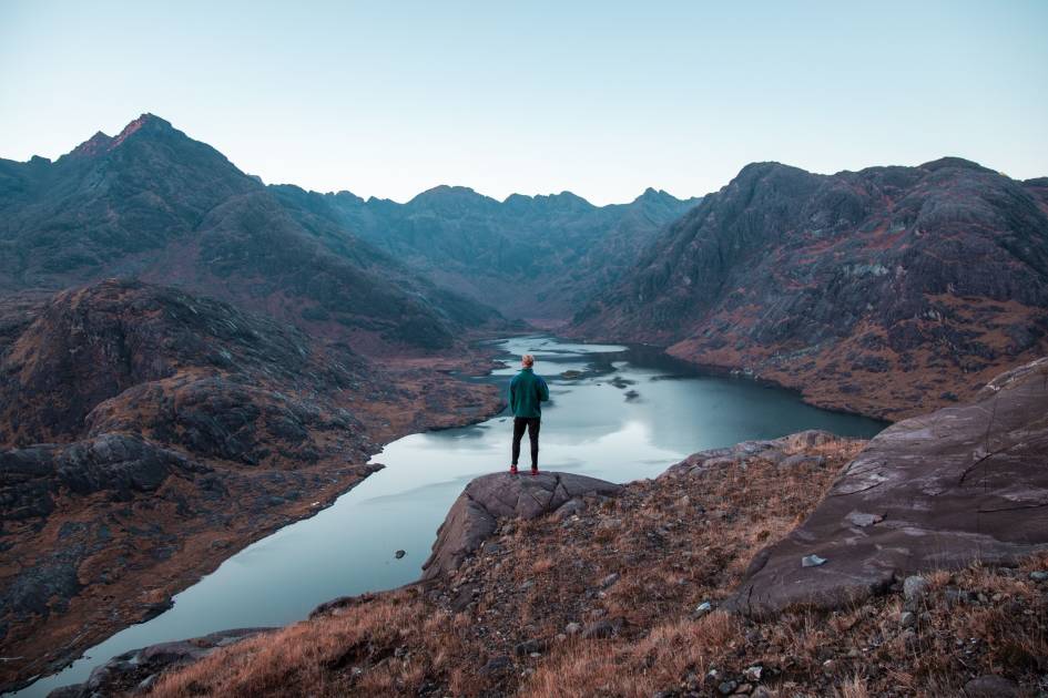
After an hour, the path relents, and for a brief moment, we become the high point of this ancient island...
The clouds dissipate overnight, so we make the decision to move our summit day forward, to take advantage. It’ll mean a longer day, but in better weather. We head out from Papadil, and can soon finally see out to Muck and across to Eigg.
Rounding a corner, the spearhead peak of Askival comes into view for the first time, connected to the lower Beinn nan Stac by a deep saddle. Both mountains are green, scree grey, and slope dramatically down to the ocean. We climb the gorgeous Glen Dibidal - a majestic U-shaped valley ringed by a horseshoe ridgeline and made entirely unique by the fact that it empties out to the Atlantic.
The climb is slow and tiring, neither of which are an issue in such weather.
We eventually reach Bealach an Oir, a saddle below Askival, and stop for lunch, looking back at Ainshval (781m) and Sgurr nan Gillean (764m) which flank the river Dibidil on the other side, and Eigg still visible, far in the distance beyond.
Our final ascent is steep, on gradients nearing 50%. The rock is loose but the trail is good. “Watch out for all the holes up here,” says Jeannie, explaining that Rùm is home to the largest colony of Manx Shearwaters - small birds, with long, slim wings - in the world, and that Askival is their chosen nesting site. Indeed, the higher we get, the more burrows we see.
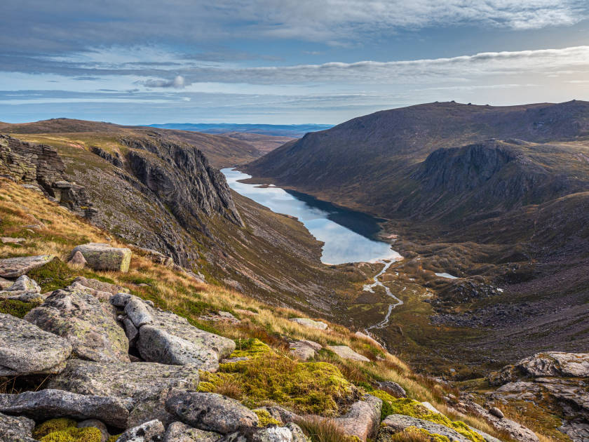
After an hour, the path relents, and for a brief moment, we become the high point of this ancient island. The clouds draw in, but through them we can still see Glen Dibidil, out to the sailing boats of Cave’s Bay to the east, and trace the river Abhainn a’ Ghlinne to the north, which drops out of sight as it curves to Harris.
The descent is a grade one scramble, including a knife-edge ridgeline to Hallival.
We camp in An Coire Dubh, as the peaks fade into the mist. It’s a stroll back to Kinloch in the morning - a village of 30 which feels bustling after such isolation.
Kinloch itself has been in community ownership since 2009, when the Rùm Community Trust was formed and the 17 people living on Rùm at the time voted in favour. There was a 100% voter turnout by lunch, it's said. The shiny new Rum Bunkhouse (and its showers) are a haven as the rain restarts.
After picking up some locally-made Askival rum - Sir George would not approve - we leave the next morning. A pod of dolphins chase the ferry to Canna as sunlight dances on the water.
“I just love it,” says Jeannie, of the Isle of Rùm, as we sail. “It's remote. It’s this mountainous terrain; and the gabbro rock which makes it similar to the Skye Cuillin. There is wonderful scrambling and climbing, and it’s just especially beautiful - the wildlife and the wilderness. There’s so much about it.”
We spot a live minke whale in the water as we near Mallaig. The Isle of Rùm turns back into a squiggly shadow - and the Isle of Eigg regains its dorsal fin.
Inspired? Check out our full range of adventures in Scotland!