


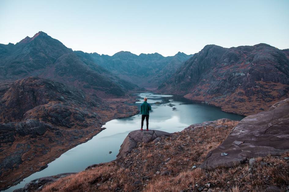
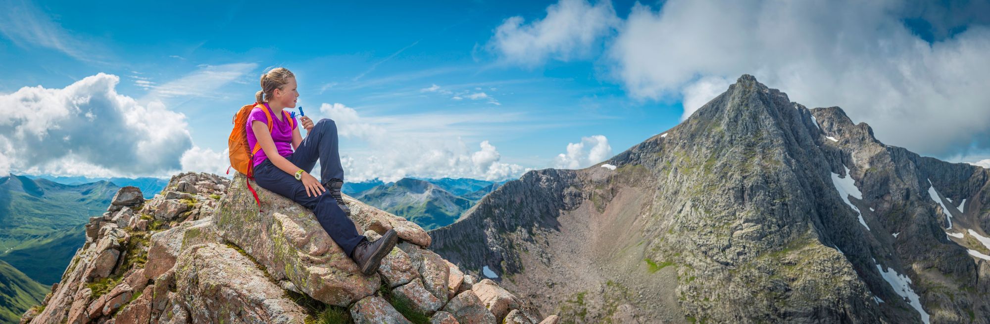
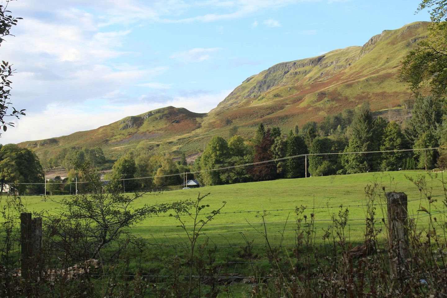
Hiking in Scotland can mean anything from a walk up the most southerly Munro, Ben Lomond (near Glasgow) to a trek with dramatic ocean views and rugged, rocky coastlines on islands like Skye, Rùm or Mull. It can mean taking on one of the country's great ridgeline walks, from the Five Sisters of Kintail to Ben Nevis, the highest mountain in the UK, via the Càrn Mòr Dearg Arête - or can find you criss-crossing the Highland Boundary Fault from lowland to highland on the Cateran Trail, on Arran or on the West Highland Way.
The lochs, bens, glens and extensive coastline of Scotland offer something for everyone, whether you're new to hiking, or you've been doing it all of your life.
As Nan Shepherd, who adorns the £5 notes in Scotland, famously wrote in her foundational text The Living Mountain - these mountains are “like a work of art […] perpetually new when one returns”. Shepherd was talking about hiking in the Cairngorms specifically, of course, but the turn of phrase applies all over.
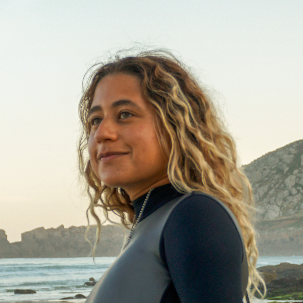
 Stuart Kenny
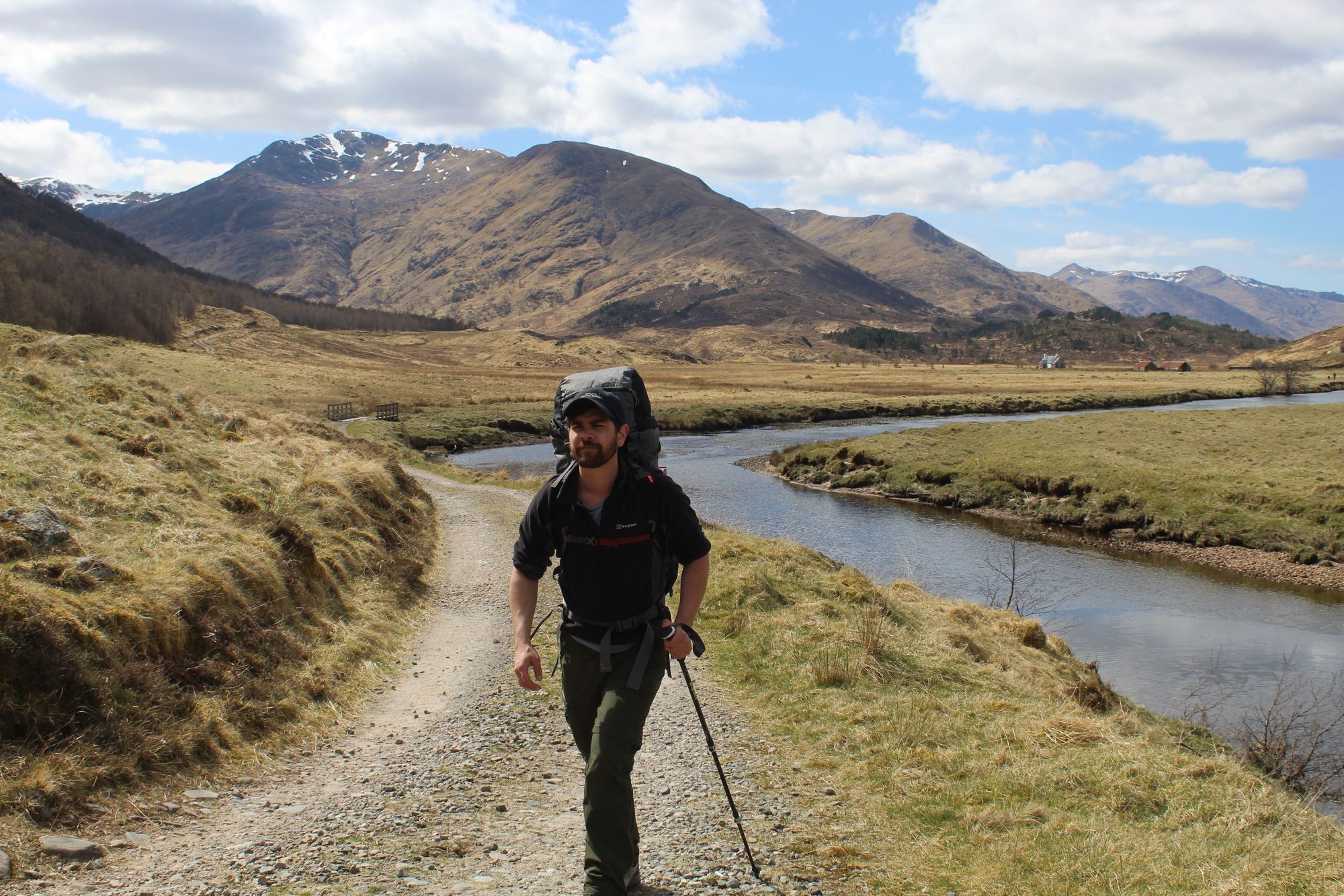
To the south of Scotland you have the Southern Uplands and the rolling farms and forests of Dumfries and Galloway and the Scottish Borders. Move north to the Central Belt and you'll find excellent hiking routes connecting the cities - though the best hiking and scenery in Scotland lies further north still.
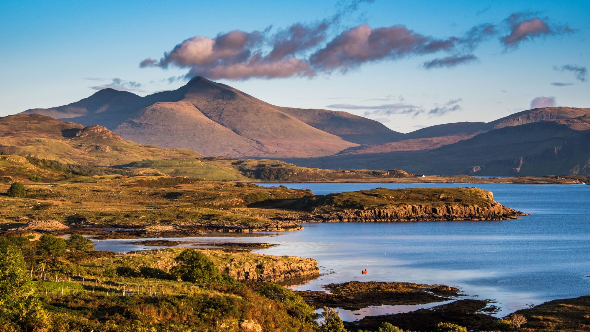
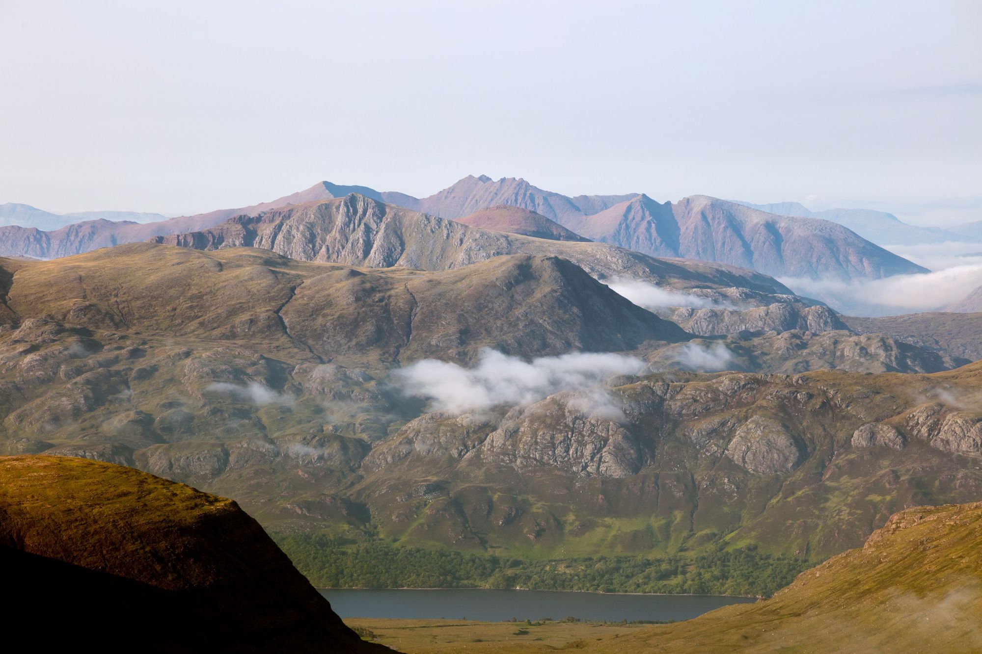
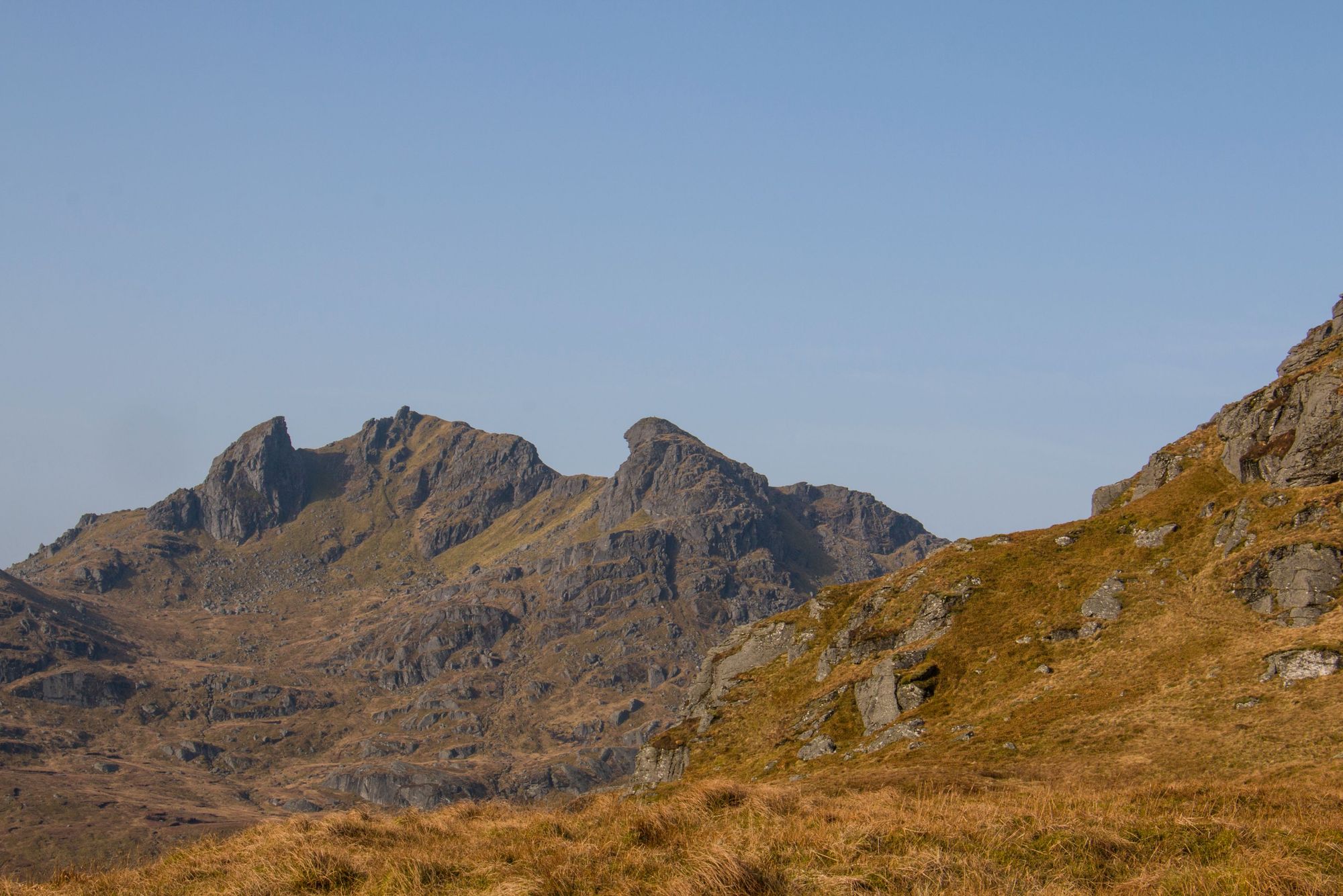
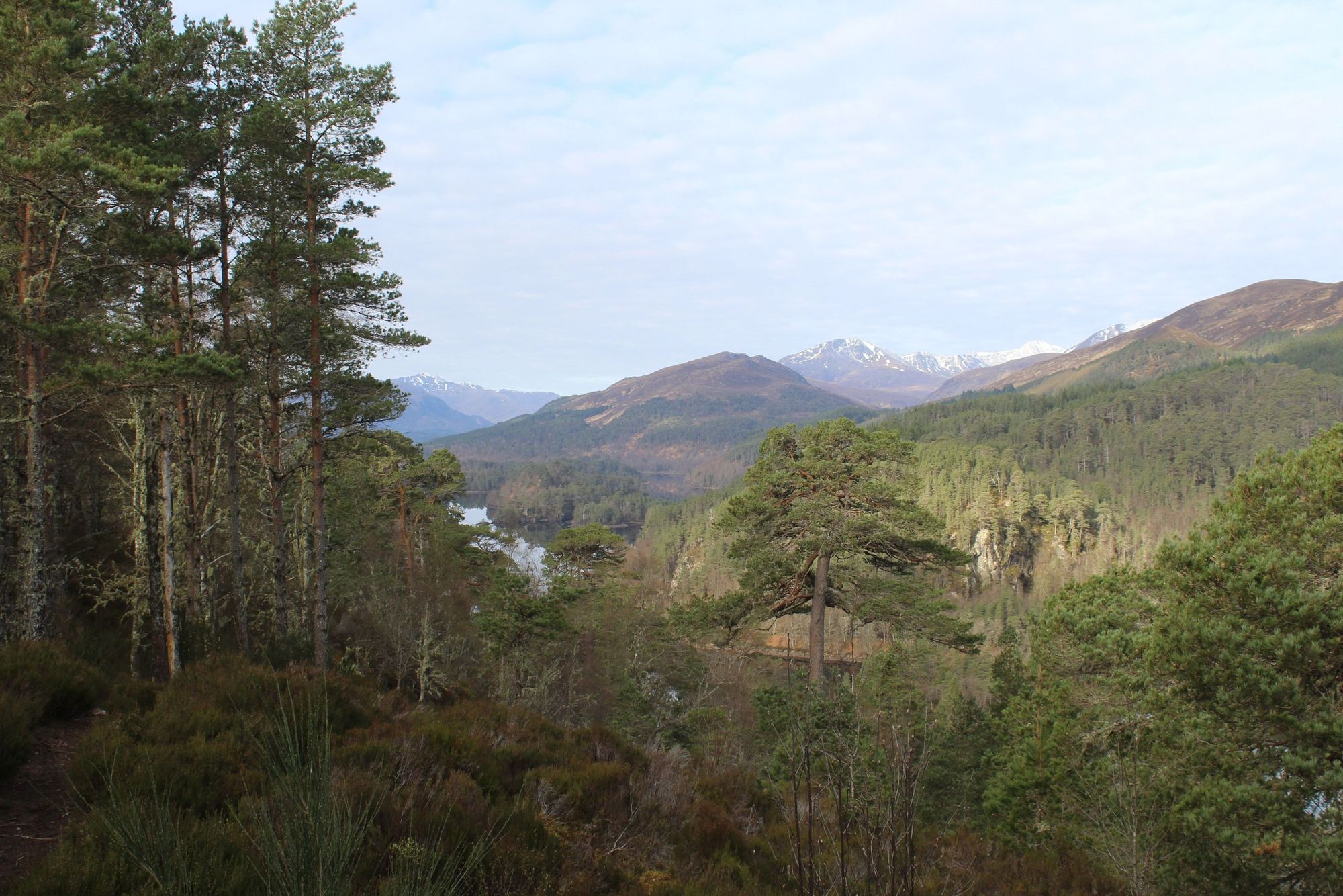
The Scottish Highlands are a place of remarkable beauty, punctuated by Caledonian pine forests, glimmering lochs, serrated ridgelines and outstanding coastal views. Off the west coast, the islands sprawl - from the mountainous island of Arran up past Jura and Islay to Mull, the Small Isles and beyond to the legendary Isle of Skye - home to the famous Cuillin ridge and 12 Munros (mountains over 3,000ft, of which there are 282 in Scotland).
Through all of this weaves world-class, waymarked multi-day hikes; from the John Muir Trail (coast-to-coast across the Central Belt) to the Glen-Affric Way (from Loch Ness to Morvich), to the far-flung Cape Wrath trail, which delves into the far north. The 537-mile Scottish National Trail encompasses nearly every walking route in Scotland, if you’ve got the time (and legs).
The Best Hikes in Scotland: Using This Guide
In this guide, we're going to look at both the best day hikes in Scotland, and the best multi-day hikes, or long-distance hikes, in Scotland, culminating in the following list of 19 excellent hikes spread far and wide throughout the country.
We'll also look at what you should wear while hiking in Scotland and how to best avoid midges. Naturally, any guide to the best hikes in Scotland will be entirely subjective, but what we’ve tried to do in the list below is provide a resource that will give you a great introduction to the different regions, as well as provide a few ideas to get you started. These are certainly our favourite Scottish hikes.
Take walk difficulty and conditions into account. Many of these walks will not be possible in winter.
Remember, the mountains of Scotland should not be underestimated. For many Munros, and even smaller mountains, you need a knowledge of mountaineering and experience hiking in all sorts of conditions, on all sorts of terrains.
Crucially, this guide is designed to inspire but not intended for any navigational purpose. Research your route fully before hiking, and make sure you're certain that you will be able to navigate without danger. Take walk difficulty and conditions into account. Many of these walks will not be possible in winter. Guides are always recommended if in doubt. Please don’t end up being that person without a map or compass stuck up Ben Nevis in flip flops in February.
15 of the Best Day Hikes in Scotland
Later on in this feature we're going to look at the best long-distance hikes in Scotland, but first, here are 15 of the best day hikes in Scotland. All the details are below, but our list includes the following hikes. In no particular order:
- Climb Ben More, Isle of Mull
- Walk the Uath Lochans, Cairngorms
- Climb Ben Lomond, Loch Lomond and The Trossachs National Park
- Walk to the Old Man of Hoy, Orkney
- Climb A' Mhaighdean, Northwest Highlands
- Climb Blaven, Isle of Skye
- Walk to Whitta Hill, Dumfries and Galloway
- Summit Ben Nevis on the Carn Mor Dearg Arête, Lochaber
- Climb Stac Pollaidh, Northwest Highlands
- Climb the Cobbler, Arrochar Alps
- Climb Liathach, Glen Torridon
- Walk to the Bone Caves, Assynt
- Hike the Eildon Hills from Melrose, Scottish Borders
- Walk to the Pink House, Easter Ross
- Hike the Five Sisters of Kintail, Kintail
1. Climb Ben More on the Isle of Mull
- Start/Finish: Ben More Car Park (out-and-back)
- Distance: 6 miles (9.7km)
- Duration: 6-7 hours
- Difficulty: Moderate/Challenging
- Best for: An island Munro outside of Skye
The island of Mull is easily accessed on the ferry from Oban, and it’s an island made for adventure. Follow the rolling roads - ideal for cycling - over to the west coast of the island, which is particularly scenic, with Loch Na Keal (a sea loch) providing a beautiful combination of Atlantic coastal beauty and Highland mountain drama.
The biggest mountain of all here in Ben More. At 966m (3,169ft), it’s the only Munro on Mull, and indeed, the only Munro on any Scottish island that isn’t Skye. It’s also a beauty of a walk - and on a sunny day, it’s not overly demanding, and provides sensational views from the summit over all of Mull and out to Ulva, the majesty of Staffa, Lunga and the Treshnish Isles beyond.
The path is fairly apparent from the car park, which is on the edge of Loch Na Keal.
It’s a straightforward Munro climb, passing some streams, rock pools and waterfalls on the way up. You’ll pass the ruins of some ancient houses too and if you’re lucky, you might spot some of the local white-tailed eagles, which soar through the skies around here searching for the next meal. After the waterfalls, the path becomes rockier and more eroded, and you’ll then zig zag up to the summit ridge, where the view becomes a picture of Scottish beauty - with mountainous ridgelines and layering mountains guiding the view back out to the wild Atlantic ocean.
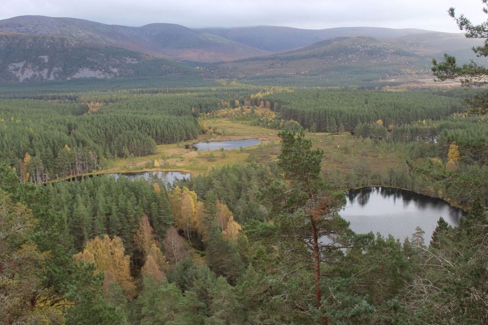
2. Walk the Uath Lochans in the Cairngorms
- Start/Finish: Utah Lochans Forestry Commission car park (circular)
- Distance: 2.5 miles miles (4km)
- Duration: 2-3 hours
- Difficulty: Easy
- Best for: Stunning Cairngorm views without a big hike
Hidden in dense forest behind the excellent outdoors centre at Loch Insh are the Uath Lochans, a collection of small, scenic bodies of water hidden amongst the trees. There are two waymarked routes around the area from the car park, and we’d recommend walking both, starting by following the path which leads out of the car park, and then turning to the right.
You’ll walk through silent forests, looking out for red squirrels and slowly climbing uphill on gentle inclines. There are various detours possible but if you stick to the path, it won’t be too long until you get to your first viewpoint out over the great Caledonian Pine Forests of the Cairngorms National Park. This sort of tree density is actually quite unusual in Scotland today, as most of the old forests have been lost. Continue on the path though, and you’ll reach an ever better viewpoint, looking down on the Uath Lochans from a boulder - a perfect lunch stop.
This is one of the best viewpoints in the Cairngorms requiring such little hiking, making this an ideal route for anyone looking for a casual day out in the hills, without sacrificing the scenery.
Leaving the viewpoint, you’ll follow the trail back down and connect onto the second waymarked trail, which will take you over marshy land on a boardwalk where you can commonly spot hunting birds of prey. This will guide you back to the car park, though it’s worth taking your time as you saunter back to take in the sweeping views of the glens, and loch-side beauty, as you go.
3. Climb Ben Lomond, Scotland’s most southerly Munro
- Start/Finish: Rowardennan car park (circular)
- Distance: 8 miles (12.9km)
- Duration: 5-6 hours
- Difficulty: Moderate
- Best for: Your first Munro
Ben Lomond is the most southerly Munro in Scotland, meaning it’s also the closest Munro to the central belt (a one-hour drive from Glasgow), and the plus 3,000ft mountain many Scots climb first. At 974m (3,195m), Ben Lomond isn’t the biggest Munro, but just because it's further south than the other Munros doesn’t mean it’s an easy climb, or that it’s not as scenic as the others.
Starting from the Rowardennan car park (with Rowardennan also being the site of an excellent youth hostel, often filled up with people climbing the Munro or out on the West Highland Way), this trek follows a well-trodden path up the mountain, via regenerating trees and views of Loch Lomond which quickly establish themselves behind. As you climb higher, the loch will really unfold behind you though. The loch has the largest surface area (27.5 sq miles/71 sq km) of any loch in Scotland, and there are a full 23 islands dotted on its waters.
There’s a great high-level horseshoe route that's one of the finest high level walks in Scotland...
This is a steep climb which eases out near the top, before once again inclining for the final hike to the summit, where there are outstanding views out over the loch, the surrounding hills, and of course, back over Loch Lomond. From here, you can either descend the same way, or for more of a challenge (and great views of the Arrochar Alps), take the Ptarmigan route down, which follows a tight ridge, and requires more experience of mountain climbing and a head for heights.
Don’t just take our word for it, though. “It's just one of these Munros that I keep coming back to again and again,” says Andrew Dempster, author of ‘The Munros: A History’. “There's a lovely path all the way up to the top. You can then vary the descent by coming down the Ptarmigan Ridge, and there’s a great high-level horseshoe route that's one of the finest high level walks in Scotland - if you do the complete circuit of the Tourist Path and then the Ptarmigan Ridge.”
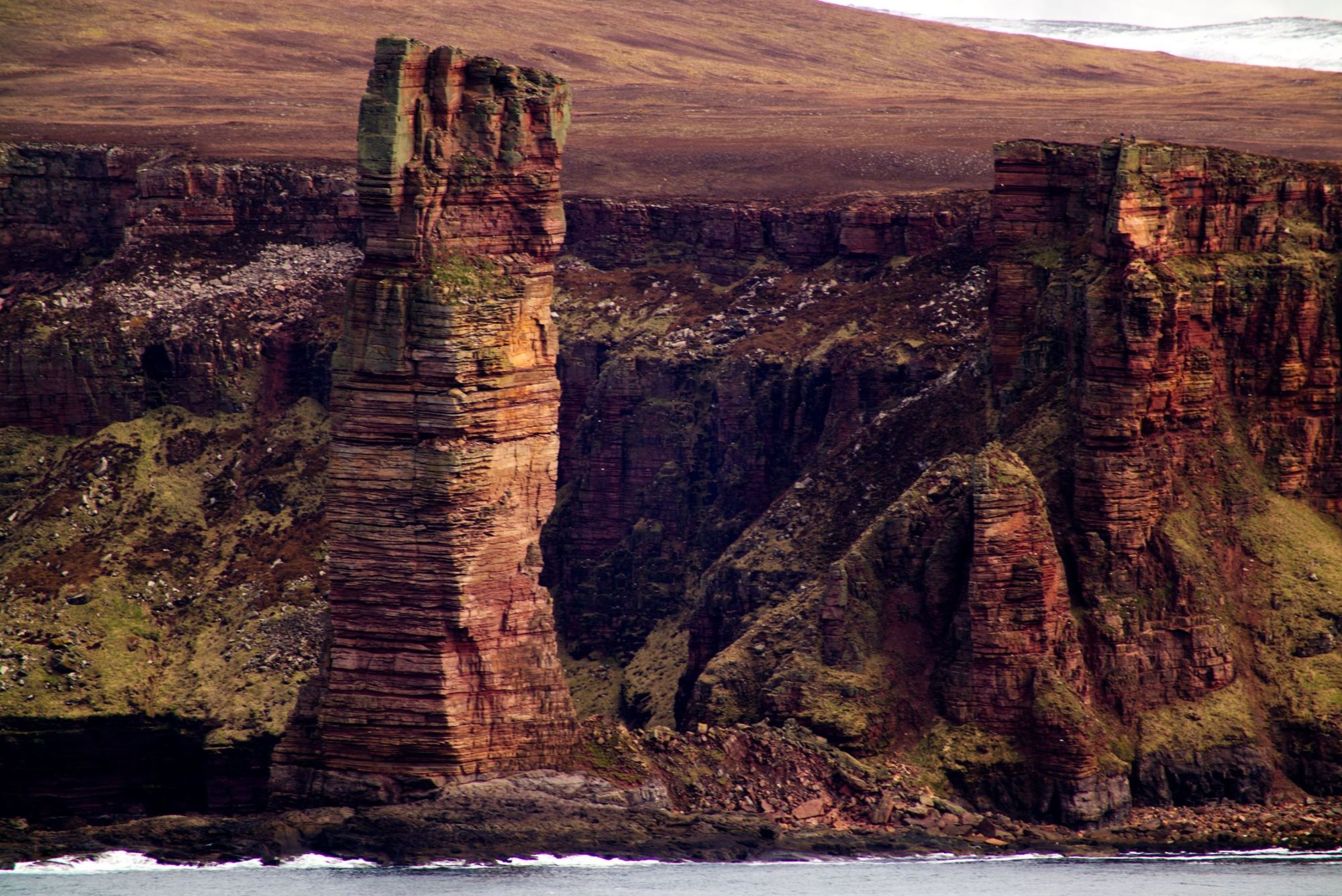
4. Hike to the Old Man of Hoy in Orkney
- Start/Finish: Rackwick (out-and-back)
- Distance: 6 miles (10km)
- Duration: 3-4 hours
- Difficulty: Easy/moderate
- Best for: A scenic day out on Orkney
Orkney is composed of 70 different islands, and is home to enough fascinating and breathtaking walking routes to populate a list of its own several times over. Perhaps the pick of the hikes though is this route, out to the Old Man of Hoy, a 137m (449ft) sea stack on the island of Hoy.
Hoy itself is a fascinating island. The name comes from the Norse for “high island” and Hoy is the most mountainous island in the Orkney archipelago, which is better known for rolling hills sweeped clear of trees by the wind and by agriculture.
This route from Rackwick to the Old Man of Hoy is very much a classic Scottish hiking route.
It will give you great views of the sandstone cliffs, of the circling beauty of Rackwick Bay, take you past traditional turf-roofed buildings and then on to the breathtaking sea stack itself.
5. Climb A' Mhaighdean and the Fisherfield 6, Scotland’s most remote Munros
- Start/Finish: Shenavall bothy (circular)
- Distance: 18.6 miles (30km)
- Duration: 18 hours
- Difficulty: Challenging
- Best for: Seriously experienced Munro baggers
We’re perhaps pushing the ‘day hike’ boundaries here, as to climb A' Mhaighdean and the surrounding peaks, you first need to make your way to Shenavall bothy, or camp nearby.
A' Mhaighdean sits in the Fisherfield Forest, eight miles north of Kinlochewe in the northwest Highlands, and it is commonly regarded as the most remote out of all 282 Munros. The name translates from Scottish Gaelic as “the maiden” (with the ‘Mh’ at the start of the name being pronounced as a ‘v’). This highly demanding route is a real beauty - but it can take the best part of a full-day, even in good conditions, and should only be attempted by experienced, confident hikers.
The fact that it requires an overnight camp or bothy stay in order to climb it gives the ascent an extra, adventurous flavour...
During this route, you’ll ascend the Munros Sgùrr Ban, Mullach Coire Mhic Fhearchair, Beinn Tarsuinn, A' Mhaighdean, Ruadh Stac Mòr and the corbett Beinn a' Chlaidheimh. The terrain includes everything from scrambly boulders to vertigo-inducing ridgelines, heathery hills, grass, rivers and bog, but in return, you’ll earn some properly tear-jerking views out over Scotland.
There’s an excellent full description of the route on Walk Highlands, a great walking resource.
The climb of A' Mhaighdean is another favourite of author Andrew Dempster. “The fact that it requires an overnight camp or bothy stay in order to climb it gives the ascent an extra, adventurous flavour that you don't necessarily get from the Munros that you can climb from your car,” says Andrew. “It gives it that magic. I think the view from A’ Mhaighdean is probably the finest of any Munro. It's one of those mountains that gets into your soul. It's craggy, it's wild and it's so far from anywhere.”
6. Climb Blà Bheinn (Blaven), on the Isle of Skye
- Start/Finish: Loch Slapin (out-and-back)
- Distance: 5 miles (8km)
- Duration: 6-7 hours
- Difficulty: Challenging
- Best for: Your first Skye Munro
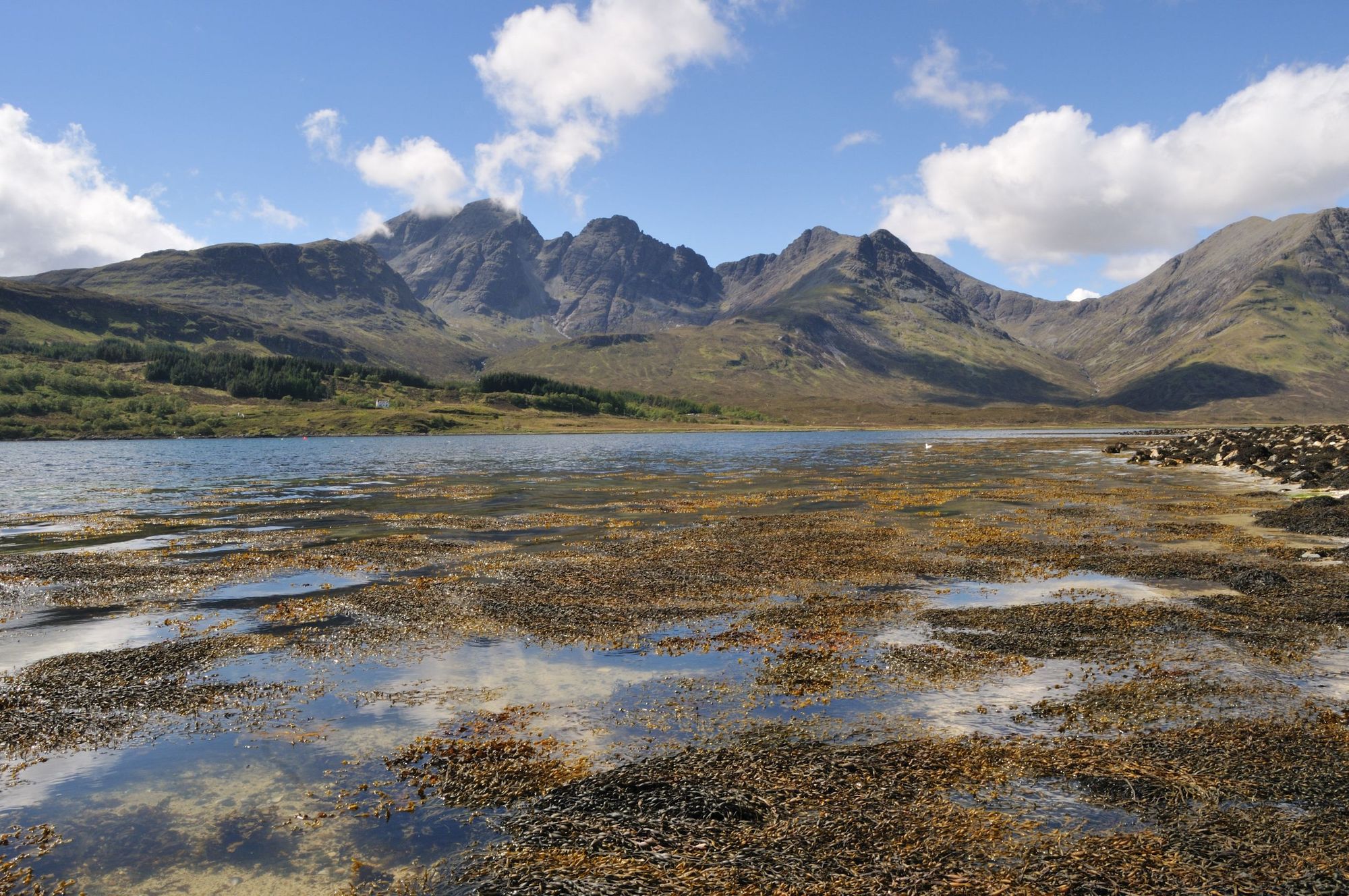
Blà Bheinn is not just one of the best hikes on Skye - it's surely one of the best in the country. Often anglicised as Blaven, this is the only Munro on the Skye Cuillin that’s not actually a part of the main Cuillin ridge, and as such, it has an absolutely terrific view of it.
It’s another favourite of Andrew Dempster’s, who told us: “The south ridge of Blaven rises from the sea to the summit, and it rises right from Camasunary Bay.”
From the ridgeline of Blaven, you can see the Cuillin ridge to the west, and Rùm and Canna, two of the Small Isles, to the southwest.
“The most common route up Blaven is from Loch Slapin, which is round a different part of the mountain,” says Andrew. “I usually go up the south ridge - or do the Clach Glas-Blaven traverse, which is a lovely scrambling route including one of the other routes near Blaven called Clach Glas. It [Clach Glas] is sometimes called the 'Matterhorn of Skye' because it is quite a climb. There’s a scramble to the top. I've never found it that difficult but you often see people roped up climbing Clach Glas. The traverse is one of the finest ridge traverses in Scotland.”
7. Walk up Whita Hill in Scenic Langholm
- Distance: 4.5 miles (7.2km)
- Duration: 3 hours
- Start/Finish: Langholm town (circular)
- Difficulty: Easy
- Best for: A country walk without crowds
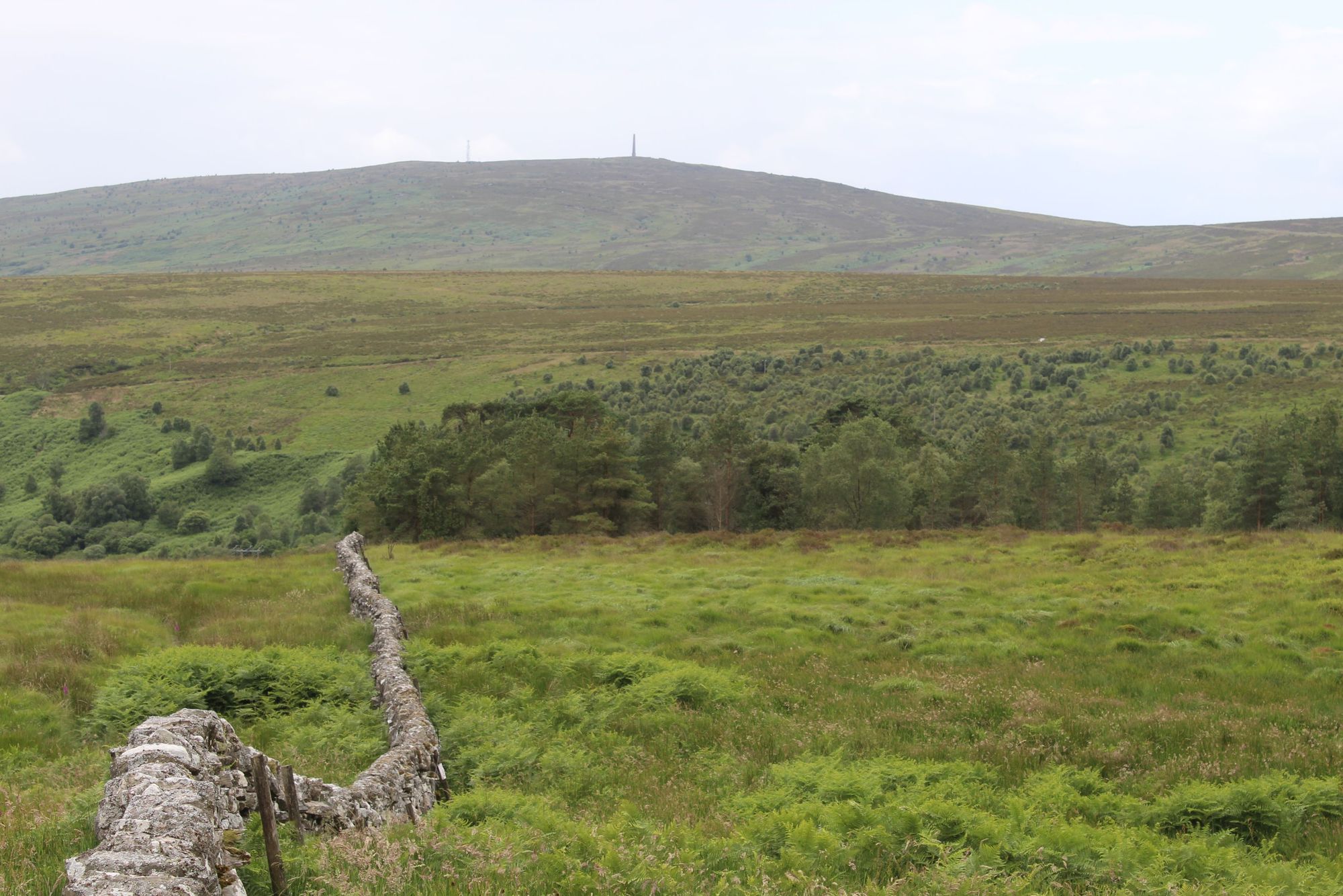
Scotland isn’t just about the Munros. There are plenty of beautiful walks in the rolling hills of the Scottish Borders and Dumfries and Galloway too. This beauty is a walk in Langholm, a tranquil town in Dumfries and Galloway, with the River Esk flowing through the centre and some beautiful bridges to boot, including a Georgian three-arched bridge which was worked on by Thomas Telford, who would become one of the world’s foremost civil engineers.
The town sits in the shade of Whitta Hill, and a walk up the hill showcases the best of the landscape, including the Tarras Valley Nature Reserve, which is now owned by the community of Langholm and is undergoing a period of regeneration aimed at serving nature and locals.
“Now local people and the community get to shape what happens to the land around them,” Jenny Barlow, Estate Manager of the Tarras Valley Nature Reserve, told me when I was passing through the area on the Kirkpatrick C2C cycling route. “The community owns almost the entire river catchment, so it gives us the chance to do a full-system, full-scale ecological restoration.”
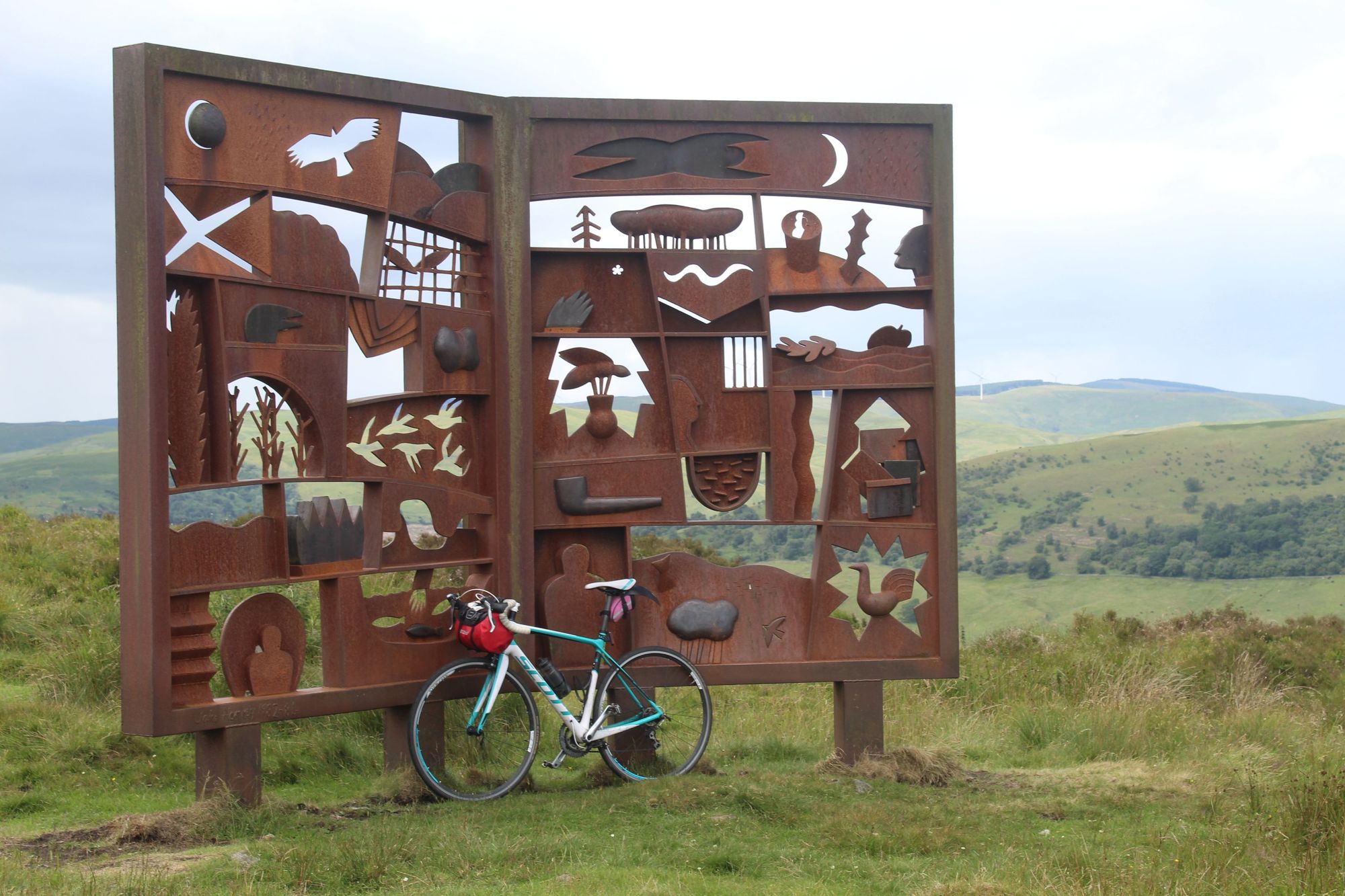
This particular walk takes you from the centre of town out to the rolling hills of the countryside, over Highmill Bridge and up through some lush woodland. You’ll then join a narrow road, where you’ll be able to see the Malcolm Monument - an 100ft obelisk built to commemorate Sir John Malcolm, one of the ten Malcolm sons of Burnfoot, Langholm, which can be seen for miles.
You’ll follow an old stone Galloway dyke up the track, with farmland and forestry to view on your left and ferns on the right, and soon you’ll reach a fantastic metal memorial to the famous poet Hugh MacDiarmid, who was born in the town of Langholm. The memorial depicts topics described in his poetry in cut-out form, with the greenery of the land shining through behind.
You can see right the way down the community reserve, right the way down the valley to the lakes, to the Solway Firth...
From there, it’s a clear track up to Whitta hill and the Malcolm Memorial, where there are great views both back to Langholm and out over the Tarras Valley Nature Reserve, on the other side.
“You can see right the way down the community reserve, right the way down the valley to the lakes, to the Solway Firth, and then over the valley, you've got a chance to see Hen Harriers flying over the moorland,” says Barlow (who was discussing the ongoing route to Newcastleton - though the same views do apply). “There are black grouse, so nationally-rare birds. It really is quite amazing - and in terms of ecological restoration, there are regenerating forests.”
Rather than following your footsteps back to Langholm, you can continue on from Whitta hill down another, more direct route to town from the summit. An interesting and accessible walk.
8. Summit Ben Nevis (via the CMD Arete Route)
- Start/Finish: The North Face car park (circular)
- Distance: 11 miles (17.7km)
- Duration: 11-12 hours
- Difficulty: Challenging
- Best for: Seasoned summit baggers
It might strike you as rather obvious, but we can’t write a list of the best hikes in Scotland without including one up the highest mountain in Scotland and the UK - the mighty Ben Nevis.
At 1,345m (4412ft), Ben Nevis in Fort William is the King of the Munros, and is the peak of the United Kingdom, 36m higher than Ben Macdui, on the edge of the Cairn Gorm plateau over in the Cairngorms National Park. The so-called Tourist Track (or Mountain Track) up Ben Nevis can be quite crowded on a good day, and while still a great way to see the mountain, there is another, more interesting route up the Ben - via the knife-edge Carn Mor Dearg Arête, known as the CMD Arête.

To follow this route, you’ll walk out of the North Face car park and fairly quickly climb up to some great views over Loch Linnhe and Loch Eil. Big views of Ben Nevis will follow as you walk towards it, but you’ll swing a left to climb to Càrn Mòr Dearg - another Munro - which you’ll bag en route to the big Ben via another ridge. Beyond this summit is the CMD Arête, which follows a crack on top of these fantastic mountains over to a shoulder beneath Ben Nevis.
This really is a challenging, demanding route, and while beautiful, the difficulty should be respected. As with most daring ridgelines, you need experience, nerve and a head for heights.
Even after the arête, the route to Ben Nevis is a climb up steep boulders and on scree paths. You’ll then rather suddenly emerge to the highest peak in the UK - crowds and all. Return via the Mountain Track, or Tourist Track, marvelling at the comparative silence of your route up.
9. Climb Stac Pollaidh in the Northwest Highlands
- Start/Finish: Stac Pollaidh car park (circular)
- Distance: 3 miles (5km)
- Duration: 2-4 hours
- Difficulty: Easy/Moderate
- Best for: Incredible views, with minimal hiking
Stac Pollaidh, on the Northwest coast of Scotland, above Ullapool, is another mountain which shows that height isn’t everything. This mountain in the Northwest Highlands is just 613m (2,011ft) high, but the scenery that surrounds it is everything you dream of when you think of the Highlands and of the romance of the great outdoors in Scotland.
The hike to Stac Pollaidh has outstanding views of Assynt to the north and of the Summer Isles to the south. A good path up the mountain also means that you can make the climb in just a few hours (one-way), and while it's exhausting work getting up there, it's not technical at all.
This has got to be one of the best hikes in Scotland, and in particular, one of the best singular days out in Scotland. There are few summits in Scotland where you get such stunning views for only a few hours of hiking. Picture Torridon sandstone, steep gullies, and ice-age ridgelines.
From the car park, you follow an obvious path up the mountain, climbing on a curve to the right of Stac Pollaidh, which stands dominant for all the hike, up ahead. You don’t have to climb high before the view back down to Loch Lurgainn, with Sgùrr Tuath beyond it, becomes truly sublime, but as you reach the back side of Stac Pollaidh and Suilven and the far-reaching nothingness of Assynt come in to view, you really will be blown away.
The trail will take you up to a top plateau, and then it's a simple climb to the eastern summit. The true summit is on the west though, and is a tricky scramble which should only be done by those who are experienced. If you're sticking to the regular trail, then this same level of experience isn't required (though of course, care up on the summit is always a necessity). You can then descend a little, circle around Stac Pollaidh, and return via the other side.
10. Climb the Cobbler (Ben Arthur) in the Arrochar Alps
- Start/Finish: Succoth car park (circular or out-and-back)
- Distance: 7 miles (11km)
- Duration: 5-6 hours
- Difficulty: Moderate/Challenging
- Best for: One of Scotland's finest Corbetts
At 920 metres (3,018m) tall The Cobbler isn’t quite a Munro (rather, it is a Corbett), but that’s just more proof that if you only ever climb the Munros, you’ll miss out on some of the best hikes in Scotland.
Also known as Ben Arthur, this hike is found in the Arrochar Alps. It’s accessible from the Succoth car park in Arrochar, about a one hour 45 min drive from Edinburgh or one hour from Glasgow. The path up is clear and easy to follow, starting with a zig-zagging path with views back over Loch Long before walking three miles to the foot of the mountain to begin the ascent.
The triple-headed mountain has one of the most distinctive outlines of any mountain in Scotland, Munro or not. It’s also one of the most rewarding summits to reach as well – with some great views at the top. Not least if you make the tricky scramble up the rocky tower at the top after “threading the needle” on the north summit. Careful now.
11. Hike up Liathach in Glen Torridon
- Start/Finish: East of Glen Cottage.
- Distance: 7.5 miles (12km)
- Duration: 10-11 hours
- Difficulty: Challenging
- Best for: A demanding, remote Munro
Liathach in Glen Torridon is considered by many to be the most beautiful Munro in Scotland. It’s not an easy day in the mountains, though. This is for experienced hikers only.
From the very start of this climb, the wonders of Liathach loom before you, with the huge elevation making the climb seem (in some ways rightly) like a fairly daunting task. There is a good path, though it is incredibly steep. When you’re on the ridgeline - and you’ve caught your breath from those hours of climbing up a big old incline - you’ll get stunning views of Torridon, then you’ve got ups and downs on the ridgeline to come.
All in all, there’s a lot of scrambling involved in this climb, a lot of exposed paths, some tricky ridge spots and plenty of steeps. You’ll bag two Munros on your way to Liathach, Spidean a’Choire Leith and Mullach an Rathain. The scenery has to be seen to be believed, but do heed our warnings on the difficulty of this climb. Exceptional care and planning is needed here.
12. The Bones Caves of Assynt, Inchnadamph
- Start/Finish: Car park on A837 near Inchnadamph (out-and-back)
- Distance: 3 miles (5km)
- Duration: 2 hours
- Difficulty: Easy/Moderate
- Best for: Geology fans
This is one of the shorter walks on our list of the best hikes in Scotland, and one of the easier ones too, but it’s particularly interesting for the history that surrounds the area. The hike will take you through a beautiful valley in Assynt and out to the site of some fascinating caves which tell the tale of when this landscape was home to an ecosystem much different to ours today.
Starting at a nearby car park, this walk will take up by a river and past the Fuaran Allt nan Uamh falls. You’ll then walk through the valley, and keep to the right as the path begins to ascend the hillside. Up above, you’ll see the caves, dotted around the limestone cliff faces.
Reaching the Creag nan Uamh (or Craig of the Caves), take time to nip into the caves and explore, make a coffee or eat some lunch.
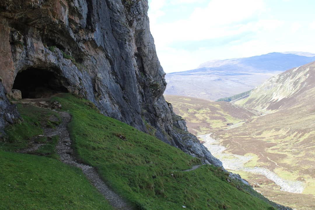
These caves were first excavated way back in 1889 by geologists Ben Peach and John Horne, but it wouldn’t be until 1928 that a full investigation took place, by geologist JE Cree. He found not just evidence of badgers, bears and reindeers, but also the jaw bone of a wildcat and later - a human skull, and human bones, which suggested that this was a burial site. The bones were dated all the way back to 2515-2720 BC, and further finds suggest lynx, arctic wolf and even polar bears may also have lived here at this time.
It’s worth sauntering a little further down the glen, as there are more waterfalls, and interesting geological formations around each corner, but the caves are the main attraction here.
13. Hike the Eildon Hills from Melrose
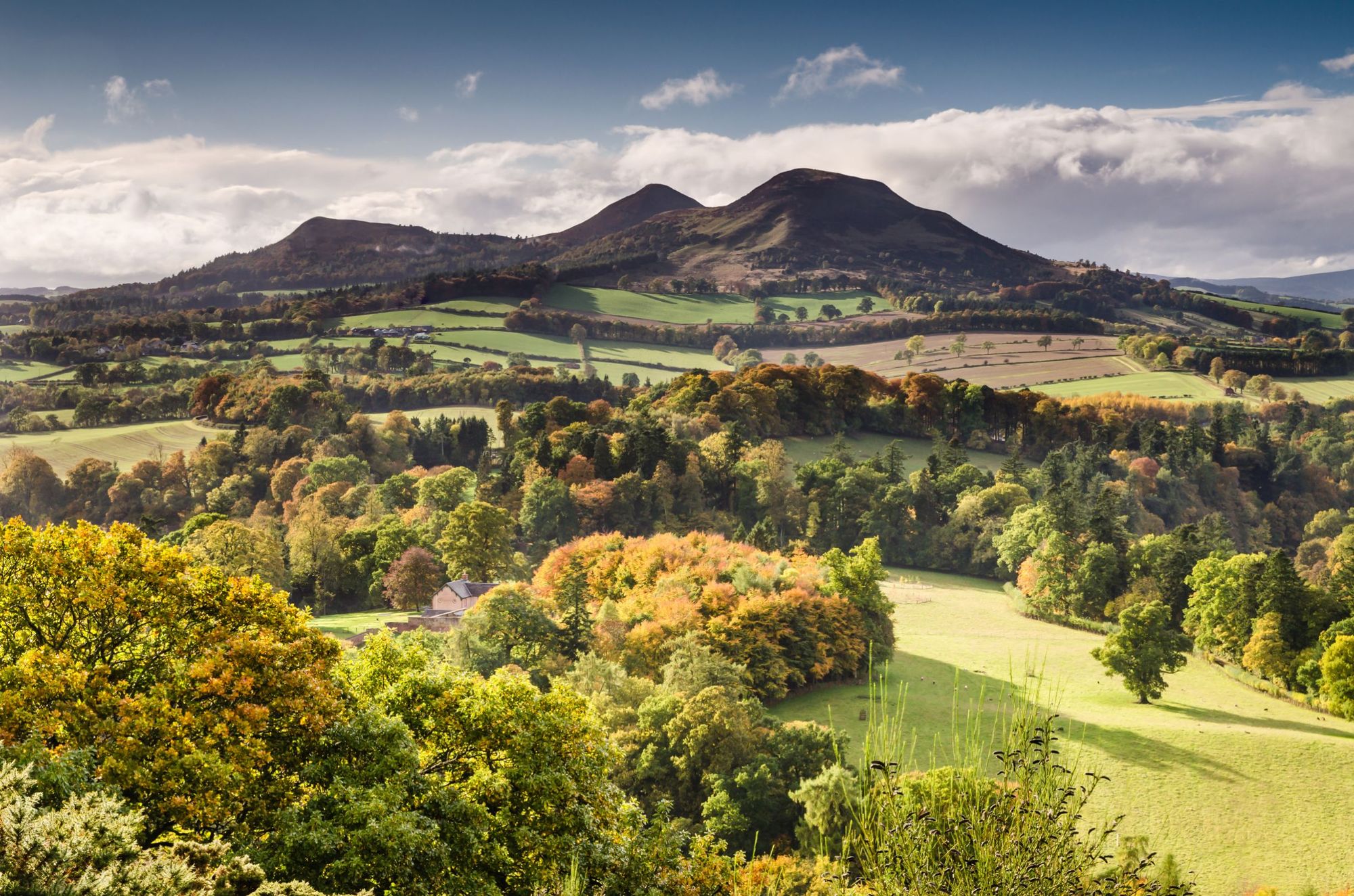
- Start/Finish: Melrose (circular)
- Distance: 6.2 miles (10km)
- Duration: 4 hours
- Difficulty: Easy/Moderate
- Best for: A day in the Scottish Borders
Melrose is a delightful, historic market down in the Scottish Borders, which sits on the River Tweed and beneath the peaks of the Eildon Hills, a gentle but delightful range for walking.
From the heart of Melrose, follow the signs for the St. Cuthbert’s Way (a long distance hike which runs from Melrose Abbey to the Holy Island of Lindisfarne). You’ll soon find yourself climbing up into the hills and quickly gain vantage points back over Melrose and Galashiels.
Leaderfoot viaduct recently stood in for a viaduct in Switzerland inIndiana Jones and the Dial of Destiny...
What’s interesting about the Eildons is that their volcanic origins make them quite different, in terms of both appearance and vegetation to other spots in the Borders. You’ll notice this as you walk, and leaving the St. Cuthbert’s Way, you’ll climb Eildon Mid Hill, then begin your summit bagging adventure, as you head on to Eildon Wester and Eidon North - retracing your steps a few times in between to access the appropriate saddles and approach routes.
You get great views out over the farms and forestry of the Borders here, as well as of Leaderfoot viaduct, which was originally opened on 16 November 1863 to carry the Berwickshire Railway, which connected Reston with St Boswells, via Duns and Greenlaw - and actually recently stood in for a viaduct in Switzerland in the 2023 film Indiana Jones and the Dial of Destiny.
There’s some fairy mystique around here. Be sure to visit the Rhymer's Stone, where Thomas Rhymer, the poet, is said to have met the Queen of the Fairies in the 13th century. Then head back to town on the Borders Abbeys Way - and when back in town, do be sure to explore the wonderful Melrose Abbey, which dates back to 1136AD, before heading home.
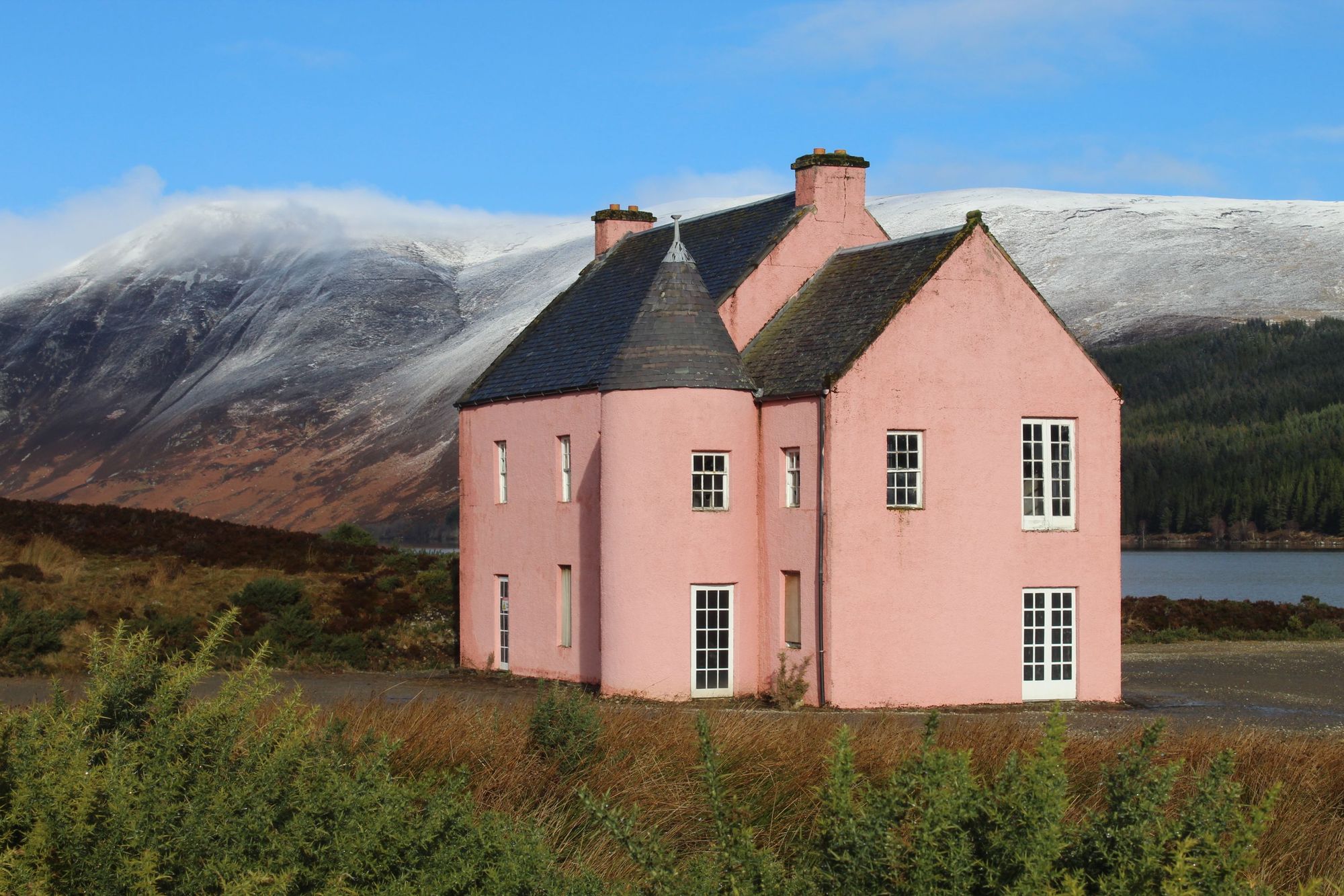
14. Walk to the Pink House on Loch Glass, in Easter Ross
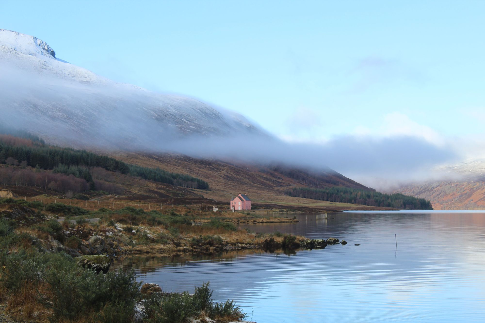
- Start/Finish: Eileanach Lodge (out-and-back)
- Distance: 3.5 miles (5.6km) from Eileanach Lodge and back
- Duration: 1-2 hours (if starting and finishing at Eileanach Lodge)
- Difficulty: Easy (to Challenging if you walk the whole way down)
- Best for: A quirky hike without the crowds
We’ve got a lot of serious, hard-hitting hikes on this list. This… is something else entirely.
From Eileanach Lodge, which can be found at the end of a public road, stroll through a wonderful forest, in the direction of Loch Glass. A short walk later, you’ll find yourself emerging on the banks of the loch, with Culzie Lodge, a distinctive, abandoned pink house, visible on the edge of the loch, and the fierce crags of Ben Wyvis visible behind it.
Fans of the hit TV show The Traitors may recognise the pink house from the final episode of the series. They will also recognise the wild boars. Either way, this is a beautiful landscape, and a fun, quick outing in a relatively isolated, quiet but beautiful part of Easter Ross.
Across the water from the lodge is a wind farm, while it’s worth doing an out-and-back on Loch Glass, which really feels a lot more secluded than it actually is - and is lined by mountains which feel much bigger than they actually are - to take in the beauty of the loch. The loch is sublime when there's a sprinkling of snow on the 738m (2,421m) Meall Mór, and the image of the mountain bounces back off the water.
Returning down to Evanton 200m-300m below (which can be done on foot with careful navigation) can also include a pass through the Black Rock Gorge, which featured in Harry Potter and the Goblet of Fire. It is a sublime gorge which it's hard to do justice to in imagery.
If you’re going to start at Eileanach Lodge and walk down to Evanton after, the hike time is more like 5-6 hours and the length is closer to 8 miles (12.8km).
15. Hike the Five Sisters of Kintail
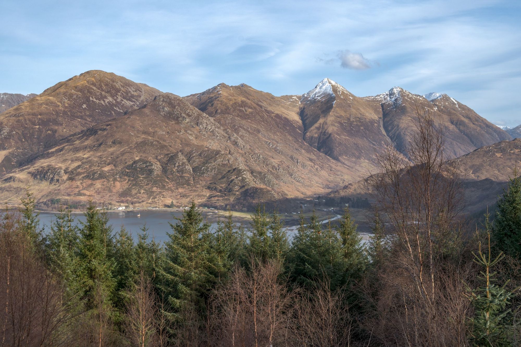
- Start/Finish: Glen Shiel car park/Allt a' Chruinn
- Distance: 9.5 miles (15.2km)
- Duration: 10-11 hours
- Difficulty: Challenging
- Best for: A huge day in remarkable mountains
Just shy of the Isle of Skye and scenic Loch Duich is where you’ll find this outstanding ridgewalk taking in the Munros of Sgùrr na Ciste Duibhe, Sgùrr na Càrnach and Sgùrr Fhuaran. While it’s an incredibly demanding hike, it also offers an incredible amount in return.
Starting from the Glen Shiel car park, this route starts with a climb up to Bealach an Lapain on a fairly unrelenting route. The good news is that you get some of the worst of the ascent out of the way early on this one, and while there are plenty of ups and downs ahead, once you’re up onto the ridgeline, you’ve done the hardest bit. You’ll then head on to the Five Sisters of Kintail, heading first to Sgùrr na Ciste Duibhe (1,027m/3,369ft), then Sgùrr na Càrnach (1,002m/3,287m), Sgùrr Fhuaran (1,068m/3,503m), Sgùrr nan Saighead (929m/3,047m) and finally, on to Sgùrr na Moraich (876m/2,874m) before descending to Allt a' Chruinn.
The elevation of the mountains here above Loch Duich, back down at sea level, makes the views from the majority of this ridgeline just sublime, and when on top, some of the gully and layering mountain views will either immerse you like nothing else, or put a knot in your stomach.
We should note there are various alternative exit points for those who want to hike just some of the five sisters. Map out your route carefully before you go - as you should with any hike.
11 of the Best Multi-Day Hikes in Scotland
Scotland is home to some of the finest multi-day, long-distance trekking routes in the world, from the famous West Highland Way to lesser known, more further-flung routes, like the excellent Affric-Kintail Way through a rewilded glen, the Arran Coastal Path, circling the island of Arran, or the Hebridean Way - a route which spans over 150 miles and includes visits to 10 islands in the Outer Hebrides.
All the details are below, but here is our list of the 11 best multi-day hikes, or the best long-distance walking routes in Scotland. In no particular order, they are:
- The West Highland Way
- The Southern Upland Way
- The Affric-Kintail Way
- The Cateran Trail
- The Cape Wrath Trail
- The John Muir Way
- Summit Askival on the Rùm Cuillin
- The Fife Coastal Path
- The Arran Coastal Path
- The Hebridean Way
- The St Magnus Way
16. The West Highland Way
- Distance: 96 miles (154km)
- Duration: 4-7 days
- Start/Finish: Milngavie/Fort William
- Difficulty: Moderate
- Best for: The iconic Lowland to Highland hike
Hikers travel from all over the world to walk the West Highland Way, which was Scotland’s first official long-distance trek when it opened to the public in 1980, and remains the best known.
The route runs from Milngavie, a town a short drive from Glasgow, all the way up to Fort William, taking walkers from the lowlands of Scotland to the Highlands along the way.
Leaving from Milngavie, you’ll find that the trail opens on humble forest tracks, passing Dumgoyne Distillery and the notable lump of Dumgoyne Hill on the edge of the Campsie Fell, before arriving in Drymen. It’s from here that the West Highland Way explores into life, as hikers summit Conic Hill and earn sweeping, panoramic views out over Loch Lomond, the Arrochar Alps behind and all the islands dotted around the water of Scotland’s biggest freshwater loch.
Trekkers walk the length of Loch Lomond - with the option to stay an additional night at Rowardennan Youth Hostel and climb Ben Lomond along the way - and will notice the trail becoming increasingly more tranquil and wild the further north they get. The journey continues on from here through Tyndrum and the Bridge of Orchy, lined by Scotland’s Munros, before passing through the Rannoch Moor, a stunning expanse of moorland that is the most isolated spot on the route. By this point, you’ll likely be sharing the trail with people you recognise from previous days or stopovers. One real big selling point of the West Highland Way is this community aspect, as there’s always people walking it - in their own time and at their own pace.
As you leave the moor and enter Glencoe, Buachaille Etive Mor, one of Scotland’s finest mountains, dominates the view. This beautiful stretch culminates in a climb up the Devil’s Staircase, leaving Glencoe and heading on to Kinlochewe and Fort William, with views of the Grampian Mountains and some of the highest mountains not just in Scotland, but all of the UK.
There’s a reason the West Highland Way is world famous. It’s an education in the lochs, bens and glens of the Scottish mainland - and it’s still to this day one of the best hikes in Scotland.
17. The Southern Upland Way
- Start/Finish: Portpatrick/Cockburnspath
- Distance: 211 miles (341km)
- Duration: 12-16 days
- Difficulty: Challenging
- Best for: A full border experience
The Southern Upland Way was the first official coast to coast walk in the United Kingdom. It takes you a full 214 miles from Portpatrick, on the south west coast of Scotland, to Cockburnspath on the east.
This is a hell of a multi-day hike which is normally split between 12-16 days. You’ll take on over 80 peaks which rise above 2000ft (there are no Munros in the south of the country) and get a real sense for the forests, farmland and rolling hills of Dumfries and Galloway.
Often described as “Scotland’s forgotten corner”, there is real beauty in the tranquillity here. In the Galloway Forest Park you’ll experience some of the darkest skies in Scotland, ideal for stargazing at night, and the route then takes you to the Lowther Hills, and into the Scottish Borders via tremendous historic market towns like Moffat, Selkirk, Galashiels - where it’s worth a visit to the Great Tapestry of Scotland - and Melrose, home to one of the great ruined abbeys.
From here it's out to Pease Bay, on the east coast of Scotland, before turning back inland to the finish at Cockburnspath. This is an area often overlooked by those who hike in Scotland, but it really is beautiful. Make no mistake - despite the low altitude, this is a challenging hike for even the most experienced of walkers, given the distance and the days required, but if you’re looking for a lesser known way to discover the country, then this is one of the best hikes in Scotland.
18. The Affric-Kintail Way
- Start/Finish: Drumnadrochit/Morvich
- Distance: 44 miles (70km)
- Duration: 3-5
- Difficulty: Moderate/Challenging
- Best for: A rewilded Highland experience
This beauty of a trail runs from Drumnadrochit, on the banks of Loch Ness, through the rewilded landscape of Glen Affric to Morvich, which sits by Loch Duich, a sea loch which leads to Skye.
From Loch Ness, you exit out into the hills and forest, following the Affric-Kintail waymarking into Craigmonie Woodland and earning great views back out over Milton and Loch Ness. You’ll walk through a lot of forestry commission land on the first day, which takes you to Cannich, but it’s on the following day, and most specifically from Dog Falls that this route really comes into its own.
On a route past Loch Affric, which is lined by Sgurr na Lapaich and An Tudair, and bookended by a fantastic, curving beach...
Climbing high up above the river, you’ll find yourself at the Glen Affric Viewpoint, staring down at the beautiful Beinn a' Mheadhoin, with its forested islands, connecting to Loch Affric in the distance, and with the mighty mountains of Mam Sodhail and Carn Eighe rising high behind.
The walk along the lochside is tremendous, with a mess of naturally regenerating trees on your left and the water and mountains always to the right. Passing the River Affric, where many people end day two, the route then heads on to Alltbeithe - home to Glen Affric Youth Hostel, perhaps the most remote youth hostel in mainland Britain. It’s reached via what must be one of the best hiking routes in all of Scotland, on a route past Loch Affric, which is lined by Sgurr na Lapaich and An Tudair, and bookended by a fantastic, curving beach.
The Allt Garbh river will then guide you through Glen Affric itself and to the hostel. We’d recommend staying for a couple of nights at the hostel - which has a delightful fireplace - and spending a day climbing the remote Munros of An Socach, Sgurr nan Ceathreamhnan and Mullach na Dheiragain, which are otherwise tough to access, even for dedicated hikers.
The exiting day down to Morvich is equally superb. The wonderful Cambon Bothy is always a scenic site, and a remarkable descent, down huge slabs of stone and past the powerful Allt Grannda waterfall, awaits. From the foot of this path, it’s out to Morvich through the farmed landscape at Gleann Lichd, and beneath the Five Sisters of Kintail ridgeline.
If you want to make your hike a Loch Ness-Isle of Skye epic, the Skye Bridge is six more hours - or of course, you can grab a bus from near Morvich all the way to Portree.
19. The Cateran Trail
- Start/Finish: Blairgowrie (circular)
- Distance: 64 miles (103km)
- Duration: 4-5
- Difficulty: Moderate
- Best for: Experiencing the Highland Boundary Fault
Starting from the Perthshire town of Blairgowrie, this lovely 64-mile loop takes you through some of the finest landscapes of Glen Shee and Glen Isla, and showcases a wonderful Scottish landscape often overlooked simply because of its proximity to the more mountainous Highlands.
The name of the trail comes from the Caterans, fearsome cattle thieves who used to raid the surrounding areas during the 17th century. You’re safe from such pirates today, but the route does follow old Drove Roads - once used to drive herds of cattle down for sale at market.
You’ll travel out from Blairgowrie to forestry commission land at Blackcraig with tremendous views of rolling hills, dotted with trees. You’ll pass Dalvey loch en route to Kirkmichael village, then reach a real highlight the next day at the Spittal of Glenshee, reached via the hilltops of Ben Earb, Creag an Dubh Shluic and Meall Uaine - and the An Lairig pass, the lowest point between the latter two of those aforementioned mountains. It’s a sprawling landscape, the type of which many picture in their heads when they imagine a Cairngorm landscape.
You’ll pass Forter Castle en route to Glen Isla, and all pass into Angus from Perthshire. Get lucky and you may spot a beaver or two in the rivers around this area. Then via the Kirkton of Glenisla, lovely farmland and the town of Alyth, it’s back to Blairgowrie to the finish line.
There is also a 20-mile “mini” version of the Cateran Trail, which runs from Kirkmichael to Lair, which is a great option for those who have less time to spare in the area.
20. The Cape Wrath Trail
- Start/Finish: Fort William/Cape Wrath
- Distance: 240 miles (386km)
- Duration: 15-20 days
- Difficulty: Challenging
- Best for: A true remote challenge
The Cape Wrath Trail takes hikers from the end of the West Highland Way in Fort William to the very top of the mainland, at Cape Wrath (the most northwestern point on the mainland). It’s an entirely unmarked and largely isolated trail - and is the most demanding route on this list.
Often called the toughest long-distance hiking trail in the UK, the Cape Wrath trail actually doesn’t have one set route. Rather, there are options as you walk. Some leave Fort William and go through Glenfinnan, past the famous viaduct and the Jacobite memorial, then head on to Morvich (on the edge of Loch Duich) via Barrisdale Bay. Others follow the Great Glen from Fort William, passing through Gairlochy, Poulary and Cluanie before reaching Morvich.
From Morvich, though, the route is more or less set (though still don’t expect paths or markers).
A handful of the highlights include the beaches of Morar, a stroll through Knoydart, home to the UK’s most remote pub, the famous views of Kinlochewe and the legendary Torridon scenery which follows, and of course, the remote wilderness of Assynt, perhaps Scotland’s wildest area.
This is a route which requires proper planning, and for the large part, you will need to camp, so you’ll need to have equipment (from tents and sleeping mags to maps and compasses) which is up to the elements of the Scottish outdoors. You’ll also have to cook most of your meals along the way. For those who live outdoors, this is the pinnacle of long-distance hiking in Scotland, but it is certainly not a route to be underestimated, or to be taken on without serious consideration.
21. The John Muir Way
- Start/Finish: Helensburgh/Dunbar
- Distance: 134 miles (215km)
- Duration: 5-10
- Difficulty: Moderate
- Best for: Your first coast-to-coast
A quote from John Muir, the famous conservationist and father of the US National Park system, marks the beginning of the John Muir Way, which runs coast to coast across Scotland, ending at Muir’s birthplace in Dunbar, on the east, and starting at, Helensburgh - from where he emigrated aged 11 - on the west coast of the country. “When we try to pick out anything by itself, we find it hitched to everything else in the universe,” reads the quote and opening marker for this trail.
Certainly this route hitches hidden paths and trails across the central belt of Scotland, to create one of Scotland’s most accessible long-distance hikes for those in Glasgow or Edinburgh. It’s excellently waymarked with little purple circles bearing the name and icon of the trail.
Walking by the deer of Hopetoun House, you’ll soon emerge at the famous bridges and from here it’s a 15.5 mile walk into Edinburgh itself.
Leaving Helensburgh, the route initially heads to Balloch, on the shores of Loch Lomond, venturing then through Balloch Castle Country Park and out over the Kilpatrick Hills, where there’s a sense of isolation which belies the geographical position of this route. You’ll head on to Kilsyth and join the Forth and Clyde Canal, walking to the Falkirk Wheel and the Helix, a couple of extremely popular tourist attractions, near the populous town of Falkirk.
Reaching Linlithgow, the trail will take you over the hill to Bo’Ness, and then out to South Queensferry on a beautiful coastal walk along the Firth of Forth, which passes Blackness Castle, a ship-shaped castle from the 1400s. Walking by the deer of Hopetoun House, you’ll soon emerge at the famous bridges and from here it’s a 15.5 mile walk into Edinburgh itself.
The final stretch out to Dunbar is on superb coastline, passing North Berwick Law and Tantallon Castle before heading on to the finish in Dunbar, a beautiful seaside town with sandstone cliffs.
22. Hike Askival and Hallival on the Rùm Cuillin
- Start/Finish: Kinloch, Rùm (circular)
- Distance: 25 miles (40km)
- Duration: 4 days
- Difficulty: Challenging
- Best for: A wild taste of the Scottish islands
Rùm is the biggest and by far the most mountainous of the Small Isles off the west coast of Scotland, and boasts fantastic views of both Eigg and the Isle of Skye across the water. The mountains on Rùm were named by the Vikings, and so there’s an extra drama to their names - Ainshival, Askival, Hallival - compounded by their rugged features, which rise high out the sea.
The highlight of this route is reaching the summit of Askival (812m/2,664ft), the highest point of the island, which sits on the Rùm Cuillin. The Cuillin is forged from gabbro rock - the same kind of rock that you’d find on the Isle of Skye. That means that in many ways, the Rùm Cuillin traverse is similar to mountaineering on Skye - in terms of terrain, climbs and scrambles on the mountain - but of course, without the crowds or tourist footfall. But before you start the traverse, you have to get from Kinloch, the only town on Rùm, to the starting point for the hike.
There is a very direct way of hiking the Rùm Cuillin from Kinloch that would allow you to complete it in 15 hours, but we prefer to take our time - and visit some of the other Rùm sites.
Padapil provides one of Scotland’s great wild camping spots, with the ruins of ancient homes providing some shelter from the harsh winds, and a mighty sea stack framing this deeply isolated view.
Leaving Kinloch, home to the 30 or so people who live on the island, you’ll hike from the east coast of Rùm to the west, and camp at Harris, where there are wild ponies, goats, and an old mausoleum left by a previous (rather eccentric) owner of the island. The views on the west of Rùm are truly wild, with the Atlantic waves pounding down on the coastlines.
From Harris, with no clear paths, you have to navigate over to Papadil, which can be done with great care over the summit of Ruinsival (528m/1,732ft), or indeed around the mountain. Padapil provides one of Scotland’s great wild camping spots, with the ruins of ancient homes providing some shelter from the harsh winds, and a mighty sea stack framing this deeply isolated view.
The hike from here to Dibidil (where there is a bothy) is an easy one, and it’s from here that you begin the hike of the Rùm Cuillin, first climbing to Askival, the highest mountain on the Island of Rùm, then traversing over to nearby Hallival (722m/2,368ft), the second highest mountain.
The view from both mountains is tremendous, looking steeply down into Glen Harris in one direction and all the way out to the mainland, and to the Isle of Eigg and beyond in the others. There’s an incredible drama to this ridgeline, but as the mountains are Corbetts rather than Munros, they don’t have anywhere near the same footfall as other competitively beautiful spots in Scotland.
Even the descent back down to Kinloch here is fun, with some light scrambling, and then following a path along a river to the town, bypassing the abandoned Kinloch Castle on the way back into town. The Rùm Bunkhouse is an excellent, community-owned option here.
23. The Fife Coastal Path
- Start/Finish: Kincardine/Newburgh
- Distance: 116 miles miles (187km)
- Duration: 7-10 days
- Difficulty: Moderate
- Best for: Calm, coastal beauty
The Fife Coastal Path gives a tremendous route along a coastline of golden sand beaches which isn’t often visited (at least, not by those uninterested in golf). You’ll start off on the Firth of Forth, walking from Kincardine to North Queensferry, then passing the famous bridges connecting Edinburgh and Fife, it’s on to Aberdour and Burntisland and Wemyss. Along the way you’ll see curving, tranquil beaches, ancient sea towers and ruined fortifications, plus a fascinating network of caves at Wemyss - and you’ll never stray far from the North Sea.
Anstruther is renowned for its fish and chips, but it also has excellent views out to the sea, notably of the Isle of May, home to a huge puffin colony, and Bass Rock, which is home to the largest colony of northern gannets in the world. Follow the well-marked route from Crail to Kingsbarns and you’ll soon arrive in the iconic town of St. Andrews, with all its niceties.
The route continues on to Newport on Tay and finishes in Newburgh. This is a quiet and comforting walk - with most days fairly casual walking. It’s all about following these tranquil trails along grassy banks, sandy beaches and caves; taking in the fantastic Fife coast.
24. The Arran Coastal Path
- Start/Finish: Brodick (circular)
- Distance: 65 miles (105km)
- Duration: 5-8 days
- Difficulty: Challenging
- Best for: Scotland in miniature
Arran is a sublime Scottish island off the west coast of the mainland. It’s the largest island in the Firth of Clyde, and from the mainland, the view of it is dominated by a fantastic, craggy ridgeline, the peak of which, the corbett Goat Fell, climbs 874m (2,867ft) high from the sea floor.
This circular path is perhaps the best way to spend a week on Arran. Starting in Brodick, the main village on Arran, it heads off first to Sannox. Hikers have a quick choice to make over whether they stick to the low coastal route or summit Goat Fell on a high level route - which really is worth the effort. The forestry commission site at North Sannox is a pleasure to walk through, while the An Scriodan boulder field demands a little more attention.
The route round to Catacol passes through the village of Pirnmill, and there are great views of the Kintyre Peninsula here - plus an optional detour to Coire Fhionn Lochan. Fantastic caves and geological cliffs follow, while more scrambly terrain awaits between Kilmory and Whiting Bay. This can be slow going at times, but it is a delightful stretch of coastline, and the finishing line then comes back at Brodick (via Lamlash), where you can catch the ferry to the mainland.
This route is a mixture of mountains, sublime wildlife - with otters, seals, seabirds, eagles, minke whales, dolphins and basking sharks all possible to see - plus there’s castles, boulders and an abundance of quaint little villages which you’ll always be glad to see. This is one of Scotland’s finest islands to circumnavigate - and it’s certainly one of Scotland’s best multi-day hikes.
25. The Hebridean Way
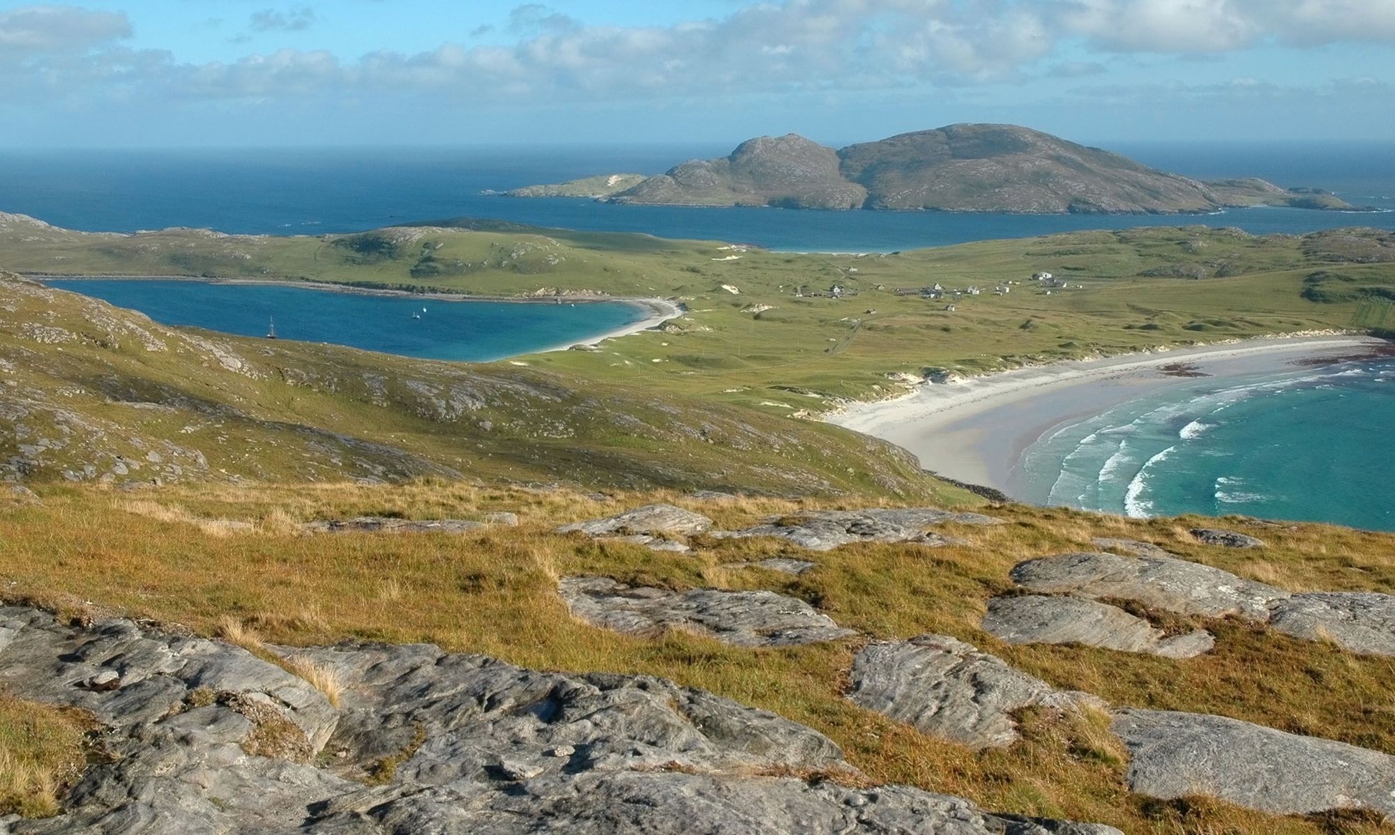
- Start/Finish: Vatersay/Stornoway
- Distance: 156 miles (252km)
- Duration: 8-13 days
- Difficulty: Challenging
- Best for: An island immersion
This remarkable route takes in a full 10 islands, six causeways and several ferries to complete. In return, you’ll get some of the most remarkable coastal views in Scotland if not the world - turquoise waters which are dotted with rolling islands - and you’ll no doubt see an abundance of marine wildlife to boot. The route also allows you to learn the gaelic heritage and archaeological history of these Outer Hebridean islands, from Vaterdsay to the Butt of Lewis.
Beginning on Vatersay, this route goes, in order, to Barra, Eriskay, South Uist, Benbecula, Grimsay, North Uist and Berneray before reaching Harris and finishing on Lewis.
It is the beaches, the sweeping Atlantic scenery and the sun sets over both that steal the show here...
The first day on Vatersay sets the tone of this route. You’ll be walking on rolling hills, past beautiful beaches, with far-reaching ocean views and beautiful lookouts over Barra. You’ll follow the Machair Way on South Uist - with the machair flowers vibrant in June and July - and be able to look out to the hills, Ben Kenneth and Ben Mhor, which stand over the landscape here.
There’s moorland in North Uist, hill passes in Berneray and delightful hills in Harris, but it is the beaches, the sweeping Atlantic scenery and the sun sets over both that steal the show here.
If you’re interested in seeing the white-sand beaches of Scotland which can truly contend with anywhere in the world, and walking on grasslands with far-reaching, glimmering ocean views, then this is perhaps the best hike in Scotland. We should add though, it does get rather windy.
26. The St Magnus Way
- Start/Finish: Egilsay/Kirkwall
- Distance: 58 miles (93km)
- Duration: 3-5 days
- Difficulty: Moderate
- Best for: Discovering Orkney
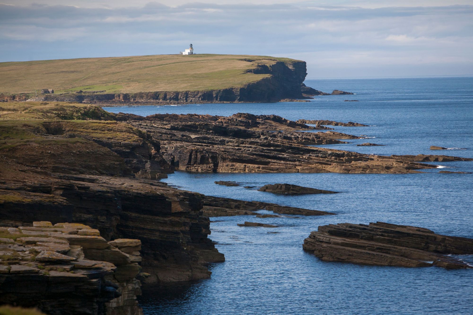
This pilgrimage route is a particularly good way to discover and explore the mainland of Orkney (the largest of the Orkney islands, which is simply known as ‘Mainland’, with little care for what lies across the water!). The route follows the story of St Magnus, the former Viking Early of the islands, whose story is intrinsically linked to that of Orkney.
The route begins on another island, though - Egilsay - which can be reached by a short ferry journey from Tingwall. This island is the site of a towered church, memorial and beach all with deep connections to St. Magnus - and there’s also an RSPB reserve on the island.
Back on the Mainland, you’ll follow the route that Magnus’ body was carried after being granted a Christian burial in the 12th century. Setting off from the Iron Age Broch of Gurness, you’ll pass the Sands of Evie and Costa Head, some rugged, remarkable coastline and look out over Eynhallow, Rousay, Westray and the Brough of Birsay.
Heading in-land, you’ll walk through farmlands, lush forests and past lochs, and as with almost any hike on Orkney, you’ll have the chance to see an abundance of sites of Neolithic importance. The route finishes back in Kirkwall, the capital of Orkney, and the home of the stunning, red and yellow sandstone St. Magnus Cathedral. But not before you round some beautiful beaches at Waulkmill and Scapa and pass the RSPB reserve at Hobbister.
When is the Best Time to Hike in Scotland?
Scottish comedian Billy Connolly once said, “there are two seasons in Scotland: June and Winter.” That may be a little on the extreme side of things, but it's certainly true that the seasons are unpredictable here in Scotland. The sun will shine when it shines and the sky will rain when it rains.
Naturally, the winter is (usually) colder than the summer.
From November-March, particularly in the north of the country, you can get a lot of snowfall. So if you’re going to hike in that time period, you need to have the gear and experience for those conditions. We would say that many of the hikes we've listed above are not possible, and should not be attempted, in winter conditions.
Peak hiking season in Scotland is from June-August, and these will be the busiest but driest times. April could honestly be anything from snow to substantial sunshine, depending on how the Gods are feeling that day, and so could September. Personally, I love hiking in these shoulder seasons, though, as you get less people and you also get less midges - but the important lesson to take away from this is to be prepared for all weathers in Scotland.
That means having a good waterproof jacket that will actually keep out the rain, plus a pair of boots that can scramble and support but also keep out the wet weather. If you’re camping, a tent and sleeping bag that are up to scratch (meaning appropriate for the warmth, wind and again, can keep the rain out) is key, and of course, if there’s snow, appropriate gear for that – which may include crampons, ice axes and the knowledge of how to use them and navigate in such conditions.
What Animals Live in Scotland?
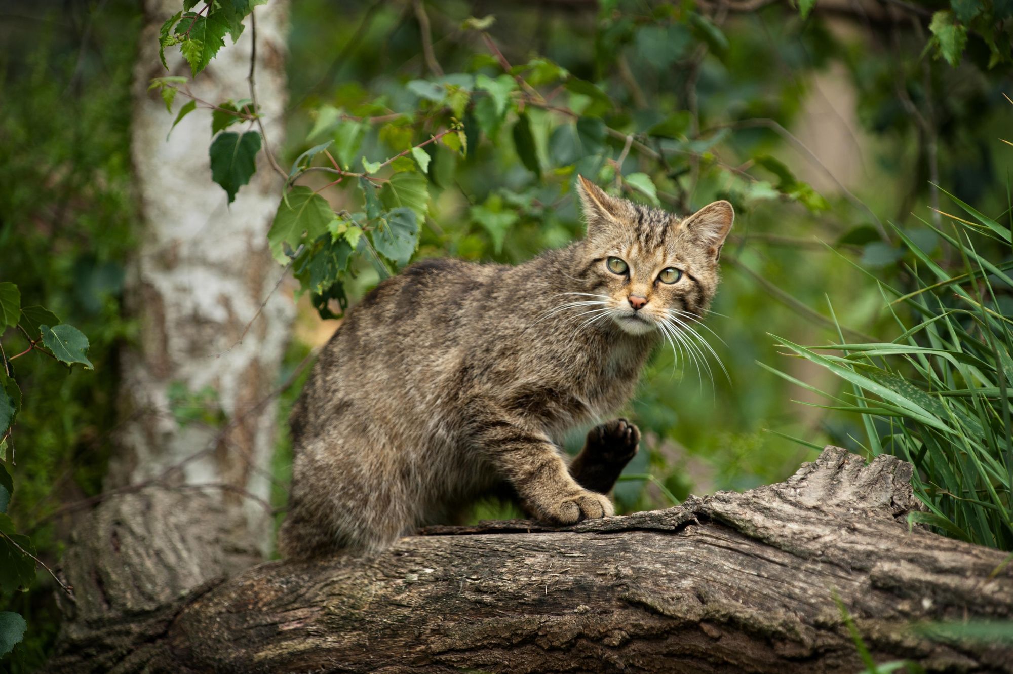
In the Highlands of Scotland, you can see a wide range of animals, from red squirrels and pine martens to mountain hares, beavers and even elusive Scottish wildcats. What we will say, though, is that all of these are quite rare.
You're much more likely to come across some deer in Scotland. Red deer are the largest, with huge antlers that they shed each year. Roe deer are also native, while sika and fallow deer have been released in the country as well.
In the skies, you might catch a glimpse of a white-tailed eagle if you're near the coast, or a golden eagle if you're in the hills. Look out for ospreys near rivers.
In the oceans, you can see dolphins, porpoises, seals and even basking sharks and orcas if you're lucky (though again, sightings of these animals are rare).
Hiking in Scotland: Avoiding the Midges
If you don’t know what a midge is, then you’re a very lucky person. Unfortunately though, you’ll find out when you come to Scotland. Midges are tiny little flying blood-suckers (literally) who will bite anything that moves, and leave an itchy mark. They’re attracted to the CO2, scent and heat of humans and are very much the bane of all hiking in Scotland - particularly from March to September.
Midges' favourite conditions are warm and damp but not windy. They also love still and humid, or cloudy conditions. If it’s actually raining or if it’s windy you should be fine, though. Midges can’t fly in winds beyond 7mph. They’re only wee, so get blown about easily – but when the weather settles, they do swarm. Cold and dry or full on sunlight – should you be so lucky – and you’ll also likely be fine.
Fires keep them away, as does insect repellent, which is really a must. Smidge is often used as a decent repellent, but different people prefer different things.
Where to Stay in Scotland?
All around Scotland you will find exceptional hospitality. Hotels are dotted around, as with any country. My advice would be to go the extra mile to ensure that your accommodation is locally-owned. You'll get a better visitor experience, an enthusiastic host, and you'll be benefiting the local economy when you visit.
Hostelling Scotland run an excellent network of hostels, many of which are in remote areas. A few of their remote hostels include the hostel on Birsay, on the northwest coast of Orkney's mainland; the Glen Affric Youth Hotel, in a rewilding hotspot; and the hostel at Glenbrittle, at the starting point to the walk up Scotland's most westerly Munro, Sgùrr na Banachdaich on the Isle of Skye. The Loch Ossian Youth Hostel is also often cited as a real beauty.
My advice would be to go the extra mile to ensure that your accomodation is locally-owned.
Of course, bothies are famous in Scotland. These are old, emptied farmhouses which tend to be found in remote areas. They are generally maintained by the Mountain Bothies Association and they are free to use (and not possible to book), but you should follow the Bothy Code if you are going to stay in one. You can often light a fireplace inside a bothy, but a sleeping bag is usually still essential.
As a quick note, it's worth knowing that many boutique hotels or glamping spots will include the word 'bothy' in their name, but will not be bothies in the sense described above. This doesn't mean they won't be brilliant accomodation spots, it usually just means their accomodation is inspired by the traditional bothy, but in a more modern sense (being commercial, and offering a more cosy experience).
And finally, under the Land Reform (Scotland) Act 2003 Scotland does have what is commonly referred to as the much loved 'right to roam' (or right of responsible access). This means that you are allowed to wild camp on most unenclosed land here. Again, be sure to follow the Scottish Outdoor Access Code if doing so. It essentially boils down to leaving no trace. Note that due to issues with litter, permits are requires to camp in areas near Loch Lomond & The Trossachs.
What to Eat in Scotland?
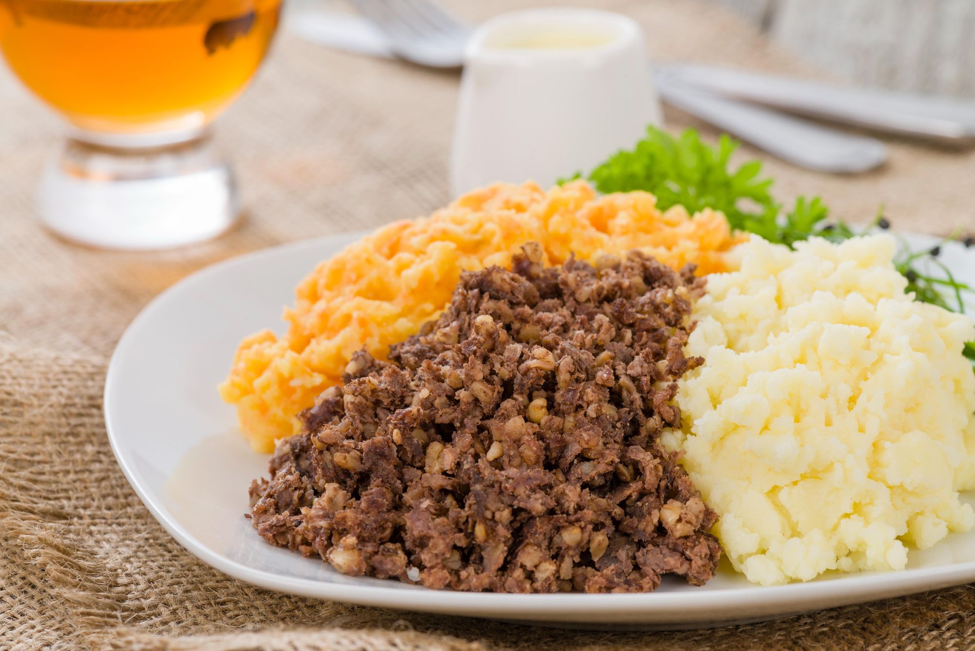
The most famous element of Scottish cuisine, by far, is that described by the bard Rabbie Burns as "Great Chieftain o' the Pudding-race". Of course, it's haggis. It comes with neeps (turnips), tatties (potatoes, usually mashed) and whisky sauce - and you'll find it all over the country. If you're a meat eater, haggis is genuinely delicious, and if you're veggie, fear not - the vegetarian version of it is great too.
There is a lot of game meat and chicken in the Highlands, and naturally, a lot of fish around the coasts. You'll see a lot of salmon on the menu (which is likely to be farmed), as well as langoustines, mackerel, cod and haddock. If you like your fish, I'd recommend trying cullen skink - a fish soup made with smoked haddock, potatoes and milk. It's creamy and though it's usually a starter, it's very filling too.
A classic Scottish dessert is cranachan - a mix of whipped cream, toasted oats, honey, whisky and raspberries, all mixed together into a glorious, delicious mess.
How to Get to (and Around) Scotland?
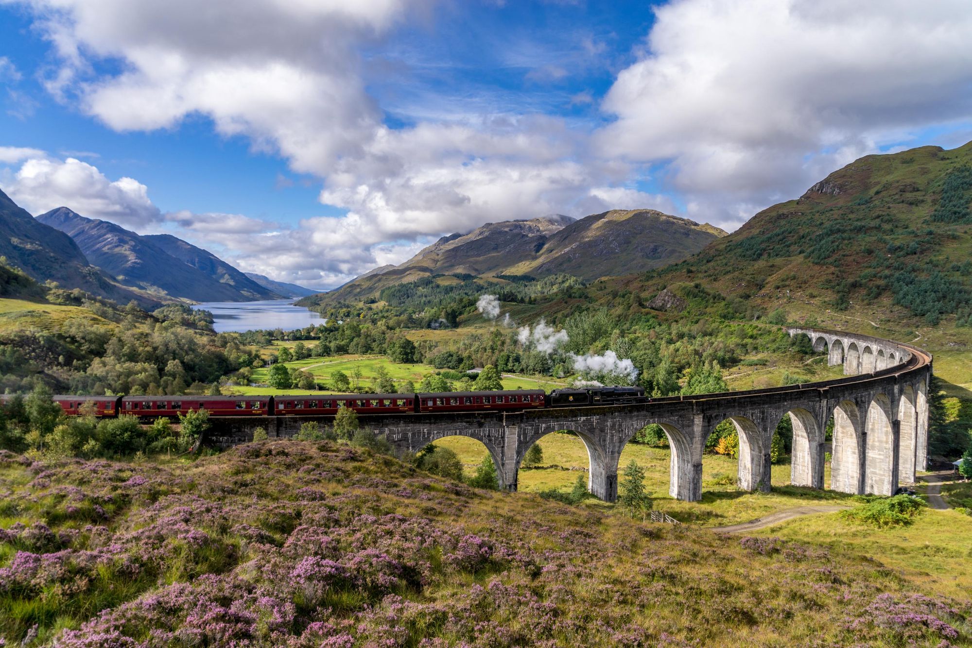
By train: Scotrail is the network provider here, and runs a fantastic network of trains all around the country, including out to remote areas. The West Highland Line is the most famous train line in Scotland, and perhaps in Europe. It runs from Glasgow to Fort William and Mallaig. The above photo is of the Glenfinnan Viaduct. Specifically, that photo is of the Jacobite Steam Train (better known to many as the Hogwarts Express), but you'll cross the same viaduct on the Scotrail train to Mallaig. Book your train in advance to get the best fair.
By plane: Most people fly into either Edinburgh or Glasgow, though both are in the lowlands. The quickest access to the Highlands is via Inverness (or Aberdeeen) Airport. Still, the journey from Glasgow or Edinburgh north is only a few hours, and of course, it's a good base from which to head to the Borders too.
By bus: Local bus services operate around Scotland. You'll usually get frequent services in the city, and infrequent services (which can be delayed) visiting more remote areas. Though many of these take card, it's good to carry cash with you.
Read More:
- 11 of the Best Hikes on the Isle of Skye
- A Guide to Walking the West Highland Way
- Climbing the Rum Cuillin, on Scotland's Forbidden Isle
Check out our full range of adventures in Scotland and the UK now!
Article by Scottish travel writer Stuart Kenny.