


The best hikes in London... are usually a little bit outside London. It's nice to get away from the big city when you go out for a walk after all. As any outdoor enthusiast based in London will know, having a good few day hike plans in your locker is an essential. Sometimes you need to just leave it all behind, and it’s important to be able to get away to spots where there isn’t a skyscraper in sight, a car horn in your ears or people all over the place. Thankfully, it’s not hard to do, either. There are whole hosts of hiking trails around London.

Best Hikes in London: Hiking trails near the City
Below we've listed some of the best hikes near London - all reachable by train within 90 minutes. The Komoot maps used below are designed to inspire but not to direct. They only give a rough illustration of the routes involved, and those routes may change over time. If you are planning to head out to take on any one of these routes, or indeed your own London hike, make sure you have done further research with a map of your own, and are confident navigating the route.
Here are the 10 hikes that we've selected as the best near London:
- Tring to Princes Risborough (The Ridgeway)
- Seaford to Eastbourne (The Seven Sisters Cliff Walk)
- Ockley to Leith Hill
- Rickmansworth to Chesham (The Chess Valley Walk)
- Hassocks to Lewes
- Lewes via West Firle Circular
- The Isle of Grain to Woolwich (England Coast Path)
- Epping Forest
- The Kent Downs AONB
- Tilehurst to Sonning Bridge (The Thames Path, West)
This Google Map gives you an idea of the distribution of the walks near London.
While we always strive for accuracy, transport in and around London can sometimes be erratic and changeable, and our directions to and from each location may not be possible at all times, every day of the week. Double check your travel before leaving, and leave plenty of time to get yourself home again.
Beware of snow on the ground or any adverse weather conditions before walking.
1. Tring to Princes Risborough – The Ridgeway
- Start/Finish: Tring/Princes Risborough
- Distance: 13.3 miles (21.5km)
- Walking time: 6 hours
- Difficulty: Challenging
- Best for: Getting a taste of the Ridgeway
This walk is a section of The Ridgeway, a long-distance trail following an ancient travellers' route along the chalk escarpments and downlands of southern England. We've selected one of the most undulating parts of the route, along the idyllic Chiltern Hills (an area which is also great for cycling).

Head south along Hastoe Lane towards Hastoe, then turn right along Gadmore Lane and enter Pavis Wood along a wide track. The will take you through sections of fields and Wendover Woods, before descending down Boddington Hill - the site of an Iron Age hill fort - to the picturesque town of Wendover.
Walk through the town until you reach Ellesborough Road, where you'll see a footpath waymarked 'Ridgeway'. It climbs up Bacombe Hill and then Coombe Hill, which offer views over the rolling Chilterns landscape. After a while, you'll pass through the Chequers Estate (the country home of the Prime Minister), crossing a camera-guarded main driveway, before heading into a woodland.
The Ridgeway is well signposted as it winds through the woods, up Pulpit Hill and around the hamlet of Whitleaf. It eventually becomes an unsurfaced track which will lead you down to Princes Risborough, where you can catch the train home.
Getting there from London: take the direct train from London Euston to Tring (44min). Take the 389 Bus from Tring Station to the town centre (stop at Church Square, 6 minutes). Return to London by taking the train from Princes Risborough to London Marylebone (also direct, and around 45mins).
Liked this? Check out our Intro to Gravel Biking Weekender in the Chiltern Hills.
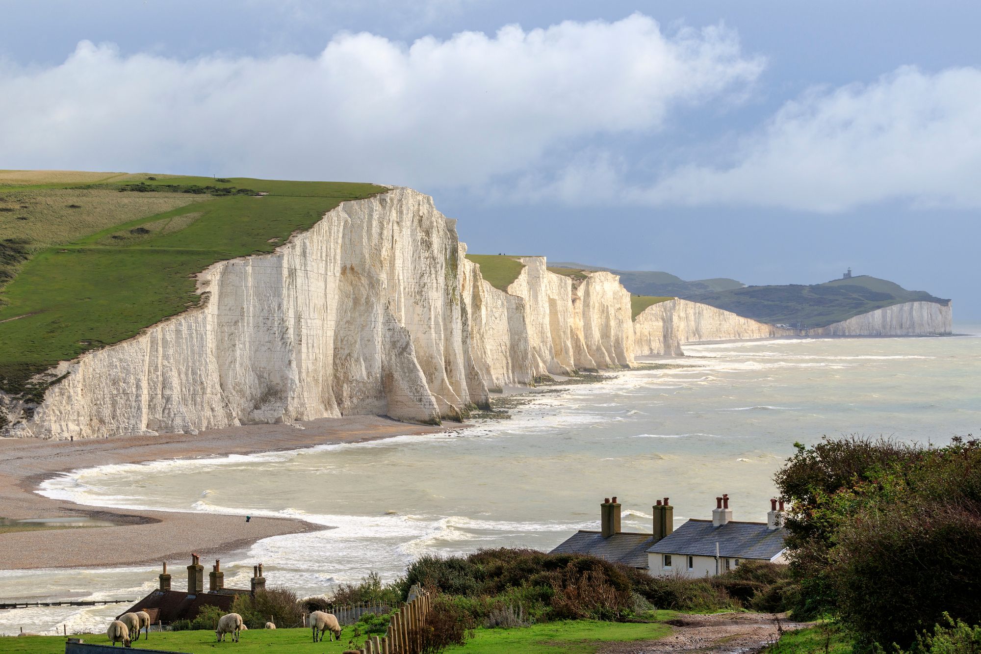
2. Seaford to Eastbourne – The Seven Sisters Cliff Walk
- Start/Finish: Seaford/Eastbourne
- Distance: 13.6 miles (21.8km)
- Walking time: 6 hours
- Difficulty: Challenging
- Best for: Coastal beauty
The Seven Sisters Cliffs Walk from Seaford to Eastbourne is the route to pick if you want coastal views. It’s near enough all either up or down, though, and you do have to be careful around the cliffs. It’s a steep drop!
The route is a fair trek at 13.6 miles, so you also need some fitness, but you’ll be rewarded with beautiful ocean and chalk cliffs views for the majority of the way. All those highs and lows mean you often drop to beaches, which is fun. This translates into great wild swimming opportunities – particularly at the beautiful Cuckmere Haven. Of course, this is weather permitting. Make sure you stay safe in the water!
The route starts in Seaford, and takes in landmarks along the way. You’ll see Martello Tower, one of over 100 fortresses built to protect the South East coast during the Napoleonic Wars, the beautiful chalk cliffs of the Seven Sisters, formed in the Ice Age, the Cuckmere River, and join the South Downs Way trail for part of your route. You’ll summit Haven Brow, the highest of the Seven Sisters, pass Belle Tout Lighthouse, and finish your journey by rejoining the seafront promenade at Eastbourne Pier, from where the train station is a short walk.
Getting there from London: take the train from London Victoria to Seaford, changing at Lewes (1 hr 26 mins). Returning, take the direct train from Eastbourne to London Victoria. The trains are less regular on Sundays, so check the timetable.
Liked this? Come and SUP, hike, and wild swim in Snowdonia with us.
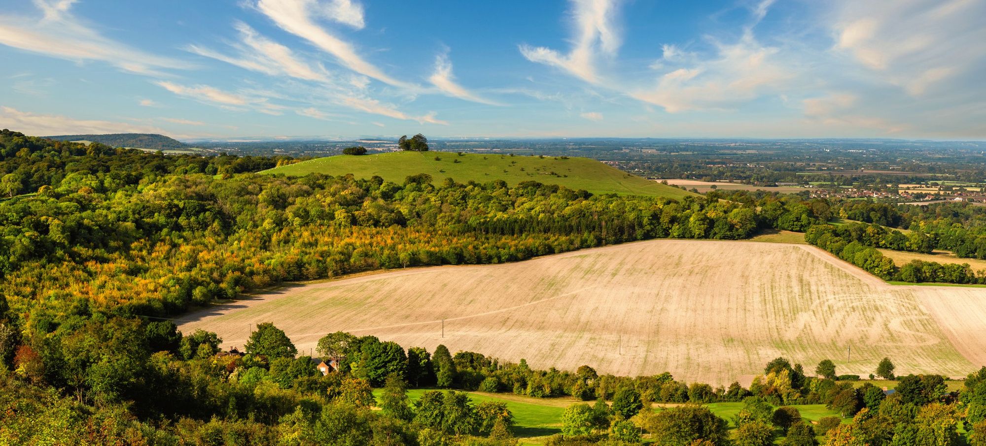
3. Ockley to Leith Hill
- Start/Finish: Ockley (loop)
- Distance: 7.9 miles (12.7km)
- Walking time: 3hrs 30 mins
- Difficulty: Moderate
- Best for: A hill hike (with great pubs nearby)
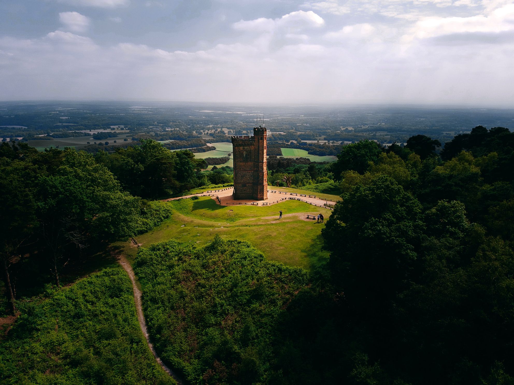
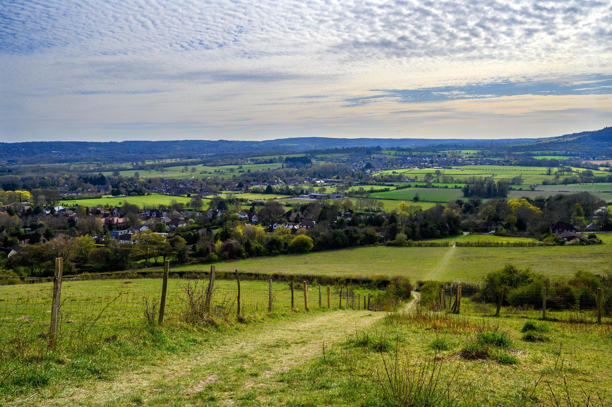
This one is the short and sweet contingent of our hiking list. For those looking to get the quickest bang for your buck, get yourself out on a train to Ockley and on the path up to Leith Hill, from where you can see all the way back to London. On a clear day you can even pick out Big Ben.
The route in the map below is a bit of an extension of the usual up and down on Leith Hill. Instead of heading straight for the main event, you’ll first head out to Vann Lake, a really beautiful, often overlooked ancient woodland a short stroll from Ockley. Vann Lake is actually a man-made lake which dates back to the mid 18th century, when a forest gill was dammed to power a mill which was never built.
Still, it wasn’t all in vain. It looks nice, and it’s become a hotbed for nature! There are more than 900 species of fungi, 17 species of dragonfly and damselfly, 10 species of fish in the lake and more than 100 bird species nearby – including kingfishers and woodpeckers. A note of warning – when you get back on the Leith Hill route, it will get steep. Gradients get up around the 20% mark, but that doesn’t last for long. After you’ve seen the tower and the views, you can of course head back down the same path, or for a change of scenery why not head down via the rhododendron woods before rejoining up with the path and heading back down to Ockley.
Getting there from London: trains from London Victoria run regularly to Ockley, and take roughly one hour ten minutes.
4. Rickmansworth to Chesham – The Chess Valley Walk
- Start/Finish: Rickmansworth/Chesham
- Distance: 10.3 miles (16.5km)
- Walking time: 4hrs 30 mins
- Difficulty: Moderate
- Best for: Experience chalk streams
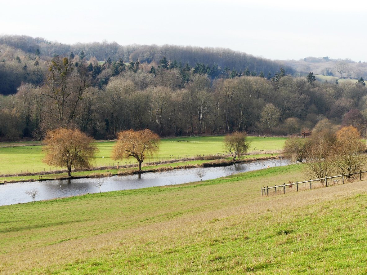
The Chess Valley Walk is a 10 miler through the Chilterns. The route passes through whole heaps of beautiful scenery and picturesque villages, and follows the River Chess from Rickmansworth to Chesham. The river is a chalk stream, which means it’s wide, shallow and mostly very clear. This walk is waymarked, which makes it a lot more accessible and comfortable for those less familiar with using maps, compasses and so on, and it means it’s pretty tricky to get lost.
The Chess Valley is full of sights to see along the way. There’s a Roman farm-villa at Latimer, which dates all the way back to the first century AD. The Chenies Manor, roughly half way on the route, have beautiful gardens open to the public. There are points where you can spot watercress beds and water voles, kingfishers, orchids and dragonflies rare to the United Kingdom. The scenery is beautiful throughout, and oh so close to London.
Getting there from London: You can do the Chess Valley Walk either way, beginning from either Rickmansworth or Chesham underground stations (both on the Metropolitan Line).
5. Hassocks to Lewes
- Start/Finish: Hassocks/Lewes
- Distance: 10.4 miles (16.7km)
- Walking time: 4hrs 30 mins
- Difficulty: Moderate
- Best for: A taste of the South Downs Way
There are regular trains from both London Victoria and London Bridge Station heading to Hassocks. They take around 50 minutes to get there, though remember to check availability on weekends. The return train from Lewes is around an hour and goes to Victoria.
Starting in Hassocks, a large village in West Sussex, this is a hilly hike of ups and downs in the South Downs, starting with a steep hike up to the Clayton (Jack and Jill) Windmills around a mile in. This steep can be on gradients of 10-20% for around half a mile, so be prepared! Once you’re up the steep though, you’re on for a rolling walk with few notable steeps until the final descent about eight miles in. And your reward for getting up that initial big hill is to see those windmills – which date back to 1765. There’s a post mill, a tower mill and the roundhouse of a former post mill, all three of which are Grade II listed buildings.
You’ll be on the South Downs Way for part of this hike, and enjoying the rural scenery of the countryside throughout. This route passes through Ditchling Beacon, the third-highest point on the South Downs in south-east England, and you’ll see Lewes castle on the horizon too. If you get to the end of this walk and would like to extent it, you could take on the first leg of the Lewes Circular which is up next on this list, and get yourself up to the hill fort on Mount Caburn, then go home from Glynde (various trains to Victoria, though first you need to go to Brighton or back to Lewes). Or, of course, you could call it a good day of hiking and go to the pub.
Getting there from London: take the train from London Victoria or London Bridge Station to Hassocks (around 50 minutes). The return train from Lewes is around an hour and goes to Victoria.
Liked this? Challenge yourself on a mountain hike in Snowdonia.
6. Lewes via West Firle Circular
- Start/Finish: Lewes (circular)
- Distance: 12.2 miles (19.6km)
- Walking time: 5hrs 30 mins
- Difficulty: Challenging
- Best for: A valley walk with far-reaching greenery
This is a long, sometimes steep walk which can be broken up into three sections. The first is a hike from Lewes to Glynde, the second from Glynde to Southease and the third from Southease back to Lewes.
On the first third you’ll enjoy great views of the historic town of Lewes and the picturesque Lewes Castle. There’s a beautiful valley you’ll stroll through and beautiful greenery. An early(ish) viewing point on the route is Mount Caburn, at the summit of which you’ll find an Iron Age hill fort, dated to around 400 BC. Mount Caburn is about a mile east of Lewes and overlooks Glynde. The fort itself has been said to be possibly the most excavated site in Britain, with 170 trenches. It’s assumed that it was a defensive fort, though it may also have been a religious enclosure. There are over 140 burial pits on Caburn.
On the South Downs Way section you’ll be able to look all the way out to the water at Newhaven and beyond, and back across the lovely green landscape you’ve just journeyed through. And then finally, it’s back to Lewes along the River Ouse. The ascents on this route come in the shape of three distinct, and steep hills on the route. They’re no easy gradient, but when the three are done, you’re mostly strolling flat.
Getting there from London: take the train from London Victoria to Lewes (1 hr 7 minutes). Check weekend train times - there are reduced services on Sundays.
7. The Isle of Grain to Woolwich (England Coast Path)

Distance: 47 miles
Total ascent: 1,598ft
Rough time: 2-3 days.
- Start/Finish: Isle of Grain/Woolwich
- Distance: 47 miles (75km)
- Walking time: 2-3 days
- Difficulty: Moderate/Challenging
- Best for: A long-distance hike from coast to London
 Stuart Kenny
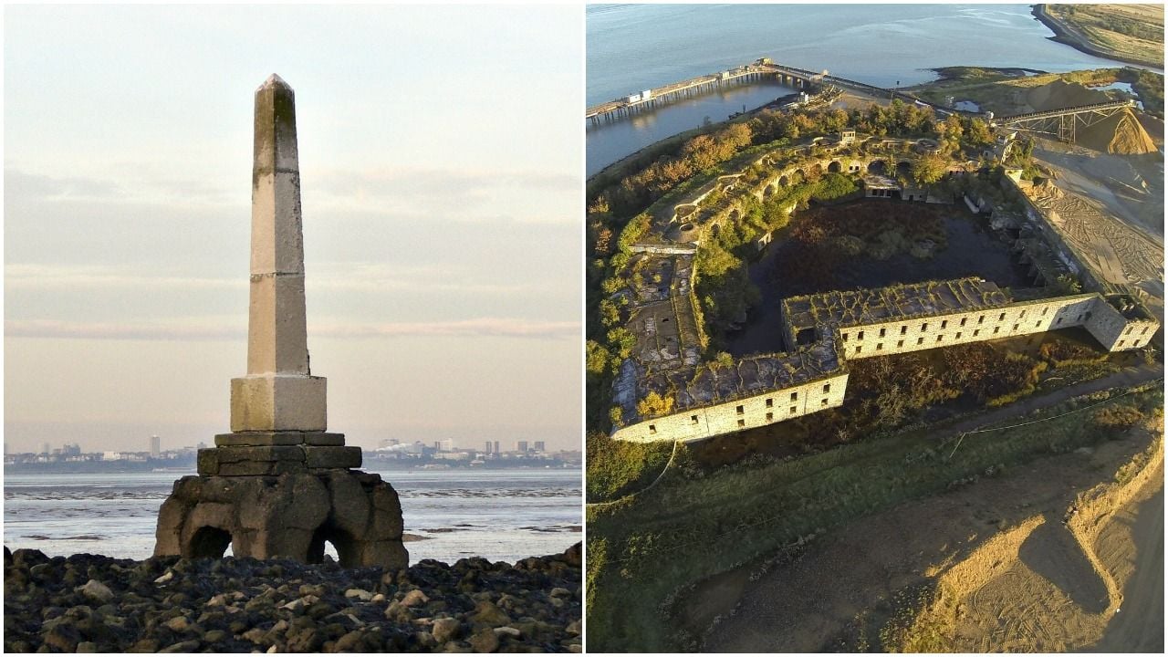
One of the latest stretches of the England Coast Path to open, this beauty of a trail runs from the Isle of Grain to Woolwich, taking you from the Kent Coast to the foot tunnel. There, the trail connects with the Thames Path, another National Trail, to create a new 231-mile source-to-the-sea route across England.
Leaving from the Isle of Grain, you simply have to follow the famous National Trail acorn waymarkers back to London. You'll pass the London Stone, marking the edge of the Thames estuary, and walk through marshes full of wildlife. There are RSPB sites on the way, old, abandoned forts and little pocket beaches to boot.
“From Allhallows to Gravesend, you’re on your own," Jenny Bowen of Natural England, and one of those involved in setting the trail, told us. "It’s a unique landscape. It's the old Dickensian marshes that inspired Great Expectations. And there's a church, St. Mary's Church, where his daughter got married.”
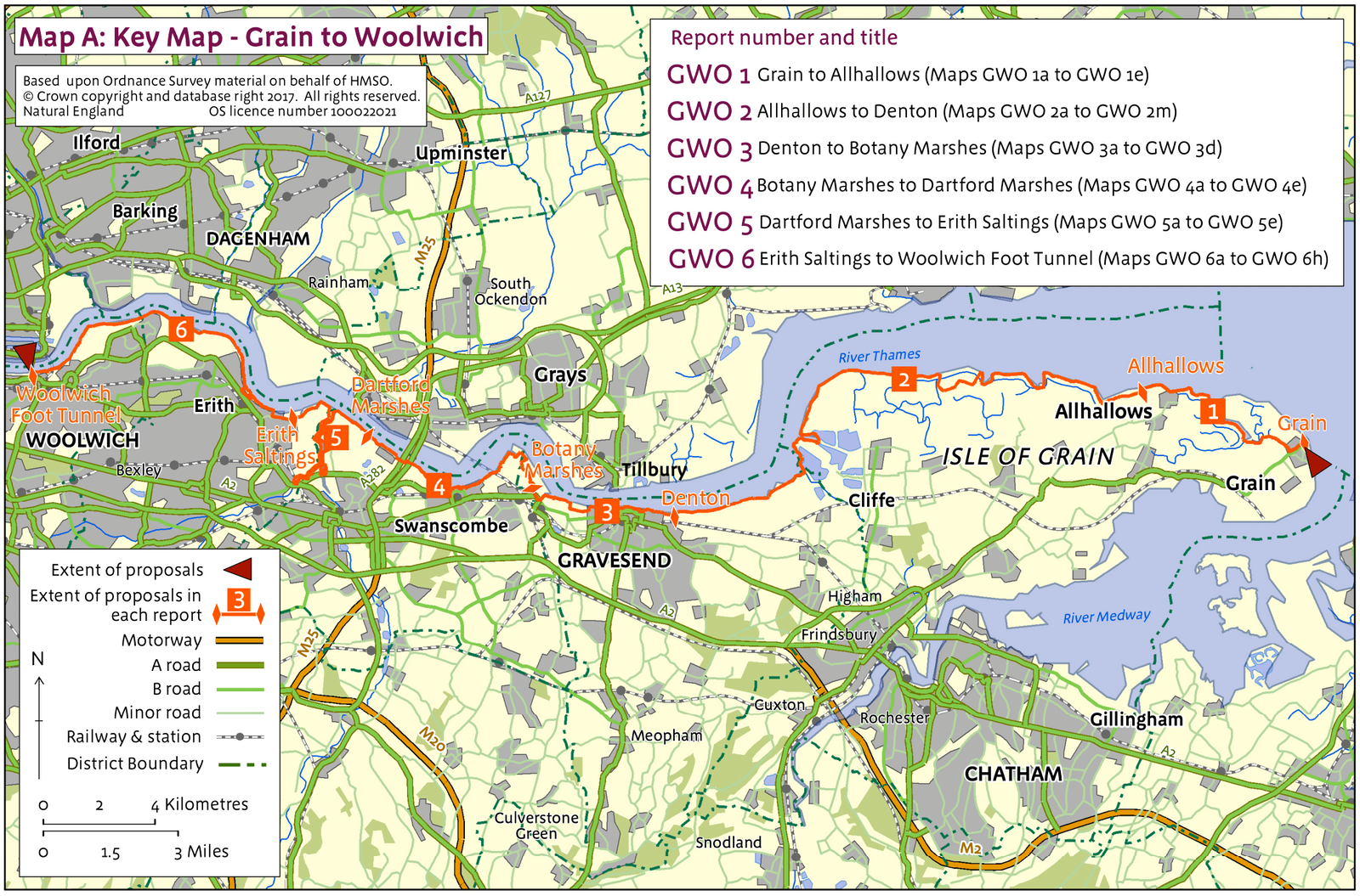
As you get closer to London, you'll pass the Grade-I listed Crossness Pumping Station, designed by Sir Joseph Bazalgette and dating back to 1865. You'll then pass the Royal Arsenal as you get in touching distance of the Woolwich Foot Tunnel. Here, it becomes the Thames Path, if you wish to keep on walking.
Getting there from London: take the train to Chatham from Victoria Station. The 191 bus will then take you to Lapwing Road on the Isle of Grain. This would be just shy of a two-hour trip. There are plenty of train stations along the route though, if you wanted to bite off a shorter portion of this trail. Swanscombe, for example, can be reached in 48 minutes on from London Bridge.
8. Epping Forest
- Start/Finish: Ivy Chimneys (loop)
- Distance: 13.1 miles (21km)
- Walking time: 6 hours
- Difficulty: Moderate/Challenging (due to distance)
- Best for: An immersion in Epping Forest
Epping has been the forest of the people of London since 1882, when Queen Victoria declared it as such. There are over 175 miles (280km) of paths and trails in the 6000+ acre that make up this forest; the largest open space in London.
This area offers a real, natural getaway from the city for anyone who loves woodland, open grasslands, deep ponds and all the critters - birds, insects and deer - that come with such terrain.
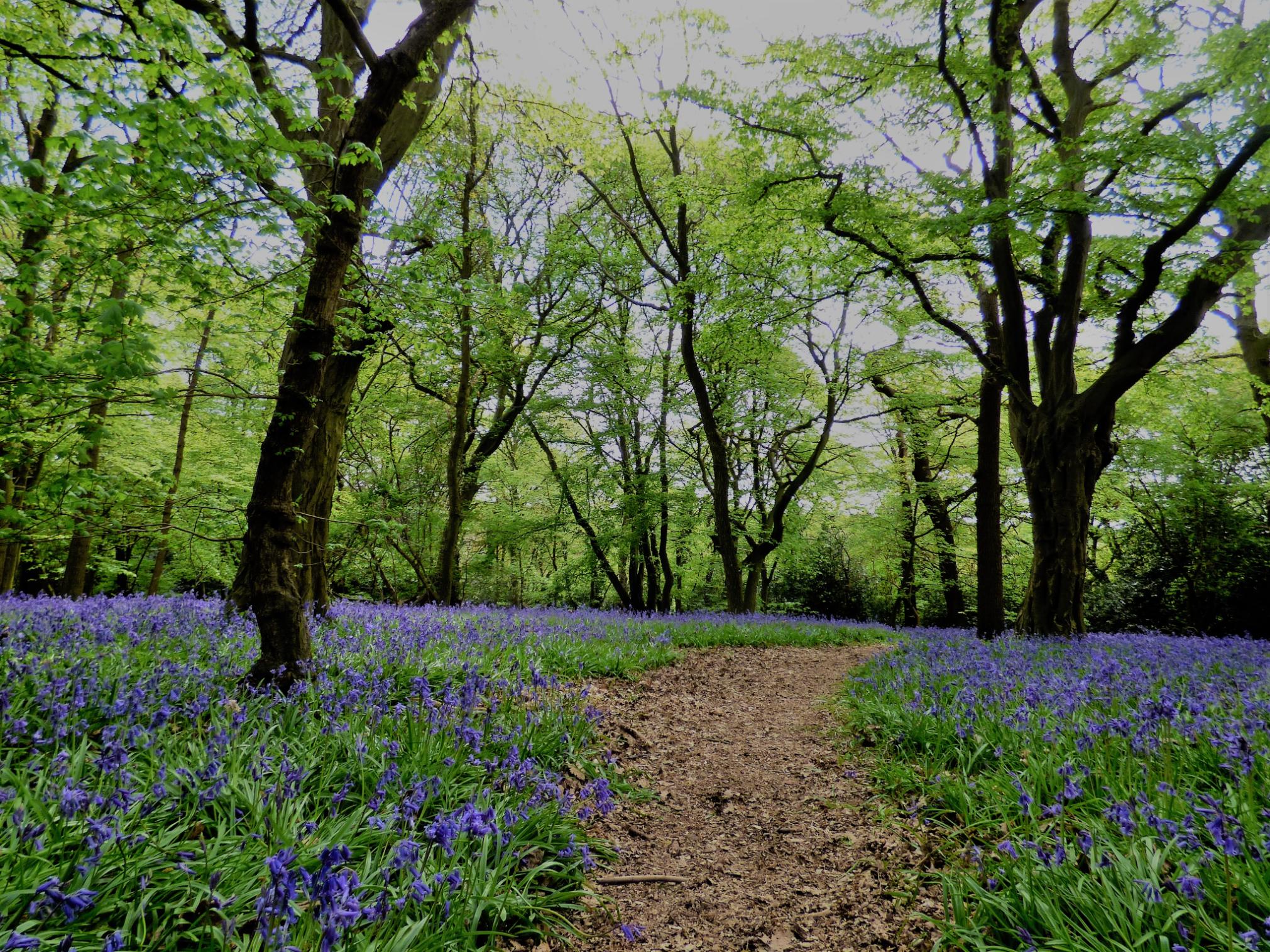
The route we've chosen is one of the longer hikes to be done in Epping Forest, which takes in much of the forest and the highlights, from the grasslands to the woodlands (which are particularly beautiful in Autumn, or when the bluebells are out in May). Around halfway on this hike you'll come across Butlers Retreat, a great lunch stop if it is open, and after this you'll pass the popular Connaught Water and Strawberry Hill Ponds before forests and leafy paths guide you back.
The Epping Forest Heritage Trust is a great resource for planning out a hike in the area. There are plenty of places you can go for a shorter walk than this; notably by doing a loop from either Theydon Bois or Loughton.
Getting there from London: The Central Line goes to Epping. It takes 52 minutes to get there on the Central Line from Oxford Circus.
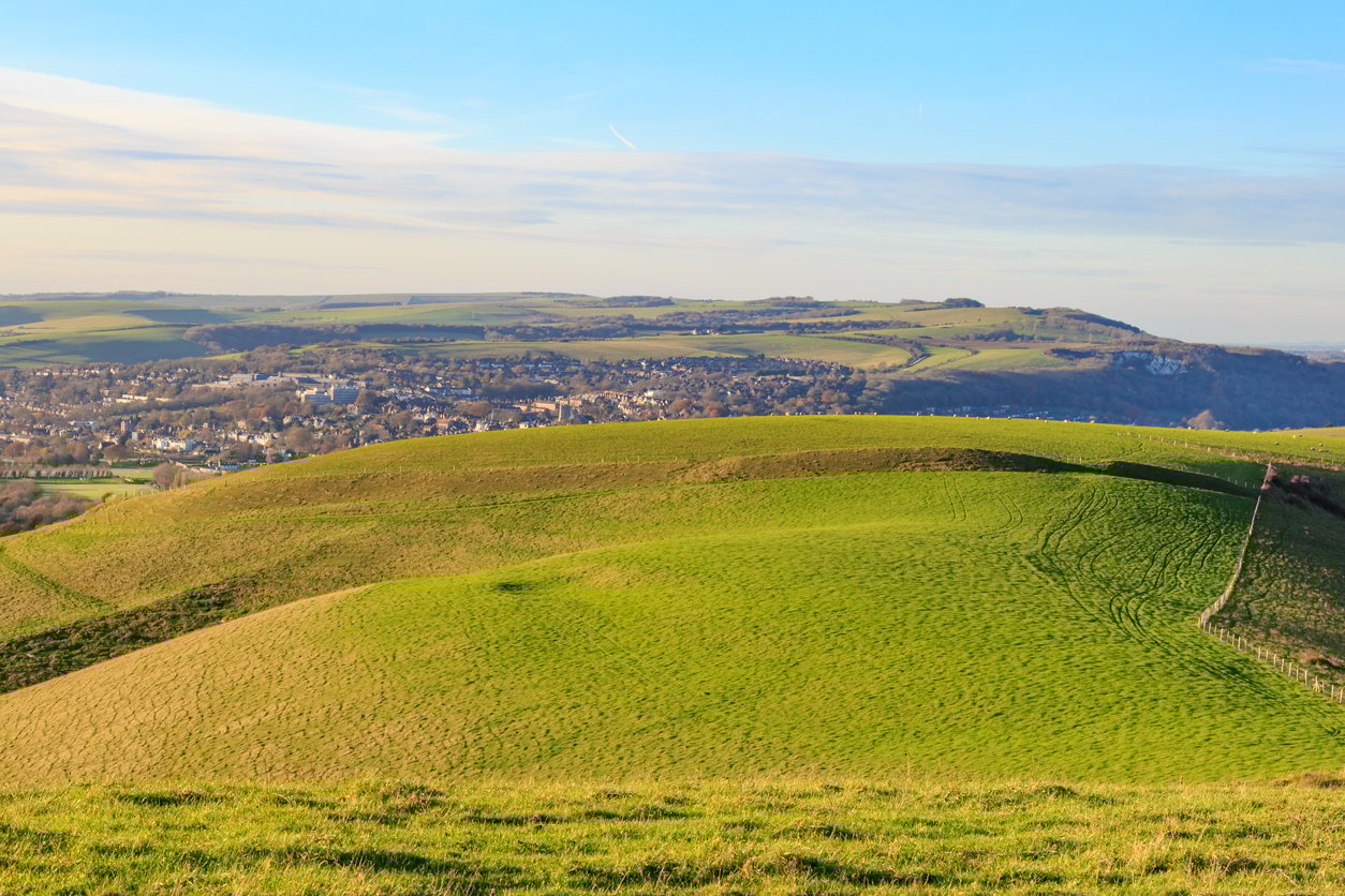
9. A Walk in the Kent Downs AONB
- Start/Finish: Cobham, Gravesend (circular)
- Distance: 11.4 miles (18.3km)
- Walking time: 5 hours
- Difficulty: Moderate
- Best for: Discovering the Kent Downs AONB
This is a lovely route which will make you feel like you've travelled a lot more than 90 minutes away from London. It's a big circular which allows you to discover the Kent Downs AONB (Area of Outstanding Natural Beauty).
Highlights include the viewpoint out over the rolling farmland from Mill Hill, which comes after 2.8 miles, lovely paths through open fields, and a pass by Luddesdown, which is a rural parish said to be the oldest continually inhabited house in South England. Silverhand Estate and apple orchards follow before this lengthy, 11-mile loop brings you back round to the start point by Cobham.
Do note that if you type Cobham into Google, a different Cobham will come up first - a village in Surrey. It's also lovely there, but it is a different place entirely.
Getting there from London: From Victoria, take the southeastern railway to Meopham (in the direction of Dover Priory). The train takes 33 minutes. From here, it's a nine-minute ride on the 416 bus to the War Memorial near Cobham.
10. Tilehurst to Sonning Bridge (The Thames Path, West)
- Start/Finish: Tilehurst to Sonning Bridge
- Distance: 7 miles, or 10 miles to get to Twyford Station (11.2km/16km)
- Walking time: 3 hours
- Difficulty: Easy/Moderate
- Best for: A look at the Thames to the west
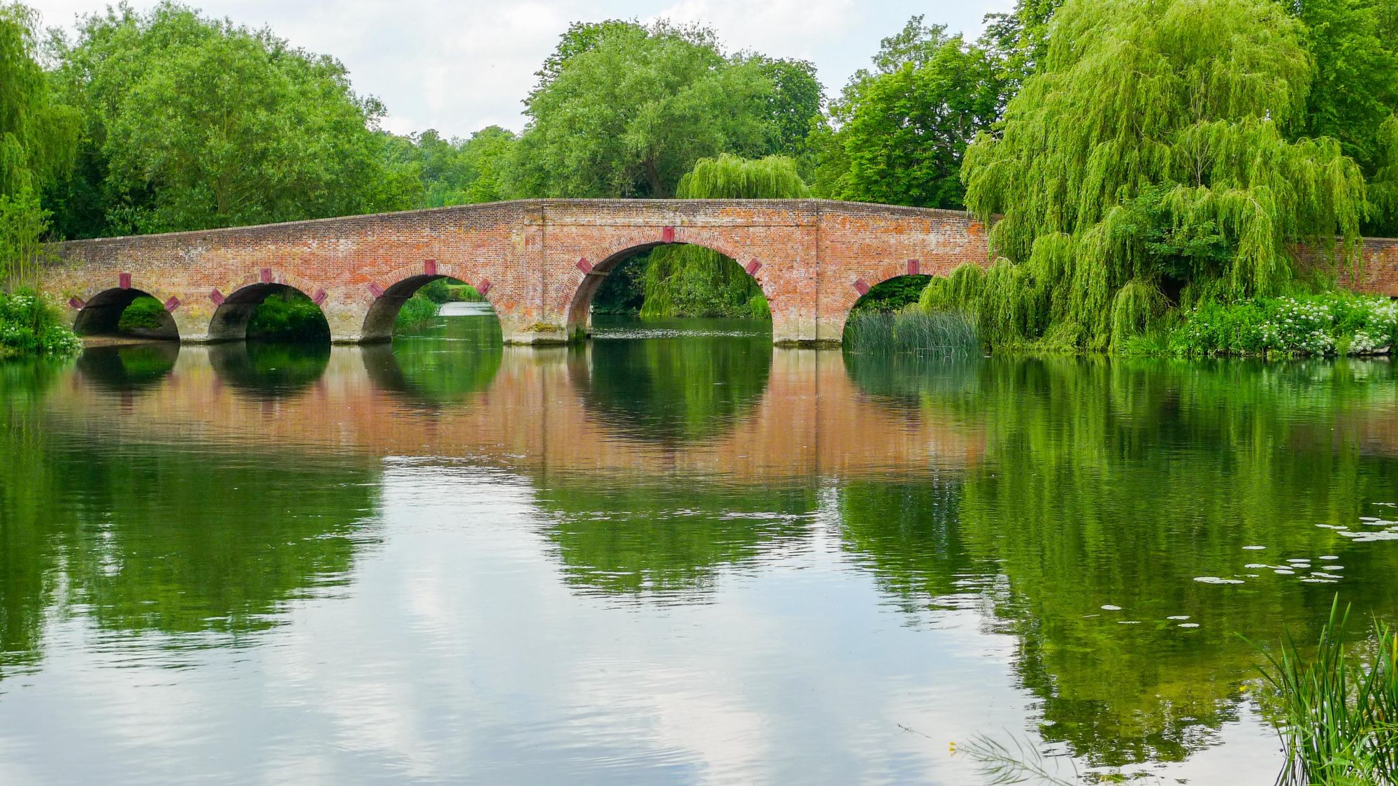
This walk takes you on a tranquil stretch of the Thames Path west of London.
From Tilehurst Railway Station, you'll have to walk towards Reading, then turn past a Waitrose and walk through an industrial estate to get to the Thames River. Here, the landscape transforms. There should be swans, ducks and geese around.
You'll find a lush, green, relaxing riverside path, with narrowboats passing every now and then. As you walk, you'll pass fields before reaching Rivermead Park. You'll walk to Caversham Bridge and pass Fry's Island, a natural island in the centre of the river, which is home to a private house and the Caversham Boat Service. Christchurch Bridge follows, and will guide you in the direction of Reading - which is the biggest town in England which is not a city.
Reading Bridge will take you out to Caversham Lock. You'll pass over islands and meadows, and find the point where the Thames meets the River Kennet.
Before reaching Sonning, you'll then pass through the Thames Valley Park nature valley park - 80 acres of tranquil wetland near a business centre. From here, you can either jump on the bus to Twyford, walk there, or return to Reading to get the train back to Paddington, London.
Getting there from London: From Paddington Station, it's 45 minutes west on the Elizabeth Line to Reading, and then a four minute ride on a GWR train (in the direction of Didcot Parkway) to reach Tilehurst. This route ends at Sonning Bridge. From here, you can walk three extra miles to Twyford Station and return to London on the Elizabeth Line - or take the 128 bus, a 10-minute ride to Twyford.
When to Go Hiking Near London?
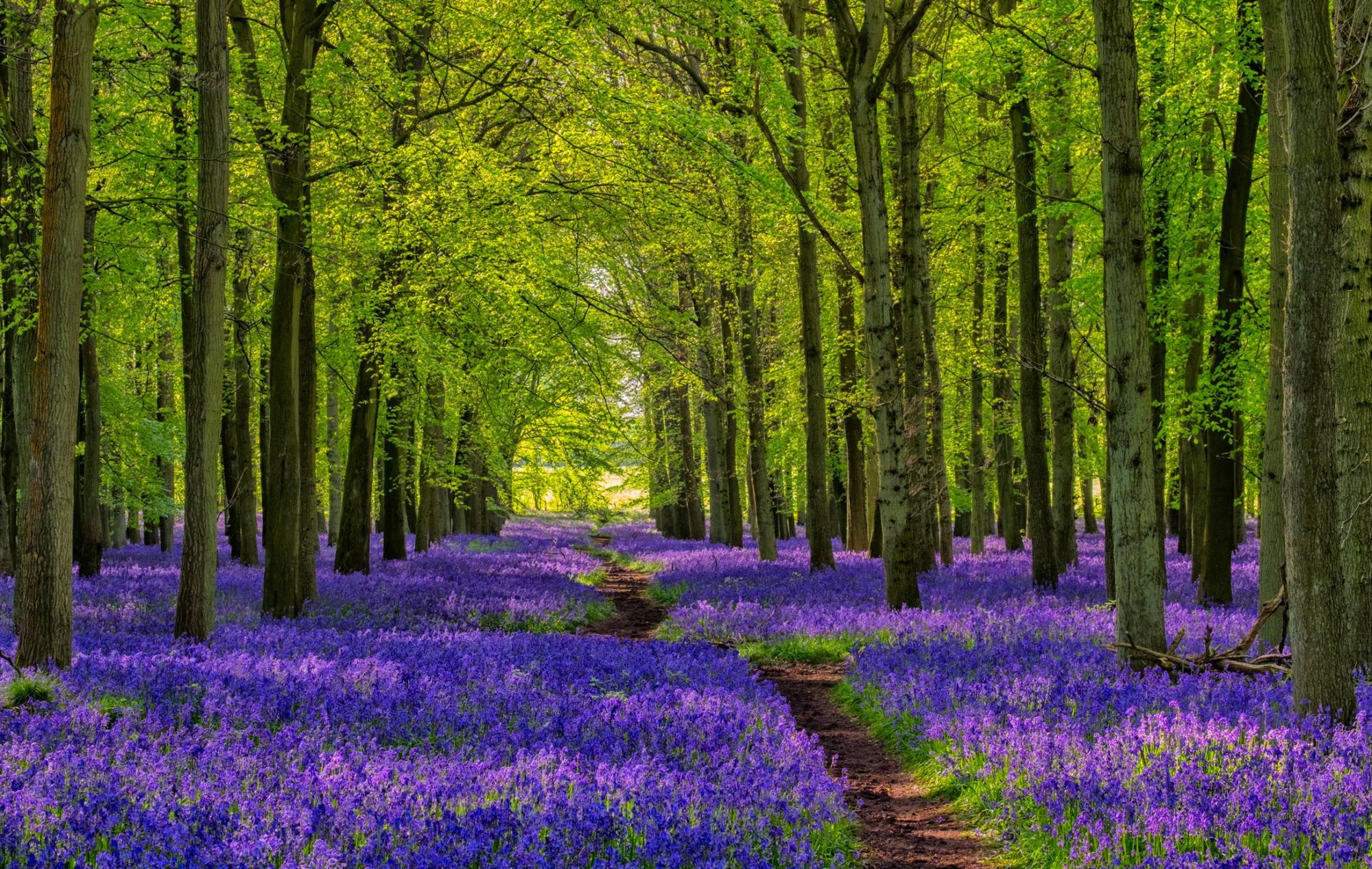
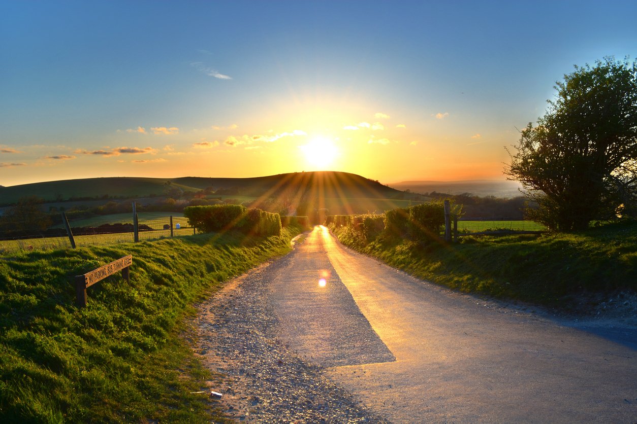
The areas around London obey the seasons of the year. That means that from June to August you can expect the sun to be out, and the greenery to be lush. From September to November, the forests will turn an Autumnal gold and from December through to February, you can expect it to be cold (although snow is rare in these parts). From March to May, Spring comes back, the bird call returns and in late Spring, you can find bluebells fields like the above in certain places.
What Animals Can I See Near London
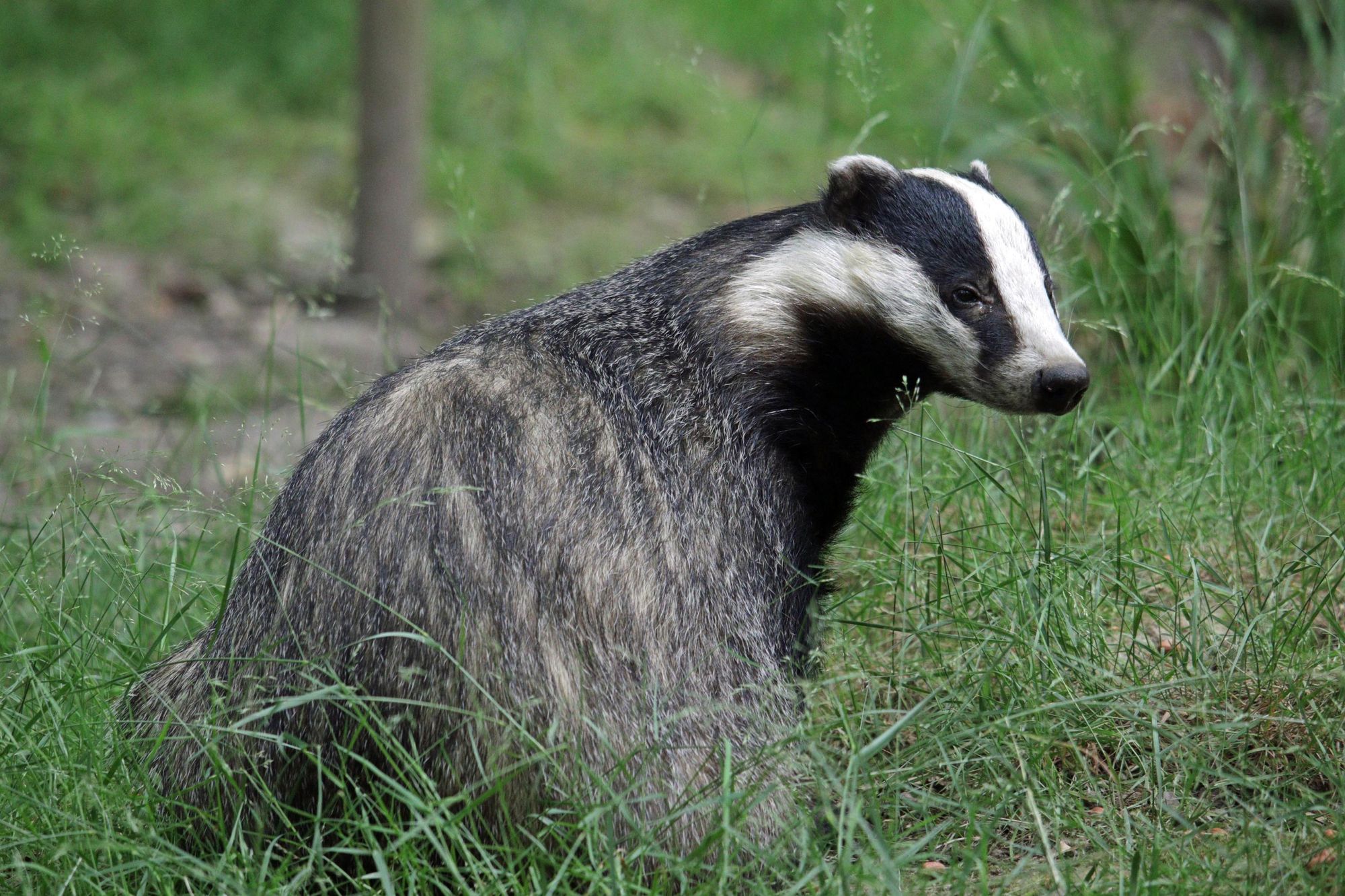
In the countryside around London you can find several species of deer, including roe, fallow and muntjac. You might spot foxes or, if you're lucky, badgers, weasels and stoats. Look to the skies and you might see red kites soaring around, looking for their next meal. Otters and water voles can also been seen by rivers.
FAQs
What are the best day hikes within 90 minutes of London?
There are some excellent hikes within 90 minutes of London. Top choices include the Seven Sisters hike in the South Downs National Park (reachable by train in around 90 minutes) and the Chess Valley Walk in the Chilterns (on the Metropolitan line). Head to Ockley (1 hour 10 minutes by train from London Victoria) to climb Leith Hill, for spectacular views of London and the surrounding countryside.
Are there any hikes near London accessible by train?
London is well connected by train and underground to numerous hiking destinations. Head to the Chilterns to hike the long distance Ridgeway path from Tring to Princes Risborough (both start and end points have a train station). The Lewes Circular is a circuit across the South Downs countryside (1 hour 7 minutes from London). Epping Forest, on the outskirts of London, offers plenty of woodland hiking trails, and is accessible on the Central Line.
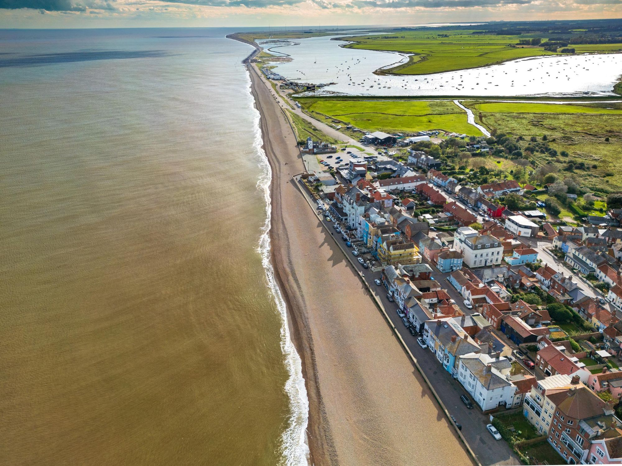
Which coastal hikes near London are most scenic?
The Seven Sisters Cliff Walk from Seaford to Eastbourne (on the south coast) is widely considered to be the most scenic coastal hike near London. But there are plenty of other options. Head northeast to hike along the Suffolk Coast Path (the area around Dunwich is particularly scenic) and southeast to the Kent Coastline where you can hike between quaint seaside resorts.
What Should I Pack for Hiking in London?
Make sure you bring a waterproof jacket and warm layers (weather can change quickly, especially in the winter months). You also need water and snacks, as well as a waterproof map or a route mapping app with offline coverage (e.g. OS map via Komoot/AllTrails). Make sure you wear sturdy, waterproof hiking boots or shoes.
Read more:
- 17 of the Best Places to Visit in the UK for Adventures
- Best Hikes in the UK: 10 of the Most Adventurous Routes
- The New 47-Mile Hiking Trail from London to the Kent Coast
Feeling inspired to explore further? Check out our UK adventures, and our weekend adventures designed to maximise your annual leave.