


"Isolated islands off Atlantic coasts. Unbounded forests, and blue snow-light falling on to drifts marked with the paw prints of wolves. Frost-shattered summits and corries holding lochs of great depths," Robert Macfarlane writes in Wild Places, a journey through Britain's remotest landscapes.
Despite having a reputation for being "green and pleasant," there's far more to the British countryside than a bucolic idyll. There's the gritstone crags of the Yorkshire Dales, austere under moody skies, and the granite ridges of the Cairngorm Mountains. The wild moors of Dartmoor and the rugged fells of the Lake District. Then there's the coastline - all 11,000 miles of it (much more if you count its offshore islands) - from the vast, windswept Norfolk beaches to the polygonal basalt columns of Giant's Causeway, in Northern Ireland.
The United Kingdom is the perfect place for an adventure. The highest peak, Ben Nevis (1,345m/4413ft), might pale in comparison to the Alps, but climbing it in the middle of winter, using crampons and ice axes, is a worthy challenge. You can also head to Snowdonia (Eryri) in Wales, where slate peaks dominate the skyline, for some epic hiking and scrambling opportunities. You can explore the country on a cycling adventure, tracing the gravel trail along The Ridgeway, Britain's oldest road. Or head south to the Cornish coast, to surf on its rugged shores.
The difficulty - choosing where to go. We’ve selected our 17 favourite destinations for adventure in England, Scotland, Northern Ireland and Wales. Some are in the remote Scottish Highlands, others a short train ride from London, but they’re all accessible by public transport. They’re the places we and our friends visit on our own adventures across the country - in fact, a fair bit of persuasion was used to get some people to reveal their under-the-radar spots.
The Best Places to Visit in England for an Adventure
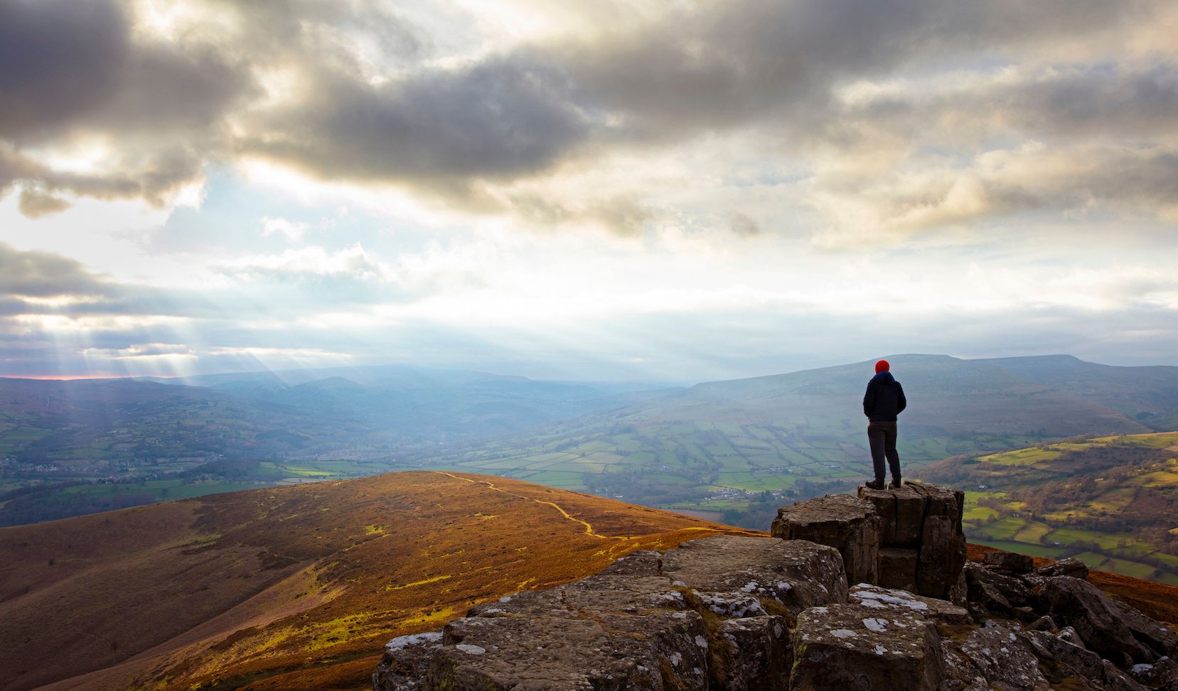
1. Peak District
The Peak District was the UK's first National Park, and is hugely popular with walkers, climbers and fell runners. It also played a vital role in England’s right to roam movement. It’s a park of two halves: the northern region of Dark Peak is renowned for its exposed moorland and austere gritstone ‘edges’; and ‘White Peak’, in the south, has a landscape of green hills, heather moorland and limestone caves.
Possibilities for adventure are many and varied. Try your hand at caving (there are several providers catering to beginners) or climbing the gritstone crags - Stanage Edge is one of the most popular spots. There’s ample opportunity for hiking in the Peak District, from the long distance Pennine Way to shorter walks along the park’s ‘edges’ and tors. Cycling is also well catered for, with beginner-friendly routes like the Monsal Trail and more gruelling challenges, like the Peak 200, a 136-mile-long (219km) mountain bike circuit around the park.
The perfect adventure: climb Kinder Scout, a hill where the first mass trespass took place. Take the Jacobs’ Ladder path up from Edale, and then hike a circuit of the entire plateau. You’ll have gorgeous views of limestone crags and rolling moors. Finish up at Edale, and enjoy a pint at Ramblers’ Inn.
By public transport: there are train stations throughout the Peak District. The Hope Valley Line runs from Sheffield to Norwich, stopping at stations in Edale, Hope, Hathersage and more. There is also the Buxton Line and the Glossop Line, both running from Manchester. There are extensive bus routes throughout the park: service 271 will take you from Sheffield through the Hope Valley, terminating at Castleton; service 65 goes from Sheffield to Buxton via historic Eyam.
2. Lake District
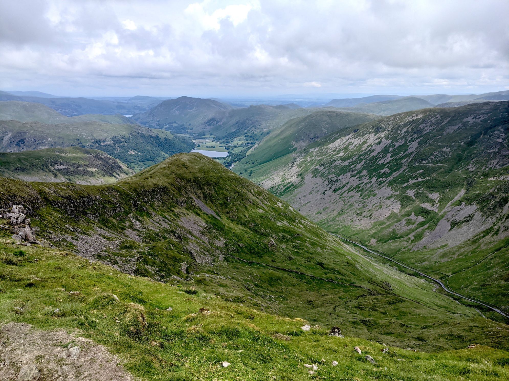
The Lake District National Park, in Cumbria, is known for being one of the most beautiful places in England - its deep glacial lakes and rugged fells provided literary inspiration to the Romantic poets, such as William Wordsworth. It gets busy in tourist honeypots such as Windermere, but it’s easy to get off the beaten track in search of adventure.
Head to one of the region’s many lakes for a wild swim, such as Devoke Water (the largest tarn in the Lake District). If it’s scrambling you’re after, we recommend Sharp Edge on Blencathra or the less busy Pinnacle Ridge. There are some epic fell and ridge walks in the Lake District as well, from the Fairfield Horseshoe to England’s highest mountain, Scafell Pike. There’s a huge range of road cycling and mountain biking routes too - check out the Skiddaw Loop.
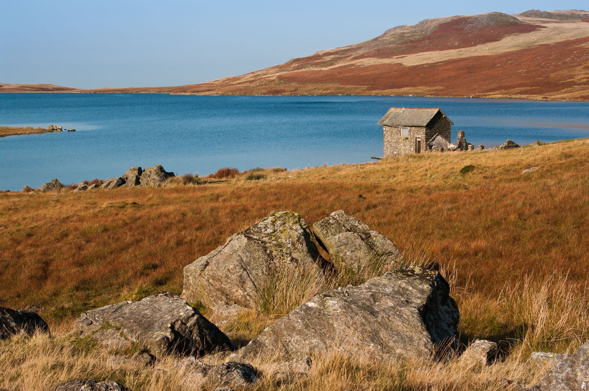
The perfect adventure: climb Scafell Pike via the Piers Gill route (to avoid encountering many others on the trail), then head to Black Moss Pot - a deep section of river surrounded by high stone cliffs - for a dip.
By public transport: There’s a direct train from Manchester to Windermere, and the West Coast mainline connects Oxenholme with London and Glasgow. There are shuttle and public bus routes throughout the Lake District.
3. The North Coast of Cornwall
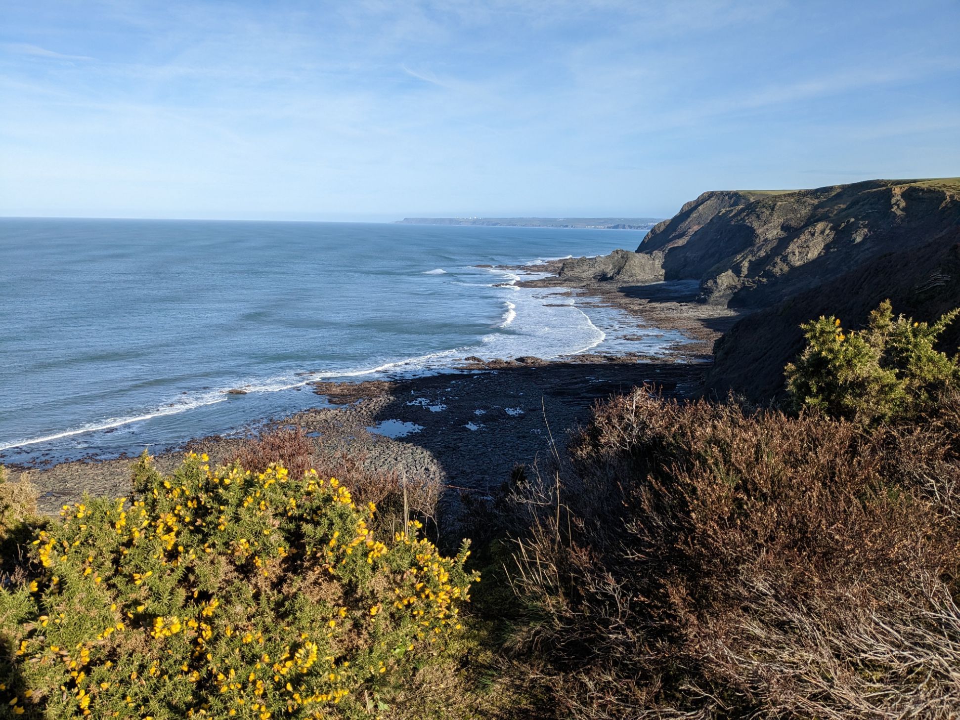
The north Cornish coast stretches from Portreath all the way up to Bude, and is renowned for its dramatic clifftop scenery - it’s more wild and rugged than the picturesque coves and estuaries of the south. Inland you’ll find the windswept heathlands of Bodmin Moor - with granite tors popular with climbers - and pockets of ancient woodland threaded with rivers, which you can navigate by kayak.
If you’re interested in watersports, North Cornwall is the place to be. The beaches around Newquay are paradise for surfers, although we also like the quieter, more rugged beaches at Gwithian (with some excellent beach cafe options). Coasteering is also a popular activity, as is sea kayaking - it allows you to experience the region away from any crowds. If you’re a hiker, there are plenty of coastal walks to enjoy, such as the stretch from St Genny’s Beach to High Cliffs in Boscastle, or the St Agnes Heritage Coast.
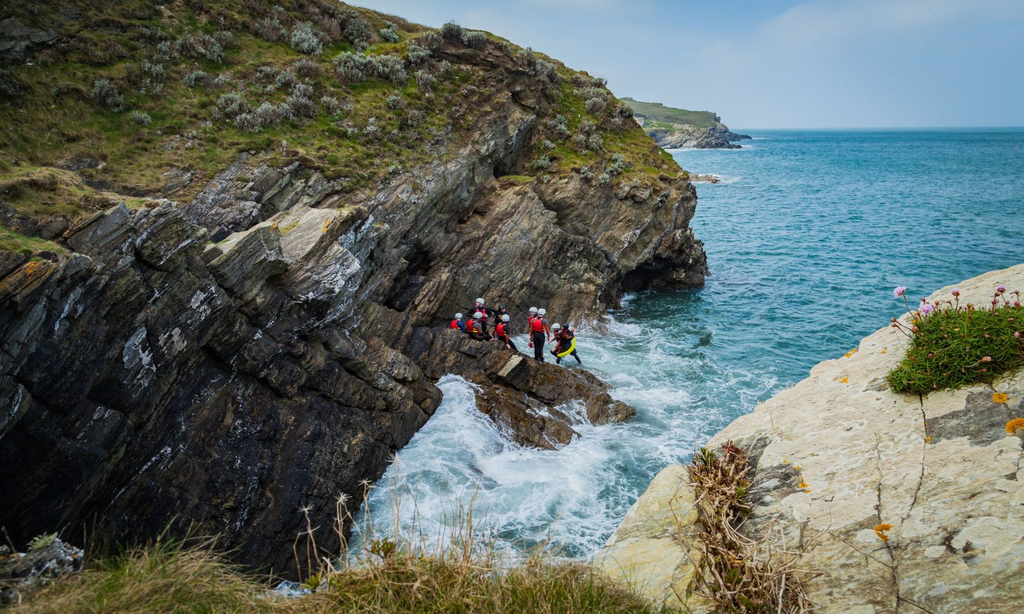
The perfect adventure: discover an adventurous side to the Newquay area, by learning to surf on some of its bays - we particularly like Fistral Beach. You can also try out coasteering round Towan Head, navigating the rugged headland by swimming, traversing and cliff jumping.
By public transport: You can grab the train from London to Penzance, which stops at several places along the North Coast of Cornwall, such as Hayle. Change at Par for Newquay rail station. There’s also a bus network between places of interest.
4. The Chilterns
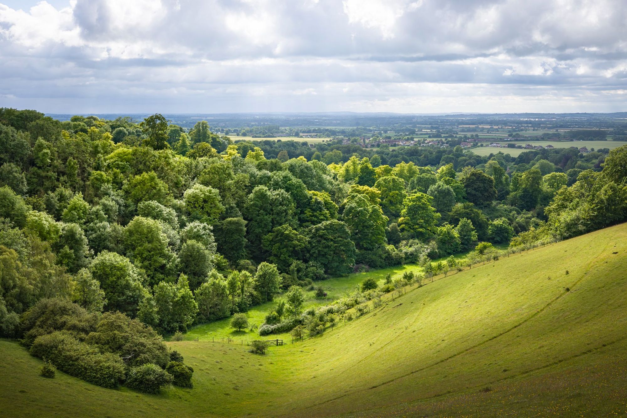
Lying north-west of London, the Chiltern Hills AONB covers 324 square miles of rolling chalk hills, ancient woodland and serene riversides - quintessential British countryside at its finest. It’s also easily accessible from London, making it the perfect day trip from the capital.

The Chilterns is the perfect spot for off-road cycling, with a wide network of country lanes, gravel trails and bridleways. It’s also a popular trail running spot, thanks to the undulating terrain and quick draining chalk soil (meaning paths are rarely too muddy). Known as the ‘larder of London’, meaning there are some excellent opportunities for post-adventure refreshments -we recommend visiting one of the region’s many vineyards and farm shops for a picnic.
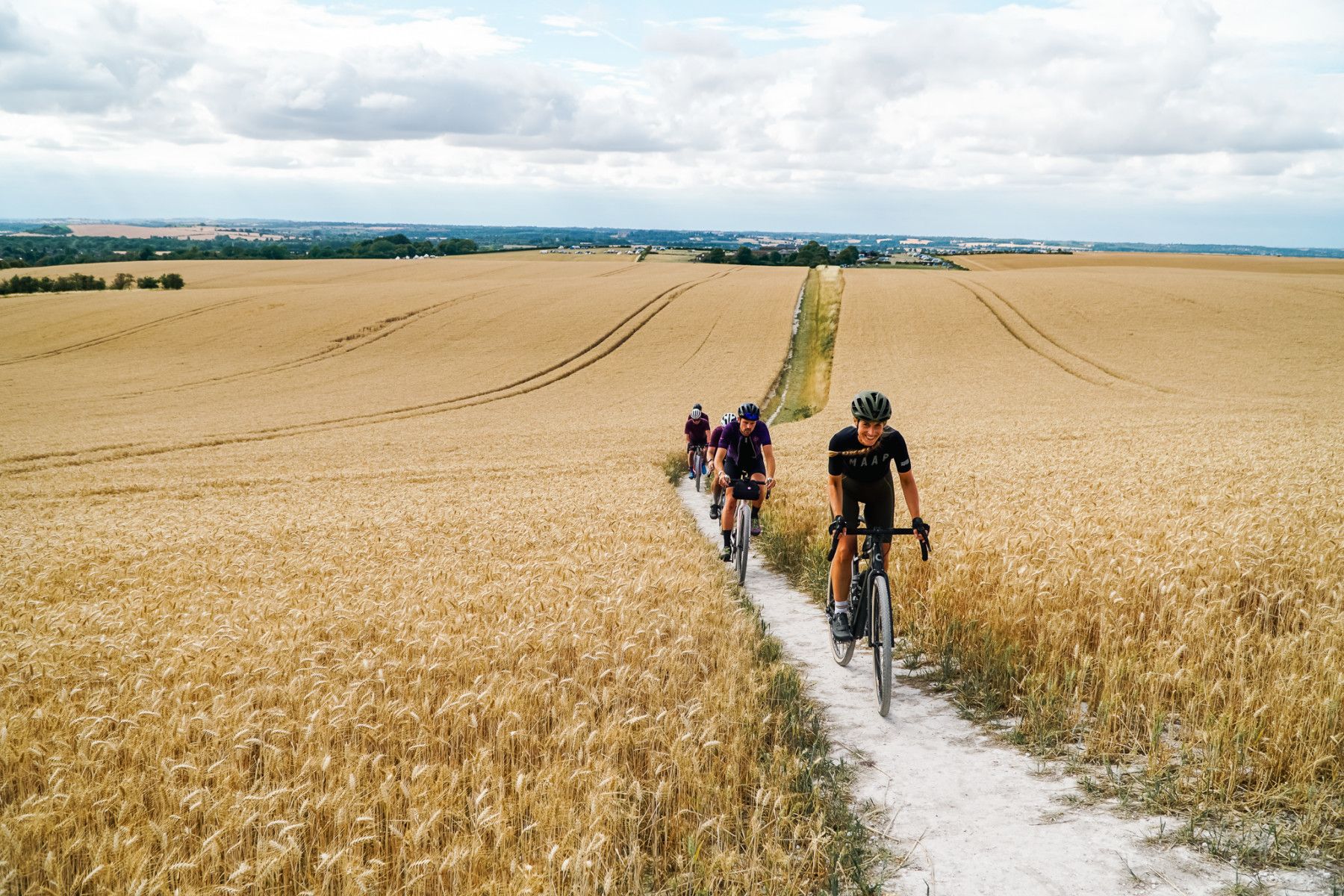
The perfect adventure: spend a glorious weekend getting an introduction to gravel cycling in the Chilterns. Hit up The Ridgeway - a cycle route along the oldest road in Britain - and whizz down the tracks in Wendover Woods. Spend the nights at a campsite, or better, a ‘glampsite’ with bell tents and campfires.
By public transport: The Chilterns has 20 railway stations and are even served by the London Underground’s Metropolitan Line (Amersham and Chesham stations). The town of Tring - accessible by rail from London - is a good base for cycling in the region.
5. Dartmoor
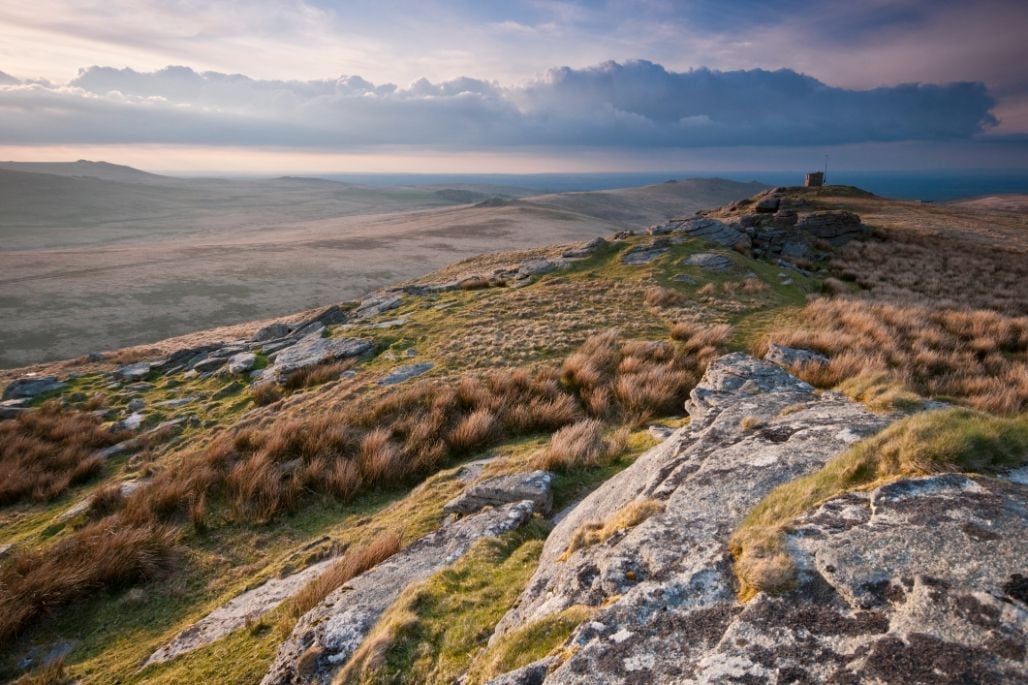
There’s something very special about Dartmoor, with its Tolkeinesque landscape of moorlands, scattered with austere granite tors which are perfect for climbing and bouldering. Haytor and Bonehill Rocks are particularly good spots. Tucked away in the valleys you’ll find pockets of ancient woodland with moss-covered boulders, mirror-still reservoirs and ancient neolithic tombs. The River Dart rises up in the north of the moors and winds down to the sea at Dartmouth - kayaking, wild swimming and SUP are popular activities on its waters. There’s some brilliant grade four and five rapids on the River Tavy as well.
There are some amazing hikes on Dartmoor - we recommend walking the Lych Way, or ‘Way of the Corpses’, an ancient route across the bleak heart of the moor, which people used to take to Lydford bury their dead. Wild camping is no longer permissible on Dartmoor common land, as it once was - but there are now several areas in the national park where landowners have given permission for wild camping that follows the Dartmoor Code of Conduct.
The perfect adventure: start at Okehampton and head out to open moorland on a tor-bagging adventure (with a decent map and compass). Yes Tor and High Willhays are some of the highest points in the area. It’s permissible to camp in this part of the park, so you can spend the night under the stars.
By public transport: Take the Dartmoor Line from Exeter St Davids train station to Okehampton. Buses from the station will take you to Tavistock, Brentor, Lydford and more. During summer months, you can also use the Haytor Hopper and Dartmoor Explorer buses.
6. The Yorkshire Dales
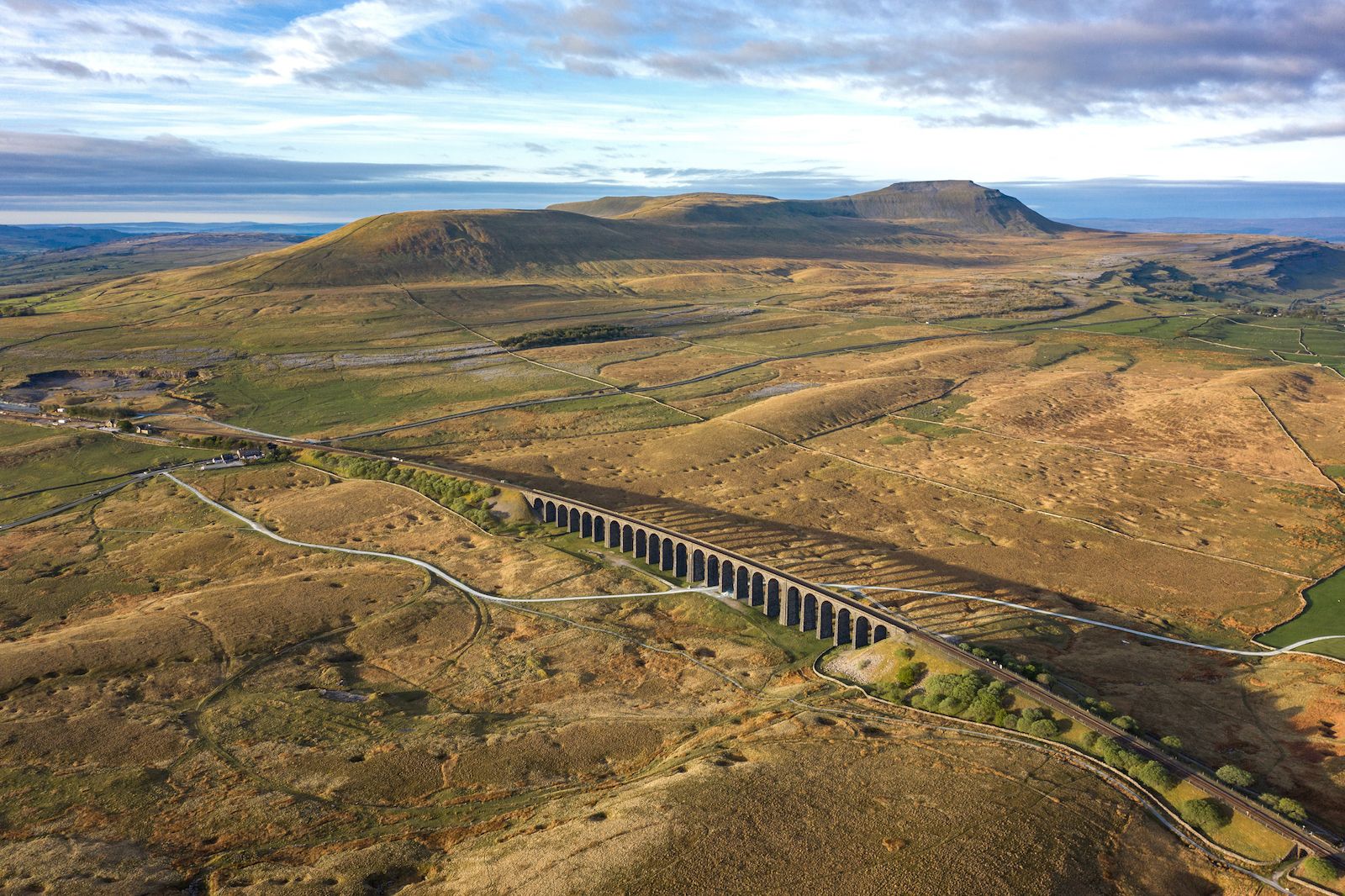
The Yorkshire Dales National Park has a striking landscape of glacially formed limestone valleys and ravines, flat-topped hills and rugged moorland. There are plenty of hiking trails through the park, from the Yorkshire Three Peaks Route to the Dales High Way, alongside shorter hikes. And there are lots of mountain biking trails too - we recommend the Tour of Nidderdale, starting at Scar House Reservoir.
The limestone topography makes the Dales the perfect location for climbing, scrambling and bouldering. There’s a decent grade two scramble to be had up Strans Gill in Wharfedale. We also recommend going bouldering in Nidderdale or Brimham Rocks, and checking out Yorkshire’s only via ferrata at How Stean Gorge.
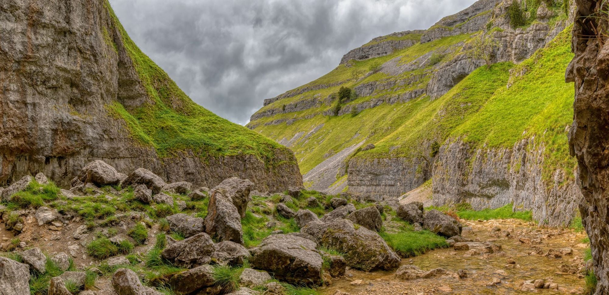
The perfect adventure: go for a scramble up the limestone ravine Gordale Scar (inspiration for Helm’s Deep in Tolkein’s Lord of the Rings). When you reach the top you can walk over and above Malham Cove along an incredible limestone pavement. Looking down, you’ll likely see some climbers on the rock face, and even peregrine falcons. Head back to the start for a swim at Janet’s Foss waterfall.
By public transport: two train lines run through the Dales, including the Settle to Carlisle line, named one of the most scenic rail journeys in the UK - Skipton and Horton-in-Ribblesdale stations are popular stopping-off points. There are also public bus routes throughout the park.
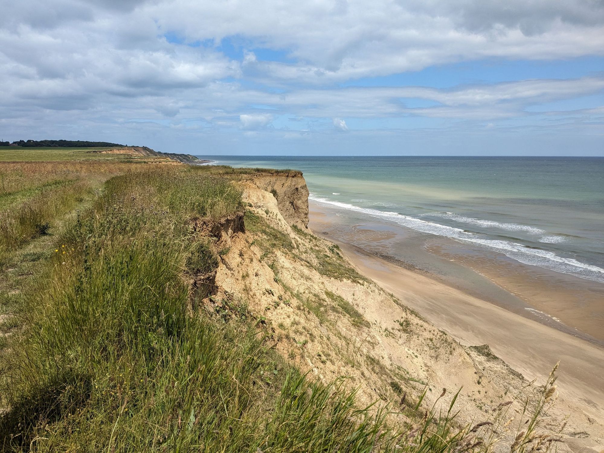
7. North Norfolk Coast
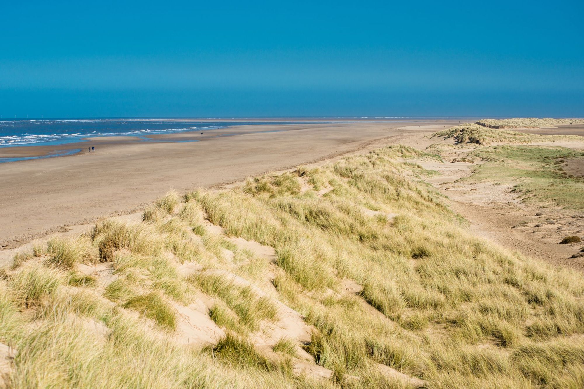
Norfolk is a county known for being both the flattest and the driest in the UK, but it also has its own quiet beauty, especially on the North Norfolk Coast. It’s an AONB of salt marshes and endless skies, crumbling cliffs and vast sandy beaches which stretch for miles. We love the pine-fringed Holkham Beach, a shoot location for everything from Shakespeare in Love to the All Saints’ Pure Shores video.
One of the best ways to explore the area is by hiking the Norfolk Coast Path, an 84 mile (134 km) stretch from Hunstanton to Hopton-on-Sea. You’ll be immersed in vistas of sea and sky, pass through gentle woodland and beautiful flint villages, and can stop to snack on freshly caught seafood at one of the local crab huts. Bird watching and foraging are also popular along the coast - we’ve seen locals picking samphire and mussels. Sailing trips are plentiful, and there are also several beaches good for surfing.
The perfect adventure: a day spent hiking the underrated North Norfolk Coast Path. Walk from the salt marshes and tidal creeks of Brancaster Staithe to the gorgeous Holkham Beach, and then on to Wells. End your hike with a swim in the ocean and a meal of fresh Norfolk seafood at one of the local huts.
By public transport: There are train stations in the resort towns of Cromer and Sheringham. The coast is also well served by two buses, the CoastLiner 36 (from Hunstanton to Wells-Next-the-Sea) and the CoastHopper (from Wells to Cromer). Then there’s the Coastal Clipper, from Winterton down to Great Yarmouth - this makes linear walks along the coast path very easy by public transport.
The Best Places to Visit in Scotland for an Adventure
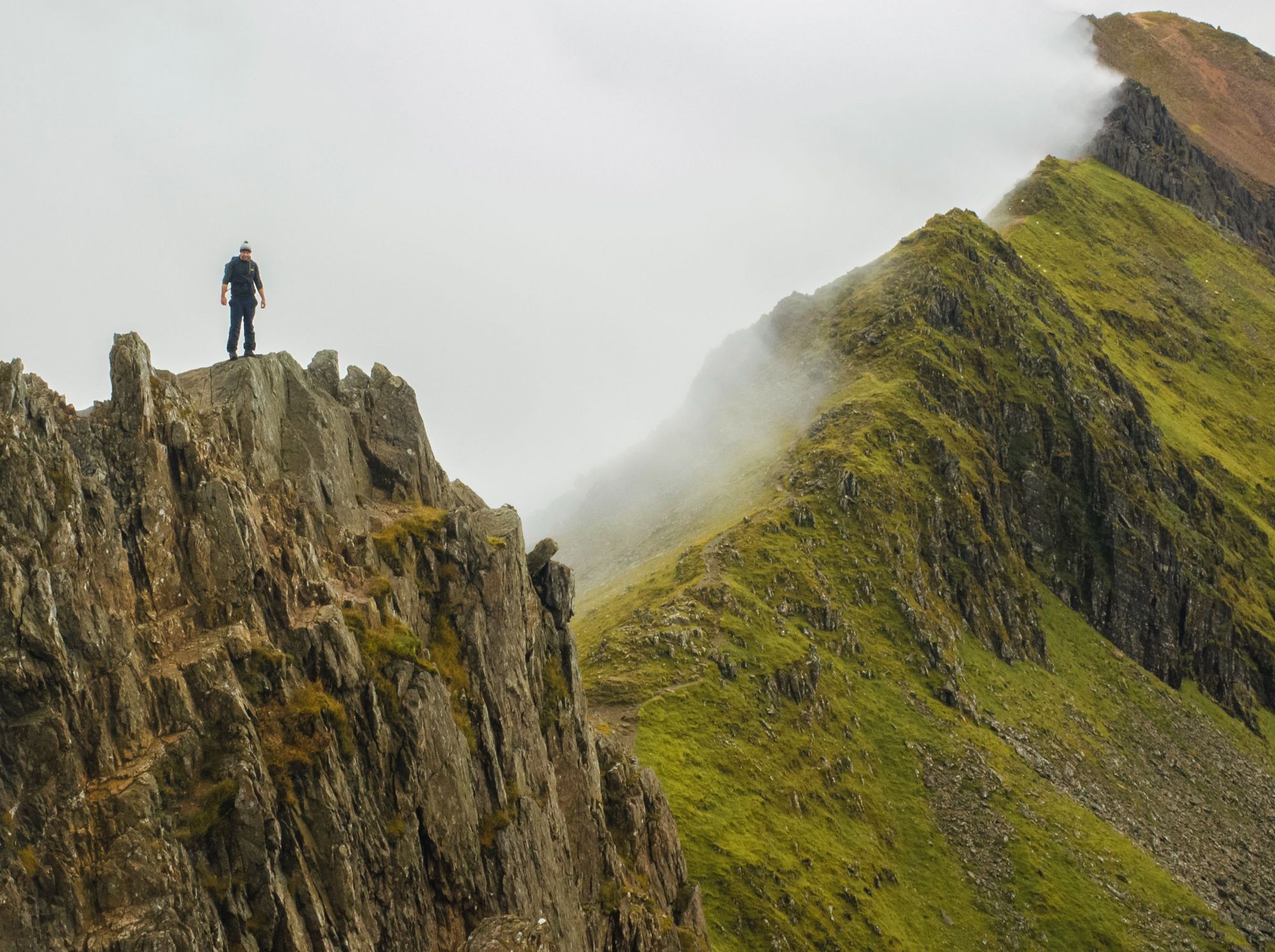
8. The Isle of Rùm
Rùm is one of The Small Isles - a wild island of around 29 inhabitants, rocky peaks leading to undulating moorland, and down to remote bays. The entire island is a nature reserve - eyes peeled for sea eagles and red deer. It’s the ideal spot for hiking and mountaineering, whether you’re ready for a challenging traverse of the Rùm Cuillin, the island’s foreboding mountains, or an isolated tramp to some of the island’s hidden beaches.
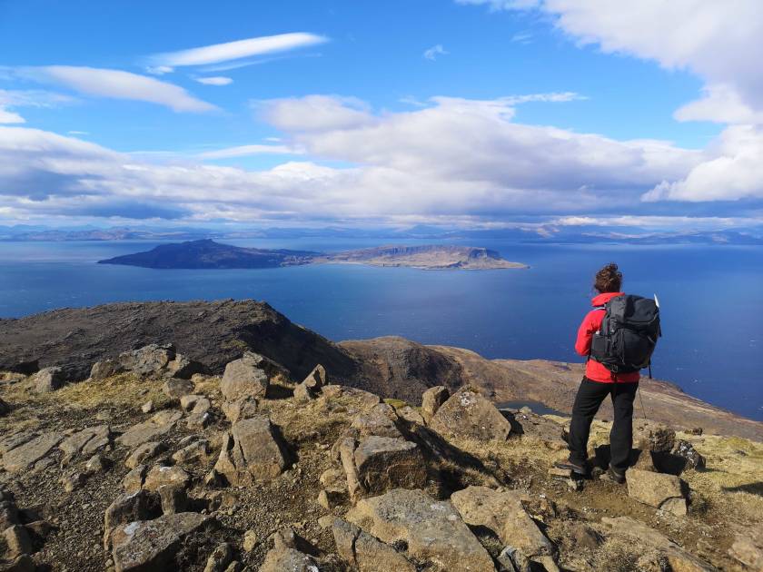
Unlike the rest of the UK, Scotland allows wild camping under its right to roam. Rùm has an abundance of spots to set up your tent, from Kinloch (the only town on the island) to the coastline near towering Papadil Sea Stack.
The perfect adventure: take an expedition across Rùm, hiking from the ferry jetty to Harris Bay, and wild camping overnight. Trek from Harris Bay to Papadil, then inland to Dibadil - on your final day you’ll tackle the Rùm Cuillin. The unpredictable weather and the island’s remoteness mean we strongly recommend doing this with a guide.
By public transport: catch the train to Mallaig and take the ferry from the port. Public transport on the island is nonexistent - you’ll get around via walking or cycling.
 Stuart Kenny
9. Ardnamurchan Peninsula
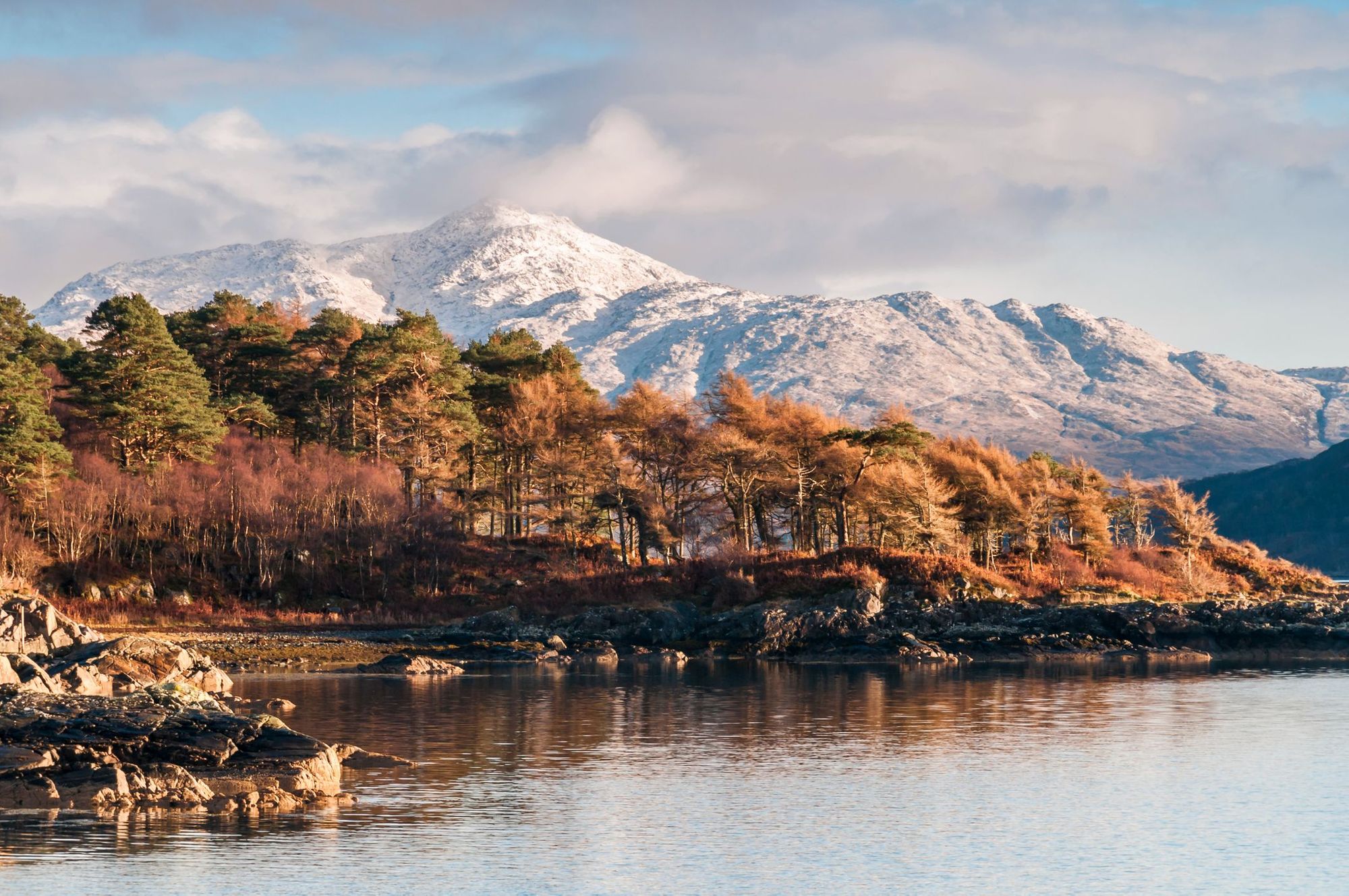
The Ardnamurchan Peninsula is the most westerly point of mainland Britain, with a stunning view of the islands of Mull, Coll and the Small Isles from beautiful Sanna Bay. It’s also one of the most remote peninsulas in the West Highlands, accessible only by a single track road. Rarely visited beaches are nestled into the rocky coastline - we particularly like secluded Smirisary Beach - while inland you’ll find rolling moorland and tree fringed lochs.
People visit the peninsula to get away from the crowds. For blustery coastal hikes and wild swimming in the cold, clear sea; to explore the ancient woodlands of Salen, or to kayak on mirror-still Loch Sunart. Wild camp spots are plentiful, and there are some sleepy villages where you can get refreshments. It would be remiss not to mention Ardnamurchan Distillery, one of the remotest distilleries in Scotland and run on renewable energy.
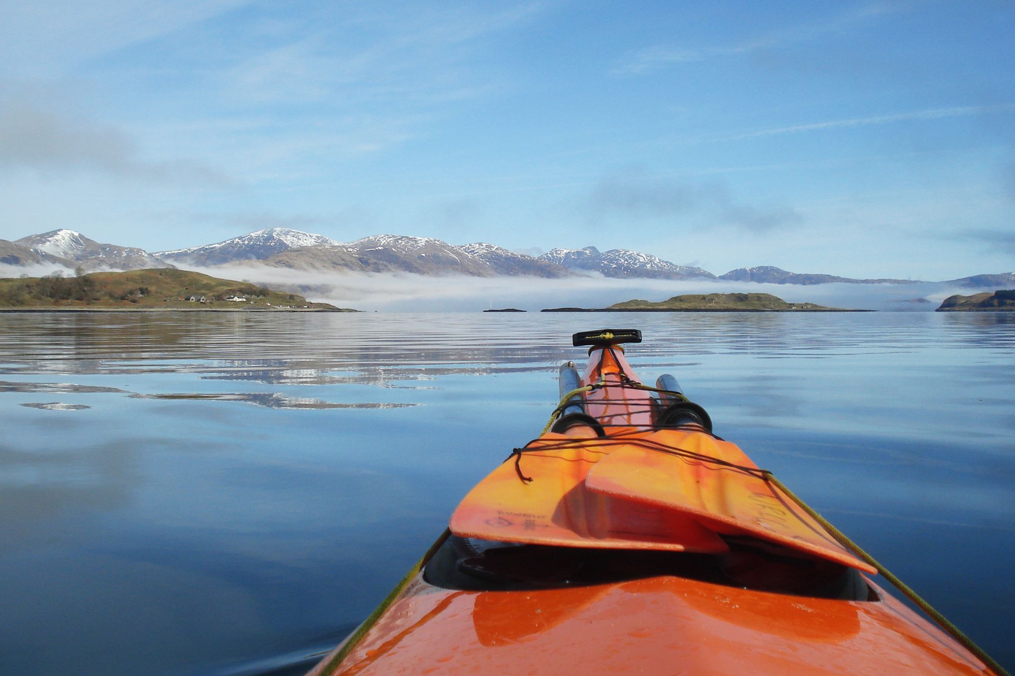
The perfect adventure: spend a couple of days exploring the peninsula by kayak, wild camping by the shores of deserted lochs and beaches. Launch from Kinlochmoidart and head down Loch Moidart towards the ocean, before travelling north along the coast to wild camp at Smirisary Beach. Carry on heading north and you’ll cross over Loch Ailort to reach the Ardnish Peninsula.
By public transport: there are no train stations on the peninsula, but you can travel by train to Fort William. From here, Shiel Bus 506 has a route along the south side of the peninsula, as far as Kilchoan. Cyclists exploring the peninsula by road could catch the train to Loch Ailort on the Ardnish Peninsula, and from there head south.
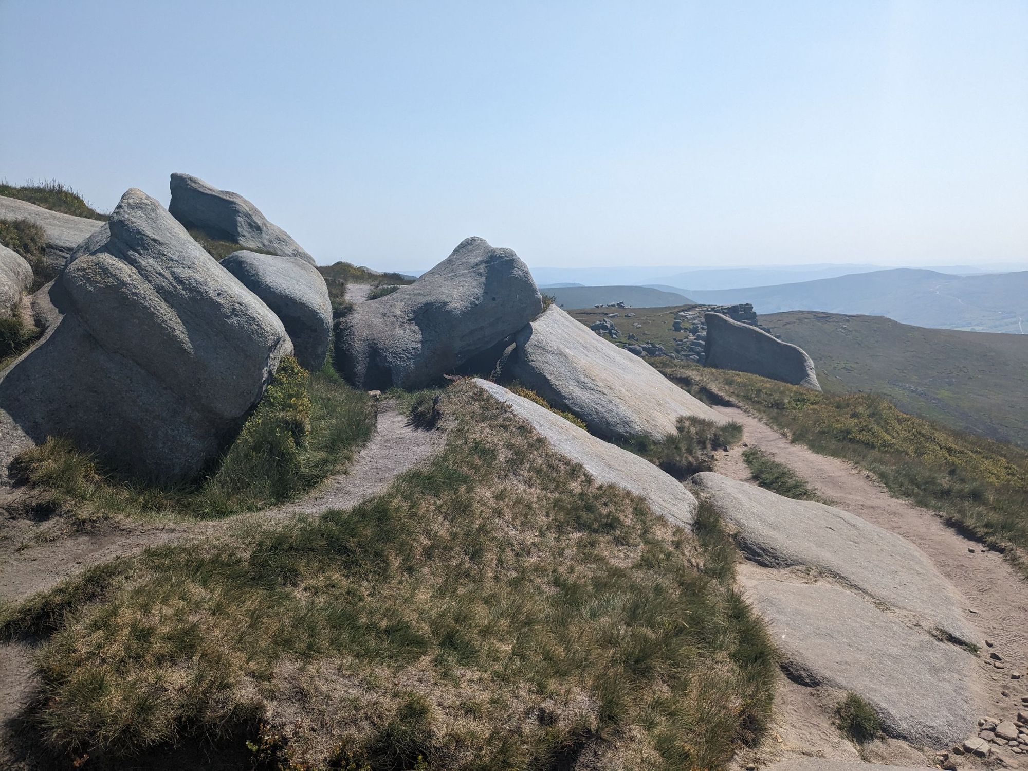
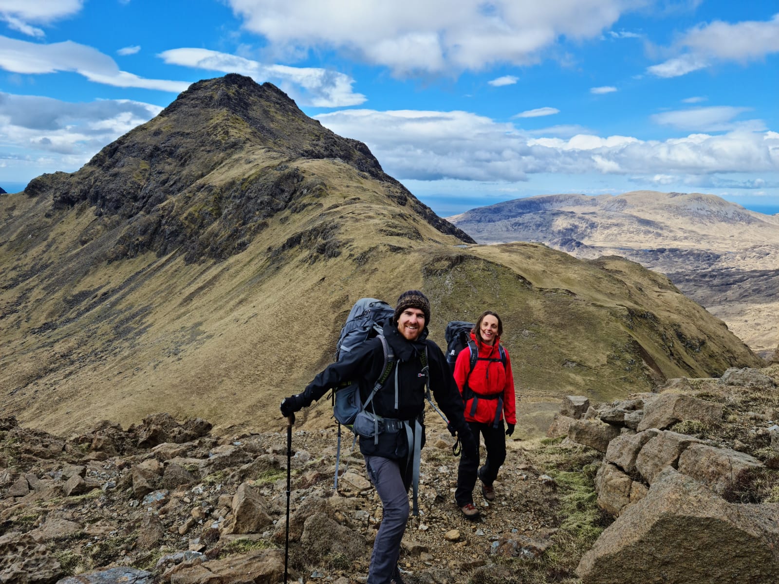
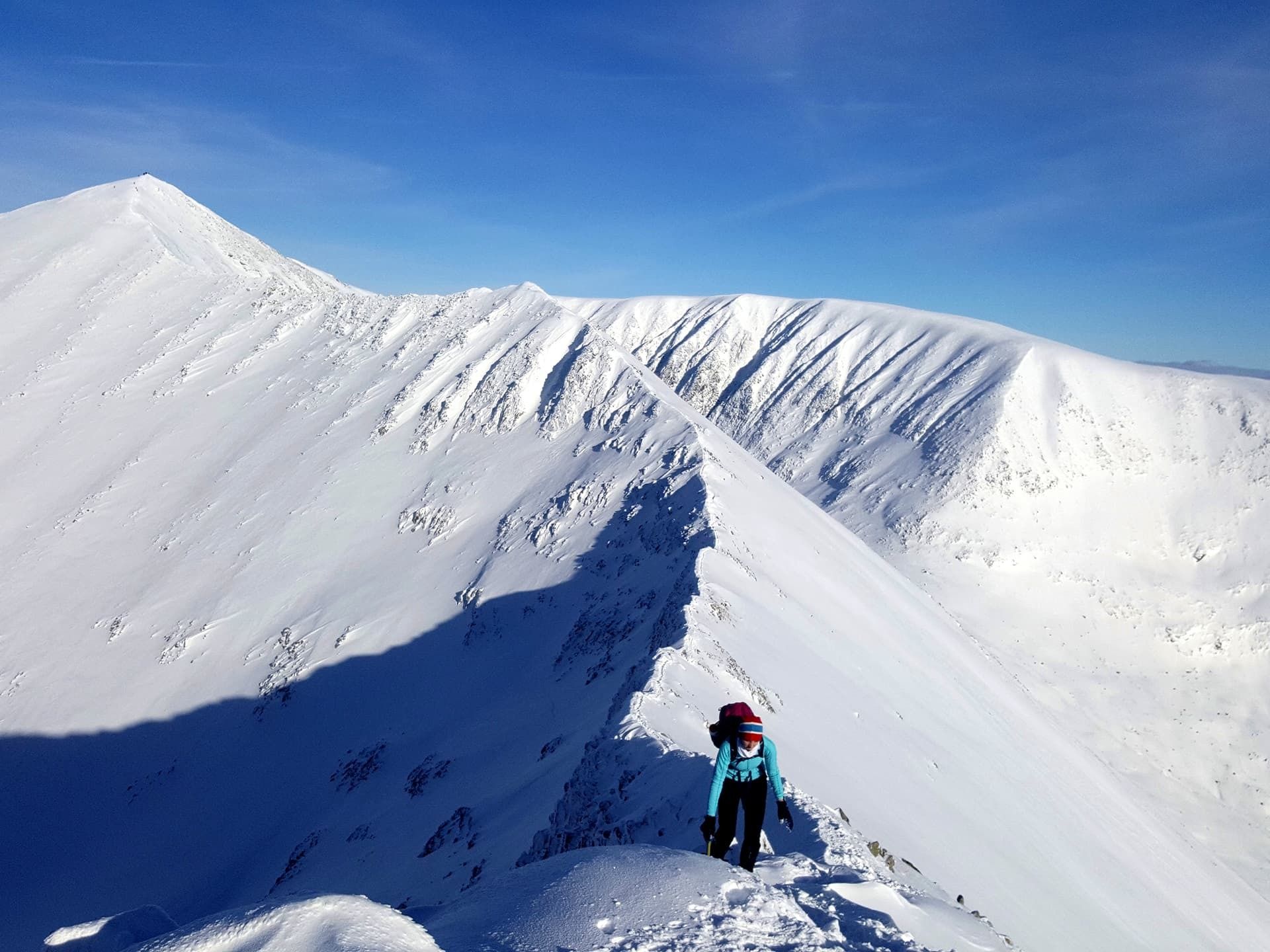
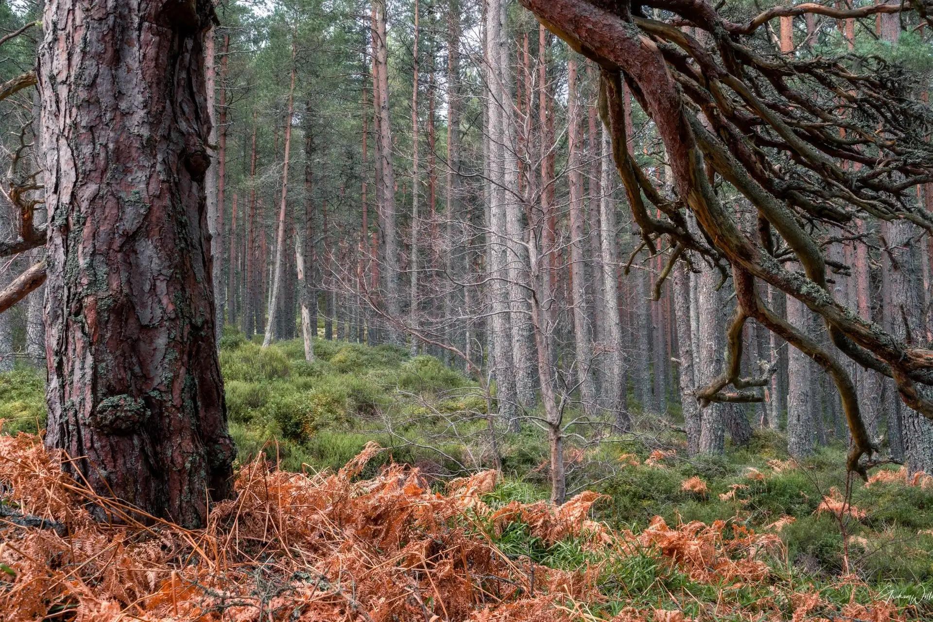
10. The Cairngorms
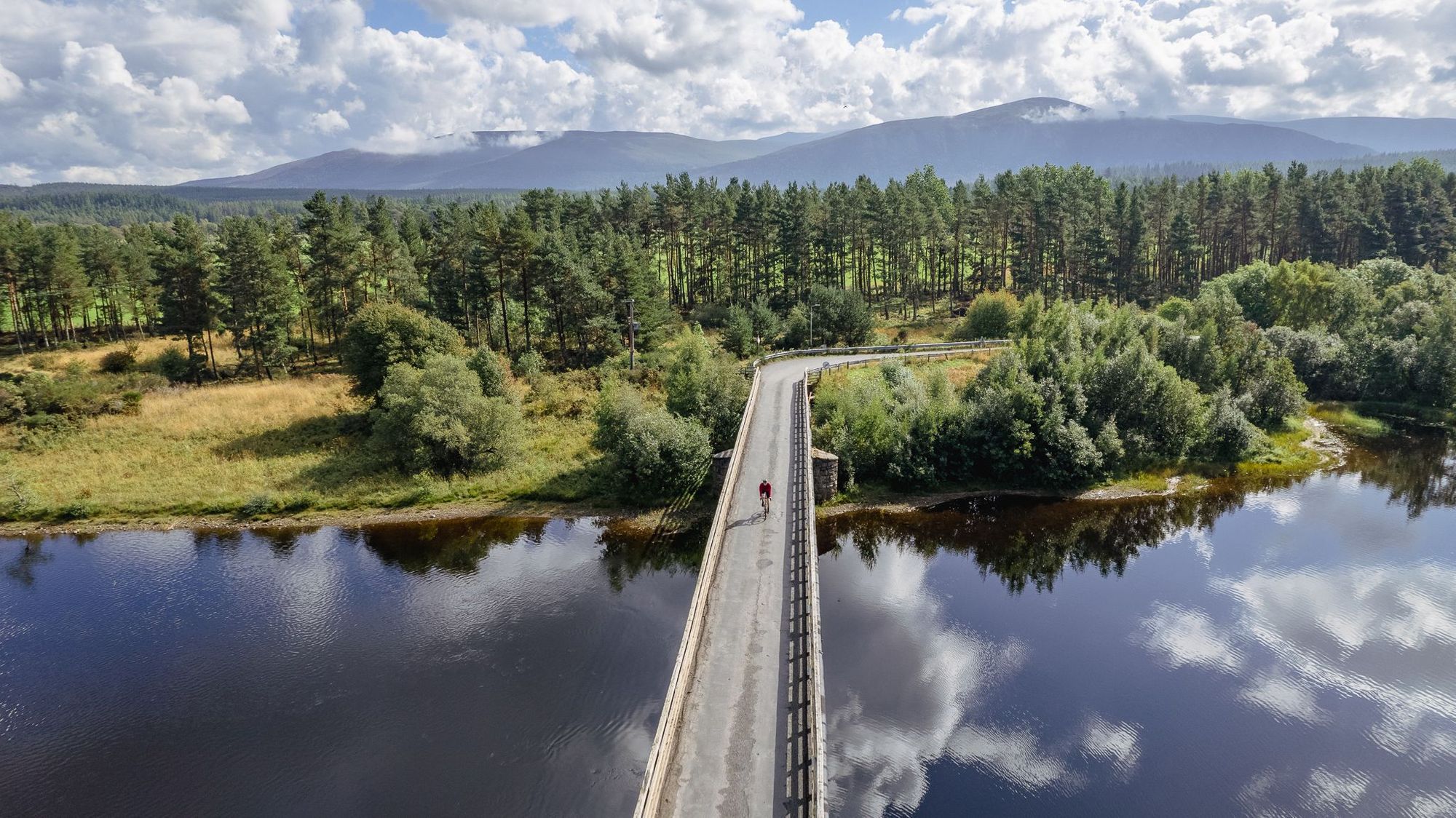
The Cairngorms National Park is home to a quarter of Scotland’s native forest and the highest mountains in the UK. This is one of the best places for hiking in Scotland, thanks to a diverse range of trails: scramble up Ben Macdui (the highest mountain in the Cairngorms and second highest in the UK) or walk the haunting Frank Bruce Sculpture Trail in Inshriach Forest.
Stuart Kenny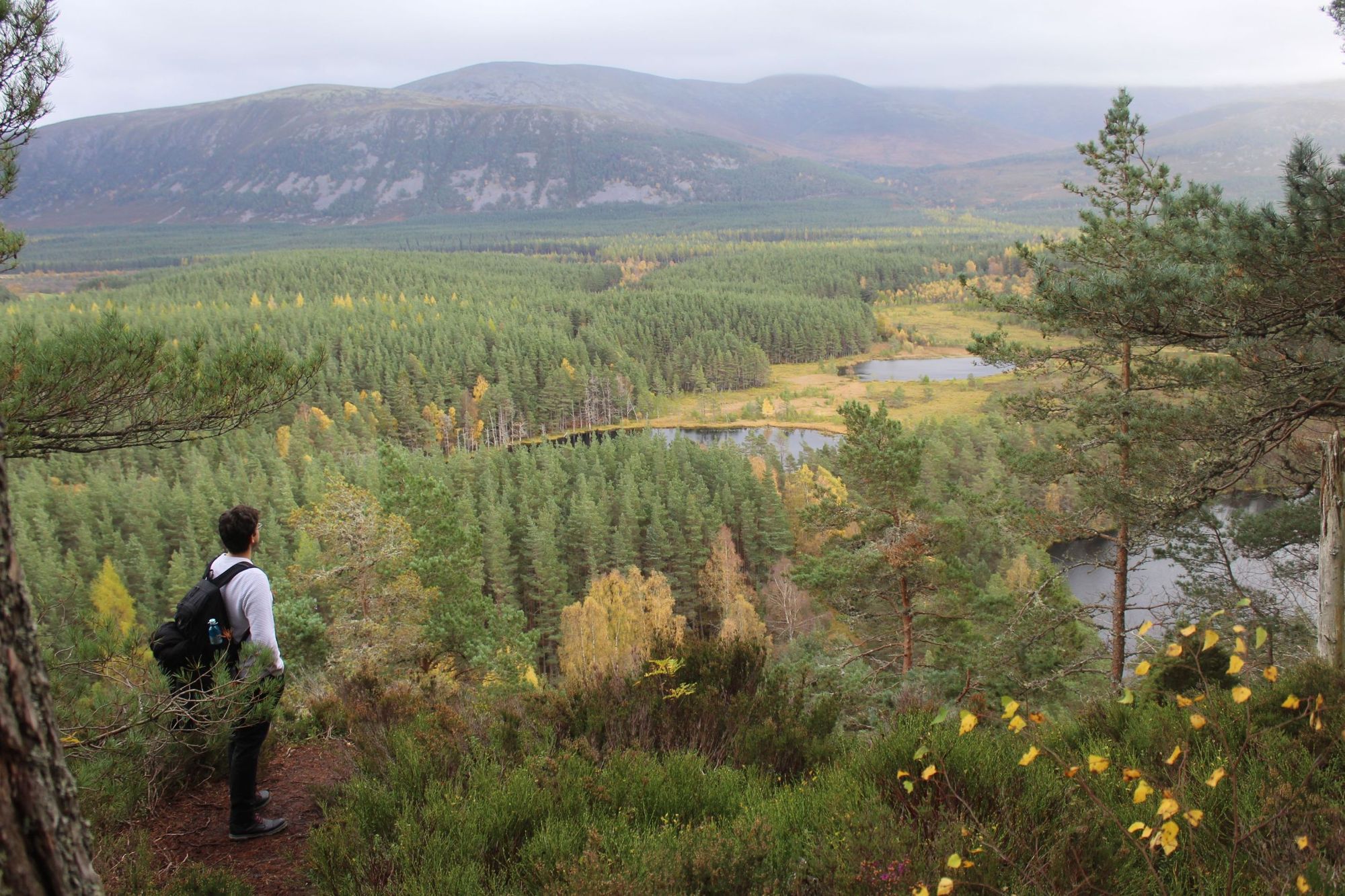
Into cycling? There are routes for a variety of abilities all over the national park. If you fancy bikepacking, then we recommend the 165-mil -long (266km) Cairngorms National Park Loop designed by Markus Stitz. Snowsports? Visit in winter to try skiing or snowboarding and ski ‘The Tiger’ at Glenshee.

The perfect adventure: the Cairn Toul to Braeriach hike has you trekking up Garbh Choire corrie and along a summit ridge to bag four Munros: The Devil’s Point (1,004m); Cairn Toul (1,291m); Sgòr an Lochain Uaine (1,258m) and Braeriach (1,296m), the third highest peak in the UK. We recommend breaking the hike into two days, and spending the night at Corrour Bothy.
By public transport: There are train stations at Dalwhinnie, Newtonmore, Kingussie, Aviemore and Carrbridge. Stagecoach operate local buses in the Aviemore and Braemar areas. The new Aviemore Adventurer bus takes you into the heart of the national park.
11. Fort William
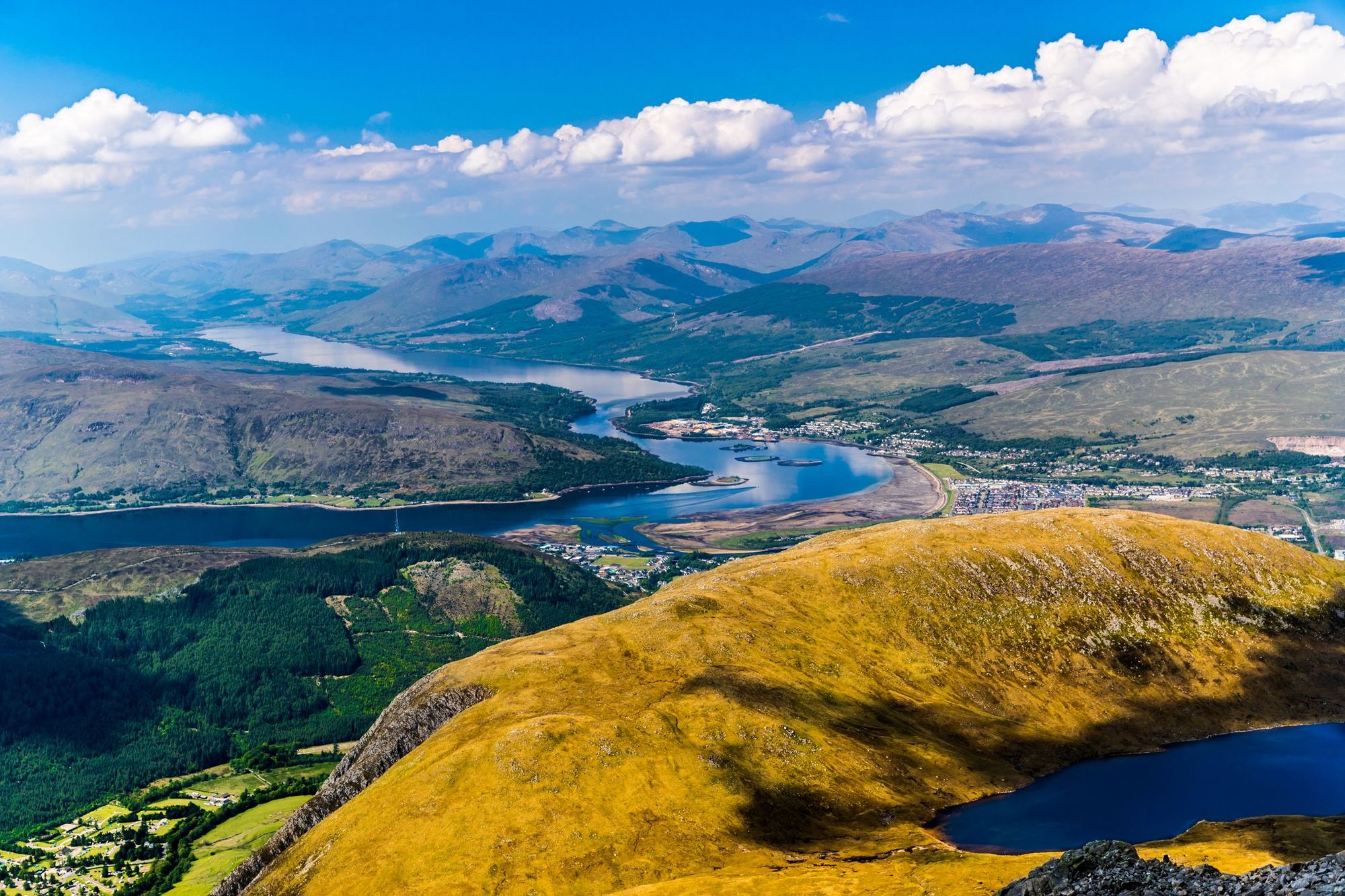
Known as the ‘Adventure Capital of Scotland’, Fort William is a small town in the Western Highlands, on the shores of Loch Linnhe and the shadow of the Grampian Mountains. Ben Nevis, at 1345m (4412ft) is the highest in the range, and in the whole of the UK - climbing it makes for a challenging full day’s hike. Fort William is also the start point (or end point, depending what direction you hike) for the long distance West Highland Way.

Fort William isn’t just for hikers. It also attracts rock climbers wanting to test their mettle on the routes up these stony crags - Tower Ridge, on Ben Nevis, is an absolute classic - and scramblers looking for exposed ridge walks. If you’ve never tried either, there are plenty of qualified local instructors who’ll show you the ropes.
Fort William is also great for watersports, especially kayaking and canoeing. It’s the start (or finish) point for the Great Glen Canoe Trail, which stretches from Corpach in Fort William to Clachnaharry (Inverness), passing through 22 miles of man made canal and 38 miles of open water, including a crossing of Loch Ness.
The perfect adventure: go in the off season and tackle a guided winter ascent of Ben Nevis. The day before will be spent doing winter skills training, such as learning to use an ice axe and crampons. Warm up in one of Fort William’s cosy pubs afterwards - we recommend aptly named Grog & Gruel.

By public transport: there’s a train station at Fort William, and the overnight Caledonian Sleeper train from London will get you there in style. Shiel Buses provides transport around the Fort William area.
The Best Places to Visit in Wales for an Adventure
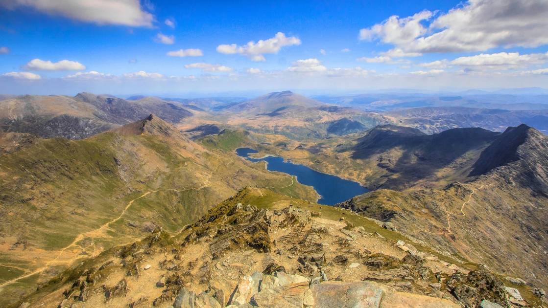
12. Snowdonia (Eryri)
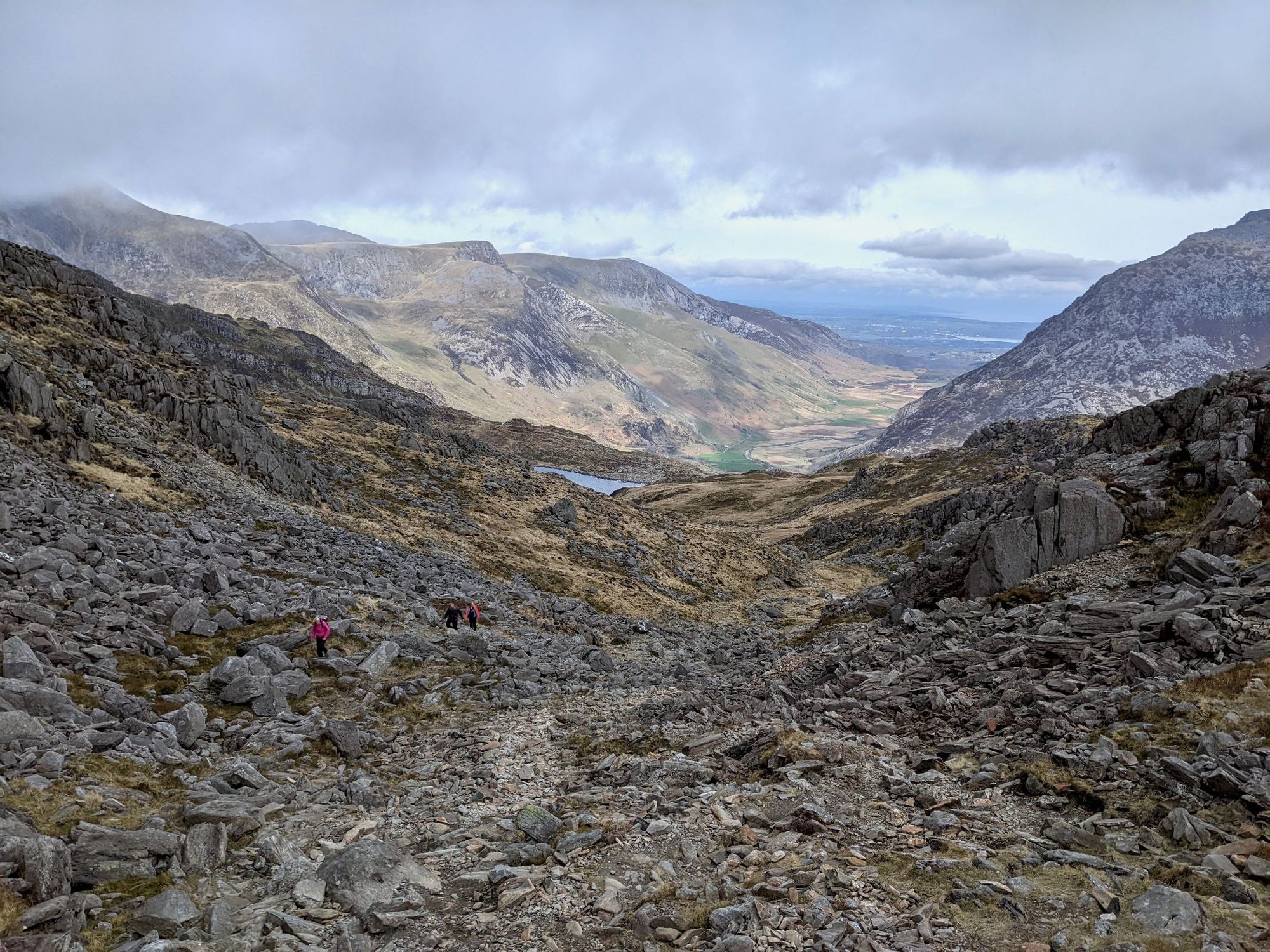
Wales’ largest national park has nine mountain ranges, 74 miles of coastline and 11,000 hectares of native woodland to explore. Many people visit the park to climb Snowdon (Yr Wyddfa), the highest mountain in Wales. But there are many other hikes in Snowdonia: we like the austere Glyderau, and the rocky spine of Nantlle Ridge if we’re in the mood for a challenge (it involves a grade one scramble).
There are plenty of other adventures in Snowdonia to be had alongside hiking. Bala, a town in the south of Eryri, is a renowned white water rafting centre. Llyn Padarn, a picturesque lake ringed with mountains, is ideal for a spot of kayaking or wild swimming. And there’s plenty of opportunity for mountain biking - Coed y Brenin Forest Park is particularly popular.
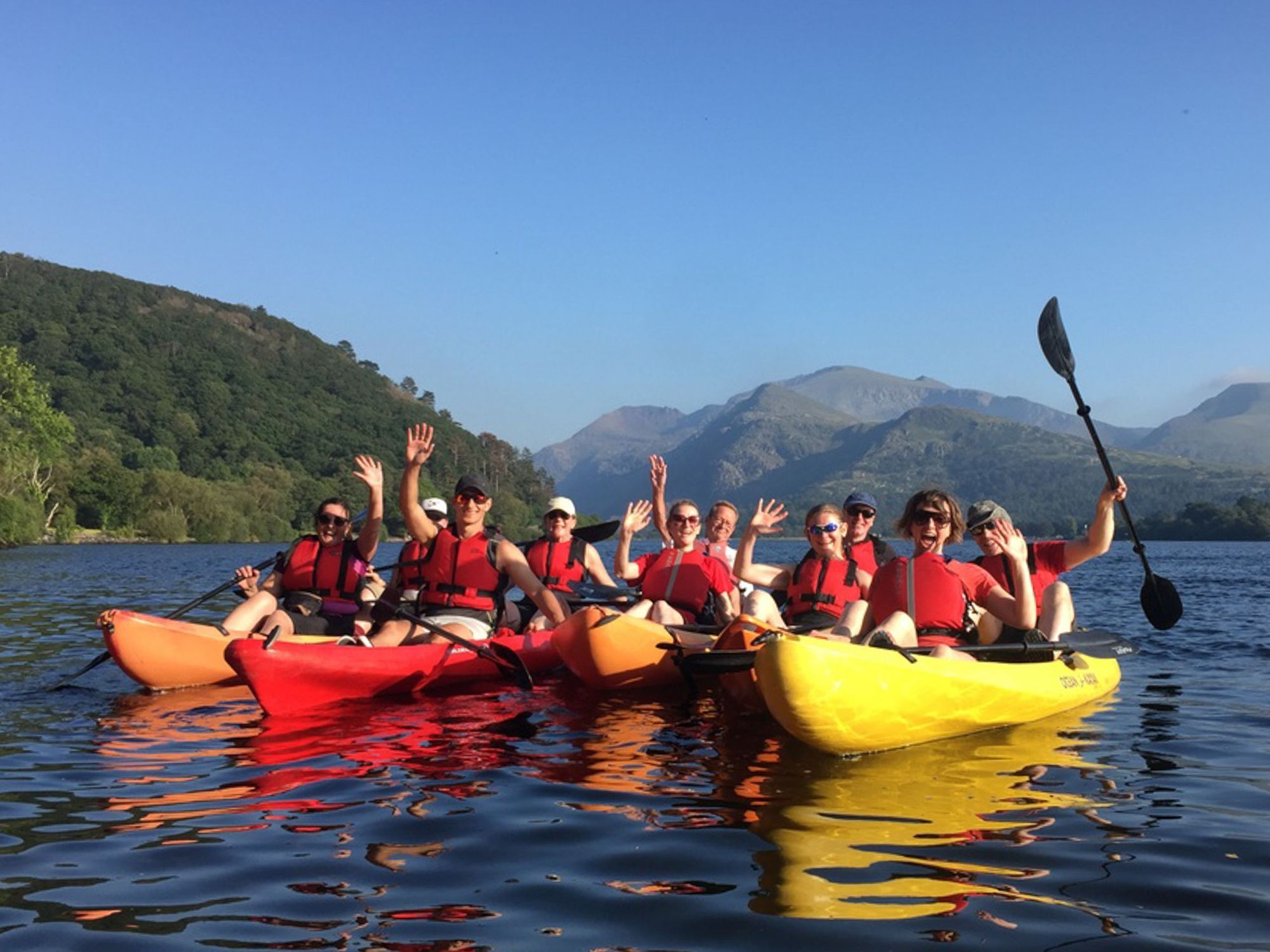
The perfect adventure: Challenge yourself by tackling the Snowdon Challenge. You’ll bike down 10.5 miles (17km) of country lanes, climb Yr Wyddfa and then kayak across the gorgeous Llyn Padarn - all across a single day.
By public transport: There are several train stations within Snowdonia National Park. Betws-y-Coed is probably your best bet, or Bangor, located just outside the park. Both of these locations are well serviced by the Sherpa’r Wyddfa bus, which takes you to popular hiking destinations within the park.
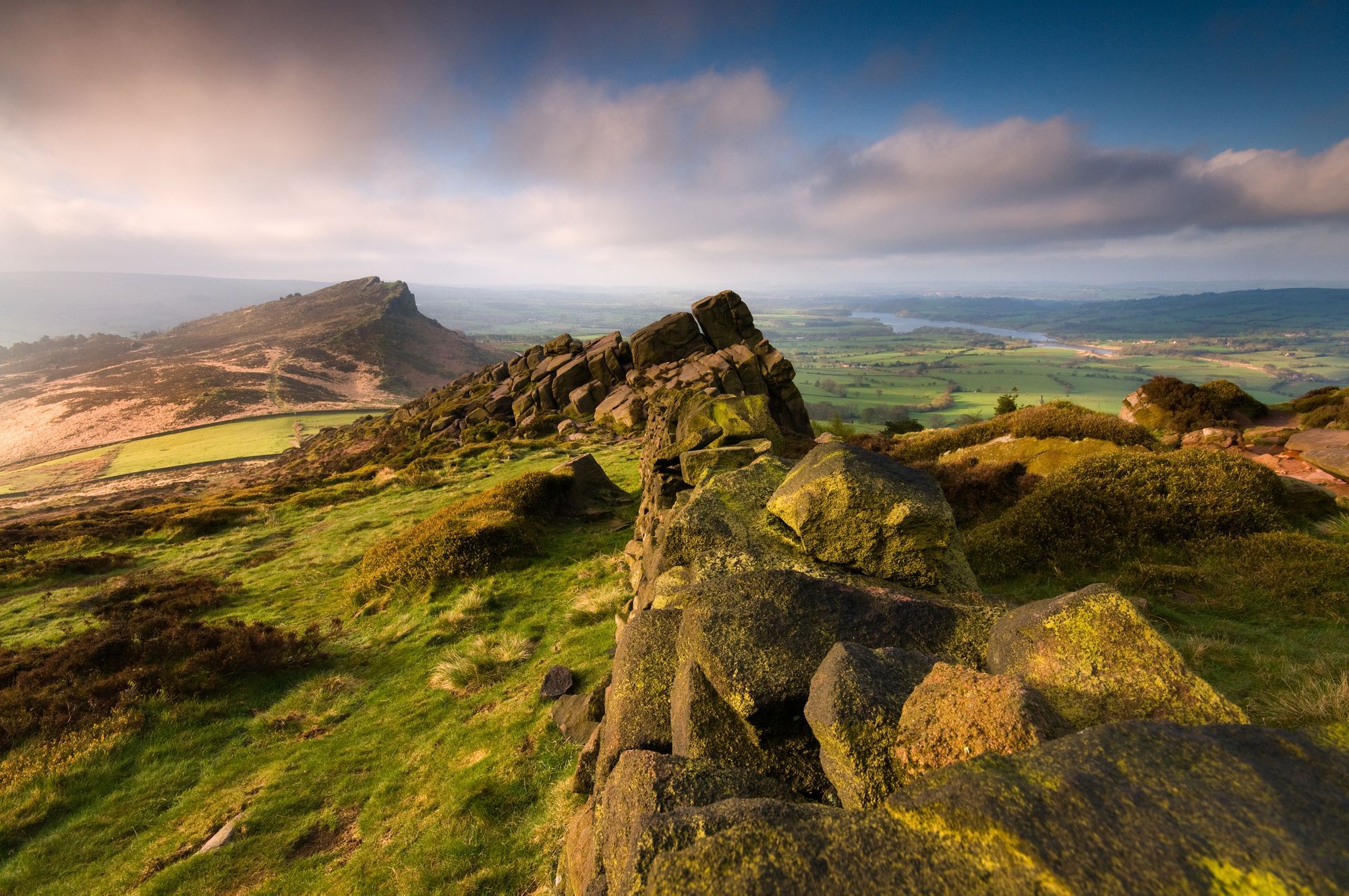
13. The Brecon Beacons (Bannau Brycheiniog)
The Brecon Beacons National Park has a gentler, but no less scenic topography than Eryri. It contains four mountain ranges: The Brecon Beacons; Fforest Fawr; the Black Mountains and (confusingly) the Black Mountain. Expect grassy moorlands, heathery escarpments and sandstone peaks, while Forest Fawr is a UNESCO geopark of boulder strewn hillsides, caves and waterfalls.
There are plenty of hiking trails within the Brecon Beacons National Park, from an ascent of its highest peak, Pen Y Fan (886m) to the Dragon’s Back Circular Walk in the Black Mountains. But there’s far more going on in the park than hiking. Llanwrtyd Wells hosts a year-round calendar of alternative events, from the Bog Snorkelling Championships to the Real Ale Wobble, a mountain biking race with ale served at each checkpoint. There are several other intriguing towns within the national park, including foodie haven Abergavenny, and the famous book town Hay-On-Wye.
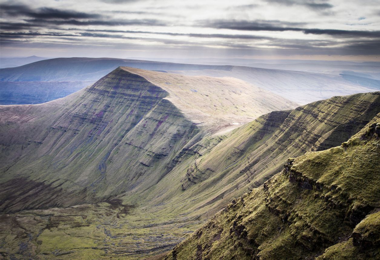
The perfect adventure: Spend the day hiking the Pen Y Fan Horseshoe Ridge, a circuit taking in some of the highest peaks of the national park. Then head to nearby Brecon for a meal and a pint.
By public transport: There are train stations at the vibrant gateway towns of Abergavenny and Llandovery, both of which make for good bases. The park is also served by public bus - the X43 line from Abergavenny to Brecon is particularly convenient.
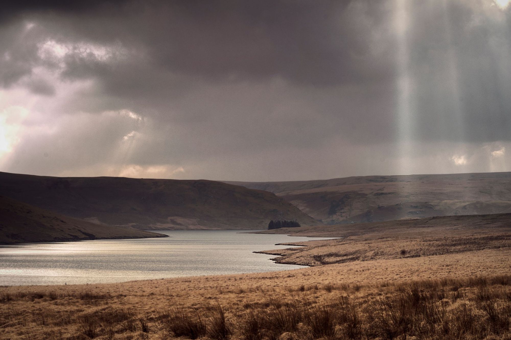
14. Elan Valley
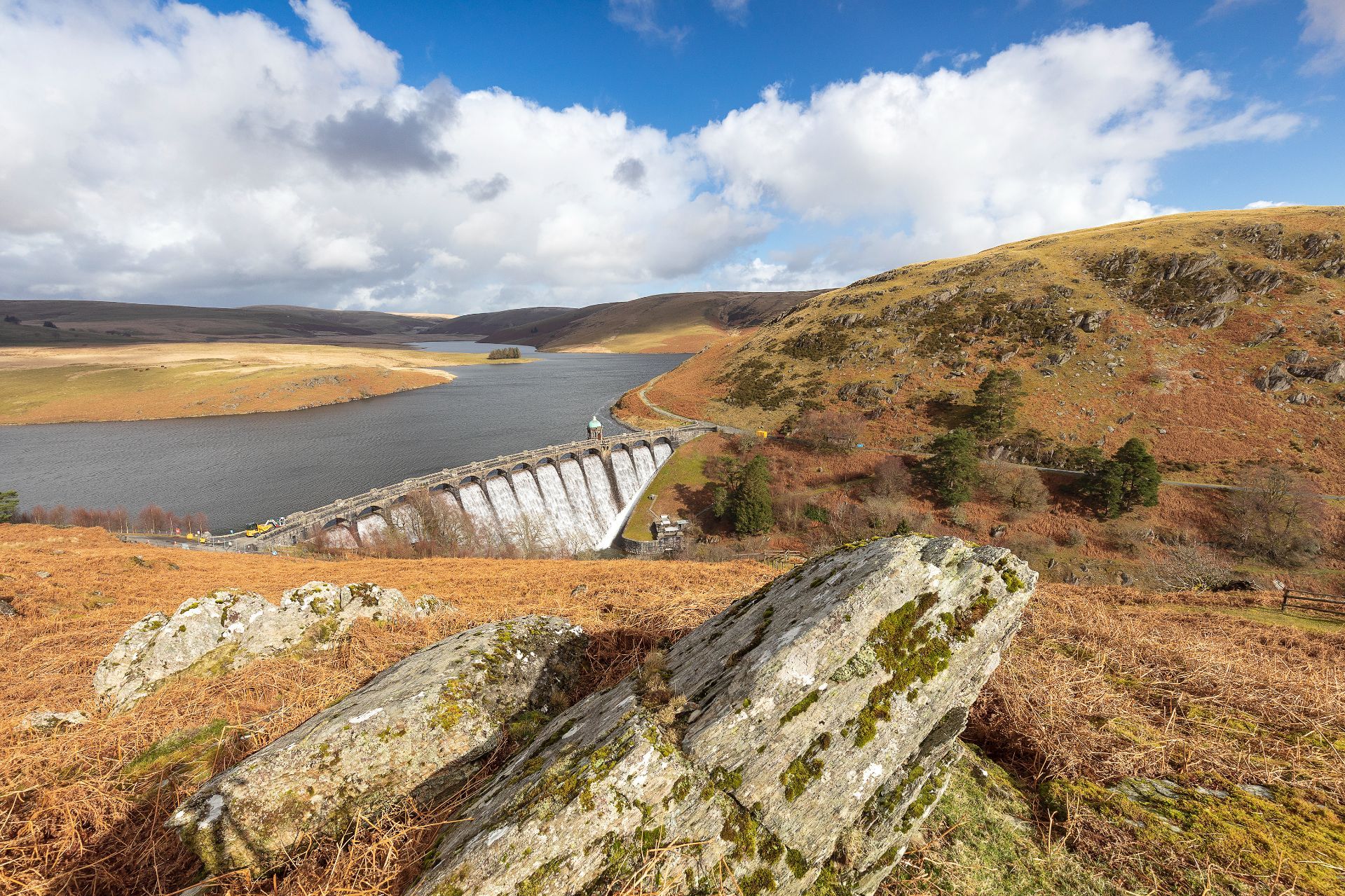
The Elan Valley is a private estate of rugged hills and forests, located in the heart of the Cambrian Mountains in Mid-Wales. The landscape has been transformed by a series of attractive stone dams, which have created large reservoirs along the River Elan. The area is known for its gravel and mountain biking trails - it’s also popular with bikepackers as the popular Trans Cambrian Way passes through it.
With 80 miles (128km) of designated hiking paths, Elan Valley is also a great spot for hiking. The Nant Y Gro Walking Trail serves up views of the vast Caban Coch Reservoir, Garreg Ddu Dam and Dryfarn Fawr (the highest point in the estate at 641m, which can also be hiked).
The perfect adventure: spend the day cycling the Elan Valley Trail, an 18 mile (29km) route that takes you from Rhayader into the heart of the Elan Valley, climbing up over Rhayader Tunnel and passing the Garreg Ddu Reservoir. There’s also a more challenging Elan Valley trail for mountain bikes.
By public transport: take the train to Llandrindod Wells, and from there it’s a 30 minute bus ride to Rhayader, the gateway town to the Elan Valley - or you could get a taxi from the train station directly to your accommodation. Bikes can be hired in Rhayader and at the Elan Valley Visitor Centre.
15. Llŷn Peninsula
This unspoilt peninsula juts into the Irish sea just of Eryri. It has 100 miles of coastline, from small coves to sweeping bays, backed by plunging cliffs, which can be experienced by hiking the spectacular Llŷn Peninsula Coast Path (110 mile/180km). Climb to the Llŷn’s highest point - the triple summited Yr Eifl - and you’ll be treated to views of the undulating peninsula, Anglesey and the stony peaks of Snowdonia.
But there’s more to the peninsula than hiking. It’s a popular destination for water sports, including wakeboarding, surfing and sea kayaking - and rarely gets as busy as other coastal spots in Wales.
The perfect adventure: spend half a day surfing at Porth Neigwl (Hell’s Mouth), a four-mile long bay with good breaks - you can also take beginner surf lessons. A short but scenic circular hike along the coast near Aberdaron completes the day.
By public transport: a train line runs along the south coast of the peninsula, with Pwllheli being the end of the line. The fleccsi bus service is inspired; working within a service area (the entire Llŷn Peninsula) rather than a route - download the app to book a journey, and it will drop you off wherever you want to go.
The Best Places to Visit in Northern Ireland for an Adventure
16. The Mourne Mountains
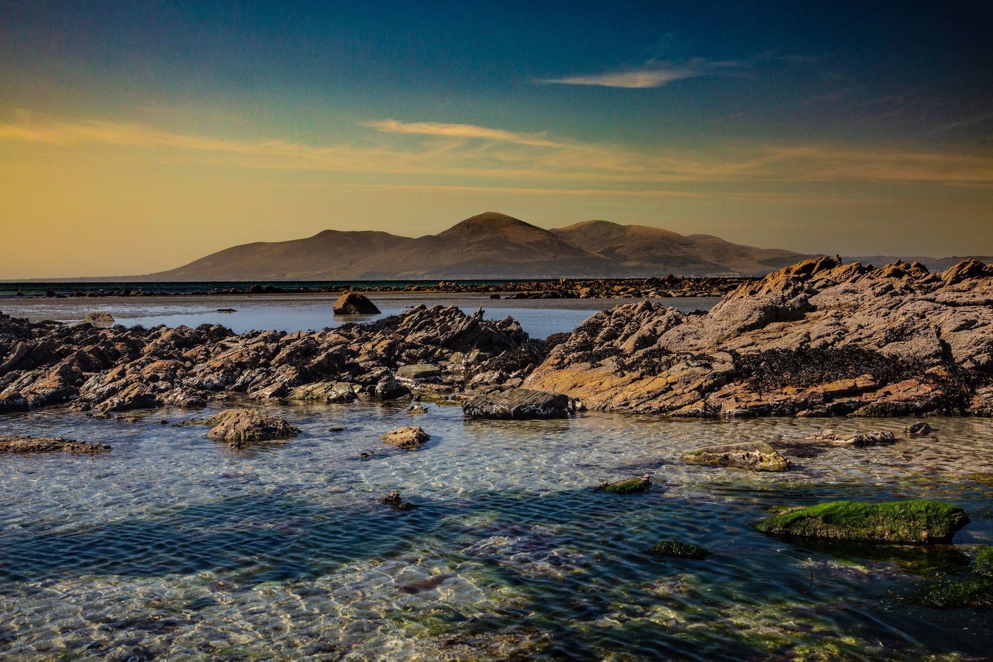
The Mourne Mountains, in County Down, are the highest peaks in Northern Ireland. They consist of the Eastern Mournes, rugged mountains crowned by granite tors, and the gentler Western Mournes. The mountains slope down to loughs and pockets of forest such as Kilbroney Park in Rostrevor, which inspired C.S Lewis’ Narnia, and then on to the coast.
Walk NI voted the Mournes ‘Best Walking Destination’ in Ireland, and it’s easy to see why. There are some excellent hiking trails in the Mourne Mountains, such as an ascent of Slieve Donard (849m), the highest mountain in the range, and coastal hikes such as the Bloody Bridge Coastal Route. Sea kayaking and bouldering along the coast is also popular, and you can sail and SUP across the loughs and reservoirs inland. Cyclists won’t be left out, as there are MTB and road trails in abundance - check out the 45 mile (72km) Mourne Loop.
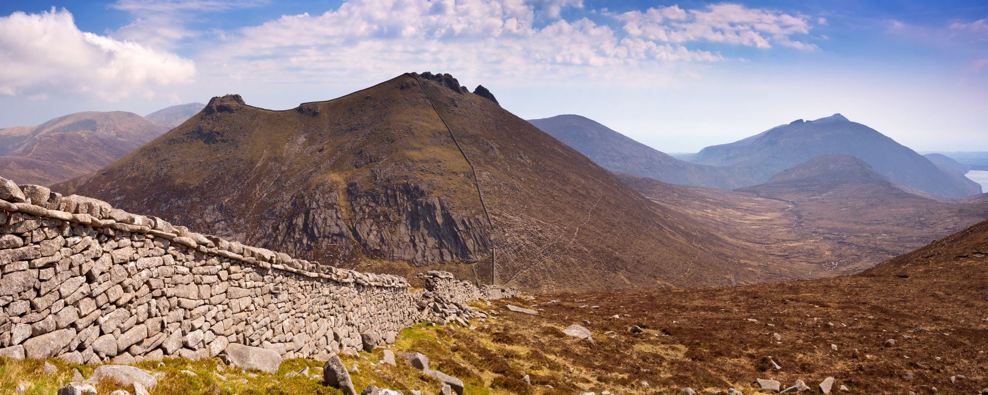
The perfect adventure: Tackle the Mourne Wall Challenge, a circular hiking trail following a historic stone wall across 15 mountain peaks. After, head off to Mullartown for refreshments - we recommend the Harbour Inn for freshly sourced seafood.
By public transport: you can catch the train or bus to Newry - the gateway to the Mourne Mountains - from Belfast and other major cities. The Mourne Shuttle Bus is a service catering to walkers, dropping them off at hiking areas within the Mourne Area.
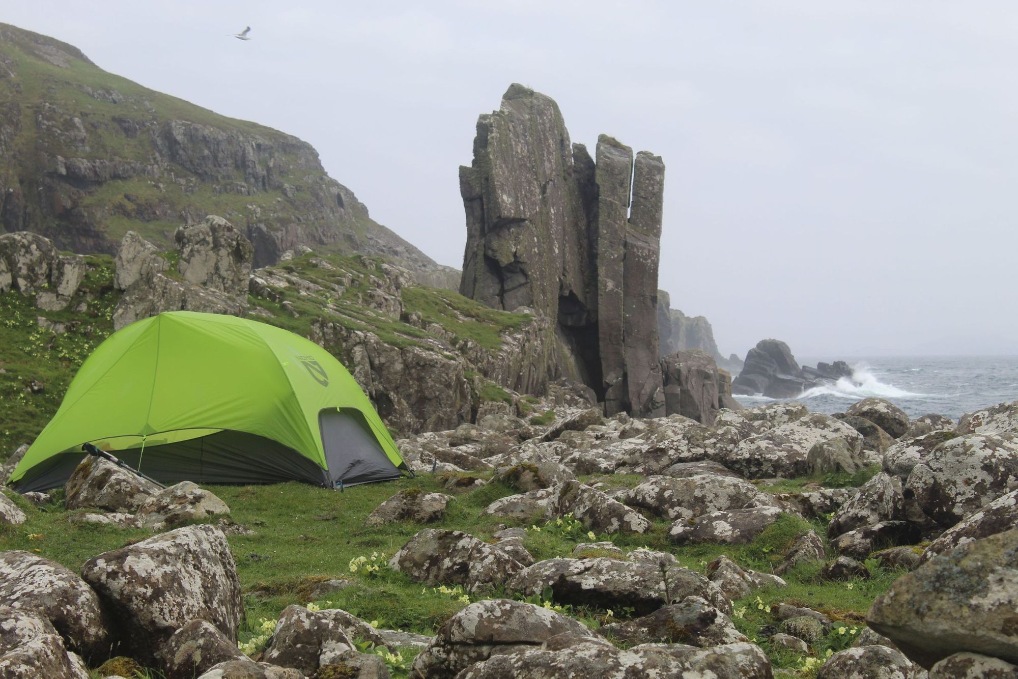
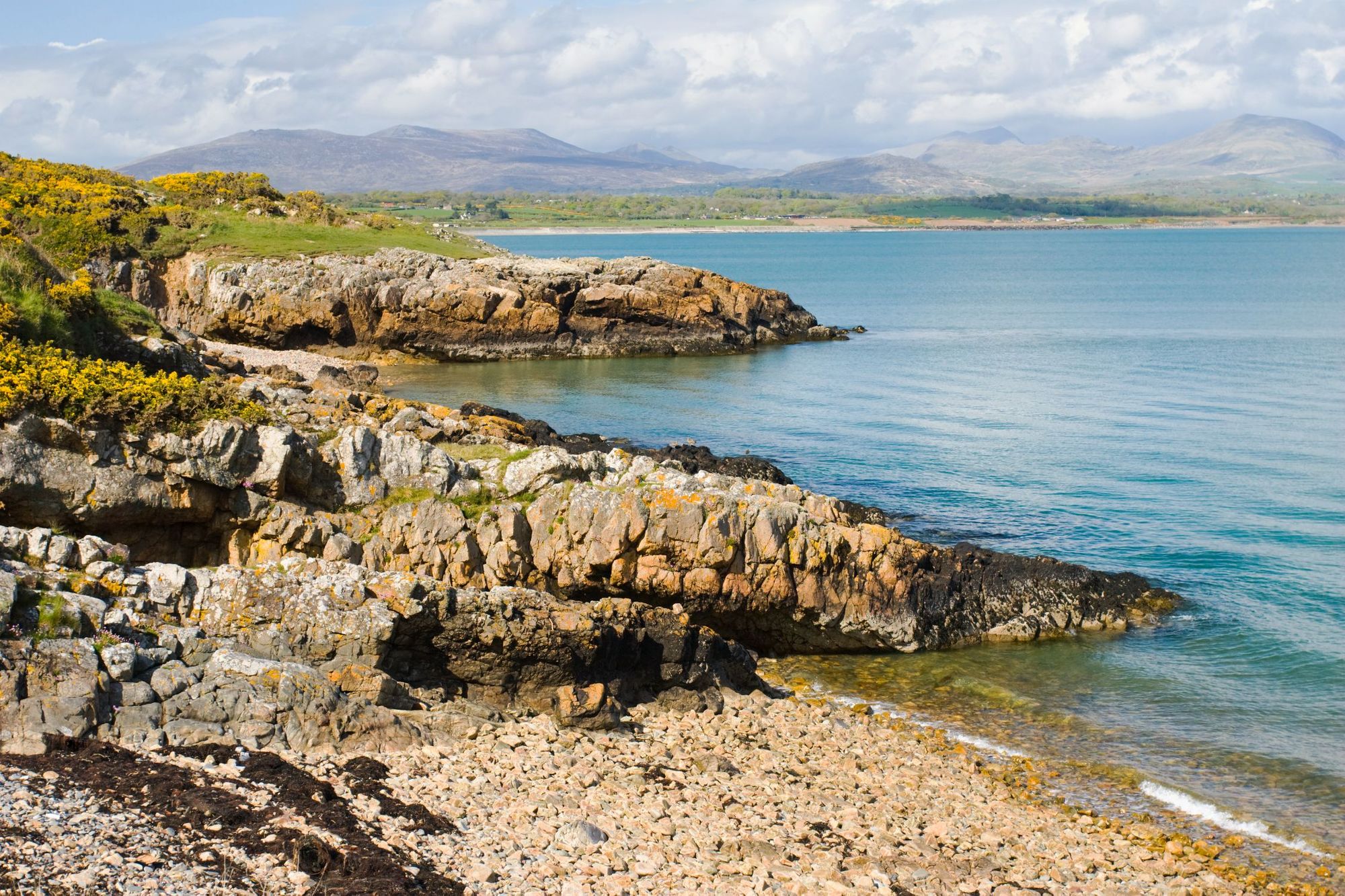
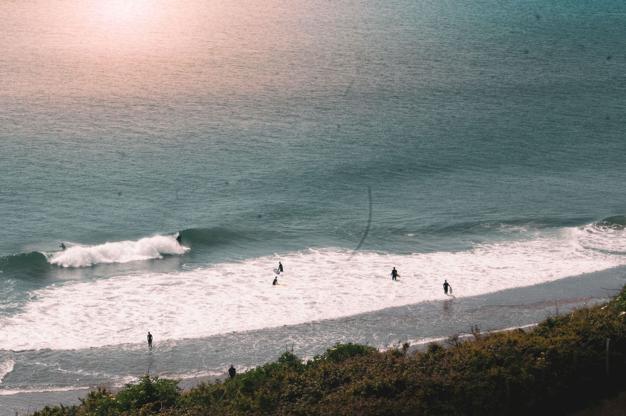
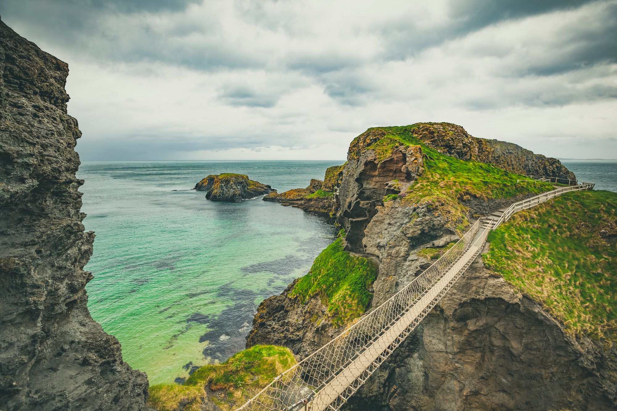
17. The Causeway Coast
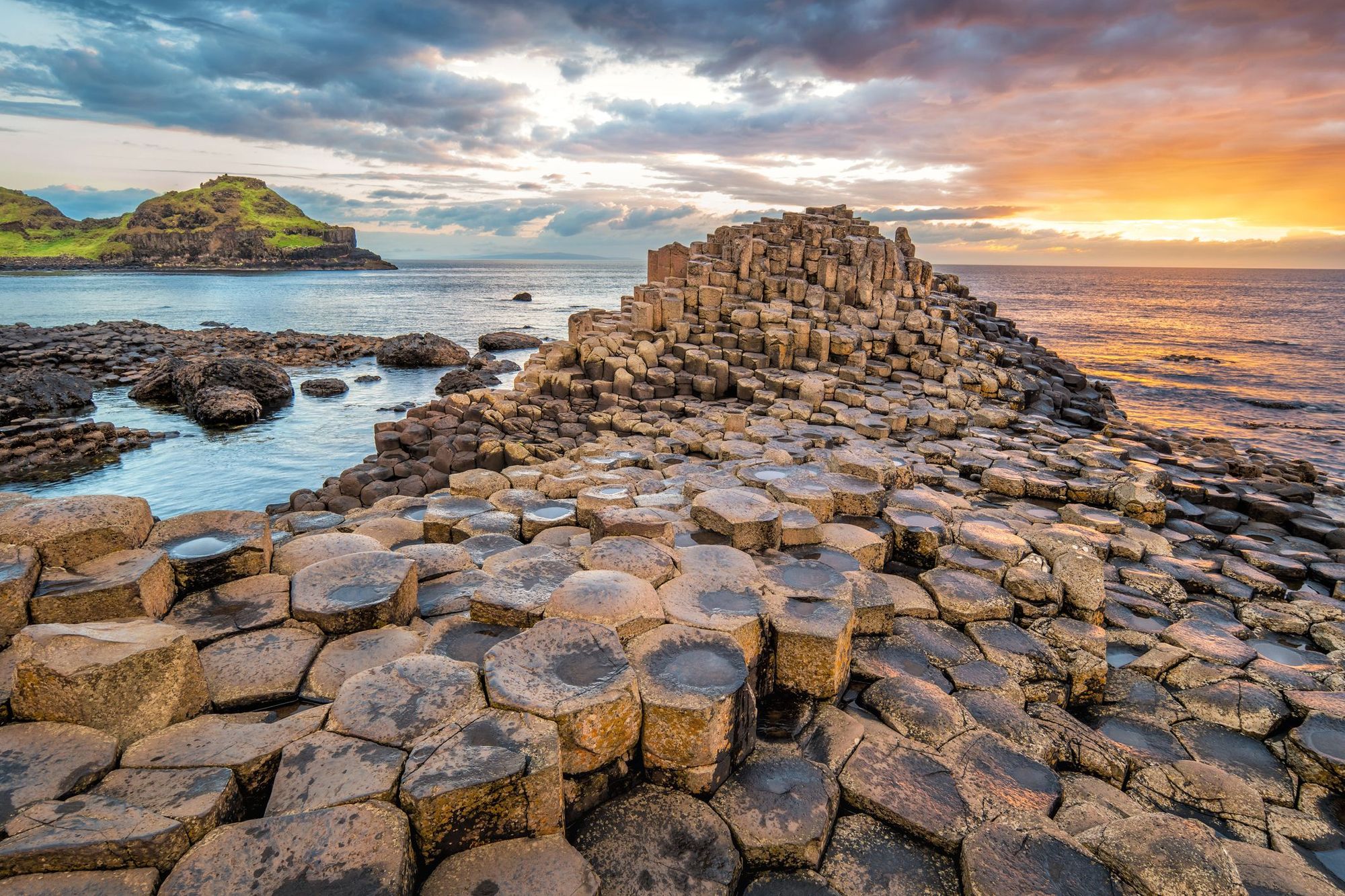
Northern Ireland’s rugged north coastline - The Causeway Coast - is where rolling green hills rub up against striking basalt cliffs, which tumble down into the ocean. The region boasts wild, windswept beaches that literally stretch for miles, and are popular with surfers and swimmers. One of the most spectacular sights is the UNESCO-designated Giant’s Causeway, which consists of some 40,000 polygonal columns of basalt, a natural ‘pavement’ jutting into the sea.
If you’re a hiker, we recommend the Causeway Coast Way walking trail, a 31 mile (51km) hike from Ballycastle to Port Stewart that can be done over a weekend. The rope suspension bridge at Carrick-a-Rede is also fun to walk across (but get there early to avoid the crowds). Inland, check out Bregagh Road, an avenue of ancient intertwined beech trees featuring as the King’s Road in Game of Thrones.
The perfect adventure: Hike the section of the Causeway Coast Way from Dunseverick Castle to Giant’s Causeway - it’s the longest section away from main roads, and consequently the most isolated. Spend some time exploring the stones, before heading to nearby Salmon Rock Beach for a swim (if you dare - the water’s cold!) and inland to eat at the foodie village of Bushmills.
By public transport: There’s a scenic train route from Londonderry-Derry to Coleraine. From Coleraine, it’s possible to explore the Causeway Coast by bus.
FAQs
What are the best coastal walks in Britain?
The best coastal walks in Britain include the Pembrokeshire Coast Path in Wales, the South West Coast Path in Cornwall and Devon and the Northumberland Coast Path. These routes feature dramatic cliffs, beaches, wildlife and historic castles.
What are the top national parks for outdoor activities in the UK?
The top national parks for outdoor activities in the UK are the Lake District, Snowdonia, the Cairngorms and the Peak District. These parks offer hiking, climbing, kayaking and biking through diverse landscapes of mountains, rugged moorlands and forests.
Lake District vs Snowdonia: which is better for hiking?
The best national park for hiking depends on your preferences. The Lake District offers rolling hills (called fells) and vast lakes, while Snowdonia features rugged peaks and more technical ascents like Mount Snowdon.
Which UK hikes are accessible by public transport?
UK hikes accessible by public transport include routes in the Peak District such as the Kinder Scout hike from Edale, and the hike to Mam Tor from Castleton. Plenty of hikes in the Lake District are train-accessible, including the Langdale Pikes walk from Windermere. The famous Seven Sisters hike on the south east coast is also accessible by train.
Are there any guided adventure breaks in the UK?
Yes, Much Better Adventures offers guided adventure breaks in the UK including wild camping in the Scottish Highlands, kayaking in Snowdonia and gravel biking in the Chilterns. These trips include expert guides, equipment and stays in local accommodation.
Inspired? Join us one of our adventure holidays in the UK or, if you're up for something a little different, why not try one of our UK-based challenges? We'll take care of the route and kit, you just focus on the graft!