


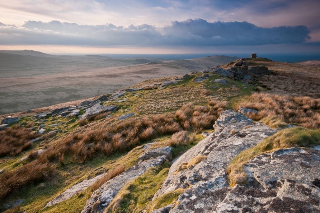
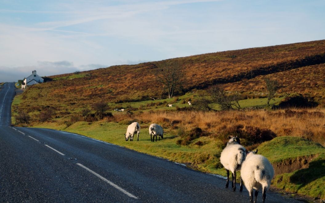
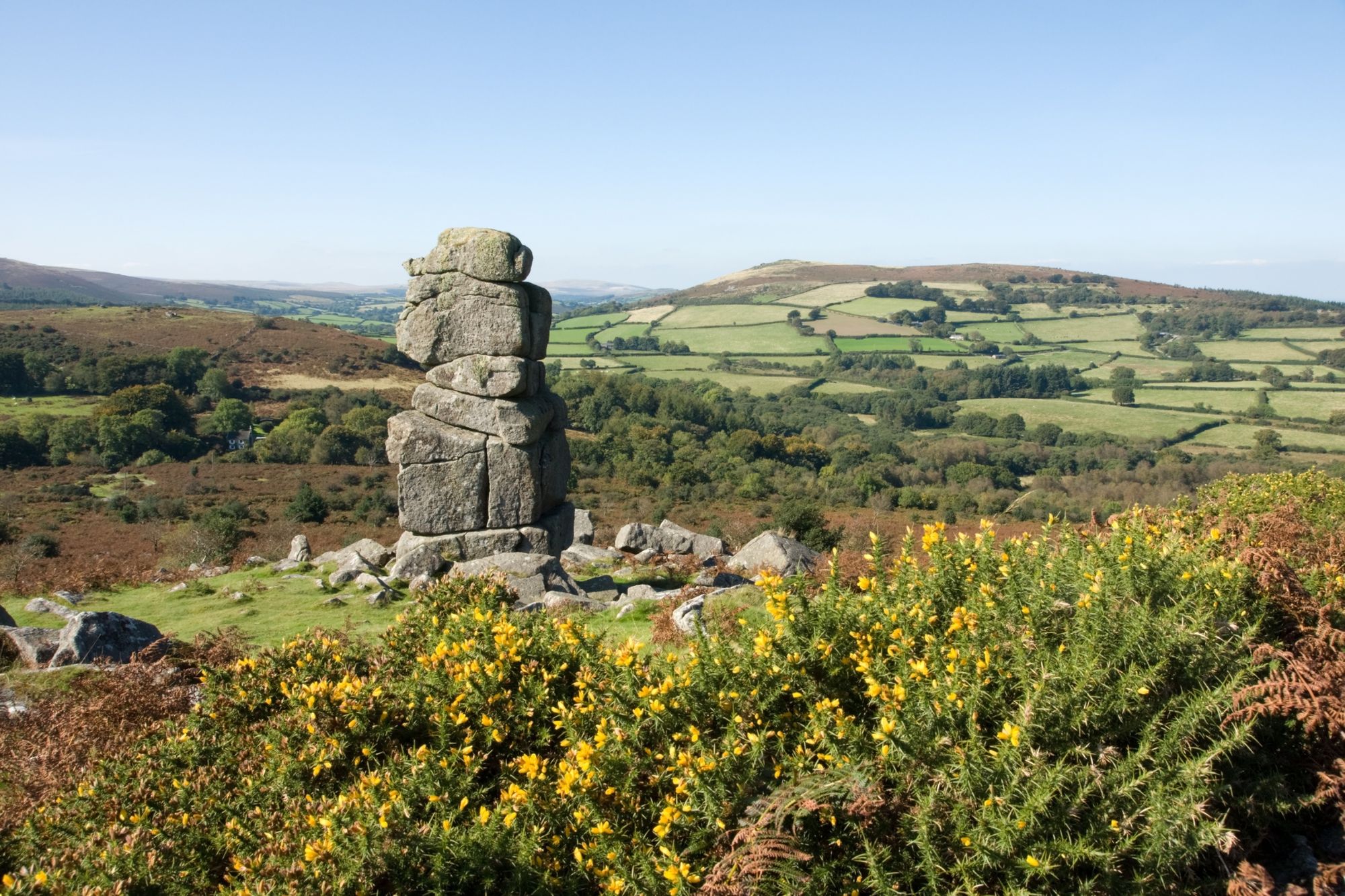
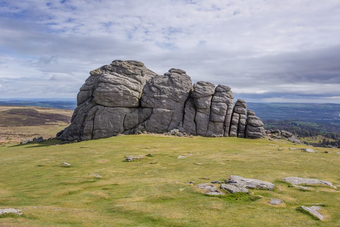
Dartmoor National Park is famous for its bleak moorland landscape, rolling hills, granite tors and wooded river valleys. With a healthy measure of fog, bog and folklore on the side.
Although it looks fairly benign, it's worth remembering that Dartmoor really is a wilderness. Huge areas are used by the military for training and live firing (watch out for red flag markers). The weather is notoriously fickle and you can quite easily expect to have sunshine, hail and fog all on the same day - regardless of what the season is meant to be. It's also very easy to get lost in the featureless interior. You can easily see how the Hound of the Baskervilles was inspired by these moors.
Here are a selection of great hikes on Dartmoor to give you a taste of what Dartmoor National Park has to offer.
1. Combestone Stepping Stone Hike
Length: 15km
Ascent: 300m
Start point: Dartmeet
Dartmeet is a confluence, where the East Dart and West Dart join together to become the river that flows all the way to the sea. The River Dart starts high in the boggy areas of Dartmoor and is its main river. By the time it reaches the edge of the moor, it's wide enough to fill the lakes of River Dart Country Park and is popular with kayakers. Paddling is permitted between Newbridge and Dartmeet from 1st October to 31st March.
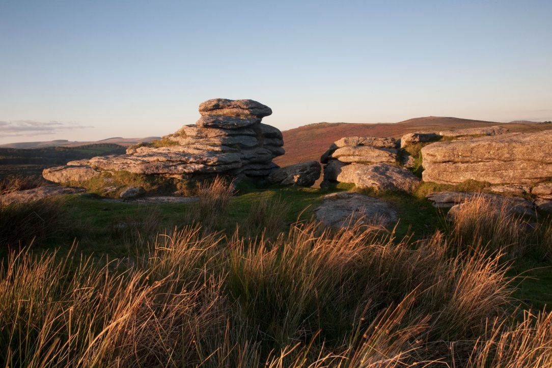
From the national park carpark at Dartmeet, cross the river on the road and follow the footpath left through the fields. Cross the West Dart and head straight uphill through the woods to Combestone Tor. On a clear day, you'll have a great view north across towards Yar Tor and Bellever.
Head south from Combestone Tor on a wide, open grassy path. At Horn's Cross, turn left and follow the boundary work towards Venford Reservoir. Horn's Cross is a distinctive granite cross, marking the course of the Maltern Way, one of the oldest tracks on Dartmoor thought to predate the 1500s. Contour around the bottom of Venford Reservoir, weaving through the gorse bushes as best you can. On the north side of the reservoir road is Bench Tor, with a very steep north side that drops impressively down into the wooded Dart valley below.
After taking in the views, head back to the road and cross the dam, veering off onto a footpath back towards Combestone Tor. You'll be following the course of Holne Moor Leat and the dry Wheal Emma leat that used to carry water to a local copper mine. But, instead of returning north back to Dartmeet, take a footpath roughly north west, down towards the river below Hexworthy. Cross on the huge stepping stones that span the river. This is usually easy in summer, but if the river is too high, retrace your steps back to Dartmeet. Otherwise, after enjoying the shady area of river, continue on the footpath across fields and back to Dartmeet.
2. Dewerstone to Ivybridge on the Dartmoor Way
Length: 20km
Ascent: 510m
Start point: Shaugh Bridge
The Dartmoor Way is a new 108-mile hiking route that circumnavigates Dartmoor, just within the edges of the national park. The route was created as a celebration of the lesser-visited edges of Dartmoor National Park, connecting villages by footpaths and quiet country lanes. It is completely waymarked by purple and white footpath signs, although sometimes a little sparsely - and not at all over any open moorland. However, the Dartmoor Way website has thorough route descriptions and downloadable GPX files.
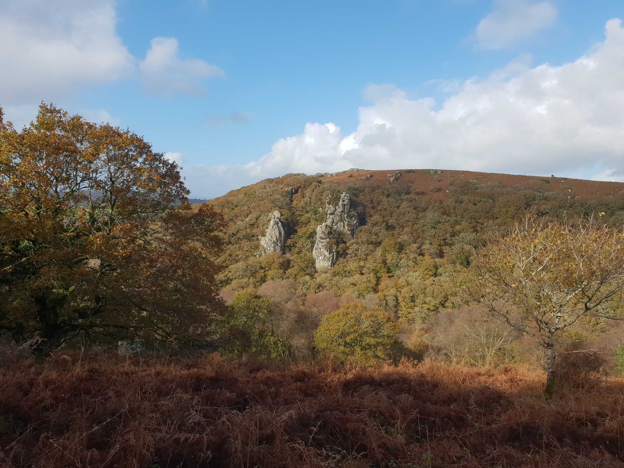
Start from the car park at Shaugh Bridge, near the Dewerstone. If you'd prefer to use public transport, the number 59 bus from Plymouth stops at Shaugh Prior - although it's always worth checking timetables. Follow purple and white Dartmoor Way footpath signs up onto the ridgeline opposite Dewerstone Rocks. These distinctive towering crags are popular with rock climbers. And of course with plenty of local legends - it would hardly be Dartmoor without them. Dewer is a local name for the Devil and he is said to have lured unsuspecting travellers to the cliff edges at night, falling into the jaws of his wist hounds.
Above the wooded Plym valley, your path has a great view of these granite spires. Follow along the dirt path into the trees until Cadover Bridge. This is a very popular area of the River Plym in summer. From here, the path uses access roads and dirt tracks for the China Clay Works. It makes a very strange contrast, with a national park on your left and a huge white pit on your right, still being actively dug out.
There is a small section of unmarked route over the open moor, dropping down over Rook Tor into a hamlet called Tor (yeah, original) just above Cornwood. From here, the path follows empty country lanes and footpaths across fields until you arrive in the woods beside the River Erme. Just when you least expect it, an enormous stone viaduct will appear through the canopy, high above you. It was built in the 1800s and designed by Isambard Kingdom Brunel for the South Devon Railway - marking your entry into Ivybridge. There are plenty of bus routes and a train station to get you home.
3. Burrator Reservoir Skyline Loop
Length: 15km
Ascent: 400m
Start point: Burrator Reservoir Dam
Burrator Reservoir is a 150-acre reservoir in the southwesterly corner of Dartmoor. At full capacity, it can hold 4210 mega litres of water. The reservoir was built in the late 1800s and early 1900s to supply fresh water to the nearby city of Plymouth. Plymouth, as a thriving port and dockyard, suffered from that same problem as the Ancient Mariner: "water, water everywhere but not a drop to drink".
A whole valley was flooded and the dam was built high to accommodate as much water as possible. Nowadays it is overseen by the South West Lakes Trust and has lots of nature trails around the reservoir and an arboretum. However, this hike will take you away from the tarmac and onto the tors around the Burrator skyline.
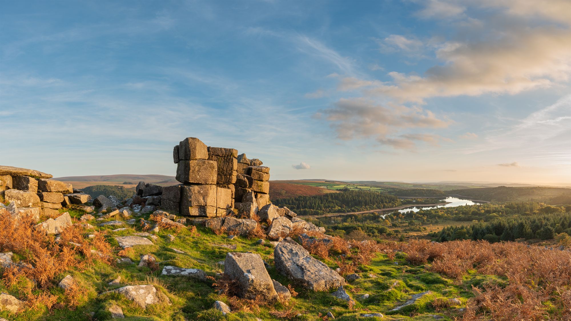
Start your walk by crossing Burrator Dam, maybe even sweeping a first pass at the ice cream van as you go. After a short section on the reservoir ring road, you can cut off left onto a public footpath. Walk along the shoreline as far as you can, then cross the road (ice cream van number two should be around here in summer). Take a stony track, opening into moorland as you climb the side of Sheeps Tor. There is a classic view from the top back over Burrator Reservoir towards Plymouth and the sea.

Walk east until you reach the drystone wall above the Roughtor Plantation. There is a stony track here which eventually peters out. Follow the wall around and down a steep hill into the Deancombe Valley (this is not the right of way marked on the map).
Pass the ruined farm houses at Deancombe, take a narrow stony path directly uphill between two walls. In winter it may look like a stream. Squeeze out onto the moor again at the top, below Down Tor. More views to be had here, then pop back down to Norsworthy Bridge carpark, across old field boundaries. In high summer there'll be another ice cream van here for the opportunists.
Back on ring road, take the footpath through gate on right, immediately after crossing the River Meavy, that heads uphill through the forest. Take the track right alongside the Devonport leat until the edge of the plantation. This leat was another attempt to get drinking water to Plymouth, built at the turn of the 1800s with help from prisoners at Princetown.
As you exit the woods, turn left and follow the wall around the woods and over Sharpitor and Peak Hill. Descend south however you can (there is not always a path) back to the leat and then down again to the road. Cross over Yennadon Down to complete your circuit and return to Burrator Dam alongside the ring road.
4. The Warren House Inn from Widecombe
Length: 20km
Ascent: 650m
Start point: Widecombe in the Moor
Widecombe-in-the-Moor is about as quaint as a village can get. Surrounded by Dartmoor hills and fields, with a little church and village green - you can think of it as a smaller version of Sandford from Hot Fuzz. Presumably without the Greater Good. It's famous for Widecombe Fair, which still happens to this day, and is the subject of a folk song you might have learnt at school.
The Warren House Inn is a 19th century pub on the single road over the moor. At 434m above sea level, it's the highest pub in south England and the original inn was built in 1700s on the ancient packhorse road. There's plenty of folklore and legends about the place. Most notably, it's said that the hearth fire in the inn has never gone out. Even when they rebuilt and moved the inn to the other side of the road, the hot embers were moved from one hearth to the other.
Start your walk at the main carpark in Widecombe. Head west out of the village on a single track road that slowly turns into a track and then footpath. It's a steep climb out of the valley, but you'll soon be on the wide ridge of Hamel Down. There are lots of ancient remains in this area: barrows, granite crosses, boundary stones, cairns - you name it! But most striking is the enormous Grimspound, a prehistoric settlement spread across the dip in the hillside.
From Grimspound, take the footpaths down by Headland Warren Farm and through the remains of Vitifer Mine to the Warren House Inn. This tin mine was worked from the mid 1700s all the way until 1925. The shafts are fenced off and grown over (phew) but you can still see the remains of some buildings.
Either take a mid-walk rest at the Warren House Inn, or carry on away from the inn along the road to Bennet's Cross. Turn back towards Widecombe, passing Birch Tor and near Grimspound again to the moor gate by Natsworthy Manor. Take the quiet country lane south until the stony track that leads up to Honeybag Tor. It's a bit steep from this side with no direct path, but head left of the tor if you're stuck.
On the ridge, tick off Honeybag, Chinkwell and Bell Tor in quick succession, then Bonehill Rocks. There are excellent views out across the Widecombe valley and the hills you spent your morning on. Finally, follow the road from Bonehill Rocks back down into Widecombe.
5. Bowerman's Nose and Lustleigh Cleave
Length: 25km
Ascent:650m
Start point: Bovey Tracey
Bowerman's Nose is a mysterious rock formation, in a patch of open access land west of Lustleigh. It's right on the eastern edge of Dartmoor National Park, and - you guessed it - has a Dartmoor legend about its origins. Long ago, there was a hunter called Bowerman who lived on the east side of the moor and took his pack of hounds out hunting hares. At this time, all the local people were scared of the witches who lived on the high moor. Everyone except Bowerman. One day, he ran his pack through a circle of witches in the middle of an incantation.
The witches were furious and set out for their revenge. One witch turned herself into a hare and gave Bowerman and his hounds a chase like they'd never had before. Exhausted, they finally reached the top of a hill as the hare darted behind a granite stack. Bowerman ran round to find it and straight into all the other witches. They turned Bowerman and his dogs to stone - and you can still see the outline of his head and shoulders, face and cap as an isolated pillar of granite.
From Bovey Tracy, take footpaths and small sections of country lane across Low Down and in front of Yarner Wood. Soon you'll be in Houndtor Wood, the western side of the wooded valley that surrounds the River Bovey here. Follow the rocky track down to the stream, cross and climb back up through the woods passing Beck Falls. This is a 70ft high waterfall in an ancient deciduous forest.
Out of the woods, take the lane left to Hayne Cross and onto Hayne Down, home of the famous Bowerman's Nose. It is a very distinctive pillar of granite, at the north end of the hill. The clitter below it is the pack of hounds Bowerman was out hunting with. Keep walking around the column until you see the famous profile.
Head back to Hayne Cross the way you came and take a left into Manaton. From here you can pick up footpaths that take you across the River Bovey and along Lustleigh Cleave. There are both high paths (taking in all the tors) and lower paths through the woods. Both ways eventually join to take you right down beside the river. After a small section on road you can rejoin a footpath along the river into Parke Estate. This is where Dartmoor National Park Authority has its head office and is also a National Trust property - although you'll have to cross the river to visit. Otherwise, you'll soon be back in Bovey Tracy.
6. The Templer Way
Length: 29km
Ascent: 200m
Start point: Haytor Rocks
The Templer Way has, perhaps sadly, nothing to do with the Knights Templar. Although the idea of knights with helmets, lances and shields hiking on Dartmoor seems pretty surprising, this stark reality has killed many a childhood dream. The Templer Way is in fact named after the Templer family who built the Stover Canal and tramway that connected Dartmoor Granite to the coastal port. The route travels from Haytor Rocks to Teignmouth (pronounced Tin-Muth), Dartmoor's very own summit to sea. Although it's almost entirely flat or downhill, there's something very satisfying about starting on a summit and finishing at the beach. Of course no one's stopping you from hiking it uphill all the way, but really...?
The route officially starts on the granite tramway behind Haytor Rocks - but since you're there it would be rude not to climb the tor. From the tor, make your way down towards the quarry, now filled with water, and onto the old tramway. Most of the granite from this quarry went to London for the construction of some of the famous bridges - like London Bridge. Although that's not in London any more... it's a tourist attraction in the desert in Arizona!
Technically this Dartmoor hike leaves the national park at Bovey Tracey and you could call it a day there if you really wanted. But since you've packed your bucket and space, continue alongside the River Bovey towards the River Teign and onto the Stover Canal. At this point the granite would have been loaded onto barges on the canal, but it's probably best if you don't get your feet wet and stay on the path.
The Stover Canal takes you into Newton Abbot and the start of the estuary, all the way along the River Teign to the sea. Officially, the end of the Templer Way is at headland just south of Teignmouth, where it meets up with the South West Coast Path. Time for a dip and some icecream.
7. Belstone Ridge and Cosdon Hill
Length: 12km
Ascent: 500m
Start point: Belstone main car park
The north-most parts of Dartmoor are characterised by steep river valleys and rocky tors, unlike the more rolling hills in the south. This area is also used for live firing practice by the military. But when you are able to visit, it makes for a bleak - and often boggy - Dartmoor experience.
Walk uphill through Belstone village and out onto a stony track at the moor gate. After only a short section on the track, cut up on a footpath to your left onto the grassy hillside. You'll pass Nine Maidens stone circle: a group of maidens who danced on a Sunday and were turned into stone.
Continue up onto the ridgeline, passing through Belstone Tor and Higher Tor. On a good day there will be sweeping views of the tors ahead and where you're going next: Oke Tor. Note that you're now passing into the Okehampton Firing Range, be sure to check the Dartmoor Firing Times - getting shot on a hike is always a bit of a downer. If you see any red flags flying, stay well away.
After enjoying the views of moorland in all directions as far as the eye can see, descend east from Oke Tor, contouring above the steep drop. You'll pick up a section of track to a ford over the River Taw. Cross where you can. Your final summit is Cosdon Hill - a pretty severe ascent as Dartmoor goes, from the ford 200m vertically to the trig point. From here there are even more views across to North Devon.
Finally, descend north off Cosdon, cross a disused leat and follow the footpath back to Belstone. You'll cross over the River Taw again, this time at a foot bridge, and arrive back alongside the village green.
8. The Two Moors Way - Dartmoor Section
Length: 59km
Ascent: 1300m
Start point: Ivybridge
The Two Moors Way is Devon's answer to the Coast to Coast route. Although unlike most coast-to-coasts in the UK, this one goes roughly south to north. It is 117 miles in all, starting at Wembury on the south coast near Plymouth and finishing at Lynmouth on the north coast in Exmoor National Park.
The route is well documented by books, maps and guide. However, there is no (or very sparse) waymarking over any of the Dartmoor sections - although you can rely on them through footpaths and ways in the wider national park. Just make sure to bring a map and compass for the wild bits!
The Dartmoor section of the Two Moors Way starts at Ivybridge, easily accessible by train. The route follows the old railway that used to run to Red Lake - now a reddish spoil heap in the distance. Red Lake China Clay Works was active from 1913 - 1932.
Next, the Two Moors Way takes a right hand turn to cross River Avon and just misses the top of Pupers Hill before heading off the moor. There is a section through fields and bridleways before arriving at the River Dart. It takes in the ridgeline of tors on the north bank of the Dart before dropping down again off the moor into Ponsworthy.
Just before Widecombe, the Two Moors Way splits, offering a choice of the high moor route - through Grimspound and near Fernworthy Reservoir - or the low route takes the valley. The left is more direct but not necessarily quicker depending on the weather. After about 10 km, the routes join together again and continue northwards.
There is a long section alongside the River Teign, then on to Castle Drogo and finally Drewsteignton. You've reached the end of your Dartmoor hike, but since it's only the start of the Two Moors Way, maybe you'll carry on...
Ready to put your hiking boots on? Check out our UK hiking and trekking holidays.