


The Peak District was the first National Park in the United Kingdom, so it's no wonder that walking in the Peak District is so popular amongst British outdoor lovers. The peaks are famous for limestone caves, precipitous edges (with views to match) and long distance hiking routes. There are no fewer than ten named trails that pass through the area - quite possibly more as we speak - and the area is actually well known for its involvement in shaping Right to Roam laws and access to the UK's hills.
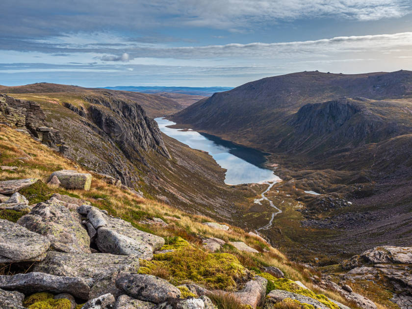
The Peak District has two halves with distinctly different geology. The northern part is known as the Dark Peak, with course black gritstone rock. The south is called the White Peak, dominated by white limestone and chalky soil. This means bogs, peat and heather moorland in the Dark Peak and rolling green green hills in the White Peak. Plus caves, lots of limestone caves. Most people have heard of Padley Gorge, a deep but narrow valley in the peaks, or perhaps know the Monsal Trail. In this feature, we're going to look a little further than that.

Although you're never too far away from civilisation on a Peak District hike, there are plenty of cliffs to fall off, holes to fall down and open plateaus to wander around in the fog. So it's still worth taking it seriously. Now that the safety announcement is over, here are our recommendations for the best hikes in the Peak District - to give you inspiration for your next beautiful hill walk.
Best Hikes in the Peak District
1. Mam Tor and Cave Dale
Length: 10 km
Ascent: 300 m
Start point: Mam Tor National Trust Car Park
Mam Tor is a Peak District classic. Owned by the National Trust, the paths are well made and there are plenty of short circular walks in the area. The view over the Great Ridge is particularly good at sunrise and sunset, plus you'll avoid the late risers. Like they say, the early hiker catches the photo... Around Mam Tor area, there are lots of interesting cave and castles to explore.
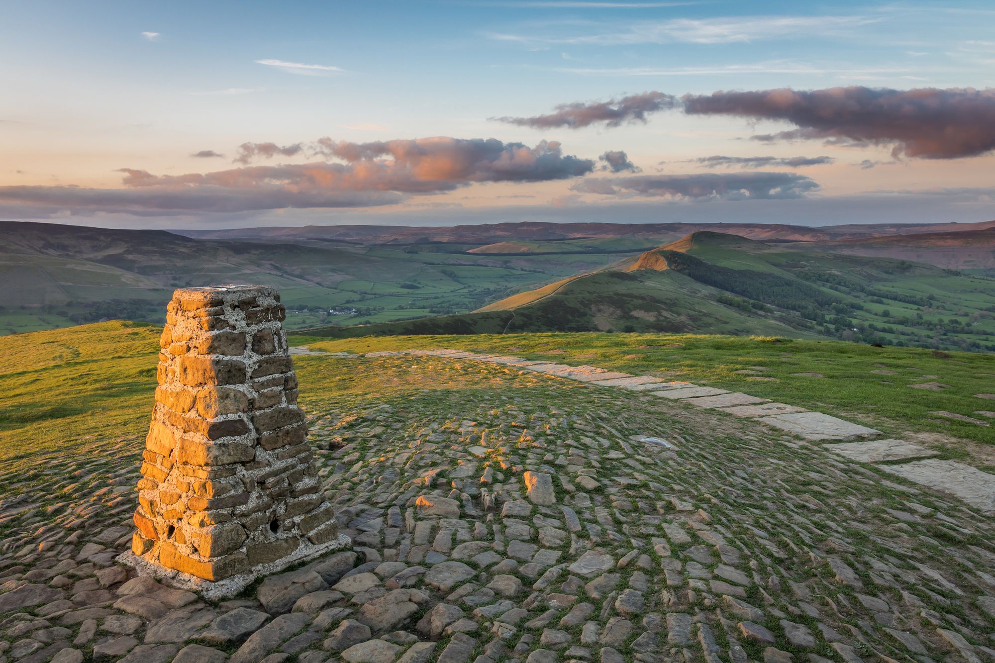
From the National Trust car park, it's only a very short walk to the top of Mam Tor. There's a trig point at the summit and the remains of an Iron Age hill fort. Follow the curving ridgeline along to Hollins Cross. A short cylindrical stone marks the viewpoint. In good weather you can see all the way out across the Hope Valley and across to Kinder Scout. After taking your fill of the panorama, descend to Castleton through the fields.
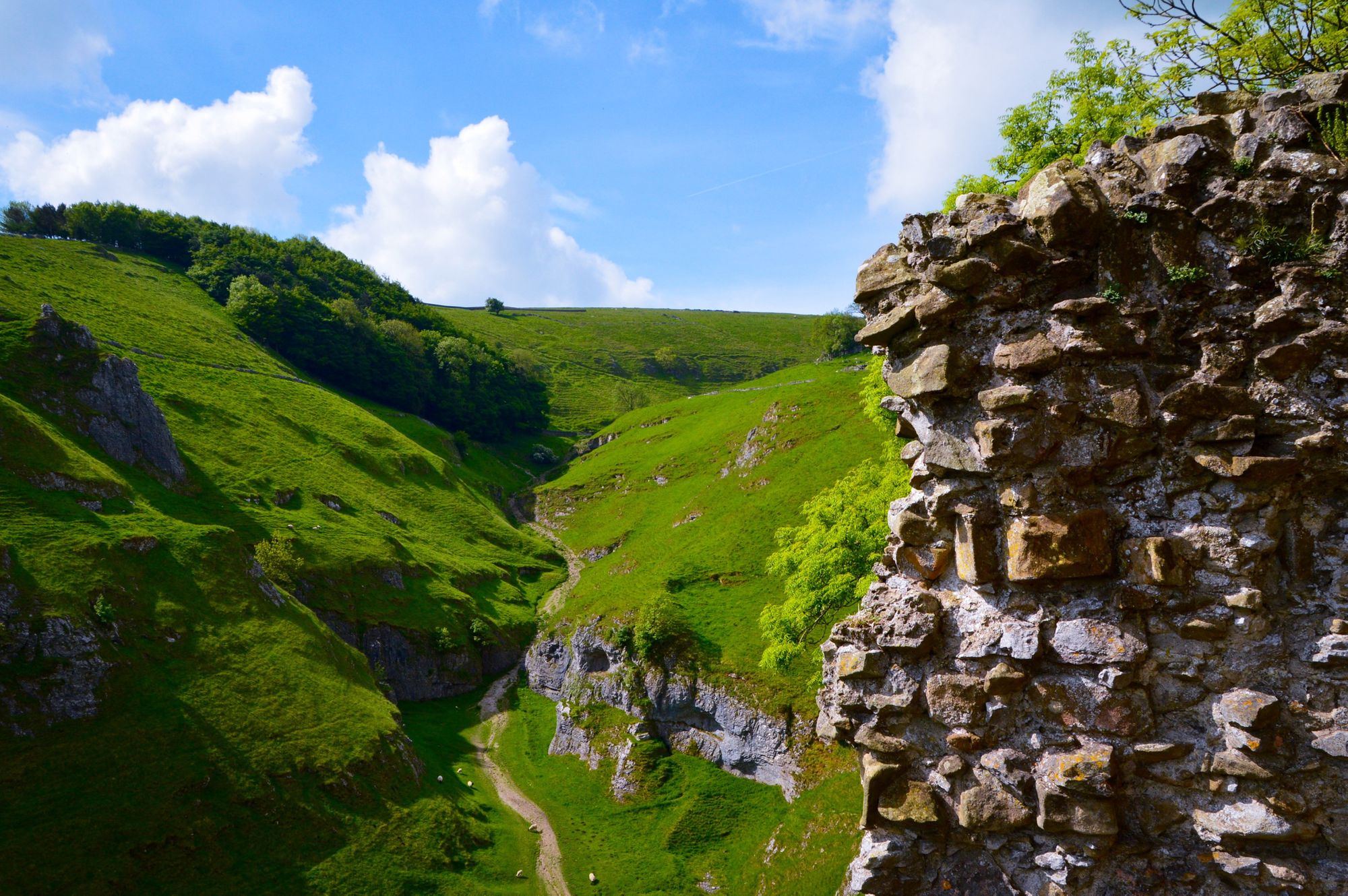
Although you could start at Castleton, it makes a great midday stopping point. Its castle was built in 1086 by William Peverel, son of William the Conqueror. On the edge of town, there are show caves that you can book a visit to explore. Peak Cavern, in the deep gorge below Peveril Castle, has the largest natural cave entrance in the British Isles.
Whether or not you go on a cave excursion, there are plenty more caves on this route. Out of Castleton, head up the long enclosed valley of Cave Dale. Its steep sided limestone slopes might seem familiar to anyone who's watched The Princess Bride a few too many times. Pause at the top of the gorge for an inconceivable view back down the valley, framing the old fort.
Back out in the open, it's only a short walk across fields until you've returned to your start point. There's a reason this is one of the best loved walks in the peaks.
2. The Limestone Way
Length: 74km (over 3-4 days)
Ascent: 1,794 m
Start point: Castleton, Derbyshire
The Limestone Way is a long distance hiking route through the southern Peak District. It was officially opened in 1986 and extended south to Rocester in 1992. So yes, it technically leaves the Peak District National Park at Thorpe, but with only a few kilometres to go, it would be rude not to finish. The full route is waymarked with a green ram's head logo.
The Limestone Way starts in the village of Castleton and heads south through the limestone dales of the White Peak, until it reaches the Dove valley near Rocester. The route is characterised by caves, steep valleys and rolling green hillsides. Perfect if you thought Cave Dale sounded epic and fancy a bit more of that. The route starts out of Castleton via Cave Dale, quite a dramatic start.
Typically, people split the Limestone Way into three days (stopping at Youlgreave and Tissington) or four days (stopping at Flagg, Matlock and Thorpe). Of course, you don't have to do it in a oner either. Each of these could be an interesting day hike, if you can arrange transport from either end.
3. Stanage and Bamford Edge Circuit
Length: 12 km
Ascent: 300 m
Start point: Car park near Bamford
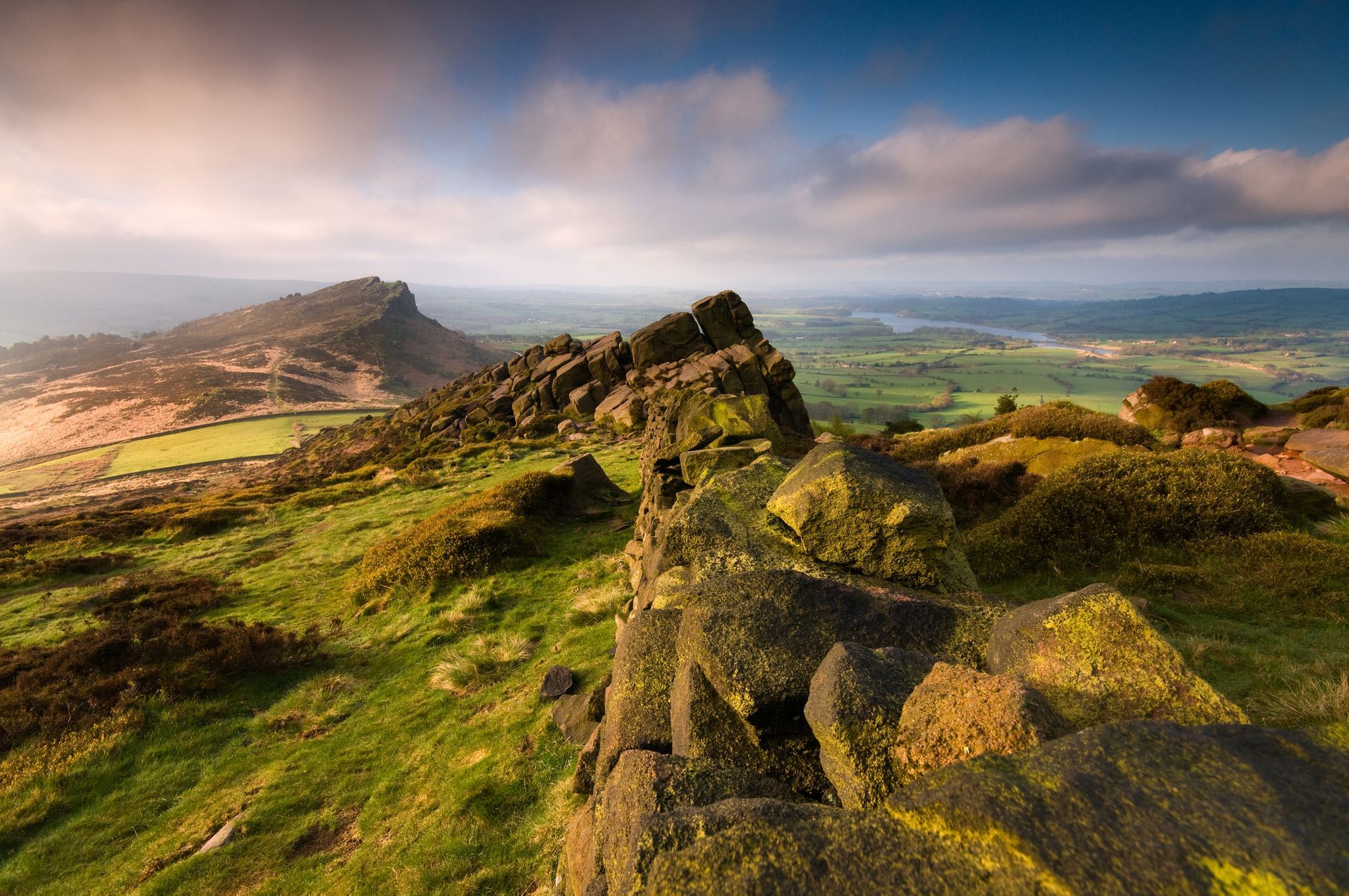
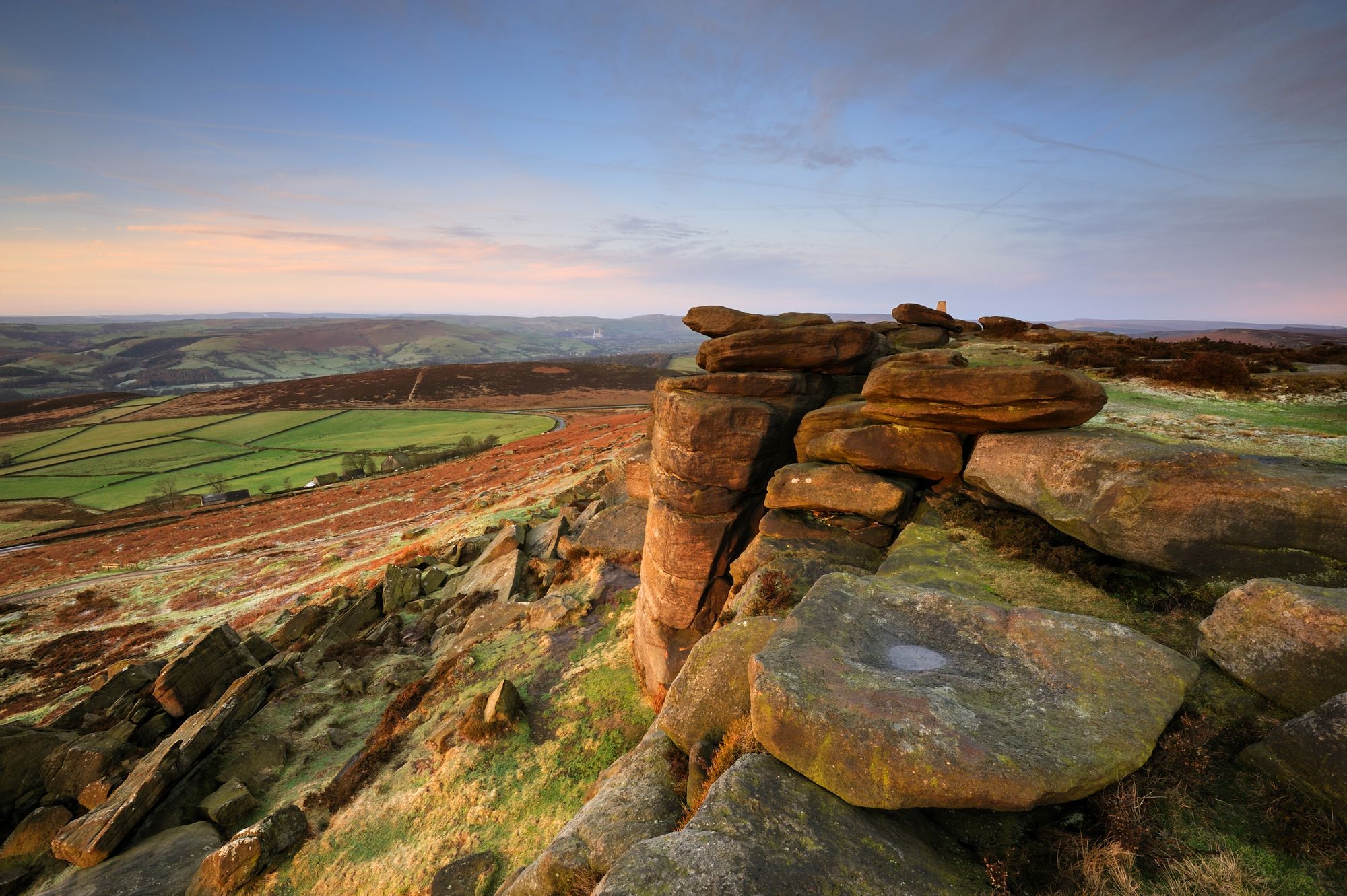
While the White Peak is famous for its caves, the Dark Peak is all about edges. Of these, Stanage is the largest and most impressive continuous edge. It's the site of much history and folk lore - from the Romans to Robin Hood. Due to its height and interesting gritstone rock, Stanage is very popular with rock climbers.
Out of the car park, turn right and make the quick ascent to Stanage Edge. This road, the Long Causeway, is an old pack horse route and thought to be the Roman road to Buxton. Standing on top of the edge, you'll get a good view along the sweeping escarpment, 25 metres high in places.
Take the path north to High Neb, not significantly higher than the rest of the ridge, but a summit and a trig point nonetheless. You'll pass a pile of old mill stones, abandoned in the early 1900s. They were quarried and shaped from the edge but left where they were carved as the industry collapsed. There are over a thousand mill stones abandoned across the Peak District.
Just before Stanage End, take the path downhill off the edge, avoiding the bog, until you join up with the north end of Bamford Edge. You'll have a great view over Ladybower Reservoir and the surrounding woodland. Follow along with the cliff on your right, enjoying the rolling countryside, until you get down to the road. It's a short walk back beside the road to the car park.
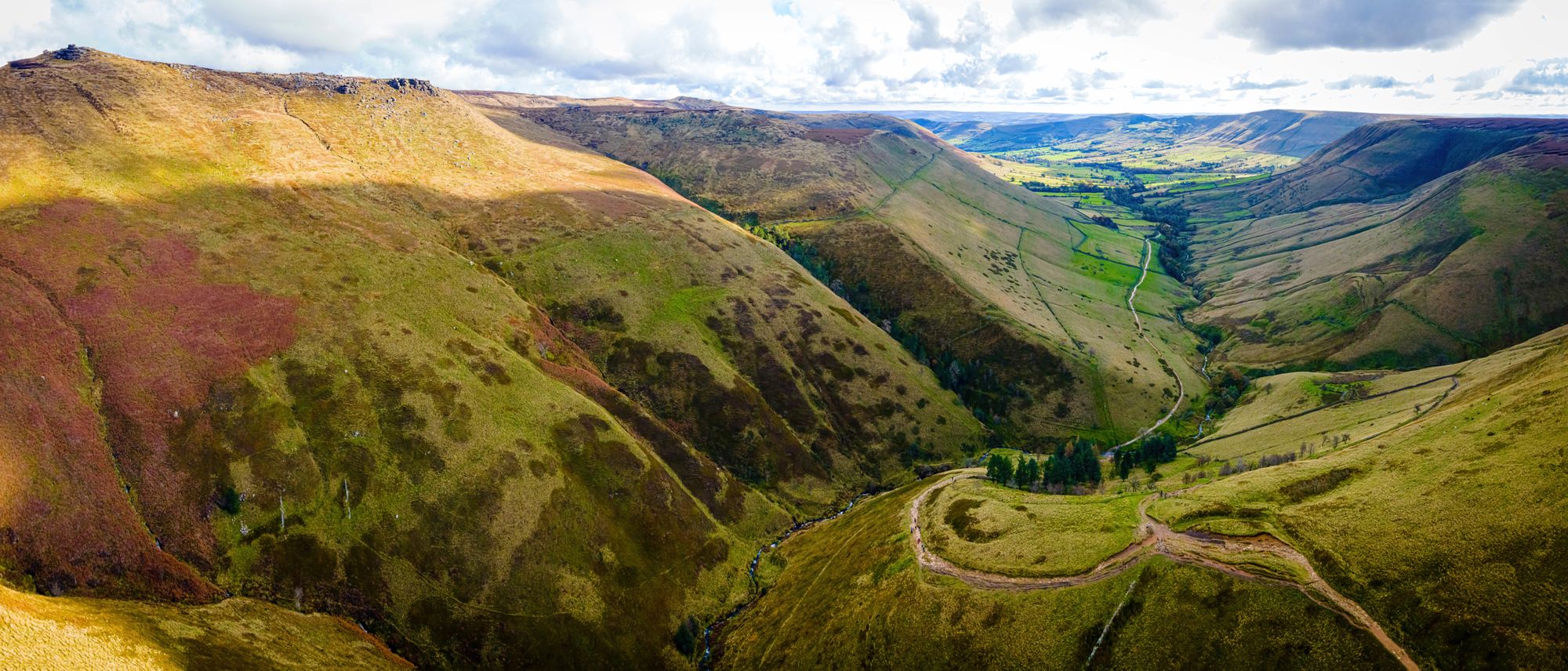
4. Kinder Scout Plateau Circuit
Length: 31 km
Ascent: 650 m
Start point: Edale Train Station
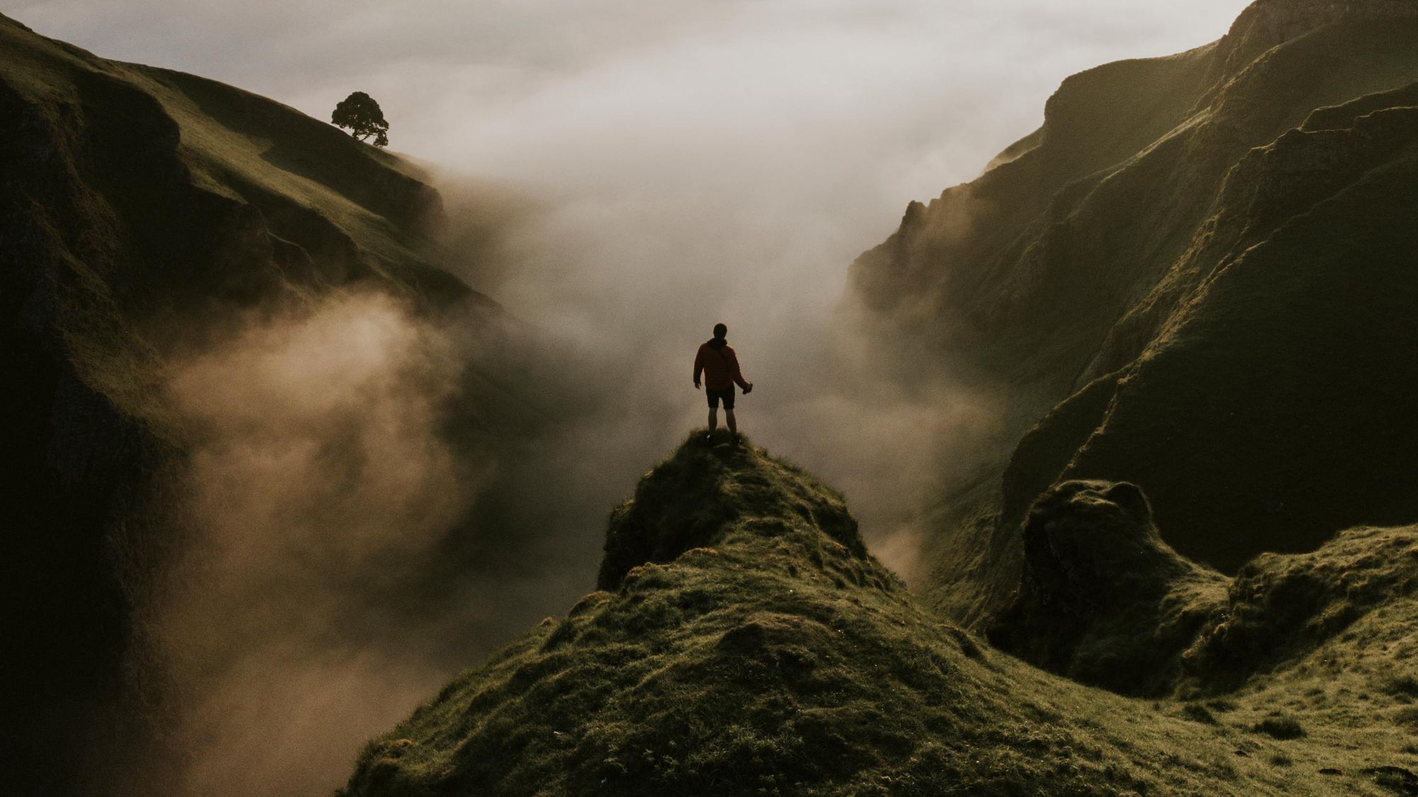
Kinder Scout is perhaps most famous for its mass trespass, that took place in 1932, aiming to highlight the issues with legal access to open country for hikers. It is a huge open plateau, with steep cliffs on all sides, which allowed several groups to arrive at once from different directions. This protest arguably helped pave the way for the National Parks Act and the Countryside Right of Way Act. It's especially fitting that the Pennine Way, the first of England's National Trails, starts here too.
From the train station, walk up the hill and turn left onto the Pennine Way. Follow the waymarkers across fields and through Upper Booth village until you reach open moorland. This is Jacob's Ladder path, which winds steeply up onto Kinder Plateau. It is a paved and well-used path, named after Jacob Marshall, a local farmer who first cut steps into the hillside in the 1700s.
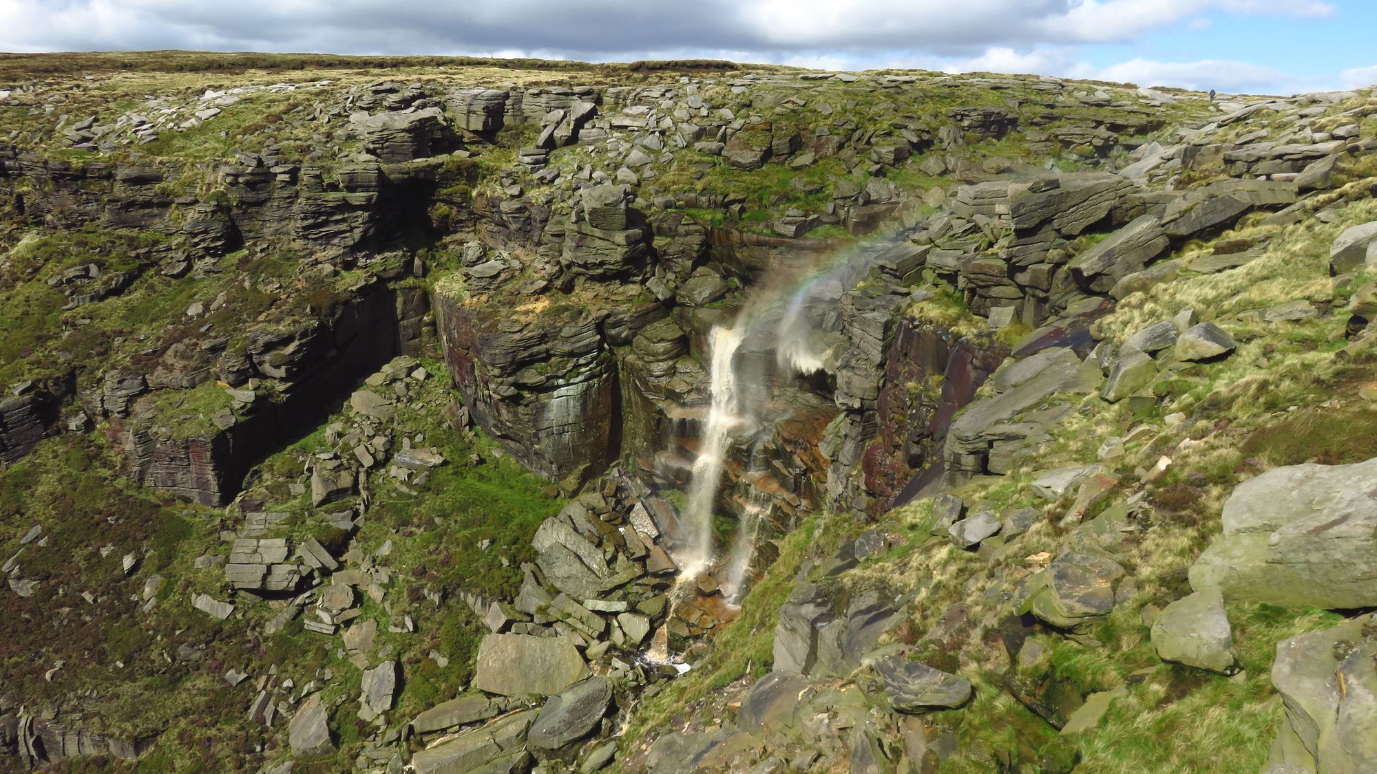
On the ridgeline, turn right and head towards the trig point above Kinder Low. There will be a steep edge to your left and you'll pass the blocky Edale Rocks and distinctive Pym Chair. Stay close to the path. Kinder Scout, or at least its high point at 636 metres, is the highest point in the Peak District. But it's also a huge area of peat bog, with hundreds of little streams starting from the plateau in wet weather. People have lost boots in this bog, so stay close to the path! The most impressive water to exit the plateau is definitely Kinder Downfall. The waterfall drops almost 100 feet into a rock amphitheatre.
The rest of the walk takes you all the way around the edge of Kinder Plateau. Keep to the Pennine Way until the north west corner of the plateau, then continue around above the cliffs always keeping the drop to your left. You'll be treated to staggering views for miles around and unusual rock formations. The gritstone forms bulbous crags and boulder, smoothed by years of weathering into unlikely shapes.
Before you quite complete the circuit, take the good path down Grindsbrook Clough beside the river and back into Edale.
5. Curbar Edge and Chatsworth House
Length: 22 km
Ascent: 400 m
Start point: Nether End Car Park, Baslow
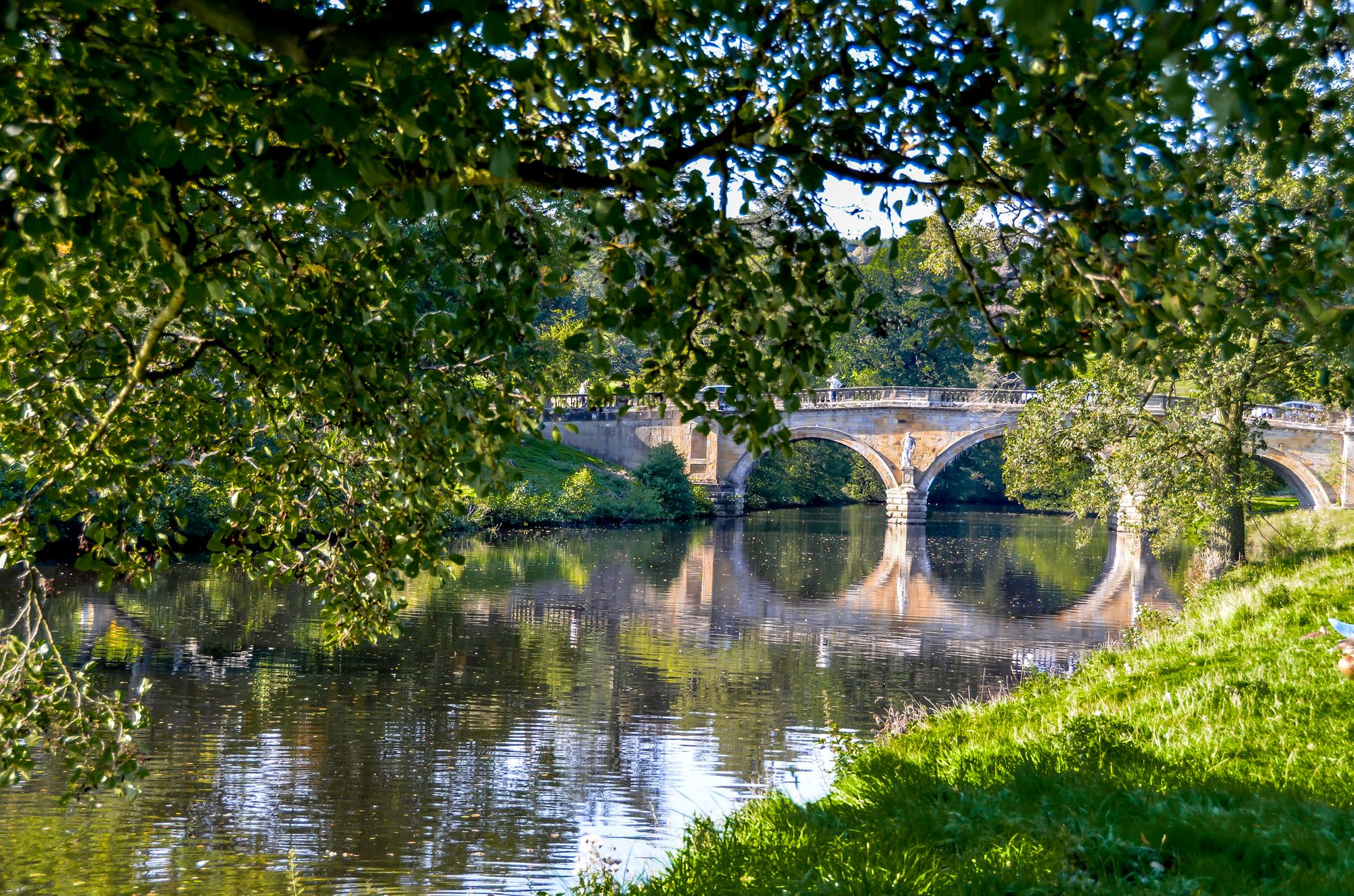
Curbar Edge and Froggart Edge form a striking rocky escarpment that overlooks the Derwent Valley. You can stand out on the cliff top, feeling like the King of the Castle as you look out over the rolling hills below. Chatsworth House, nestled beside the River Derwent, is not quite a castle. But with 25 rooms full of art and sculpture, it's certainly more comfortable. The 100 acre garden has been tended for some 500 years and there are 1000 acres of surrounding parkland.
From the car park, head north through town and then out onto Baslow Edge. You can see down into the river valley that you'll be walking along later. Follow the edge, keeping the steep precipice on your left. You'll cross a road onto Curbar Edge and then further to Froggart Edge. The heather moorland on your left is purple in late summer.
As the path curves round to the right, take the path down through the woods. Cross the road and head steeply down and left towards the River Derwent by Grindleford. Here you'll pick up the Derwent Valley Heritage Way (DVH Way to its friends). This trail follows the River Derwent all the way through the Peak District and is marked by a purple disc with a yellow arrow.
The DVH Way takes you south, on the east bank and then west bank of the river, all the way back to Baslow. You'll pass by fields, woodland and weirs. If you've had enough hiking for one day, you could stop here, but we've extended the route with an extra little loop to take in Chatsworth House.
Continue on the long distance footpath, down the east side of the river, until you reach the grand sandstone bridge and entrance to Chatsworth. There is free access to the estate, so continue through the Deer Park and towards the Hunting Tower. Stop to admire the view over the Derwent, imagining you own the place and are in fact the mistress of Pemberley. Finally, return to your start point by descending back to the river and into Baslow.
6. Pennine Way across the Peaks
Length: 46 km (typically over 2 days)
Ascent: 1200 m
Start point: Old Nags Head Pub, Edale
The Pennine Way is a famous long distance walking route. It's perhaps best known in recent years from the infamous Spine Race, which takes place in January. Sometimes people run it in snow. It made international news when Jasmine Paris completed the entire 429 kilometres in just over 83 hours, knocking 12 hours off the course record (and 15 hours before her next nearest competitor).
If you're in the Peak District walking the Pennine Way, you'll just be taking on one section. This route is the Peak District section of the Pennine Way. You'd typically need 16 days to complete the whole thing from Edale to Kirk Yetholm. But this section across the Peak District can be done in a weekend. Luckily, these are the first two days of the full trail, so if you get carried away... Most people stay at campsites or in hostels over night.
From the Old Nags Head Pub at Edale, follow the Pennine Way acorn markers out of town and up towards Kinder Plateau. This is the Jacob's Ladder path. Follow along the left edge of the plateau, past Kinder Downfall and down to Mill Hill, then across High Peak. The sheer number of place names involving the word 'moss' in the area tells you everything about what to expect underfoot.
Cross the road and continue on a rather featureless open moor. The boggiest bits have been paved. Finally, head down Clough Edge along the left side of a gully towards an impressive line of five reservoirs on the River Etherow. Most people spend the night here in Crowden, but with only a campsite and youth hostel make sure you've got plenty of supplies.
Day two starts immediately uphill (we sense a running theme here) and out onto another plateau, slowly ascending to the wonderfully named Soldier's Lump on Black Hill. After star jumps on the trig point, you'll head steeply downhill and alongside a series of reservoirs. Wainwright described the area as "desolate and hopeless" but he was probably having a bad day. Before you know it, you'll have reached the edge of the Peak District at the A62 road. Turn right and follow the roads down into Marsden, where you can spend the night or catch a train home.
FAQs
What is the best hike in the Peak District?
The best hike in the Peak District is widely considered to be the ascent of Kinder Scout from Edale. This circular route takes you through dramatic gritstone formations, past the historic site of the 1932 Mass Trespass, and up to the highest point in the Peak District at 636 m. The views across the moorlands and down into the Vale of Edale are breathtaking. Other top contenders include the Mam Tor Ridge Walk, the Monsal Trail, and Dovedale’s limestone gorge—each offering a different experience, from family-friendly strolls to more rugged adventures.
When is the best time of year to hike in the Peak District?
The best time to hike in the Peak District is late spring to early autumn (May to September). During this period, the trails are typically dry, the days are longer, and the views are clearer. Autumn offers beautiful foliage in the wooded valleys, while summer brings the heather into bloom across the moors. Winter hikes can also be rewarding, but expect muddy paths, shorter days, and colder conditions. Always check the weather and be prepared for rapid changes, especially on higher ground.
Is Kinder Scout hard?
Kinder Scout is a moderately challenging hike, best suited to walkers with good fitness and some experience of uneven terrain. The classic route from Edale via Grindsbrook Clough involves scrambling and steep ascents, while the Jacob’s Ladder path is more gradual but still requires stamina. The moorland plateau at the top can be boggy and hard to navigate in poor weather, so good footwear, navigation skills and preparation are essential. That said, the route is achievable in around 4–6 hours and offers huge rewards in scenery and adventure.
What is the best place to stay in the Peak District for hiking?
For easy access to many of the best walks, Edale, Castleton, and Hathersage are top places to stay in the Peak District. Edale is the starting point for Kinder Scout and the Pennine Way. Castleton is close to Mam Tor, Cave Dale, and several ridge walks, while Hathersage gives access to Stanage Edge and Padley Gorge. These villages are well connected by train or road, and they offer a mix of cosy pubs, campsites, B&Bs, and hostels—ideal for walkers.
Can you wild camp in the Peak District?
Wild camping is not officially permitted in the Peak District. However, there are several ‘nearly wild campsites’ where you can enjoy back-to-basics camping. The National Trust also manages several campsites within the national park.
Read More:
- Hiking in Scotland: 26 of the Best Hikes in the Country
- Best Hikes in the UK: 10 of the Most Adventurous Routes
- 7 of the Best Hikes Near London
Check out our UK adventure holidays to explore further afield by foot, paddle and bike.