


“Well it’s quite a thing,” Jenny Bowen, of Natural England, tells me. “It’s going to be about 2,700 miles long. And it does what it says on the tin. It’s the England Coast Path, and it will be going around the entirety of the English coast. When it's all open, it will be the longest coastal walking route in the world.”
Little stretches of the England Coast Path have been opening up, one at a time, since the first section of the trail was completed at Weymouth Bay in Dorset in 2012. The ultimate aim is to have the full trail finished by 2024.
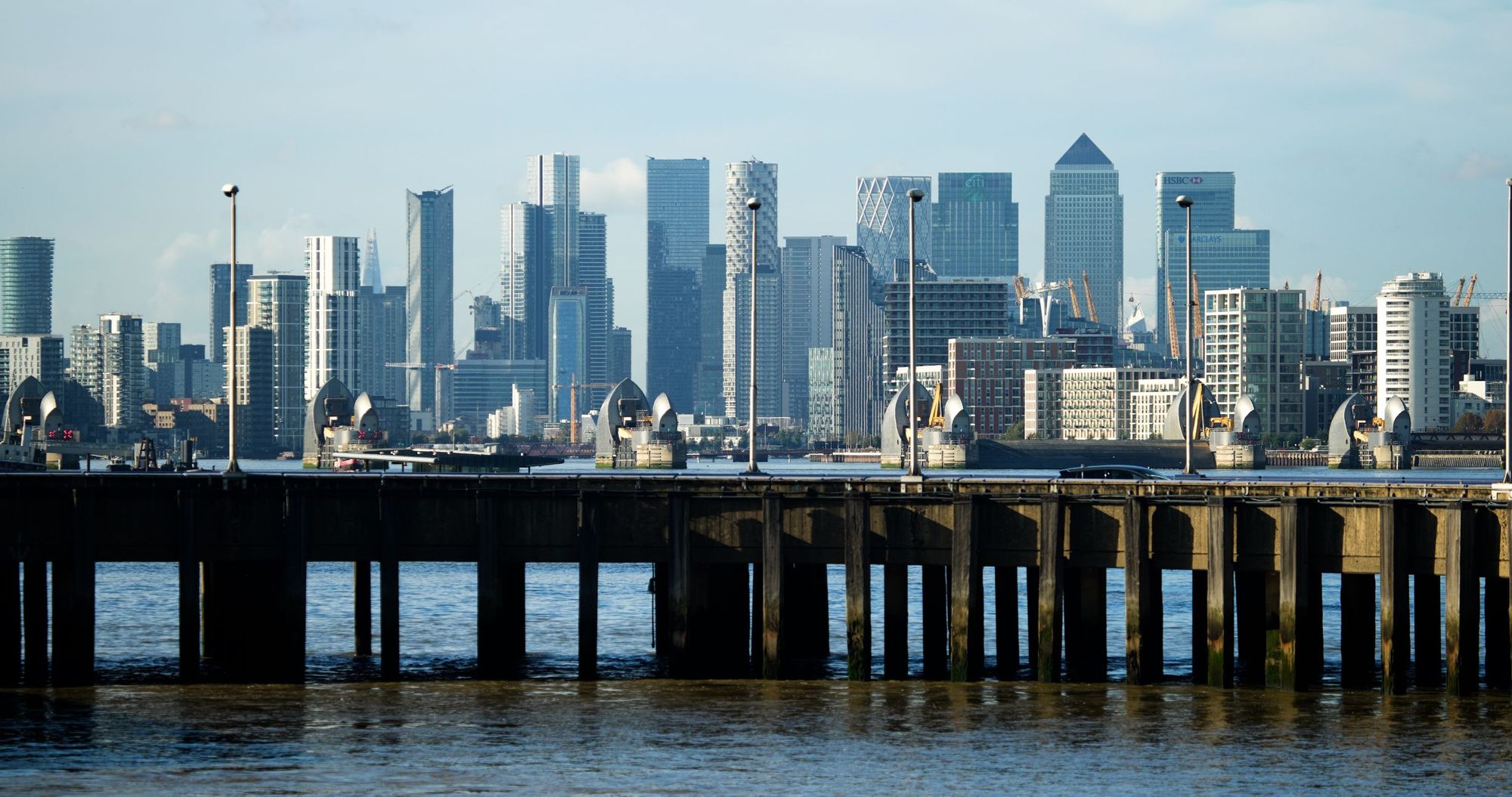
In Woolwich, it connects with the 184-mile Thames Path, another National Trail, creating a new 231-mile source-to-sea route across England...
“If there’s an existing footpath or bridleway, or an informal walking route, we’ll often adopt it,” says Jenny. “But we’re also going across new areas of land that haven’t previously had any access. So we’re working with thousands of landowners to secure new access for the public.”
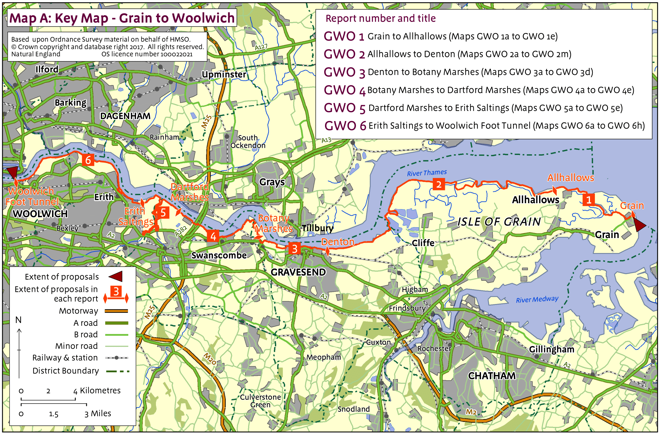
One of the latest segments of the trail to open is the Grain to Woolwich stretch, which runs 47 miles (75km) from the west coast of England to London. There, it connects with the 184-mile Thames Path, another National Trail, which runs from the source of the Thames in Gloucestershire to London. In doing so it’s created a new 231-mile source-to-sea route across England.
“It runs pretty much across the whole country,” says Jenny. “It’s a phenomenal route. Our national trails are a real resource. They’re high quality, promoted nationally, they’re well maintained and they’re easy to follow. They’re a real boon to tourism.”
Waymarked with the acorn of England’s National Trails, walkers will pass through various SSSI (Site of Special Scientific Interest) and RSPB reserves on the Grain-Woolwich stretch.
Bowen is the Senior Advisor for the coast path in the southwest of England, and knows the Grain to Woolwich trail inside out. She takes to Google Maps to talk me through the route.
“There’s a wonderful juxtaposition between this kind of mad mud industrial area with a big sky feel to it, and this little town of Grain,” says Bowen. “It feels like a different country.”
The Isle of Grain isn’t a true island, but it is separated from the mainland by Yantlet Creek.
“We’ll be unlocking a lot of interesting places,” says Bowen. “Grain is an isolated little village, and this will connect it to London for the first time. There was a fair amount of access already in place, but it wasn’t patched together very well. We’re already seeing that as different sections of the trail open up, spending is coming into these local communities. They’re thrilled by the draw.”
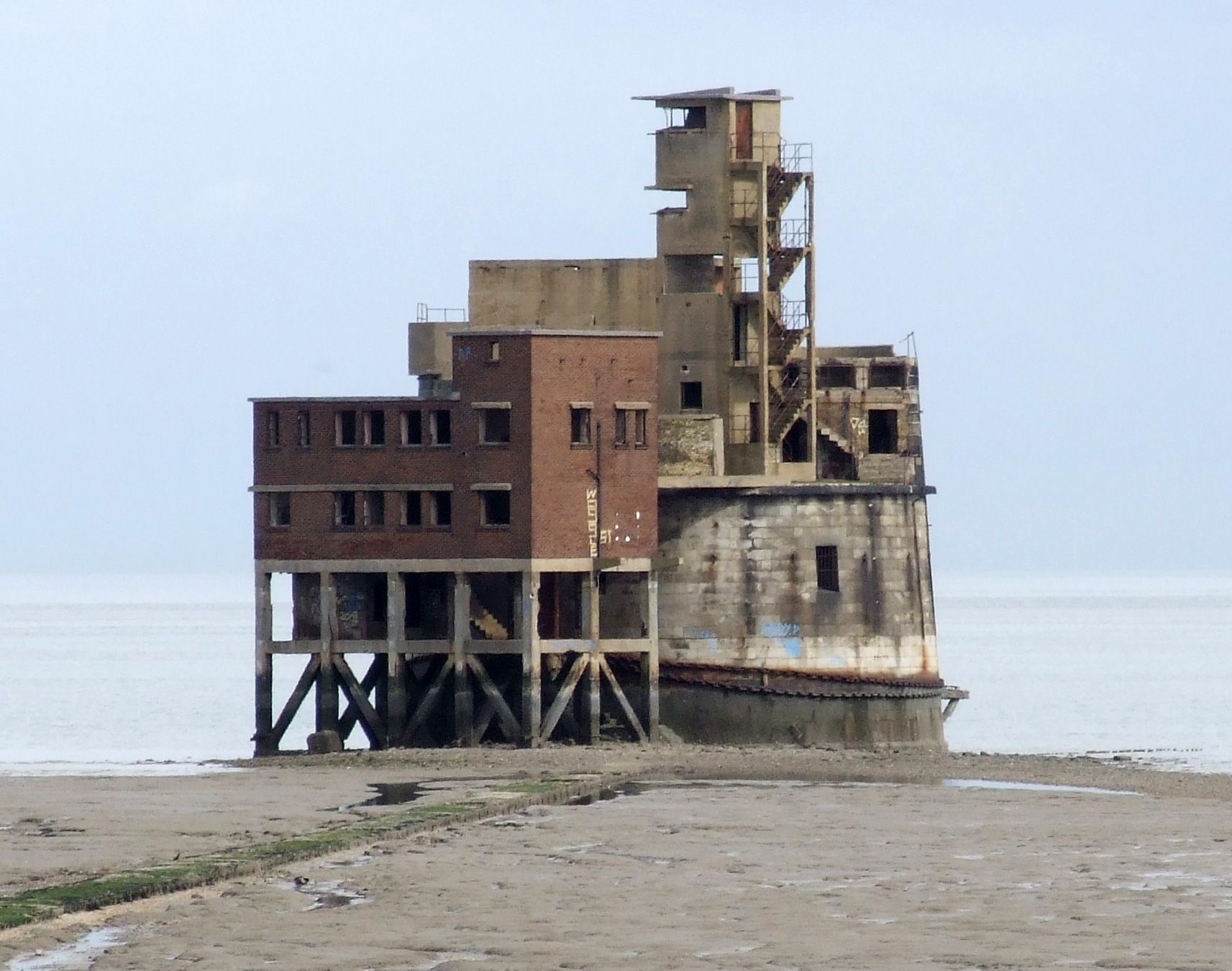
The area is covered in war battlements, from anti-tank blocks from WW2 to Grain Tower Battery, which was built in the mid 1800s, and sits 500m off the shore.
“Below Grain you’ve got the Isle of Sheppey and the Port of Sheerness between,” says Jenny. “Then you’ve got Chatham docks. The port is really important, so they were desperate to defend this area during wartimes.”
One of the unique features of the English Coast Path is that the legislation means that the route can roll back with the changing coastline, so you won’t lose your public rights of way into the sea.
Grain Tower was built in response to a perceived French naval threat in the 1850s, and over the years has housed cannons to bend off ships and huge, quick-firing coastal defence guns during WW2.
From here, the route begins east, hiking towards London, moving firstly through Yantlet Creek. “It’s the first time we’ve been able to secure pedestrian access across the creek, so it’s the first time people can walk safely off the island,” says Jenny.
The trail comes inland a little. “You’ve got some incredibly important areas of wildlife,” says Bowen. “There are breeding birds and lots of wintering birds.”
These include snow buntings and wheatears, as well as herons, skylarks, little egrets, shelduck, oystercatchers and more.

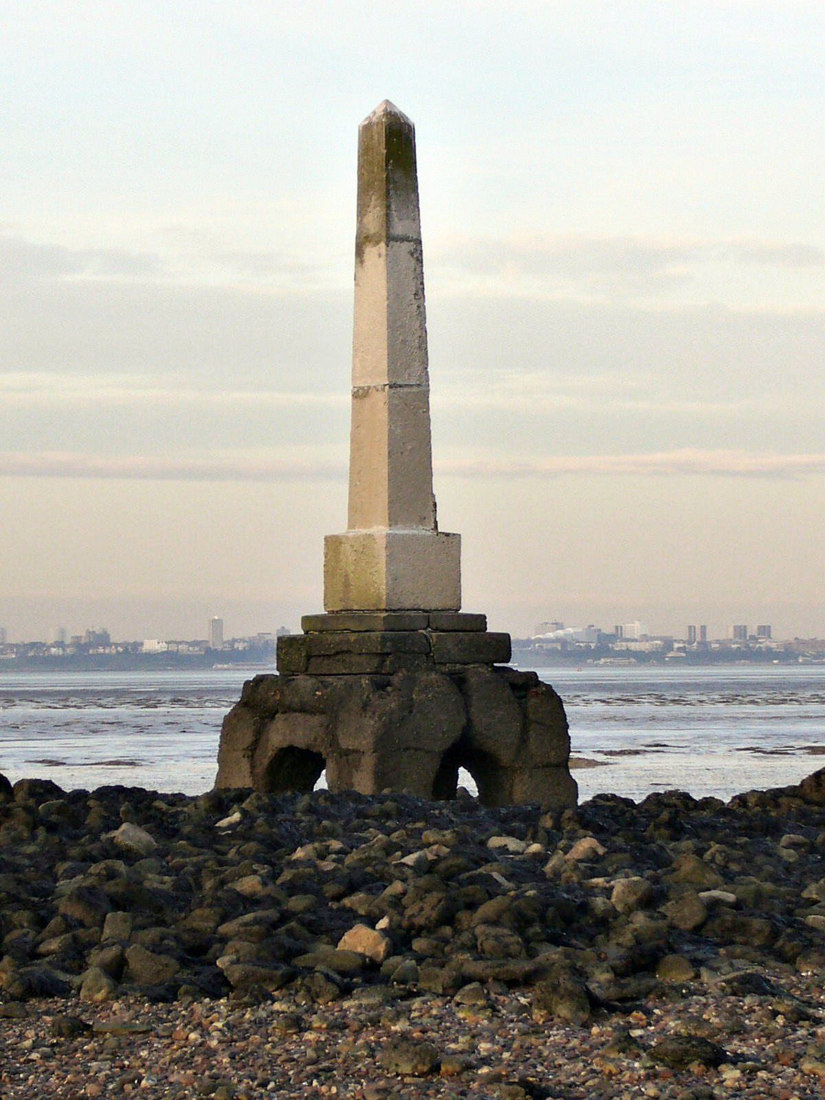
As the path comes up, “you can look out across to the London stone, which marks the edge of the Thames estuary.” It’s an 8m marker, which “used to mark the jurisdiction of the city of London.”
Jenny says the area is “heaving with wildlife,” and adds: “all along this stretch you’ve got these little pocket beaches. It’s a muddy coastline, but there are beautiful beaches to visit.”
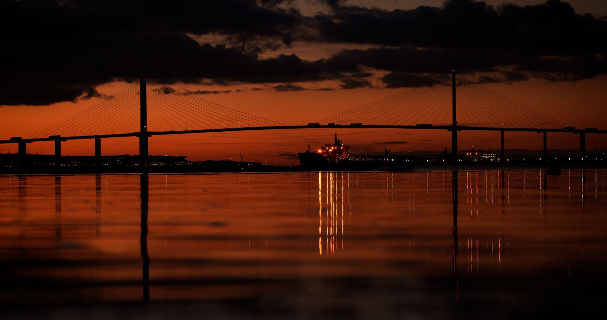
Walking along the top of the sea wall, with views out to Southend-on-Sea, you’ll see tankers passing as they head up the Thames. “It’s a really unusual sight, and quite different from other types of national trails, because you’re on a working river,” says Bowen.
The route runs into mainland Kent, and through Allhallows Holiday Park, as you progress through the H00 Peninsula.
“From Allhallows to Gravesend, you’re on your own. It’s a unique landscape. It's the old Dickensian marshes. So it's the marshes that inspired Charles Dickens to write Great Expectations. And there's a church, St. Mary's Church, where his daughter got married.”
You’ll come to the Salt Fleet Flats, where there are more pocket beaches. “As part of the development of London, the seawall is breached, allowing the water to come in and create this new area of salt marsh to offset potential damage to the port up there. It’s a really wild, rich palace for birds.”
Indeed, the RSPB Cliffe Pools reserve is just ahead. “It has the biggest population of avocets, and at the moment it’s perfect for nightingales.”
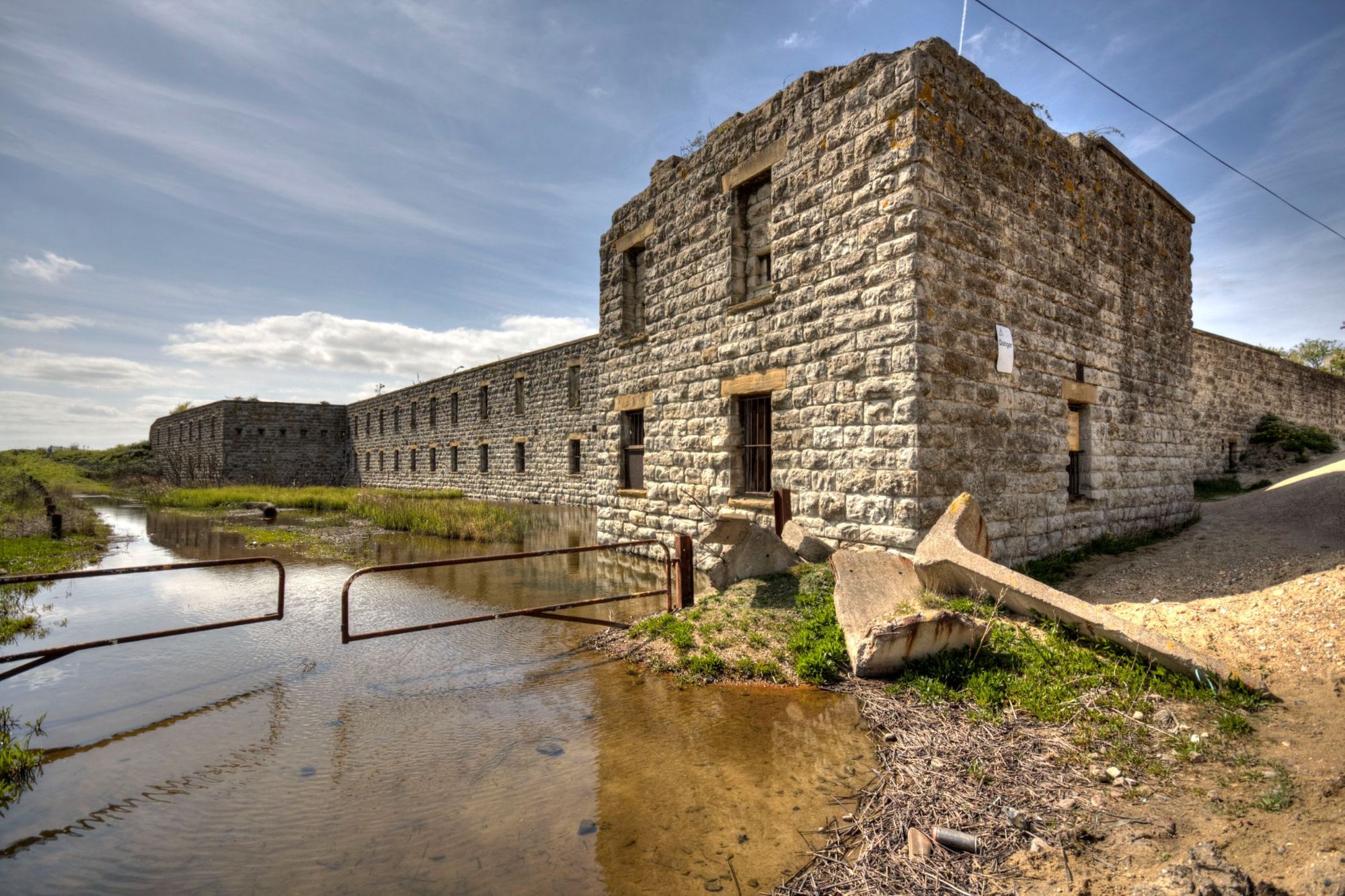
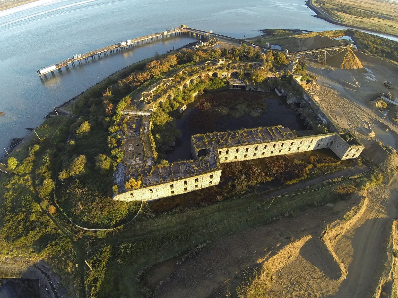
There are more military forts, the abandoned Cliffe Fort and Shornemead Fort, which have been handed back over to nature. “The area here is quite prone to erosion,” says Jenny, “and one of the unique features of the English Coast Path is that the legislation means that the route can roll back with the changing coastline, so you won’t lose your public rights of way into the sea.”
The trail passes through the town of Gravesend, then on to Swanscombe, which has been dedicated a new SSSI “in recognition of its national importance for plants, geology, birds and invertebrates,” including, the government site says, “one of the rarest spiders in the country”.
The remainder of the route contains some rather less conventional highlights. Jenny zooms in on the satellite map that she’s sharing. “You see that shadow?,” she laughs. “That’s the biggest pylon in Britain.” It’s 190 metres tall.
You later come to Crossness Pumping Station - “the biggest sewage pump in the country,” Bowen says. “It’s incredibly nice for a sewage pump,” we agree.
“The Thames used to be the sewer of London and Sir Joseph Bazalgette sorted all of that with a sewage system,” Jenny says. “He built this and it opened in 1865.”
It’s now a Grade I Listed Building with a visitor centre. The architectural historian Sir Nikolaus Pevsner described it as “a masterpiece of engineering - a Victorian cathedral of ironwork.” It sits adjacent to Erith Marshes, part of Crossness Nature Reserve, and an important spot for amphibians and water voles.
Between the giant pylon and the sewage stop (not a descriptor I’ve written before, I must say) there are various train stations - Chafford Hundred, Purfleet, Greenhithe for Bluewater, Swanscombe and Stone Crossing - providing easy access to join the trail from London.
We’re an island nation, and we have this draw to the coast. To create this long-distance walking route, which is clearly marked, is quite amazing.
Continuing on, you come to the Royal Arsenal, which (as well as being a DLR stop) once housed one of the UK’s largest munition factories. There are statues by the sculptor Peter Burke here, and a row of Tuscan-style Cypress oaks. “The whole area is undergoing a regeneration, and I think that bringing people along the Thames is another contribution to that,” says Jenny.
From here, you’ve got the Ferry terminal, and the London Clipper service.
“Our trail starts at the point where the first pedestrian crossing of the River Thames is, at the Woolwich Foot Tunnel,” she says. “Here it becomes the Thames Path."
I finish our chat by asking Jenny how important it is to be able to connect people with this sort of nature, particularly in a megacity like London.
“It’s the driving force behind the coastal path,” says Jenny. “Over the last period, more than ever, we’ve come to understand the importance of green and blue spaces, and that they’re not just for walkers or tourists - they’re for everyone.
“We know that the mental health benefits are huge. We know that the economic benefits are huge, which contribute to that, and the physical benefits. So it’s really part of Natural England’s mission to connect people with nature. We’re an island nation, and we have this draw to the coast. To create this long-distance walking route, which is clearly marked, is quite amazing.”
Inspired? Check out our range of adventure holidays in the UK!