

Hiking in Wales gives you a hugely varied choice of views and landscapes. As well as its famous mountains, like Mount Snowdon and Pen y Fan, it has 870 miles of coastline linked up in a single long distance footpath. Wales' three National Parks - Snowdonia, the Brecon Beacons and the Pembrokeshire Coast - cover an impressive 20% of the country. You can expect everything from long sandy beaches to sheer craggy mountains, with most things in between too.
Obviously, with so much choice, the best hikes in Wales form a list as long as your arm. If you like being outdoors in the elements, it’s a country that keeps on giving all year around. So rather than overwhelm you with options, consider this a flavour of what hiking in Wales has to offer. They vary from serious mountain days out to more relaxed coastal adventures, but all can feel the brunt of the wild Welsh weather. Choose your hiking days well.
Here are some top hikes in Wales, from lesser-known gems to absolute classics.

7 of the Best Day Hikes in Wales
1. The Snowdon Horseshoe (Pyg Track and Watkin Path)
Length: 12 km
Ascent: 800m
Start point: Pen y Pass
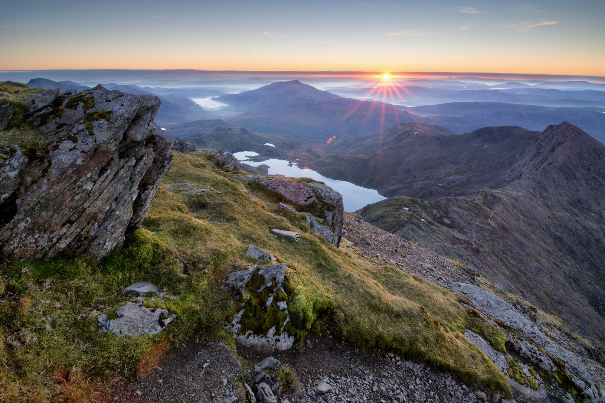
Mount Snowdon is the highest mountain in Wales and part of the Three Peaks Challenge. Many people slog up and down the same way, taking the shortest route possible to the top from Pen y Pass or the longer, more gentle ascent along the route of the railway line. The Snowdon Mountain Railway runs from outside Llanberis to the very top of Snowdon during summer.
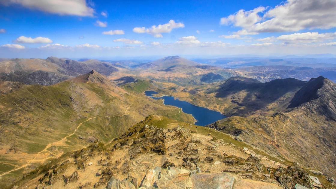
There are plenty of ways to climb Snowdon but this horseshoe is, in our opinion, the best circular hiking route that takes in the summit. You get views down to Llyn Llydaw from all directions and off-piste ascent that joins up with the quieter Watkin Path.
From Pen y Pass car park, initially take the wide and flat Miner’s Path past Llyn Teyrn. At the shores of Llyn Llydaw, you are right at the bottom of the horseshoe, with mountain ridges rising up on each side. Snowdon rises high above the lake in front of you.
Cross a small river and head uphill onto the spur to your left. There is a small path that leads you up and left of the crags as the drop gets steeper below you. The path may be patchy but the steep ascent is worth the view back down over Llyn Llydaw. Follow the curve of the ridgeline around to the right until it joins up with the Watkin Path - a distinct track. Continue uphill on this path until you reach Snowdon’s summit cairn and trip point.
To complete the horseshoe, head north and downhill from the summit to the standing stone that marks the start of the Pyg Track. Follow this track down, back towards the lake, staying high when given an option. Eventually, you’ll pass through a gate at the base of Crib Goch and finally return to Pen y Pass. It is possible to take the Crib Goch ridge, rather than the Pyg Track below it, but this is a grade 1 scramble (not hiking) and is usually very windy and exposed.
It is very hard to get parking at Pen y Pass in high season, so arrive early or catch the bus up from Llanberis. There is a youth hostel just the other side of the car park if you’d like to stay in the area for several days.
2. Pen y Fan Horseshoe
Length: 30km
Ascent: 900m
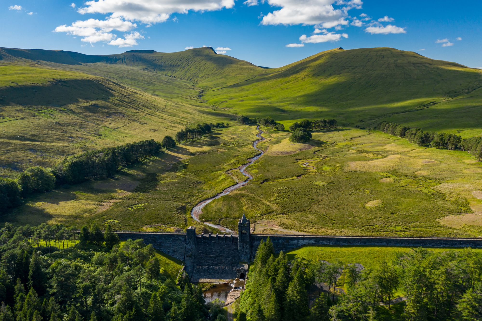
Start point: Talybont Reservoir Car Park, near Brecon
Pen y Fan is not the tallest of mountains, but it’s certainly a classic. Located in the Brecon Beacons National Park, it’s a not too shabby 886m above sea level. What makes it so appealing is the fantastic cliff-like face, with distinctive horizontal lines in the crags, making it look like a pyramid. The peak and some of the surrounding area is owned and maintained by the National Trust.
Most people hike directly up to Pen y Fan on the wide track from the National Trust car park at Pont ar Daf. We’re starting from the other side of the mountain. You’ll have this hike almost entirely to yourself, except for the summit cairn of Pen y Fan.
From the car park at the north end of Talybont Reservoir, either walk up the quiet country lane or cross at the dam and take the bridleway through the forest, part of the Taff Trail. Both ways take you to a corner in the road below the Blaen y Glyn Uchaf waterfalls. Follow Taff Trail signs through Taf Fechan Forest until you reach the edge of the forest. Then turn left and drop down into the valley to cross the exit river from Upper Neuadd Reservoir. There are great views across the reservoir, of the horseshoe and Pen y Fan in the distance.
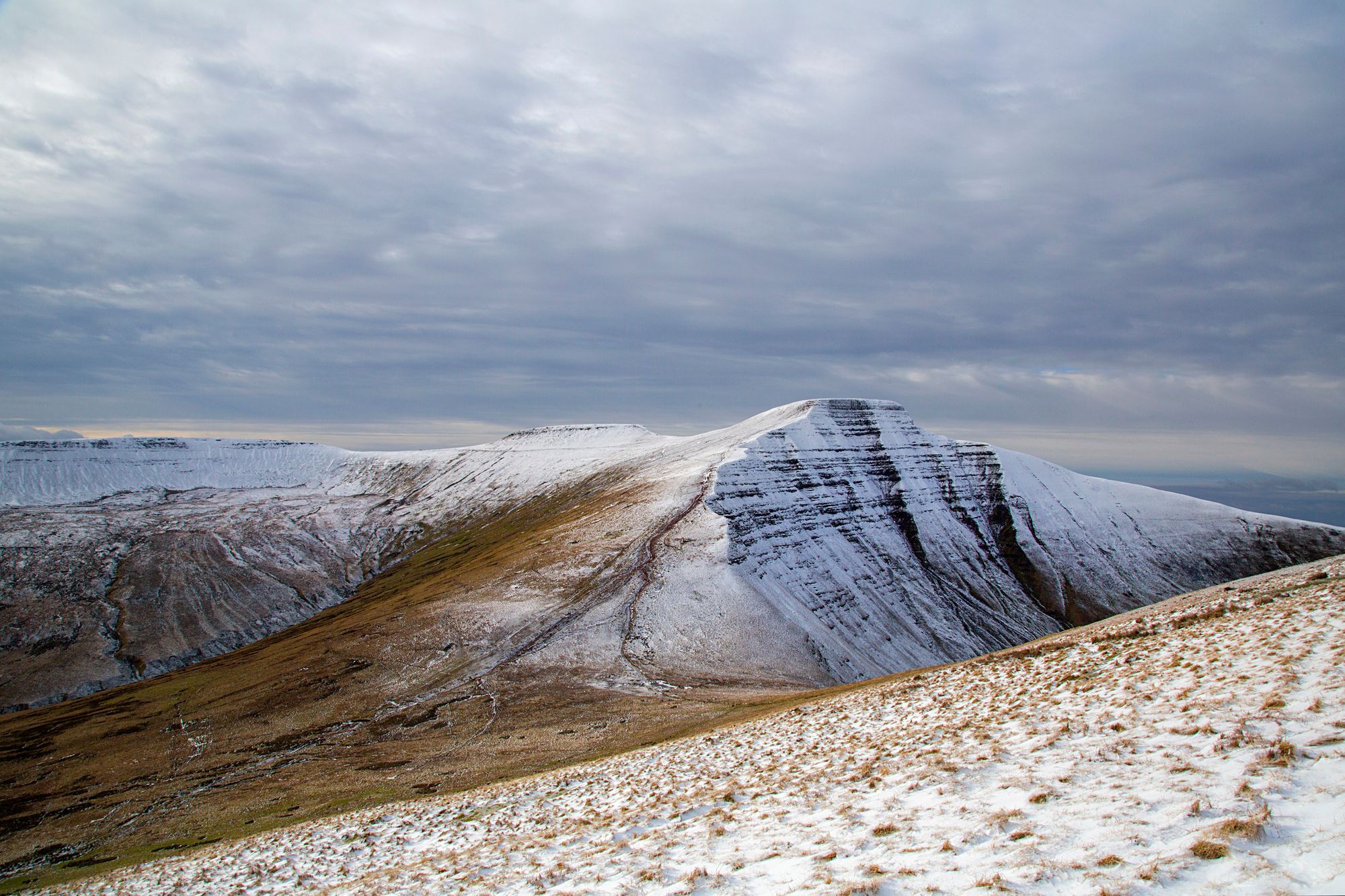
Take the small, steep, grassy path up to the ridgeline. At the broad crest of the mountain ridge, turn north and follow the clear path towards Corn Du. There are even more fantastic views over the valley and the distinctive broad-topped mountains in the area. Pop up to Corn Du summit cairn and then across to Pen y Fan on the wide stony path. On a clear day you can see as far as the Bristol Channel and Exmoor from the top.
Your return route takes you over two more peaks, Cribyn and Fan y Big, both likely to be empty again. Just past Fan y Big, as the left hand ridge starts to curve around, split off to the right and follow the Beacon’s Way on a gentle descent back to the waterfalls. From here it’s easy to return to the car park through the forest or on the road.
3. Cadair Idris via the Minffordd Path
Length: 10km
Ascent: 850m
Start point: Dôl Idris Car Park at Minffordd
If you’re into a bit of legend and folklore, Wales has plenty of tales set in its mountains. Cadair Idris has more than its fair share. The name means Chair of Idris, referring to either a giant called Idris or a 7th Century prince of the same name who won a battle on the mountain. It’s also said that if you spend the night on Cadair Idris, you’ll come down in the morning either a poet or completely mad.
There are three main paths to the summit. The Pony Path is the longest but easiest to climb. The Fox’s Path is the most direct route, but involves a slightly sketchy route up a scree slope. But the Minffordd Path winds up along the rim of Craig Cau above a glacial lake - and you may as well complete the circuit while you’re up there.
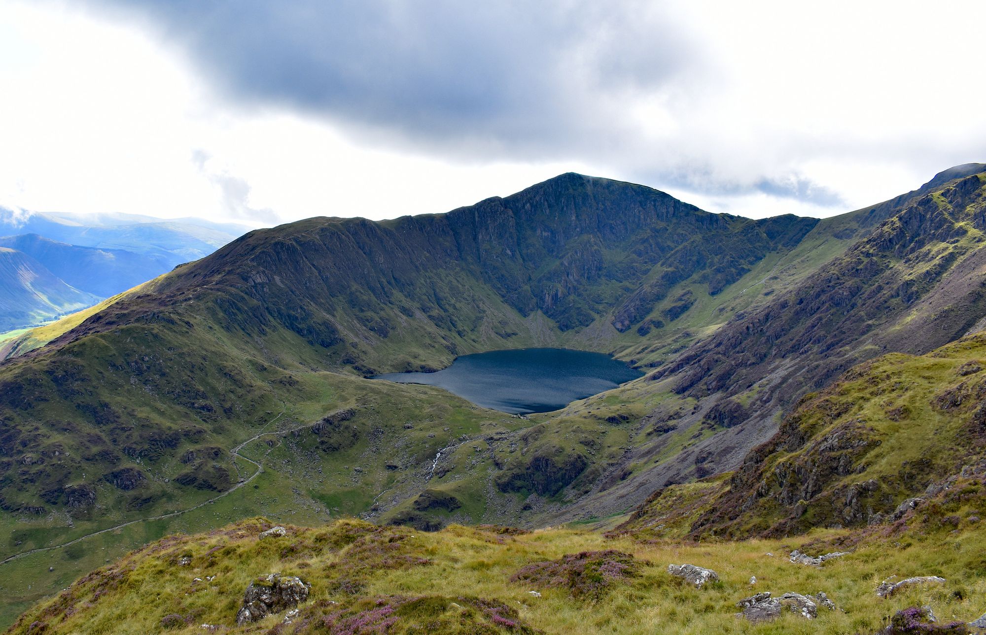
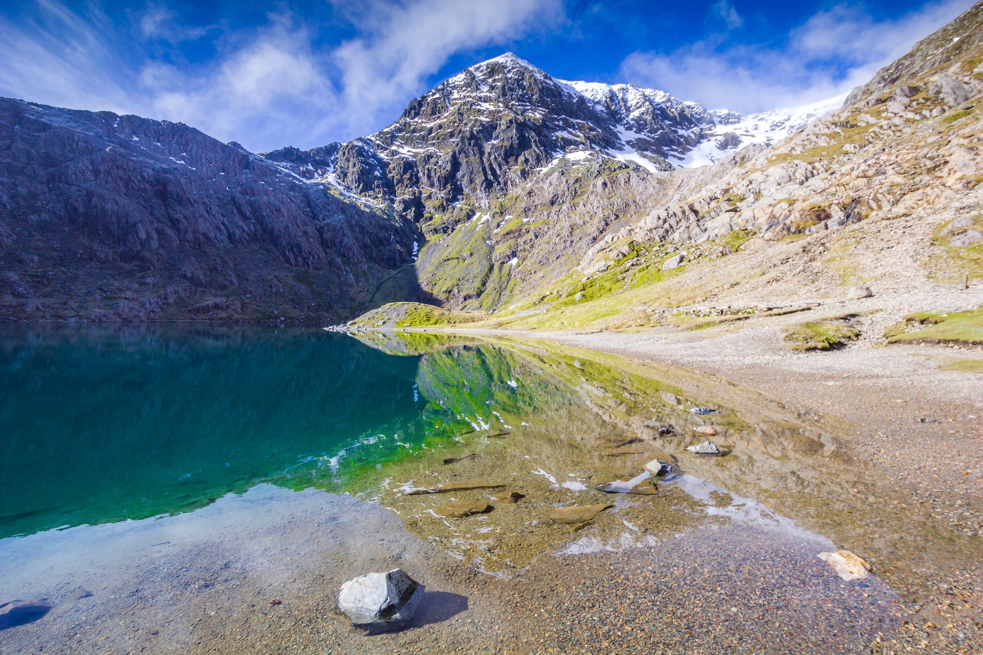
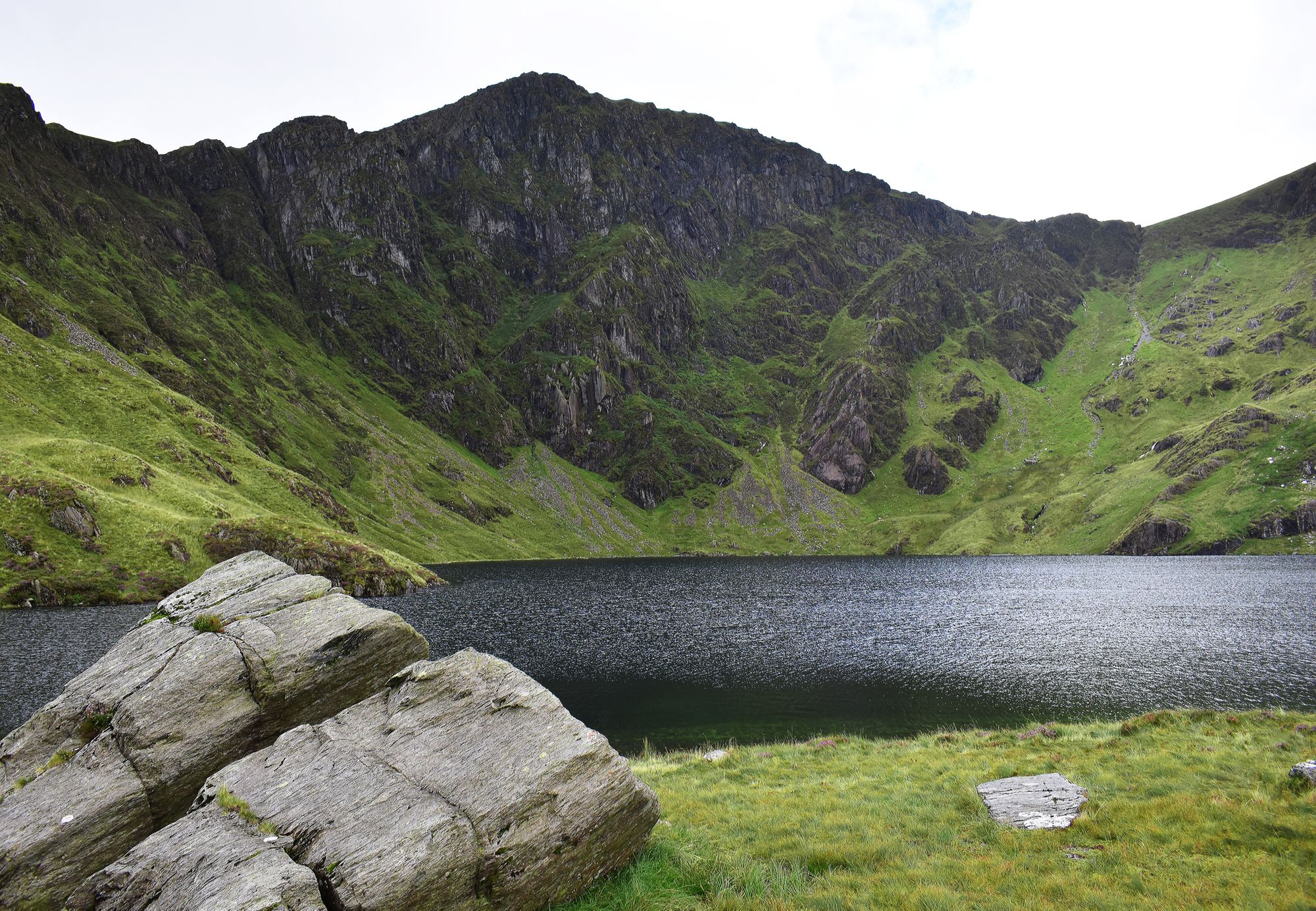
From the car park, head out onto the Minffordd Path, up a steep and wooded gully alongside the stream. The path bends left below some crags at the plateau, providing a sweeping view of Llyn Cau and the mountains you’ll be climbing. Head up through the crags, carefully sticking to the path, and onto the horseshoe ridgeline. The landscape carves out a steep bowl below you to the right, with jagged rocky outcrops. Staying away from the edge, follow the ridgeline around above the lake and up the final little ascent to Penygadair - the high point of Cadair Idris. There is a trig point and a stone summit shelter with a roof to hide from the elements under.
The path continues down the center of the ridge, this time with the steepest crags on your left and Llyn Cau on your right. Follow the path that descends close to the wall from Mynydd Moel. It is rocky and uneven, but eventually funnels you down to the corner of a drystone wall. Cross the wall and take the footpath right to rejoin the path you set out on.
4. Offa’s Dyke Path and Llanthony Priory
Length: 19km
Ascent: 700m
Start point: Car park at Pont Rhys Powell near Stanton
Offa’s Dyke is the Hadrian’s Wall of Wales. Built by the eponymous King Offa in the 8th Century, it was supposed to defend his kingdom of Mercia from the welsh. Since the Offa’s Dyke Path, which follows the route of the original boundary, is still broadly along the border between England and Wales, we’re guessing it worked! The original dyke was an earth bank with a wooden or stone wall along it in some places.
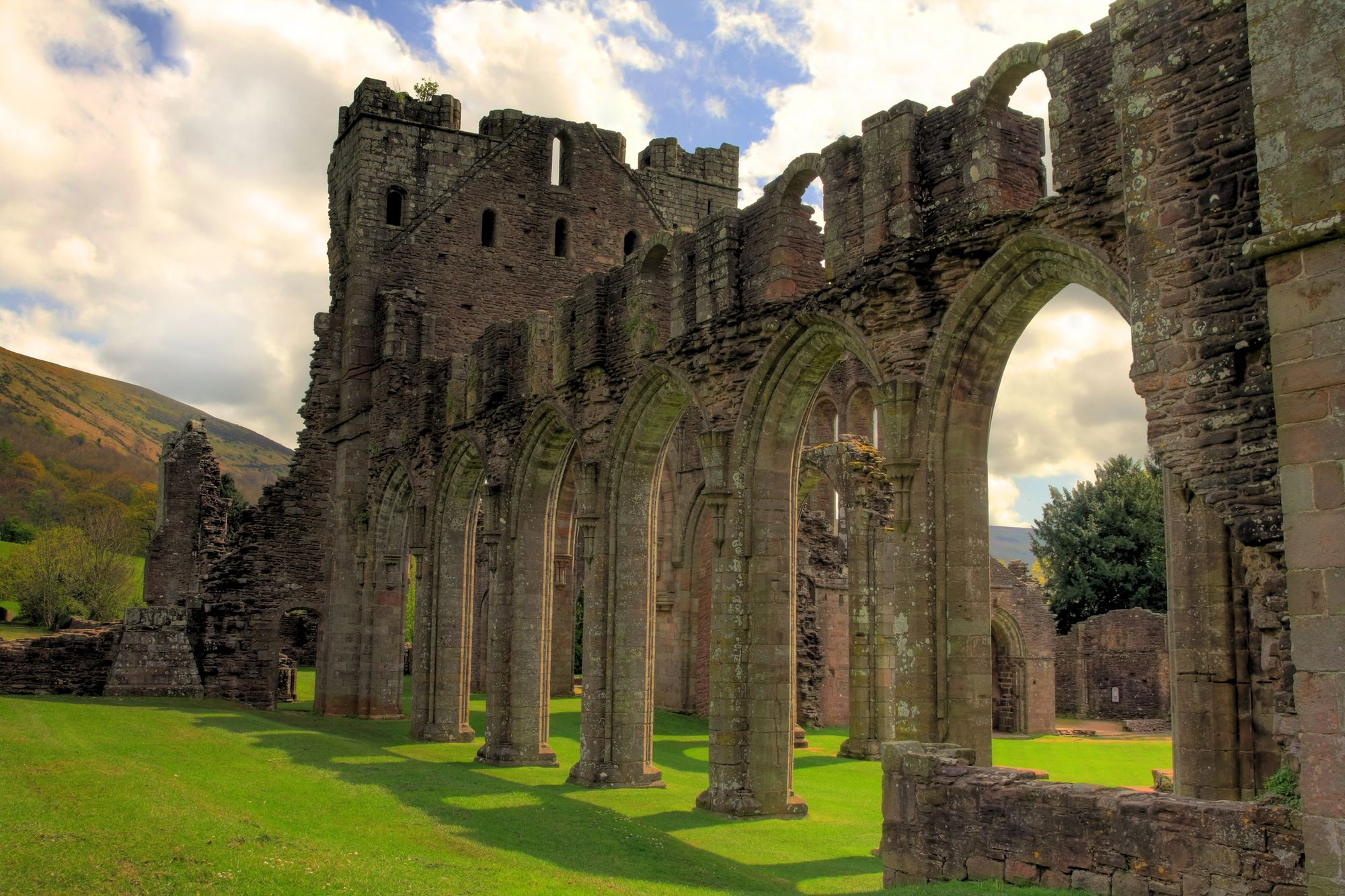
Out of the 177 miles of the Offa’s Dyke Path, it was hard to choose the best section. But the part by Llanthony Priory, in the Black Mountains, is a beautiful area of rural Wales. With the added bonus of a ruined priory hidden among the rolling hills.
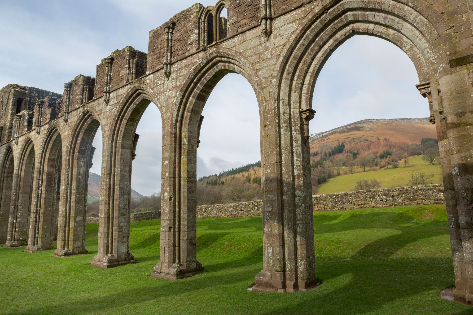
From the start point, cross the river and take footpaths, then a single track lane to Trawelleyd, where you’ll meet the Offa’s Dyke Path. Turn left at the crossroads and simply follow the footpath up and onto the shallow ridgeline, passing a trig point and an old Iron Age hill fort. Before the second trig point, turn left off the Dyke Path and start the gentle descent to Llanthony Priory. You should be able to see it in the distance. This footpath is the Beacons Way and takes you straight into the ruined arches of the Augustinian priory.
Continuing on the Beacons Way, cross the river and head steeply uphill, back onto an open ridgeline. Below Bâl Mawr, turn left and walk south down the ridge until you are level with the forest. The Beacons Way diverges right, but instead contour above the treeline to your left, slowly descending until your track turns into the end of a road. Follow this road and you’ll soon be back at your start point.
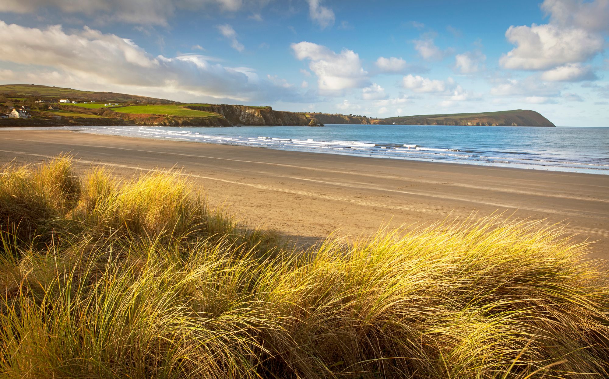
5. Wales Coast Path: Rhossili Bay and Worm's Head
Length: 16km
Ascent: 300m
Start point: Rhossili
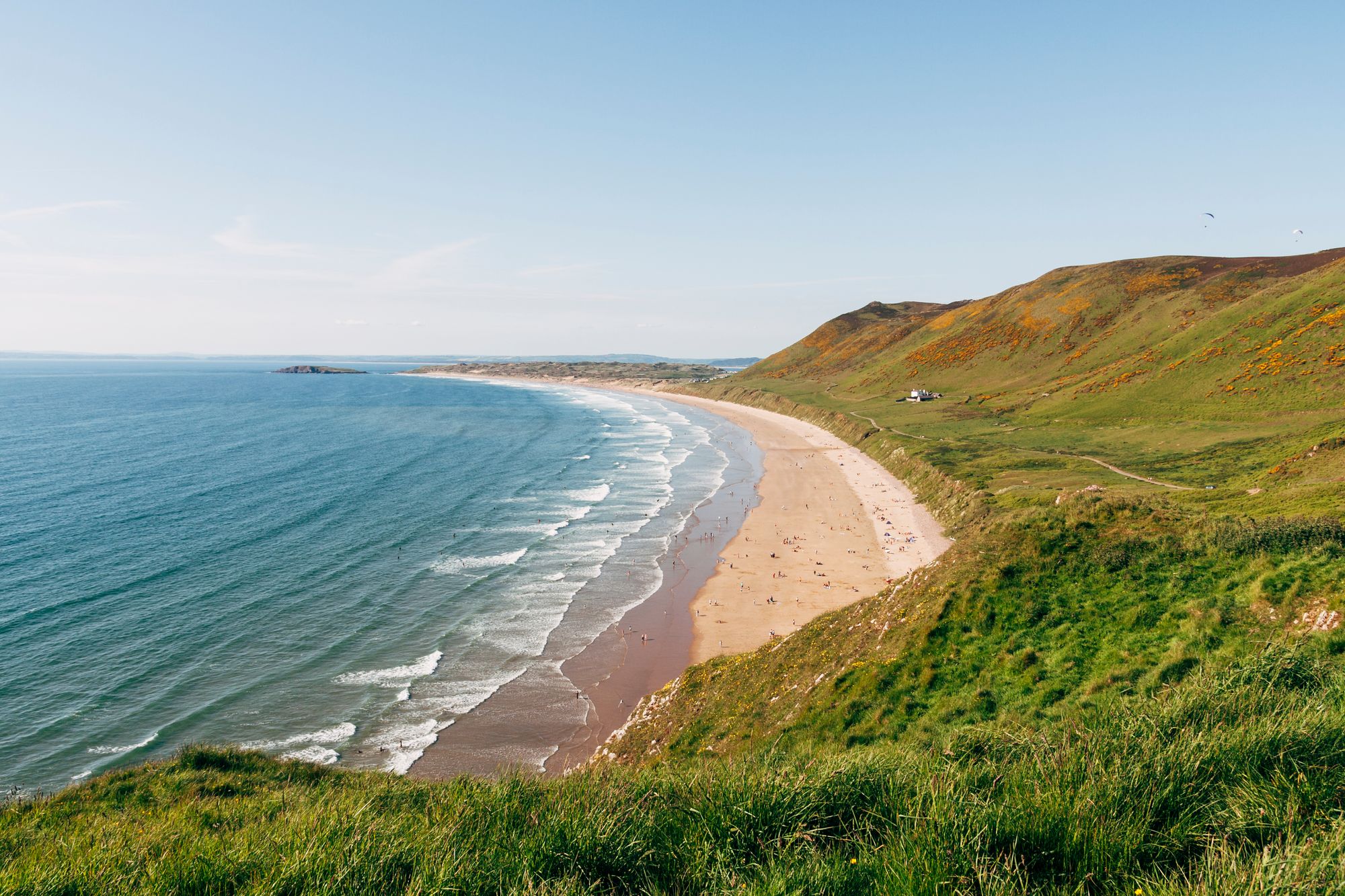
The Wales Coast Path was joined up into one complete trail as recently as 2012. It makes a 870 mile hike that starts in Chester at one end and Chepstow at the other. But that’s a bit far to recommend as one hike - it takes most people six or seven weeks to complete. So we’ve picked out a rather lovely section through the Gower Peninsula. We’re not quite ready for space tourism yet, but the cliff top view over Rhossili Bay, back towards Worms Head, looks remarkably similar to New New York - as visited by a certain time traveller in a blue box.
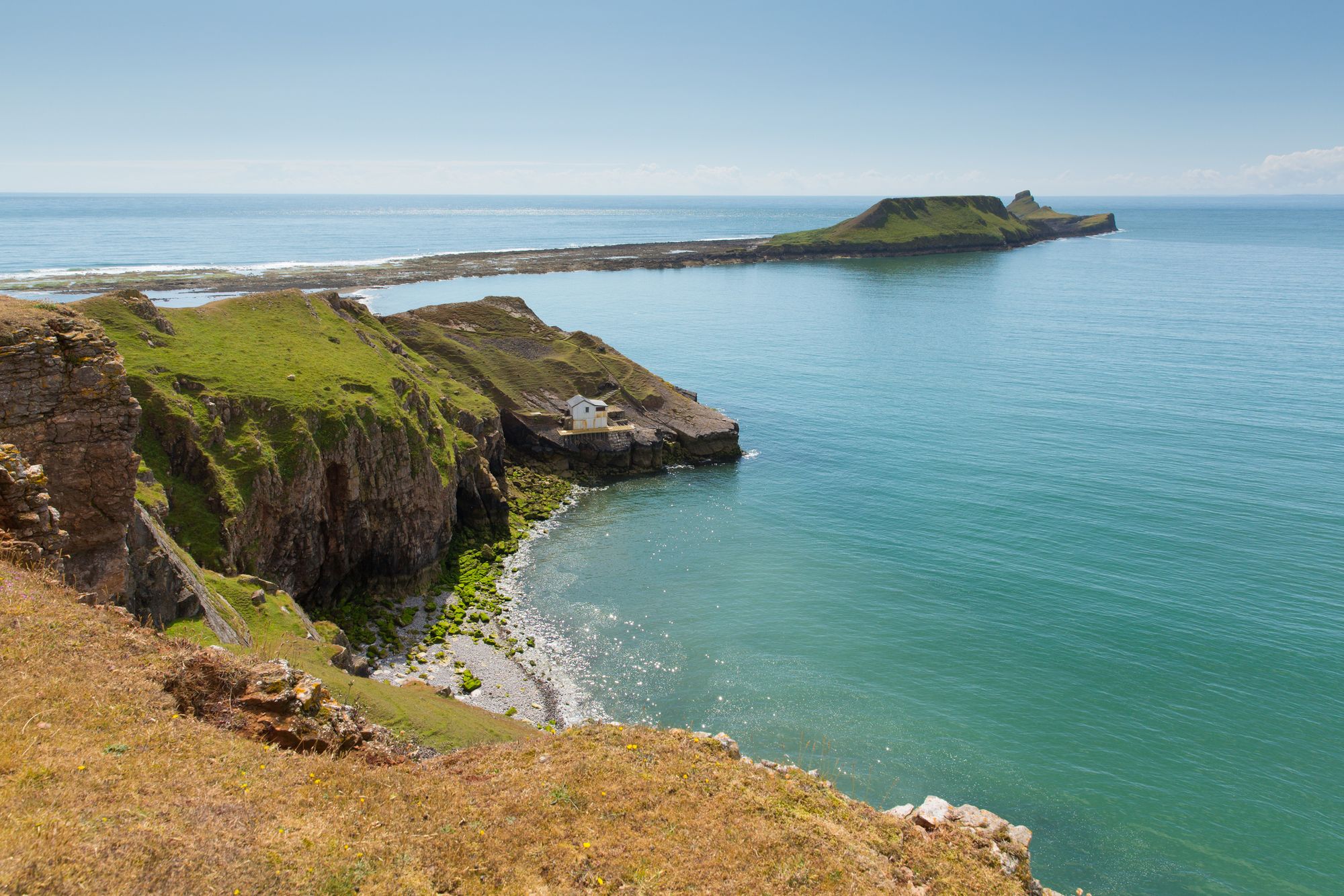
The Gower is an Area of Outstanding National Beauty. It’s also an area of outstandingly windy cliff tops - so be prepared for that. But the beauty more than makes up for the occasional gale in the face. And as Snowdon is to Snowdonia, so the Worms Head is to the Gower. That’s Worm as in fire-breathing serpent, not wriggly thing found in compost. The name is thought to date back to the Vikings because of its shape and the loud booming noises its blow hole makes in stormy weather.
This is a figure of eight shaped walk, starting in Rhossili. Take the Gower Way out of the village and up onto the hills above the coast. There is a footpath that heads straight up to The Beacon (193 m). From the trig point at its summit, you have an enormous view out to sea and over the golden sands of Rhossili Bay. Continue along the footpath above the cliffs, until it descends to Hillend. Turn left and walk back along the coast towards Rhossili, this time below the cliffs, close to the beach. This is part of the Wales Coast Path.
Follow the footpath through Rhossili and further south west towards Worm's Head. Look out for seals chilling on the rocks below. If you time your walk right, the causeway will be clear and you can walk all the way out to the end of the head. There is no footpath and sharp rocks underfoot. Make very sure you know the tide times so you don’t get caught out - there are strong currents over the causeway and there are fatalities every year.
Back above the tide line, on top of the cliffs, follow the coast path around to the next inlet. You will have fields on one side and rocky cliffs on the other. There are many rock climbing routes in the area. At the top of the inlet, take the footpath left across the fields and back into Rhossili.
It’s possible to extend the walk in either direction along the coastline, but be very aware of the tide times. Some of the Wales Coast Path crosses the long sandy beach of Rhossili Bay, which is sometimes under water. Don’t get caught out.
6. Pembrokeshire Coast Path (Fishguard to Newport via Dinas Island)
Length: 19km
Ascent: 350m
Start point: Fishguard
Pembrokeshire Coast National Park is the only National Park in the UK that’s protected specifically because of its coastline. Located in the south west corner of Wales, the coast landscape varies from craggy volcanic outcrops in the north to huge limestone cliffs further south. The National Park was opened in 1970 and the Pembrokeshire Coast Path was the first national trail in Wales. It’s a 186 mile walk that winds its way all the way along the coast, with more total ascent and descent than climbing Mount Everest.
On the stretch between Fishguard and Newport, Dinas Island is casually subverting expectations by not in fact being an island at all. Not even remotely close. It’s got iconic rocks and wildlife, like the grassy stack of Needle Rock where puffins nest. Plus the highest point on the Island, at 142 metres above sea level, is helpfully called Pen y Fan. Fair, it does just mean “top of the hill”, but that name’s kind of already taken.
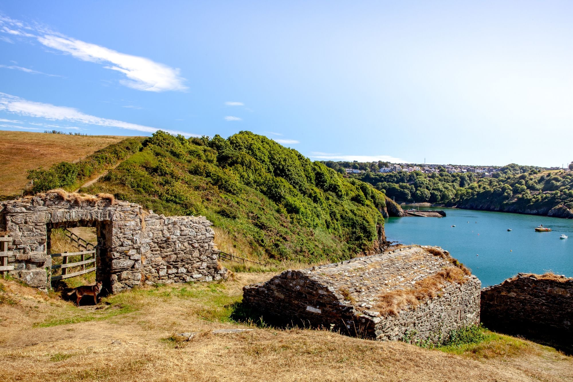
In Fishguard, find your way to the sea and pick up the well marked coast path. Head right as the path winds around the cove and harbour, then up onto the hillside with views down over the breakwater. On Castle Point, just outside of Fishguard, the coast path goes right through the remains of a fort, complete with cannons.
Stay high and walk high above the sea cliffs jagged spurs of rock that reach out into the waves. Soon you’ll reach the almost round peninsular of Dinas Island. It’s possible to cut the corner by a footpath above the woods. Otherwise, continue on the coast path all the way around, taking in Pen y Fan and the ruined church of St Brynach which was wrecked by storms in the 1850s.
Keeping the sea on your left, continue along the coastline to the golden beach of Newport Sands ahead. To complete this walk, you’ll either need a car at each end or to make use of the local bus service. You probably want the T5 but be sure to check local times and services to make sure. If you miss the bus, you might have to turn around and go back the way you came! You can walk in either direction, but the prevailing wind is usually westerly.
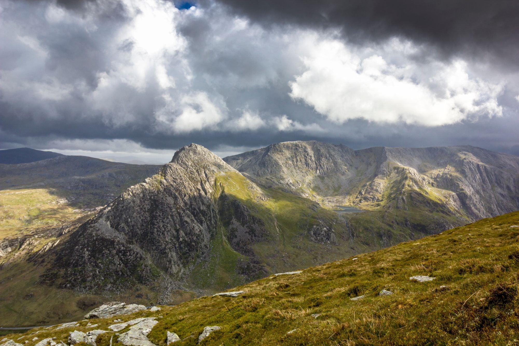
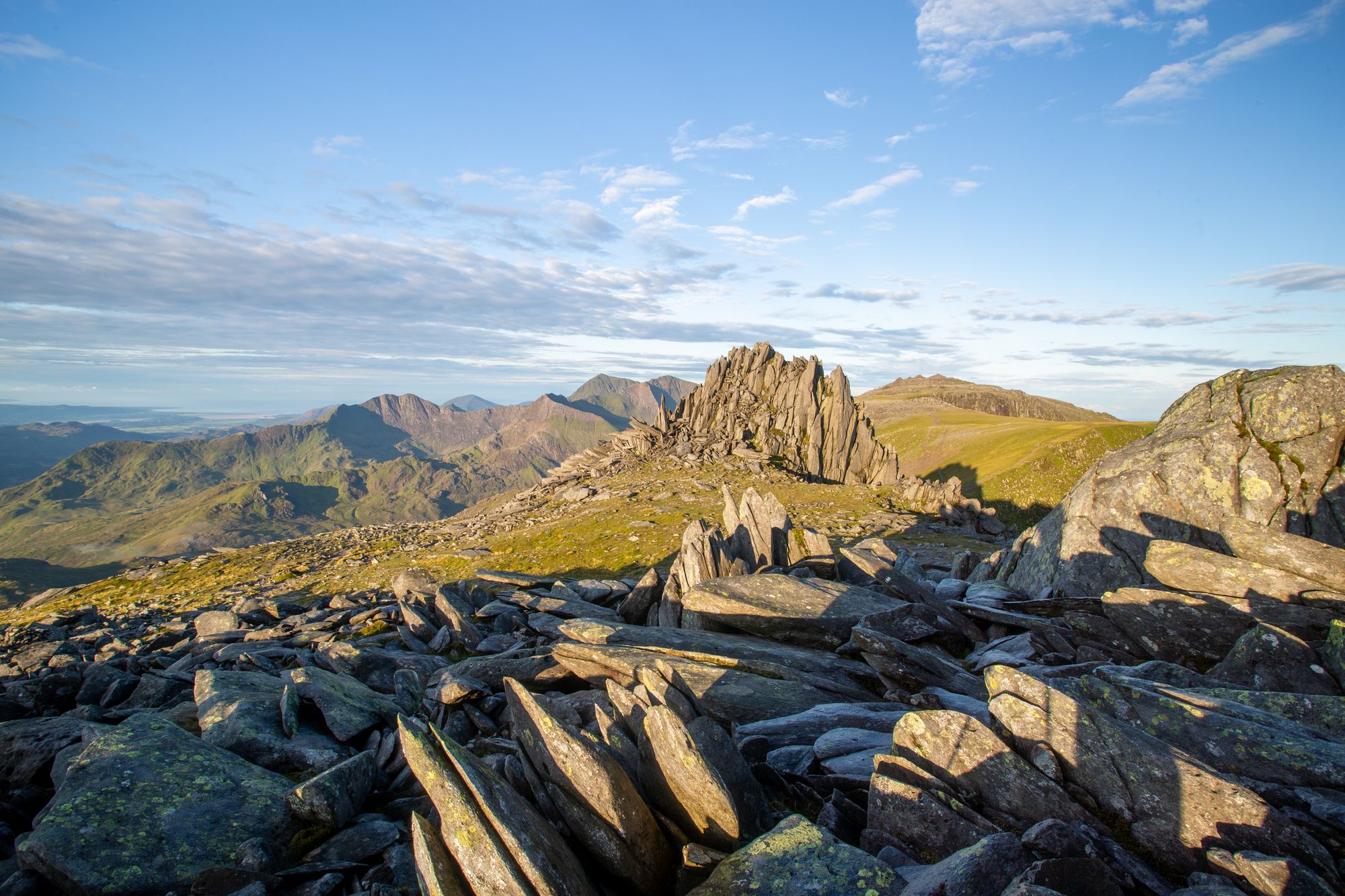
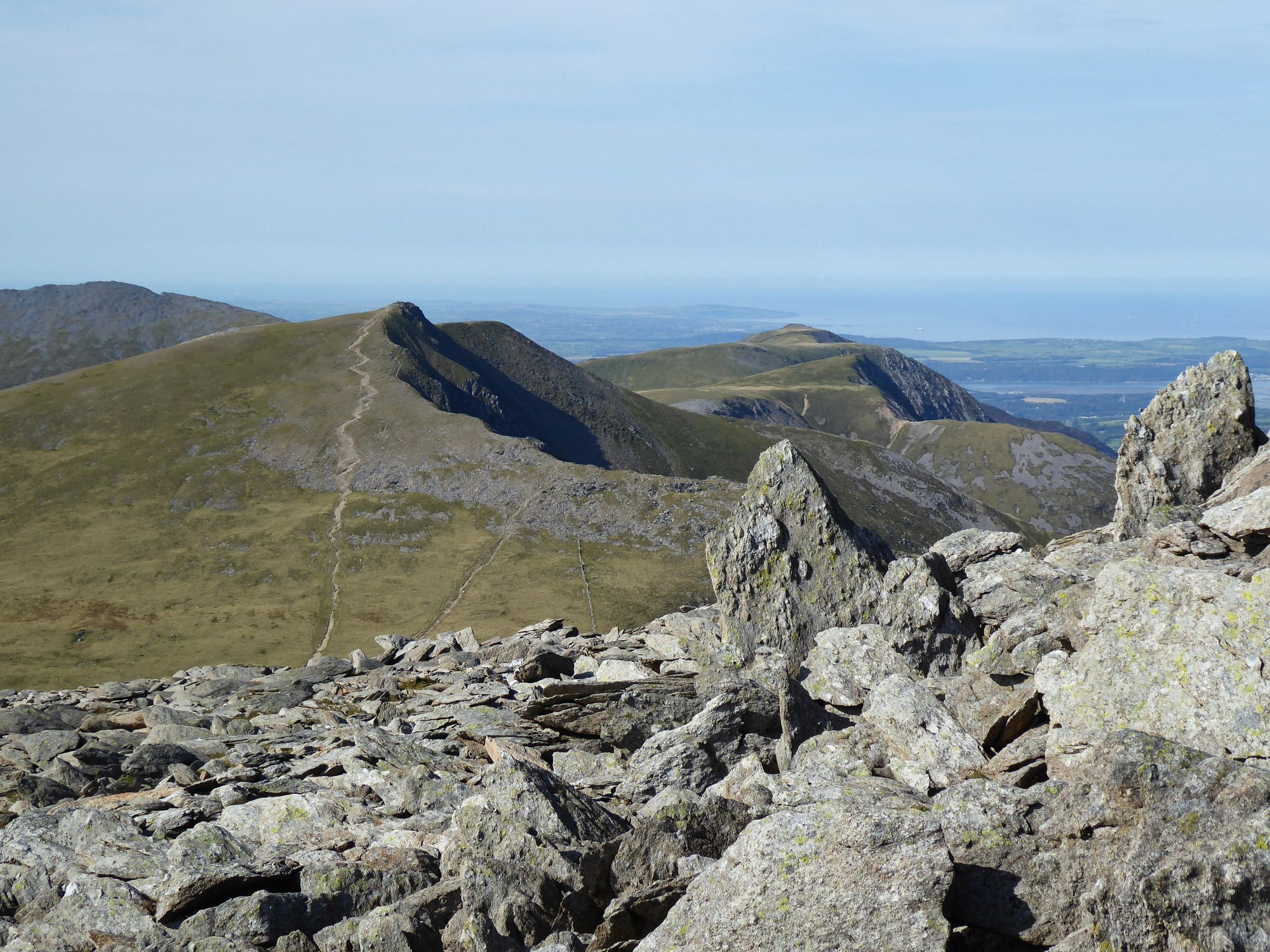
7. The Glyders Ridge Walk, Snowdonia
Length: 19km
Ascent: 1300m
Start point: Capel Curig
The Glyderau, affectionately known as The Glyders - are a collection of mountains along a gorgeous long ridge in Snowdonia National Park. The ridge is very close to Snowdon, just the other side of the road, and yet its peaks are completely empty by comparison.
It’s possible to walk the whole ridge in one day, starting from either Capel Curig or Nant Peris. Which direction you do it in will depend on the weather - not much fun walking into the wind all day - and if you prefer a very steep uphill over gradual ascent. However it is a very committing hike and once you’re on the ridge there are limited ways to escape back down to the valley.
Starting at the car park in Capel Curig, head north along the track and immediately up onto the very tip of the ridge you’ll be walking along for the rest of the day. The path ascends gradually and continuously to the first peak, Y Foel Goch at 805m. Continue down to the col and up the other side to Glyder Fach. You’ll have great views across to Snowdon if the weather is clear. If you stray off the path a little on the descent, you might get a view of the incredible rocky massif that is Tryfan, dropping steeply down on your right.
From Glyder Fach, continue past the Castle of the Winds to Glyder Fawr. The ground here is very rocky and the path may not always be clear. Take the path steeply down to Llyn y Cwm and then straight up the side of Y Garn, above the Devil’s Kitchen. Nant Peris is far below the sloping sides of Y Garn but there are a few more peaks left to bag. Keeping the steep cliffs to your right, take the undulating path over Foel-goch and around the steep bowl of the river on your left. Depending on time and peak-bagging prowess, you could pop up to Mynydd Perfedd and Elidir Fawr. Finally, make the long steep descent along the Afon Dudodyn gorge and into Nant Peris.
As this is a linear walk, you’ll need two cars to do it, or some logistics with the Snowdon Sherpa bus which runs from Llanberis to Betws-y-Coed. Both options are do-able with some thought and the ridge is worth it on a clear day. If you’re going to do this be absolutely sure that the bus is running and you can make the last bus! It’s a long old walk into Llanberis after a big day on the hill.
Check out our full range of hiking and trekking holidays around the world.