


Lake Como stretches nearly 50 kilometres from north to south, contained by 200 kilometres of shoreline and boasting the title of "Deepest Lake in Europe".
It glitters among the mountains just 50 kilometres north of Milan – the ideal gateway with three airports and fast train connections throughout the continent. Lake Como forms an inverted ‘Y’ shape, with each branch surrounded by beautiful Alpine peaks, topping 2500 metres in places. The highest peaks surrounding the northern tip of the lake. It’s nice. Like, seriously nice. One of those places you hear about often, and then wonder if it lives up to the hype, and then go there and are like… yup, fair play, this is nice.
The undeniable beauty of the region is another pull, and views from the various trails are jaw dropping. Woods and pastures surround ancient stone villages, with snow-clad peaks above and the inky blue lake below: the scenery is nothing short of epic. Add in hearty mountain fare and a balmy microclimate – what’s not to love?
The Top Hikes in and Around Lake Como
1. Monte Legnone
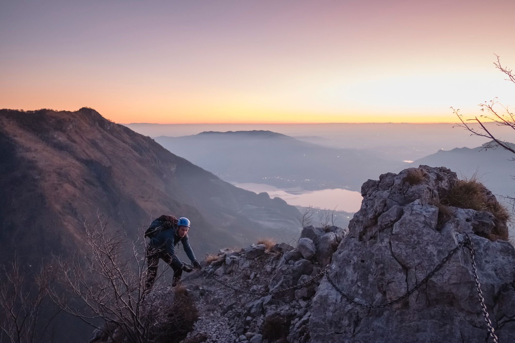
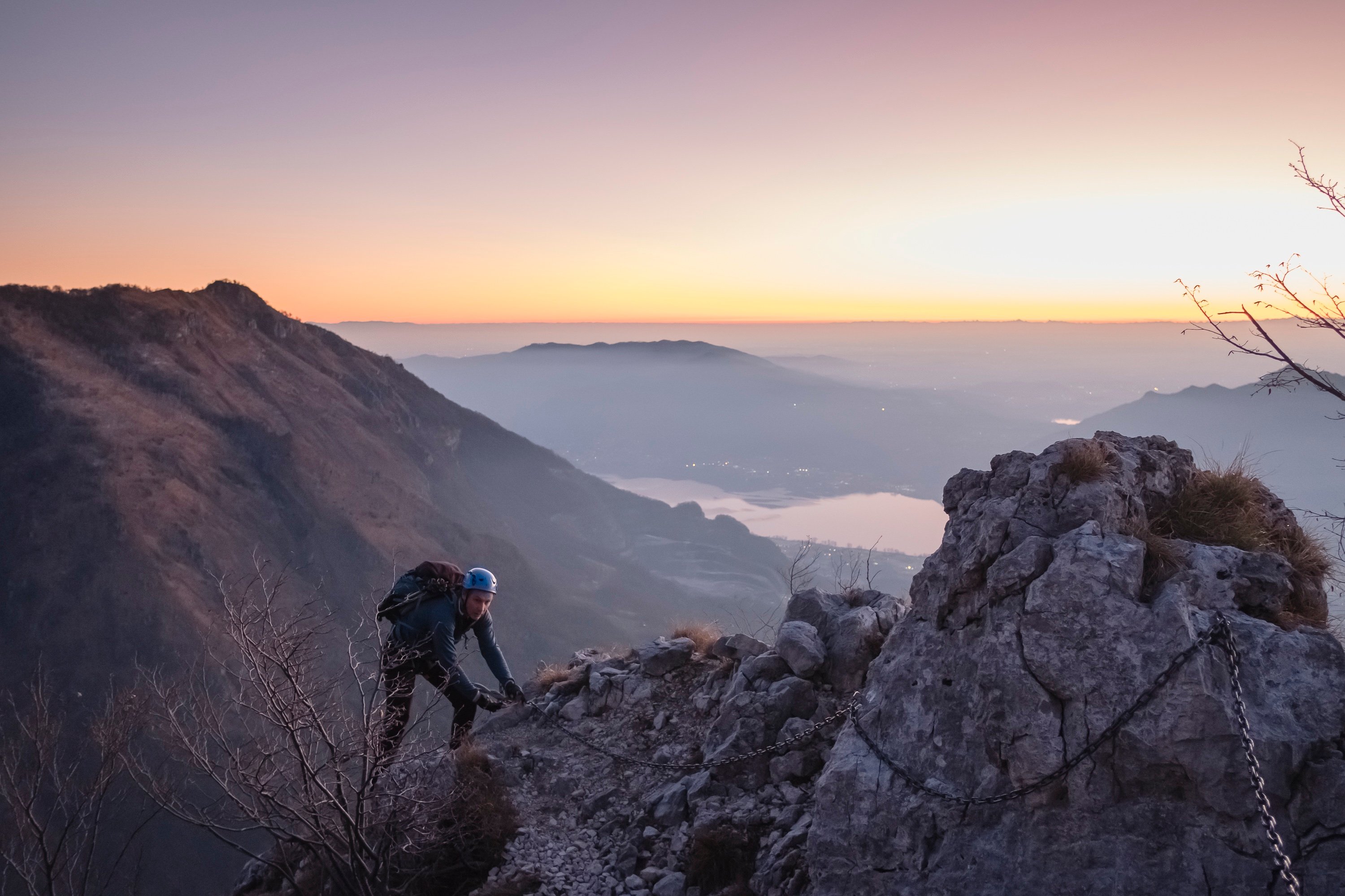
This great pyramid of a mountain can be seen from most parts of the lake, rising straight from the 200 metre waterline to its 2610 metre summit. It’s a classic climb, one of the most popular of the Orobic Alps and when you see the mountain you’ll understand the allure. Standing at the junction of Lake Como and the Valtellina, this great triangular icon promises a stunning panorama to those who reach the summit.
The ‘Via Normale’ is the usual approach, beginning at the Roccoli dei Lorla refuge and following the ridgeline for a total of 1150 metres ascent in around four hours. This is a fairly technical hike suited to experienced climbers with some stretches of fixed cable and some exposed sections.
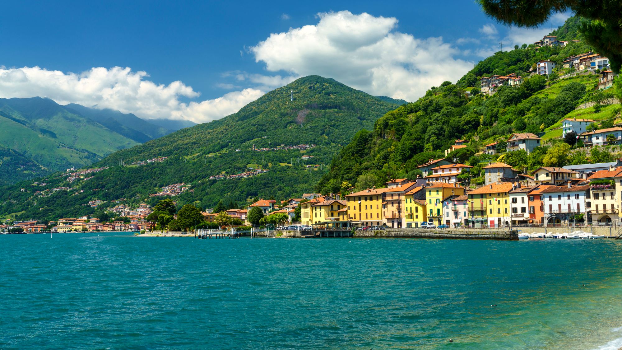
2. Via dei Monti Lariani
Stretching 125 kilometres above the western shore of the lake, this trail is the definition of scenic. It’s divided into four sections each one requiring two or three days of leisurely walking. The average altitude is around 1000 metres, meaning it’s around 800 metres above the water, but this does fluctuate in parts. Trailheads are at Cernobbio in the south and Sorico in the north, but sections can be easily tackled individually as there are plenty of connections down to the lakeside towns along the route.
Agriturismo or refuge accommodation is relatively easy to come by on or near the route, meaning multi-day treks are a possibility. The terrain is generally easy, following old mule tracks and quiet lanes through woods, meadows and timeworn villages, dipping in and out of side valleys revealing ever more spectacular views. After prolonged periods of rainfall there are likely to be some deep streams to cross, but otherwise there are no serious challenges on this walk.
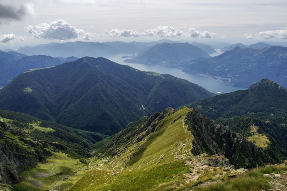
3. The Dorsale
Between Como, Lecco and Bellagio the region is known as the ‘Triangolo Lariano’, an aptly named triangle of peaks which gradually drop into undulating hills as you approach Bellagio. The Dorsale trail is a panoramic 2-day route beginning in Brunate, which can be reached from Como town on a short, steep funicular railway. From the Volta lighthouse in Brunate, (named for Alessandro Volta, the inventor of the battery) follow path number one. It is waymarked with red and white signs and follows clear tracks through woods and pasture towards the ridge of Monte Bolletone , topping out at 1318 metres. From here the trail descends to Bochetta di Lemma and views over the water begin to open up.
You can stay overnight at one of three refuges, two of which are staffed and offer great meals. The next day the trail follows the ridge of Monte Palanzone, dipping slightly before ascending again to the top of Monte San Primo at 1686 metres, where the long descent towards Bellagio begins. It’s a varied trek with incredible views which doesn’t require any technical knowhow and can be tackled by anyone with a basic level of fitness.
> Check out our wild hike collection, which summits mountains in Europe and across the world
4. Alta Via Lariana
This high-level route hugs the ridge line, which marks the watershed between Italy and Switzerland, for a demanding 58 kilometres. This is a five-day trek for experienced mountain walkers involving nights in mountain shelters and refuges, following days traversing the high summer pastures and rocky peaks of the Lepontine Alps. It’s a lofty, empty trail linking 10 separate peaks - most of them over 2000 metres high - above the northwestern corner of the lake with dramatic views of Monte Legnone, the Orobic Alps and the Valtellina Valley towards Bormio.
The highest point is Monte Cardinello, standing at 2520 metres, and although the entire route unfolds at altitude, there are only two sections which are equipped with chains. May and October present the best climatic conditions, whereas the high summer temperatures often mean clouds build up on the peaks. Highlights of the route – other than the views and the sense of isolation – are the two staffed mountain bunkhouses: the Rifugio San Jorio right on the Swiss border and the Rifugio Menaggio, above Breglia, which are both convivial and serve great local food.
Hub towns for Lake Como Hikes
The northern tip of the lake hosts a string of towns between Domaso and Colico which make the most convenient bases for many of the outdoor activities that are available in the Alto Lario, the local name for the upper branch of Lake Como. Domaso is a hub for outdoor enthusiasts, with plenty of opportunities to windsurf, kayak, SUP, trek and MTB - as well as a good stretch of lakefront beach and a picturesque old town.
The large grassy lake shore at Gera Lario is a tempting spot for lakeside time out, and there is a shoreline path from here all the way to Gravedona for an easy evening passeggiata. Colico spreads out on the opposite flank at the foot of Monte Legnone, and the grassy shore there is one of Europe’s premier kite surf destinations. Menaggio, a little further south on the western shore, is one of the bigger towns in the area, with plenty of accommodation options and a good choice of things to do and see, plus good ferry connections for sightseeing elsewhere on the lake.
Discover our Italian adventures, and check out our wild hike collection across Europe and the world. They’re great. Trust us.