


The Rwenzori mountains in Uganda, which are home to six of the highest mountains in Africa, are better known to many by the mythical moniker, 'the Mountains of the Moon'. But while 30,000 climb Mount Kilimanjaro in nearby Tanzania each year, only around 1,000 visit the deep valleys, montane forest, jagged peaks and glaciers of the Rwenzori. Despite offering so much in terms of trails and biodiversity this remains a paradise, off the tourist beat.
You may be familiar with the Alps and the Caucasus, the Himalayas and the Rockies, but if you have not explored Rwenzori, you still have something wonderful to see...
The Mountains of the Moon is not a new term. It’s ancient - over 2,000 years old, referring to a legendary mountain range in east Africa, known for being the source of the Nile. The term comes from a Greek merchant, Diogenes, who travelled to East Africa and claimed to have found the source of the Nile - which the natives called the Mountains of the Moon due to their snow-capped peaks.
It wasn’t until 1862 that British explorers James Grant and John Speke, also searching for the source of the Nile, ventured into the Rwenzori mountains, and found the summits blanketed in white, fitting Diogenes' description. Rivers fed by the upper streams of the mountains do form one of the sources of the great river
Warfare took the Rwenzori mountains off the tourist map for decades but today, this remarkable landscape, where grassland, montane forest, jagged peaks and glaciers are layered by altitude, is one full of little-explored, world class hiking.
As British mountaineer Douglas Freshfield wrote in 1906, “You may be familiar with the Alps and the Caucasus, the Himalayas and the Rockies, but if you have not explored Rwenzori, you still have something wonderful to see.” And as author Cam Burns wrote in his 2006 guidebook: “Simply put, if you’re a mountaineer, the Rwenzoris are it when it comes to East African climbing.”
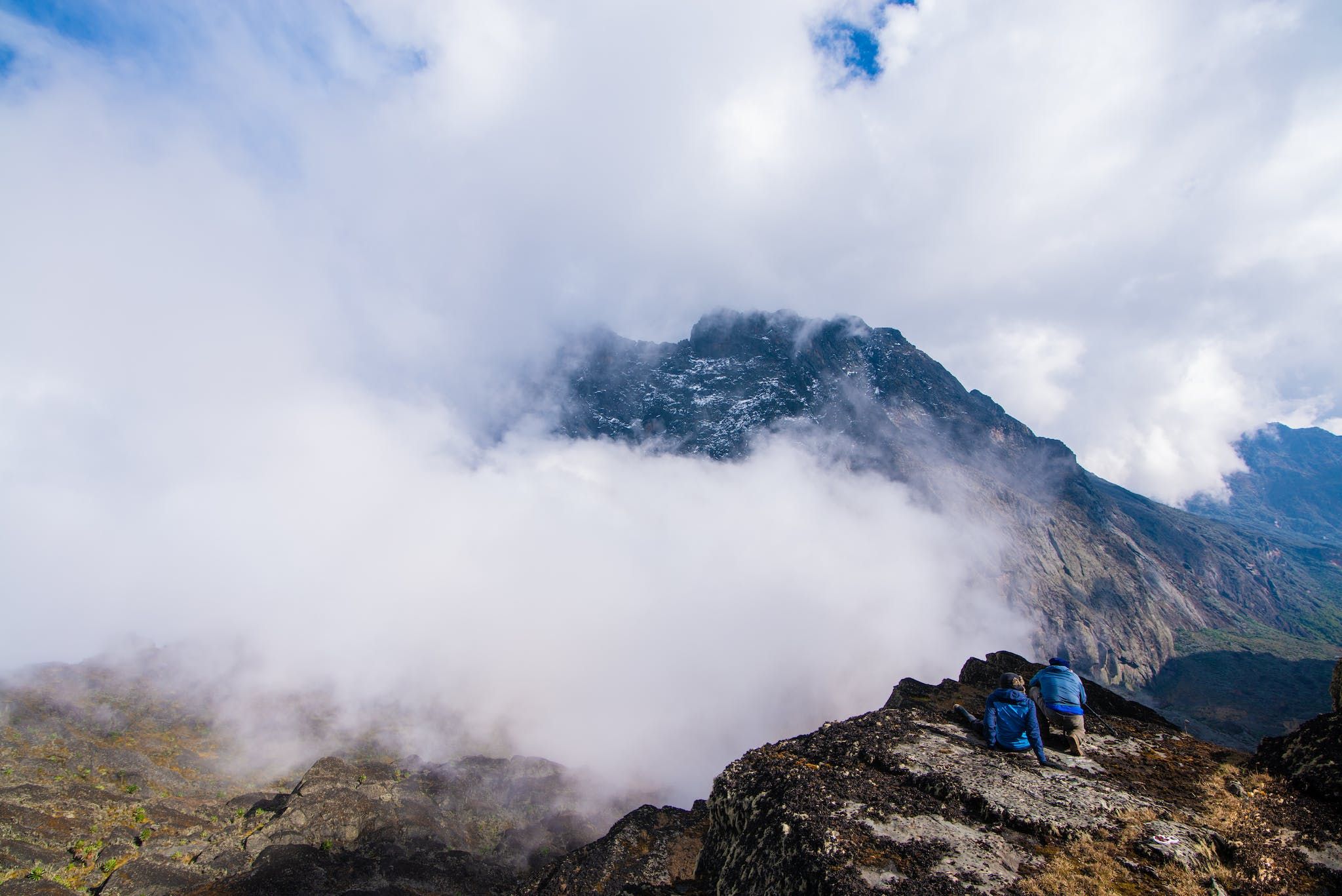
This is a place of serious summits and stunning beauty, the highest point being the enormous Margherita Peak, at 5,109m, which is at the summit of Mount Stanley - and is also the third highest point on the African continent.
It’s important to note that these route descriptions are only short summaries, designed to inspire but not to serve any navigational purpose. They are not intended to guide you on the route and further mapping and planning (or a local guide!) will be required if you want to safely walk any of the trails featured.
Uganda: The Basics
- Currency? Uganda Shilling.
- Language? Swahili and English.
- Plug adapter? Type G (the same as UK).
- Do I tip? 10%-20% if satisfied.
- Average beer price? £0.91 (4,000USh)
- Nearest adventure? Mountain trekking and gorilla safari in Uganda.
Where are the Rwenzori Mountains? Geography and Climate
The Rwenzori mountains, also sometimes spelled Ruwenzori, Rwenzururu or Rwenjura, are in western Uganda along the Uganda-Congo border, split between the four districts of Kasese, Kabarole, Ntoroko and Bundibugyo. The range is 120km long and 61km wide - covering 995km2 in total.
 Stuart Kenny
To get to Rwenzori Mountains National Park, you’ll take a four to six-hour drive from Kampala, the capital of Uganda. Another option is to take a charter flight from Entebbe International Airport to Kasese Airstrip, and then drive under an hour from there to the national park. You can also reach the Rwenzori mountains National Park from the Democratic Republic of the Congo - though it requires a 4x4 and some challenging roads. The best way to get there is from Uganda.
The Central Circuit, with Margherita Peak Detour: The Best Hike in the Rwenzori Mountains
There are an abundance of excellent trekking routes in the Rwenzori mountains, easily as beautiful, if not more so, than many better known and more popular routes in East Africa. One stands out above the rest though. The Central Circuit is the classic trekking route in the Rwenzoris, taking you through the layers of the park. It is also known as the Summit Circuit, Rwenzori Loop Trail or Bujuku-Mubuku Circuit. The only issue for us? The traditional route doesn't actually scale Margherita Peak - but it can do, if you take the right detour. We believe that this is the best multi-day trek you can do in the Rwenzori mountains.
- Days required: 7
- Distance (approx): 50km
Starting at Nyakalengija, this route will take you through the Rwenzori mountains, stopping at mountain huts aplenty, and reaching Margherita Peak, the summit of the mountain range and the third highest peak in Africa.
You’ll begin by walking through farmland along the Mubuku River, making your way up from 1,615m to the Nyabitaba Hut at 2,651m. Here you’ll hear (and hopefully see) chimpanzees and black and white colobus monkeys. The next day will see you climb to John Matte Hut (3,505m) and get your first sight of Mount Stanley and Mount Speke. If you would like to summit Mount Speke (4,890m), this is where you’ll leave the circuit for an out-and-back return day.
Otherwise, it’s on to the Bujuku Hut at 3,962m, via the isolated Bujuku Lake in the remote Stuhlmann Pass, sandwiched between two tall-rising peaks.
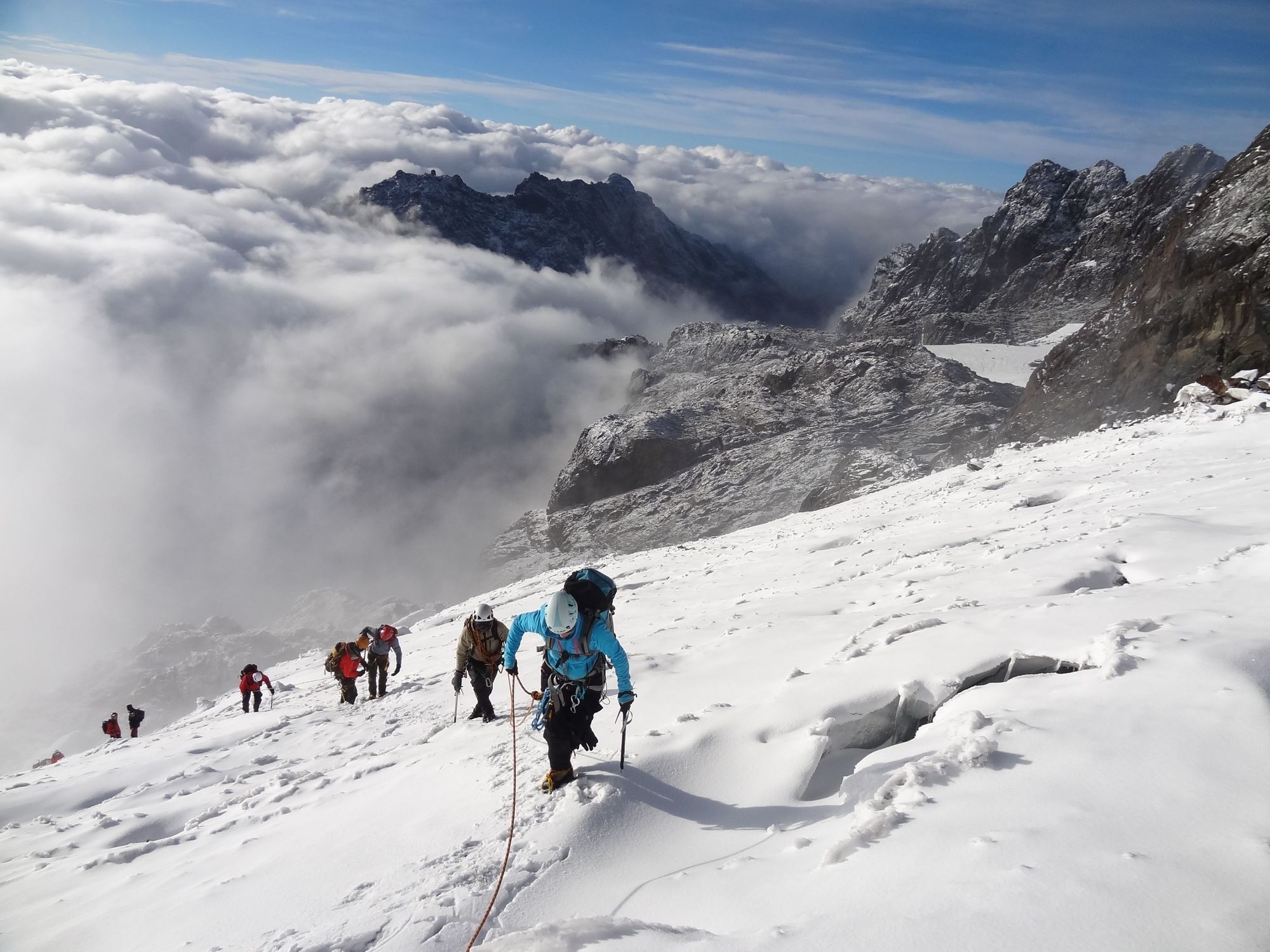
You'll notice the landscape transforming from grass to rock as you ascend above this level, to Elena Hut (4,541m) on Mount Stanley. Not every tour of the Bujuku-Mubuku Circuit goes up to Margherita Peak, but if you want to (and it is spectacular), you need to spend a night at Elena Hut. From here, it’s ice axe and crampon day, as you rise early to summit Margherita Peak (5,109m), traversing the Stanley Plateau to earn views out over Uganda.
This route descends via the Elena Hut, the Scott-Elliot Pass, Kitandara Lakes and the Guy Yeoman Hut before returning to Nyakalengija Base Camp.
An Alternative Route: The Kilembe Trail
Also known as the Southern Circuit, the Kilembe Trail is a seven to eight day route which opened in 2009 and takes an alternative route up to Marherita Peak. The first night is spent at Kalalama Camp at 3,147m, and from there, you ascent to the peak (summiting on the sixth day), via Bamwanjara Pass, Hunwick's Camp - overlooking Mount Baker - and the Scott Elliot Pass.
Wildlife and Biodiversity of the Rwenzori Mountains National Park
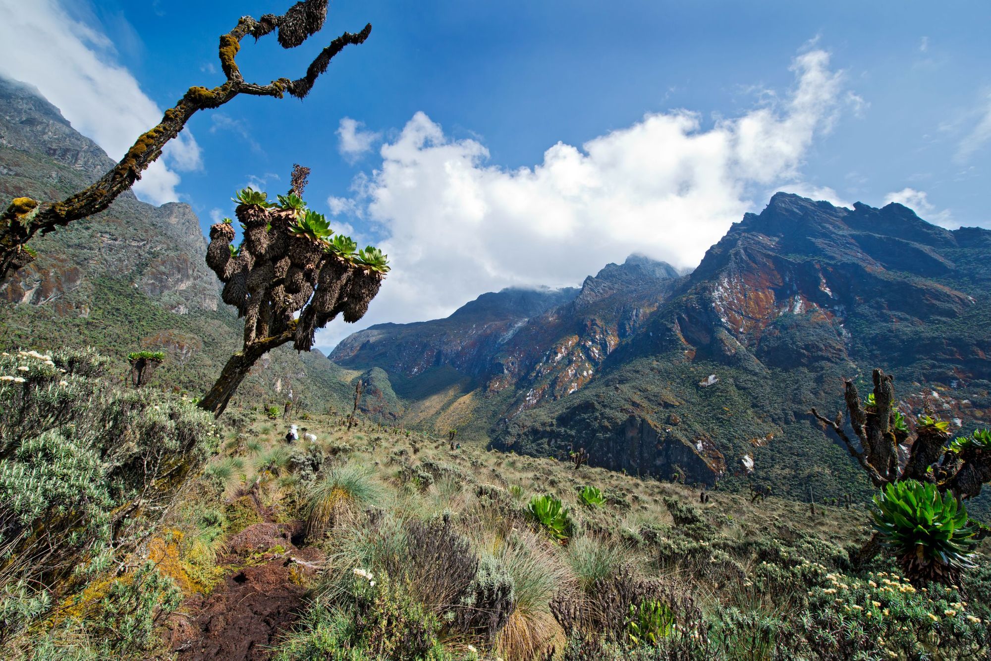
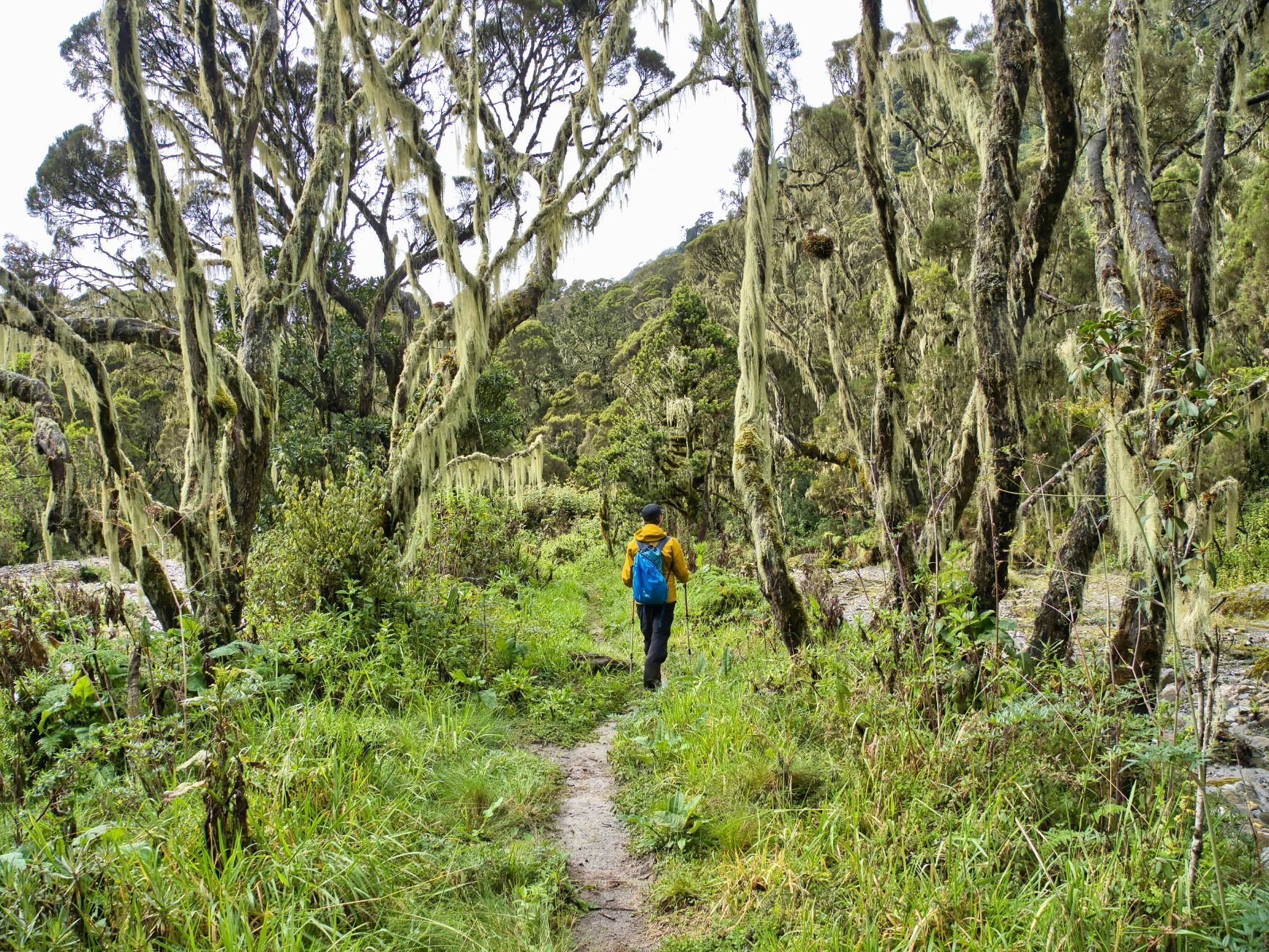
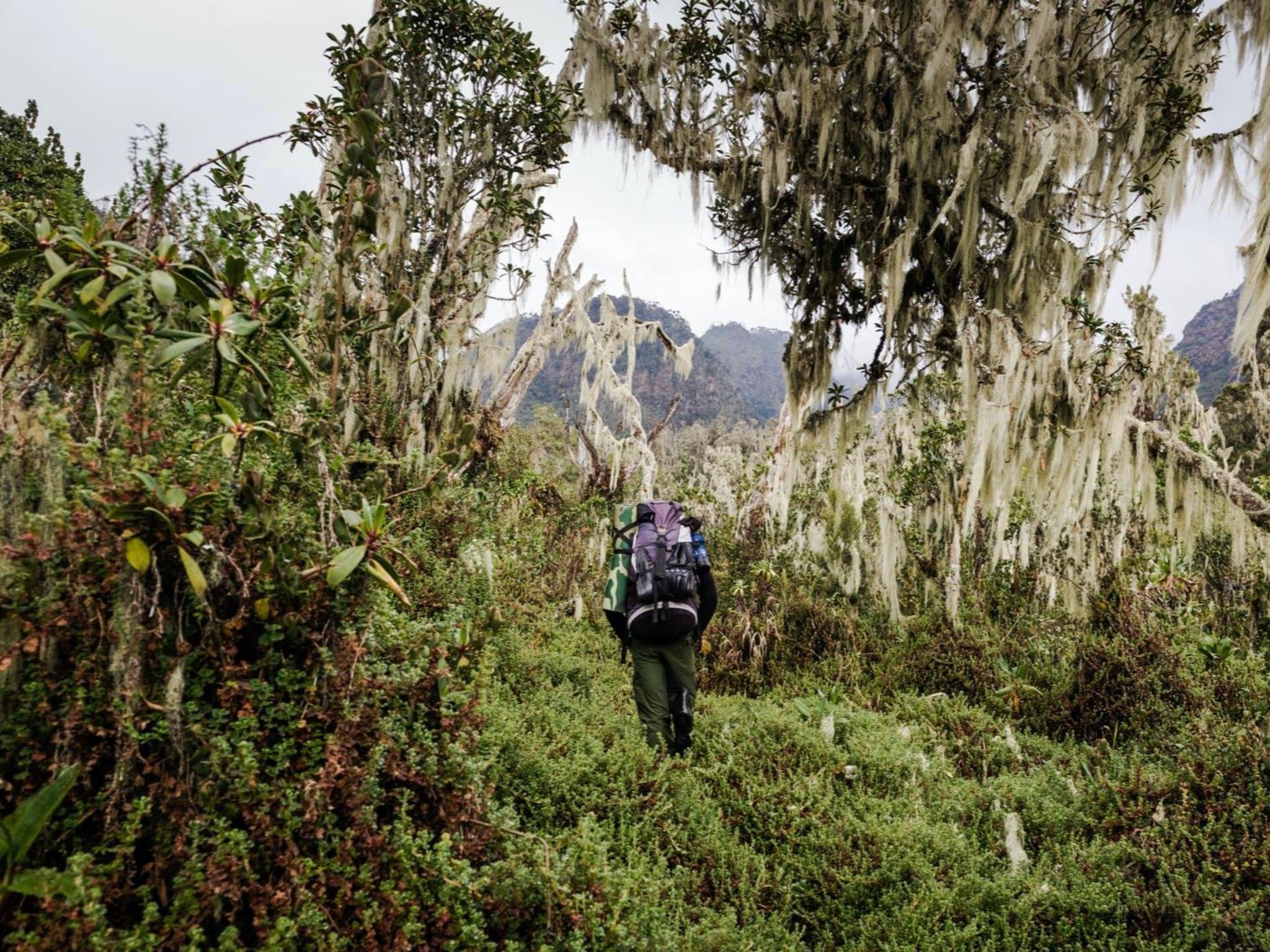
The Rwenzori mountains hugely vary in terrain. There's a stratification of vegetation, meaning that the landscape changes enormously as you gain altitude. You’ll walk through grassland between 1,000m-2000m, find montane forest between 2,000m-3,000m, find bamboo and mimulopsis territory between 2,500m-3,000m, heather and rapanea from 3,000m-4,000m and an Afro-alpine zone, including permanent snow fields, from 4,000m-5,000m.
There are 54 animals here endemic to the Albertine Rift.
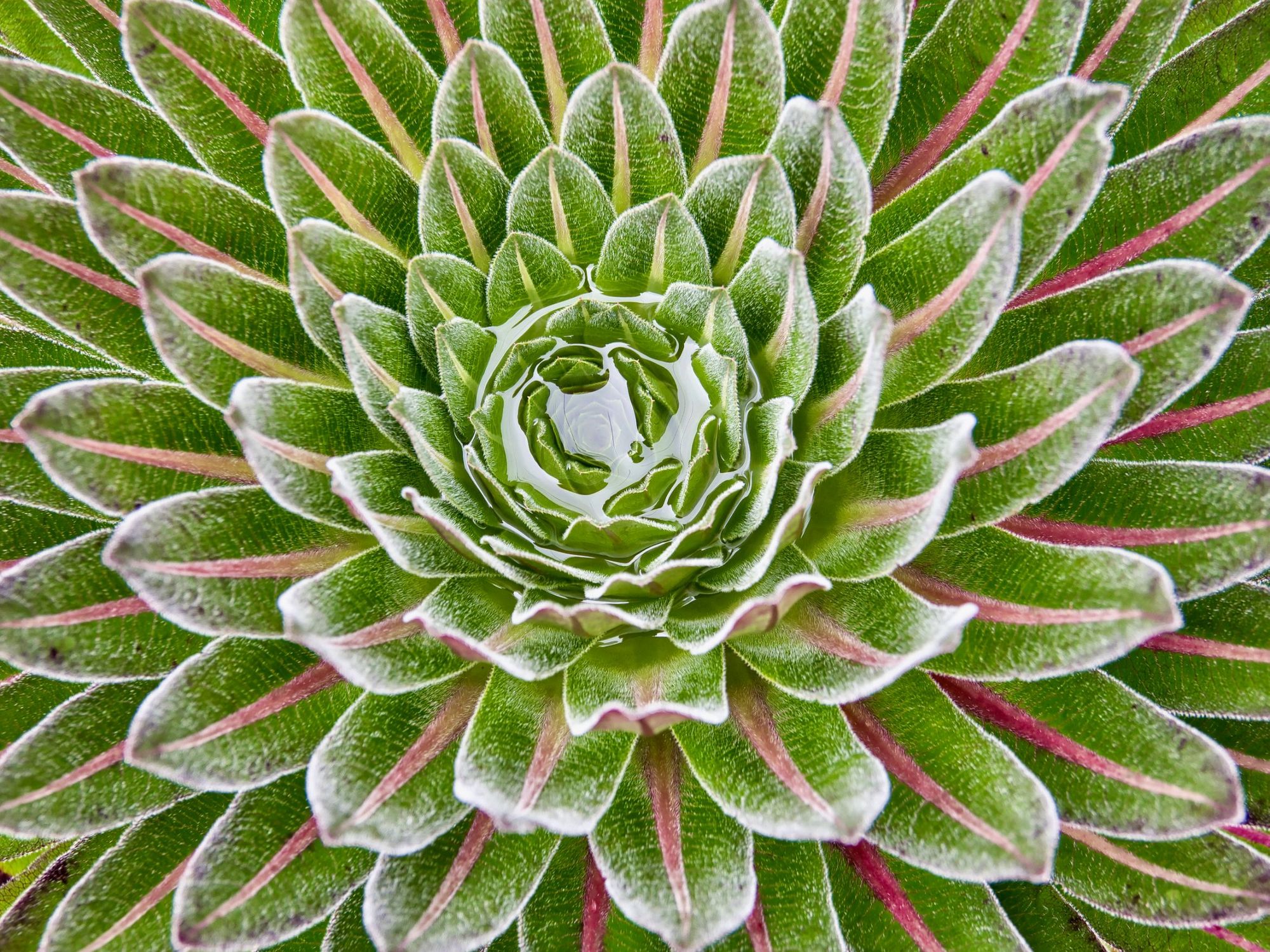
As you would expect, this means a huge variation in the flora and fauna across the mountains. “The most striking plants are found above 3000m,” writes UNESCO. These include giant tree heathers supporting aerial epiphytic gardens, unique to the Rwenzoris, and the giant lobelia (a little like a larger, spikier lotus flower, pictured above) and groundsels (small, bushy trees) which can be found in the Afro-alpine zone, and which are signature plants of the Rwenzori area.
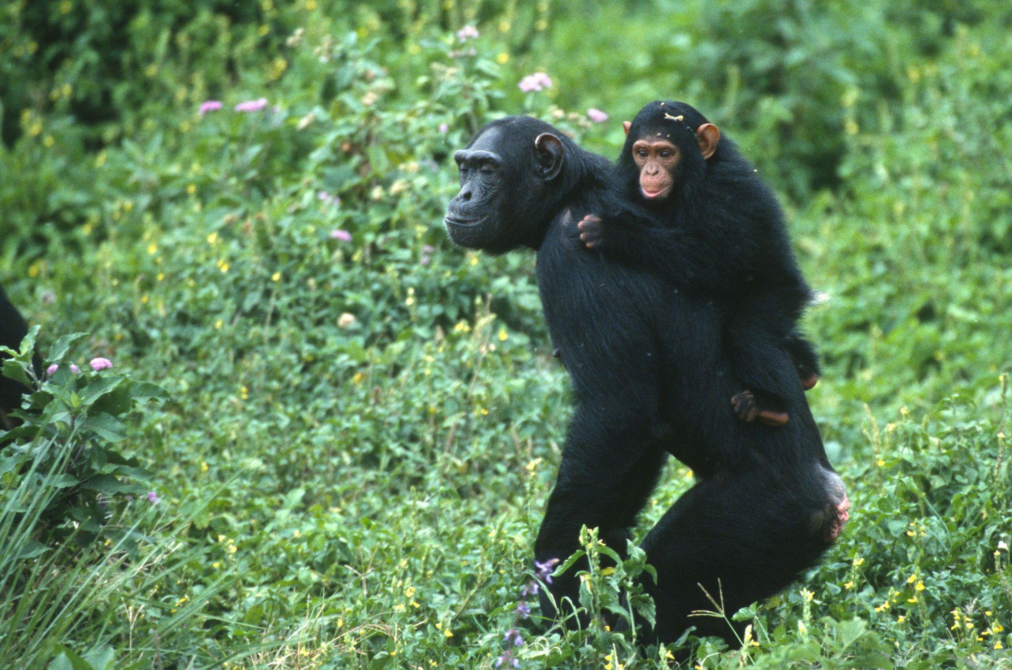
There are also an abundance of animal species that are endemic to the Rwenzori, meaning that they can only be found here, in the mountain range. There are 54 animals here endemic to the Albertine Rift, and a whole host of charismatic species, from the Rwenzori duiker, a stocky little antelope, to the montane squirrel, chimpanzee, Angola colobus monkey, giant forest hog, Rwenzori otter, leopard, African elephant, horned chameleons and Rwenzori range frog.
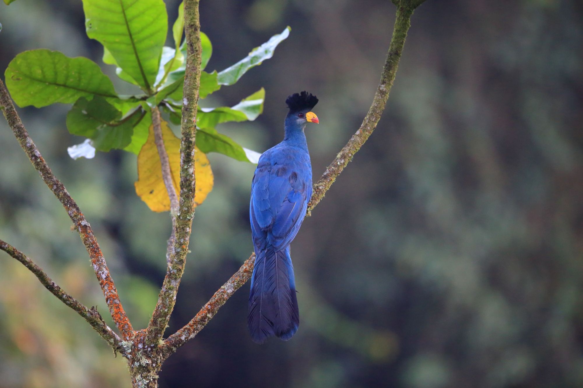
There have been 217 species of birds recorded in the area as well - from the glimmering regal sunbird to the thick-billed seedeater and Sharpe’s starling, with its almost metallic coat, and the beautiful great blue turaco.
A Brief History of Humans in the Rwenzori Mountains
The Bakonzo People are Bantu-speaking, and spread across Uganda. Believed to have originated from Congo, they have lived in and roamed the Rwenzori mountains for hundreds of years - building hunters' shrines - and with deep spiritual connections to the local nature, which persevere today.
Modern European explorers of the 1800s connected the Rwenzori mountains back to the Mountains of the Moon, and the Italian Duke of Abruzzi, in 1906, who scaled the highest peaks of the range and gave several of the peaks their names. The Duke’s tour included the first recorded ascent of Margherita Peak, which he named in honour of Queen Margherita of Italy. He was accompanied by a photographer on his climbs, Vittorio Sella, and a selection of Sella’s images can be seen in the Makerere University in Kampala.
While crowds flock to climb Mount Kilimanjaro, the more intrepid traveller now looks to Rwenzori.
During the 1960s, after Uganda gained independence from the British Empire, the Rwenzori mountains were home to rebel groups. In the 70s and 80s, Uganda was a dangerous location to visit and Rwenzori was no different. Even in the 90s, western Uganda was destabilised as rebels continued to hideout in the mountains. But tourists have now been visiting the park safely for over two decades.
These past troubles have also meant that, for large periods, there has been little-to-no tourism to the Rwenzori mountains. So today, this area represents a rare, true wilderness, with excellent climbing and trekking routes that really are little known to most of the world. While crowds flock to climb Mount Kilimanjaro, the more intrepid traveller now looks to Rwenzori.
Are the Rwenzori Mountains Safe to Visit Today?
The Rwenzori mountains are safe to visit. You may see rangers out on patrol with guns, but this isn't for fear of guerillas - it's to deter poachers in the park.
"Uganda is a safe country to visit," says Paul Kisibo of Mbogo Africa Safaris, a tour operator based in Kampala, with an extensive knowledge of the area. "The Rwenzori currently receive up to 1000 visitors a year and new trails are being developed for tourists to explore even more of the mountain beauty. Game rangers in all national parks in Uganda are mandated to carry a gun and the Rwenzori mountains National Park rangers are not an exception. This is a common standard for game rangers in Africa - usually because the ranger guides are law enforcers in the parks.
"The Rwenzori is a magnificent place to visit. There’s so much to see and experience that no amount of pictures or videos can do it justice. You can’t prepare for the beauty of the mountain."
In short, the main safety concerns here are basically the same as on any other mountain range. You need to come prepared, with appropriate gear for your challenge, and if you’re going to be climbing the high peaks - for example, Margherita Peak, the third-highest peak in Africa - altitude sickness is a risk. You can mitigate the risk of this by giving your body time to acclimatise at altitude.
Best Time to Visit the Rwenzori Mountains: Weather, Seasons, and Events
If you want to climb Margherita Peak, you’ll want to visit from June to August. These are the dry months in the Rwenzori, when the mountains receive less (but not no) rainfall - so this is the primary time to visit for hikers. The months from December to February also are a little drier, with warm days, but colder nights. During the colder months, from March to May and September to November, the mountains are full of mist, and a lot cooler than in the dry season.
So, when should you visit the Rwenzori mountains? You can go anytime of year, but the ideal time is during the dry season, during June to August or from December to February. Oh, and go soon. Before the secret of its beauty is out.
Inspired? Our Adventure in the Rwenzori Mountains is no longer on sale, but check out our other adventures in Africa now!