


The Tour of Monte Rosa is an 104-mile (167km) long-distance hiking route which circles the huge mountain plateau of Monte Rosa. It’s a remarkable route which passes through perfect pastoral valleys and farmlands, but which is defined by the rock and ice of high mountains and glaciers, taking in some of the most beautiful mountains in western Europe (if not the world), and passing through some of the continent's mountain towns in both the Swiss Alps and Italian Alps.
Sleeping in rustic mountain huts and dining on indulgent food (think fresh pasta, pizza, raclette, fondue, tartiflette), the Tour of Monte Rosa will take you to Grächen and Saas Fee, beneath the 4,545m Dom and 4,491m Täschhorn, to Zermatt and Breuil-Cervinia beneath the mighty 4,478m Matterhorn and 4,164m Breithorn, and to Alagna Valsesia and Macugnaga, gateways to Signalkuppe/Punta Gnifetti (4,554m) and Dufourspitze (4,634 m), high peaks of Monte Rosa.

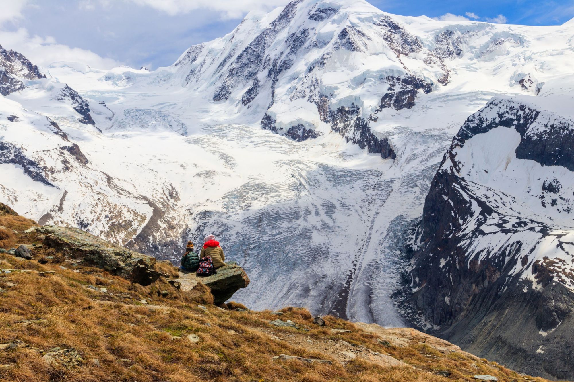
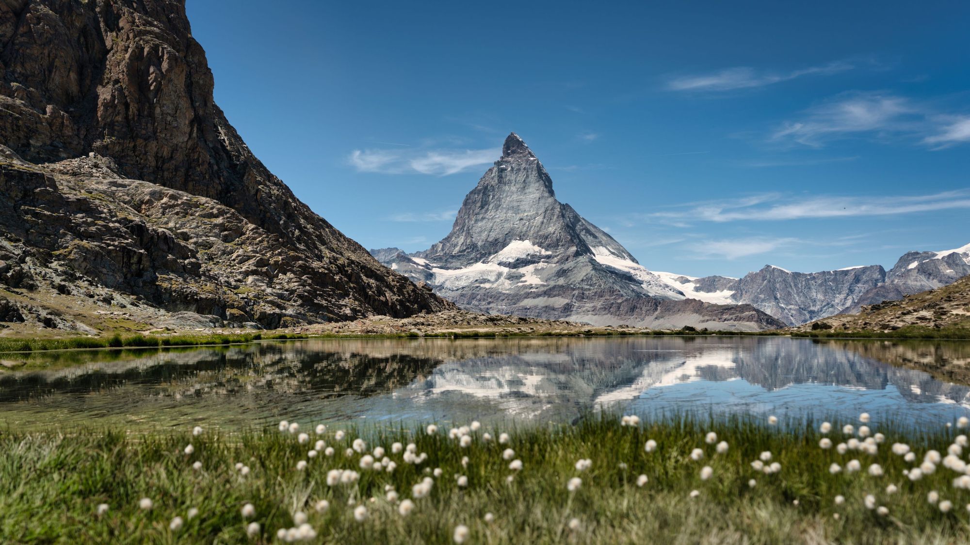
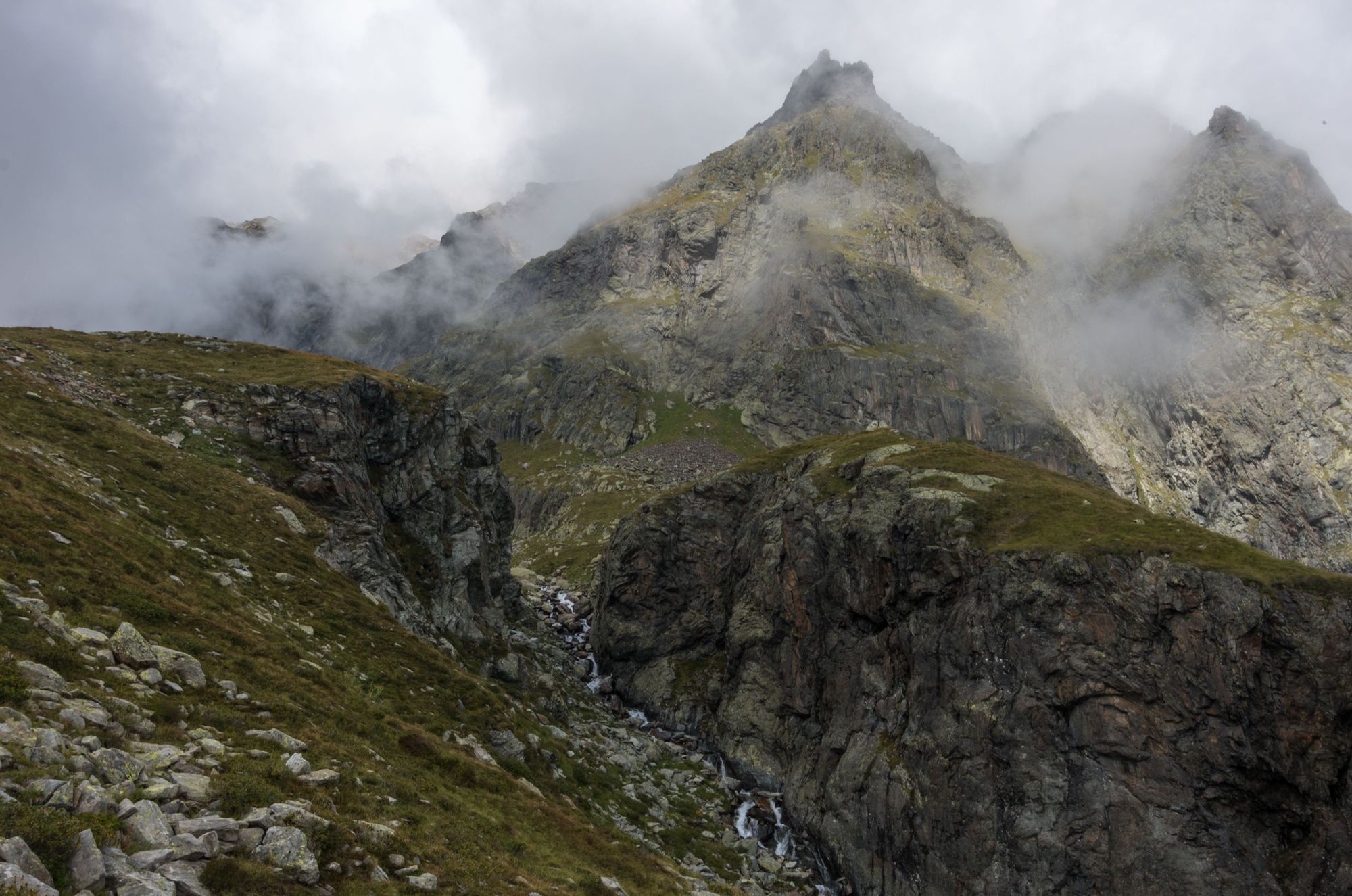
This is a demanding but highly rewarding route, which showcases one of the world’s great mountain ranges - and without the same tourist footfall that you might get on other such routes in the Alps, like the also beautiful Tour of Mont Blanc, Tour of the Matterhorn or the famous Haute Route. It’s centred around the mighty Monte Rosa, the second highest mountain in western Europe, which Leonardo da Vinci himself wrote was “so high that it seems almost to overtake the clouds,” but the Matterhorn, with its great triangular peak, dominates for several days on the circuit.
Here’s our guide to the Tour of Monte Rosa, aiming to answer all of your FAQs on the topic - from the difficulty of the Tour of Monte Rosa to the highlights, a mock kit list, and a day-by-day itinerary. The lengthy route is usually completed in anywhere from one to two weeks.
Tour of Monte Rosa: Map & Basics
Distance: 104 miles (167km)
Days to walk: 6-14 days
Elevation gain: 10,654m (34,954ft)
Highest point: 3,316m (10,879ft)
Where does the Tour of Monte Rosa Start and End?
There are various places to start and end the circular Tour of Monte Rosa route, but the most popular are Zermatt or Saas Fee (or nearby Saas Grund) in Switzerland, or Alagna Valsesia in Italy.
A Short History of the Tour of Monte Rosa
It's not exactly clear when the first Tour of Monte Rosa took place. What we do know, though, is that such circuits were already ongoing by the time that a rope team led by Charles Hudson first climbed Monte Rosa, ascending the Dufourspitze, the highest peak on the mountain, on 1 August 1855.
The reason that we know this is because of the pioneering guidebook of Mrs. Henry Warwick Cole, A Lady’s Tour Round Monte Rosa, which was published in 1859, and which documents Mrs. Cole’s journey on the route across three trips, in 1850, 1856 and 1858.
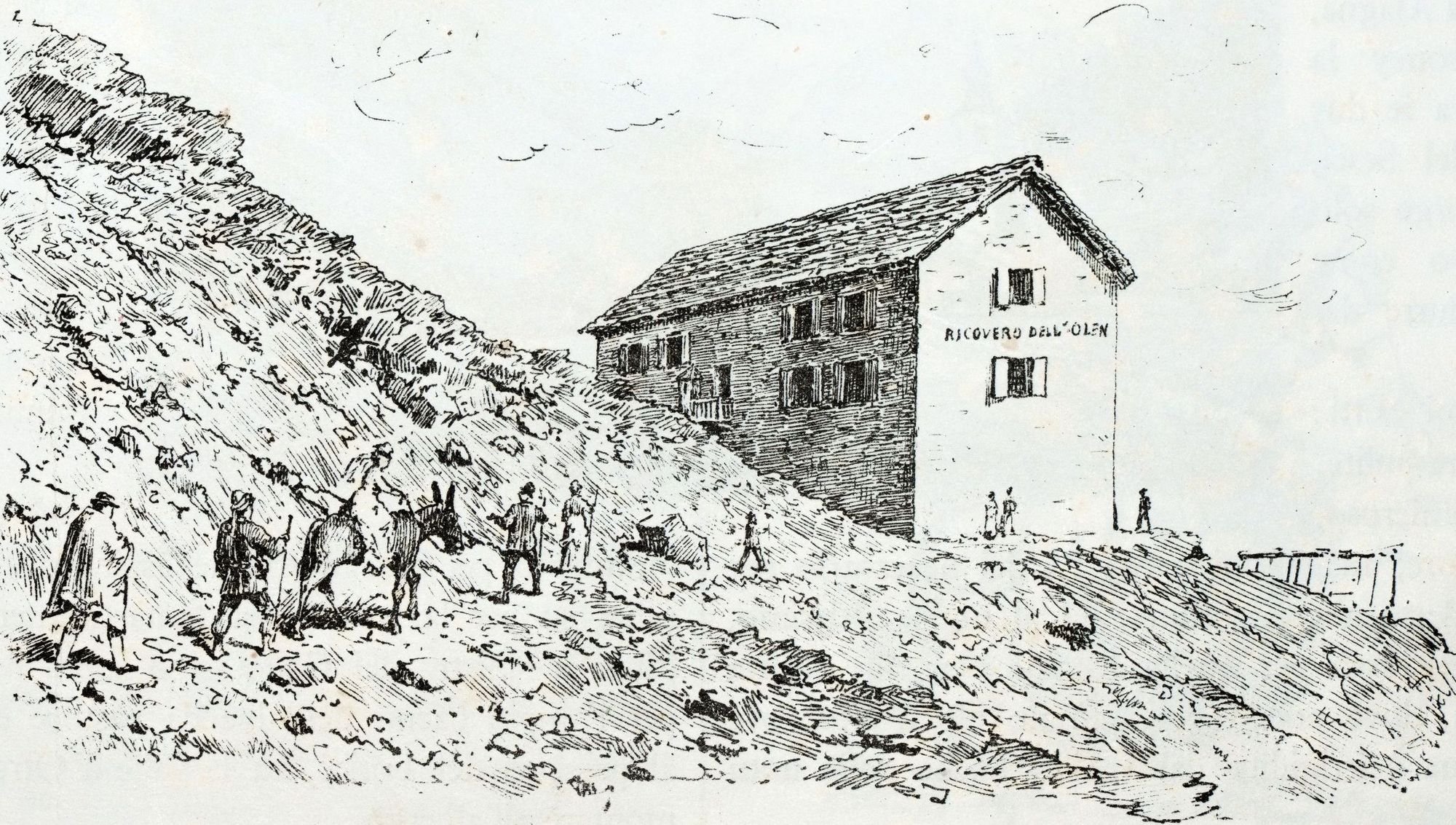
Mrs. Cole takes a different route from the modern one in numerous spots, also detailing “many divergences from the strict route to interesting points in the neighbourhood.” But it shows that there was indeed an established circuit running around the mountain.
Cole's narrative is an exceptional read, mixing startling descriptions of the alpine beauty of the Swiss Alps with tips for other women looking to explore, which have aged humorously. One such example urges ladies on the route to "wear a broad-brimmed hat, which will relieve her from the incumbrance of a parasol." We would still say a parasol is a little impractical to be fair, but perhaps a cap and a sturdy waterproof jacket with a good hood are a better replacement.
Tour of Monte Rosa: An 8-Stage Itinerary on the 104-Mile Route
There are many ways to break down the Tour of Monte Rosa, and similarly, there are many different starting and finishing points, as noted above. For this example itinerary, we’ve chosen to list an eight-stage itinerary, which starts and finishes beneath the Matterhorn, in Zermatt.
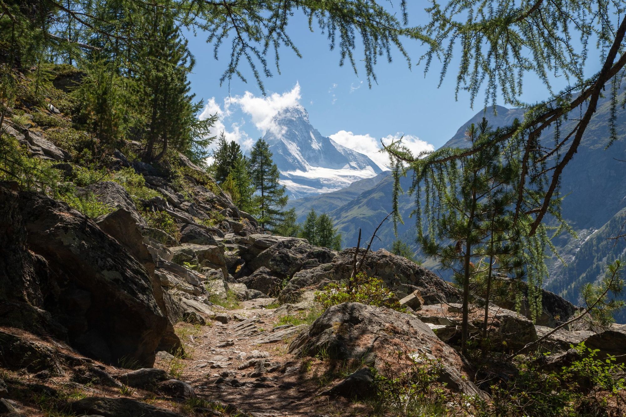
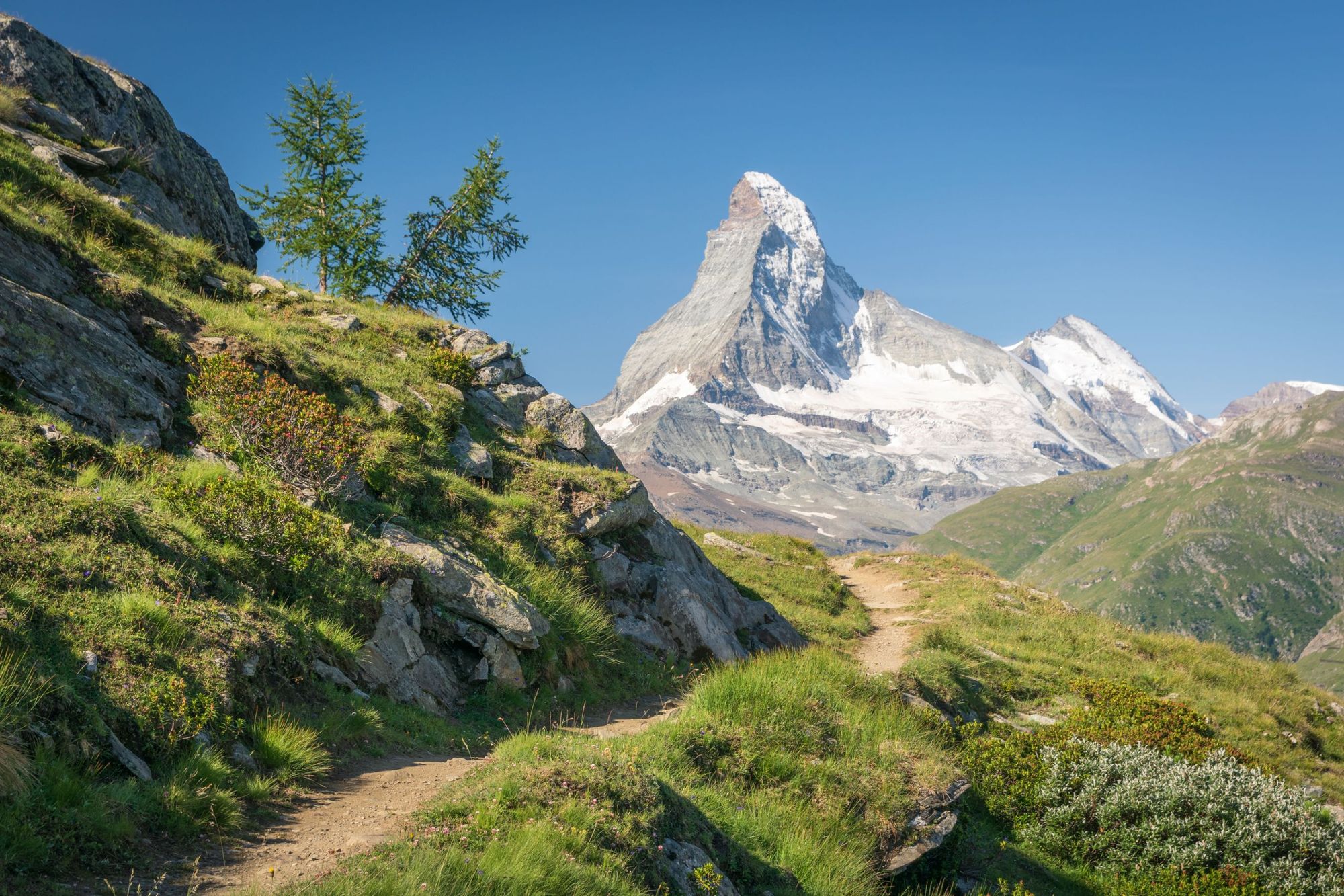
Stage 1: Zermatt – Theodul Pass
Distance: 6.8 miles (11km)
Walking time: 6hr
Ascent: 1701m (5,580ft)
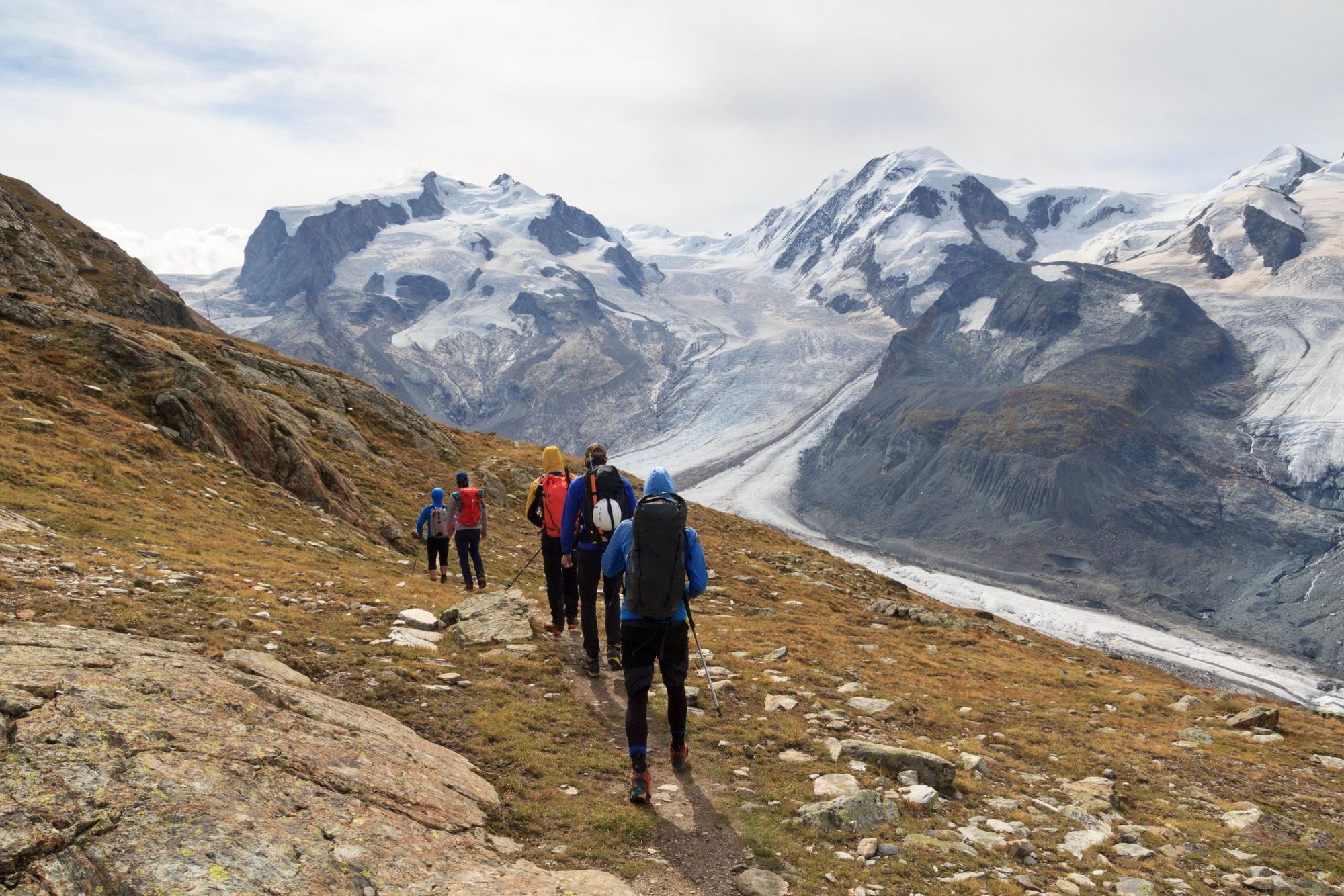
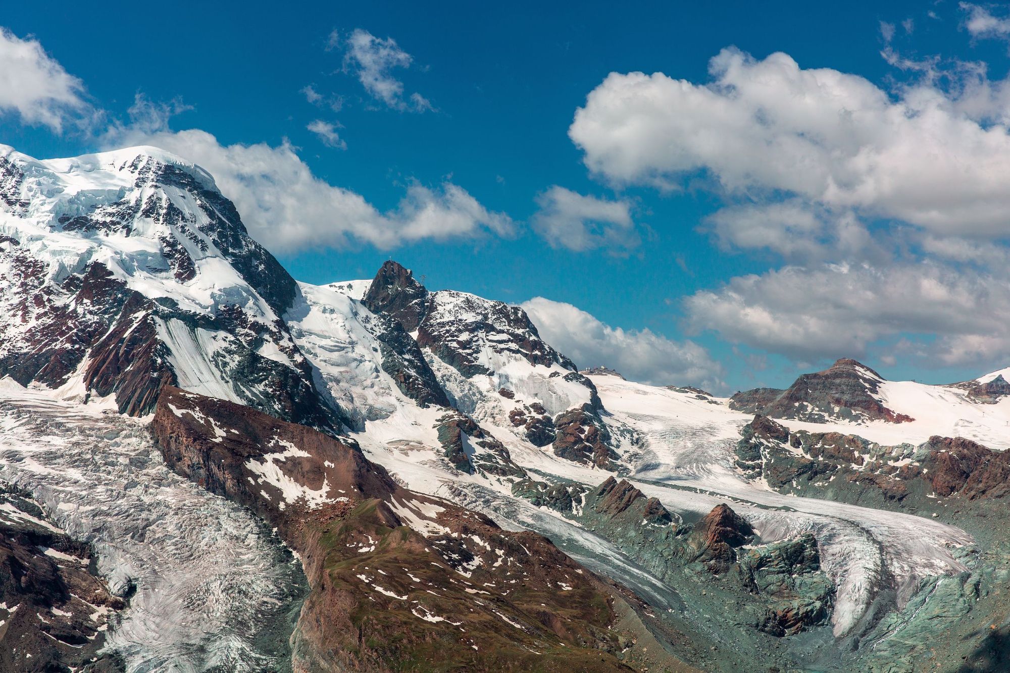
Some folk shorten the opening stage of the Tour of Monte Rosa by taking a lift out of Zermatt and up the mountain. We’d say, you’re best to walk from the start. Leaving Zermatt, you’ll follow a river to the hamlet of Furi and hike on to Furgg. As you climb the mountain, you’ll earn sublime views of the Obergabelhorn and Weisshorn. Stop for a coffee and lunch at the Gandegghütte, which sits above the Unterer Theodule Glacier, looking onto the mountain peaks.
From here, you’ll then cross the only glaciated section of the Tour of Monte Rosa to reach Gandegg. Though you are likely to see people walking on the Theodul glacier in all sorts of attires, do be careful, as there are crevasses which can be a risk to life, particularly if you’re not roped up. Follow the advice of your guide carefully when crossing the glacier. You’ll likely follow the ski piste, which, with an expert in charge, is safe enough.
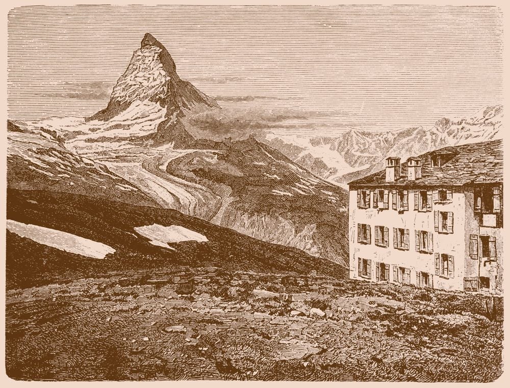
This will lead you out to Theodul Pass and the Theodulhutte, a rustic, traditional mountain hut which sits on the border of Switzerland and Italy, perhaps the most scenic border in Europe.
Mrs. Henry Warwick Cole wrote elegantly of this stage, during a moment when: “the first streaks of morning light soon appeared, the vapours which had veiled some of the higher summits vanished, and the huge pinnacle of Mont Cervin, or the Matterhorn, stood in unclouded majesty, looking wondrously grand and beautiful, against the deep blue sky.”
Stage 2: Theodul Pass - Resy/St-Jacques
Distance: 8.7 miles (14km)
Walking time: 5hr 30 mins
Ascent: 350m (1,148ft)
Setting off through dried up ski pistes, you’ll come to the Cappella Bontadini - a tiny chapel between lift buildings dedicated to the Italian alpinist Bontadini. Follow the TMR signposts with stunning views of the Matterhorn (some of the last that you’ll get on the route), and you’ll soon enter the Ventina - a rarely-visited valley bursting with colourful flora and silent lakes. This alpine wilderness will guide you to Resy, where you can stay in a mountain refuge, or alternatively on to St Jacques, where you can restock on supplies and stay in a hotel for the night. There's also the option on this night to stay in Breuil-Cervinia in the Aosta Valley.
Stage 3: Resy/St-Jacques - Gabiet
Distance: 6.2 miles (10km)
Walking time: 6hrs
Ascent: 1120m (3,674ft)
This day on the trail will have you following trails down to the Ayas Valley, with outstanding views. You’ll then walk through forest and on to Stafal, with some route options here diverting to Gressoney. You’ll walk through a larch forest, alongside a river. The day finishes with a climb to Gabiet, where you’ll find both the Albergo del Ponte hut and the Rifugio Gabiet, on Gabiet Lake.
Stage 4: Gabiet to Alagna
Distance: 7 miles (11.5km)
Walking time: 4hr 30 mins
Ascent: 550m (1,804ft)
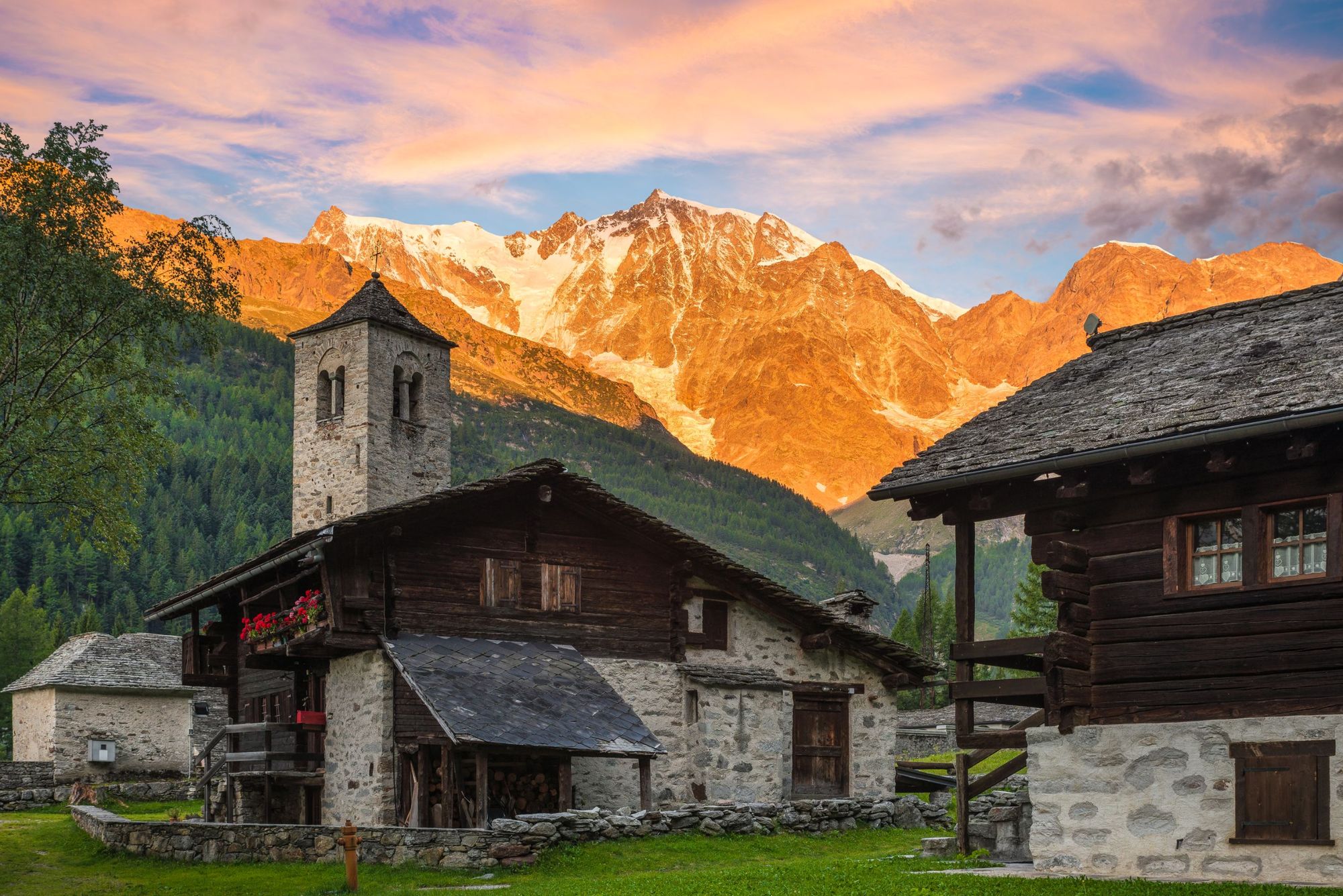
The tough ascent to start the day is worth it when you reach Col d’Olen, a stunning, immersive landscape of dramatic rock faces and far-reaching valleys with panoramic mountain views (and not much ski infrastructure in site). You’ll reach the Devil’s Rock and pass through the Valle d’Otro, where you can see the traditional hamlets of the Walsers, descendants of immigrants from the Swiss canton of Valais. From here, you descend through forest to reach Alagna, a paradisiacal commune high in the Valsesia alpine valley, with various accommodation options.
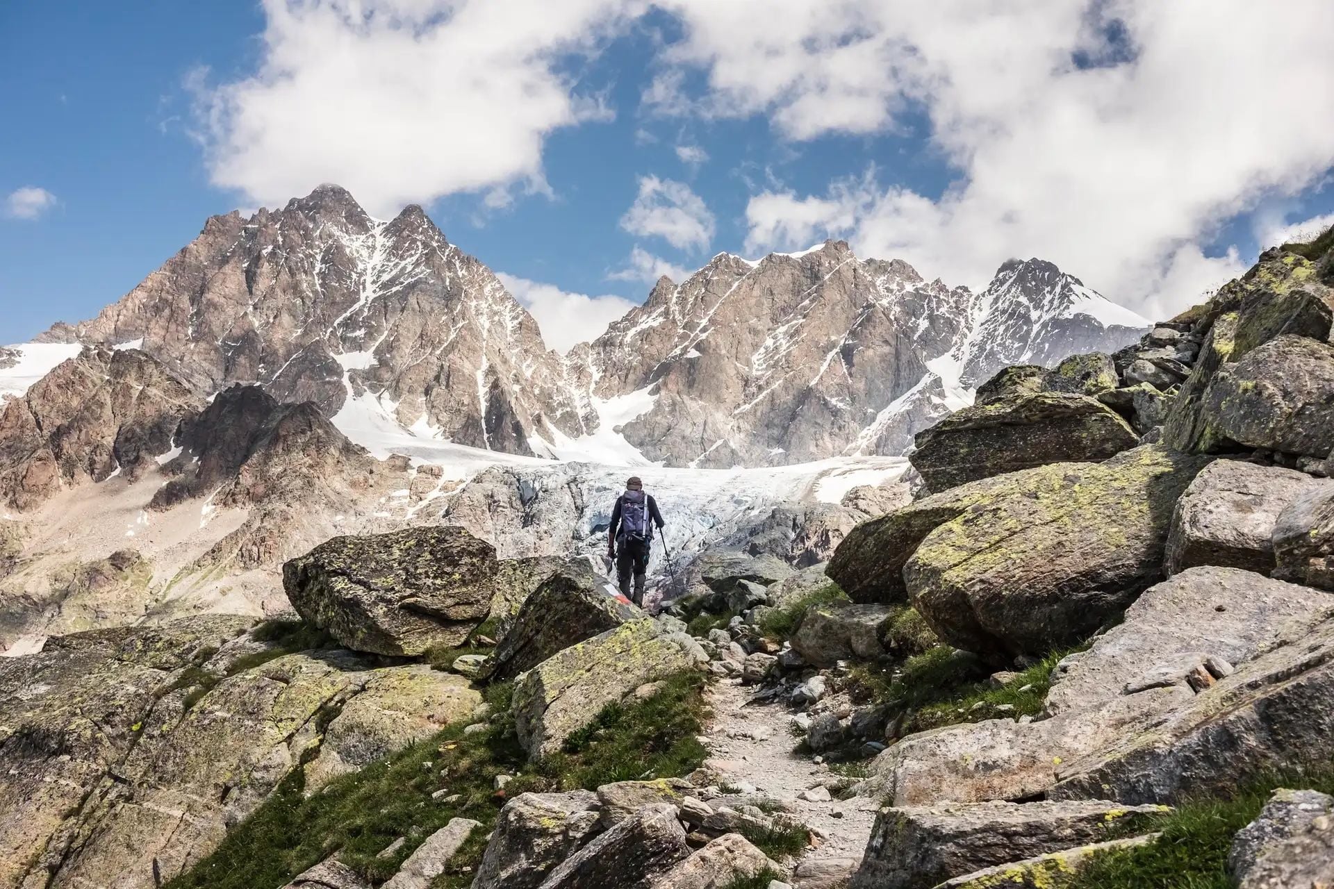
Stage 5: Alagna - Macugnaga
Distance: 12.5 miles (20km)
Walking time: 8hr
Ascent: 1,650m (5,413ft)
This is one big walk up and one big walk down, with just over 1,500m (4,291ft) of descent in addition to all that climbing. Specifically, the day is based around the Colle del Turlo, a pass which will see you zig zag up to 2,738m (8,982ft), and which has been trafficked for hundreds of years as it’s the only clear route to get to Macugnaga from Valsesia. You’ll follow mule tracks through lush meadows, past streams, alder bushes and eventually down to the Quarazza valley, where you can grab a coffee before heading into Macugnaga.
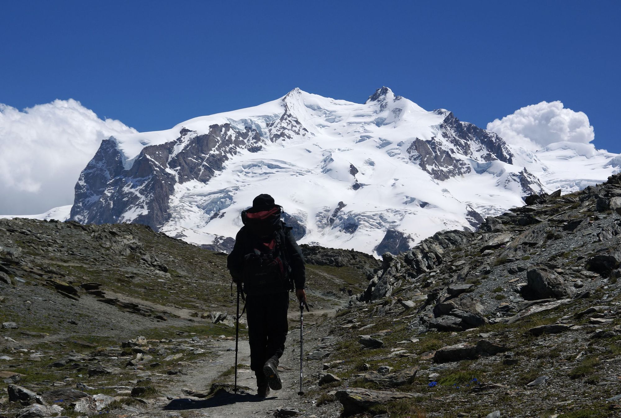
Stage 6: Macugnaga to Saas Fee
Distance: 12.5 miles (20km)
Walking time: 9hr
Ascent: 1,540m (5,5052ft)
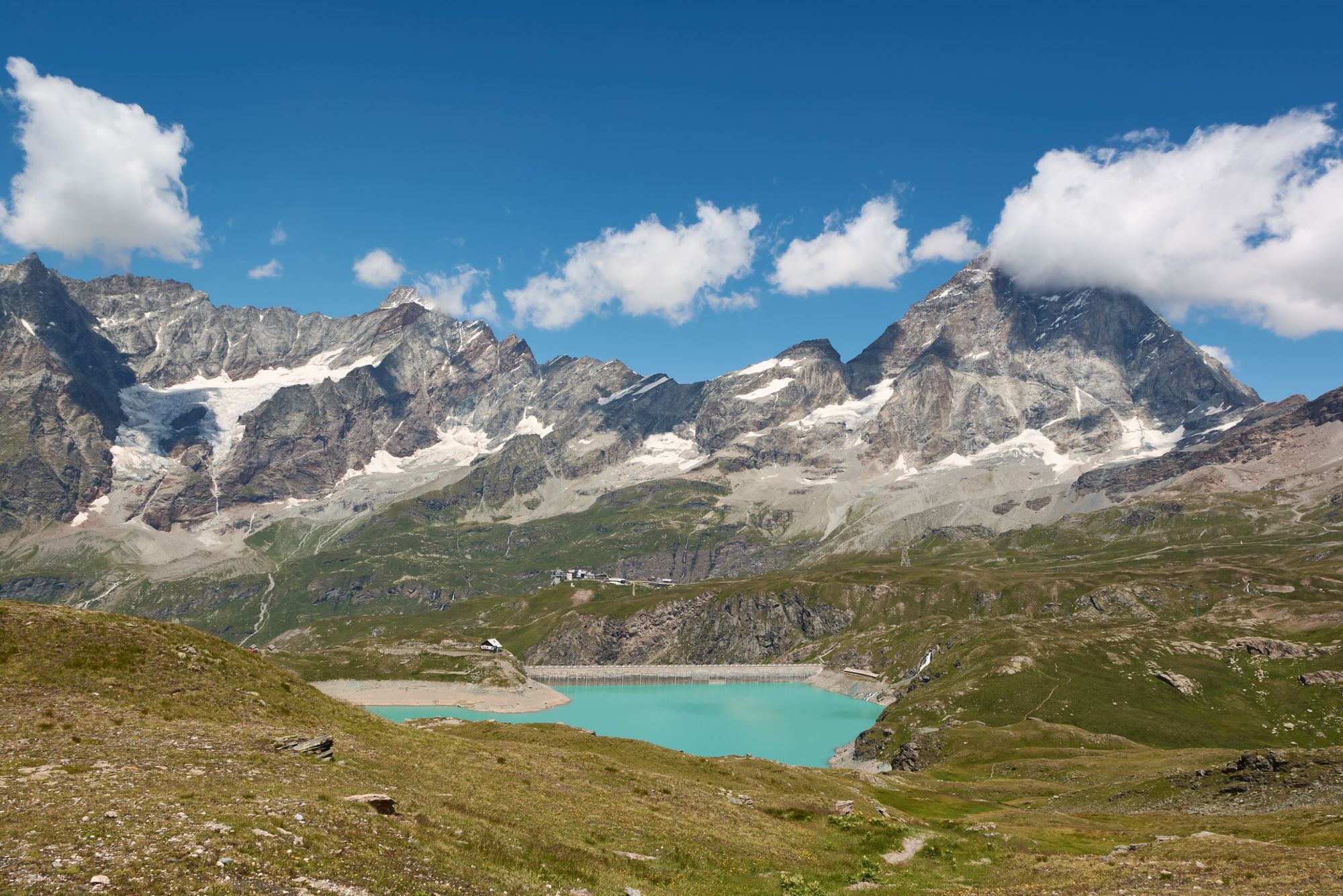
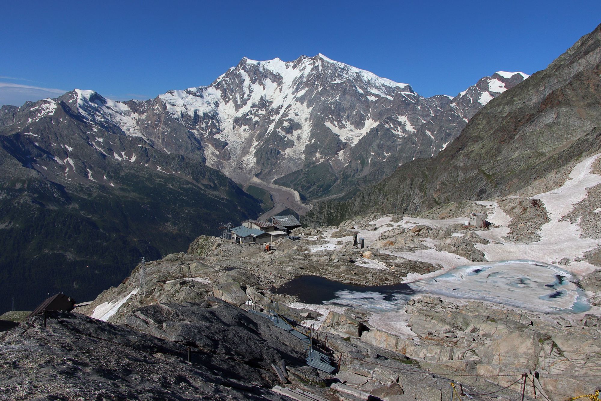
This is a long old slog which will see you steeply climb up to the Monte Moro Pass (2,853m/9,360m), rounding the summit of Monte Moro itself, which will be visible on your left. Thankfully you’ll be treated to excellent views of the rock faces of Monte Rosa while you’re climbing, and when you re-enter Switzerland here, passing over the col, you’ll trade harsh stone for lush grassy meadows and beautiful streams which guide you all the way down to Saas Fee, via the Mattmark Lake (and Mattmark dam, the largest earth dam in Europe) and Saas Almagell, a scenic little mountain town set up amongst the mountains, not far from Saas Fee.
Stage 7: Saas Fee to Grächen
Distance: 10 miles (16km)
Walking time: 6hr 25 mins
Ascent: 700m (2,296ft)
The high Höhenweg trail is one of the most beautiful segments of the Tour of Monte Rosa, on the eastern slopes of Balfrin. Ahead of you are the Saastal Peaks, the likes of the Weissmies and Lagginhorn, while towards the end of the day the Mattertal peaks, notably the Weisshorn, come into view. Listen for marmots as you weave around the rocks and (weather-permitting) gaze out on the far-reaching views from this picturesque balcony trail. A real highlight.
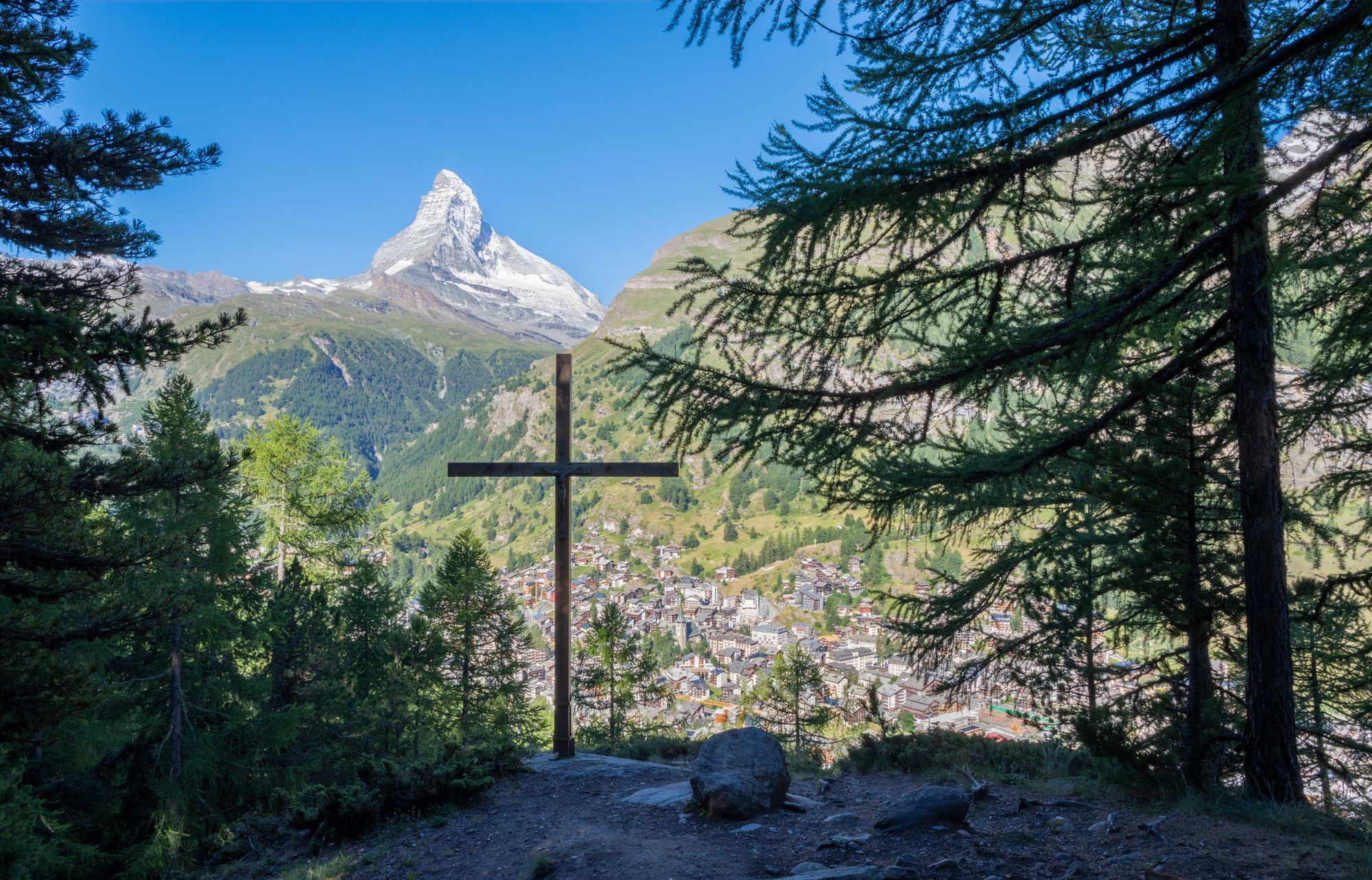
Stage 8: Grächen to Zermatt (via Europaweg)
Distance: 19 miles (31km)
Walking time: 11hr (two days, with overnight in Europahütte)
Ascent: 1,300m (2,465ft)
The Europaweg is often said to be the most beautiful two-day hike not just in Switzerland but in all of the Alps. This is when the Weisshorn, Zinal Rothhorn and Obergabelhorn are visible in all its beauty, as you walk from Grächen to Gasenried and Herbriggen above the Mattertal Valley, before turning upwards to the Europa Hut. This segment of the trail will take you around seven hours, and many will then spend the night here, at the hut, savouring these final alpine views.
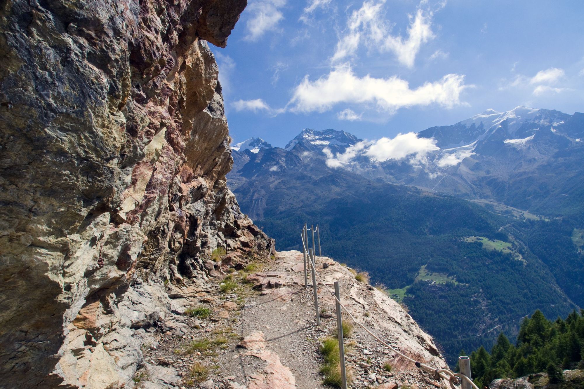
The final segment then sees you finish the Tour of Monte Rosa in style, with the best views of the Matterhorn on the trail coming into focus as you near Zermatt. You’ll cross over the longest pedestrian suspension bridge in the Alps (494m long), crossing the Grabengufer, and follow a stunning trail which weaves and winds in the direction of Täschalp, then down to Zermatt.
How hard is the Tour of Monte Rosa?
Make no mistake, the Tour of Monte Rosa is a tough, demanding multi-day hike. You’re going to be covering over 100 miles, and carrying a large pack along the way. The hiking days are also long, and you’d should expect to be hiking between four and nine hours each day.
Due to this, we would encourage people to try a shorter multi-day hike before attempting the Tour of Monte Rosa, to see if it’s the sort of adventure they like. Day after day, both the hiking, and the weight of the pack you’re carrying, will take a toll if you’re not properly prepared.
Either way, we would strongly recommend hiring a guide. There is a glacier crossing involved, and without a guide, or substantial mountaineering experience, this (and other parts of the route) can be extremely dangerous. Hire a guide, and no mountaineering experience is required. They’ll also be able to tell you all about the local flora, fauna and history as you walk.
What kit will you need on the Tour of Monte Rosa?
Here is an example kit list of everything you’ll need to bring to hike the Tour of Monte Rosa:
Bags
- Hiking pack (40-50 litres)
- Waterproof liner for hiking pack
Clothes
- Lightweight down or synthetic jacket
- Lightweight waterproof and windproof jacket
- Breathable wicking layers
- Fleece jacket or similar
- Buff or neck scarf
- Lightweight trousers/shorts/skirts for hiking
- T-shirts
- Underwear and socks
- Swimwear for hotel
- Sunglasses
- Sunhat
- Something to sleep in
- Hiking boots (worn-in)
- Lightweight shoes for refuges
Sleeping
- Pillowcase
- Sleeping bag liner
Other
- Universal travel plug adapter
- Power bank or solar charger
- Passports (and visas)
- Travel insurance documents
- Suncream
- Personal first-aid kit (inc. blister treatment)
- Personal items (biodegradable toiletries, sanitary wear etc)
- Quick-dry towel
- Alcohol hand-gel
- Face mask
- Headtorch or torch
- Two reusable water bottles and/or bladders with combined carrying capacity of 2 litres
Optional
- Sleeping sheet Earplugs
- Trekking poles
- Energy bars and snacks - read our article on Best Hiking Snacks
Accommodation on the Tour of Monte Rosa?
There’s a whole range of accommodation options on the Tour of Monte Rosa route, from campsites and mountain huts to luxurious hotels down in the mountain towns themselves.
Naturally, the number of hotels on offer will vary from town to town. Zermatt will have a lot more to choose from than Grächen, for example. Campsites are relatively common along the way, though wild camping is generally not permitted.
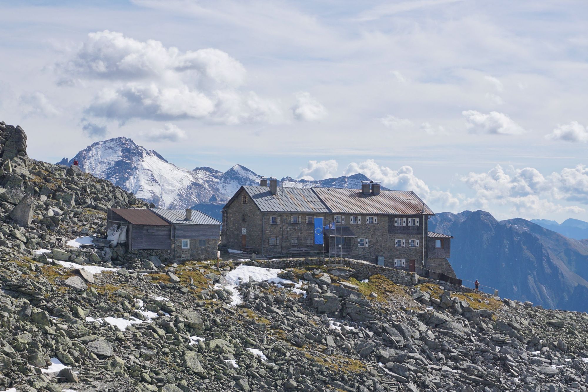
We’d really advocate for staying in mountain huts where possible though, as this is where you get a real sense of trail community (and the quality of mountain huts in Switzerland and Italy is very high). You’ll stay in old, traditionally-built, rustic wooden buildings and share communal spaces and bunkhouse-style sleeping arrangements with others walking the same or another trail, or perhaps heading on to summit some of the 4000m mountains in the area the next day.
The mountain huts along the route do vary hugely in terms of what they offer, which is all part of the charm. Some have showers and private rooms while others will be simple dormitories. Most of them are open from June to September and prices for the delicious local food are affordable.
Regardless of what accommodation you’re opting for, plan and book ahead where possible, as space (particularly in the smaller towns and mountain huts) is limited. Once it’s gone it’s gone. Another benefit of booking with a tour operator or guide is they can sort this out for you.
Best time of year to walk the Tour of Monte Rosa?
The best time of year to walk the Tour of Monte Rosa is from June to September. While the route doesn’t take in mountain peaks, it does climb to some serious altitudes, and outside of these months, you can’t guarantee that certain cols will be passable without mountaineering and winter climbing equipment.
Several huts which hikers rely on across the route don’t even open until June. Even in May, there can be snow (and regardless of the time of year, you’re going to be crossing a glacier on the route anyway). But walking the route in the alpine summer, from June to September, is an absolute joy. Those are the months we’d recommend.
FAQs
How long does it take to hike the Tour of Monte Rosa?
The full Tour of Monte Rosa hike takes between six to 14 days to complete, depending on your speed. The route covers approximately 104 miles (160km), with daily hiking stages that include steep ascents up rough alpine terrain.
What accommodation is available along the Tour of Monte Rosa?
Accommodation along the Tour of Monte Rosa includes a mix of mountain huts and small guesthouses in villages. Huts provide hearty meals, basic amenities and dormitory accommodation suited for long-distance hikers. Guesthouses offer private rooms and improved facilities.
Can I hike the Tour of Monte Rosa independently?
Yes, you can hike the Tour of Monte Rosa independently if you're experienced with navigation and mountain conditions. However, many choose guided tours for logistical ease, safety and help with navigation.
Tour of Mont Blanc vs Tour of Monte Rosa: which is tougher?
The main difference between the Tour of Mont Blanc and Tour of Monte Rosa is difficulty. The Tour of Monte Rosa is tougher due to longer trekking days, higher passes and steeper climbs, making it better suited for experienced trekkers. Baggage transfer isn’t possible every day on the Tour of Monte Rosa, due to the remoteness of the route, whereas it is on the TMB.
Are baggage transfers included on guided Monte Rosa itineraries?
Baggage transfers are not always included on guided Tour de Monte Rosa treks, as not every stage of the route is accessible by road. However, some guided treks provide baggage transfers on days when it is possible.
Inspired? Trek the Tour de Monte Rosa on our six-night adventure now, or climb Monte Rosa on our four-night adventure epic!