

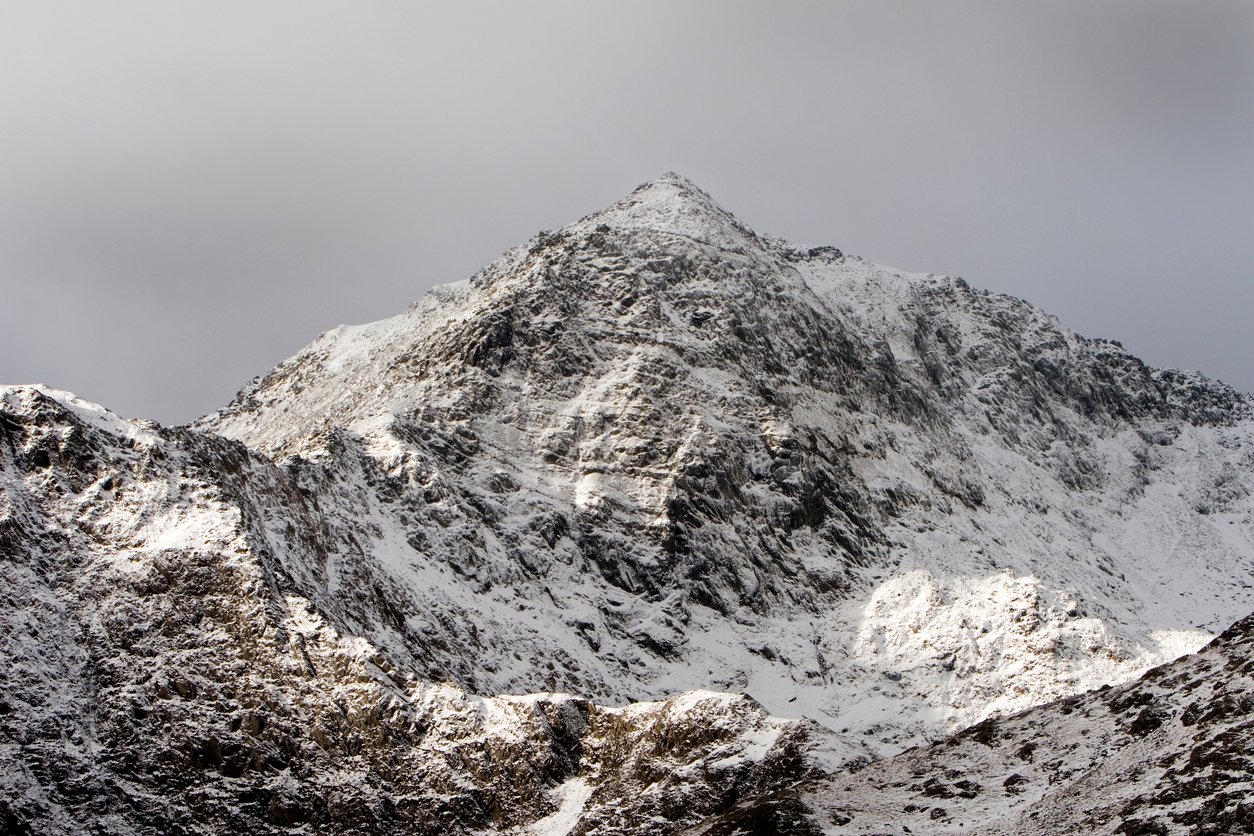
Snowdon (or Yr Wyddfa, as it's known in Wales) is the highest mountain in Wales, reaching its peak at a lofty 1085m metres. On a good day, you can see right across Snowdonia (Eryri) and if you’re lucky, all the way to Ireland. Thousands of people hike to the summit every year – so expect the route to be crowded, especially during the holidays. It is the middle child of the famous National Three Peaks Challenge, being smaller than Scotland’s Ben Nevis (1345m) but higher than England’s Scafell Pike (968m).
Fortunately, there are lots of ways to climb Snowdon, so you can choose to stay away from the crowds. In this article, we've listed our favourite six routes to the summit of Snowdon. Most people come up from the north side along the Llanberis Path. The next most popular routes are the Pyg and Miners’ Tracks from the east side (and you can also ascend via Crib Goch). If you’d like to get off the beaten path, try the routes from the south and west.
To spice things up - if you can sort out a transfer - go up one route and down another. Don’t forget to add the extra distance for the descents to these routes.
Climbing Snowdon from Llanberis (North)
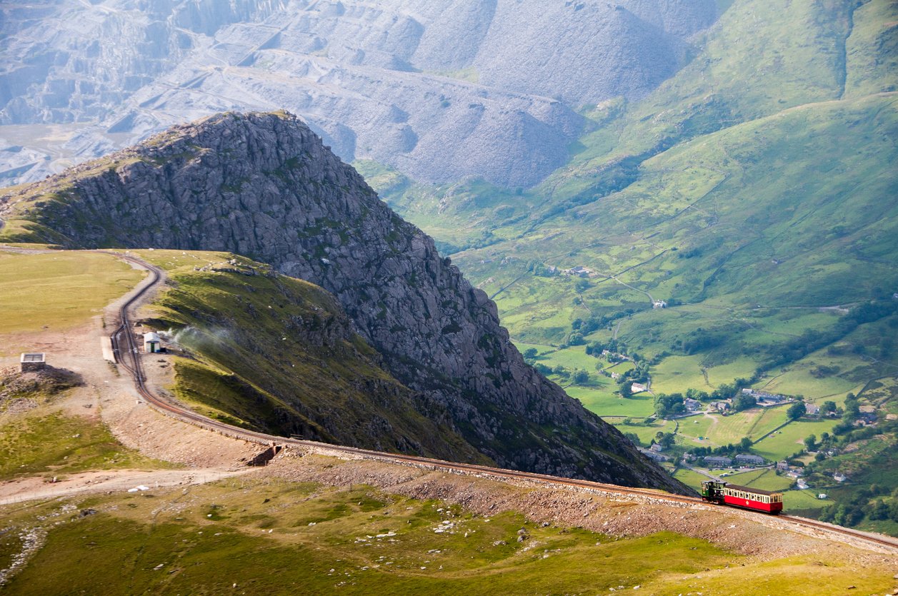
One of the most popular routes to climb Yr Wyddfa is the Llanberis Path. This is one of the stalwarts of the UK hiking network. It follows the route of the mountain railway, taking a long and gentle ascent to the summit.
- Distance to the top: 6km (4 miles)
- Ascent: 850m
- How long it takes to climb: allow at least 3 hours to reach the summit.
The Llanberis Path starts, funnily enough, from the town of Llanberis. You can either park by the Snowdon Mountain Railway station, or stay in town and walk up to the start. Walk up the mountain road a short distance until you see the large sign for Snowdon on your left. The path is well trodden and easy to follow. You’ll gradually ascend alongside (and briefly under) the railway. After the last station, the path takes a final steep ascent to the summit and the cafe. The cafe’s only open in high season, so don’t be too disappointed if it’s shut!
Climbing Snowdon from Pen-y-Pass (East)
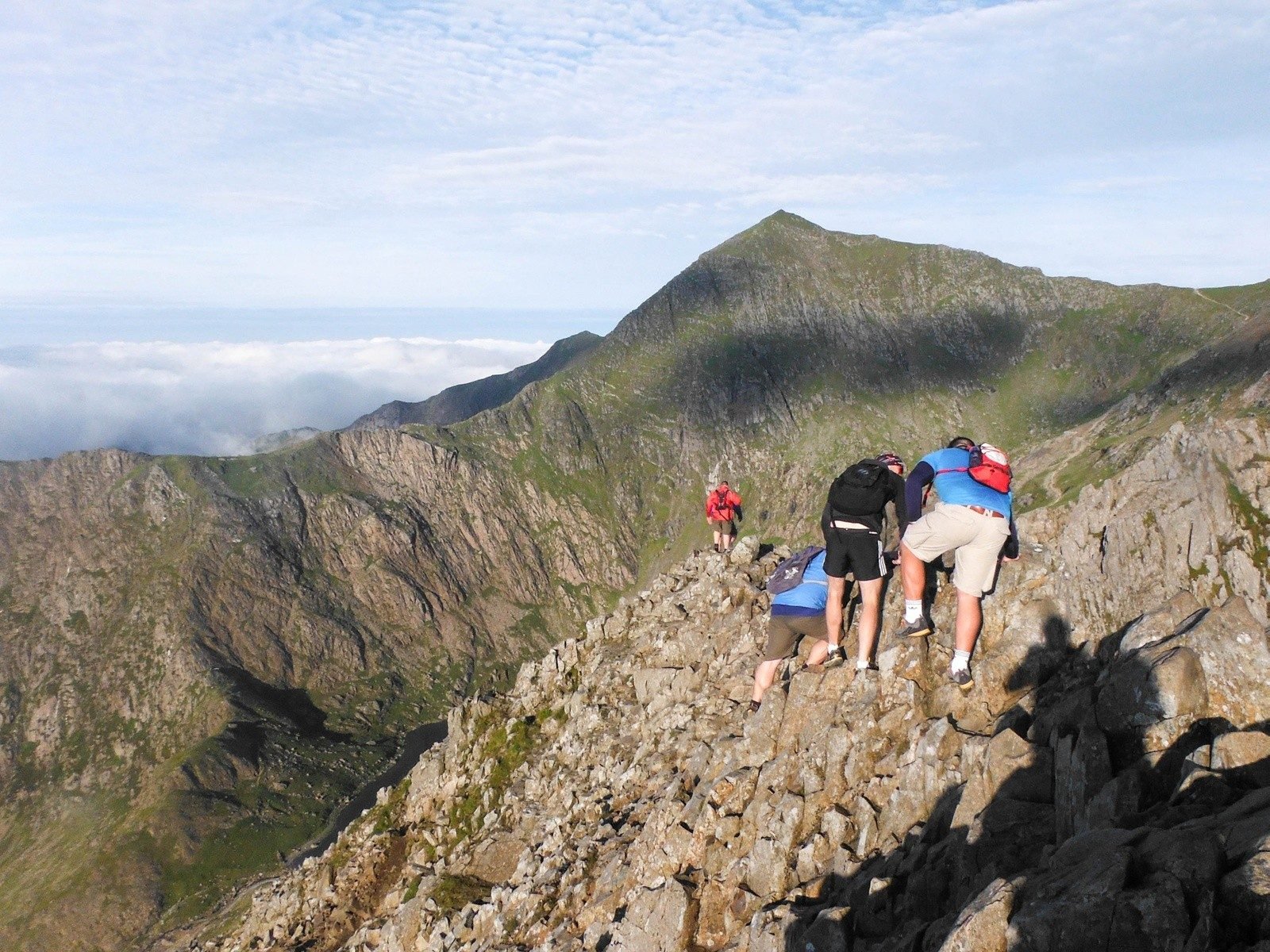
There are three routes to climb Snowdon from Pen-y-Pass, of varying difficulty. The Miners’ Track starts fairly flat, curves around the mountain lakes and then ascends steeply to join the Pyg Track. The Pyg Track climbs steeply and steadily across the hillside from the carpark, below Crib Goch. The third route, that takes in Crib Goch, is a scramble along a rocky edge with steep sides. You have to use your hands to hold on!
- Distance to the top (Miners’ Track): 6km (4 miles)
- Distance to the top (Pyg Track): 5km (3 miles)
- Distance to the top (via Crib Goch): 5km (3 miles)
- Ascent: 750m/750m/850m respectively
- How long it takes to climb: allow at least 3 hours to reach the summit.
Start from Pen-y-Pass carpark. Due to the sheer popularity of these routes, you have to book a parking space a long time in advance. For a day's hiking you can expect to pay £18+ for parking. It might be better to walk to the start from a lower carpark or take a bus from Llanberis in the summer. There is also a convenient Youth Hostel right in the pass. All routes are signed from the edge of the carpark.
At the wall, after some ascent, make a decision about Crib Goch. If the weather is wet, cloudy or very windy, it can be dangerous to take the scramble ridge.
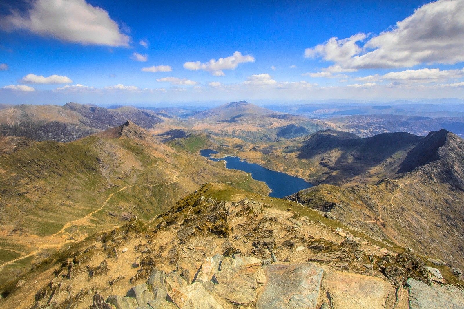
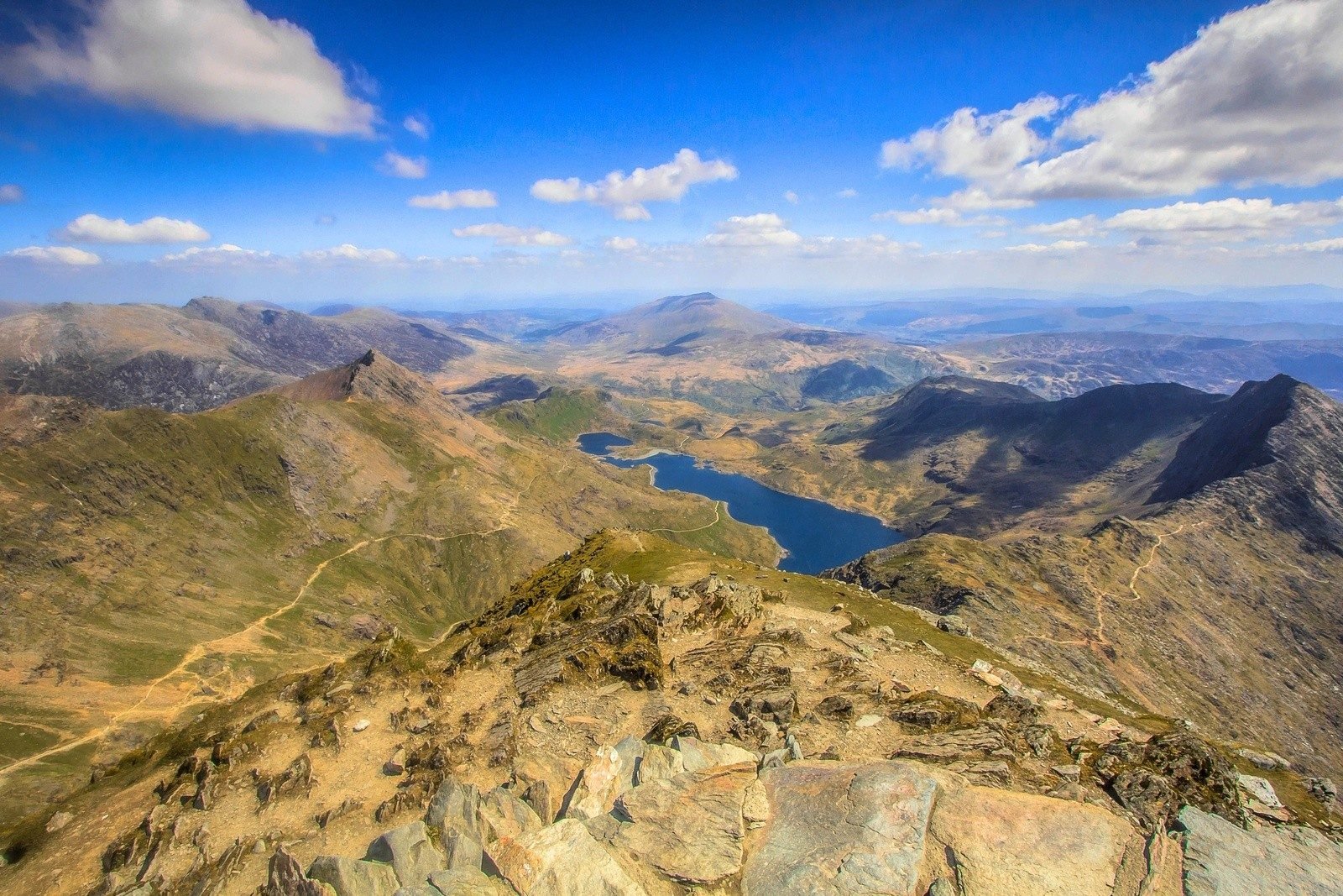
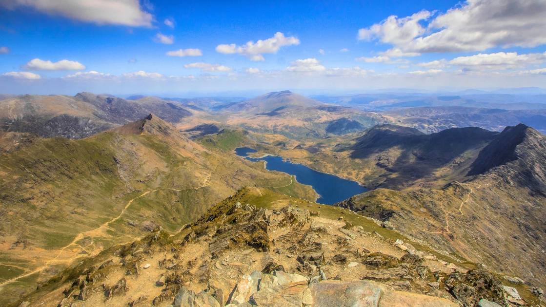
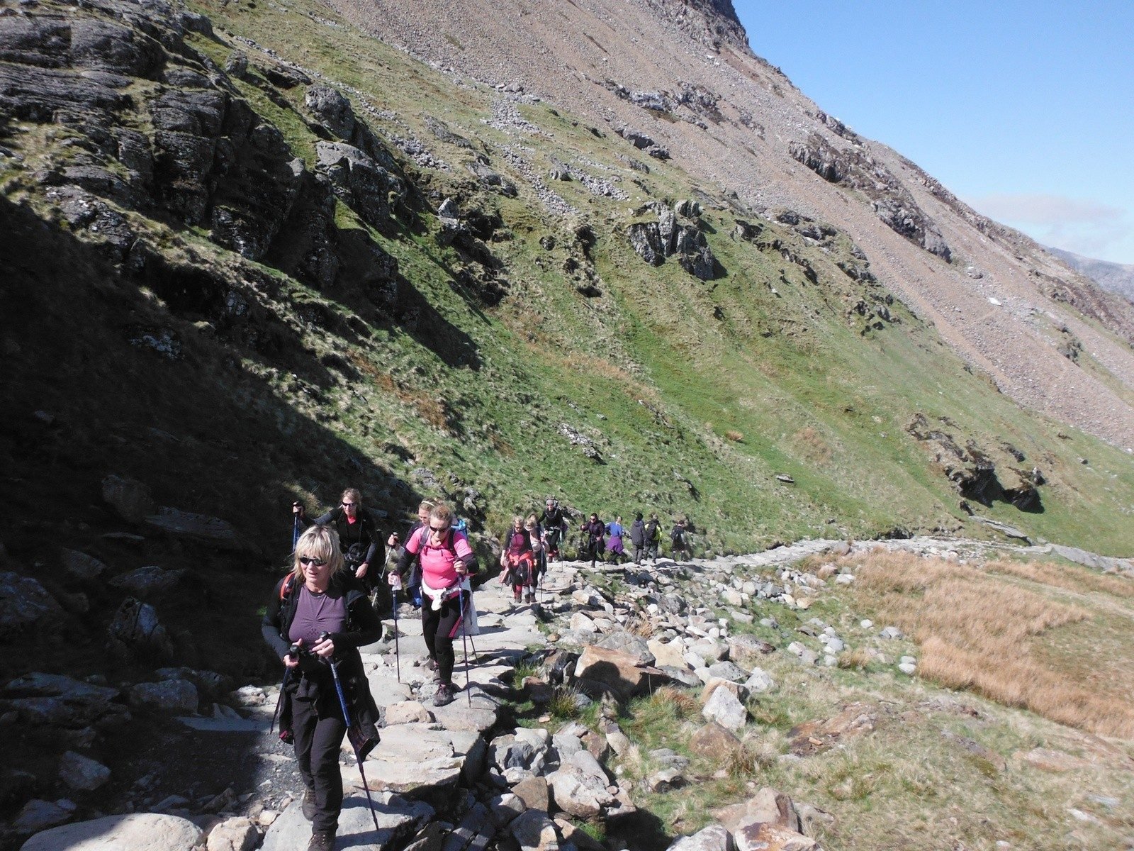
For the Miners’ Track, take the lower path on the lefthand side as you face Snowdon. The path seems flat and wide, taking you on a scenic route beside the mountain lakes of Llyn Teyrn and Llyn Llydaw. The path continues over Llyn Llydaw, with lovely views across the lake in good weather. Then the well made path changes into mountain track and ascends steeply to meet up with the Pyg Track. We're big fans of the route up Pyg Track, and recently included a Snowdon circular walk, featuring that route, on our list of the best hikes in Snowdonia.
For the Pyg Track and Crib Goch, take the stony path out of the righthand side of the car park. There are signposts marking both. At the wall, after some ascent, make a decision about Crib Goch. If the weather is wet, cloudy or very windy, it can be dangerous to take the scramble ridge. It is a grade 1 scramble in summer and a grade 1 climb in winter, more precise route details are available from the BMC.
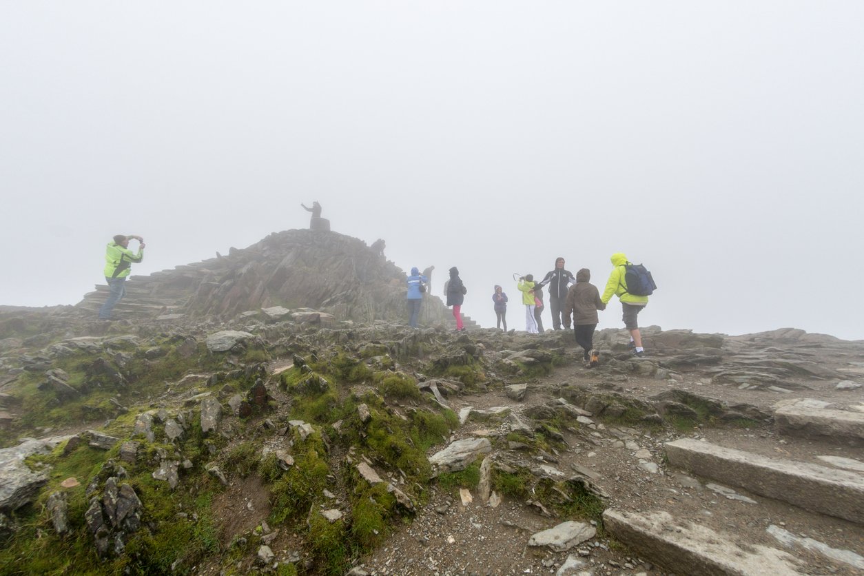
The final section of the Pyg Track and Miners’ Track is combined. You will reach the Snowdon ridgeline along a steep zig-zag path, marked by a large standing stone. From here, turn left for the final short ascent up to Snowdon summit by the same route as Llanberis Path. You will see the cafe and the summit trig point in front of you (unless it’s really foggy).
Climbing Snowdon from Llyn Cwellyn (West)
This route up Snowdon is called the Snowdon Ranger Path. It also starts from a railway station – this time the Snowdon Ranger station of the Welsh Highland line that runs along the valley. There is a Youth Hostel of the same name, both named after a local mountain guide.
- Distance to the top: 6km (3.5 miles)
- Ascent: 900m
- How long it takes to climb: allow 3-4 hours to reach the summit
From the Llyn Cwellyn carpark, follow the bridleway sign across the railway line to a farmhouse. Take a right and follow the path as it winds up the steep mountainside. Soon the path flattens out and, crossing several mountain streams, you will pass above the lake Llyn Ffynnon-y-gwas.
At the lake, your path becomes more difficult. You’ll climb up through a rocky path and scree, with the route marked by cairns. Near the top you will have two standing stones to help you navigate: one marks the path crossing the Snowdon Railway line, the other when you join all other paths to the summit.
Climbing Snowdon from Nant Gwynant (South)
The route from the south of Snowdon is far less popular, so choose this path if you want to get off the beaten track. The Watkin Path takes you up along a mountain stream before cutting up on to the main Snowdon ridgeline.
- Distance to the top: 6km (4 miles)
- Ascent: 950m
- How long it takes to climb: allow 3-4 hours to reach the summit
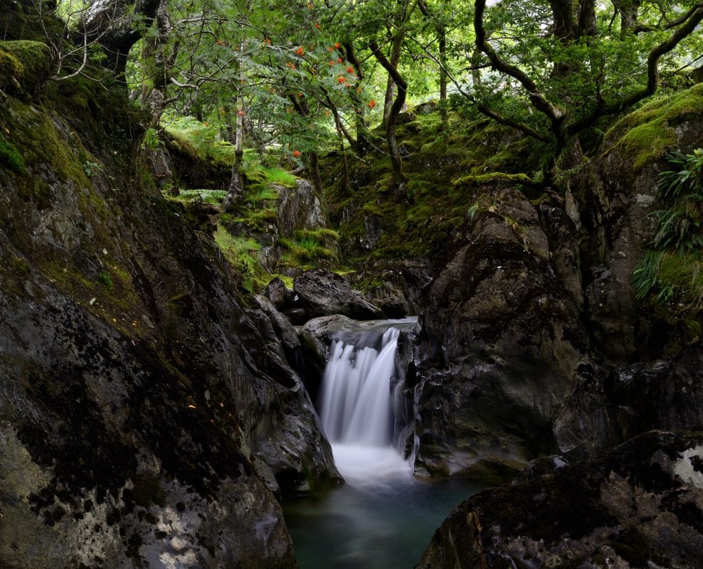
The walk starts from the National Trust carpark, along a well-made path through woodland. You will be walking alongside a river for much of the journey, passing some waterfalls and a hydroelectric plant built by the National Trust. There is also an inscribed rock, marking the day the path was opened in 1892 by Gladstone, the Prime Minister. It makes for an interesting read.
Once you are at the head of the valley, the path gets steeper and narrower as it heads up to the ridge above. Turn left on the ridgeline and follow the path through rocky terrain right onto the summit of Snowdon. Enjoy the look of surprise you’ll get from everyone who’s come from Llanberis or Pen-y-pass. It will look like you’ve arrived through the back door!
What do I need to take to climb Mount Snowdon?
This is not just a stroll in the park! You’re climbing the highest mountain in Wales after all. It’s a good idea to come prepared for a full day out and whatever weather might be thrown at you. You can check the forecast before you leave – and see what the weather looks like on Snowdon’s Webcam. Don’t be surprised if the weather changes dramatically during the day though.
What equipment do I need to climb Snowdon?
The equipment you'll need to climb Snowdon is quite typical for a mountain hike in the UK. Bring the following gear for your walk:
- Sensible walking boots with ankle support
- Waterproof jacket
- Other layers (we'd recommend a breathable t-shirt and a fleece)
- Appropriate top layer (i.e. down jacket), if weather demands
- Waterproof trousers
- Hiking socks
- Enough food for the day (more than you’d normally eat because you’ll be exercising)
- Enough water (at least two litres)
- Comfortable, quick-drying trousers for walking in (jeans will chafe)
- Map and compass
- Warm hat and gloves, sunglasses and suncream depending on the weather
Staying safe in the mountains
Accidents happen on mountains in the UK - and they happen on Snowdon too. Remember that these are only rough guides to the routes, it’s up to you to work out your exact route and navigate it on the day. It’s important to take some form of navigational tool, preferably a map and compass – and know how to use it! There might be signposts and a queue of people, but that doesn’t mean it’s always safe.
Be aware of the weather and be prepared to turn back. I have tried to climb Crib Goch four times over several years. Each time the forecast has been for 80mph winds and so I’ve had to take the Pyg Track instead. It’s frustrating to have to change your plan, but better for everyone in the long run. The mountain will always be there.
Inspired? Take on the Snowdon Challenge, including a hike up the Snowdon Ranger path, or check out our other UK adventures.