


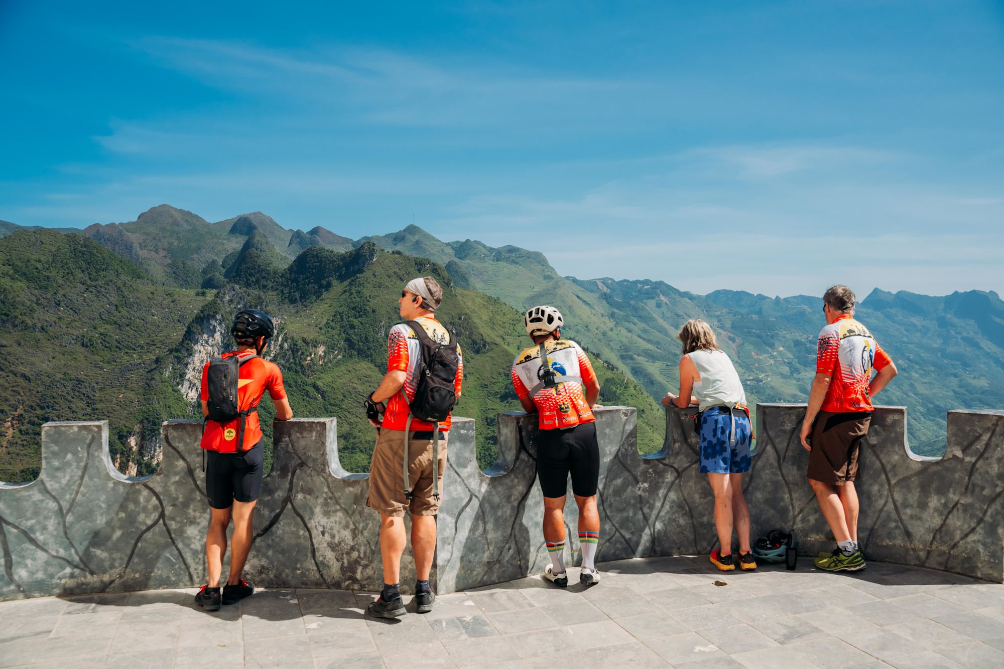
The Ha Giang Loop is a route through the soaring karst mountains, steep rice terraces and indigenous villages of Vietnam’s far north. It takes you through the Ha Giang province, one of the most ethnically diverse areas in the world – home to 16 indigenous ethnic minority groups, including the H’mong and Tay people.
The Ha Giang Loop (also known as the Ha Giang Gauntlet) recently surged in popularity as a route for motorcyclists. However, according to Thai Hang, who leads cycle tours across Vietnam, it’s also an ideal challenge for experienced cyclists.
Vietnam is a country built for two wheels
“Vietnam is a country built for two wheels,” he says. “Our roads and trails are designed for motorbikes, which means with a bicycle you can go anywhere. I’m a route designer, so I spend a lot of time exploring and looking at the map, trying to connect places.
“We designed our own variant of the Ha Giang Loop. It's a seven day ride that goes from mountain to mountain, and village to village. Every day you’ll see something new.”
- Start point: Viet Quang
- End point: Hà Giang city
- Length: 204.4 miles (329km)
- Stages: 7
- Total elevation gain: 7,450m (24,442 ft)
- Total elevation loss: 10,300m (33,792 ft)
- Best for: experienced cyclists wanting a remote ride
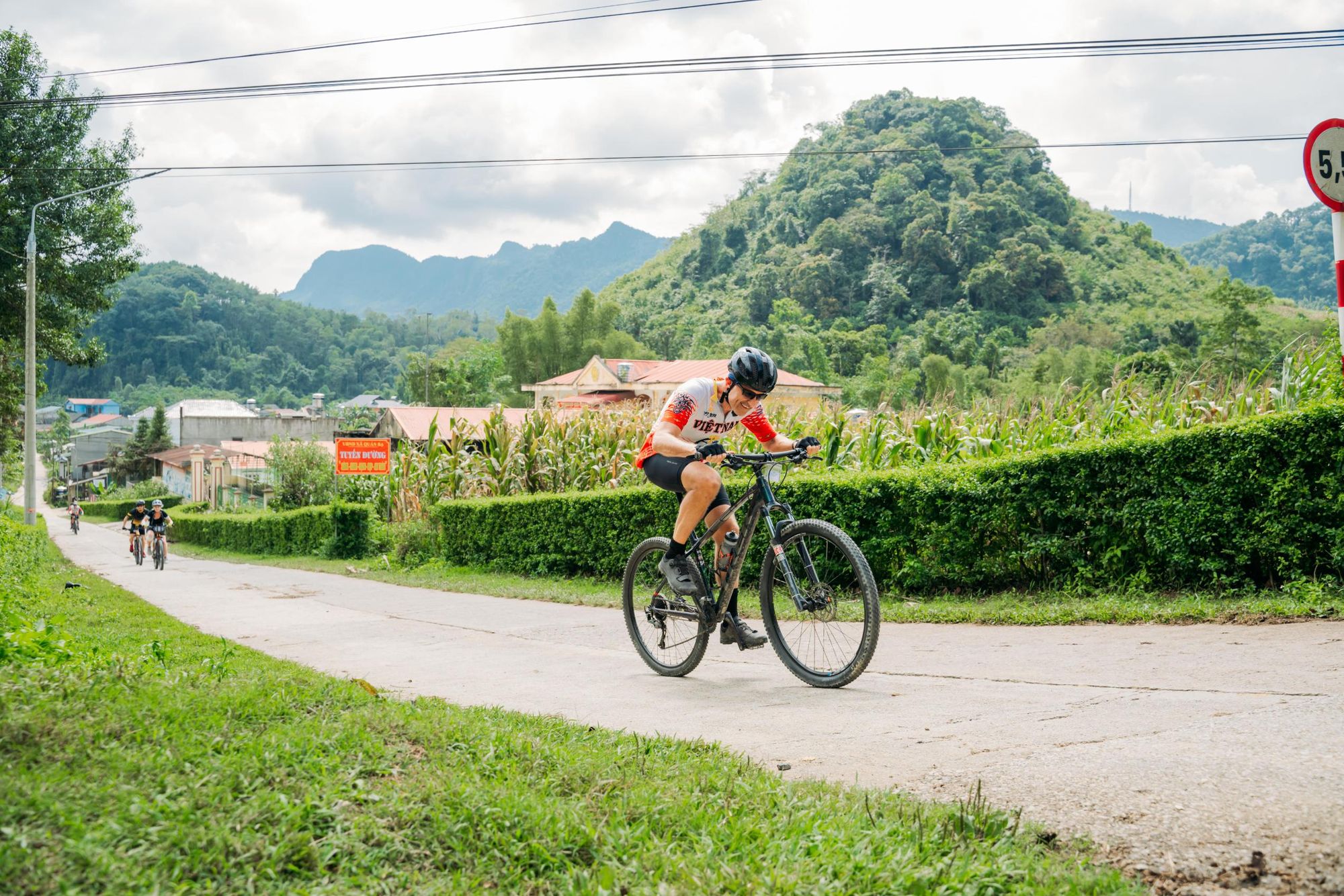
Thai’s version of the Ha Giang Loop begins in the small town of Viet Quang. The first stage is a short 13.6 mile (22km) ride allowing you to acclimatise to being in the saddle. You’ll cycle on steep backroads through lush valleys and terraced rice paddies towards the mountain town of Hoang Su Phi.
The second stage is a longer 40.3 mile (65km) ride. You’ll begin by cycling 4.9 miles (8km) along dirt tracks, winding past hillside villages surrounded by terraced mountainsides, and conclude by tackling a steep uphill stretch to the city of Ha Giang.
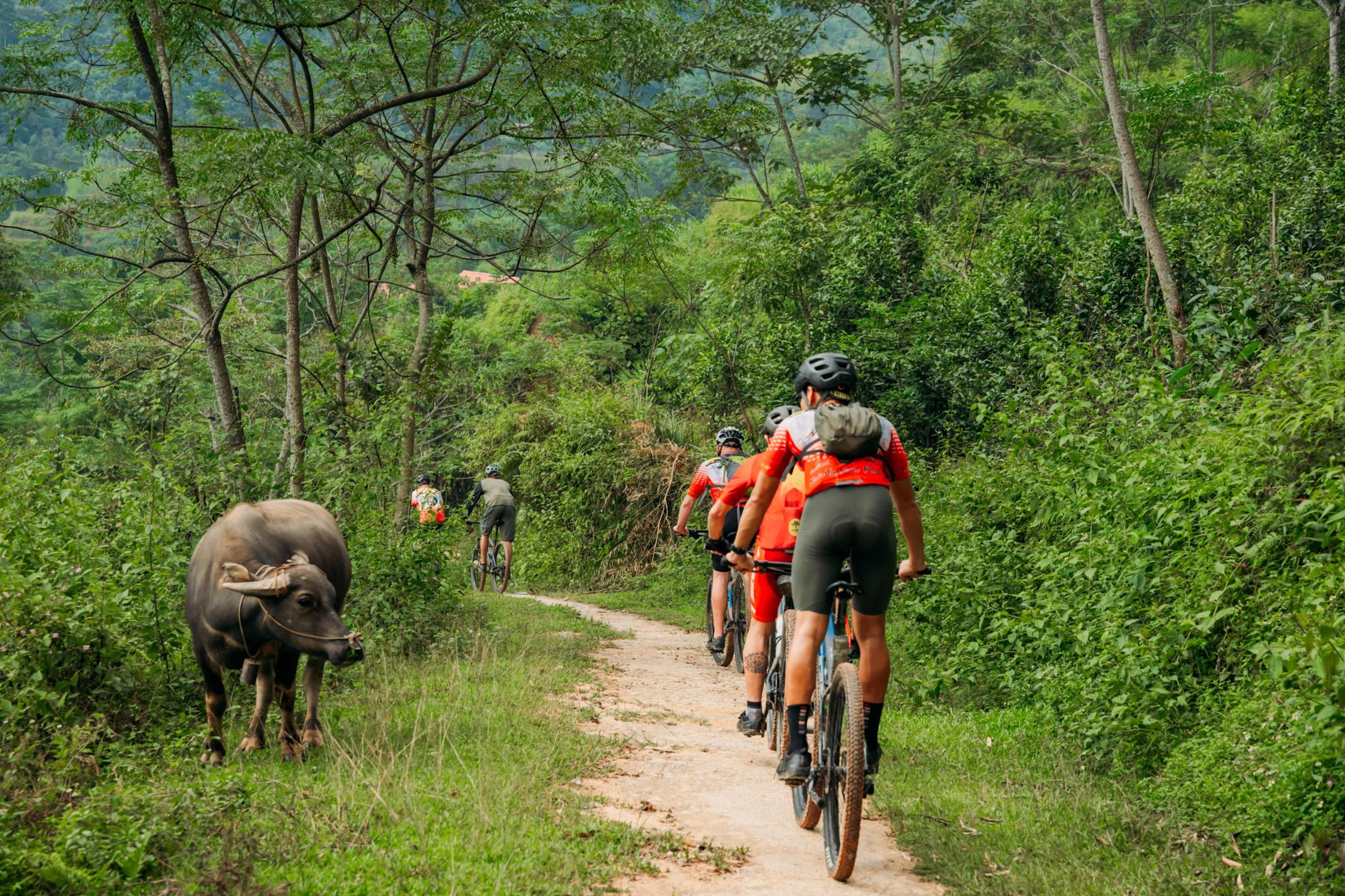
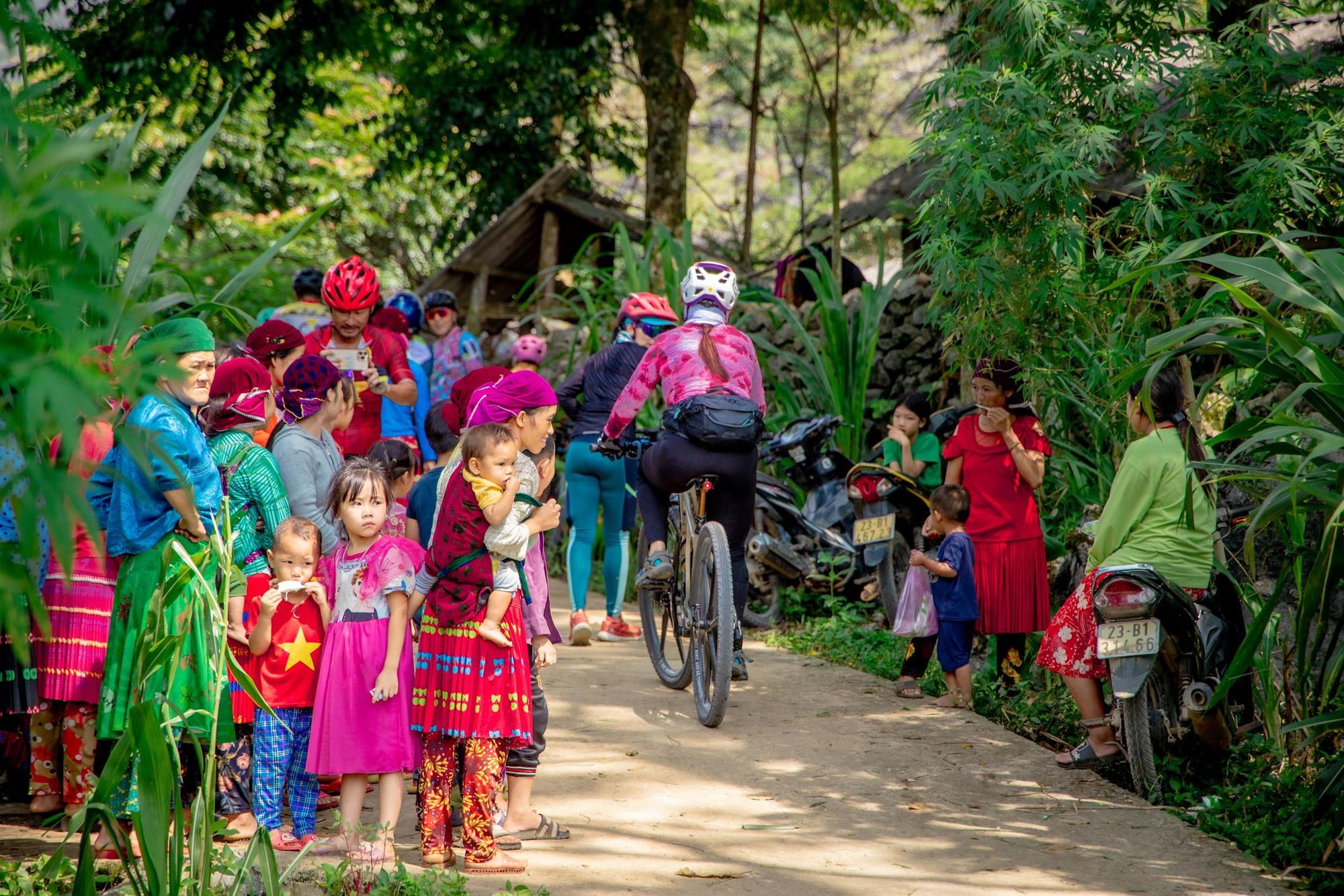
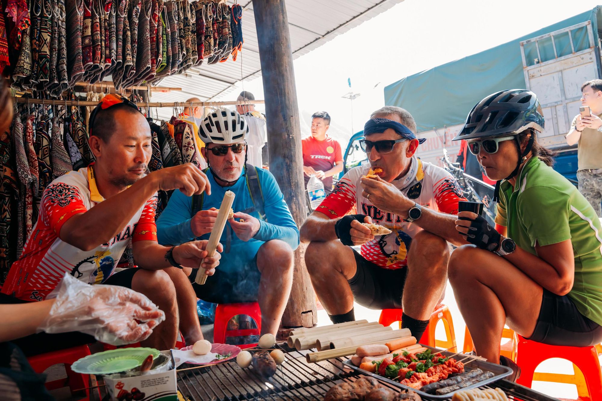
“You share the road with buffalo and cows,” Thai says. “Every indigenous group has a different style of house; you have a chance to visit local houses and learn about their culture. You also have time to stop in the villages, try some local food and go for a short walk to look around.
“The Vietnamese villagers love to see cyclists. They’ll see bus tours from time to time, but they’re far happier when cyclists come; they want to share more with these tourists. Sometimes you might pass them having a reunion or anniversary, and when you cycle past they might stop you and invite you for a drink.”
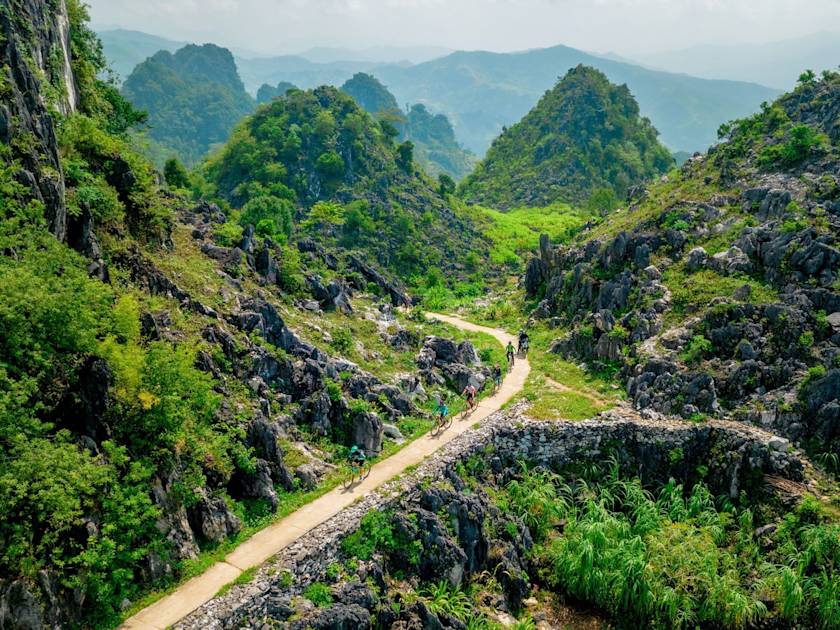
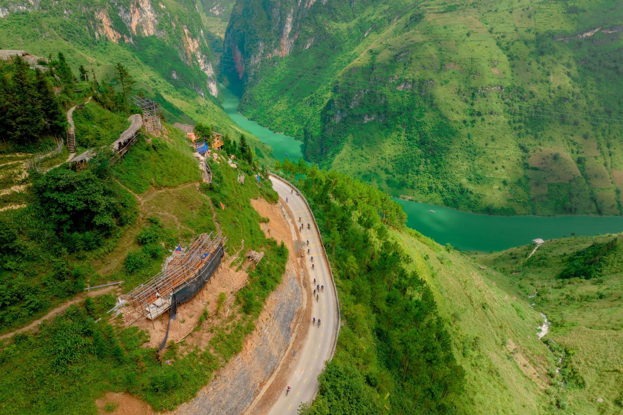
Stage three – the longest at 43.4 miles (70km) – begins with a short transfer to the mountains of Ha Giang. You’ll cycle past rows of conical limestone peaks carpeted in forest, ascending 1,355m (4,455 ft) across the day. The high point is a ride through a steep pass named 'Heaven’s Gate 1'. Your reward is a view of the Tam Son Valley, where the verdant valley floor is surrounded by high mountains including the undulating Twin Hills. You’ll descend to the village of Yen Minh.
On the fourth stage of the route you’ll cycle part of the way along the ‘Happiness Road’, so-called because it was built to connect remote communities together and bring prosperity to the Ha Giang region. The road is known for its sharp curves and the breathtaking landscapes it passes through. Today’s ride takes you through the Dong Van Karst Plateau, a UNESCO Global Geopark with a landscape of towering karst mountains, rock fields, and plunging valleys. The 31-mile (50km) stage concludes at Dong Van town.
Thai’s favourite part of the route is the fifth stage, which begins with a ride along the Sky Walk, a road known for the mist that often surrounds it, making you feel like you’re pedalling through the clouds.
“On this day you travel part of the route on water, taking a boat trip through the Tu San Canyon, the deepest canyon in South Asia,” he says. “The canyon is 700m tall; when you cycle along the top, you can see the Nho Que River and the mountains from a distance. We start this trip in November, and at that time of year the colour of the water is really blue, because of the limestone.
“You cycle all the way downhill to the river. Then you do the boat trip, where you can relax and look at the route you cycled from a different view.”
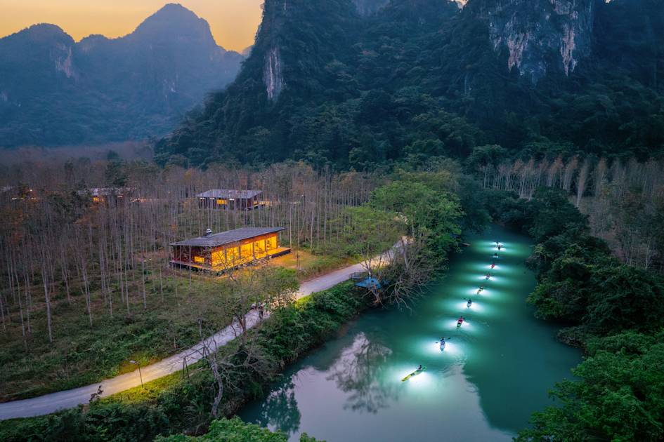
The penultimate stage of the Ha Giang Loop (33.5 miles/54km) is the most challenging part of the route. You’ll cycle on the relentless uphill road from the village of Meo Vac towards the summit between the villages of Lung Ho and Mau Due, testing your fitness along numerous hairpin bends. After a picnic lunch at the summit, you’ll descend 1,545m (5,069 ft) to the riverside village of Du Gia, known for its vibrant local market.
On the seventh day of your cycle ride, you’ve got a three mile (5km) uphill climb through a remote mountainous area, the limestone cliffs pockmarked with caves. Luckily, it’s followed by a more relaxed 12.4 mile (20km) descent. The final 6.2 mile (10km) stretch takes you along dirt roads into Ha Giang.
How Hard is the Ha Giang Loop to Cycle?
According to Thai, the Ha Giang Loop is one of the most challenging long distance cycle routes in Vietnam.
“People love this trip – the challenge, the culture, the scenery – but it’s for experienced cyclists only,” he says. “There’s a law that the main roads can’t be built too steeply, but the villagers like to build the fastest way to connect village to village. So some sections have a gradient between 18 and 25%.
“Some days you climb between 1,000 to 1,500 metres. We have some days which are more downhill – you go up 800 metres but go down 2,000 metres. We normally cycle around 60 kilometres a day.”
People love this trip – the challenge, the culture, the scenery – but it’s for experienced cyclists only
Thai recommends cyclists use a mountain bike with front suspension. “Every day will be mainly paved, but there are also some wide paths which are a mix between dirt and sand, and a lot of downhill as well,” he explains.
It’s worth noting that an extra layer of challenge will be added if you choose to cycle the route independently, rather than with a guide. Thai recommends the latter, especially if it’s your first cycling experience in Vietnam, as road conditions can be difficult.
“We have a full support team. You have a van with you, which can carry luggage, food supplies and spare parts for the bikes,” he says. “Every two hours or 15km there will be a water stop, where you can access the support vehicle. So that means you travel light, you don’t have to carry 20kg of luggage with you – it makes a huge difference.”
Food and Accommodation Along the Ha Giang Loop
Accommodation along the Ha Giang Loop consists primarily of small family-run hotels and homestays, giving you the opportunity to meet members of the community. The homestays are often built with locally sourced materials, such as stone or clay, and many are in natural surroundings with excellent mountain views.
Getting a decent meal won’t be a problem along the route either.
“We love food, and being cyclists we really understand that you need energy. So in every town and village we try something good and nutritious,” Thai says. “North Vietnam has very good vegetables and tofu. The main dish is fried tofu with fresh tomato sauce.
“In the mountains they cook a lot of barbecue. 50 years ago they couldn’t find cooking pans or pots easily; the best way to cook was over charcoal, so they’ve become good at that. And you must try bamboo rice - the rice is steamed inside the bamboo, so the flavour infuses into it.”
When to Do the Ha Giang Loop?
Thai recommends cycling the Ha Giang Loop during the dry season, from the middle of September to the end of December, and the end of February to the end of May.
“During January and February the weather for cycling is alright, but you have foggy days so you can’t see a lot,” he says. “Avoid the rainy season, from the beginning of June to the beginning of September. When it’s heavy rain, it’s not safe to ride.”
Inspired? Come with us to Cycle the Highlands of North Vietnam and complete the Ha Giang Loop.