


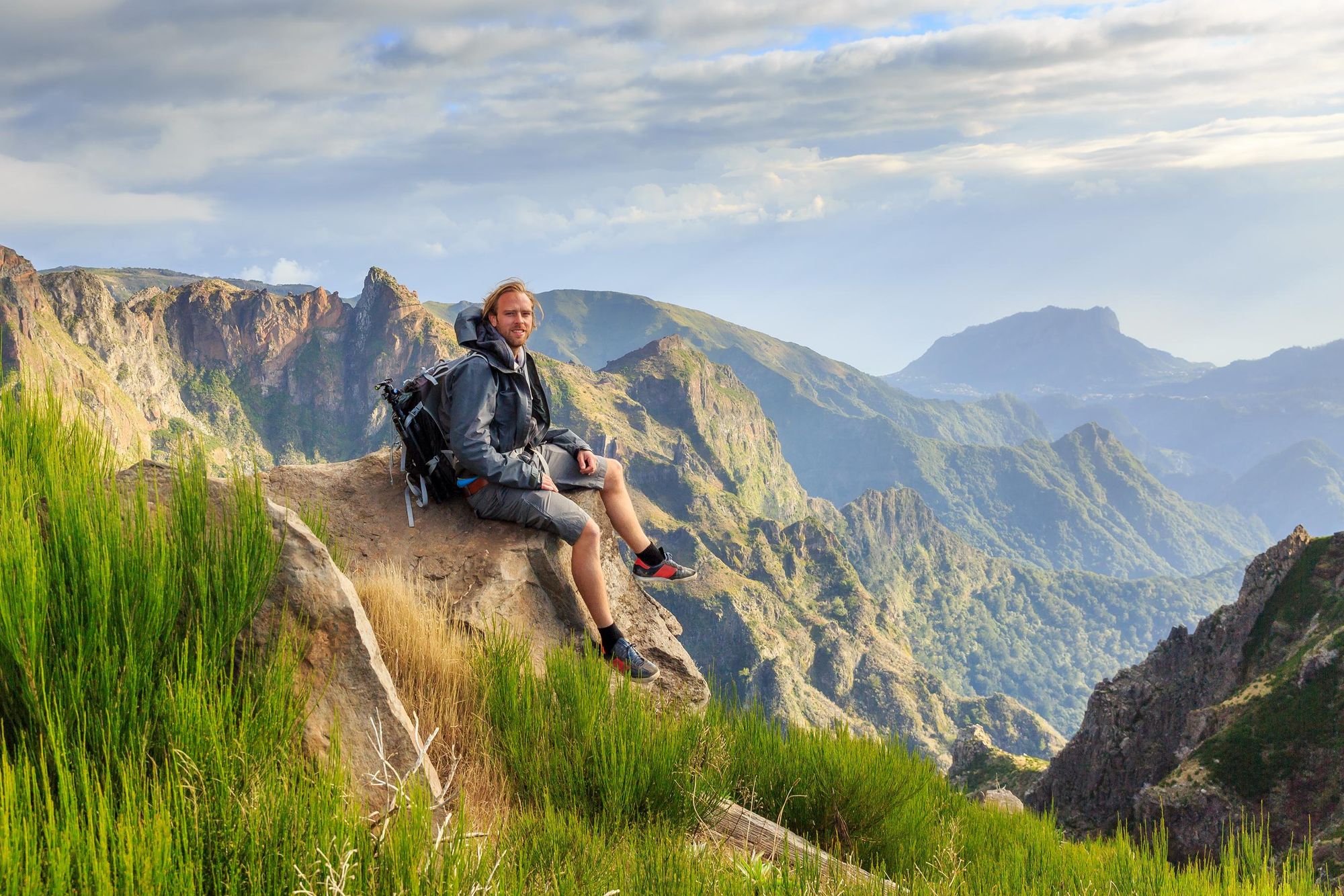
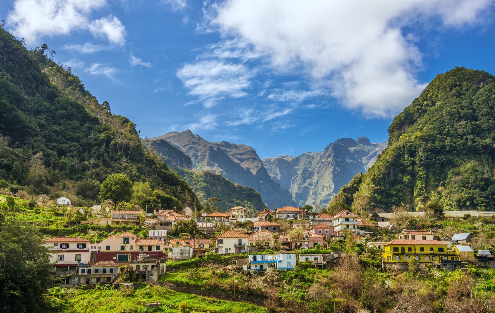
The first time I went hiking in Madeira, my tour guide explained that the island used to be a place primarily for “the newlywed or nearly dead.” As we hiked up the mountain in time to catch sunrise over Pico Ruivo (1,862m), the highest point on Madeira, it was clear that this had now changed. The place has become a haven for adventurers, and as panoramas of layering, rugged mountains lit up in the wispy clouds around us, it wasn't hard to see why.
Sure, you still get people flocking to Madeira to flop and fry. The year-round sunshine makes sure of that, but the place is a hub of adventure now too. The waves in Madeira attract surfers from around Europe. The mountain biking trails host winter training camps for professional riders each year (as well as the odd Enduro World Series stop), and the hiking trails? Well, they're absolutely terrific.
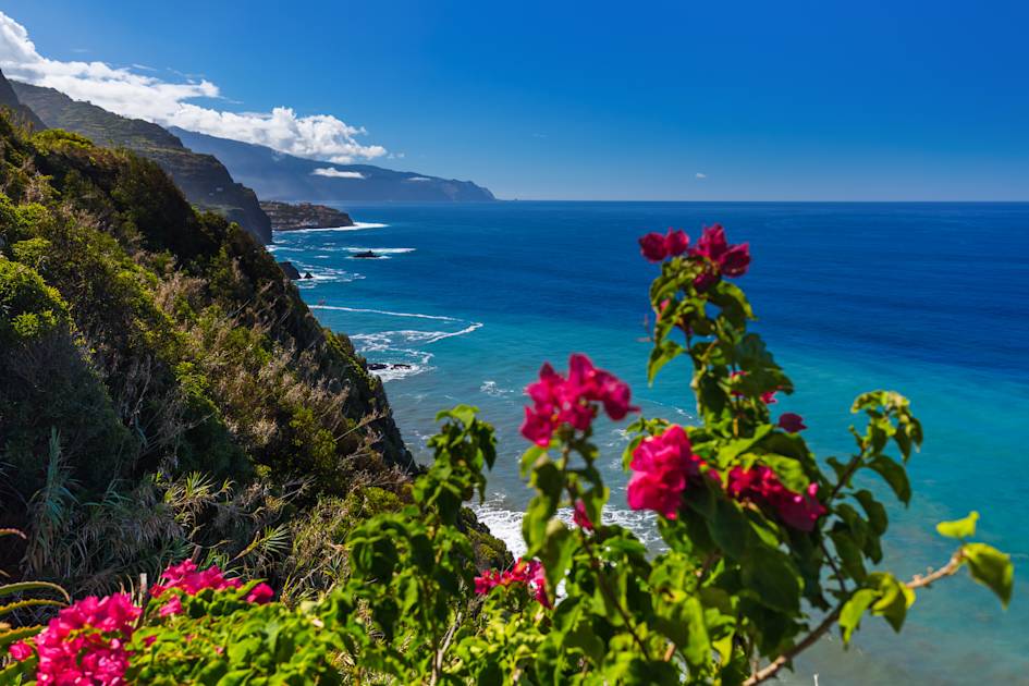
The strength of Madeira hiking lies in the variety of the terrain on the island. Rising from sea level to 1,862m, the island is a veritable playground, and much of the terrain is easily, and quickly, reached. So, hikes in Madeira can mean anything from climbing mountain peaks with Atlantic views to walking through lush forests to strolling around the rugged, cliff-drop coasts on a dry and dusty path.
5 of the Best Hiking Routes in Madeira
In listing the best Madeira hikes, we've aimed to create a collection that showcases the enormous diversity you can find across the island - and of course, we've also highlighted the trails that've stuck in our memory from our time exploring Madeira, the Hawaii of Europe, where the sun shines year-round.
- Pico do Areeiro to Pico Ruivo
- Ribeiro Frio to the Portela Pass
- Risco Waterfall and the 25 Fontes (Springs) Walk
- Climb Penha d'Águia (Eagle Rock)
- Vereda da Ponta de São Lourenço
Several of the hikes are featured in our Coast to Coast Traverse of Madeira and our Wild Isle Adventure in Madeira.
"I was blown away by its primordial beauty," says Marta Marinelli, Adventure Expansion Manager at Much Better Adventures. "Think lush mountains, tropical nature, high cliffs and jagged peaks. At times you feel like you are in Jurassic World. Many people still have preconceptions around Madeira, and associate it with cruiseships, or think of it as a retirees sunny playground, but it's the opposite of that. It's one of the best adventure and trekking destinations in the world - and I love being able to change that destination stereotype through travel. The trip really showcases the wild nature and the heart of the island."
It’s important to note that these route descriptions are only short summaries, designed to inspire but not to serve any navigational purpose. They are not intended to guide you on the route and further mapping and planning (or a local guide!) will be required if you want to safely walk any of the trails featured.
Here’s our guide to the best walks in Madeira, and when to visit the island.
UPDATE: After the wildfires in Madeira in August 2024, several of the routes below remain currently shut or are altered indefinitely. Check official sources for the most up to date routes and for path safety before setting off.
1. Pico do Areeiro to Pico Ruivo
- Start/Finish: Pico do Areeiro car park (out-and-back)
- Distance: 7.5 miles (12km)
- Duration: 3hr (one way)
- Difficulty: Challenging
- Best for: Climbing Pico Ruivo
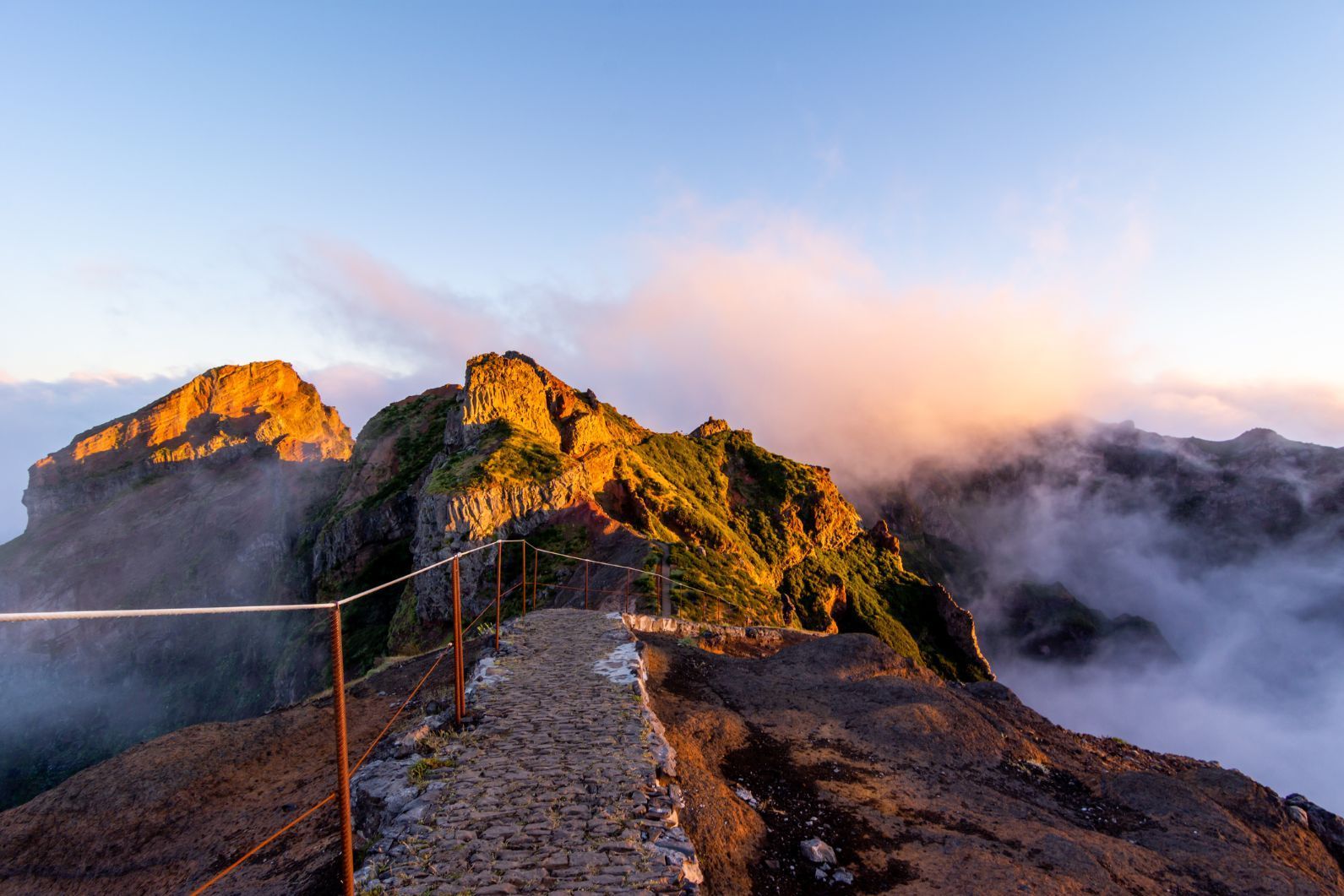
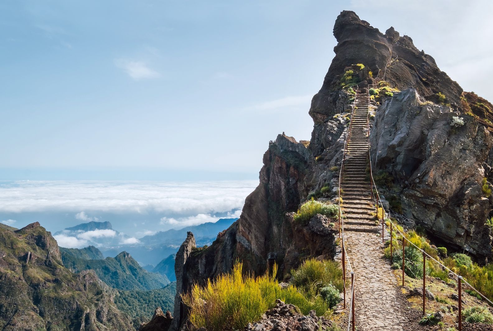
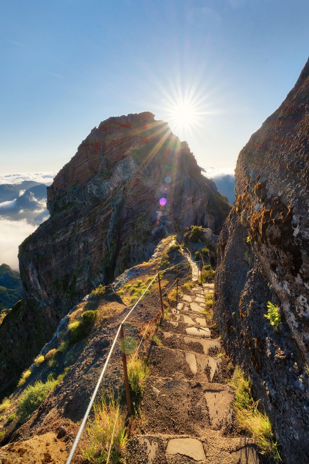
There are various routes up Pico Ruivo do Paul da Serra (1861m), the highest mountain in Madeira. The one we’ve selected here is one of the most challenging (so be prepared), but it's also one of the most famous routes on all of Madeira.
Those looking for an easy route up the mountain, which is more commonly known as Pico Ruivo, should take the path from the stony car park, past the Bica da Cana viewpoint, at Teixeira. It’s short, steep and dramatic, with a levada on the way, a central ridge, and all those remarkable views from the summit.
The path we’ve selected is a lot more demanding, and a head for heights is required. The route runs from Pico do Areeiro (Madeira’s third highest mountain, at 1818m) over to Pico Ruivo, crossing some of the most beautiful terrain in Madeira. It’s an obvious path, but you’ll also be following the markers for PR1.
Starting from the car park below Pico do Areeiro, you’ll climb a set of steps and reach the peak of the mountain pretty quickly. You’re straight into breathtaking views here. Follow the signposted route to Pico Ruivo, and walk on to the lookout at Miradouro do Ninho da Manta to gaze over your route. It's now time to descend from Areeiro. You’ll cross tight cliff faces, take on steep zig zags and descend through tunnels, often emerging to far-reaching views.
There’s then the choice of an eastern route or a western route around Pico das Torres (1853m), the second highest peak in Madeira. This comes a bit over halfway. You may be forced onto the west route as the east is prone to closure due to rockfall. If both routes are open, you can take one route heading out, and the other back.
The paths on this route can be brutally exposed, but they’re beautiful for it. Think dark grey rock faces rising like needles to pierce the sky. The raw, rugged nature of the rocks is unable to hide behind the lush greenery which coats it, and the mountain paths themselves have been carved deep into the mountain.
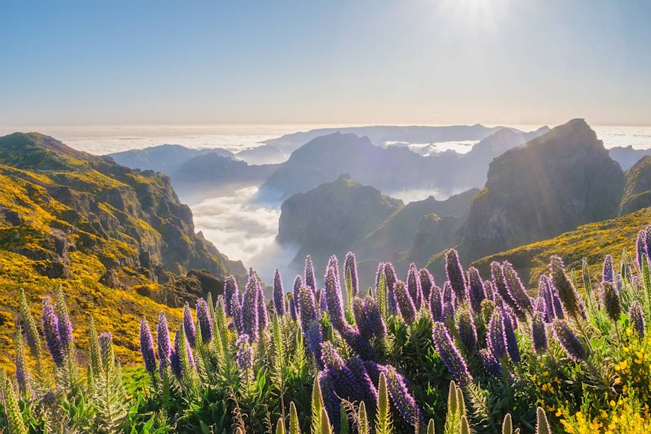
There's a fair number of steps but twisting and turning, you’ll eventually make it to Pico Ruivo - the high point of Madeira. From here, it’s back the same way, though there are several other routes down if you're not tied by a pick-up point.
2. Ribeiro Frio to the Portela Pass
- Start/Finish: Restaurante Ribeiro Frio/Portela
- Distance: 6.5 miles (10.7km)
- Duration: 3hr 30 mins (one way)
- Difficulty: Easy/moderate
- Best for: A first levada walk
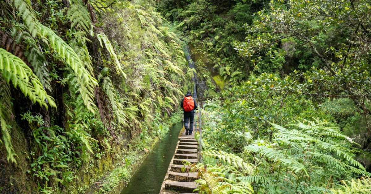
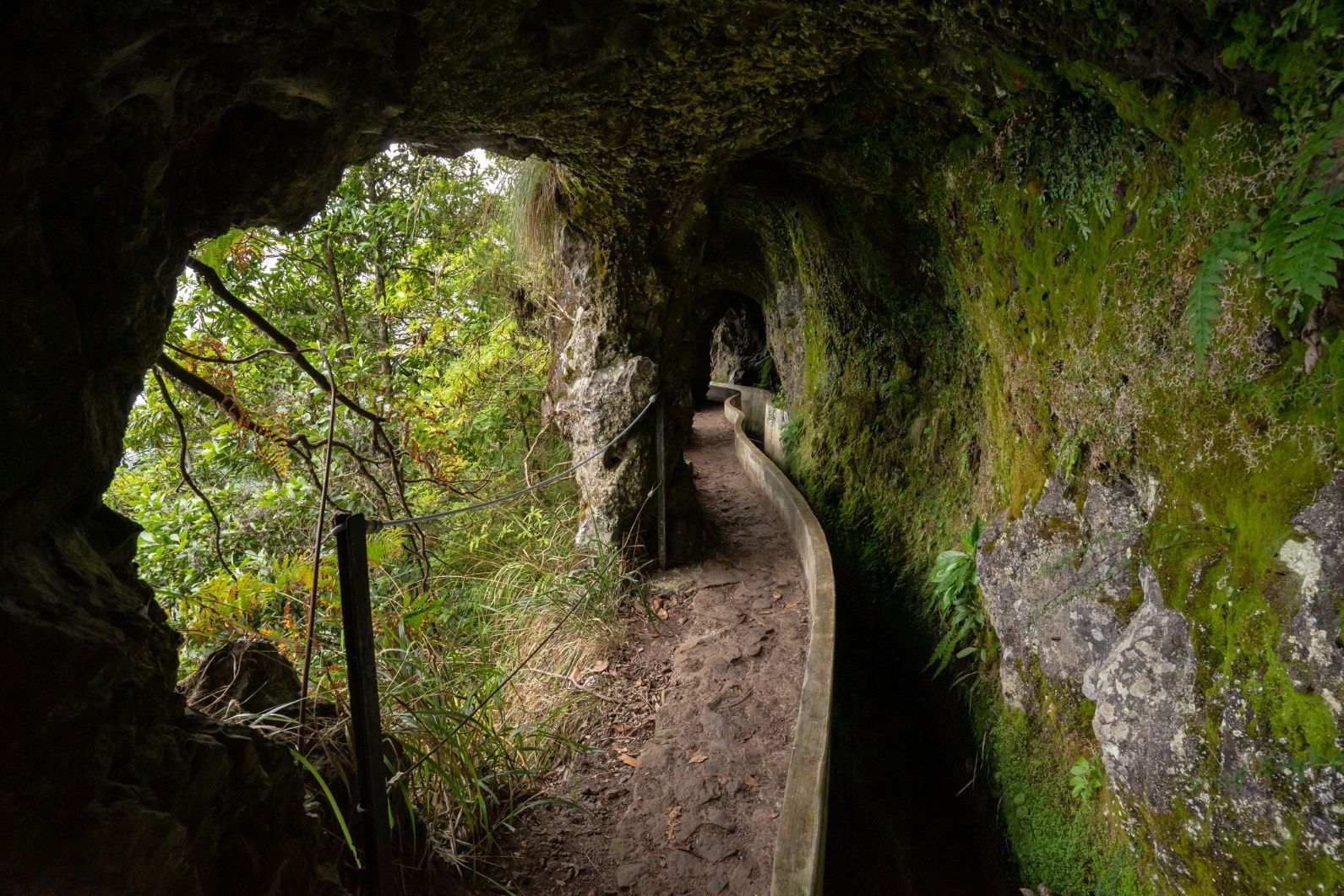
The deep, mountainous valley of Ribeiro Frio, translating as “Cold River”, is one of the most remarkable in Madeira. Here you’ll be following the classic PR10 / Levada do Furado route, which is over two centuries old. Your starting point is next to the Restaurante Ribeiro Frio, and you should already see a sign pointing you to Portela at this point. Which is always reassuring!
Begin on your journey and you’ll soon cross a river and follow some steps down to the levada and the laurel forest, or Laurisilva Forest, as it’s known in Madeira. These astonishing forests are renowned for their biodiversity, and provide an interesting insight into what the whole island (and much of the continent beyond) would have looked like until the last glaciation. The forests are UNESCO protected, and nearly all the plants and animals here are here exclusively.

The paths will be narrow, and the odd bit of tricky navigation may arise, with slippy banks and rocks that will need to be bypassed. That said, the route is pretty clear. You’ll get some good views up to the mountainous regions of Madeira, but the highlight of this trail comes when the path descends into the rock face. Continue on to views of Eagle Rock to the north-east, and then continue to follow the levada and signposts down to the Portela pass, and the small town of Portela.
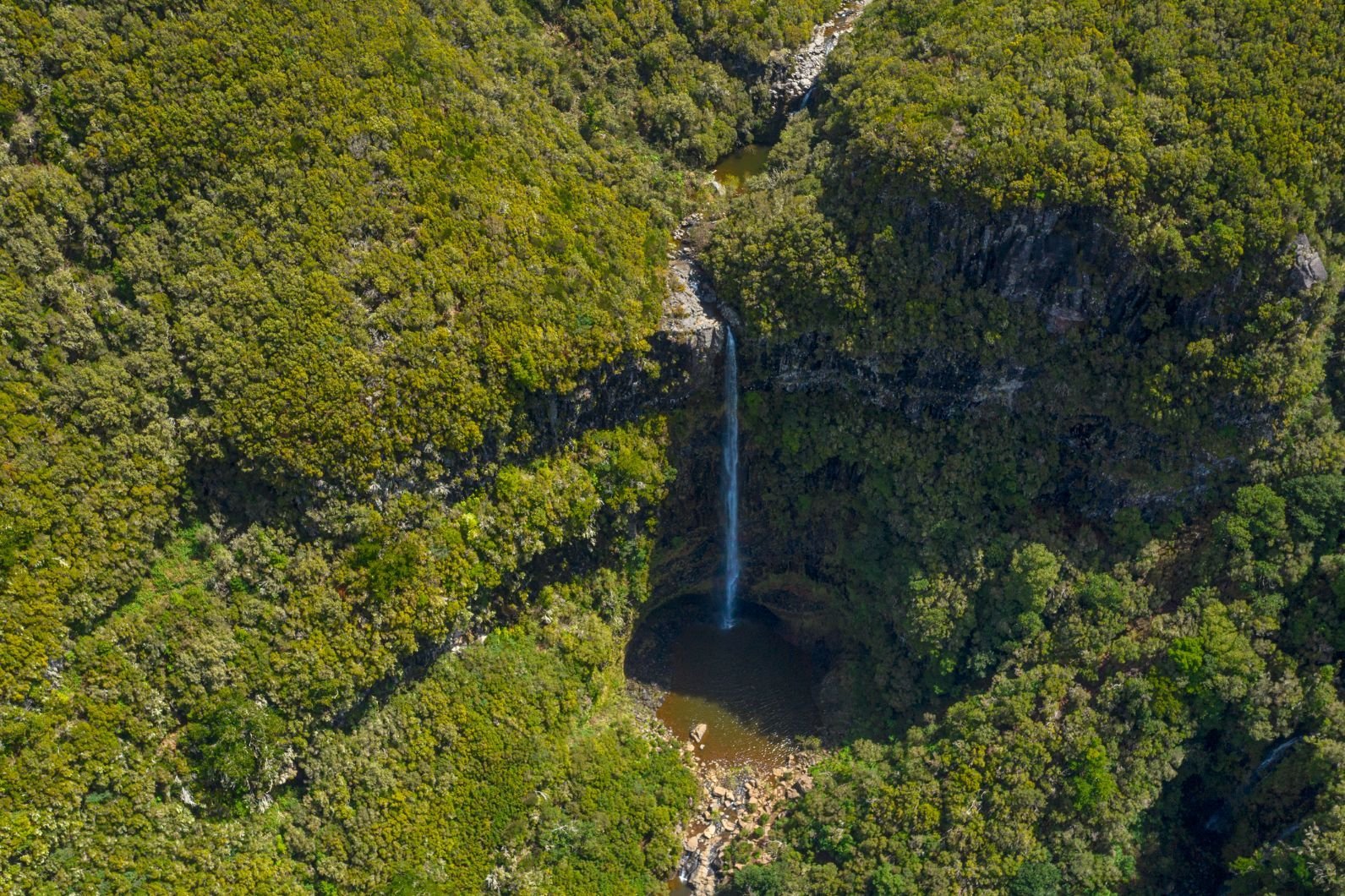
3. Risco Waterfall and the 25 Fontes (Springs) Walk
- Start/Finish: Rabaçal (E.R. 105)
- Distance: 6.4 miles (10.3km)
- Duration: 3hr (circular)
- Difficulty: Easy/moderate
- Best for: A scenic stroll in nature
The walk to the Risco Waterfall and the 25 springs, known in Portuguese as Vinte e Cino Fontes, is one of the most popular in Madeira. It’s also one of the best for families, with big forest views and plenty of water features to keep everyone interested along the way.
The walk to the springs is listed as route PR6, with the extension to the waterfall being route PR6.1. We highly recommend going to the waterfall. It’s beautiful.
You’ll reach the waterfall relatively early on in your hike. It’s an out-and-back detour of the PR6 route to the springs. Follow the levada and you'll soon see the water cascading 100m down the rocks to the pool below. It’s back the same route, and then onto the PR6 proper for the 25 springs. There’s soon a short, steep descent, and the walk offers great views of the Ribeira da Janela as you go.
Trust in the wide path next to the levada, and a bridge which will take you across a narrow gorge. You’ll pass a couple more bridges and need to deal with a few more staircases before you arrive at the 25 springs. You’ll feel like you’ve just arrived at a secret little haven. Enjoy, and see if you can count all 25.
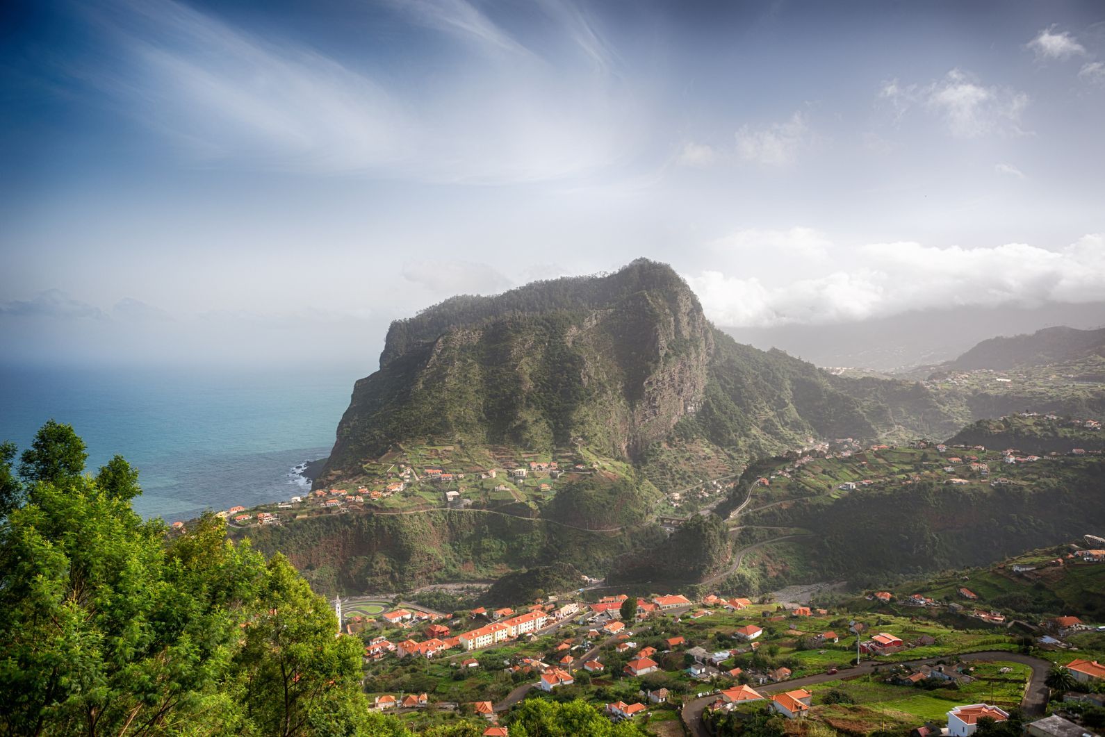
4. Climb Penha d'Águia (Eagle Rock)
- Start/Finish: Porto da Cruz (circular, via Faïal)
- Distance: 5 miles (8km)
- Duration: 2hr 30 mins (point to point)
- Difficulty: Moderate
- Best for: A sunset hike on Madeira
Eagle Rock (0r nest) is known as Penha d'Águia in Portuguese, and sits right on the coastline, looking out on the rolling waves of the ocean in one direction, and across Faial in the other. Now, the rock is “only” 580m high, but given that you’ll be climbing from closer to sea level than to the peak, it’s still no easy feat.
You can go straight up-and-down to the viewpoint of Eagle Rock, but our route here is a point-to-point, starting in Porto da Cruz (by Katrepa's Bar) and heading over to the middle of Faïal, via Eagle Rock.
There is no markings on this path - so make sure you have a map, guide or know the route - but the path is relatively obvious and it's unlikely you'll be on your own. You’ll walk by a levada, then turn off on some natural steps to spend a brief spell in a banana plantation. The route is incredibly steep from here, and so expect a lot of steps and bends.
The steepness relents a little when you reach a saddle above the 500m mark. From there, it’s not a difficult walk over to the summit marker and hard-earned views out over the surrounding villages, and over to the mountainous regions of Madeira. There are various ways down. This route involves crossing the rock, descending to Faïal and walking back to Porto da Cruz from there. Take care as there are steep drops in the area.
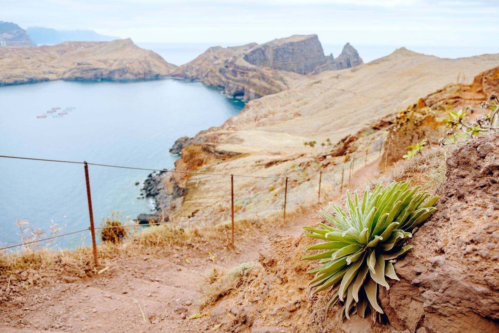
5. Vereda da Ponta de São Lourenço
- Start/Finish: Baía d'Abra / Casa do Sardinha
- Distance: 4.5 miles (7.2km) round trip
- Duration: 3hr (circular)
- Difficulty: Moderate
- Best for: A great hike near Funchal
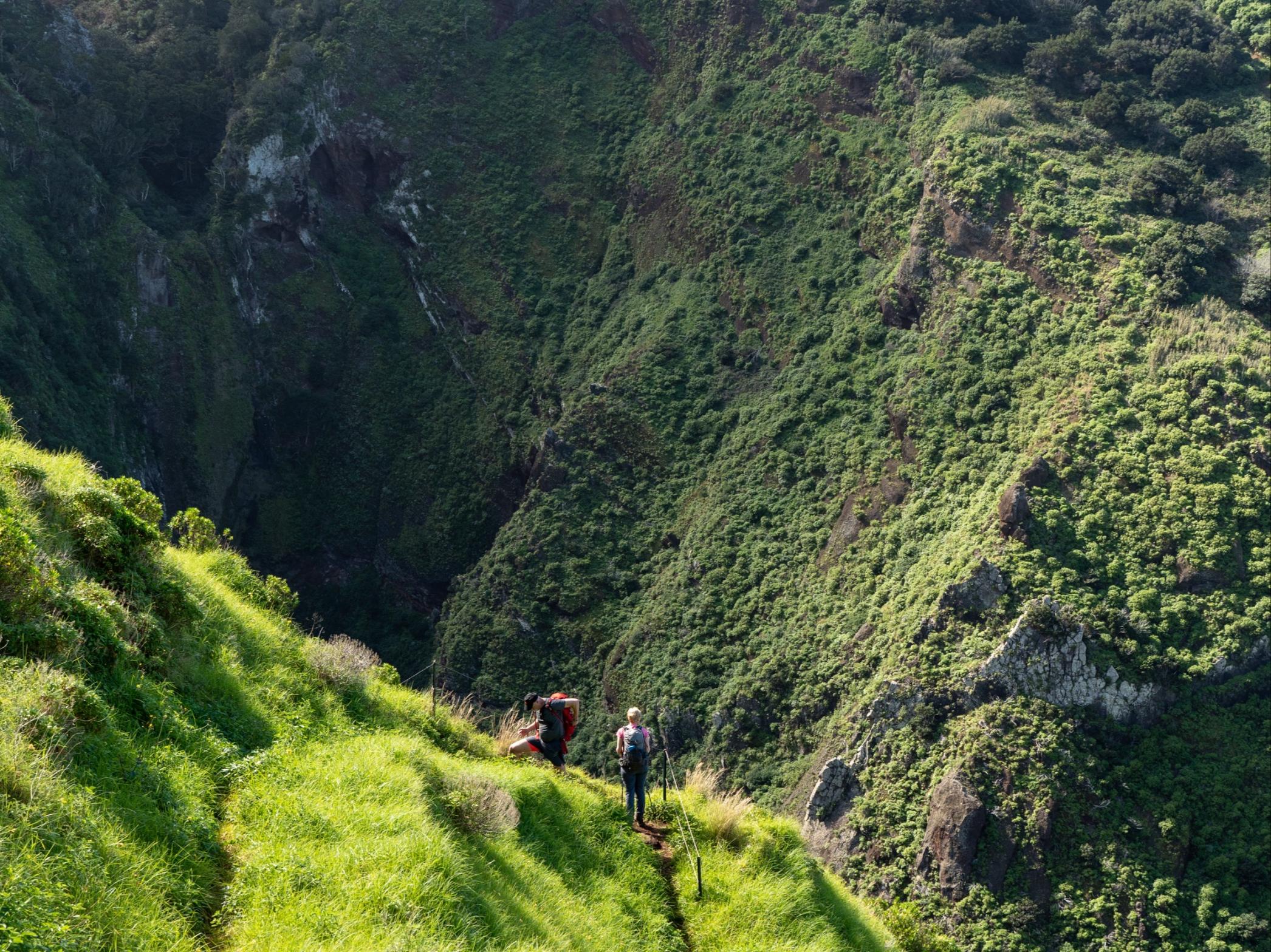
The easternmost peninsula on Madeira is also home to one of the island’s favourite coastal hikes. Part of the beauty of this one is that it’s easily accessed from Funchal. You can take the 113 bus out (which takes around an hour and 15 minutes), or drive in about 40 minutes. It’s also just a very different sort of terrain to the kinds that we’ve highlighted so far in this list. The Ponta de São Lourenço is the otherworldly part of Madeira - dry and rugged, with sea cliffs.
You’ll be following the PR8 trail to Sardinha on this one. Early on you’ll have views of the Ilheau do Farol lighthouse, and before long you’ll be gazing upon those aforementioned cliff views. São Lourenço is named after the caravel sailed by João Gonçalves de Zarco, one of the three explorers said to have discovered Madeira. It’s volcanic in origin, and it shows in this dramatic scenery.
To add a little bit of excitement to the route, include a summit of Ponta do Furado, the most easterly peak on Madeira, at the very end of the peninsula (though do note this will change the difficulty, and require more time and experience). It’s ridgelines require sure-footedness and a definite head for heights. It can be slippy up there too, so above all else be sure to stay safe and be sensible. After that, it's time to backtrack.
Madeira Climate: When is the Best Time to Hike in Madiera?
A lot of Madeira’s appeal lies in the subtropical climate which keeps the island warm year round. Don’t expect it to be scorching, though. The island is known as “the island of eternal spring”, staying roughly between 14-24 degrees Celsius for the majority of the year.
What that means in practice is that rain is uncommon, and it’s also rarely too hot. So it’s perfect weather for hiking, mountain biking, surfing and all the other good stuff. The mountains mean there are a lot of little sub-climates around Madeira too, though. In winter, for example, you can have snow on the mountain tops and then it can be really quite toasty back down on the coast.
Where to Stay in Madeira for Hiking
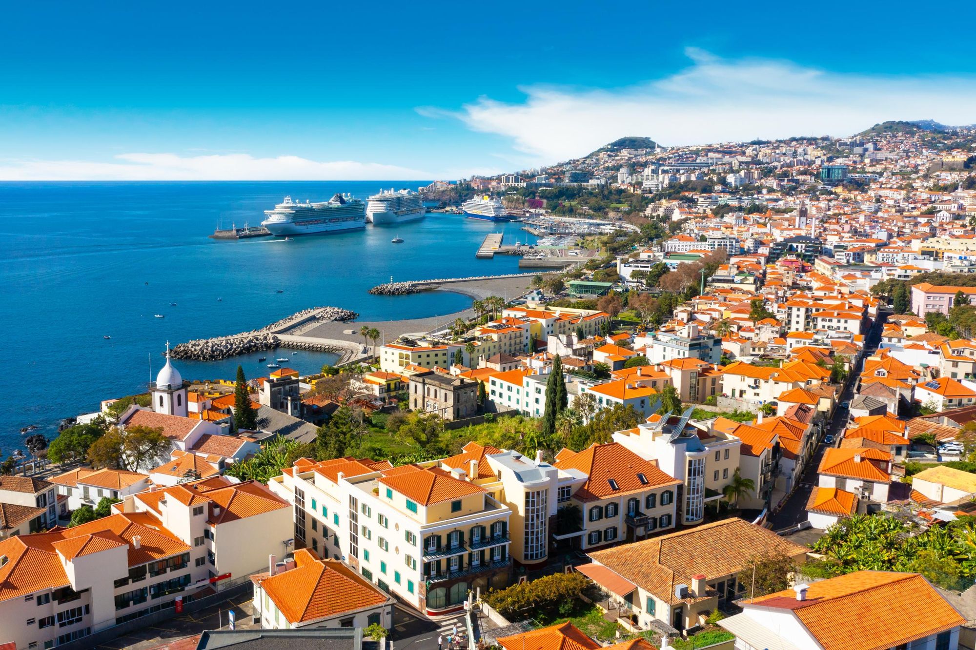
Funchal is the largest city and the capital of Madeira. It's shielded by the mountains, meaning it’s also the sunniest. Beautiful and well connected, it's a great base for a hiking trip.
A second option is Sao Vicente – an unspoilt village on the island's wild northern coast. The start points for the PR22 and PR17 walks are nearby, and you're also able to access Pico Ruivo and other inland walks from here.
What's the Difference Between Levadas and Veredas?
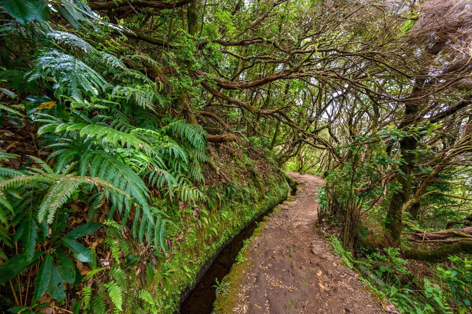
You may come across a couple of different styles of hiking trail in Madeira - namely, levadas and veredas. Both make for excellent walks. Levadas are routes which follow water springs and tend to be surrounded by lush greenery, while veredas are mountain paths, coastal paths or forest routes.
There are over 20 official trails recommended by the Regional Government of Madeira. These are known as PR routes and come with a resulting PR number. For example, PR1 will take you to Vereda do Areeiro, while PR21 will take you on the Caminho do Norther, from Encumeada to Riberia Grande.
 Stuart Kenny
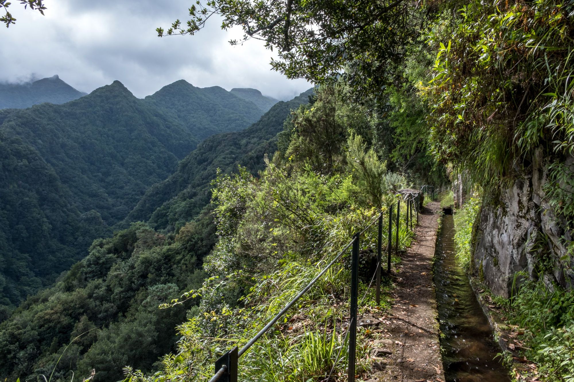
You can check out all the PR routes on the Visit Madeira website - and the website is also a great resource for checking which routes are open or not.
While there is a lot of decent signposting in Madeira, don't rely on it. Make sure you're prepared, have plenty of food and drink to last you for your hike, and if you're in any doubt at all, stay safe and hire a guide to take you out on the trails.
What Animals Live in Madeira?
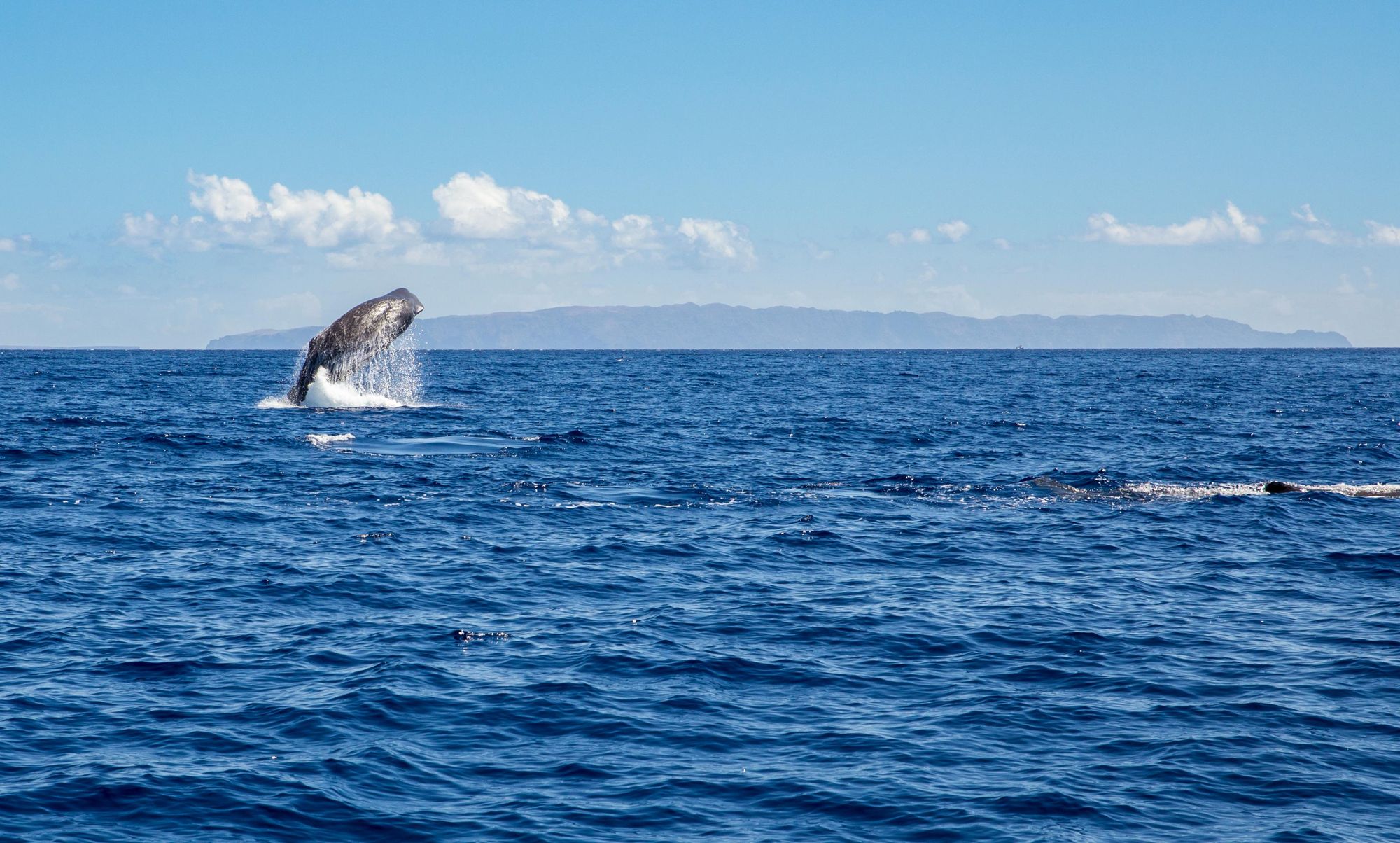
The Madeira pigeon, the Madeira firecrest and the Zino's petrel are birds which are all endemic to Madeira. In the wider area, there are a further 44 bird species, around half of which are endemic to the Macaronesia area (made up of Madeira, the Azores and the Canary Islands). Off the coast, look for pilot whales, Bryde's whale and sperm whales, and bottlenose and Atlantic spotted dolphins also pop up from time to time.
What to Eat in Madeira?
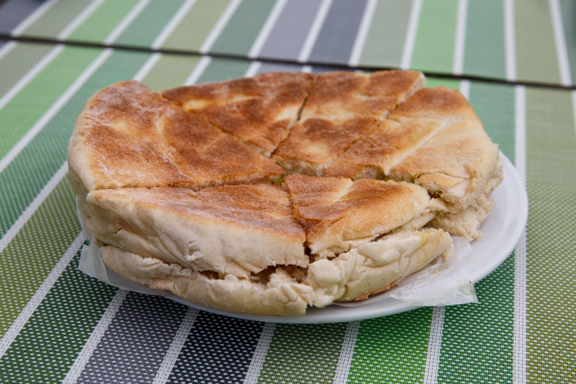
Eat espetada, a grilled beef dish traditional to the island, cooked on hot coals, seasoned with garlic and salt and then stuck on skewers. Look out too for bolo do caco, which is a type of bread made from flour and sweet potato. It's a huge favourite with locals and it comes in a slab (or in the form of a sandwich).
Naturally, there's a lot of seafood. Tuna, limpets, black scabbard fish, sea bream, mackerel and trout are all common on menus.
Of course, one of the most famous exports is Madeira wine. While it can be dry, it's a fortified wine, usually sweet and usually served after dinner.
How to Get to (and Around) Madeira?
By plane: The main airport in Madeira is the Cristiano Ronaldo Madeira International Airport. Yes, he's from here, and yes, the wonky statue is in the airport. There are regular flights from Lisbon, London and elsewhere in Europe.
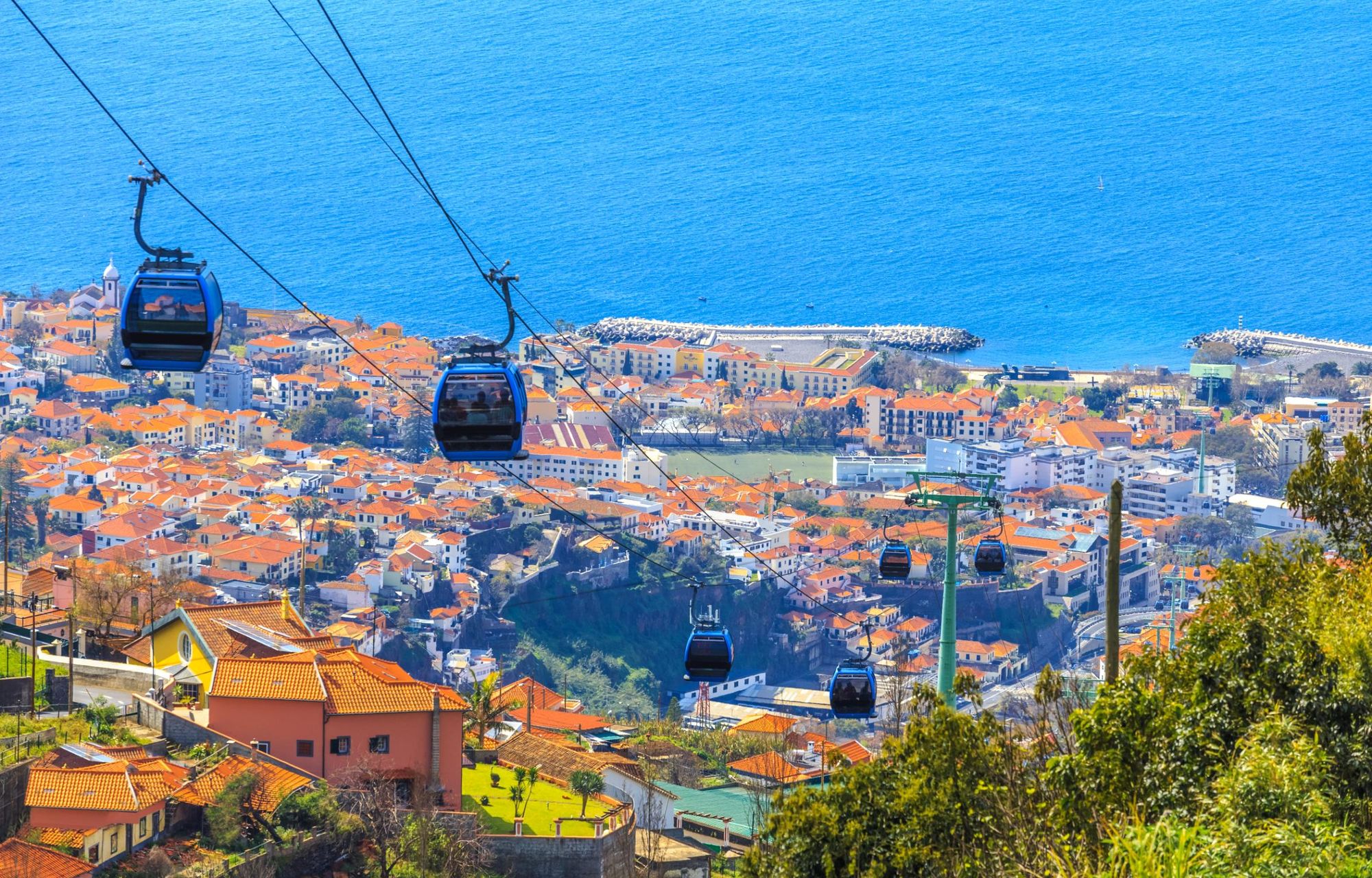
By bus: Madeira is an island where it is useful to have a car to explore freely. In towns, there are buses, taxis, tuk-tuks and there are also some cable cars in place.
FAQs
Is the Pico Ruivo walk open?
The PR1 Vereda do Areeiro trail from Pico do Areeiro (1,818 m) to Pico Ruivo (1,862 m) has been partially closed since wildfires in August 2024. Only 0.7 miles (1.2km) of the 4.3 mile (7km) route is currently open—the infamous ‘Stairway to Heaven’ hike. However, you can hike to Pico Ruivo from Achada do Teixeira via the PR1.2 trail. Before setting out, it's essential to check the latest trail status with the Madeira tourism board as high-altitude routes are particularly sensitive to safety risks and environmental impact.
Do you have to pay for hiking in Madeira?
Yes, as of 2025, Madeira has introduced a small trail access fee for some of its most popular hiking routes. Non-residents over the age of 12 must pay a €3 fee for trails such as the Vereda da Ponta de São Lourenço (PR8), Pico do Arieiro to Pico Ruivo (PR1), and others. Payment can be made through the Simplifica portal or at designated entry points. Many levada trails and lesser-known routes remain free, but hikers should check ahead to avoid fines or entry refusals.
Can you hike in Madeira without a guide?
Most hikes in Madeira can be completed without a guide, especially well-marked routes such as the Levada dos 25 Fontes, Vereda dos Balcões, and Ponta de São Lourenço. These trails are clearly signed and easy to navigate for independent hikers with basic map tools. However, a guide can be valuable for more technical or remote hikes like the PR1 ridge between Pico do Arieiro and Pico Ruivo, or for deeper insights into the island’s flora, fauna, and geology.
What is the most scenic hike in Madeira?
The most scenic hike in Madeira is widely considered to be the PR1 trail from Pico do Arieiro to Pico Ruivo. This spectacular ridge walk traverses the island’s highest peaks with views across jagged volcanic ridges, deep valleys, and, on clear days, out to the Atlantic Ocean. With tunnels, stairways carved into the rock, and constant elevation changes, it’s a dramatic and unforgettable route showcasing Madeira’s wild, mountainous heart.
Is hiking in Madeira difficult?
Hiking in Madeira ranges from easy levada walks to challenging mountain treks. Trails like the Levada dos 25 Fontes or Vereda dos Balcões are relatively easy and suitable for beginners. In contrast, hikes such as the PR1 ridge route between Pico do Arieiro and Pico Ruivo are physically demanding, involving steep ascents, narrow paths, and exposure to weather. While Madeira offers options for all fitness levels, hikers should choose trails appropriate to their experience and always be prepared for fast-changing conditions.
Read more
- 10 of the Best Levada Walks in Madeira
- Traversing the Wild Atlantic Island of Madeira
- 20 of the Best Hikes in Europe
Inspired? Our adventures in Madeira feature hikes with a knowledgable local guide.