


The Pamir Trail is a recently-developed, long-distance hiking trail through Tajikistan - a country in Central Asia where 93% of the landmass is mountainous and those mountains stretch up as high as 7,495m (24,589ft). The route runs 813 miles (1,310km), starting in Shring in western Tajikistan, not far from the border with Uzbekistan. From there, it runs through the Fann and High Pamir mountains en route to Vrang, where the route finishes on the Afghan border, with views of the Hindu Kush.
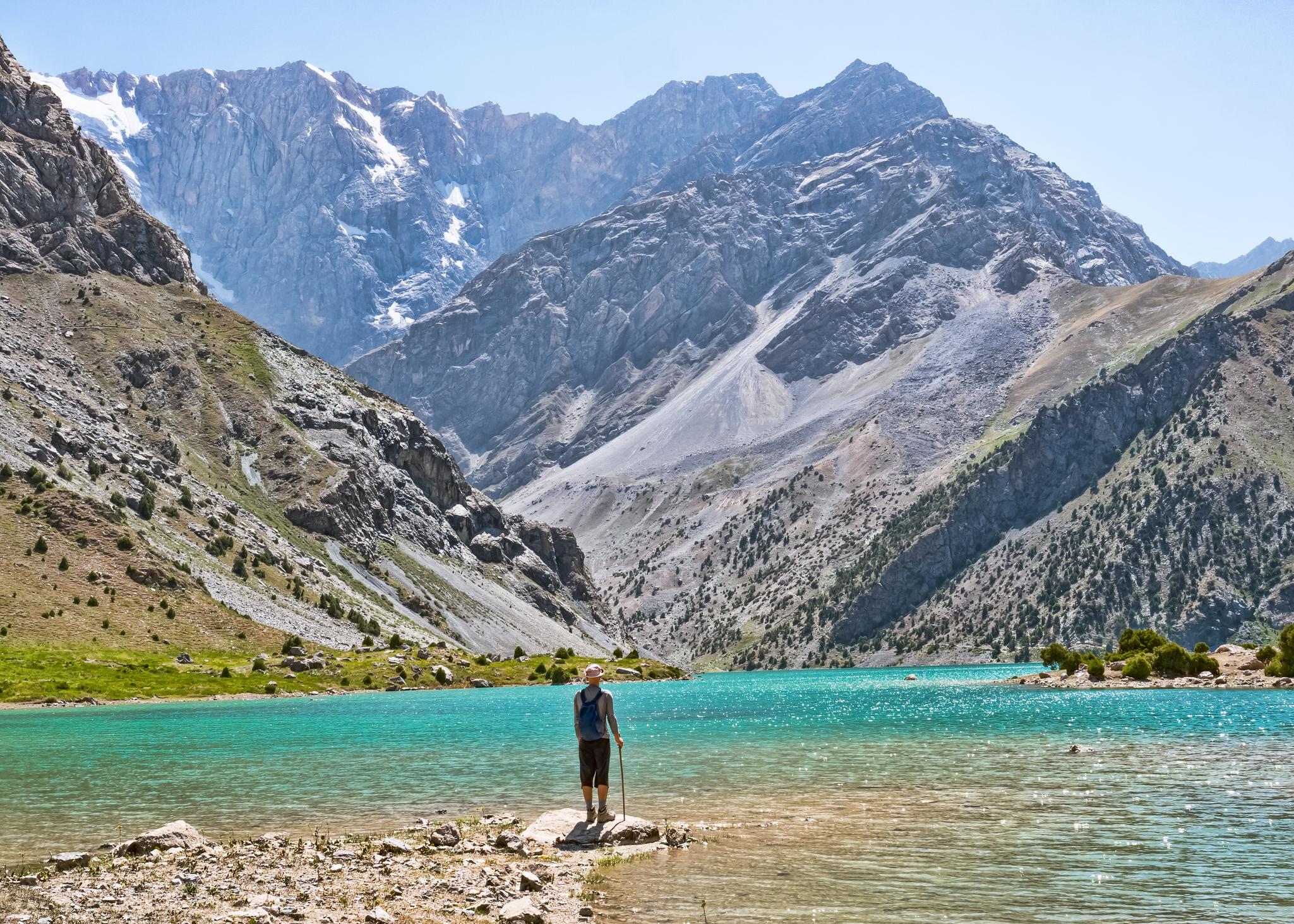
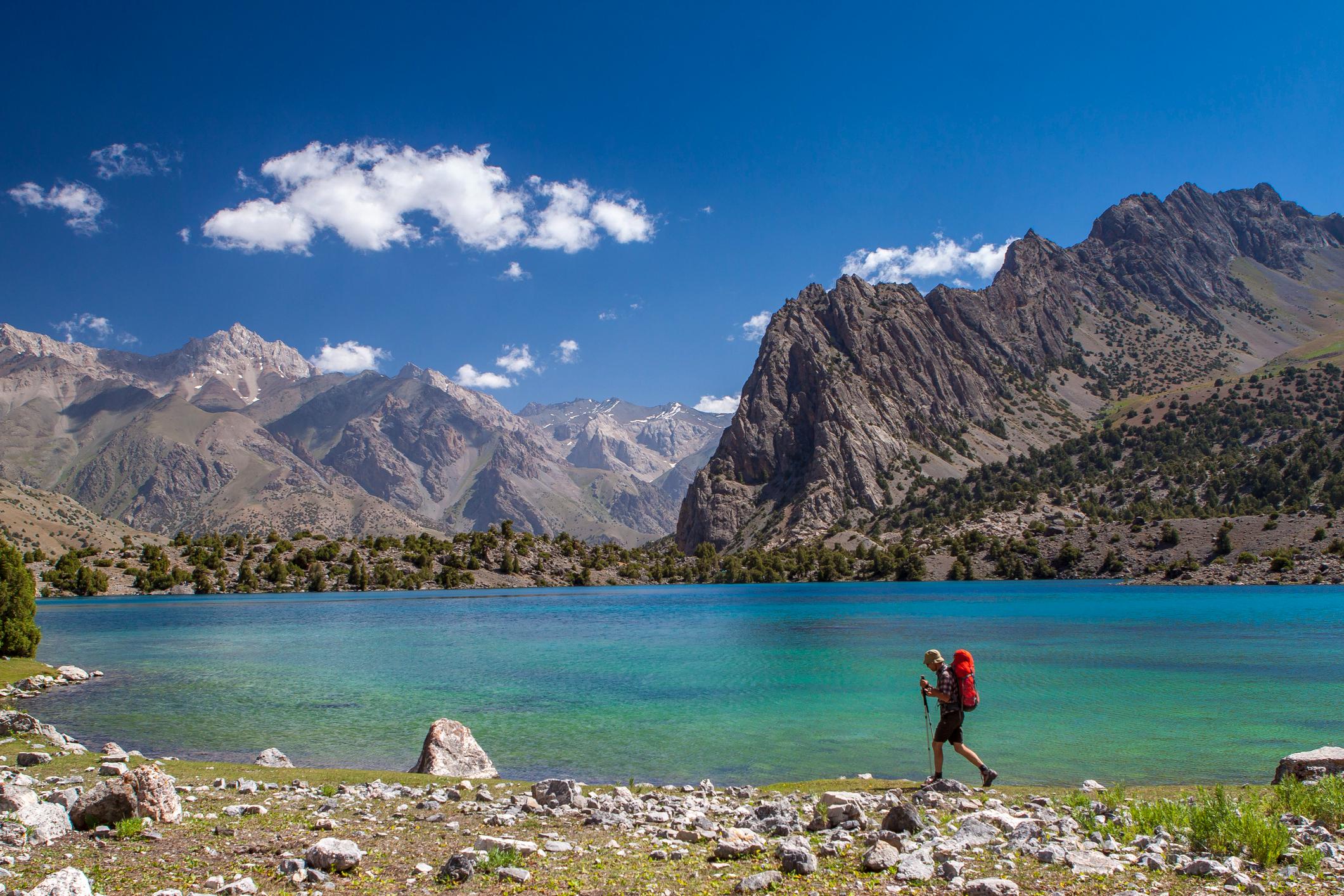
You've got narrow valleys, and a lot of really beautiful mountain lakes. The highest pass in the Fann Mountains is the Chimtarga Pass. It gives you an amazing view all over northern Tajikistan and the snowy peaks...
Tajikistan is a landlocked country. It is bordered by Afghanistan to the south and by Uzbekistan to the west and northwest. Kyrgyzstan sits to the north, while China borders the country to the east. Although Tajikistan remains little visited by tourism, recently relaxed visa regulations have made it easier to enter.
“There are lots of glaciers," says Jan Bakker, the Dutch founder of the Pamir Trail. "There are big rivers. It's really like an adventure land - and very unspoiled.
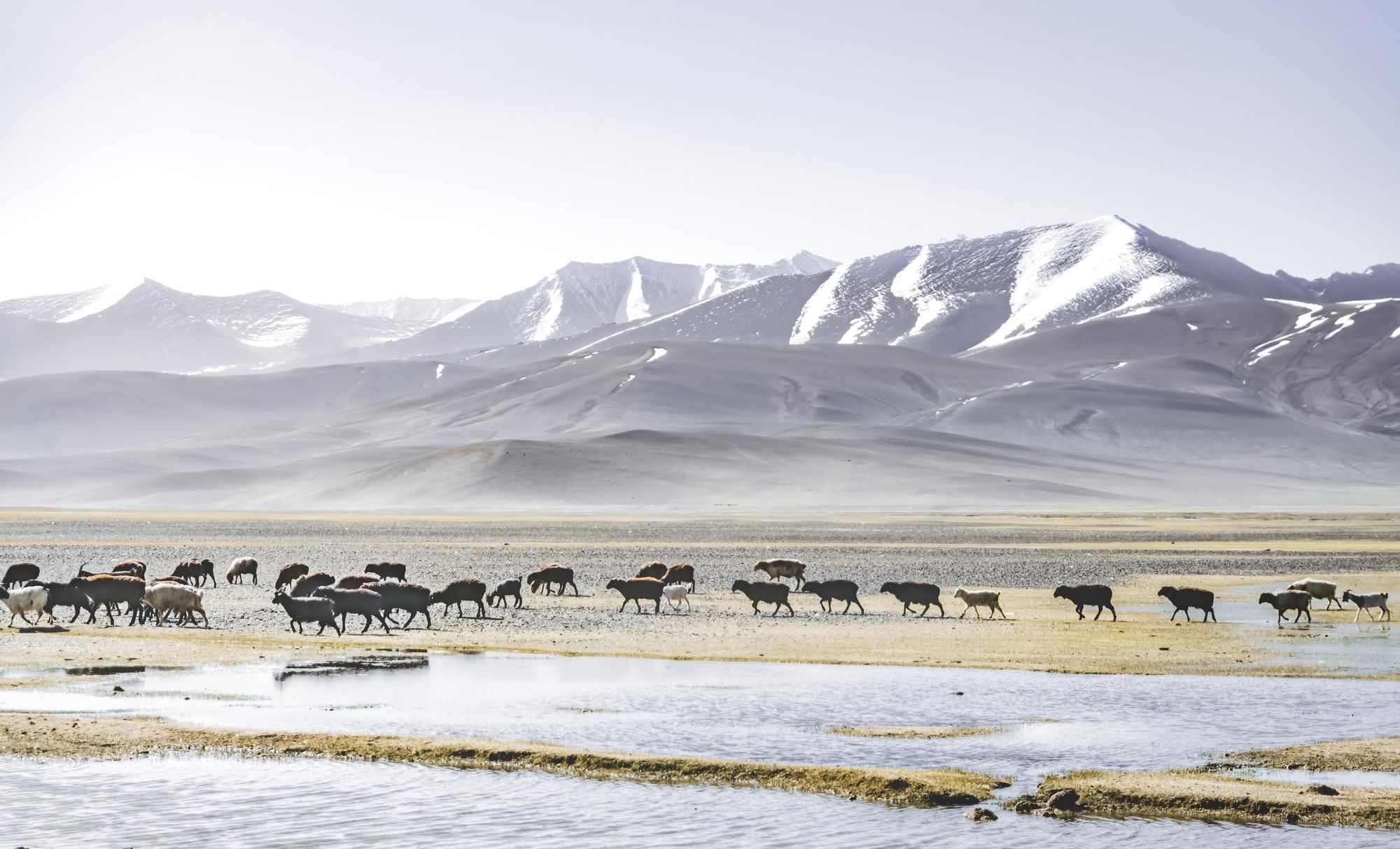
“It’s a relatively empty land. There are days where you don't meet a soul. It’s still very much under the radar of tourists, so there's a good chance you'll be alone for the entire trek and won't see anybody else. In the valleys, you will find some villages, but once you go up to the mountain passes, you’ll only meet shepherds.
"The mountains are really big. There are three 7,000ers. In the heart of the Pamirs, it’s quite inaccessible, but the pastures are really accessible. The shepherds have carved out trails all over Tajikistan, which makes it easier to connect the routes.”
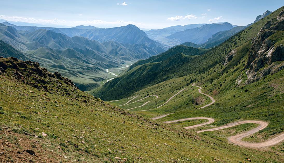
The Pamir Trail is made up of 79 stages, broken down into nine sections.
“It starts near the Uzbek border, in the foothills of the Fann Mountains,” says Jan. “Then it goes across the Fann Mountains, eastbound, skipping the border with Kyrgyzstan. It turns south across the High Pamirs - the proper Pamirs - and ends in a place called Vrang, at the border with Afghanistan in the Wakhan Corridor. At the end of every section, there’s a transport option, or you can get some supplies and restock before going back into the mountains.
There is a healthy population of snow leopards in the Pamirs, but of course they're very difficult to see...
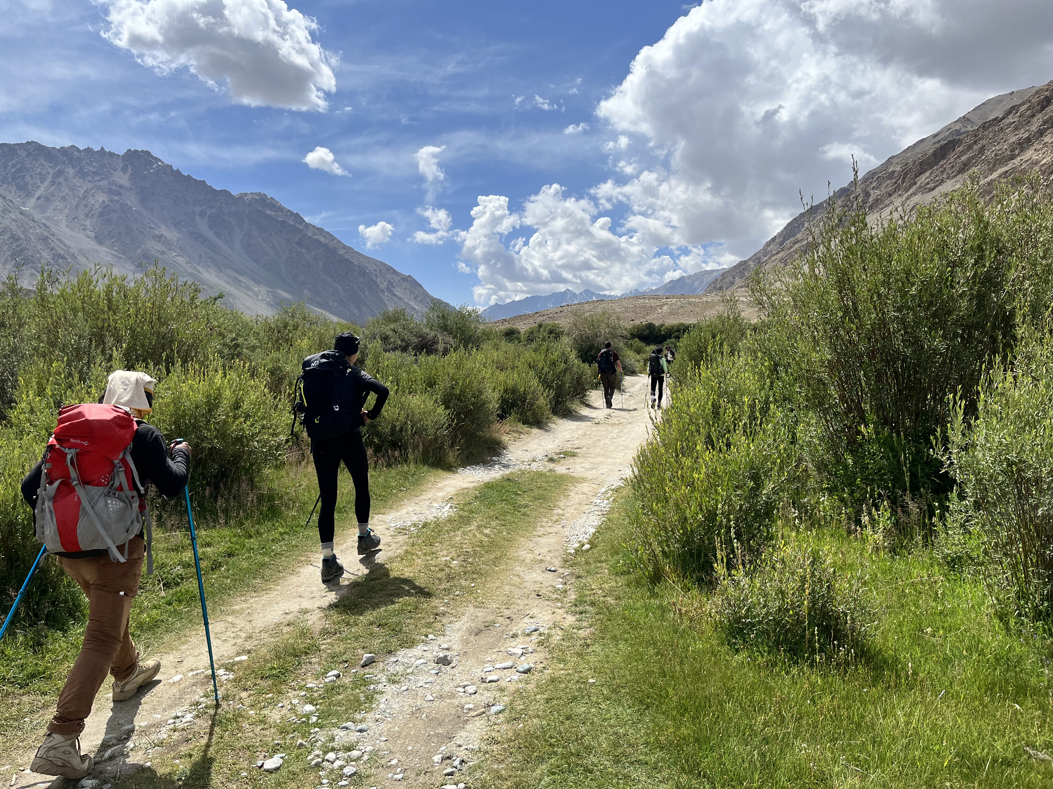
“Most of the trail involves wild camping; although some valleys have official homestays. In the Fann Mountains, for example, they have set up a network of homestays. But then, if there's habitation and people see you wandering around, it's very likely that they will offer you a place to stay. They always have a guest room. It's a Tajik and central Asian custom to open their home for strangers.”
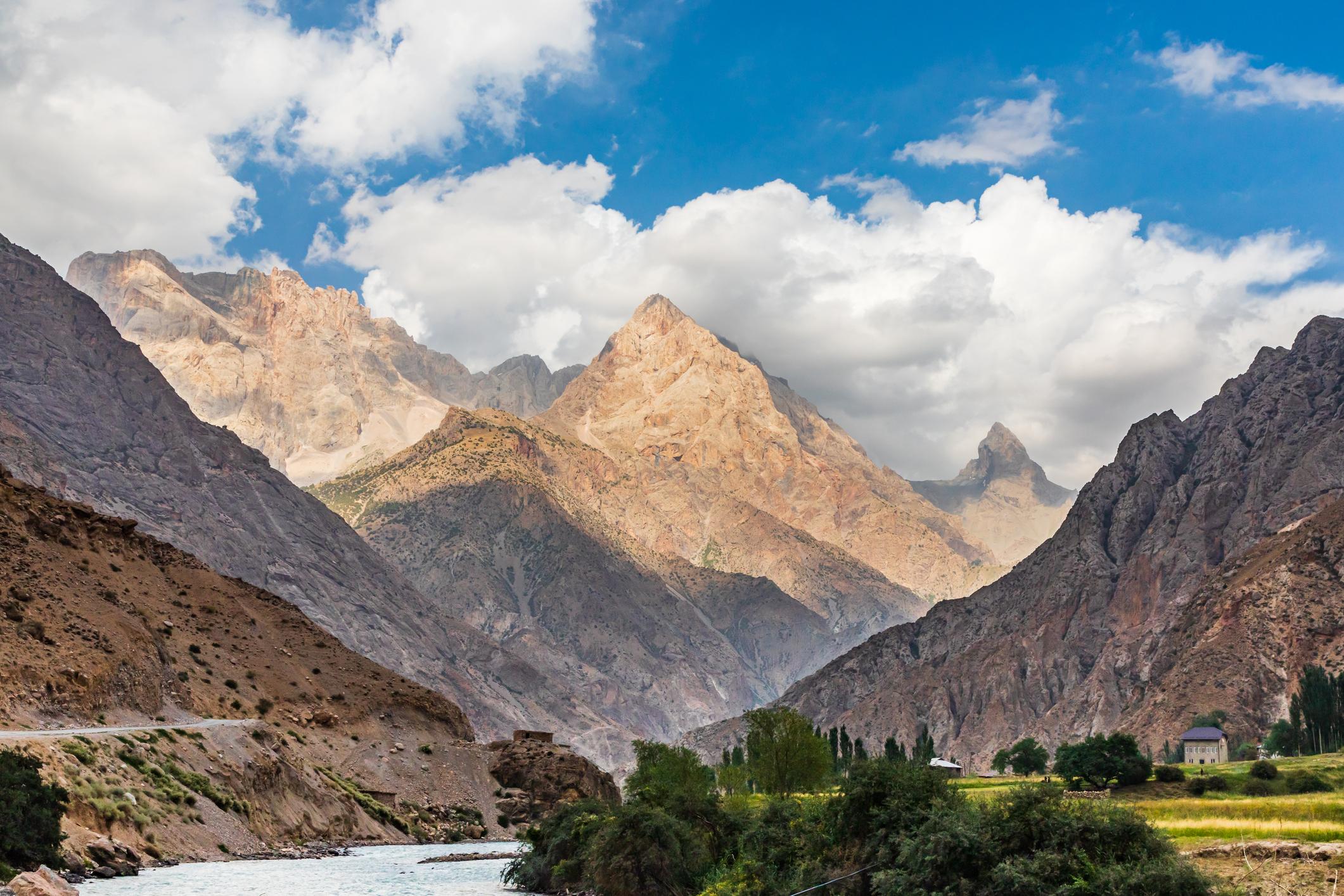
The Fann Mountains come early on the route, and are a scenic highlight.
“It's a compact mountain range,” says Jan. “So, you've got really tall mountains - the highest one is almost 5,500m - Chimtarga Peak - and they are very steep. You've got narrow valleys, and a lot of really beautiful mountain lakes. The highest pass (on the Pamir Trail) in the Fann Mountains is the Chimtarga Pass, which is 4,750m. It's also one of the highest passes on the trail itself and it gives you an amazing view all over northern Tajikistan and the snowy peaks.
“So, beautiful lakes, high steep mountains. Quite a lot of shepherds' settlements, which is quite a nice feature. You meet shepherds along the way who will invite you in for tea, or a bowl of yoghurt, or homemade bread. It's section one of the Pamir Trail, and I love it. It's very diverse, and I think it's a perfect mix of culture and raw nature. It's one of the best sections for sure.”
Jan describes Alaudin Lake - “a very clear, bright blue mountain lake, with Chimtarga at 5,500m on one end and Chapdara, also over 5,000m, on the other. And it’s not just bare mountains; there are juniper forests around it.” Bakker also touches on Margazor Lakes (known as the Seven Lakes), “which are quite close to the villages. It’s a good way to meet the locals and they’re always very curious about locals hanging out in their country. Fish out Google Translate.”
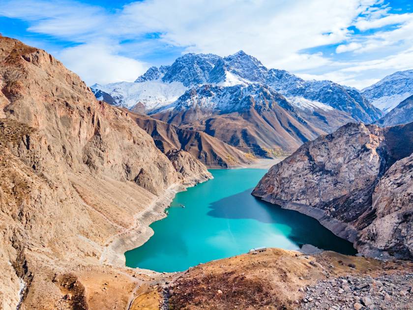
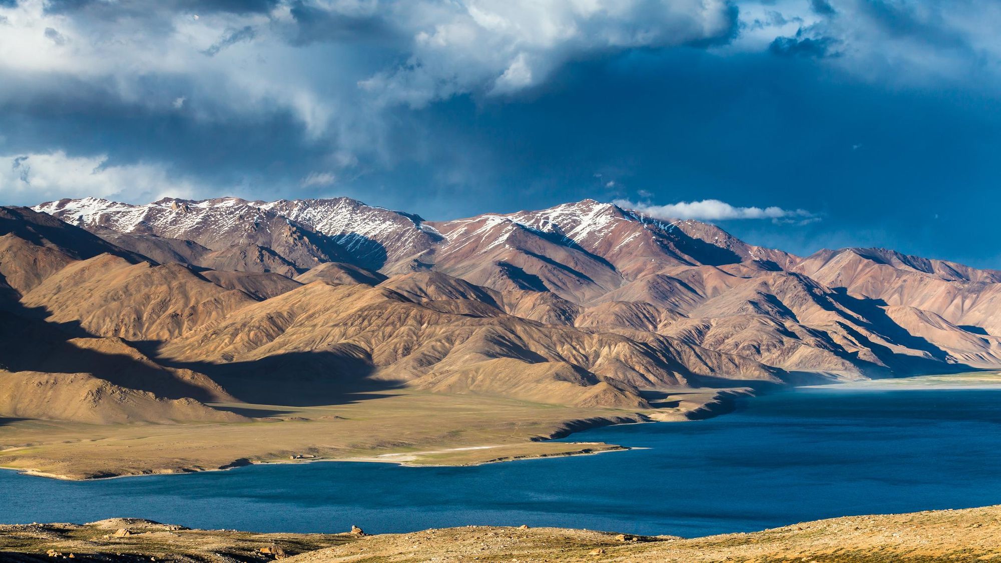
From the Fann Mountains onwards, the diversity of the landscape is immense. “In the Pamirs, the northern part is quite lush, with green meadows and snow-capped peaks, and as you go further south it gets a bit dryer,” says Jan. “There are still snow-capped peaks and glaciers, but it tends to also be flatter.
“There is a healthy population of snow leopards in the Pamirs, but of course they're very difficult to see. Ibex are more common. There’s Marco Polo sheep, which the snow leopards prey on, and then brown bears and wolves.
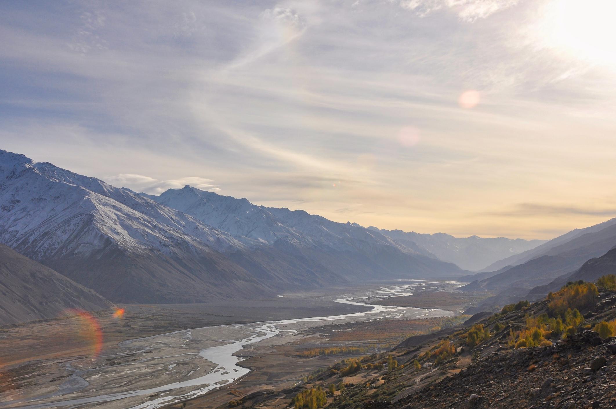
“If you go even further south then it's more like the Tibetan plateaus - it's more like a high-altitude desert until the Afghan border. The highest point of the trail is the Vrang pass, just over 5,000m. That's also the final pass. You can see the Hindu Kush, and the Wakhan Corridor.”
It was while writing a Cicerone guidebook, published with co-author Christine Oriol in 2018, about trekking in Tajikistan that Bakker first realised that most of the hiking routes in Tajikistan are connected. He first visited the country to explore on bike and foot in 2009, riding the Pamir Highway and using Google Earth and old Russian maps to plot hikes up some of the local, high-altitude mountains. He then returned for a four-month trail discovery mission in 2010.
The highest point of the trail is the Vrang pass, just over 5,000m. That's also the final pass. You can see the Hindu Kush, and the Wakhan Corridor...
“By the time COVID hit, I knew 50% of a route that could connect the northwest to the very south of Tajikistan,” Jan says. “So I thought, let’s see if I can connect all of these parts.”
That thought became the Pamir Trail, which was officially finished in 2024.
“In Spring, 2024, two Czech ladies got in touch and said ‘we’re going to thru-hike it’,” says Jan. “At that time, one section still had to be done, and they offered to scout it, and that proved that it was connected and finished. This year we have 65 independent hikers in a WhatsApp group intending to do at least part of the Pamir Trail. My guess is 100 people this year will hike it.”
Bakker’s tips for hikers heading to Tajikistan include bringing a water filter and water purifying tablets, and packing as lightly as you can for such a wild venture.
What does he hope that people will take away from the trail?
“I think the authenticity of the place,” he says. “There's hardly any infrastructure. So, it's quite a pure mountain experience. Not much is set up for tourism. It's a very genuine experience, where you encounter real people who live and work in the mountains with their livestock. There are no cable cars. It’s what mountains were like a few hundred years ago or maybe even a few thousand years ago. Not much has changed. I think the purity of the place is what people enjoy.
It's quite a pure mountain experience [...] It’s what mountains were like a few hundred years ago or maybe even a few thousand years ago.
Jan laughs: “You wouldn't be able to go on Instagram Live unless you have a satellite connection. You're really off grid. There are some places that have a few more people, but most places you are properly off grid. It's you and everything around you, without any of the distractions. Sometimes you might have to leave your tent for the toilet at night, and when you get up - and above 4,000m it can easily go -5C or -10C even in summer - you just think 'wow', because there is no light pollution at all. So it's one big sky. I have no words for it.”
In Tajikistan, adventure is not curated. It's carved by rivers, wind and time, with paths shaped by shepherds, not spades. The wilds are not just remote but utterly timeless - the trails still offering that intrepid beauty, lost to much of the world.
Inspired? Join our tour and Trek the Fann Mountains in Tajikistan!