


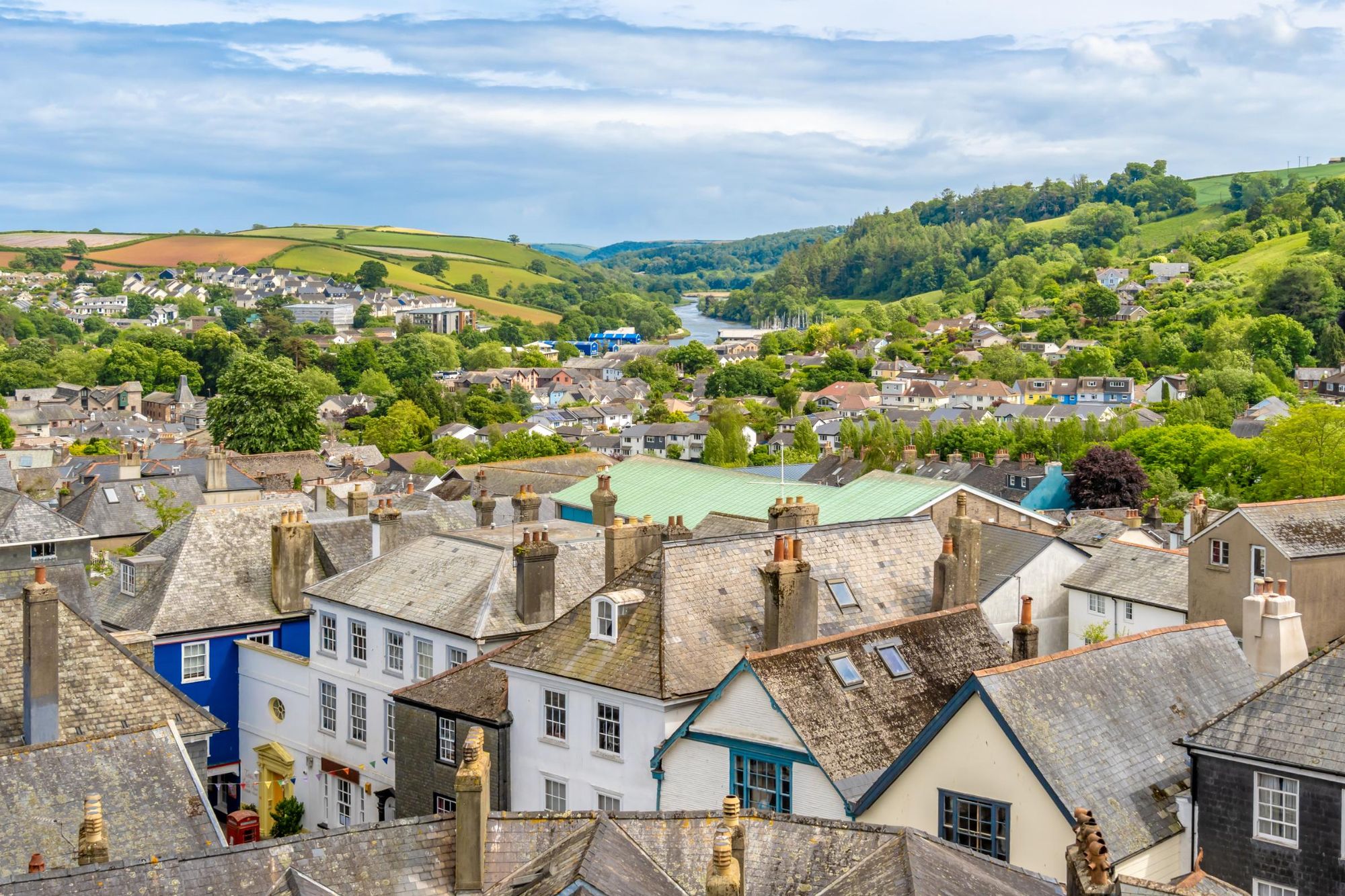
The South Hams Way is a brand new 101 mile (163km) hiking trail, which opens 14 September 2025. It is a circuit through idyllic South Devon, beginning and ending in the eccentric new age town of Totnes. It takes you through a diverse range of landscapes, from rugged moorland and rounded hills to quiet estuaries and crenellated coastline.
You’ll head north from Totnes to the Dartmoor National Park, where you’ll hike up twisting lanes and cross small streams, pass through copses of ancient woodland and arrive out onto the wild moors, which are scattered with granite tors, and offer panoramic views of the surrounding countryside.

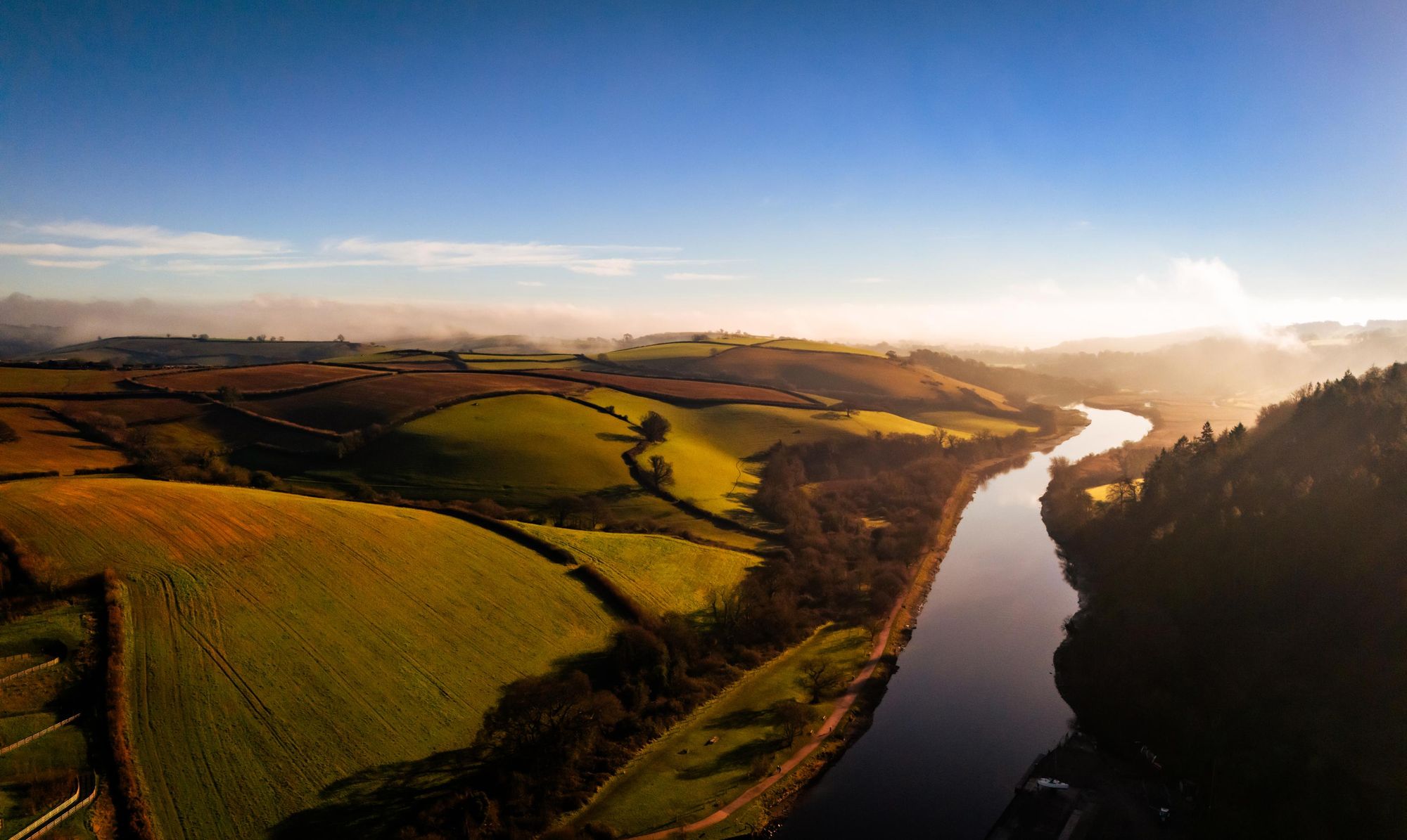
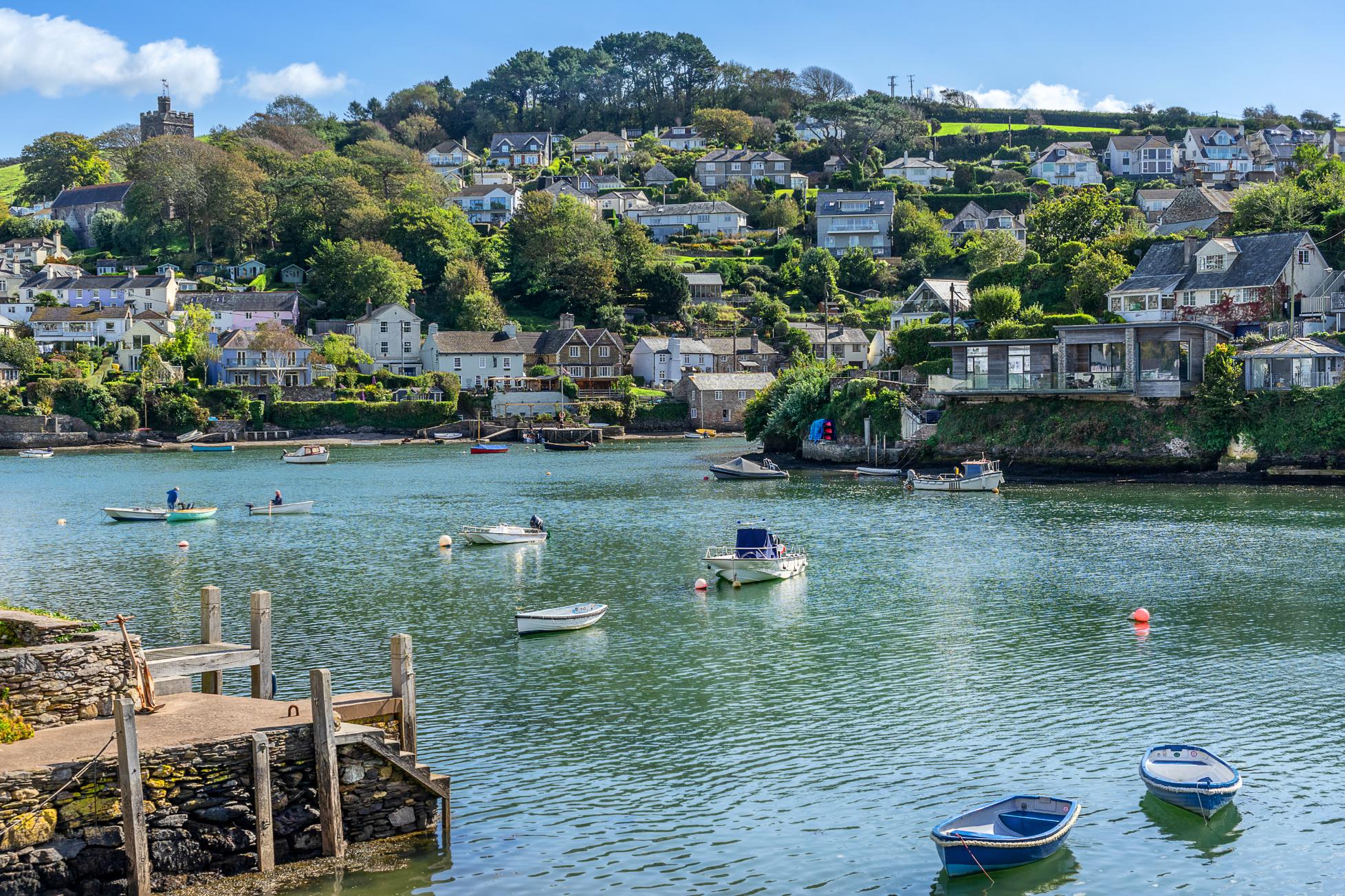
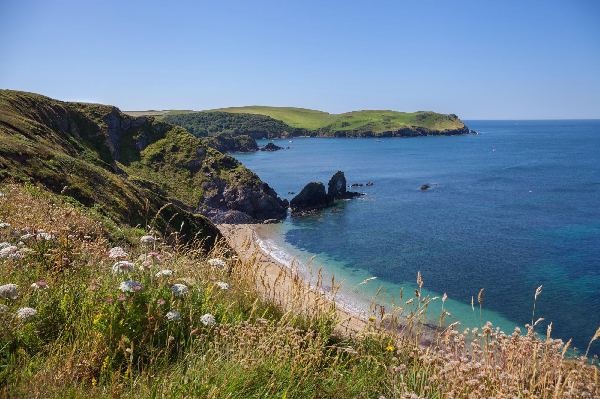
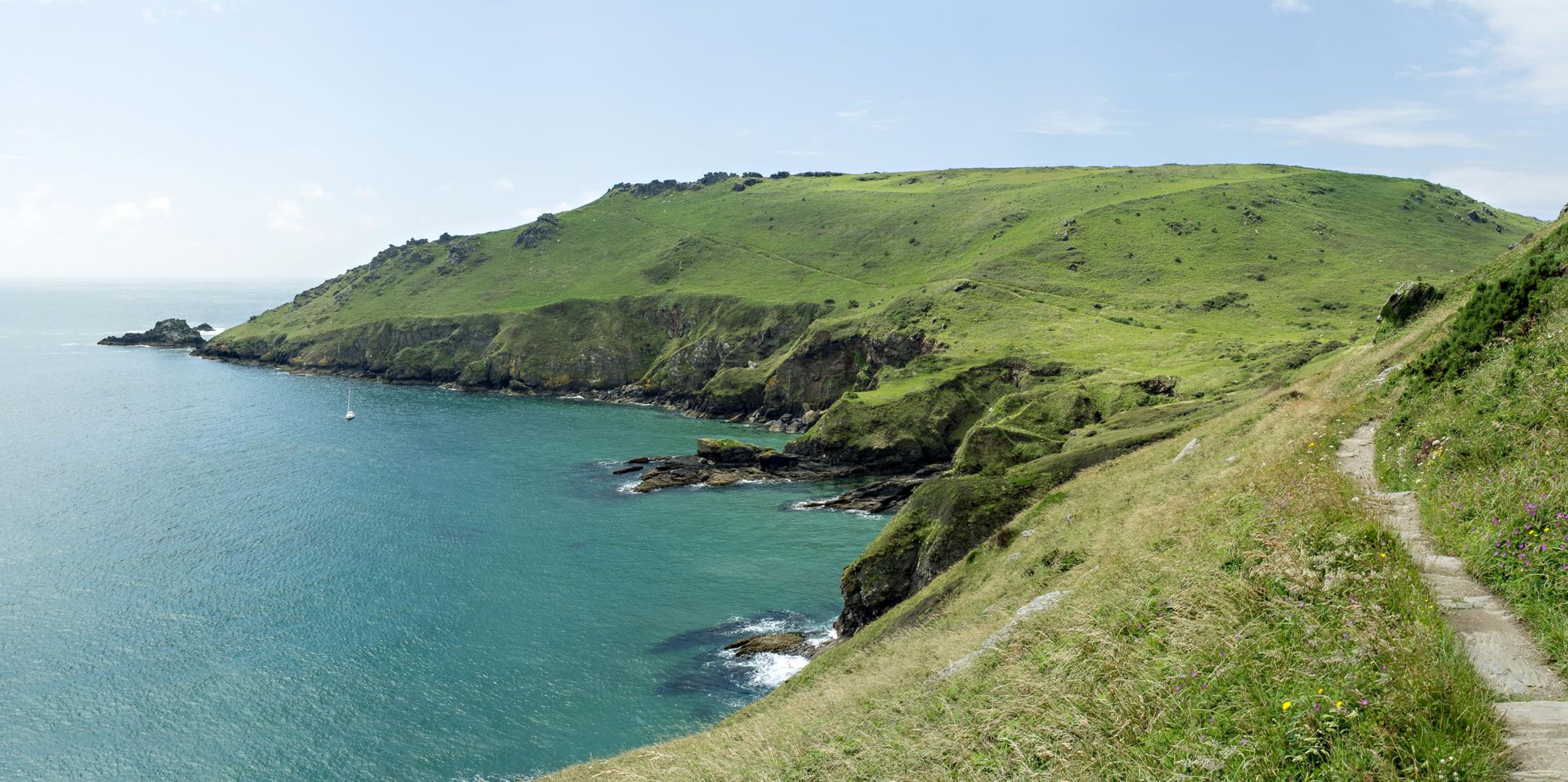
From Dartmoor you’ll travel southwards through the South Devon National Landscape, characterised by rounded hills (traditionally known as ‘hams’) and wooded valleys. You’ll reach the coast and hike 50 miles (80.4km) along the South West Coast Path, following a clifftop path past small coves and snaking around five estuaries. At Dartmouth, where boats bob in the marina, you’ll head inland, following the River Dart upstream back towards Totnes.
It takes you through a diverse range of landscapes from rugged moorland and rounded hills to quiet estuaries and crenellated coastline.
One of the benefits of this hike is its accessibility. Totnes, the start and end point, is easily accessible by train (the journey from London takes just over two hours and 30 minutes). The trail has been broken down into 10 manageable sections of between seven miles (11km) and 13 miles (21km), which also make for great day hikes.
Each stage begins and ends in a small village or town, from isolated moorland villages to upmarket seaside resorts like Salcombe and Dartmouth. Accommodation ranges from campsites to boutique hotels. There's lots of places to eat, too, from quaint cafes offering Devonshire cream teas to coastal seafood restaurants and pubs with roaring log fires. The GPX of the entire route can be downloaded from the South Hams Way website.
The South Hams Way: Route Guide
Stage 1: Totnes to Buckfastleigh
- Distance: 7.1 miles (11.4km)
Take the footpath from Totnes to Dartington, which takes you along a disused railway line through woodland. You’ll pass through Dartington Estate, an arts and entertainment venue with Grade 2 listed gardens.
Follow the signs for the Long Trail through North Wood. From here, follow back lanes to Riverford Field Kitchen, then across fields to the town of Buckfastleigh. The jewel in the crown here is Buckfast Abbey, where Benedictine monks have been brewing Buckfast Tonic Wine since the 19th Century.
Stage 2: Buckfastleigh to South Brent
- Distance: 8.9 miles (14.3km)
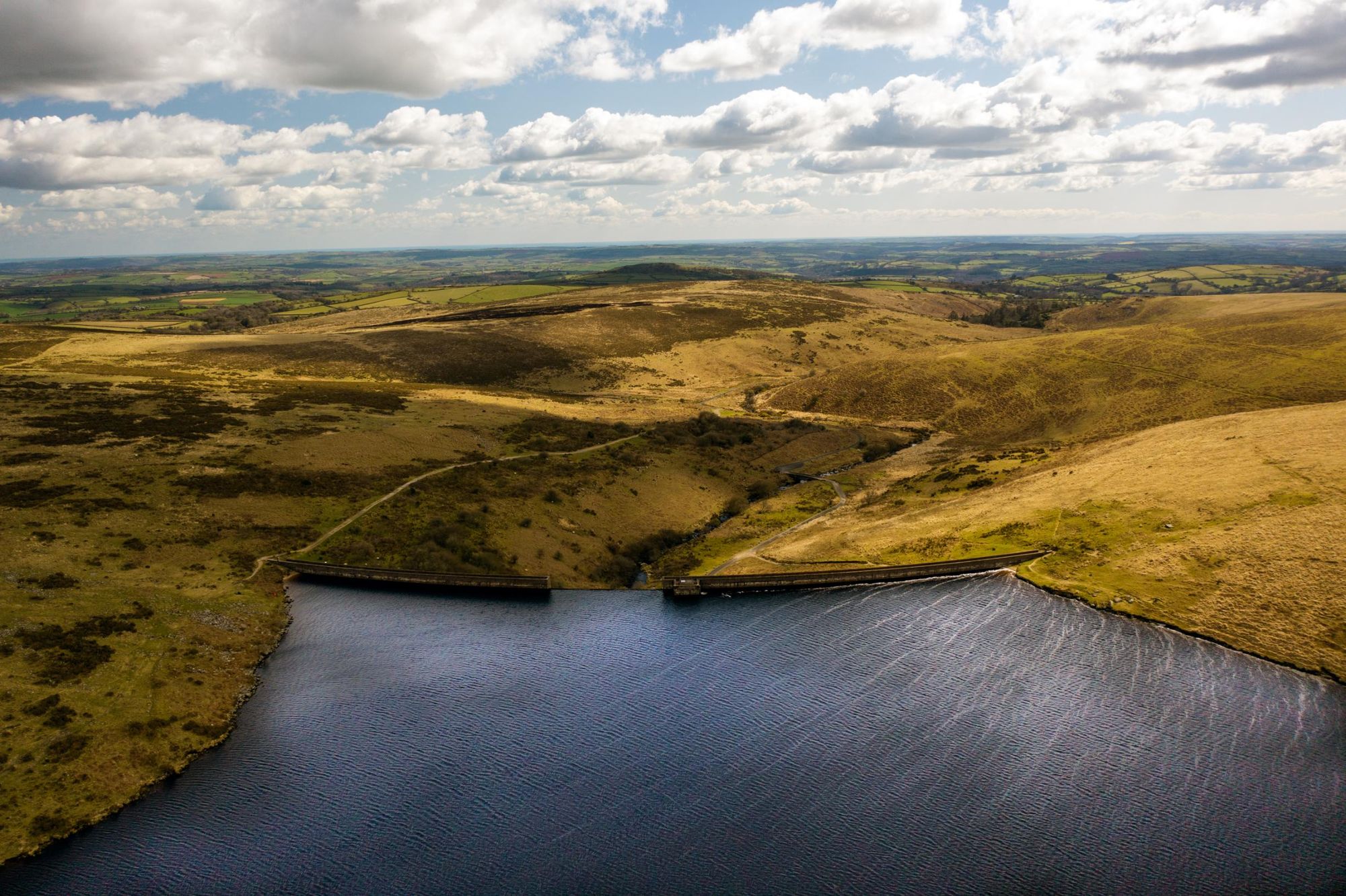
Follow a footpath out of Buckfastleigh and into the woodland. It takes you uphill through fields, along a lane and through small tracts of wood. As you climb higher, you’ll get your first glimpse of the vast wilds of Dartmoor.
Head out onto open moor, joining the Abbot’s Way. You’ll reach a copse, Water Oak Corner, before descending into a valley towards Avon Reservoir. Continue along the shore of the reservoir, and then follow a road through a steep-sided valley to Shipley Bridge. Follow a footpath through woodland towards the small town of Didworthy. You’ll pass the small hamlet of Lutton before reaching South Brent.
Stage 3: South Brent to Ivybridge
.jpg)
- Distance: 7.1 miles (11.4km)
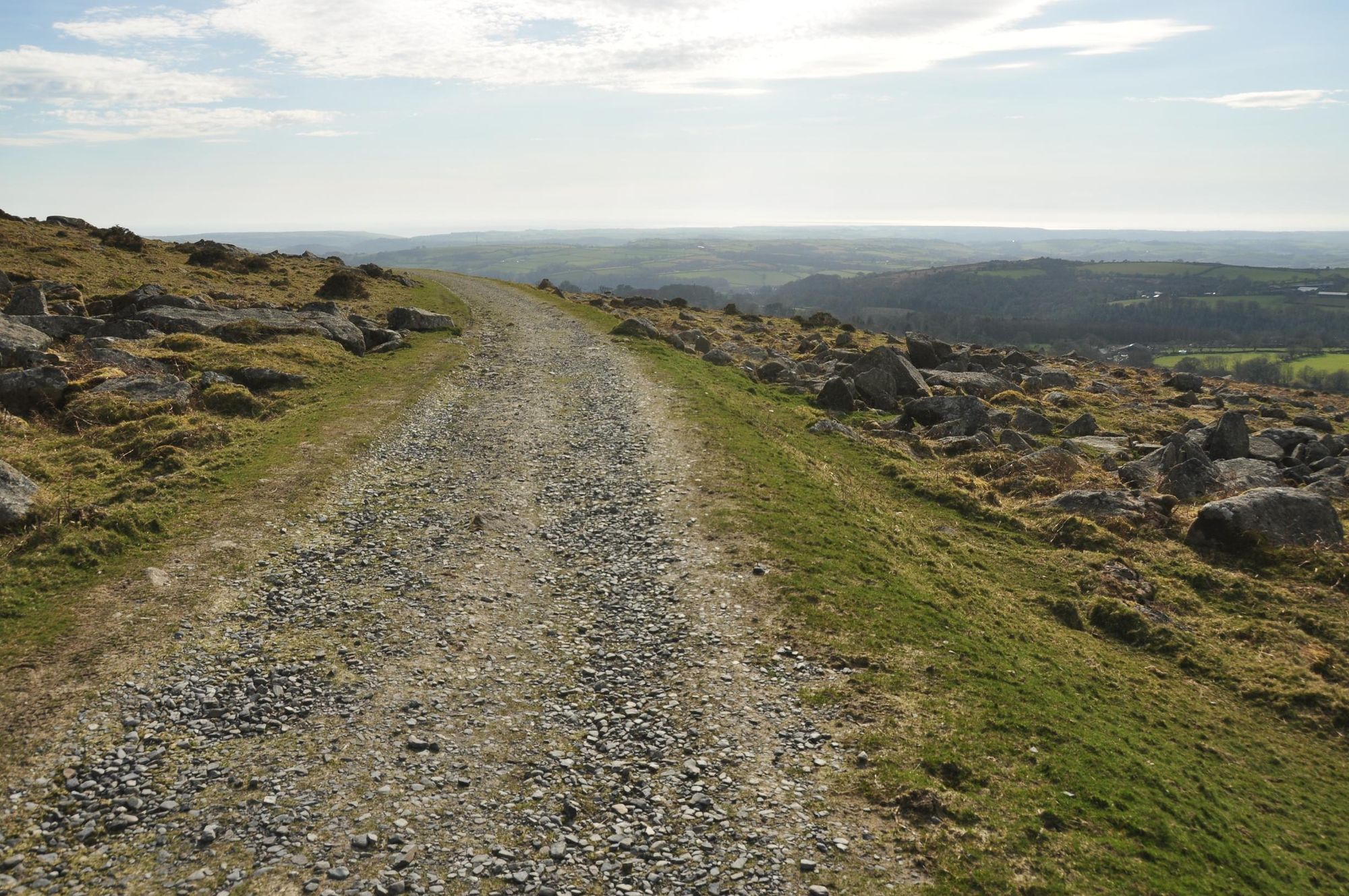
Hike alongside the Avon River as far as Lydia Bridge. From here, follow the Dartmoor Way uphill through fields. Follow a lane downhill and over a moss-covered stone arch bridge. The trail leads you uphill and out onto the open moors. Continue hiking uphill towards Ugborough Beacon, where you have views of moorland to the north and the undulating South Hams countryside to the south.
From Ugborough Beacon, you’ll hike downhill to cross a stream, Lud Brook, and then past a neolithic chambered tomb known as Cuckoo Ball. Continue downhill to the housing development of Moorhaven, and join the Redlake Tramway (a disused tramway) which takes you to Ivybridge.
Stage 4: Ivybridge to Noss Mayo
- Distance: 11.9 miles (19.1km)
Follow the Erme-Plym Trail south along the River Erme, through fields and along the top edge of Flete Wood. The trail takes you along a road and past the picturesque villages of Dunstone and Yealmpton.
You’ll now deviate from the Erme-Plym Trail, passing under an old railway bridge and heading up a stony track to the top of Ashcombe Hill. The path undulates over hills and woodlands towards Noss Mayo, a village situated on the banks of picturesque Newton Creek.
Stage 5: Noss Mayo to Mothecombe
- Distance: 10.3 miles (16.5km)
Follow the path alongside Newton Creek in a southwest direction until you reach the coast. It leads you onto a headland with views out towards Rame Head, a peninsula in Cornwall. Within two miles (3.2km) you’ll reach Stoke Beach—a right hand fork in the path leads down to the beach, or carry straight on along the clifftops.
Continue east along the coast path. You’ll descend to Mothecombe Beach, a picturesque sandy cove where you can enjoy a swim—it’s adjacent to your final destination, Mothecombe.
Stage 6: Wonwell to Hope Cove
- Distance: 10.1 miles (16.2km)
A second day along the South West Coast Path. There are some steep ascents and descents here, as you hop from cove to cove. At Bigbury-On-Sea you’ll catch sight of Burgh Island, a tidal island with an art deco hotel perched on it.
Continue uphill and then downhill to Cockleridge Ham, where a ferry will take you across the estuary to Bantham. It only runs from April to September—outside these times, you’ll need to follow the Avon Estuary Walk and head inland to cross it. From Bantham, continue along the coast path to Hope Cove.
Stage 7: Hope Cove to Salcombe
- Distance: 8.1 miles (13km)
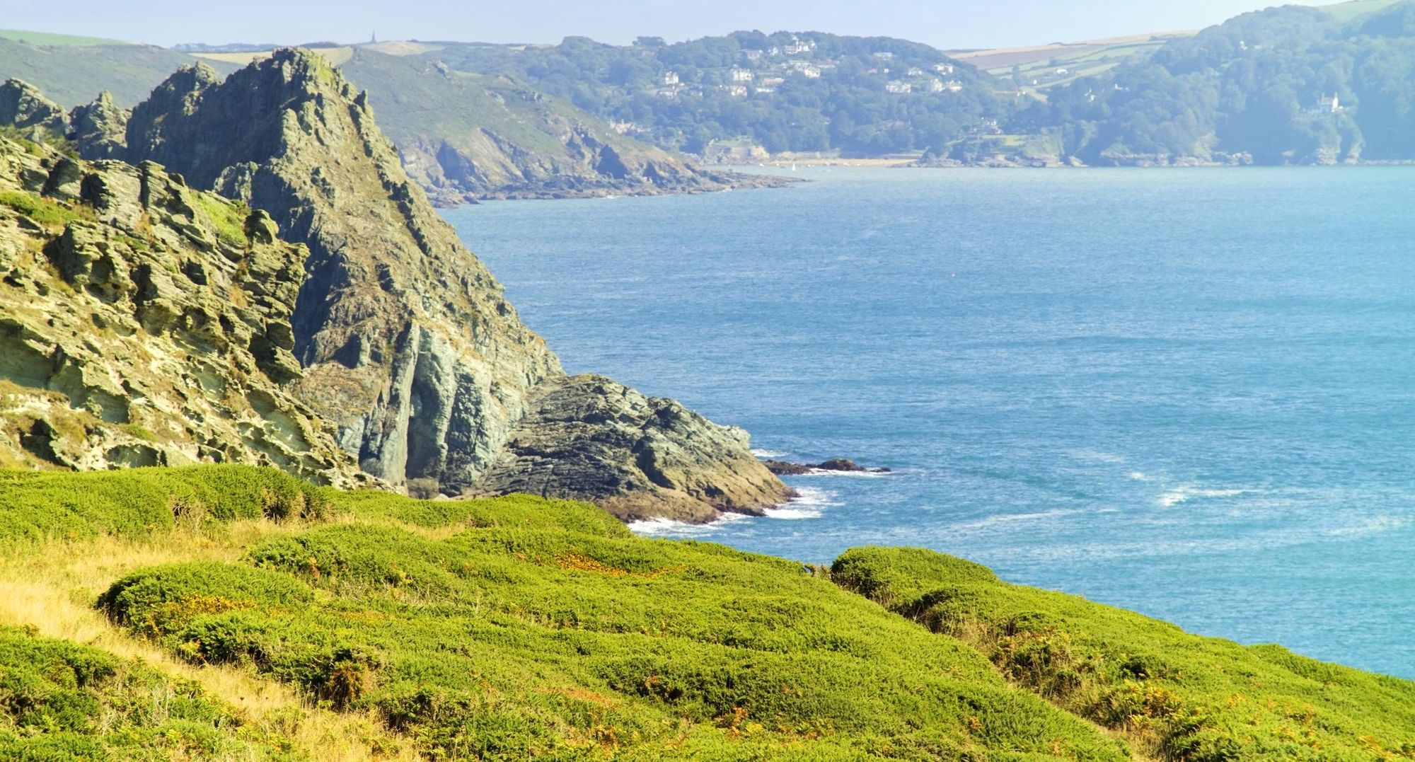
Follow the coast path through woodland to open fields, and join the Bolt Trail, with its iron age hill fort. The path leads you around a headland and across the grassy plateau of Bolberry Down.
From Bolberry Down, continue on the coast path downhill to Soar Mill Cove and continue along the coast path towards Bolt Head for about two miles. A steep, grassy gully leads down to your right—there are excellent views to the east of Prawle Point.
At the bottom of the gully is Starehole Bay, a sheltered inlet only accessible by boat or on foot. Continue along the coast path to Salcombe, a wealthy (and very picturesque) seaside town.
Stage 8: East Portlemouth to Torcross
- Distance: 13 miles (20.9km)
Begin the day by taking the ferry from Salcombe to East Portlemouth (it runs year round). From here, continue along the coast path to Gara Rock, before continuing onward to the rugged headland of Prawle Point.
Continue along the coast path to Great Mattiscombe Sand, another sandy beach and up past Start Point. Look out for the remains of the lost village of Hallsands, marked by commemorative plaque. Your next destination is the shingle beach of Beesands; from here there’s a final uphill climb before your descent, across fields, to Torcross.
Stage 9: Torcross to Dartmouth
- Distance: 10.7 miles (17.2km)
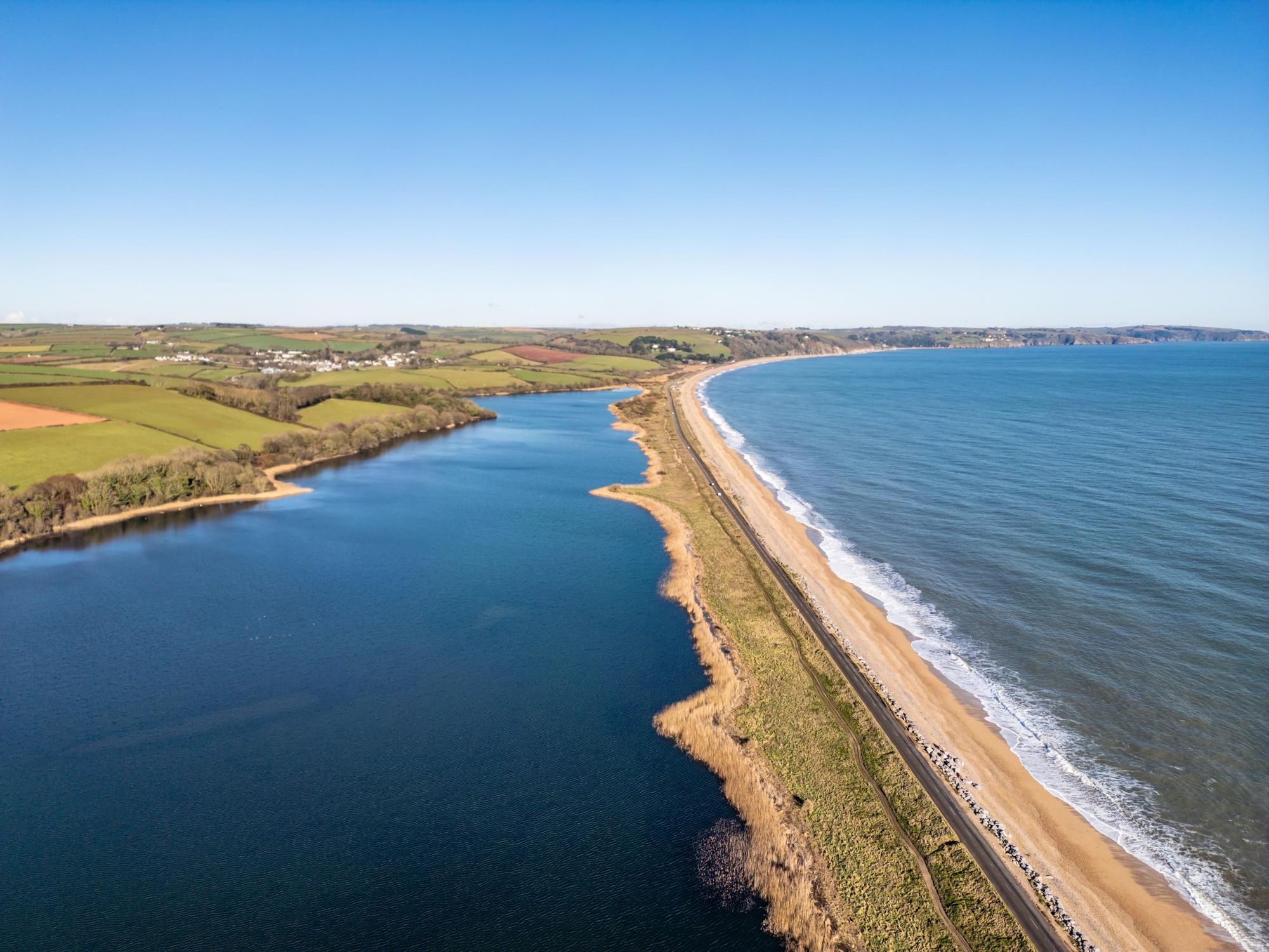
The first part of this stage takes you across Slapton Ley, a large freshwater lake formed over 3,000 years ago by a shingle ridge blocking it from the sea. It’s a nature reserve and SSSI, known for its birdlife.
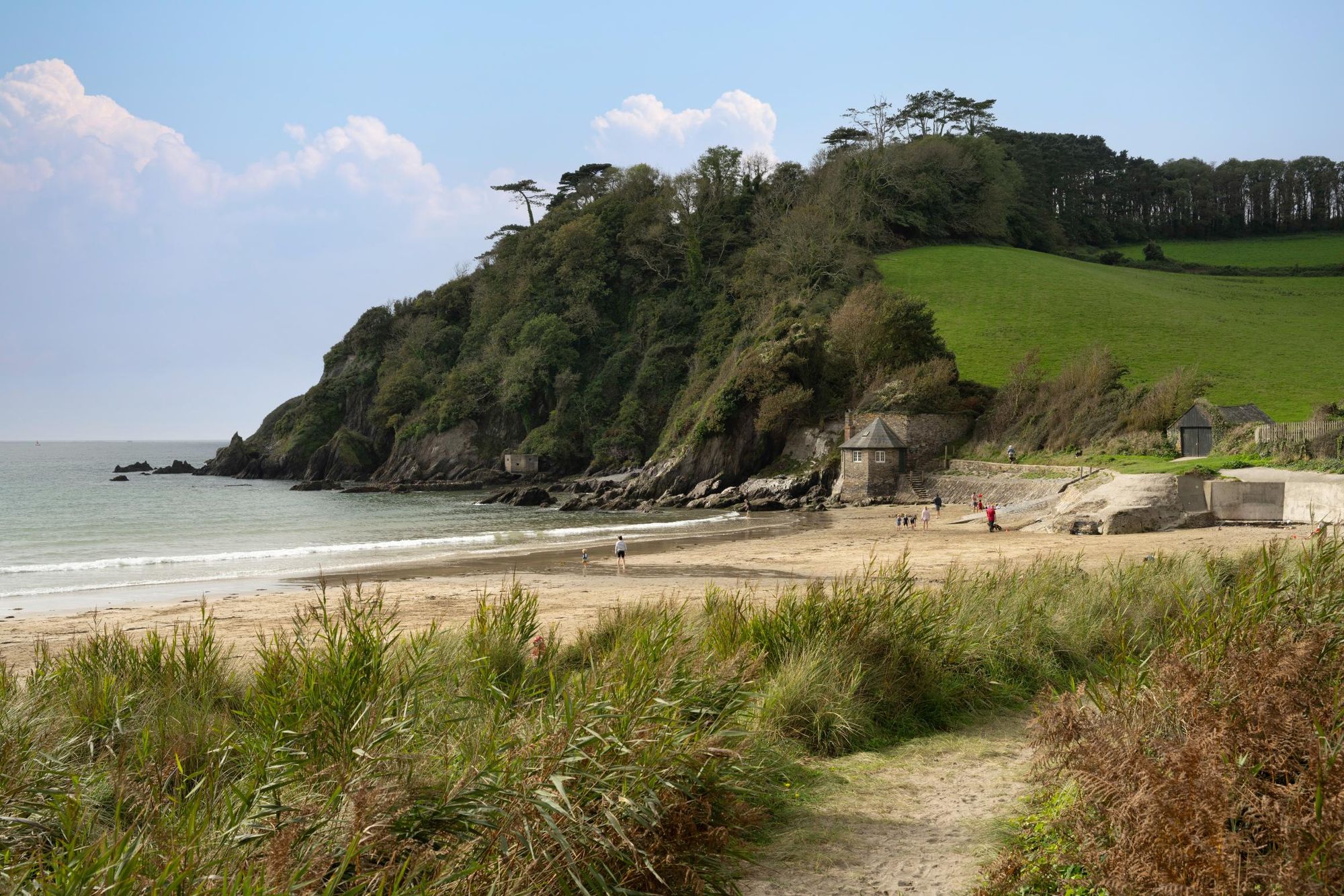
From Slapton you’ll pass across Blackpool Sands and the village of Stoke Fleming. A mile out of town you’ll reach Little Dartmouth. Follow the coast path through woodland and past a small beach, Sugary Cove. Continue to Dartmouth Castle. In the summer months there’s a ferry service from here up the River Dart to the town centre, but it’s under a mile on foot.
There are numerous independent shops and restaurants in this picturesque harbour town. For seafood, you can’t go wrong with Rockfish.
Stage 10: Dartmouth to Totnes
- Distance: 13.4 miles (21.5km)
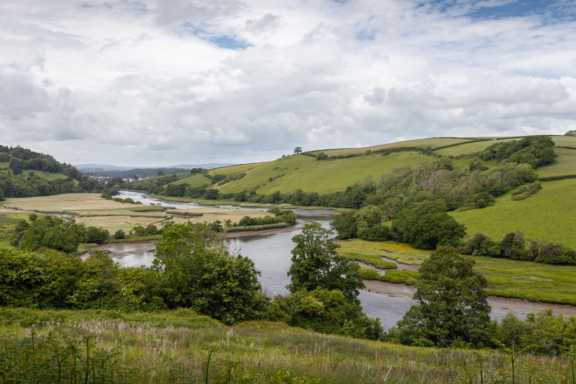
Head out of Dartmouth and follow the footpath signposted to Dittisham, keeping the River Dart on your right. There’s a long uphill ascent, where you have views across the river of Greenway, once Agatha Christie’s summer residence. Descend to Dittisham, passing through and following the green lanes to Higher Broadgates Farm.
Walk along the road to the village of Cornworthy, and then along the banks of Bow Creek—rich in birdlife such as little egrets and kingfishers—to the riverside village of Tuckenhay. From here, it’s up a steep hill to the tiny village of Ashprington, the gateway to the Sharpham Estate. This 550-acre site boasts a Georgian mansion, gardens designed by Capability Brown and even its own vineyard and cheesemaking dairy.
Enter the estate and you can follow a permissive footpath alongside the River Dart to Totnes; a walk that takes around 40 minutes.
Inspired? Check out our Hiking Adventures in the United Kingdom.