


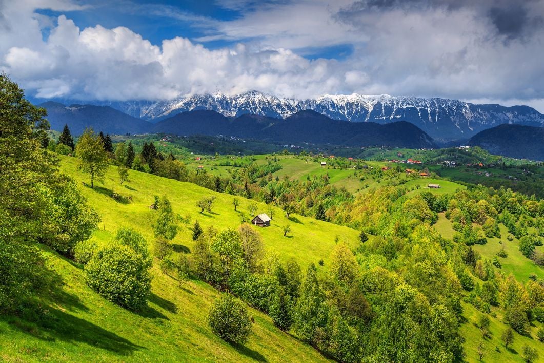
Located in south-eastern Europe, Romania has a wide range of landscapes and terrain to discover, from gothic castles to sweeping alpine grasslands. To the east of the country, the Danube forms a delta with the Black Sea, while the Carpathian Mountains curve from the north to the centre of the country, then turn toward the west, forming the so-called Carpathian Arc.
The Romanian Carpathians are traditionally divided into three big mountain groups (the eastern, southern, and western Carpathians), which separate the country’s main geographical and cultural regions from each other (Transylvania, Moldavia, and Țara Românească).
The Eastern Carpathians feature pastures dotted with wild nature reserves and rock formations, perfect for long hikes. The Southern Carpathians, also known as the Transylvanian Alps, combine glacial valleys with expansive areas of rock, especially along the mountain ridges. You’ll find easy hikes at the foot of the mountains alongside more taxing routes which may require some scrambling at higher elevations. The Western Carpathians feature a labyrinth of caves with gentle slopes, alpine grasslands, and scattered hamlets, suitable for easy trail hiking between mountain villages. Here’s your guide to the most popular areas for trekking in Romania.
5 of the Best Hiking Regions in Romania
1. The Apuseni Mountains
Recognised as a natural geological reserve, the Apuseni Mountains literally means the Western Carpathians in Romanian. They form a large, distinctive mountain group and feature a heavily karstic area, a maze of more than 3500 underground caves and subterranean rivers. The terrain includes sinkholes, deep valleys, and gentle ridges, alternating with canyons and gorges. The remote and sparse villages of the moți highlanders are among the area’s cultural highlights. High-roofed thatched cottages and pointed haystacks dot tucked-away hamlets.
In the heart of the mountains, you will find the Padiș plateau, the starting point for numerous hiking trails. Use Padiș as a base camp for doing day-hikes nearby, carrying a light backpack. The most popular circuit leads to the Citadels of Ponor, a six-hour marked trail that goes 150m deep into a cave with a flowing underground stream.
Many other trails in the area, such as the Citadels of Rădesei or The Lost World, meander among abyssal pit-caves and stunning gorges. The infrastructure in the region is pretty good, with mountain chalets (cabanas) or comfortable guesthouses. Padiș is easily accessible by the new road that comes from the small town of Beiuș and goes north to one of Huedin.
In other parts of the Apuseni Mountains, such as the Trascău or Metaliferi massifs, the hiking routes vary a lot. Easy day-walks to several-day treks are available amidst a network of traditional settlements and narrow canyons. You will follow forestry roads that link secluded villages, some of them the highest in Romania; alternatively, hike footpaths used by local shepherds during their seasonal movement of sheep between high and lowland pastures. Experience the traditional lifestyle by staying with a local family (homestays), many of which still do not have electricity.
2. The Bucegi Mountains
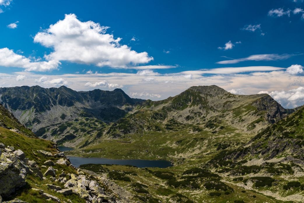
Part of the Southern Carpathians, the horseshoe-shaped Bucegi Mountains feature the highest conglomerate cliffs in Europe. Top-end resorts (Sinaia, Bușteni, Predeal) dot the mountainside above the popular Prahova Valley where traditional herdsmen settlements speckle the other side of the mountain, overlooking the Rucăr-Bran Corridor. At 1500m deciduous and coniferous forests ring the lower slopes of the massif.
Higher up the terrain varies from abrupt alpine valleys flanked by vertical rock walls, to ample meadows bedded with wildflowers. A vast plateau, almost flat, spans the top of the mountain. Babele Peak, the central point of this plateau, is home to legendary sandstone rock formations shaped by strong winds (the Sphinx and Babele rock formations).
The Bucegi Mountains encompass a network of well-marked trails, short and long, suited for all fitness levels. The Prahova Valley, Sinaia or Bușteni resorts provide the easiest starting points to approach to the massif. From each of them, a cable car whisks hikers up to the hiker-friendly Bucegi Plateau. There, an easy one-hour walk through the plateau leads hikers to the WWI memorial monument – a huge metal cross erected on Mount Caraiman. A further two-hour hike reaches the Omu Peak Chalet (the highest point of the Bucegi – 2505m), offering modest overnight accommodation.
Other trails starting from Omu Peak are pretty sheer and follow the main course of former glacial valleys. All these trails are demanding and require a good physical condition. The most comfortable alternative is to climb down Gaura or Ciubotea alpine valleys to Rucăr-Bran Corridor. After four hours descending steep and exposed footpaths, you will reach Bran village. The legendary Dracula’s Castle featured in Stoker’s famous novel stands imposingly on a hilltop. It definitely awaits visitors to discover its real secret.
3. The Piatra Craiului Mountains
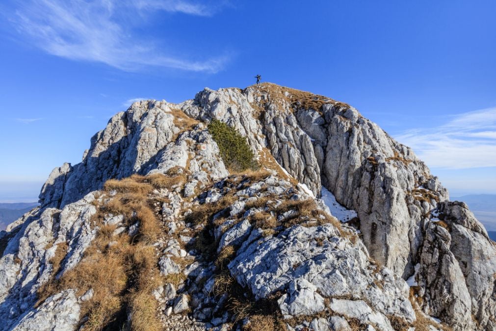
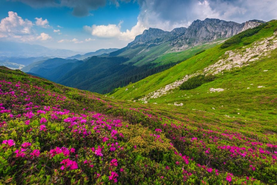
The Piatra Craiului Range lies opposite the Bucegi Mountains. Despite being a small mountain of white limestone, this massif is like a glittering jewel hiding stunning, different landscapes. Literally meaning the ‘Stone of the Prince’, Piatra Craiului is home to a challenging labyrinth of narrow glens and abrupt rock cliffs. Ample areas of juniper alternate with white peaks, precipitous slopes, and deep canyons. At higher elevations, the range features a rocky main ridge, quite sharp and exposed, which stretches over 22km. At lower altitudes, whitish scree and dense forests cover the mountain.
The most interesting trails in the massif are located on the western side of the range. They climb up to the main ridge and require easy scrambling. Cabana Plaiul Foii sits at the foot of the mountain and is the main base camp to access these trails. The most intriguing one is called ‘La Lanturi’ (literally meaning ‘At the Chains’).
The four-hour trail winds up through canyons and glens to reach the middle of the ridge at La Om Peak (2238m). It is equipped with chains and metallic cables in some places. From there, an easier trail goes down on the other side of the mountain, alternatively marked footpaths climb the northern or the southern ridge. Eventually, they will descend to Plaiul Foii after seven to eight hours of strenuous hiking.
Another good option is Cabana Curmatura, situated on the eastern side of the mountain. From there you can climb to the north ridge of Piatra Craiului and come back to the chalet after a 12-hour demanding but rewarding hike. Wherever you hike in Piatra Craiului, keep in mind you won’t find water sources along the trails, you’ll have to carry water throughout the route.
4. The Fagaras Mountains
The largest massif in the country, the Fagarisi Mountains have the longest mountain ridge in Romania (70km). Also called the ‘Transylvanian Alps’, they are home to the highest peak in the country (Moldoveanu Peak – 2544m). Dramatic pyramid-shaped peaks dot the serrated line of the main ridge; alpine valleys shelter glacial lakes surrounded by a limestone landscape alternating with crystalline schists. The infrastructure features modest mountain chalets and alpine refuges in the most accessible places.
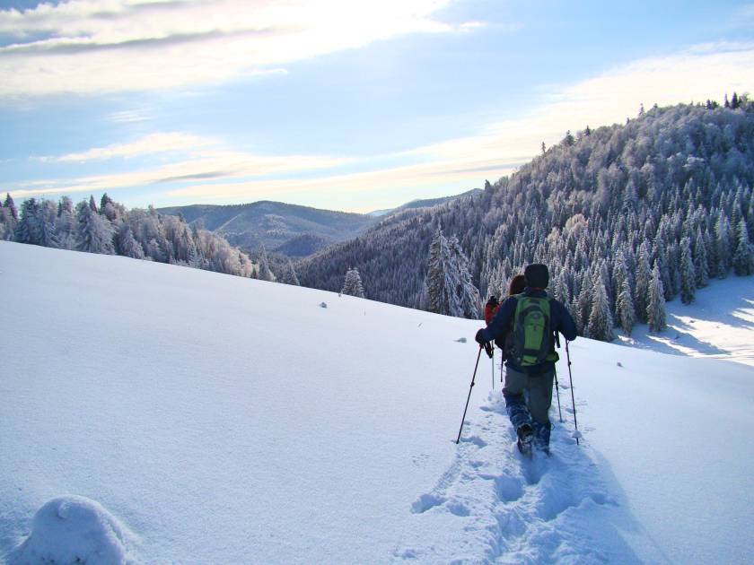
The Fagarasi Mountains are definitely the most spectacular trekking area in the country. At higher elevations, there is snow from October to May, so the window for hiking is quite short. The most popular route is trekking the main ridge (from west to east or the other way around), in four or five days. Either way, it’s a tough uphill hike (over 1500m in one day); but once you’re on the ridge, you’ll have expansive views and undulating steep ups and downs.
In a few places, you’ll have to scramble, but don’t worry, everything is equipped with resistant, metallic cables. Trekking the main ridge is a demanding hike and requires a good physical condition. Carrying a tent or sleeping in basic refuges is a good choice to preserve energy for the following day.
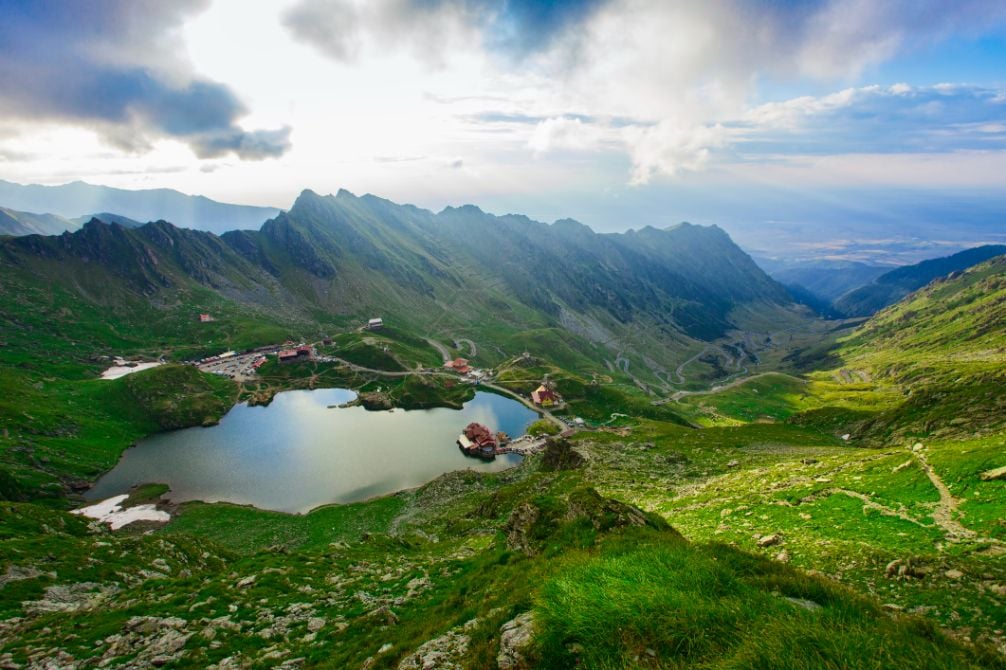
The central core of the massif is Bâlea (2040m) – the place where the Transfăgărăşan highway cuts through the mountains from south to north. In the summer months, you can get there by car. For shorter and easier hikes, the luxurious Bâlea Hotel makes a convenient overnight stay. From there a 4 or 5-hour steep hike reaches some of the most impressive peaks of the massif – Vânătoarea lui Buteanu (2507m) and Negoiu (2535m – the second highest peak in Romania, and in Făgărași).
5. The Retezat Mountains
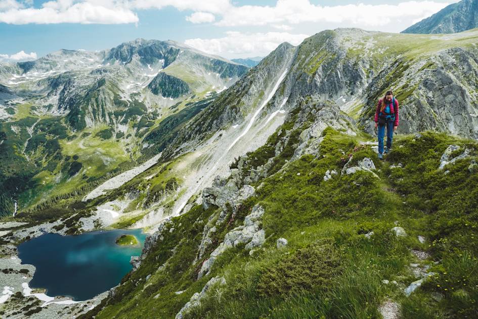
Lying in the south-west corner of Transylvania, the Retezat Mountains are a paradise of glacial lakes. Chains of emerald lakes enrich most of its valleys and create a distinctive alpine landscape with many landforms formed by glacial erosion. The well-defined upland block of Retezat covers Romania’s first national park. The park has also included a biosphere reserve in its north-western part (recognised by UNESCO). To enter the reserve, you need a special permit released by the Romanian Academy.
Even though access is harder in Retezat, this mountain range is really worth visiting. In the heart of the massif, Bucura is the largest glacial lake in Romania. A wild campsite is set on one side, making day-hiking possible on the surrounding peaks (e.g. Bucura I, Bucura II, and Judele). The six-hour hike past these peaks is moderate and winds amidst lakes situated at different altitudes. To get to Bucura, the shortest way is to hire a 4×4 and drive a 40km-long off-road to Poiana Pelegii – a large meadow that’s just a two-hour hike to Bucura Lake.
Other hikes are available but require a longer approach. From Nucșoara village a wide footpath gets you to Pietrele Chalet in one hour. This small mountain complex makes a good base if you want to climb the highest peaks in the massif – Peleaga (2509m) and Păpușa (2508m). The trail from Pietrele to Peleaga passes one of the massif’s deepest lakes – Lake Galeșu (more than 20m deep). After climbing the Păpușa and Peleaga peaks, a steep and demanding 8-10 hour descent through the Pietrele Valley will get you back to the chalet.
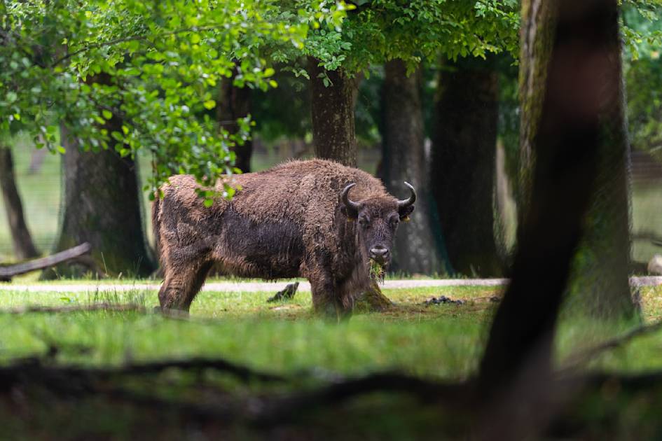
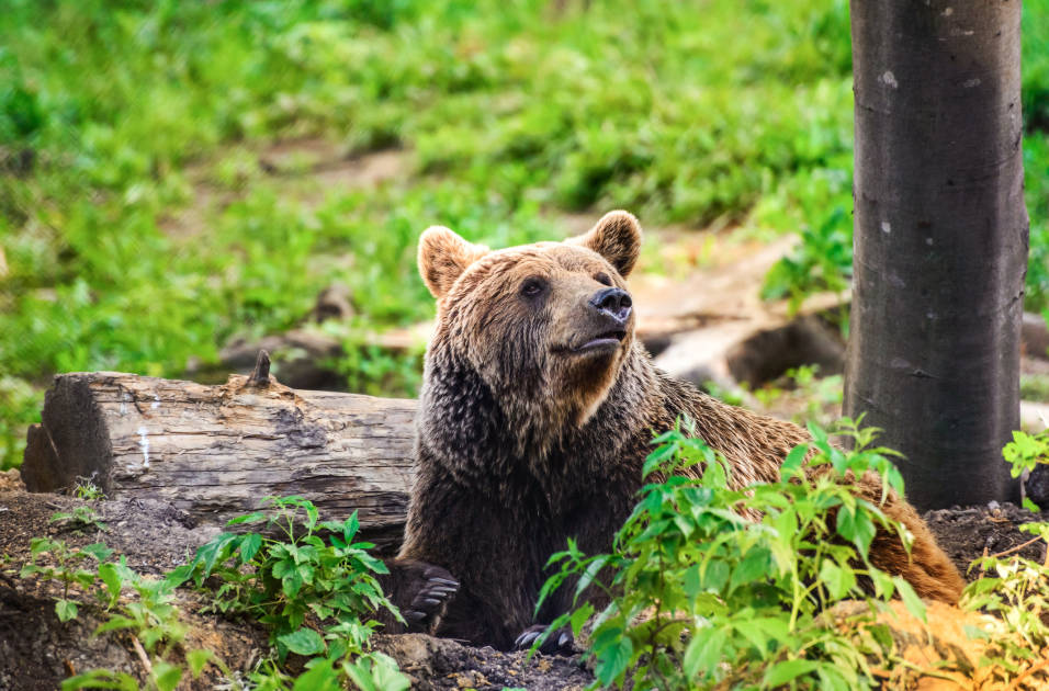
Want to see for yourself? Explore our hiking in Romania trips, and, whilst you’re out there, perhaps a touch of bear watching.