


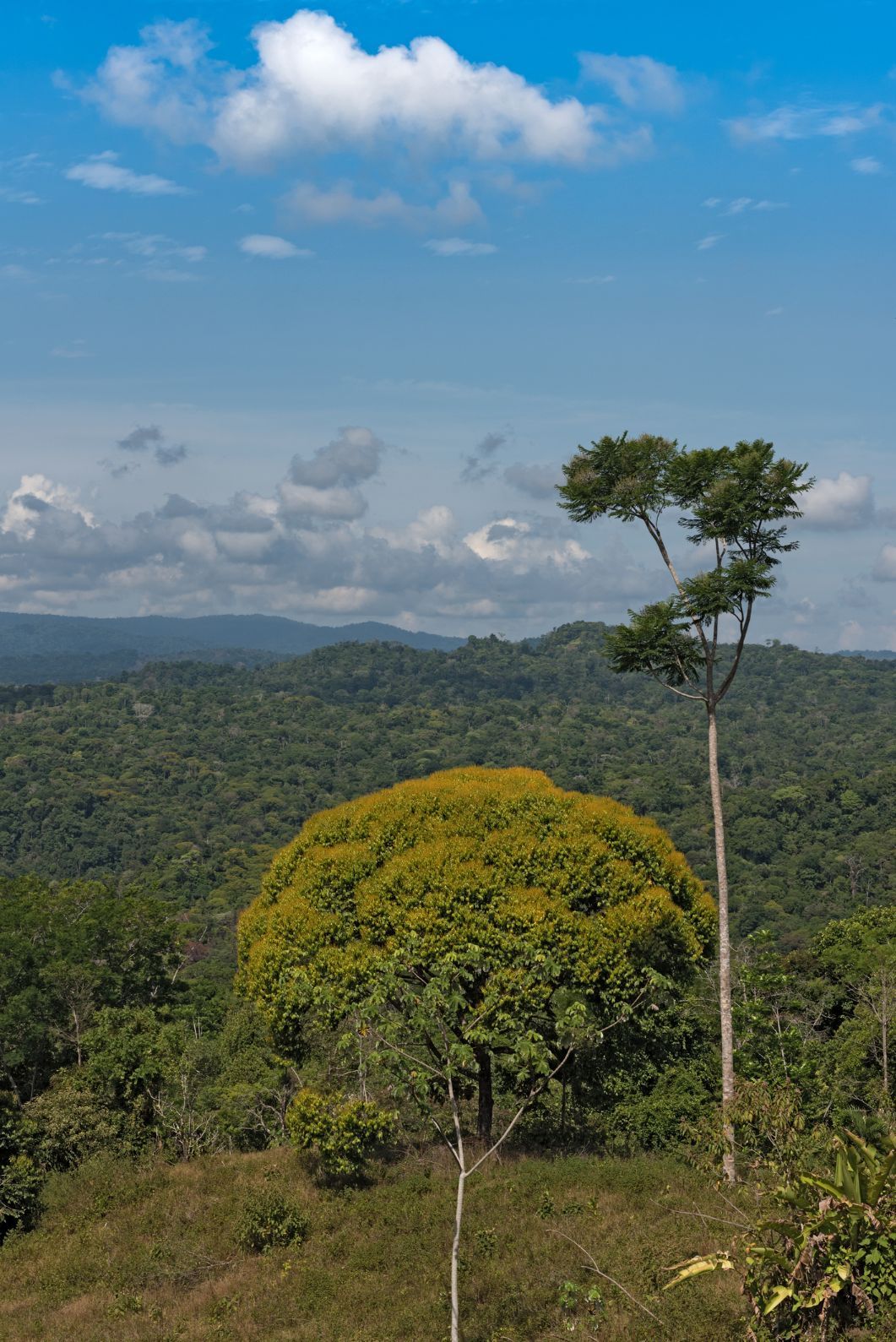
The best hikes in Costa Rica are the hikes that showcase the remarkable biodiversity of this vibrant Central American country. There’s so much forest, of so many different varieties, in Costa Rica. There are so many beautiful beaches, waterfalls and rivers, and so many dramatic volcanoes and vibrant nature reserves too - meaning there's a whole lot of beautiful scenery to hike through.
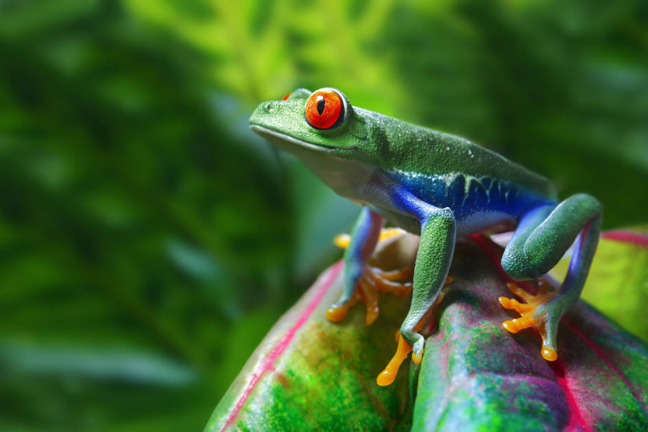
A massive 25% of Costa Rica's natural beauty is protected, with a staggering 28 national parks, over 50 wildlife refuges, and around 5% of the world's biodiversity found in the country - meaning that more than 500,000 species can be found in the natural landscapes around the country, from sloths, jaguars and howler monkeys to hummingbirds, toucans and strawberry posion-dart frogs.

So, where to start exploring? We hope to give you some answers to exactly that in the list below. Of course, the best hikes in Costa Rica are always going to be subjective, so with our choices, what we’ve really aimed to do is to give you an idea of the diversity across the country; the different areas and styles of hike available, and from there, to give you a starting point to start planning a trip.
We've selected these 10 routes as the best hikes in Costa Rica:
- El Camino de Costa Rica
- El Tajo Trail to San Josecito Beach, Piedras Blancas National Park
- The La Leona to Sirena Trail, Corcovado National Park
- Walk the Mistico Hanging Bridges, Arenal Volcano National Park
- The Catarata del Toro Waterfall Hike
- Climb Cerro Chirripó (3,820m)
- The Out-and-Back at Tenorio Volcano National Park
- Climb the Rincon de la Vieja Volcano
- Hike the Monteverde Cloud Forests
- The Cerro Cabeza de Vaca Loop
Check opening times before arriving at a national park in Costa Rica, as they can shut on certain days of the week (often Mondays) or for special occasions.
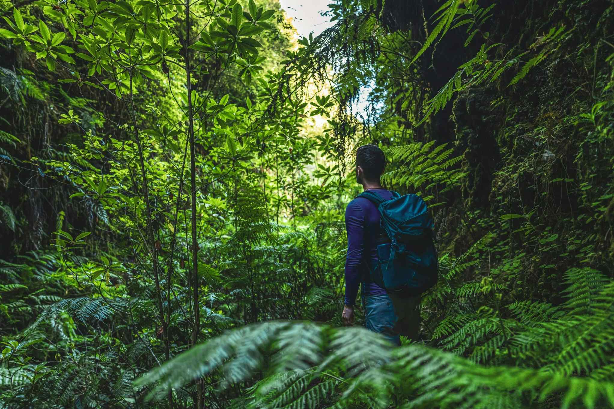
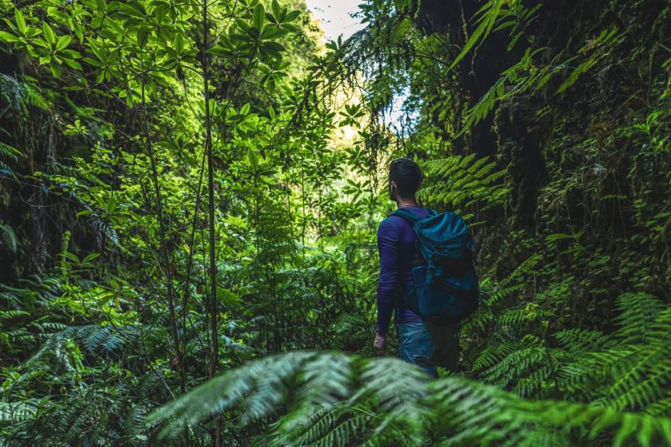
It’s important to note that these route descriptions are only short summaries, designed to inspire but not to serve any navigational purpose. They are not intended to guide you on the route and further mapping and planning (or a local guide!) will be required if you want to safely walk any of the trails featured. This is particularly important in a country like Costa Rica, where many of the best hikes go through hot and humid remote rainforests, where it's easy to get lost.
Here’s our guide to the best walks in Costa Rica, when to visit and where to stay.
10 of the Best Hikes in Costa Rica: Mapped
Costa Rica is bordered by Nicaragua to the north and Panama to the south, sitting firmly in the centre of Central America. The Carribean Sea (a sea of the Atlantic Ocean) to the east, and by the Pacific Ocean to the west.
10 of the Best Hikes in Costa Rica
1. El Camino de Costa Rica
- Start/Finish: Barra de Parismina/Quepos (coast to coast)
- Distance: 174 miles (280km)
- Walking time: 16 days
- Difficulty: Challenging
- Best for: An all-encompassing coast to coast epic
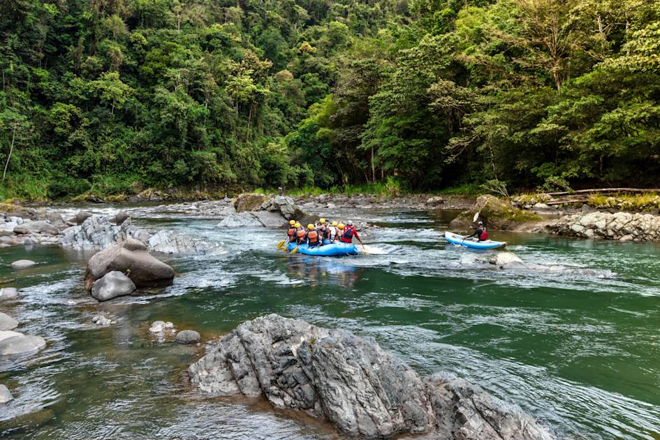
The Camino de Costa Rica is a long-distance trekking route which runs from the Atlantic coast of the country on the east to the Pacific coast on the west.
This remarkable, 16-stage route is perhaps the most immersive hike that can be done in the country, leaving the Caribbean Sea and heading into Barbilla National Park, where you'll be surrounded by an abundance of biodiversity, from sloths and howler monkeys to hummingbirds and multi-coloured frogs.
The trail was created by Conchita Espino, and opened in 2018. "Our main objective is to help these communities through which the trail passes," Espino told us. "We also use the trail as a means of ensuring there is protection for biodiversity."
The best example of this is perhaps when the route enters the Nairi Awari territory, which is home to the indigenous Cabécar people. Here, you can walk with a Cabécar guide and stay in a campsite on the edge of a national park. Other highlights include the thermal waters, the red soil of the coffee regions, and of course, the finale, arriving in Quepos to far-reaching views of the Pacific Ocean.
Read more: On the 280km Coast to Coast Hike Across Costa Rica
2. El Tajo Trail to San Josecito Beach, Piedras Blancas National Park
- Start/Finish: Golfito (out-and-back)
- Distance: 15.8 miles (25.4km)
- Walking time: 10 hours
- Difficulty: Challenging
- Best for: A tough all-day hike, off the beaten track
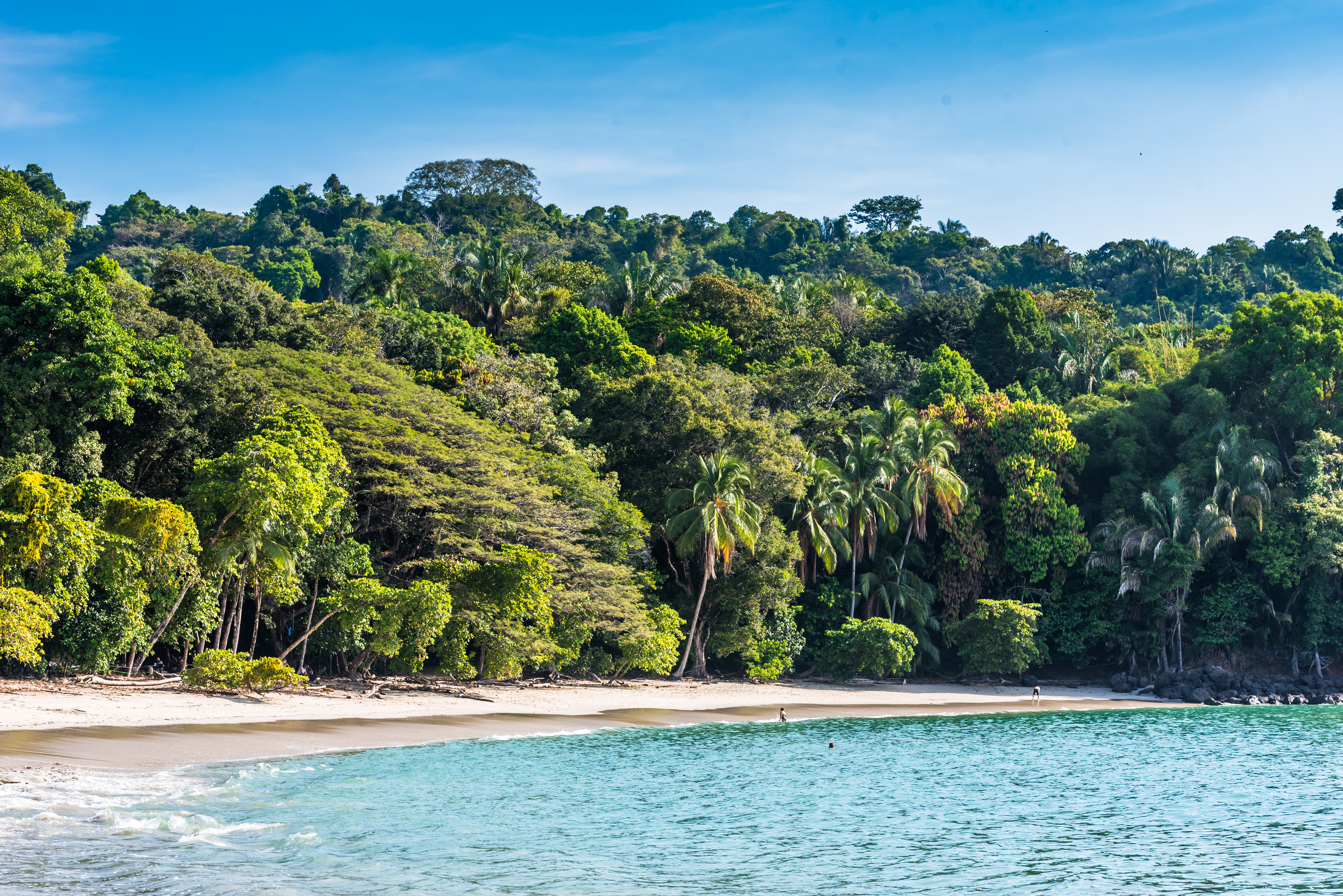
Leaving Golfito, the most southern port town in Costa Rica, this hike will soon have you passing Golfito National Wildlife Refuge en route to the neighbouring park, Piedra Blancas National Park - a lesser-visited part of Costa Rica.
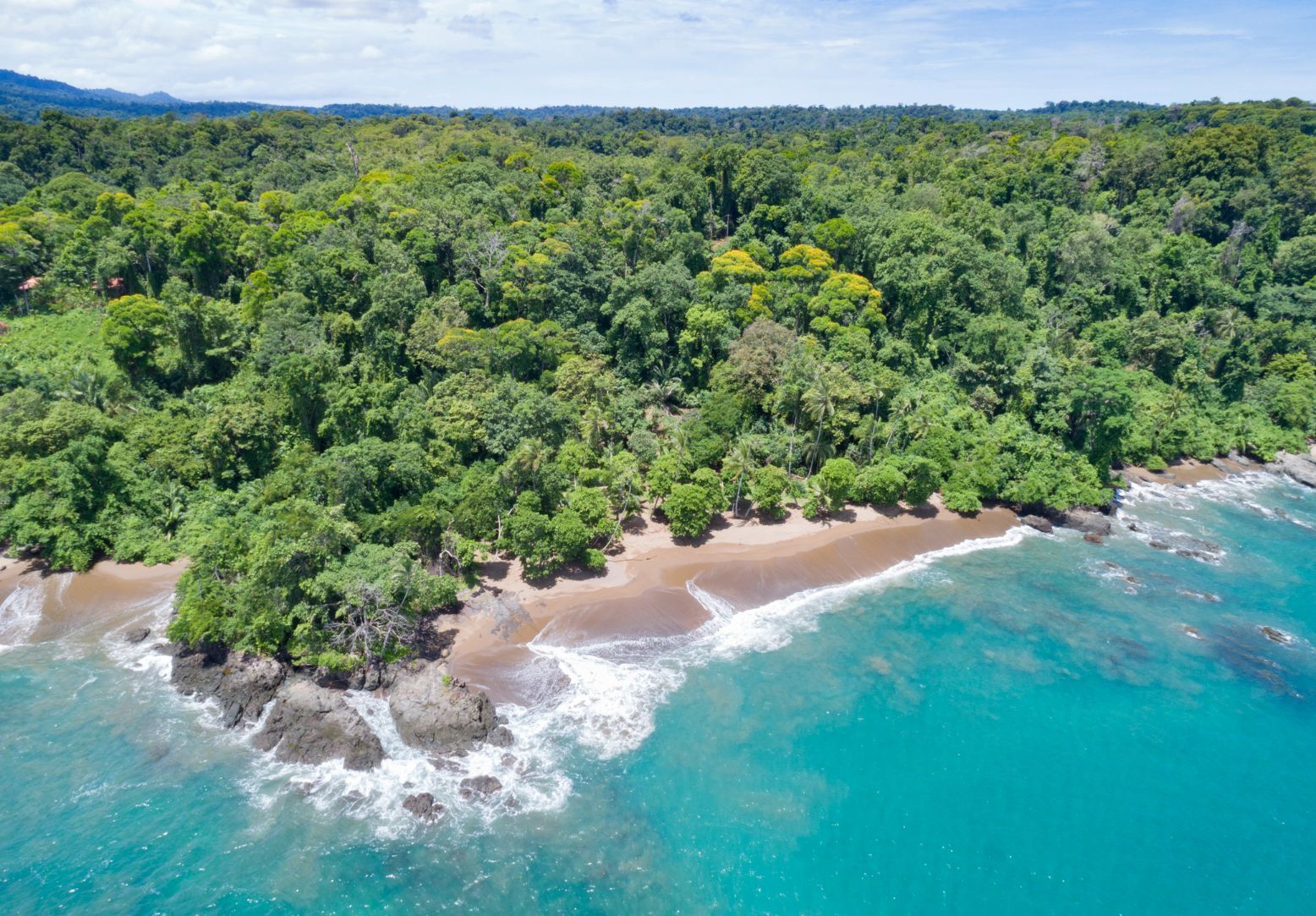
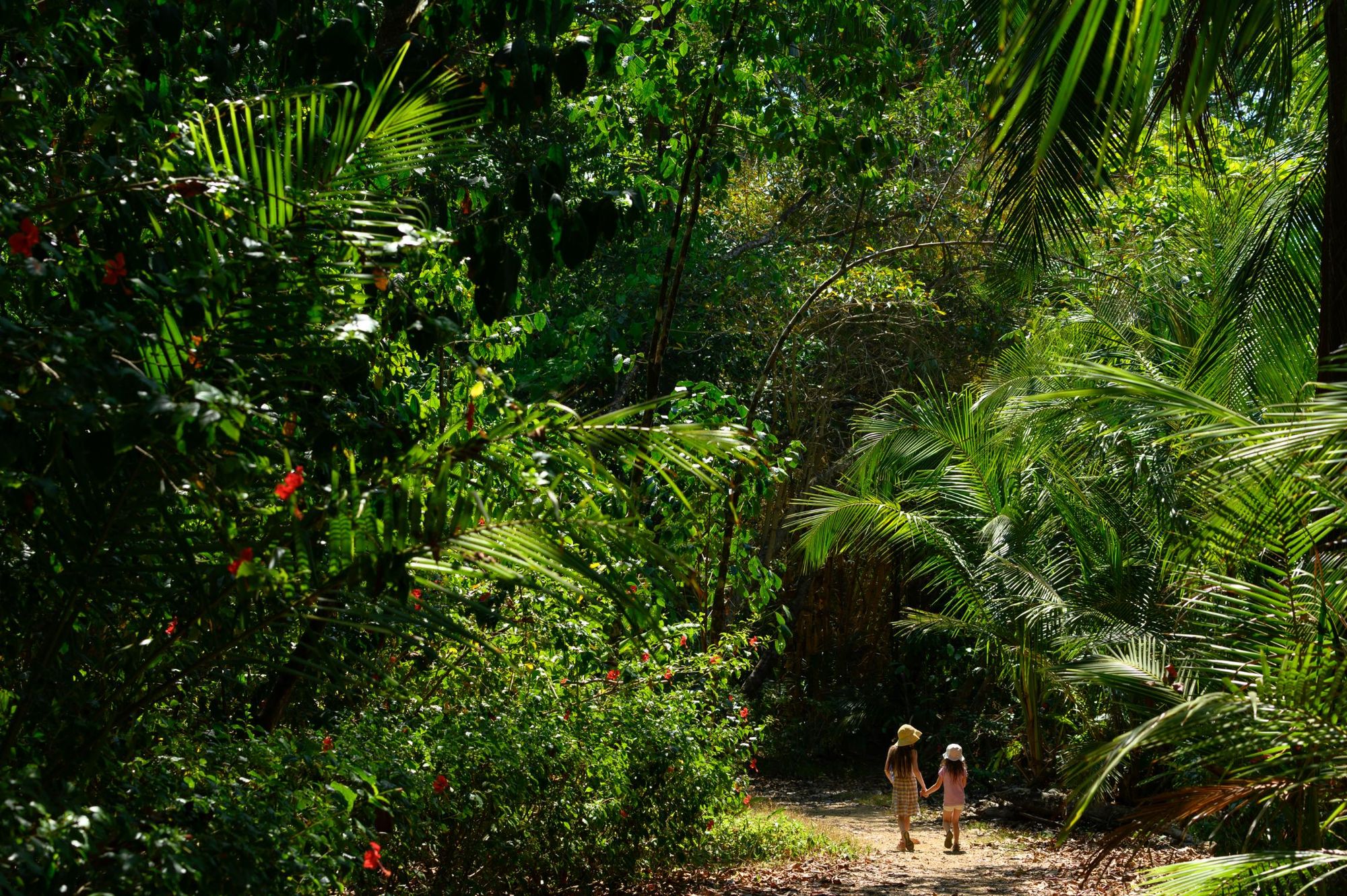
The terrain is primary rainforest on the Southern Pacific Coast of Costa Rica. Think stunning birds and animals - howler monkeys, white-nose capuchins, coatis, toucans and scarlet macaws. The place is considered to be one of the best parks in the country for bird watching, and the scenery is appropriately stunning too; wondrous waterfalls, picturesque beaches and even an off-shore coral reef.
Hike deep into the forest and you'll reach the El Bonito Operational Centre, where you can have a rest before continuing on. The final section of this trek to San Josecito Beach takes you through lowland forest to a spot where the rainforest meets the sea.
Due to remote access - Piedras Blancas National Park is 138 miles (222km) from San Jose City - this is not a frequented park in Costa Rica. Make no mistake, this is a big day out. Know that an expert local guide will be absolutely essential.
3. The La Leona to Sirena Trail, Corcovado National Park
- Start/Finish: La Leona Ranger Station/Sirena Station (thru-hike)
- Distance: 10.5 miles (17km)
- Walking time: 7-10 hours
- Difficulty: Challenging
- Best for: Seeing the diversity of Corcovado National Park
Corcovado National Park is the biggest national park in Costa Rica. It's also the largest piece of primary forest on the American Pacific coastline. Oh, and it’s one of just a handful of sizeable areas of lowland rainforest remaining in the world.
That should give you an idea of the scale and reputation, but is the best hikes to do in the park? One option is to start your hike at the La Leona Ranger Station - which marks the entrance to the park - and head in through the rainforest, across rivers and along the sandy coastline of the Osa Peninsula, to Sirena Station.
There's a reason National Geographic called this place "the most biologically intense place on Earth in terms of biodiversity".
The Osa Peninsula is home to the largest population of jaguars and tapirs in Costa Rica (though the former are particularly hard to spot). Watch out also for curious spider monkeys, wild boars, harpy eagles and more brightly-coloured insects than you knew existed. There's a reason National Geographic called this place "the most biologically intense place on Earth in terms of biodiversity".
You'll stroll along picturesque beaches on the egde of the Pacific, step through dense jungle and tackle a couple of river crosses - the last of which, near Sirena Station, is wide and deep. The station itself sleeps 30 people in bunk beds.
As with any of the hikes in this list, a guide is a requirement for safe navigation.
4. Walk the Mistico Hanging Bridges, Arenal Volcano National Park
- Start/Finish: Mistico Park (loop)
- Distance: 2 miles (3.2km)
- Walking time: 2-3 hours
- Difficulty: Easy
- Best for: A leisurely day out in remarkable nature
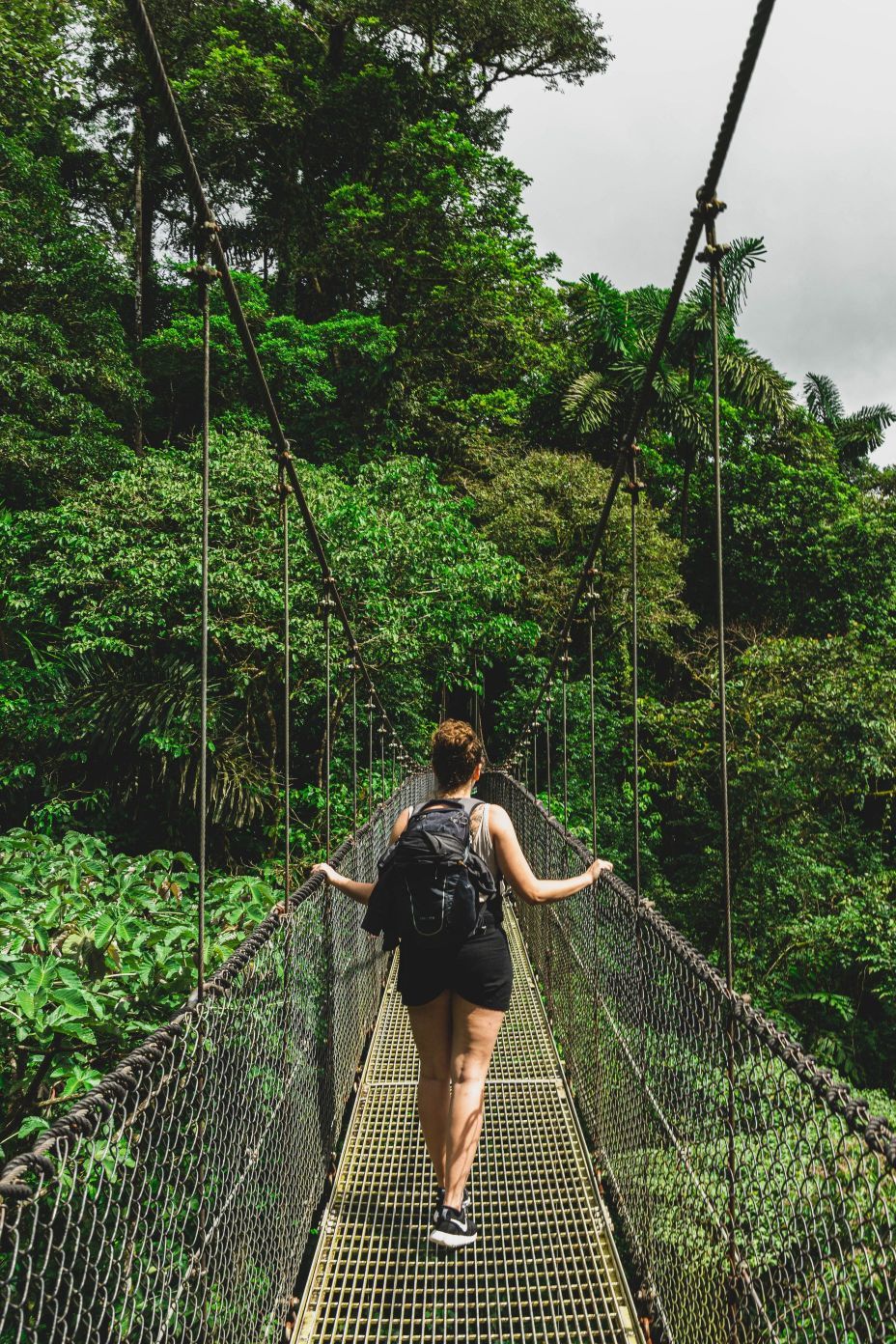
One of the most popular walks in Costa Rica is in Mistico Park on the Hanging Bridges - a series of suspension bridges in the Volcan Arenal National Park. There are 16 bridges in total, six of which are hanging, and there's a diverse range of lowland and highland forest to look out at from those bridges. The area is home to over 700 species of flora, more than 300 species of bird and countless mammals.
This is more of a leisurely stroll than a hike (there are plenty of extremely demanding walks elsewhere on this list), and it's also one of the only walks on this list where you can go self-guided, though given it's only around $12 extra to get a guide - who will be an expert in the flora and fauna - it can be worthwhile to do so.
One interesting option is to book a night walk in the park, and experience it in the dark, with nocturnal animals all around. You can also book history or bird tours.
For more, combine a visit to the hanging bridges with a two and a half hour hike from Arenal Volcano Park to a dry lava field for example, and/or with a hike to La Fortuna Waterfall - though either will require transports between hiking locations.
5. The Catarata del Toro Waterfall Hike
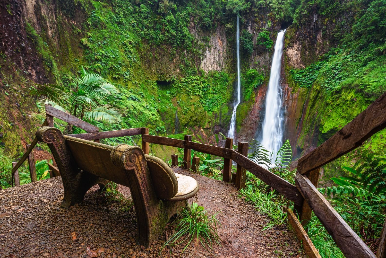
- Start/Finish: Catarata del Toro, Bajos del Toro (out-and-back)
- Distance: 2.1 miles (3.5km)
- Walking time: 1-2 hours
- Difficulty: Easy
- Best for: A short hike on a day off
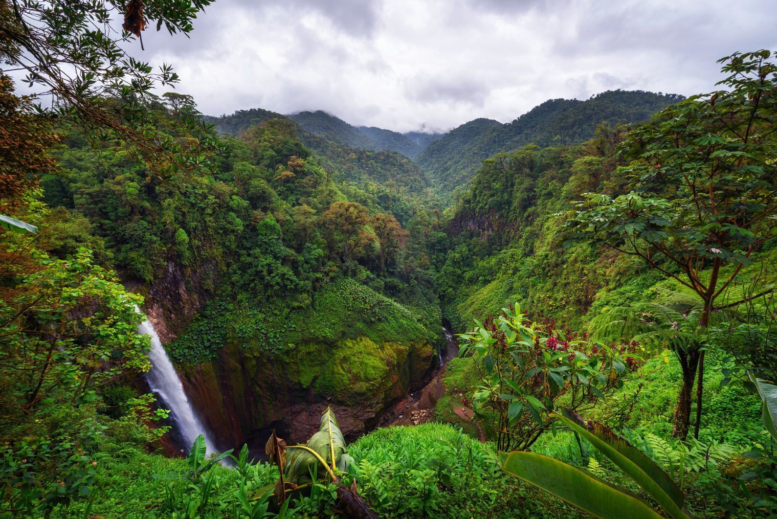
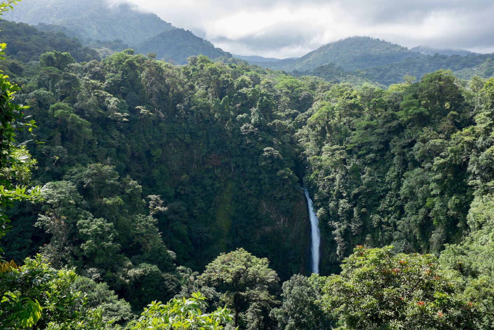
There are waterfalls and then there are waterfalls worth taking a day out of your trip to go and see, and the Catarata del Toro waterfall, plummeting 90m (270ft) into an extinct volcano crater, surrounded by cloud forest, is one of the latter.
This is on private land (as are all waterfalls around Bajos del Toro), so unfortunately there is an entry fee - and at $10 it’s not the cheapest attraction in the great outdoors - but the trail is wonderful.
It takes you through dense forest, past various viewpoints, before dropping steeply down to the base of the fall on a staircase. From there, you can wonder at the green cliffs and orange streaks on the walls that make these so distinctive. If you’re a bird fanatic, then good news too, because the area is buzzing with hummingbirds.
Waterfall enthusiasts should also check out the Nauyaca waterfalls further south, and you can also extend your trip in the Bajos del Toro region by visiting the Bajos del Toro cloud forests. Monteverde might be the crown jewel of Costa Rica's Cloud Forests, but Bajos Del Toro is pretty special too.
6. Climb Cerro Chirripó (3,820m)
- Start/Finish: San Gerardo de Rivas (out-and-back)
- Distance: 24.8 miles (40km)
- Walking time: 2 days
- Difficulty: Challenging
- Best for: Summit baggers
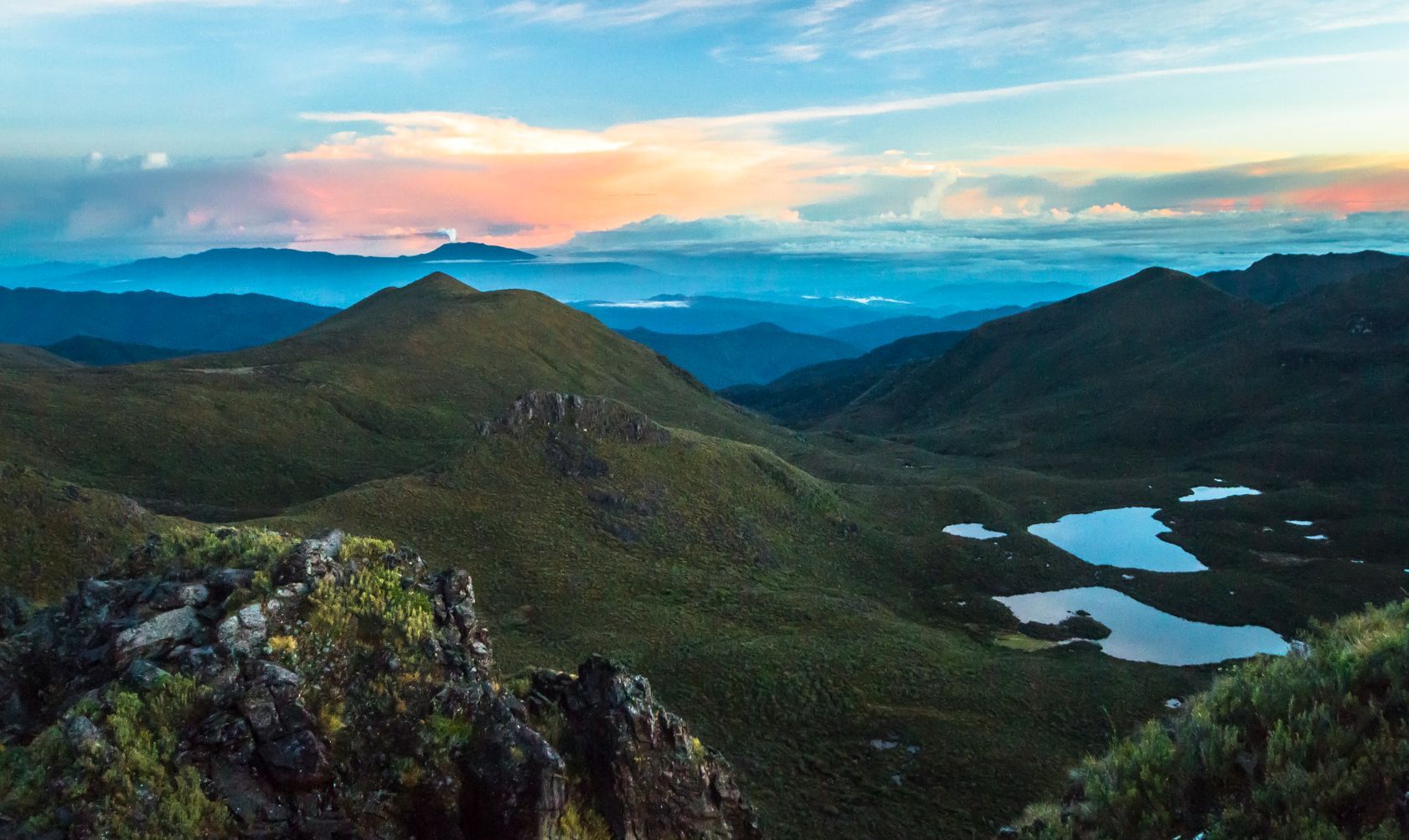
The tallest mountain in Costa Rica is the mighty Cerro Chirripó, standing tall at 3,820m (12,533ft). The hike up Cerro Chirripó is a tough 12.4 miles each way from the village of San Gerardo de Rivas, and the ascent will take you up over 2,000 metres (7,218ft). That doesn't go quickly, so Chirripó is climbed over two days, with an overnight spent at the Crestones Base Camp, a lodge up at 3,400m (11,155ft) which leaves hikers 3.4 miles (5.5km) away from the summit.
The route up Chirripó starts at San Gerardo de Rivas, passes through cloud forests and páramos (an ecosystem globally unique to the high tropics of the New World).
From here, via rugged, gravel and craggy paths, the trail eventually takes you to a summit view over all of Costa Rica, from the Caribbean Sea to the Pacific Ocean, and provides a remarkable lookout point over the Talamanca Mountains.
Note that high on the mountains in Costa Rica, you won't get the same kind of humidity you usually get elsewhere in the country. Temperatures can be around 4–18˚C on the higher reaches of Chirripó, and it can drop below 0˚C at night.
If you want to climb Chirripó, you'll need to buy a permit to do so in advance.
7. The Out-and-Back at Tenorio Volcano National Park
- Start/Finish: Tenorio Volcano National Park (out-and-back)
- Distance: 3.5 miles (5.6km)
- Walking time: 3-4 hours
- Difficulty: Moderate
- Best for: A playground of natural wonders
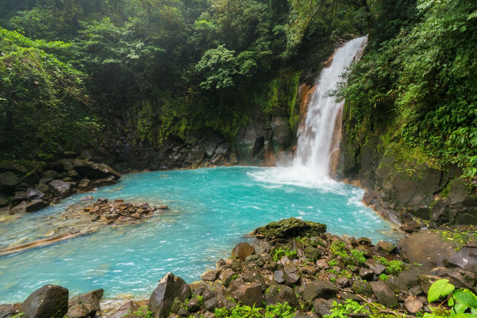
Tenorio Volcano National Park is a real beauty. It's actually better known for the Rio Celeste Waterfall than it is for the eponymous volcano. There's an out-and-back trail that runs through the park, taking in several sights of natural beauty.
From the beginning of the trail, you'll walk uphill and soon come to that waterfall. The Rio Celeste fall is a 30m (98ft) waterfall which has an intense blue colour. It's surrounded on every side by busy green rainforest, and the cliff walls around it make the location feel like you’ve just stumbled into a little piece of paradise.
For the hardcore hikers, there's also a serious hike to the volcano rim in Tenorio, though you'll need a guide to help navigate the jungle.
After a detour down to the foot of the fall, which involved descneding a long staircase (and, regrettably, climbing back up it), you can continue on the main route, which will next take you to La Laguna Azul, a lovely lagoon which is a similarly intense colour of blue. You'll then walk on to Los Borbollones, a segment of river where you can watch the water bubbling away with volcanic heat.
Hike on to El Teñidero, where two streams meet to form the Rio Celeste and you can see the water actively changing colour - with the clear current turning into that blue. The dense jungle, volcanic waters and tight paths of Tenorio are simply remarkable, but it’s really that hypnotic blue water, and the transformation of it, that is worth going for. For the hardcore hikers, there's also a serious hike to the volcano rim in Tenorio, though you'll need a guide to help navigate the jungle.
8. Climb the Rincon de la Vieja Volcano
- Start/Finish: Parque Nacional Rincón de la Vieja (out-and-back)
- Distance: 10 miles (16km)
- Walking time: 6-8 hours
- Difficulty: Challenging
- Best for: An off-the-beaten track peak
Rincón de la Vieja is an active volcano in the northwest of Costa Rica. The last large eruption was in 1991, though there were smaller eruptions in 1998 and 1999.
The National Park around the volcano is a fascinating place to explore - with hot springs and steam vents dotted around in addition to the famous Costa Rican wildlife. You still get coatis, howler, white-faced and spider monkeys here, despite the fact that the landscape is quite different to the rest of Costa Rica.
There are three main hiking trails in the park. The first and most famous is the 1.9-mile (3km) Las Pailas trek - taking in boiling mud pots, a waterfall, rainforest and hot springs. Another is the Catarata Escondita route, which involves a 2.6-mile (4.3km) walk to a waterfall.
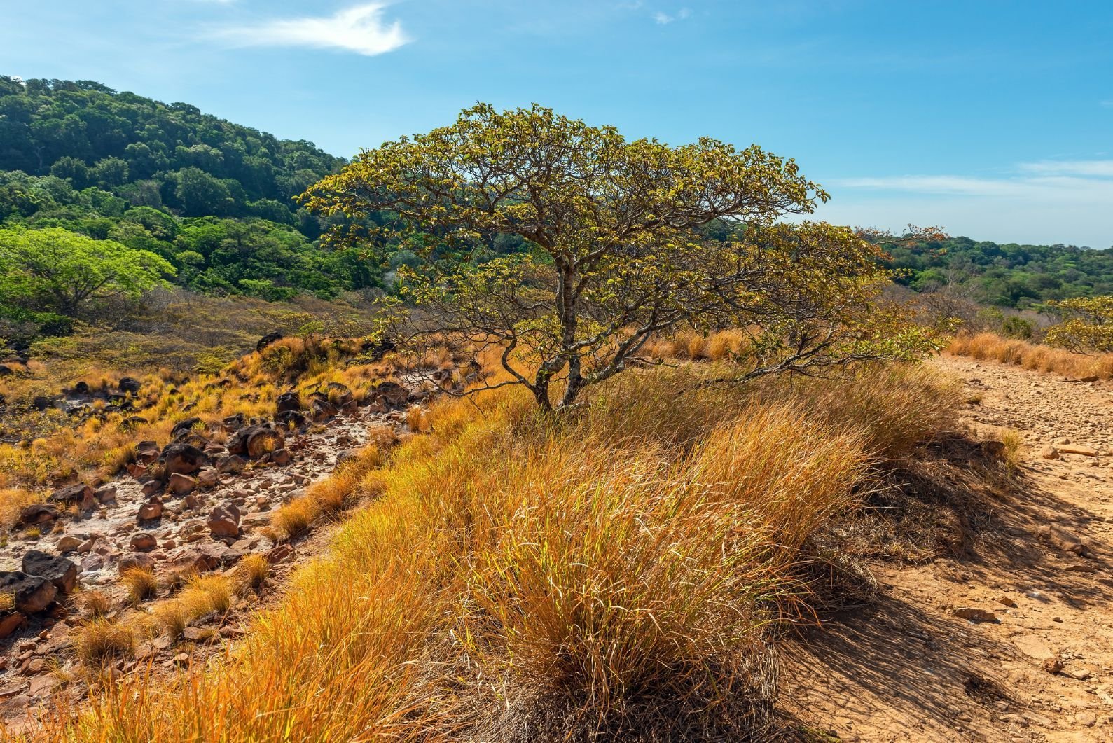
The most demanding trek is the Active Crater trail up to the 1,915m (6,282ft) rim of the Rincon de la Vieja volcano. It's demanding, but achievable. You'll go through all sorts of terrain, starting off in tropical rainforest, then walking through a drier forest before the landscape becomes rockier as you near the rim. From here it's a scramble to the rim, with remarkable views from the top around the surrounding area. The volcano is active, and December-March is the dry season, so the best time to climb to the rim. Expect to be on the go for between six and nine hours.
Please note: The trails to the peak of the volcano do close from time to time if there is an increase in volcanic activity. In 2015, permanent warning signs went up, and it is not uncommon to see these trails shut. Stay safe and obey signage. Rangers also close the trail regularly in windy conditions, and a guide is required.
9. Hike the Monteverde Cloud Forests Trails
- Start/Finish: Monteverde Cloud Forest Reserve (loop)
- Distance: 8 miles (12.8km)
- Walking time: 4-5 hours
- Difficulty: Moderate
- Best for: A truly immersive but manageable hike
The enormous Monteverde Cloud Forest Reserve comes in at 765 acres, but in order to protect the nature, visitors are only allowed access to around 3%of that. The rest, quite rightly, is for the animals and biodiversity that the reserve was set up to protect. The cloud forests are something really quite unique. They are literally forests which are shrouded in cloud, so... do be sure to bring a rain jacket.
There are several trails around the Monteverde Cloud Forest Reserve, but they don't add up to an abundance so why not... do them all? If you do so, it works out as around eight miles in total. The longest loop will take you from the Sendero Bosque Nuboso through the dense, lush forest and up to La Ventana, a terrific viewpoint of the Continental Divide - the line which divides the continent into the Pacific and the Caribbean. If the clouds clear for a moment or two, you'll be able to see the true beauty of the vast greenery often hidden beneath the clouds.
The longest loop will take you from the Sendero Bosque Nuboso through the dense, lush forest and up to La Ventana, a terrific viewpoint of the Continental Divide.
Next it's on to the Sendero Pantanoso and Sendero El Rio along a beautiful ridge. You'll find yourself in prime bird spotting territory here (eyes peeled for hummingbirds, three-wattled bellbirds and resplendent quetzals). You'll be level with the tree canopies, so you might even catch a glimpse of a few monkeys too.
Finish off by heading to the El Rio waterfall, all the while looking out for coatis, sloths and even - if you're lucky - jaguar. There’s a lot to see on those eight miles.
10. The Cerro Cabeza de Vaca Loop
- Start/Finish: Cerro Cabesa de Vaca Entrance (loop)
- Distance: 11 miles (17.7km)
- Walking time: 7-8 hours
- Difficulty: Moderate to challenging
- Best for: Getting away from the crowds
This 11-mile route will take on gravel, dirt and asphalt on a route through a fascinating landscape - up an extinct volcano in central Cartago Province.
There may not be as many animals here as on certain other trails in Costa Rica (though you'll still see your fair share), but the flora here is immensely diverse; and you'll see a lot of flowers and plants here that it's unlikely you'll see elsewhere in the country - from eucalyptus trees to pine forests. The trails are also well marked and maps are frequent, so you can sculpt your own route through the area.
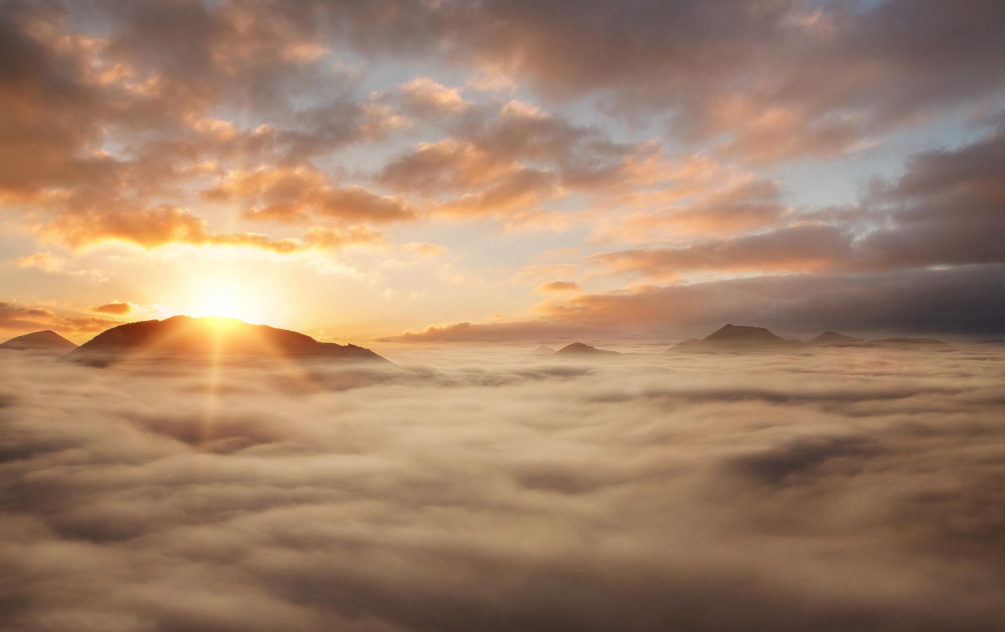
Picture high farmland with far-reaching views of mountains, gravel trails passing over ridgelines, surrounded by grasslands, and cloud immersions at sunset.
It's worth noting that if walking the full route, you'll pass a patch of private property, where they charge 1,000 colones (£1.50/$1.90) as a toll to continue on the route. This also offers a chance to top up on food though, as they've got some limited supplies, and you can also grab a coffee or agua dulce here as well.
Please note that you need to a reservation, which you should sort before arrival. Entrane costs 3,000 colones (£4.43/$5.60).
What is the best time to hike in Costa Rica?
You'll often read that for hiking, the best time to visit Costa Rica is in the dry season, which runs roughly from the middle of December to the middle of April.
This is largely because the trails won't be damp and slippy during this period. Actually, though, Costa Rica is a year-round destination, and if you visit at other times of year, you'll see other benefits - less tourists, for example, meaning you'll often have the trails to yourselves. The rainy season brings out a lot of colours and scents in the national parks too - and ultimately, it can rain anytime of year.
What Animals Live in Costa Rica?
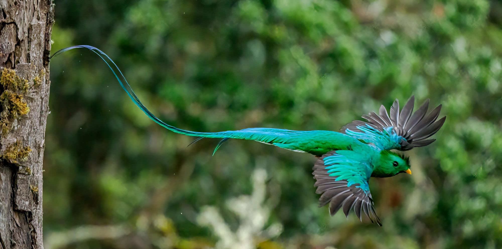
The wildlife in Costa Rica is famously diverse. In fact, with around 4-5% of the world's species being found in the country, it is often said to be one of the most biodiverse countries in the world. The most famous animals in the country are the likes of sloths, jaguars, monkeys, macaws, toucans, hummingbirds, chameleons and the many multi-coloured frogs. Lesser known are the coati, which are adorable members of the raccoon family, or the resplendent quetzal, which is a majestic, cyan-coloured bird which has a long, curling tail that floats behind it.
There are more than 500,000 species found in Costa Rica.
Other animals you might spot include tapirs, anteaters, iguanas, crocodiles and a variety of snakes. If you love wildlife, then there are few better places to hike in the world than Costa Rica. There are more than 500,000 species found here.
Where to Stay in Costa Rica?
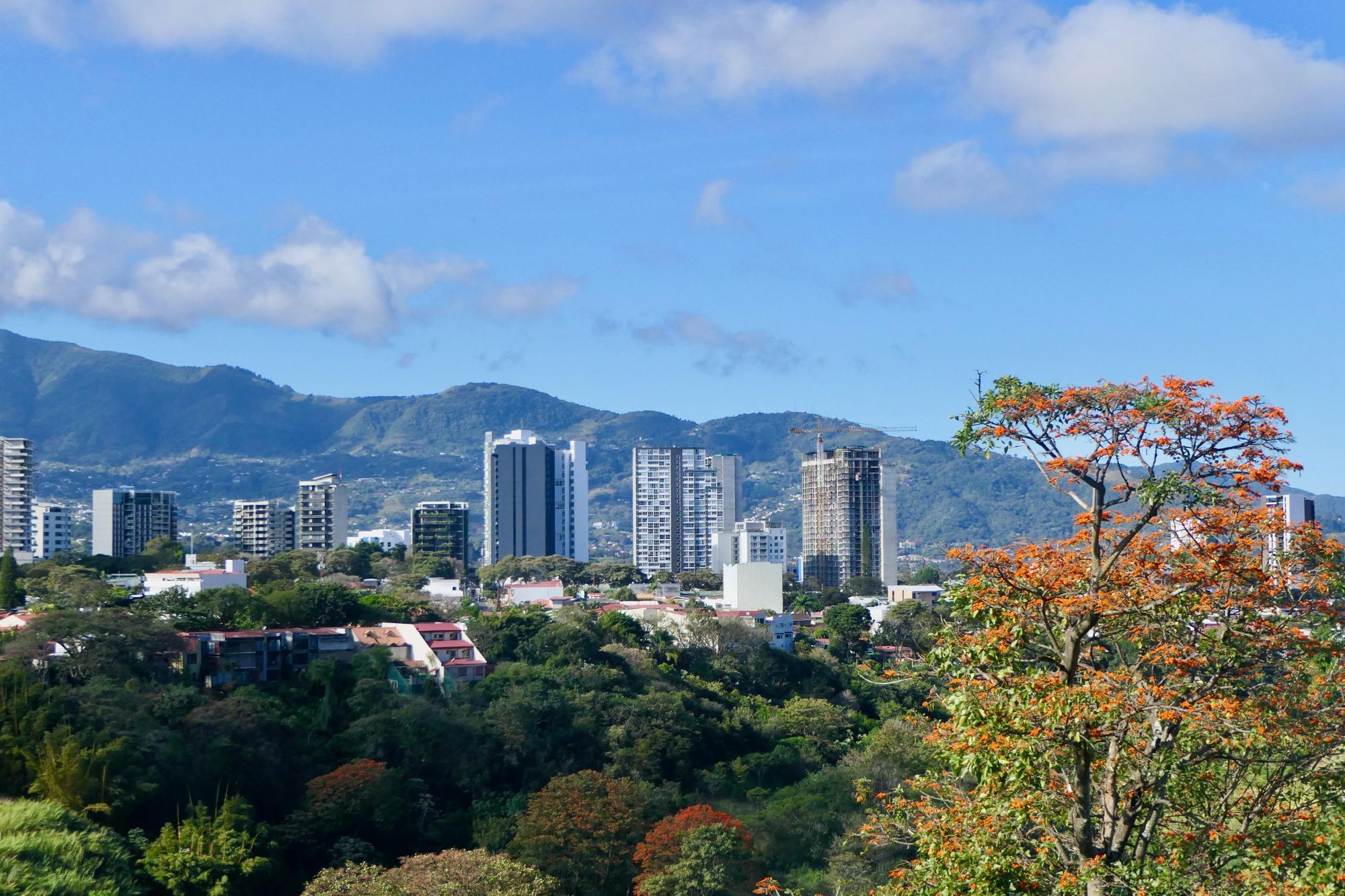
When you arrive in Costa Rica, you'll probably going to arrive into the capital city of San José, and it'll usually make sense to stay there for a night or two unless you're joining a group tour or heading off on an immediate adventure. Booking a room in San José is much like booking for any other city. There's plenty of options.
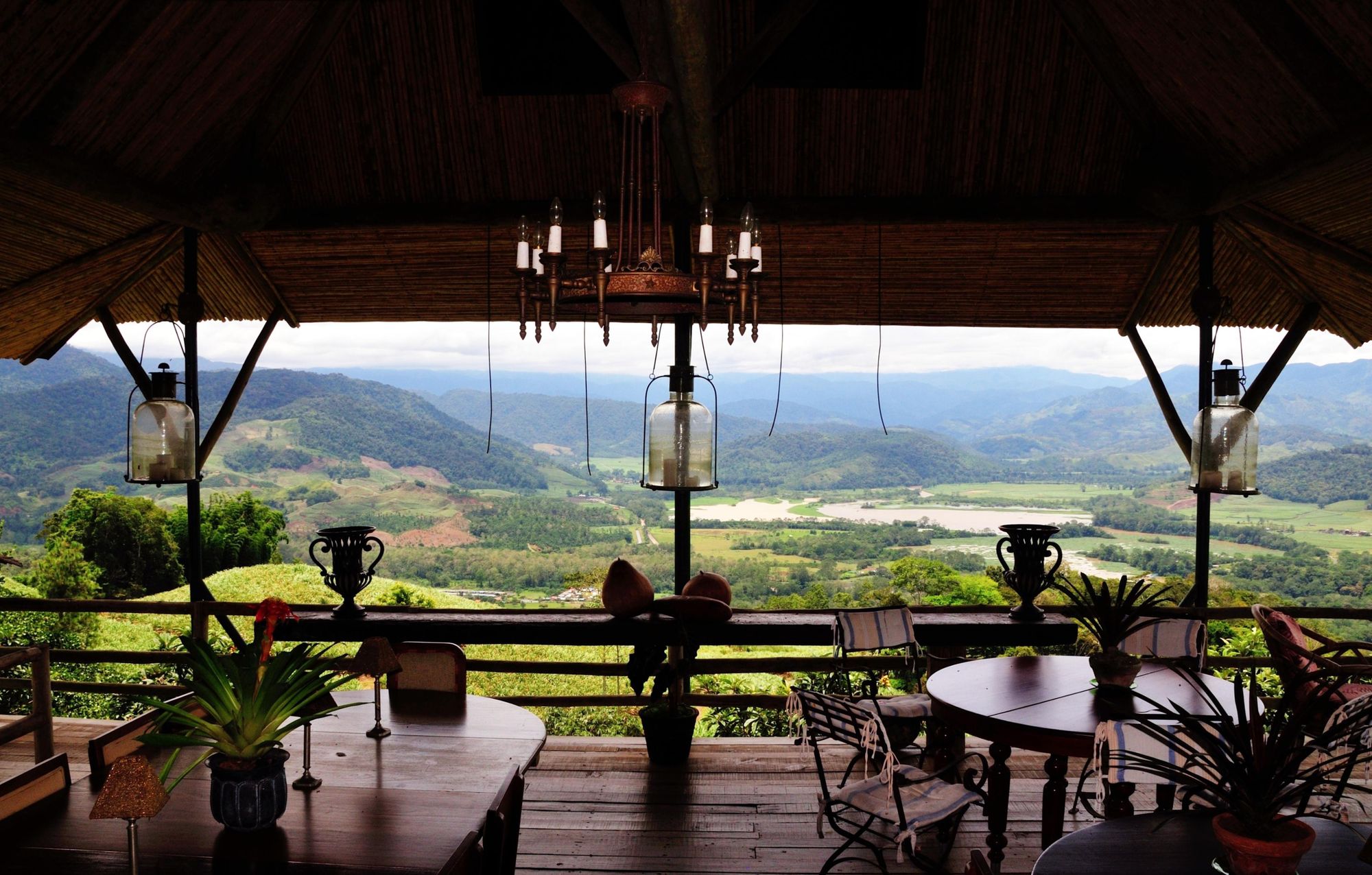
When it comes to the more rural parts of Costa Rica, we'd always recommend doing your research and trying to find community-owned accommodation that benefits local communities. Naturally, if you're staying somewhere remote, spaces are going to be scarce too, so it's always worth booking in advance. You get some great hostels, hotels and eco lodges in Costa Rica. The best are immersed in nature, with strong sustainability policies, and work to preserve the nature surrounding them.
There are also some beautiful campsites in Costa Rica - and just getting out to them can be an adventurous hike - so if you have your route sorted, it's worth doing some research to find out if there's any campsites in the nearby area.
What to Eat in Costa Rica?
If you spend a while hiking in Costa Rica, you're sure to pass banana and pineapple farms lining the trails. Costa Rica is a tropical nation, and so it has the ideal conditions needed to grow tropical fruits, as well as a wide variety of vegetables and grains. There is also a historic culture of fishing and farming here. The country's cuisine has its base in elements of corn, beans, cacao, pejibaye and more.
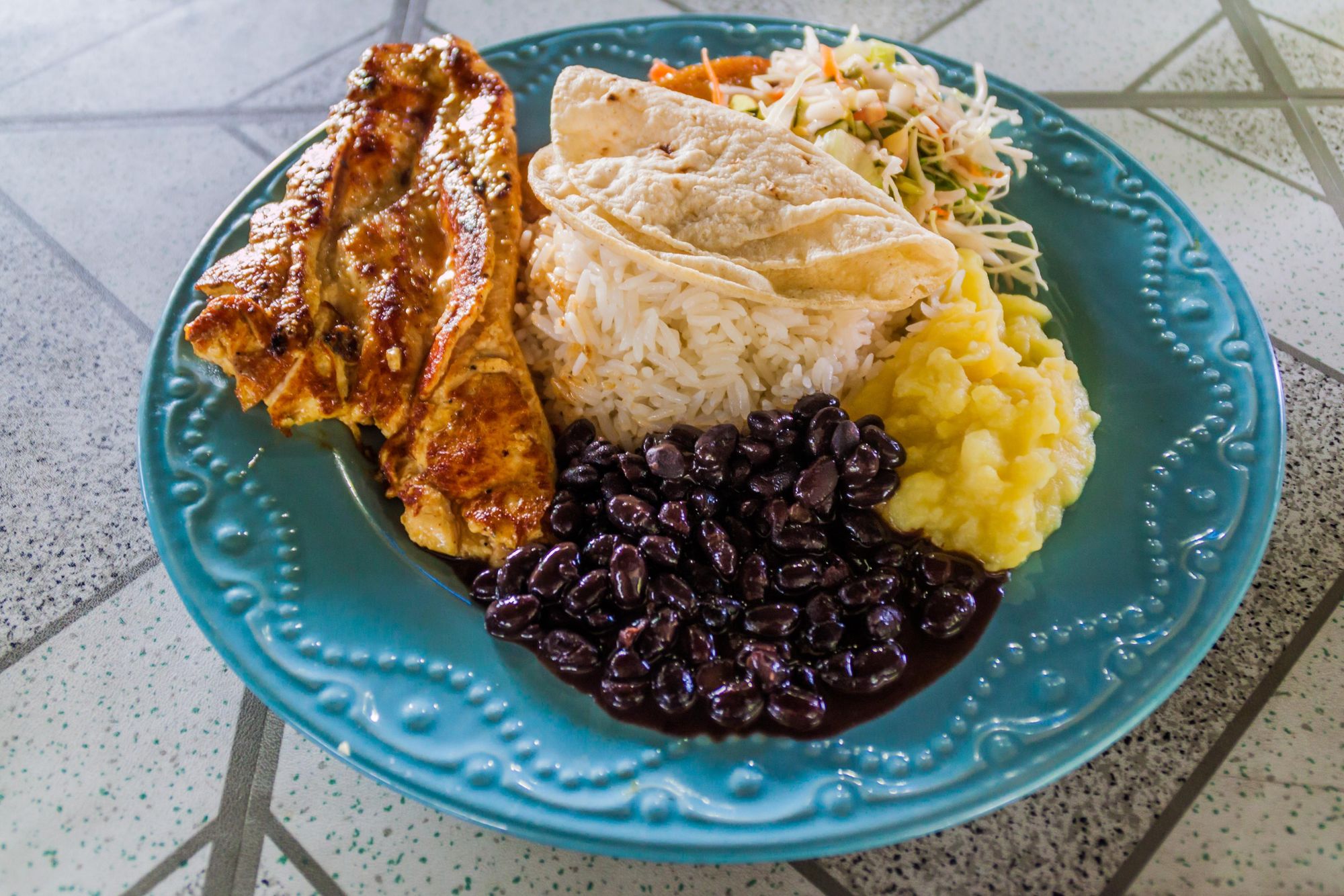
Gallo pinto (rice and beans) is a classic, usually seasoned with peppers, coriander and onions - and a great option for vegetarians. Rondón is a fish and vegetable stew, often combined with coconut, while chorreadas (corn pancakes), chifrijo (fried pork with red beans) and olla de carne (beef stew) are also common.
You may also see a casado on the menu. This is a combo plate, where shops prepare a plate of mixed vegetables, often with a source of protein like fish, beef or chicken, and beans and white rice. It's made differently by almost every shop.
How to Get to Costa Rica?
By train: Atlántico railway station is the main train station in San José, which is the capital city of Costa Rica and a great place to start your adventure. The railway lines in Costa Rica are primarily commuter lines, connecting Alajuela, Heredia, San José and Cartago. There is also a line which reaches Belen.
By plane: The gateway airport for Costa Rica is San José, with direct flights available from countries far and wide, including from Gatwick Airport in London and around the US.
An alternative option from the USA is to fly into the smaller Liberia airport.
By bus: Backpackers are well used to taking long-distance buses around the Americas, and there are plenty passing through San José. Nicaragua borders Costa Rica to the north, and Panama City does so to the south. The bus from Managua City, the capital of Nicaragua, to San José takes around eight to nine hours. The bus from San José to Panama City takes around 17 hours.
Inspired? Check out our range of adventure holidays in Costa Rica!