


There is an immediate feeling of grandeur when you arrive at Poncebos, the starting point of the 13.6-mile (22km) Ruta del Cares walk - one of the most popular hikes in northern Spain.
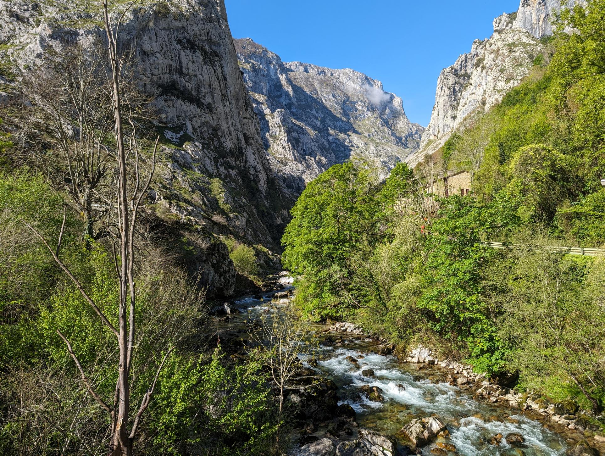
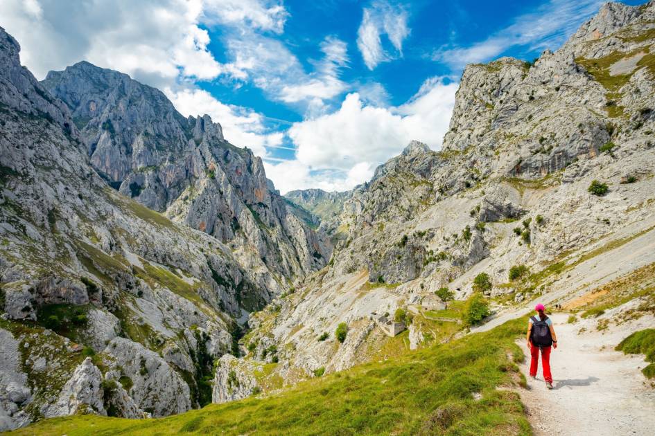
The Ruta del Cares begins around 200m above sea level, overlooked by the jagged 1,339m peak of Ariscu Sonllanu, which closes walkers off from the coast. The route then follows the Rio Cares (Cares River) as it winds into the Garganta del Cares (Cares Gorge) beneath bulking limestone mountains which form sharp, spiking summits and have huge caves hidden deep within their rocks.

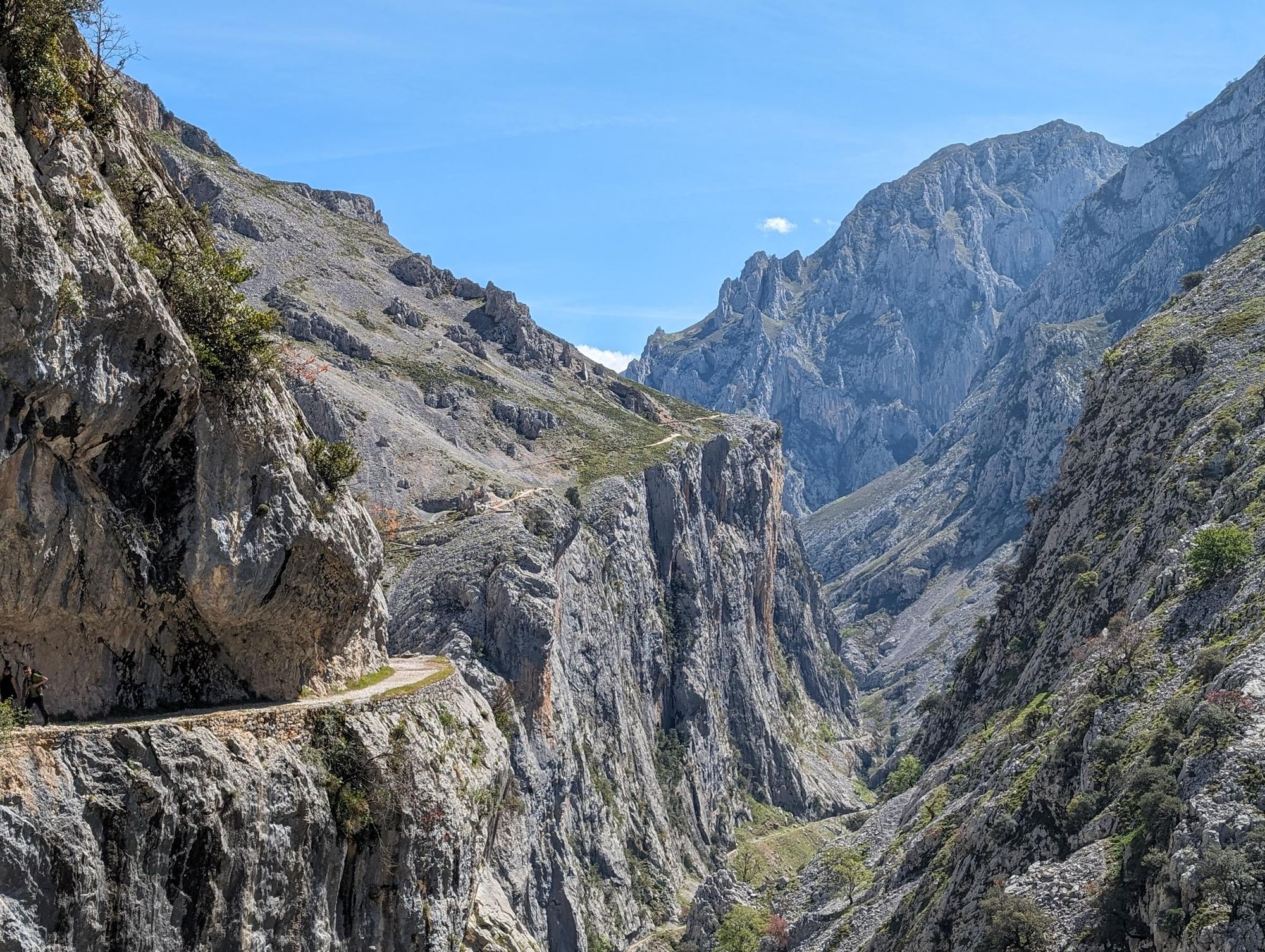
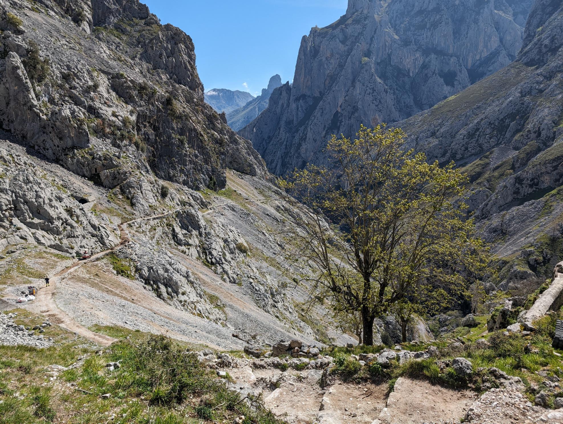
As you ascend up the path, the river stays far below the walking route, and the compelling, colossal Garganta del Cares (Cares Gorge) comes into view. High mountains frame the river - even as the hiking trail creeps along the steep gorge wall, providing a source of rugged, raw beauty for the remainder of the hike.
This is an out-and-back trek - a walk from Poncebos to Caín de Valdeón, a small village entirely flanked by mountains. It is perhaps the best day hike in Spain.
The Ruta del Cares: A Guide to the Hiking Route
Below is a map of the Ruta del Cares hiking route, followed by a description of the route from the ground. We walked the trail on a sunny day in late April.
- Distance: 13.6 miles (22km) total, 6.8 miles (11km) each way
- Time: 6-8 hours return
- Type of hike: Out and back
- Start/Finish: Poncebos-Caín de Valdeón-Poncebos
- Difficulty: Moderate
The Cares River is an important waterway in northern Spain, running through Asturias and León before it joins with the River Deva and flows out to the Atlantic Ocean at the Bay of Biscay.
The river divides the western and central massifs of the Picos de Europa, a small but mighty mountain range (and national park) which stretches only 12 miles (20km) but leaves a bite mark on all who visit. “It’s not so big,” my guide Dario tells me. “But you can do everything here. You can go hiking and canyoning and surfing all in one day if you want. In winter you can ski and surf in one day.”
We'd been staying in Llanes, a sleepy fishing village with white beaches, old squares and older fortifications. The mediaeval city walls date back to the 1200s and the mountain ridgeline, often hidden behind mist, dominates the backdrop.
The fresh seafood and creamy croquettes are dreamy here, though it’s the local cider - poured from bottle to glass from a great height, in order to carbonate the fluid - which steals the show in terms of gastronomy.
The gorge soon becomes all-consuming. It is the protagonist, the love interest and author of this story rolled into one.
The proximity of oceans to mountains in this region means adventure is never far from the heart. On our drive out to the hike in Poncebos, passing old farmhouses dotted amongst the foothills, the high mountains of the Picos - particularly well known for rock climbing - are always clear and visible.
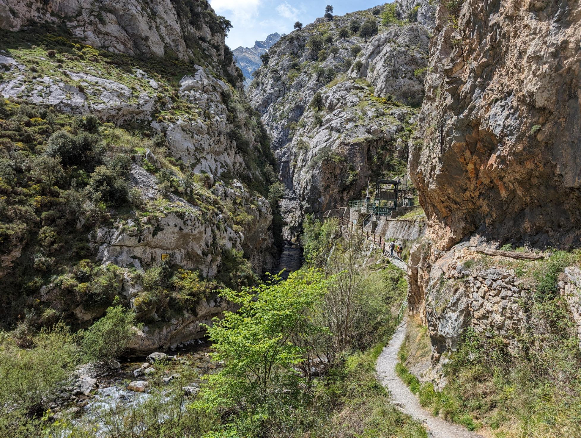
The Ruta del Cares is well signposted from the starting point of Poncebos. As you ascend up the walking path, the river drops far below, and the Garganta del Cares (Cares Gorge) comes into view.

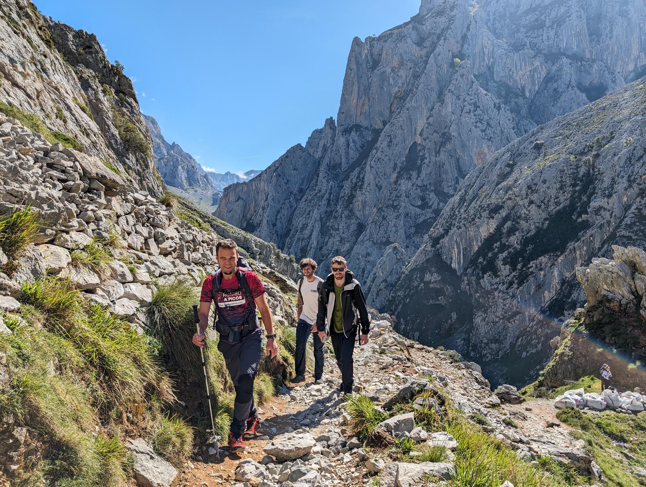
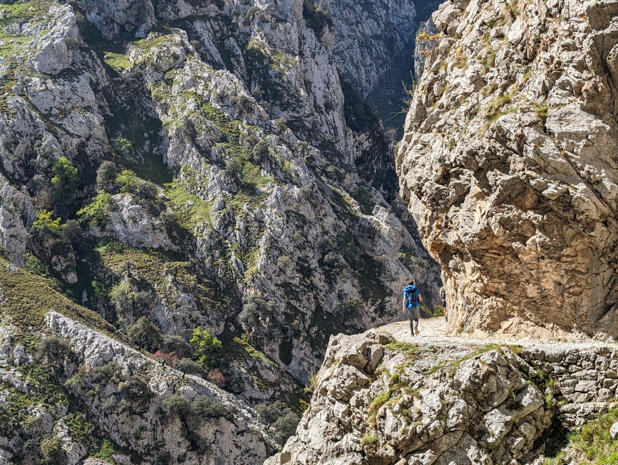
The hiking path itself is a couple of metres wide and after a short but steep climb to open the route, it's largely flat. The trail hugs a cliff wall on one side of the gorge, dropping hundreds of metres down to the river on the other. You don’t necessarily need a head for heights (although relatively long in distance, it is not a technical hike), but you certainly need a steady foot - and a focused mind.
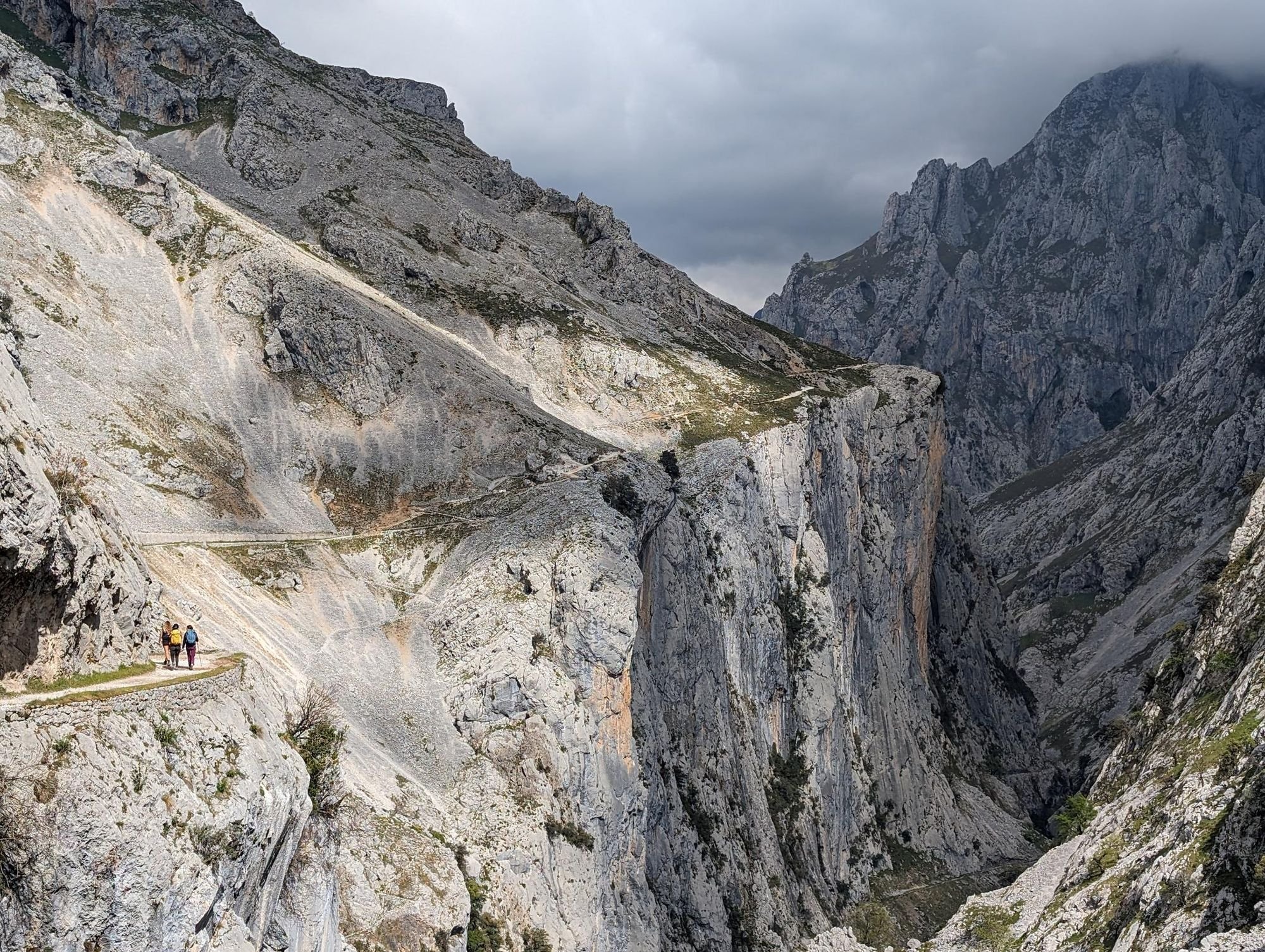
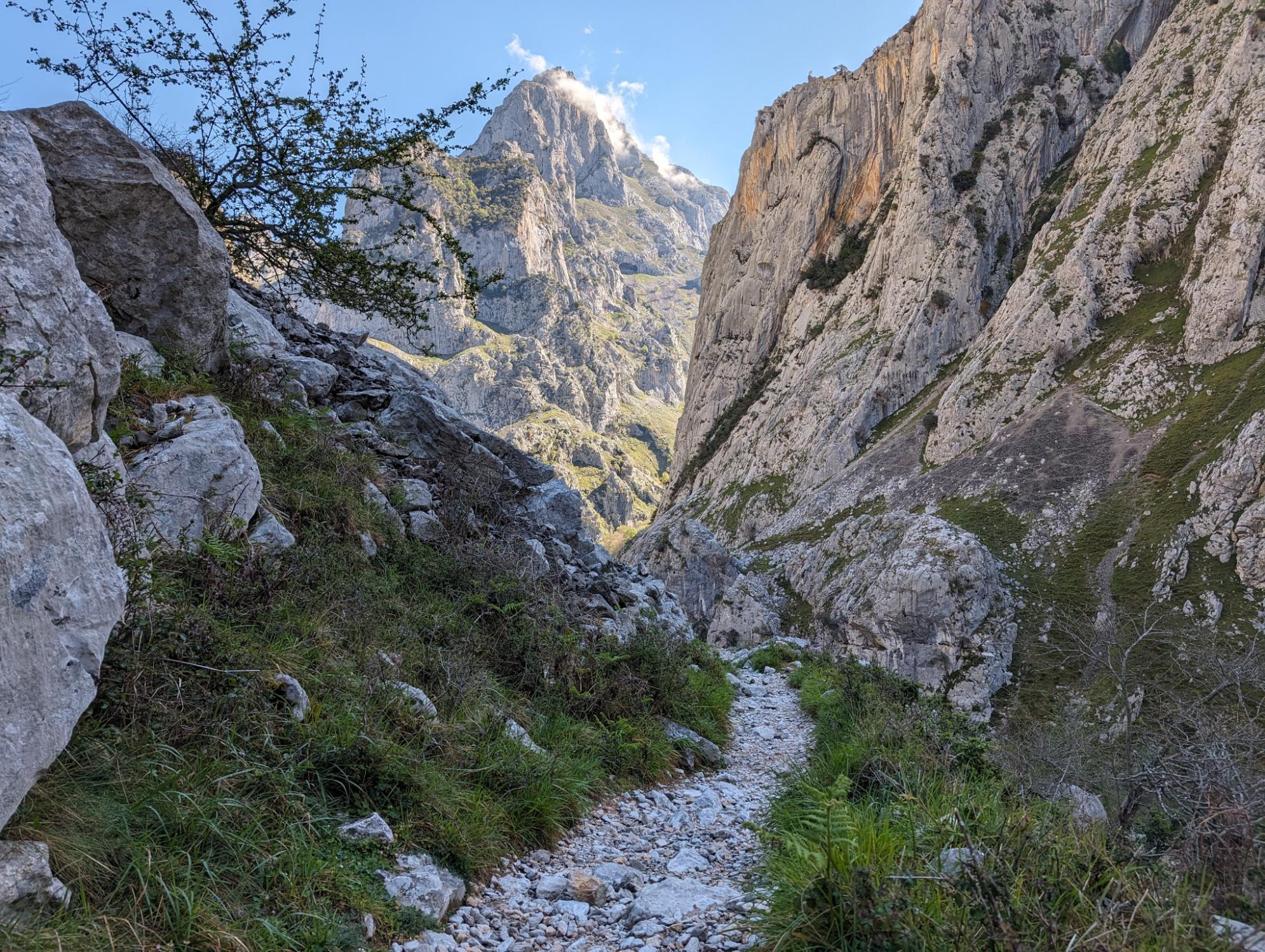
The gorge soon becomes all-consuming. It is the protagonist, the love interest and author of this story rolled into one. The path clings to it; mostly exposed but occasionally tunnelling deep through the rock like an alpine road rising to a ski resort. Corners offer particularly far-reaching view points down the barrel of dramatic vast rocky vistas which descend into one another from the left and the right of the gorge, meeting to form the riverbed down on the rocky floor.
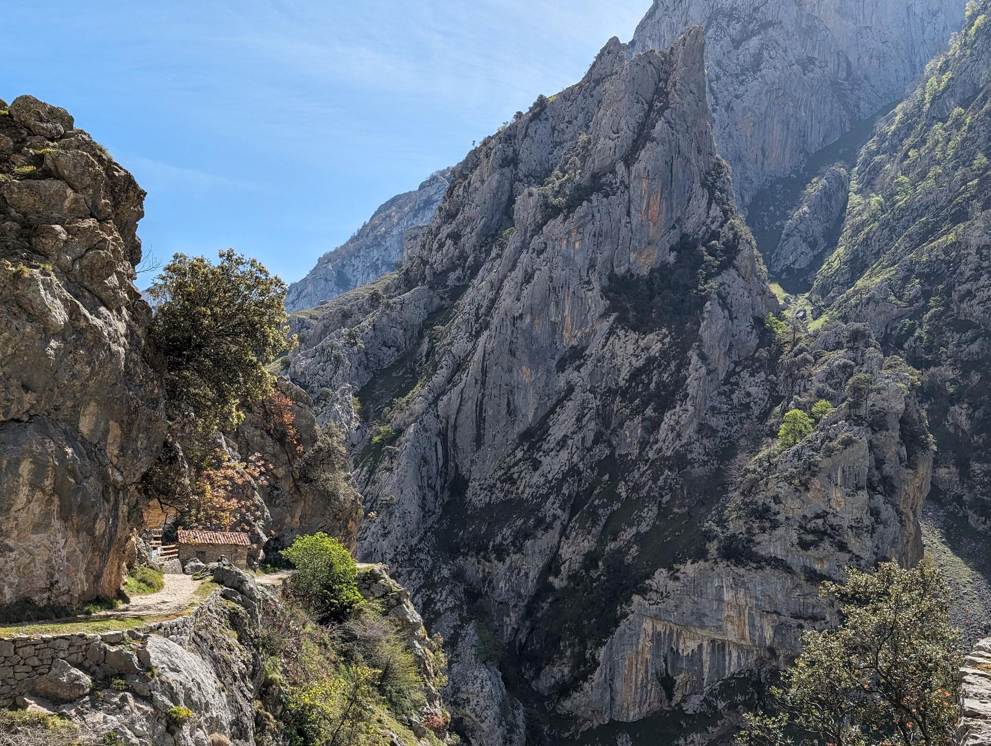
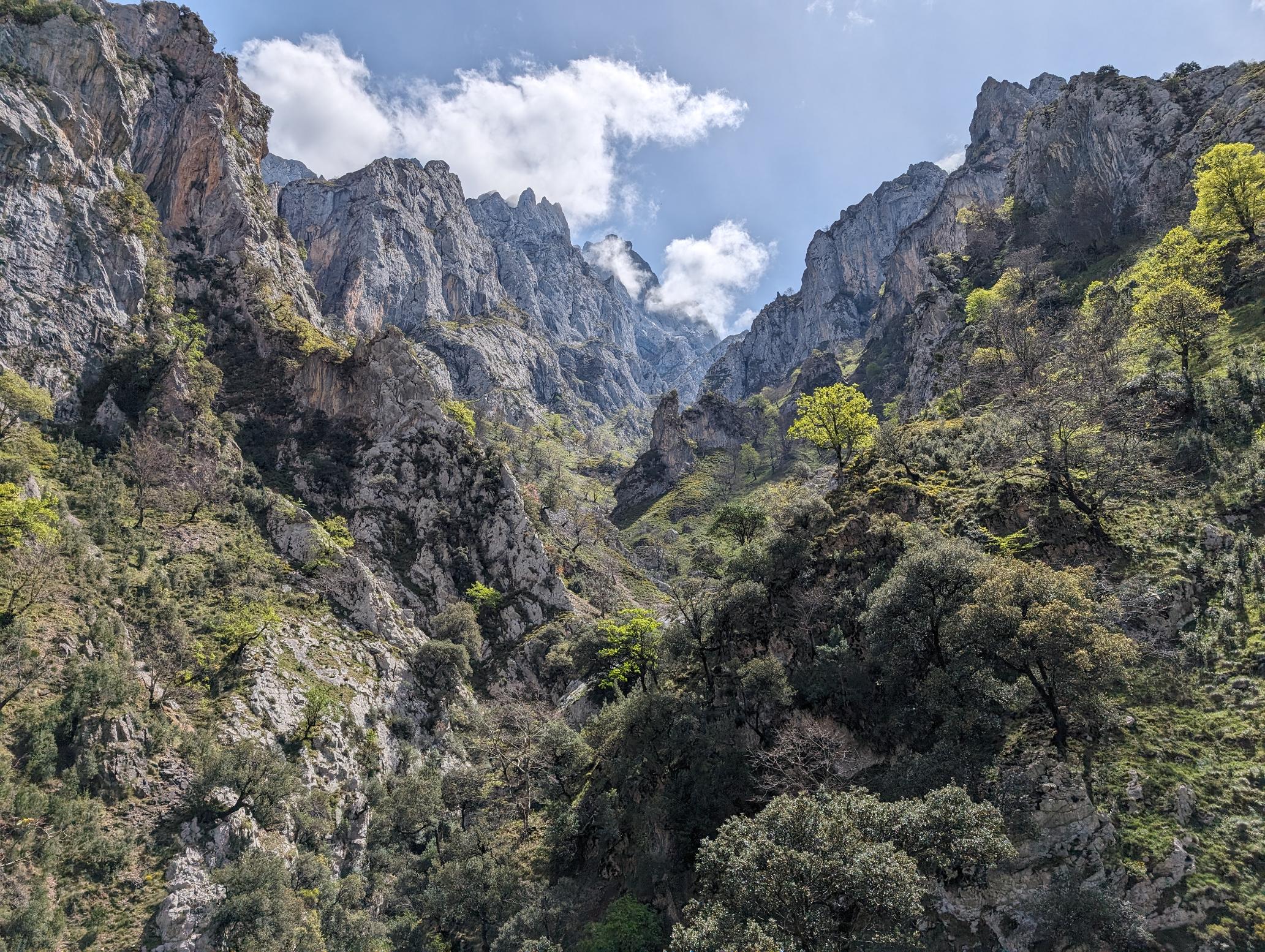
In their higher reaches, the mountains defy symmetry to layer, lap and spike into new forms and artworks as you walk. At times the limestone hangs directly above the walking route, like planks of wood ready to fall. Other times the rock looks entirely impenetrable, but the route was shaped by human hands.
While most popular walking paths like this were once sheep paths, the Ruta del Cares has a slightly more unique origin story. It was cut into the gorge to support a hydroelectric project in the 1940s. Today, 300,000 people walk the path each year, and owing to this popularity, it is likely you won’t be alone on the trail.
“It’s become a lot busier in recent years,” says Dario, pointing not only to social media as a cause, but also the development of a new motorway in the area around 20 years ago. “But there’s still not so many people around.”
Naturally, most of this footfall comes in the summer months or around national holidays. So the best time to walk the Ruta del Cares is perhaps in the shoulder season - from April-June or around September. During our hike (in April) we find that we are the biggest group on the trail, and the thaw of Spring means that waterfalls which dry out later in the year are vibrant and full.
The path, blocked off from the world by 2,000m mountains, still maintains a feeling of secrecy.
As we stroll, goats climb off the cliff walls to pester us. “Don’t get too friendly with them,” we’re warned by another passing mountain guide. “They might steal your food or push you to try and get it.” This might be true, but they’re also very cute, and so we delay our hike to chat to the goats and take photographs.
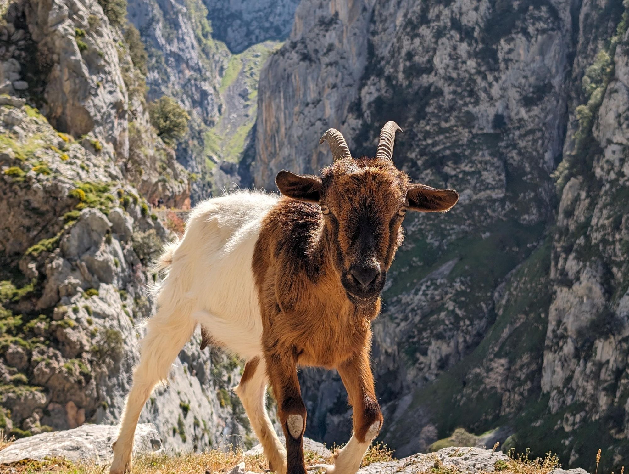
They aren’t the only wildlife we spot. This wild area is also home to Iberian wolves and brown bears, and although we don’t spot either, we do see whole families of griffon vultures hovering high in the sky above us; circling in the air, perhaps looking for the leftover meals of those aforementioned carnivores.
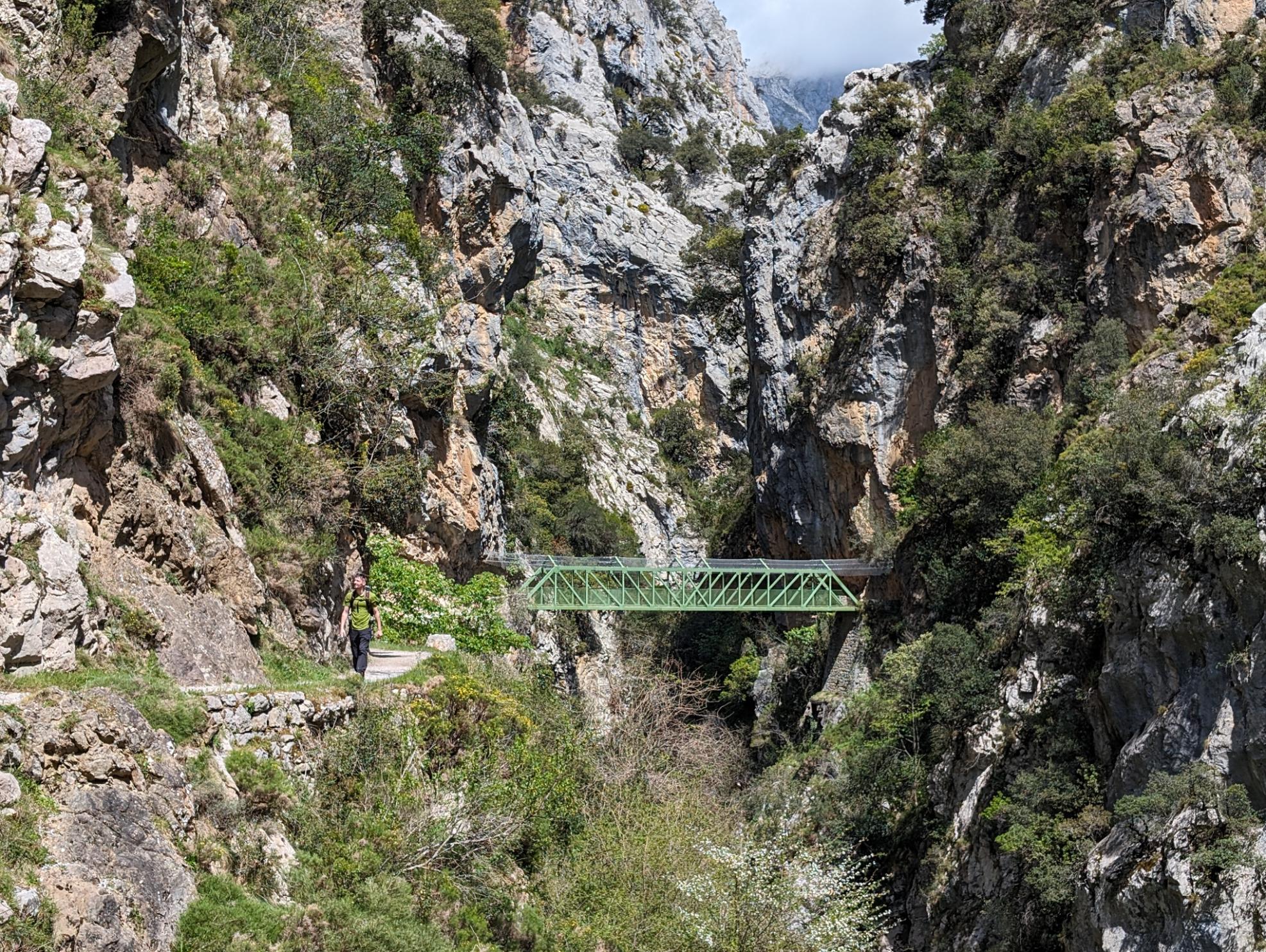
There is more than one bridge along the Ruta del Cares, though the most famous is the Puente de Los Rebecos, a scenic green bridge said to be the most photographed in northern Spain. Look down from the centre and a hypnotic river scene unfolds before your eyes; the water picking up speed and running from an idyllic pool through smooth rocks and down the gorge.
The trail gets narrower as it goes on (and as the gorge also gets narrower), and as the route nears Caín, the path grows ever greener. Beech forests drip off the opposing cliff faces hanging off walls which bump and buldge down to the river.
Beech forests drip off the opposing cliff face; hanging off walls which drop vertically down to the river.
We soon drop down to the level of the water ourselves, and walking through a damp cave - the walls of which trickle - we emerge out to a reservoir and a landscape of greenery; leaving the gorge and arriving in Caín de Valdeón (or at least, on the outskirts of the town, which is actually sits a little further on).
There are two shops here at the far point of the route; facing one another and somewhat comically in competition. Don’t buy a snack from one and sit at the other, or you may incur the wrath of the owner.
We grab an espresso here; while others sip on a beer or ice cream. We give the local cats a pet and our legs a rest before turning around and embarking on the return leg of the Ruta del Cares, back the same way we came from.
Out and back walking routes leave a bad taste in the mouths of many, but I think there’s a beauty to them. An out-and-back offers two perspectives on the same landscape; a full immersion in a place of wilderness - one seen while bright and sprightly; and the other seen while tired, quiet and with sore feet in boots covered in dirt and dust. As we walk back into Poncebos, we are ready for a cold beer - but there’s no doubt in anyone’s mind that this is a route worth walking once, twice, a hundred times. It is indeed one of the finest in all of Spain.
How to Get to Ruta del Cares Walk?
There is a parking lot in Poncebos, where you can leave your car while you walk the Ruta del Cares. If you’re driving from Asturias, as is perhaps most common, then the best route is to take the AS-114 to Cangas de Onís-Arenas de Cabrales (Las Arenas), then take the AS-264 to Poncebos. For us, the route was a 50-minute drive from Llanes.
The nearest major airports to the Ruta del Cares are Santander and Asturias Airport, both of which are around a 90-minute drive from Poncebos, where the trail starts. Bilbao Airport is around a 2 hours 30 minute drive from the trail.
Read More:
- What I Wish I Knew Before Visiting the Picos de Europa
- Spain's Best Kept Secret: Hiking the Picos de Europa
- 5 Tips for Trekking in the Picos de Europa National Park
Inspired? Hike the Ruta del Cares on our Picos de Europa adventure!