

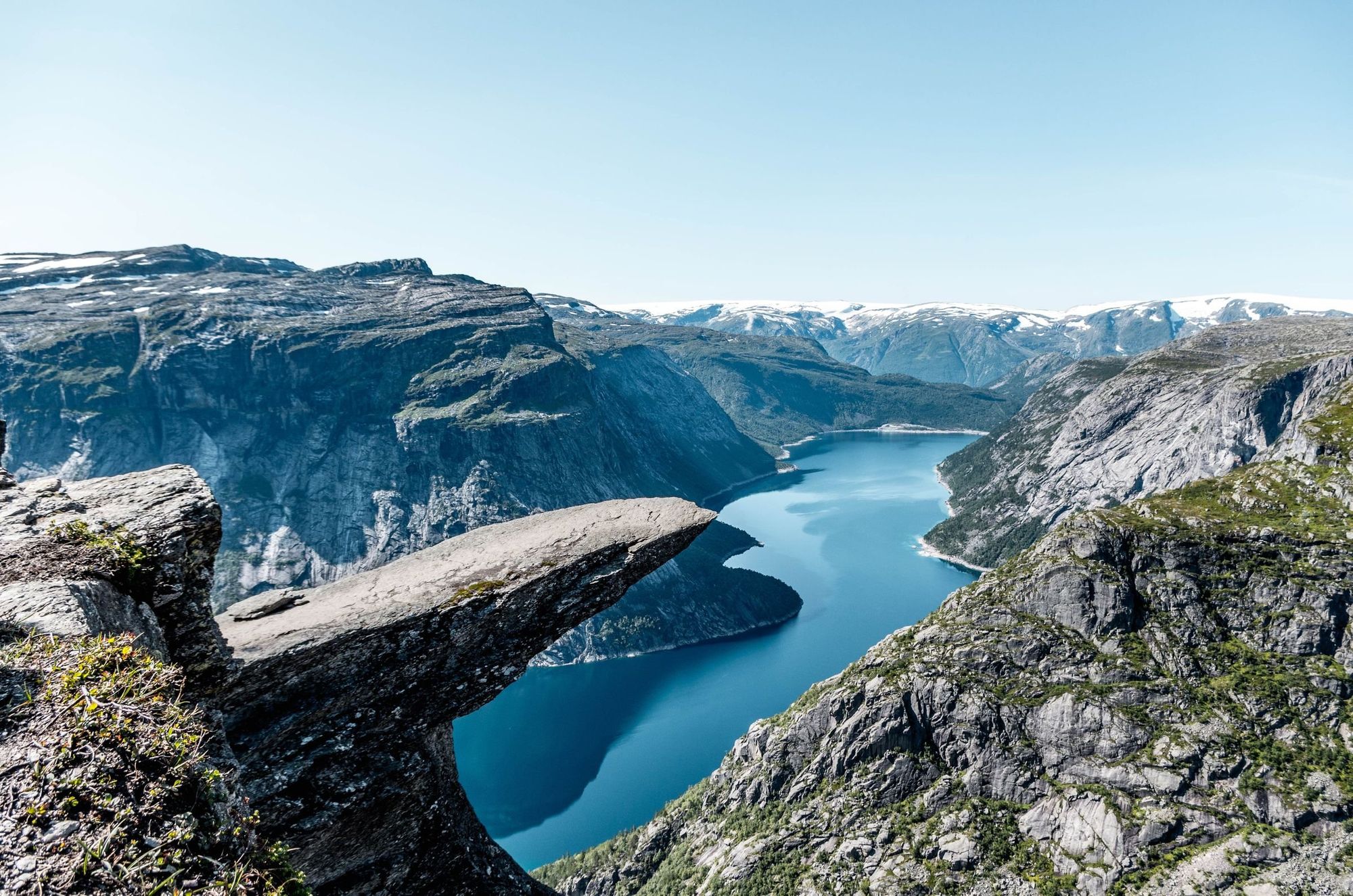
Trolltunga, or the Troll's Tongue, is a dramatic rock ledge, sticking out of a mountain top, 700m (2,296ft) above Ringedalsvatnet Lake in Norway's Vestland country, near to the town of Offa. It is one of Norway's most iconic rock formations and one of the most photographed spots in the country. It's not each to reach, though. Getting to Trolltunga is a full day hike of around 17 miles (27km). In this guide, we'll look at just how challenge that trek is, how to get to the trailhead, when to go, and explain a little about the natural scene below.
What is Trolltunga?
Trolltunga is a flat 'tongue' of rock which projects out over Ringedalsvatnet, a glacial lake which is surrounded by rocky cliffs. It sits on the western edge of the Hardangervidda plateau, near Odda in Vestland county, western Norway.


The rock is surrounded by mythology. According to legend, one night a curious troll wandered to the edge of the cliff to admire the view of the surrounding Norwegian fjords. Lost in the scenery, he didn't notice the rising sun, and as the first rays hit him he turned to stone, a common fate for trolls in Scandinavian mythology. His tongue, which had been sticking out, became the rock we see today.
Trolltunga is one of the most photographed locations in Norway, and in peak season you might genuinely have to queue to get 'that shot' - the one of you posing on the gravity-defying rock, with the Folgefonna Glacier in the background. It's worth knowing that. This can be a crowded place, but there's so much more to this hike than the ledge, so as long as you're not expecting to have the place to yourself when you get there, you shouldn't let that put you off the hike.
Where is Trolltunga?
Trolltunga is located approximately 700m (2,296ft) above Ringedalsvatnet Lake in Norway's Vestland county. It's located on the western edge of the Hardangervidda plateau, near the town of Odda.
How to get to the Trolltunga trailhead?
The closest town is Odda, about 9.3 miles (15km) from the trailhead and has a wide range of accommodation. Tyssedal, on the shores of Ringedalsvatnet, is closer still at 3.7 miles (6km) from the trailhead and has hotels, guesthouses and bunkhouses. Shuttle buses run between both towns and the trailhead, taking around 30 minutes - and we'd strongly recommend booking these in advance. You can also reach Odda by bus from Bergen, Voss and Hardanger, with Voss and Hardanger both reachable from Oslo by train.
By car, Trolltunga is about a three-hour drive from Bergen, four hours from Stavanger and six hours from Oslo. There are three car parks to choose from at the Trolltunga trailhead, each shortening or lengthening the walk:
| Option | Where it starts | What it saves | Book ahead? |
|---|---|---|---|
| P1 Tyssedal | Tyssedal village | Nothing, the longest option at a 23.6-mile (38km) round trip | No |
| P2 Skjeggedal | Skjeggedal car park | The standard start, 16.7 miles (27km) round trip | No |
| P3 Mågelitopp | Upper car park, after a steep paved climb | Around an hour and 1,312ft (400m) of ascent, shortening the round trip to 12.4 miles (20km) | Yes, essential, only 30 spaces, at 600 NOK (£42.54/day) |
How hard is the Trolltunga hike?
Expect a full, strenuous day of hiking. The round trip from the main trailhead runs about 17 miles (27km), with real elevation gain (800m/2,624ft). It takes most walkers between 10 and 12 hours. This is a serious mountain hike, not a viewpoint stroll, and it calls for a good level of fitness, sturdy boots and an early start.
While we don't currently guide a trip to Trolltunga, there is a common theme that comes up on the fjord hikes that we do guide in Norway. Roughly 20% of hikers told us the day was harder than they'd expected. The advice that comes up again and again is to train beforehand, wear boots you've already broken in and carry poles. The same principles hold true for a day hike to Trolltunga.
The path is rocky and can be slippery after rain. The trail crosses meltwater streams and open boulder fields, but it's well-marked, and anyone with a good level of fitness can complete it in summer conditions.
Hiking Trolltunga in winter is a different proposition, and only guided tours are recommended. Deep snow, ice-covered rocks and trails, short daylight hours and unpredictable weather make it a real challenge. Go with a guide or not at all.
Hiking Trolltunga: the Route
- Start/Finish: P2 Skjeggedal (out and back)
- Distance: 16.7 miles (27km)
- Walking time: 10-12 hours
- Difficulty: Challenging
- Best for: The most iconic view in Norway
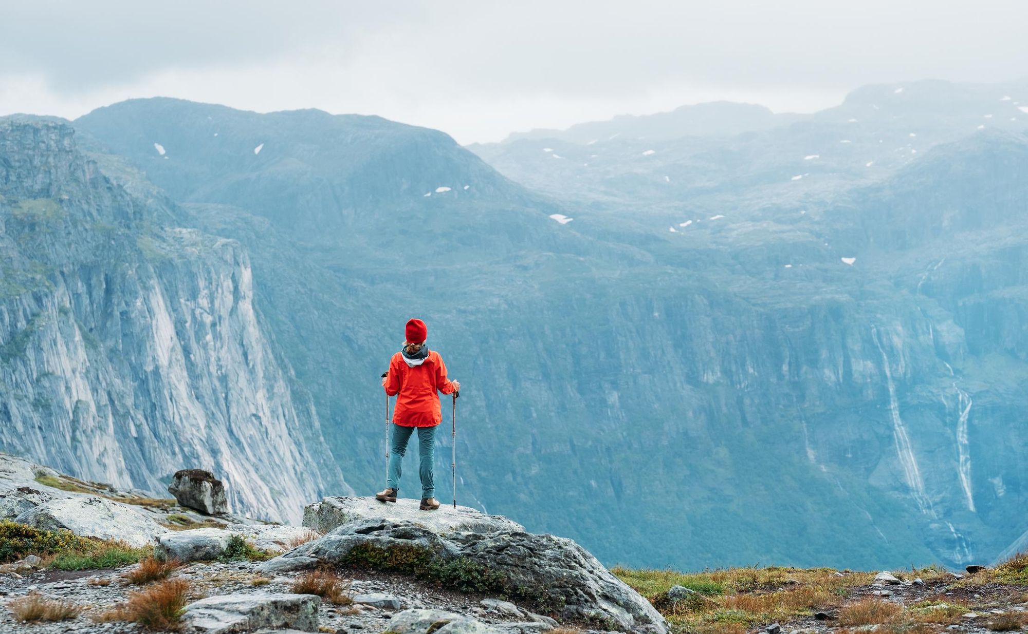
The Trolltunga hike might be popular, but it really isn’t a walk in the park. In fact, it’s a full day trek with around 800m (2,624ft) of ascent. Expect steep climbs, rugged terrain, and unpredictable mountain weather. However, you’ll be more than rewarded by the sweeping mountain and fjord views as you climb.
The hike begins at the P2 Skjeggedal car park. If you're starting here, you’ll have an initial climb up a narrow paved road leading to the higher car park at P3 Mågelitopp. This section takes about an hour to walk and gains over 400m in elevation. It is possible to skip this section and save some time, although parking at Mågelitopp is extremely limited and needs to be pre-booked.
From P3, the true trailhead of the Trolltunga hike begins. The first section of the trail takes you up a gentle slope through a lush valley, surrounded by rugged peaks. The trail quickly becomes more challenging as it climbs steeply toward Gryteskaret Pass, one of the most difficult sections of the route. The rocky path here can be slippery, especially after rain, so take care with your footing. This strenuous ascent rewards hikers with the first glimpses of the vast wilderness ahead.
After the effort of Gryteskaret, you’ll reach the Trombeskar Pass, where the terrain briefly levels out before dropping into a grassy valley. This section offers a slight reprieve from the uphill climb, with gentler walking and views of the surrounding mountains. The trail hugs the shoreline of a small, serene lake, providing an ideal spot for a short break or snack. In summer, the vivid greenery contrasts sharply with the rocky terrain and often snow-covered peaks, while in the shoulder seasons, the landscape takes on a more muted, rugged beauty.
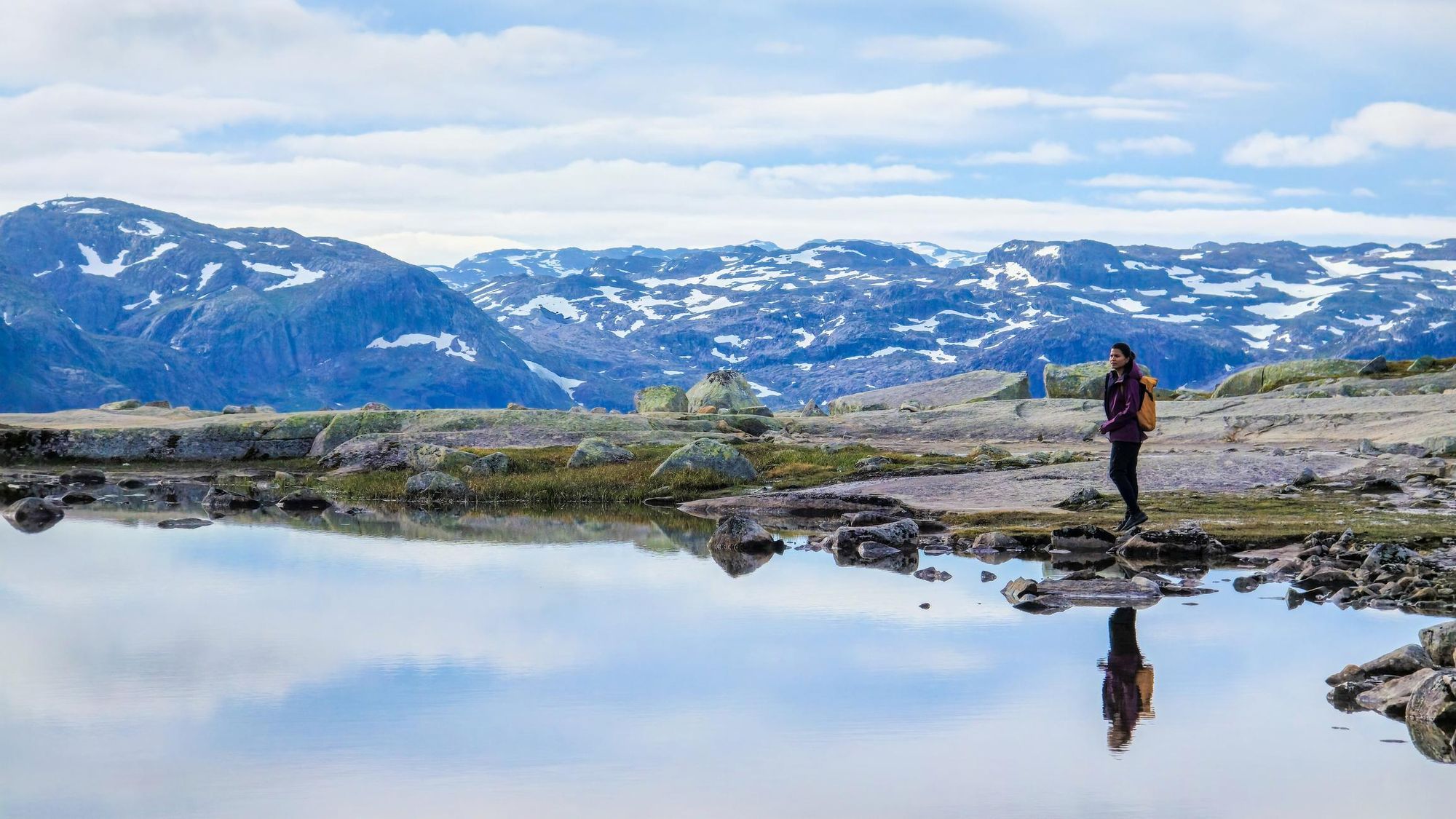
After the lake, the trail gradually ascends across a vast, open plateau - Hardangervidda - with wide, sweeping views of the majestic Ringedalsvatnet lake far below. The plateau is often covered in snow well into the summer months, and meltwater streams crisscross the trail. Wooden bridges have been built over the larger streams, but be prepared for some wet patches and small stream crossings, especially early in the season.
As you approach the final section of the hike, the trail becomes rocky again, with a steady climb toward Trolltunga over boulders and rocks. You may encounter patches of snow depending on the time of year. Along the way, you’ll pass a hydroelectric dam.
Not long after, Trolltunga itself comes into view—a dramatic rock formation that juts out horizontally above the turquoise waters of Ringedalsvatnet, nearly 700m (2,296ft) below. The panoramic view stretches out over the vast fjord, with jagged peaks framing the water below.
The return journey follows the same route back to P2 Skjeggedal. Make sure to leave enough time to return safely before dark, as the trail is not lit, and navigating in low light can be difficult. Carry a headlamp if you're starting early or expect to finish late.
When can you hike to Trolltunga?
Peak season runs from June to August, when most of the snow has melted and the weather is at its most stable, though rain is possible year-round. July tends to have the best conditions, with summit temperatures of 9°C to 13°C (48°F to 55°F) and long daylight hours to work with. During the summer, the daylight hours are long, allowing plenty of time to complete the hike.
Spring and autumn are quieter, cooler months, with snow and ice still possible on the trail between March and May. September brings summit temperatures of 5°C to 9°C (41°F to 48°F) and a good chance of autumn colour, with the summer crowds thinned out.
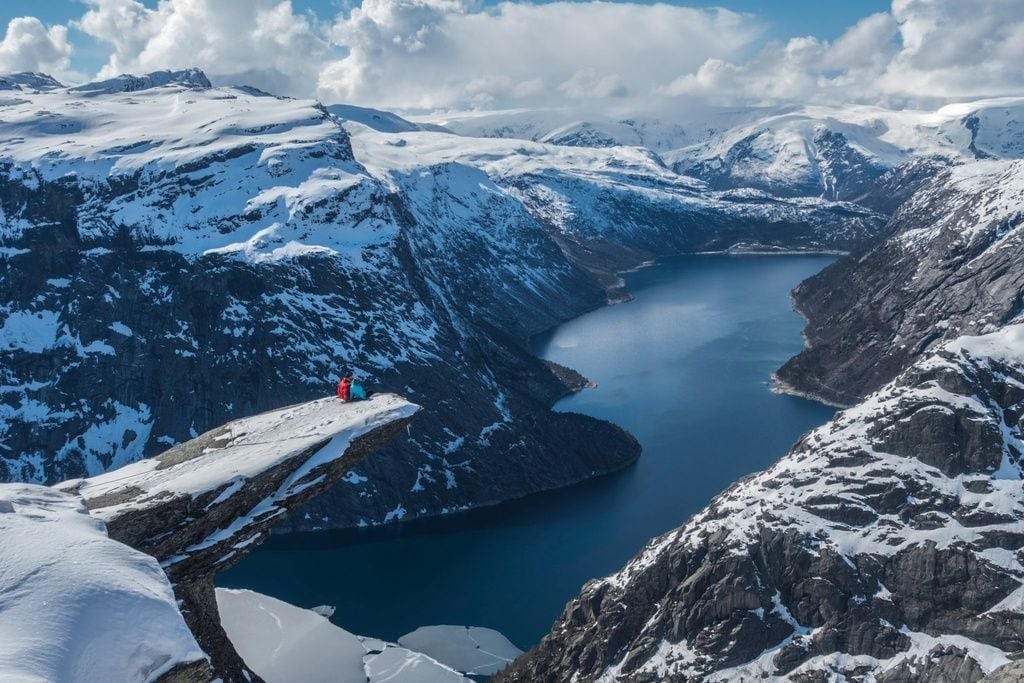
From December to February, daylight is short and the trail is under snow, with summit temperatures dropping as low as -9°C (16°F). It's a beautiful hike, the fjords and cliffs covered in snow, but it's also a dangerous one. Go with a guide if you're attempting it in winter, unless you're an experienced winter hiker. Expert local knowledge and winter equipment may be required for the walk.
How to Beat the Trolltunga Crowds
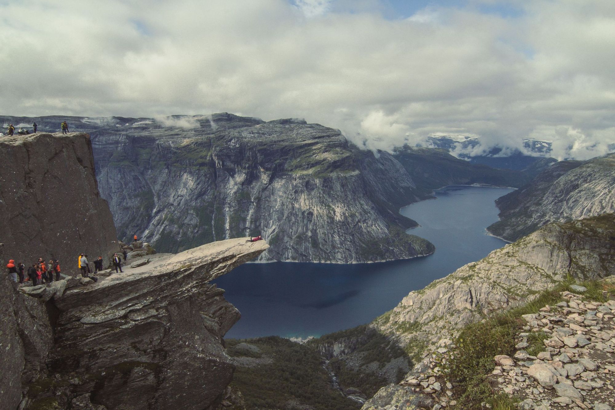
Around 80,000 people hike to Trolltunga each year - but on the trail people spread out. But when you reach the top, there might be a short queue to take your picture on that iconic jutting rock. Obviously, you don’t have to bother grabbing that shot if you don’t want to. But there are several ways you can avoid the crowds.
Our first suggestion is to come hiking in the off-season. The vast majority of hikers to Trolltunga visit between the peak hiking months of June to September. If you go in winter, go with a guide. The hike will be harder, and the terrain demanding.
Another option is to start your hike early. During the summer months, you get close to 24 hours of daylight, so you can go super early to beat the crowds. If you’re not a morning person, camp overnight and get a bit of extra room for yourself.
Where to Stay Near Trolltunga
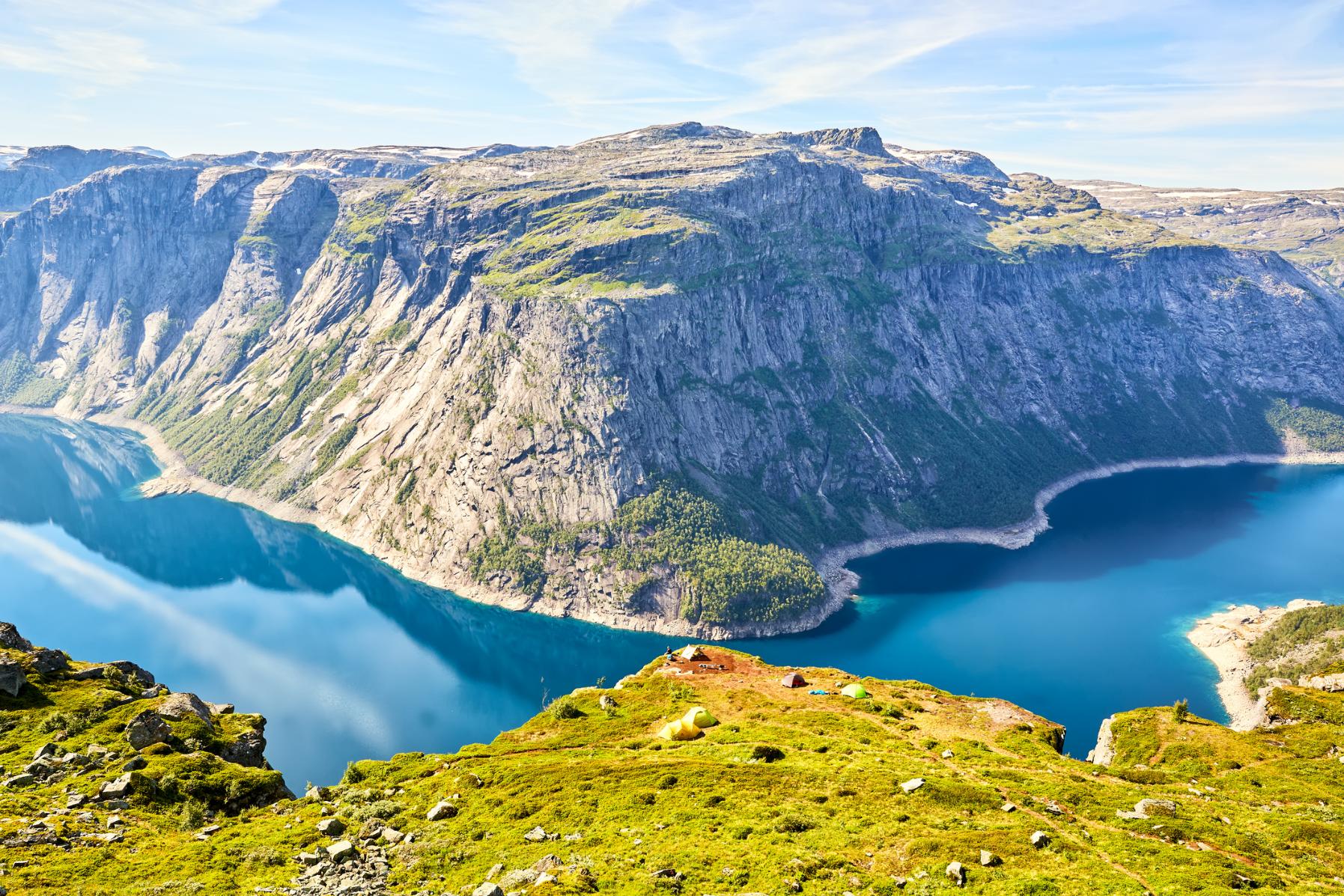
Camping is allowed on the Trolltunga route. There are designated camping areas, but wild camping is also permitted under Norway’s Allemannsretten or ‘right to roam’ law. Ensure you camp responsibly, and leave no trace when you depart.
Alternatively, there are several small villages near Trolltunga. Tyssedal is 3.7 miles (6km) from the trailhead, perched on the shores of Ringedalsvatnet Lake, and has several aparthotels, guesthouses and dormitory style accommodation. Odda is 9.3 miles (15km) away; it’s a slightly larger town with a wider range of accommodation. You can reach Trolltunga from both towns on the shuttle bus.
Hardangerfjord: the fjord beyond Trolltunga
The Hardangerfjord is the second-longest fjord in Norway, running inland from the North Sea past orchards, cider farms and waterfalls to the edge of the Hardangervidda plateau. Trolltunga is further in-land, looks down over one of its arms, and nearby towns like Odda and Tyssedal, are a natural base for hiking.
What is the Hardangerfjord known for?
The Hardangerfjord is known as Norway's "orchard fjord". The microclimate supports fruit farms and cideries that line the water in Lofthus, alongside the glaciers, waterfalls and hiking trails that draw people to the wider region. The key attraction in the area is Trolltunga, despite the fact it's actually further-inland.
Things to do on the Hardangerfjord
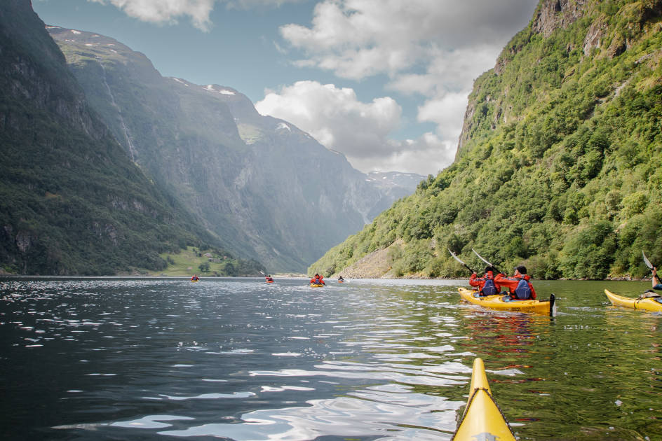
Beyond Trolltunga - which is actually further in-land above the Ringedalsvatnet lake - there are hiking trails through the surrounding mountains, kayaking on calmer stretches and waterfalls such as Vøringsfossen in the Måbødalen valley. Folgefonna Glacier, Norway's third-largest glacier, is also in the area.
Trolltunga FAQs
How long does the Trolltunga hike take?
Most walkers take 10 to 12 hours for the full 17-mile (27km) round trip from the main trailhead, including a break at the top. Starting from the upper car park at Mågelitopp can shorten the day by around an hour.
Do you need a guide for Trolltunga?
In summer, no. In peak season the trail is well-marked and manageable for a fit, well-prepared hiker without a guide, though conditions can still change quickly at altitude. In winter, a guide is highly recommended for safety, as the trail can be under deep snow, and winter equipment can be required for the ascent.
Can you camp at Trolltunga?
Yes. Norway's "allemannsretten," or right to roam, permits wild camping along the route, and there are designated camping areas closer to the trailhead. Leave no trace.
Can beginners hike Trolltunga?
This is highly individualistic. If you're fit and you have proper footwear, it is achievable, but set a full day aside, and make an early start. This isn't a casual walk for people with no hiking background - it's a tough, long trek to a mountain top.
Read More:
- 10 of the Best Hikes in Norway
- 5 of the Best Winter Hikes in Norway
- 15 of the Most Beautiful Fjord Hikes in Norway
Inspired? Check out our Adventures in Norway, taking you to some of the country's most scenic locations.