


The Norwegian fjords come to life when they're explored on foot. This guide rounds up 15 of the best fjord hikes that are easily reachable, from waterfall walks near Bergen to demanding summit days above the Lysefjord and Hardangerfjord, with distances, timings and an honest difficulty for each one.
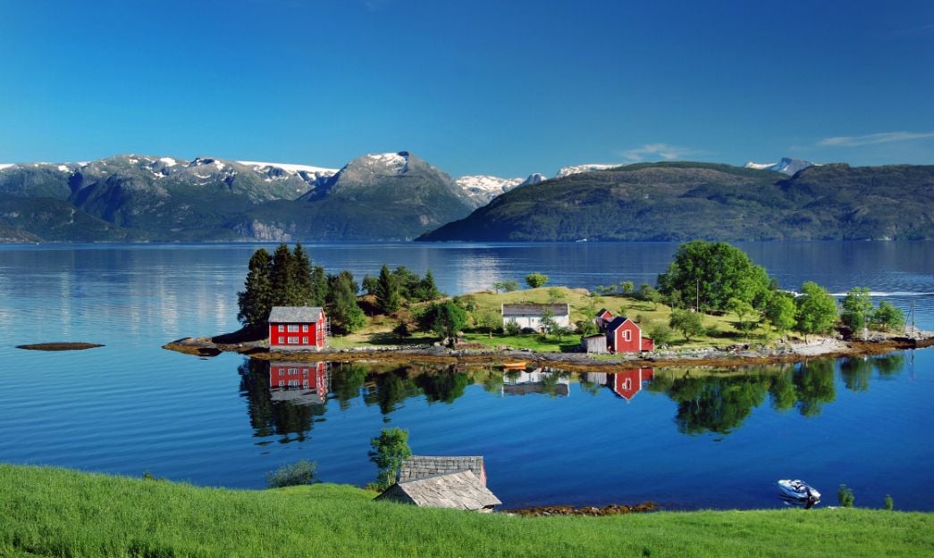
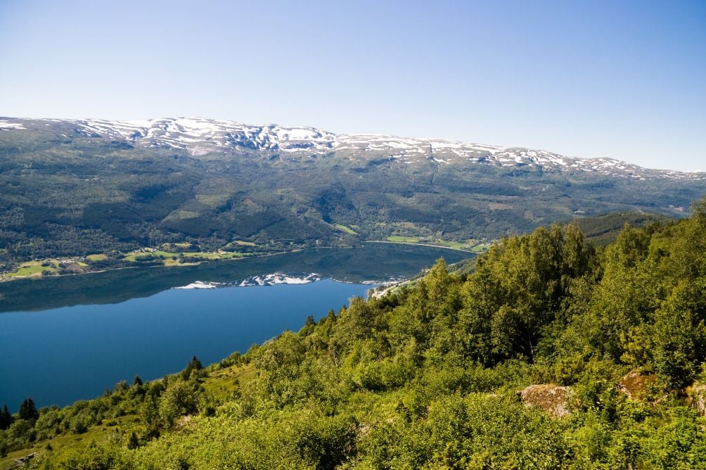
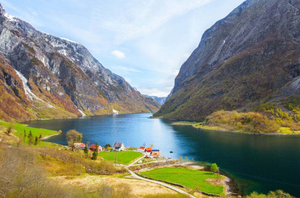
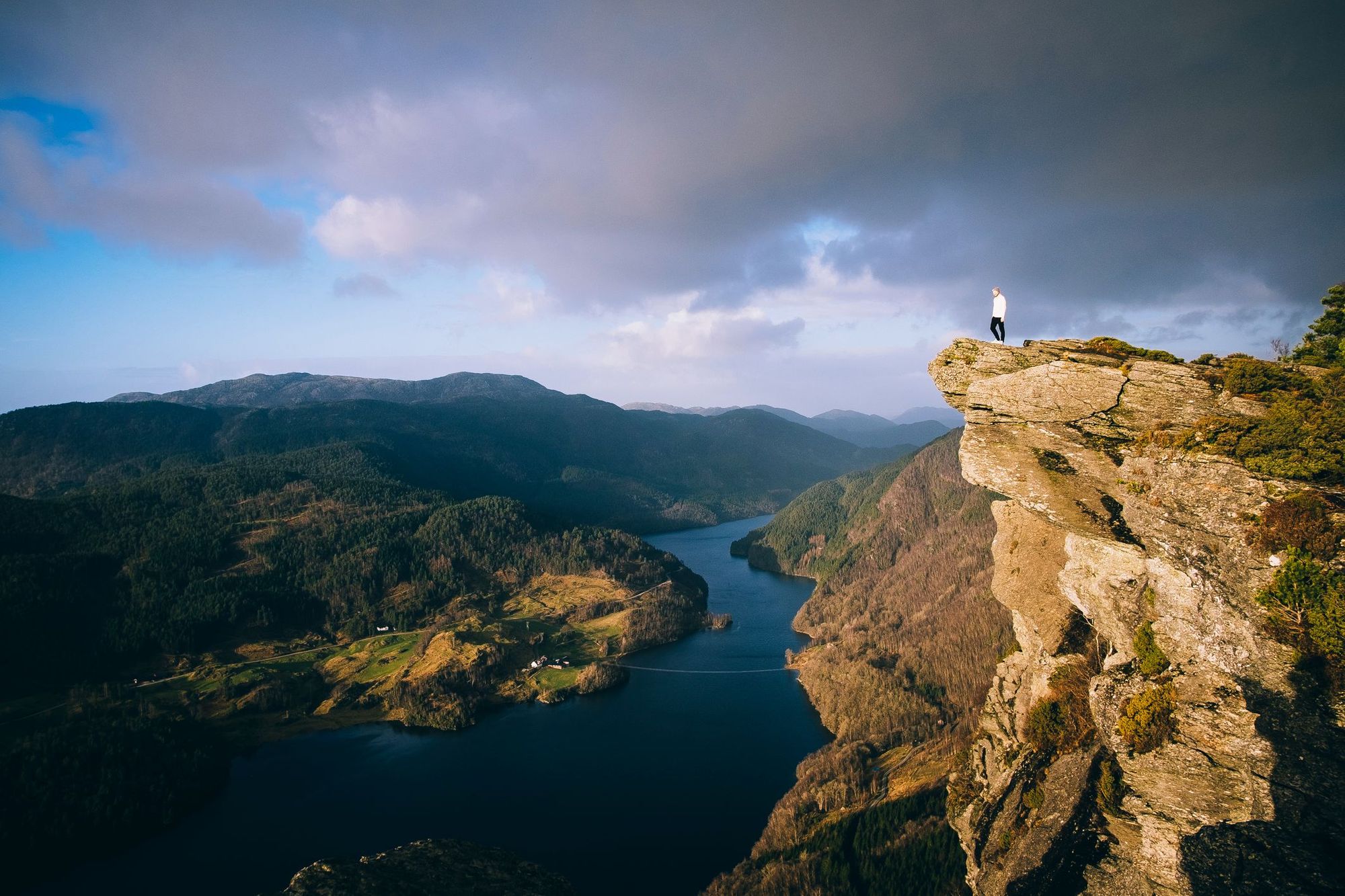
Hiking is second nature to Norwegians, and with over 1,700 fjords carved into the coastline, there is no shortage of routes to choose from. These fjords offer spectacular natural views of untouched verdant forests, ice cold lagoons and sweeping views over seemingly endless cliffs and mountains.

How we chose these 15 hikes
We've picked hikes here which are reachable by public transport, or by a manageable transfer. Mosts of the routes follow marked trails, and there's a wide range of difficulties, from two-hour walks to ten-hour summit hikes.
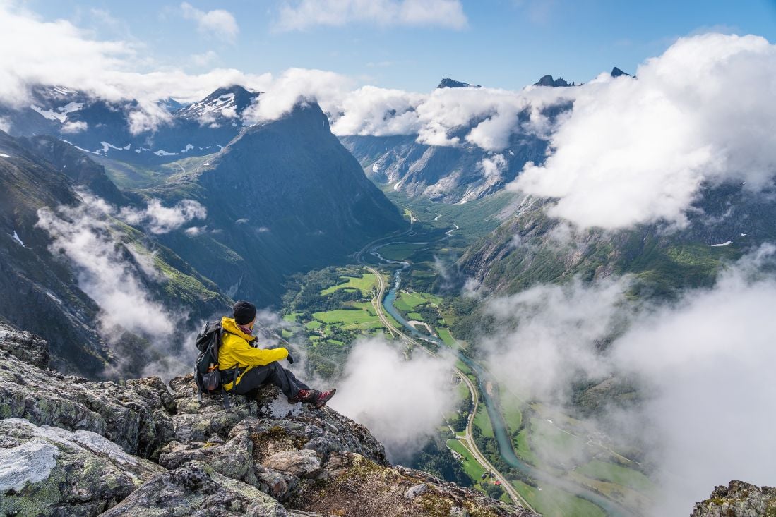
We'd always recommend travelling with a guide where possible, as not only will the guide you safely through the environment, and handle the logistics and navigation, they're also able to bring the landscape and its stories to life.
In many countries, the best hiking routes are only obtainable to those in the know or with high-tech equipment – this is not the case in Norway, the undisputed home of the fjords! However, with many of the best Norway fjord hikes accessible only by boat or kayak, we would recommend travelling with a guide where possible.
Here are 15 fjords worth hiking on your next Norway adventure. These are all day hikes with breathtaking views, many of which are accessible by public transport.
- Preikestolen, Lysefjord
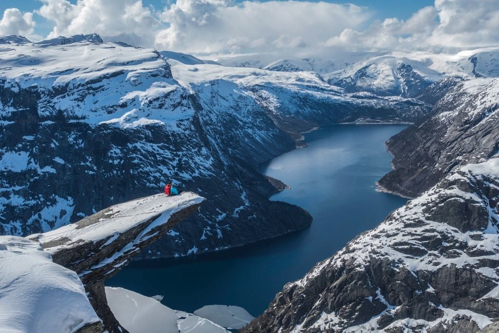
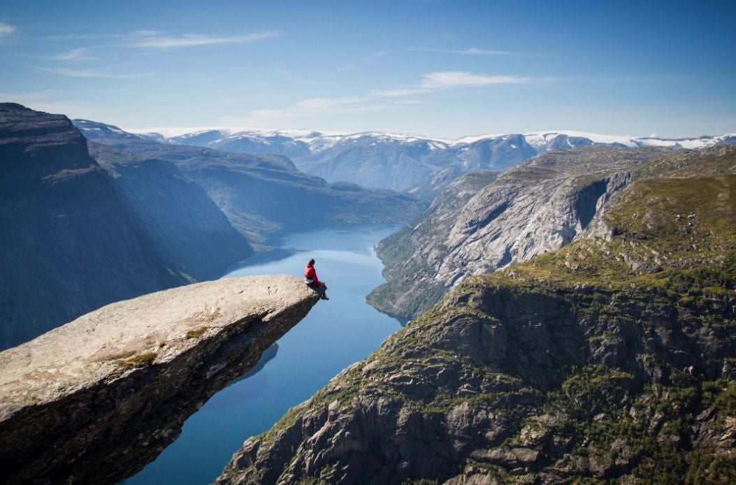
- Trolltunga (aka The Devil's Tongue), Hardangerfjord
- Dronningstien, Hardangerfjord
- Aurlandsdalen Valley, Sognefjord
- Vidasethovden, Sognefjord
- Mount Hanguren, Bergen & Voss
- Mount Fløyen, Bergen & Voss
- Mount Ulriken, Bergen & Voss
- Breiskrednosi Summit Hike, Naerøyfjord
- Rimstigen, Naerøyfjord
- Romsdalseggen Ridge, Isfjorden
- Mount Skåla, Nordfjord
- Urkeegga, Hjørundfjord
- Himakånå, Nedstrandsfjorden
- Langfoss Waterfall Hike, Åkrafjord
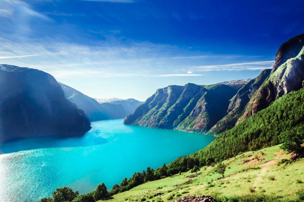
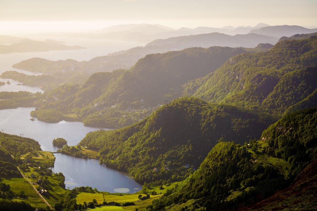
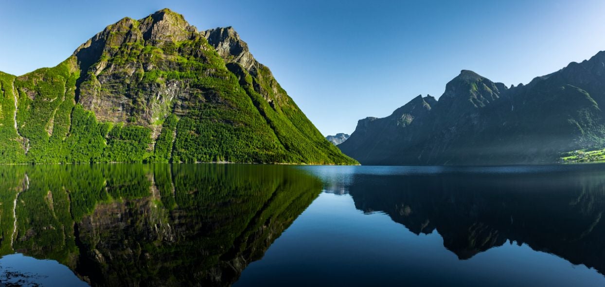
If you're choosing a fjord rather than a single hike, look at the Nærøyfjord, a UNESCO-listed fjord that narrows to 250m (820ft) in places with cliffs up to 1,800m (5,905ft) high, and several summit hikes. Alternatively, check out Hjørundfjord, which cuts through the jagged Sunnmøre Alps and delivers one climb after another. For a town base with plenty of hikes on your doorstep, Voss or Bergen sit conveniently between Sognefjord and Hardangerfjord.
The route descriptions we have included are summaries, designed to inspire rather than for any navigational purpose. Further mapping and planning - or an experienced local guide - will be needed to safely walk these trails.
Norwegian Fjord Hikes, Mapped
This is a map of the fjords listed below. We've broken them down into 'easy', 'moderate' and 'challenging'. An easy hike - by our definition - will take a couple of hours. while still requiring fitness. A challenging hike is an eight to 10 hour walk, involving a summit push. A moderate hike is somewhere in between.
The 15 best fjord hikes, fjord by fjord
Lysefjord
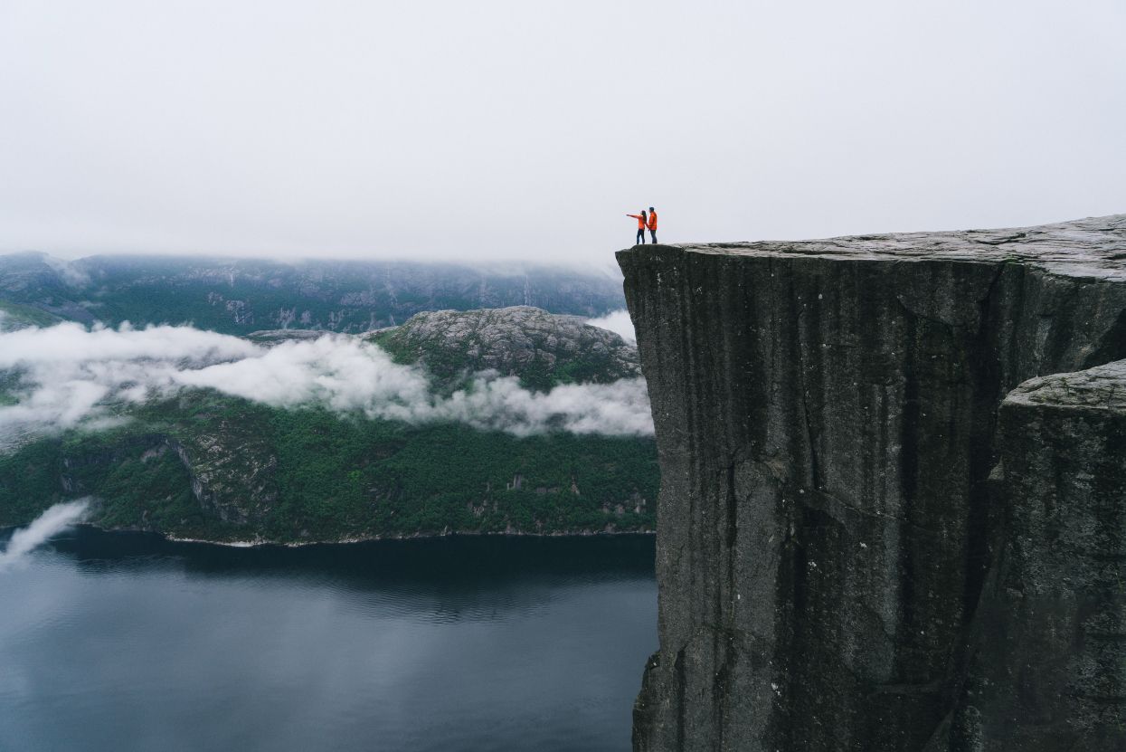
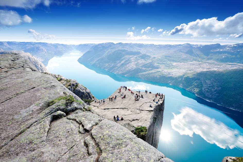
1. Preikestolen (Pulpit Rock), Lysefjord
- Start/Finish: Preikestolen Mountain Lodge (out and back)
- Distance: 4.9 miles (8km)
- Walking time: 3-4 hours
- Difficulty: Moderate
- Best for: Iconic scenery and Lysefjord views
Vistas don’t get more dramatic than this. Towering 604m (1,981ft) over the Lysefjord, Preikestolen (Pulpit Rock) is an ancient mountain plateau sculpted by into a square platform. Tourists first visited in the early 20th century and since then it has become one of Norway’s most famous landmarks. Preikestolen features on our Hike the Norwegian Fjords trip. For the full route breakdown, timings and tips, see our complete Pulpit Rock guide.
Hardangerfjord
2. Trolltunga (The Troll's Tongue), Hardangerfjord
- Start/Finish: P2 Skjeggedal (out and back)
- Distance: 16.7 miles (27km)
- Walking time: 10-12 hours
- Difficulty: Challenging
- Best for: Instagrammable views
Jutting out 700 metres above Lake Ringedal, this dramatic cliff is located deep in the fjord heartland, 170km east of Bergen. In English, the name translates as ‘Troll Tongue’. Legend has it that a cheeky troll didn’t believe he would turn to stone when he stuck his tongue out to make fun of the rising sun. The popularity of the hike to this ancient cliff has skyrocketed in recent years (in no small part due to Instagram). The waymarked round-trip from Skjeggedal is now one of Norway’s most popular hiking trails. But be warned: this is not a mere walk in the park. On average, the route takes between 10 and 12 hours, with 1,000 metres of ascent. Check out our full guide to the hike to Trolltunga for more details.
- Read more: Our Guide to Hiking in Norway
3. Dronningstien, Hardangerfjord
- Start/Finish: Røte/Kinsarvik (point to point)
- Distance: 9.1 miles (14.8km)
- Walking time: 4-6 hours
- Difficulty: Moderate
- Best for: Following in the footsteps of a queen
Dronningstien translates to 'The Queen’s Path'. This is known to be one of Queen Sonja's favourite hikes in Hardangar. It's not be confused with Dronningruta, ('the Queen’s Route), a hiking trail in the Vesterålen archipelago. On this hike you will visit Lake Fitjadalsvanet, several summer pasture farms and countless flowing streams and rivers. Start the trail at the town of Øystese and progress through the varied landscape to the peak. The trail climbs up to 1,100 meters, with the Sørfjord (an inner branch of the Hardangerfjord) on one side, and Hardangervidda National Park on the other. You'll see the Folgefonna Glacier and trace the edge of the volcanic crater overlooking Lake Fitjadalsvanet.
Sognefjord
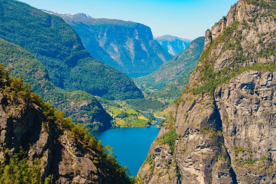
4. Aurlandsdalen Valley, Sognefjord
- Start/Finish: Østerbø / Vassbygdi (point to point)
- Distance: 9.9 miles (16km)
- Walking time: 5-6 hours
- Difficulty: Moderate
- Best for: Lush valley hikes
Once the main connection between east and west Norway, the Aurlandsdalen Valley is wild and rugged. Trace the path of the Aurland River from the small settlement of Østerbø to Vassbygdi and you will pass through a dramatic, wild valley with waterfalls, rivers and lush meadows. Notable landmarks include Nesbø farm, one of the oldest farms in Norway, founded in 1664. Nesbø lake with has particularly clear waters, and there's a steep rise over Bjørnestigen towards Vetlahelvete, and colourful wooden buildings along the way.
5. Vidasethovden, Sognefjord
- Start/Finish: Lunde (out and back)
- Distance: 5.5 miles (9km)
- Walking time: 4-5 hours
- Difficulty: Moderate
- Best for: Panoramic views of the Sognefjord
If we’re going by visitor happiness, the hike up Vidasethovden is one of the best hikes in Norway. At the summit (1,228m/ 4,028ft) you'll have a view of towering cliffs, small villages, mountains and glacial pools. The track starts in coniferous forest, near Lunde farm, and climbs steeply upwards. You'll follow the path up to the tree line along mountain creeks, passing through deciduous forest which is ablaze with colour in the autumn. At around 800m you'll pass a summer farm - from there, it's a steep climb up to the summit.

Bergen & Voss
6. Mount Hanguren, Bergen & Voss
- Start/Finish: Voss centre (out and back)
- Distance: 2.4 miles (4km)
- Walking time: 2-3 hours
- Difficulty: Easy
- Best for: Views over Voss
Snow-capped peaks define the landscapes of Mount Hanguren, and continuously catch your eye as you hike. Green pastures, mossy bogs and clean lakes are also in abundance here. This hiking route begins in Voss town centre, past Voss church and the Folkemuseum, towards Mølster. A dirt and stone path leads you from the base of Hanguren right to the peak and, although steep, this is a trail for beginners. In two hours you can savour the unrivalled views over Voss and the region.
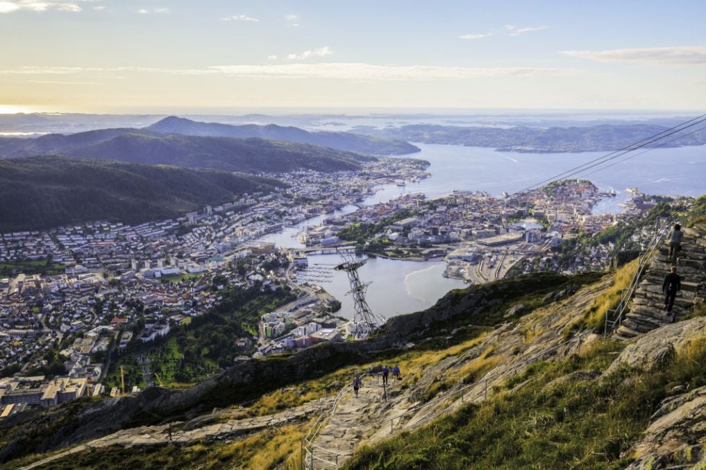
7. Mount Fløyen, Bergen & Voss
- Start/Finish: Floibanen funicular station (out and back)
- Distance: 3.4 miles (5.6km)
- Walking time: 2 hours
- Difficulty: Easy
- Best for: Easy summit hikes near Bergen
Mount Fløyen is in Bergen, and there's a funicular which will carry you up it. Start at the funicular station and follow the marked road towards Blåmansveien. Follow the signposts left and walk past the unmissable domed rain shelter (you could stop here for a picnic) to the steps of Fløyvarden cairn – offering awesome views from 393 metres above sea level. From the cairn, walk through the forest and cross a small footbridge into a clearing high above Bergen. If you want an even easier hike you can take the funicular up to the summit, and then stroll back down.
8. Mount Ulriken, Bergen & Voss
- Start/Finish: Ulriksban Cable Car (point to point)
- Distance: 3.6 miles (5.8km)
- Walking time: 2 hours (one way)
- Difficulty: Moderate
- Best for: Hiking Bergen's highest peak
This is the highest of Bergen’s mountains and has a great view back down over it. It's a local hotspot, and the hike to the peak of Ulriken (643m/2,109ft) is well-trodden. Start behind the cable car station at Ulriksbanen and follow the marked track, which winds through the thick green forest, past wooden houses and over small bridges. Before you know it, you will come face to face with the endless natural views surrounding Bergen. Take the cable car back down or double back.
Naerøyfjord
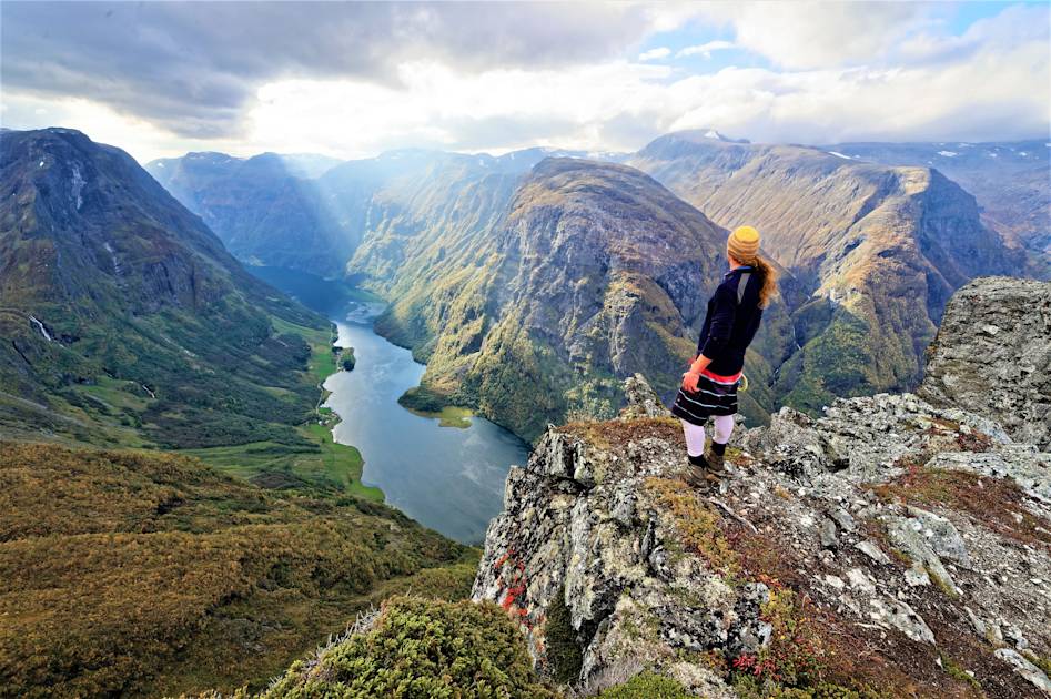
9. Breiskrednosi Summit Hike, Naerøyfjord
- Start/Finish: Drydal (out and back)
- Distance: 12.8 miles (20.7km)
- Walking time: 10-11 hours
- Difficulty: Challenging
- Best for: A bird's eye view of the narrowest fjord in the world
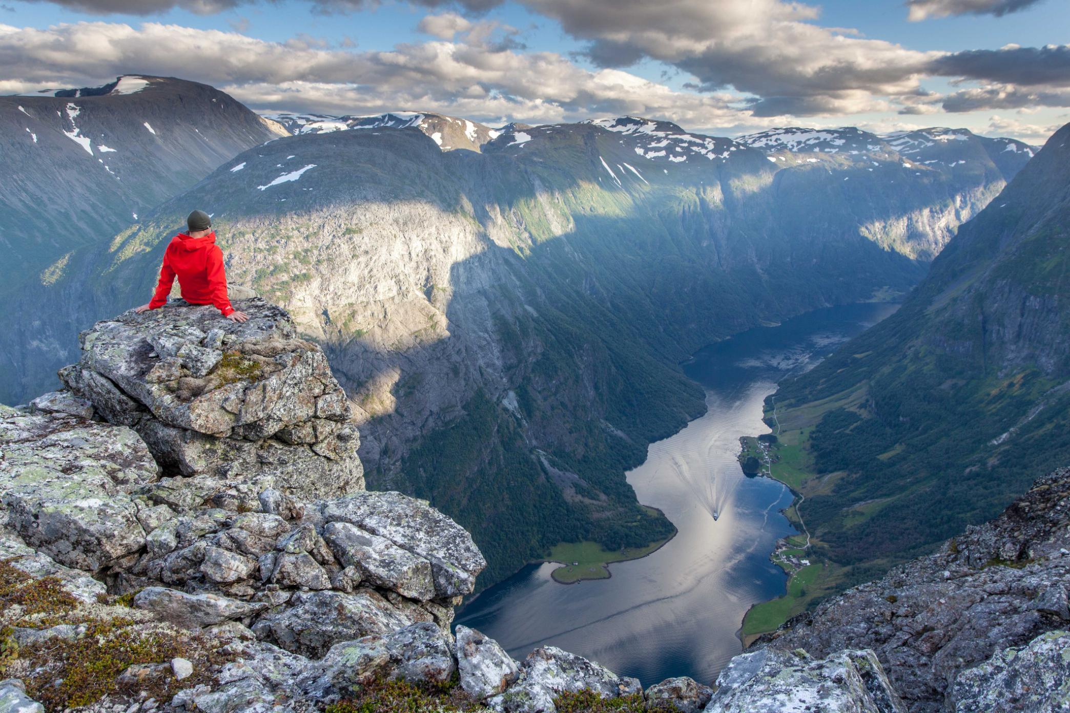
At 1,189m (3,900ft), Breiskrednosi is the highest point on the Naerøyfjord; a narrow strip of water with vast, snow covered peaks rising up on either side of it. You begin the hike more or less from sea level, meaning it’s a climb of over 1,000m (3,280ft) across a single day - hence the 'challenging' rating.

Beginning from the trailhead near the small village of Drydal, you’ll hike inland, climbing up through meadows and forest, crossing glacial streams of meltwater. For much of the year, higher altitudes are carpeted in snow, which you’ll crunch over as you climb higher. There’s a final, steep push to the summit, but the views of the mirror-like fjord and its sheer sides make the effort worthwhile.
10. Rimstigen, Naerøyfjord
- Start/Finish: Bakka (out and back)
- Distance: 4.4 miles (7km)
- Walking time: 2-3 hours
- Difficulty: Challenging
- Best for: Quiet summit trails
The Næroyfjord is a hidden gem amongst the many fjords and mountain ranges that call Norway home. It's an UNESCO-listed World Heritage Site too. This hike from Bakka should take around one and half hours from base to peak, through verdant meadows, thick birch forests and past small lakes. The trail might be short but it is steep, and the rocky terrain can be slippery in the rain. Although this is Norway’s smallest fjord, the views from the peak of Rimstigen (725m) are not to be missed. There's also the option to kayak further into the fjord though - from where you can summit some of the more central peaks. A guide is essential.
Other Fjords
11. Romsdalseggen Ridge, Isfjorden
- Start/Finish: Romsdalseggen trailhead (circuit)
- Distance: 6.4 miles (10.3km)
- Walking time: 6-8 hours
- Difficulty: Challenging
- Best for: Fjord-side ridge hiking
This trek along Romsdalseggen Ridge is often touted as Norway’s greatest hike. You'll traverse a rocky ridge towards the summit, taking in plunging waterfalls, glacial waters and craggy peaks along the way. From the summit, you can watch the sunset over the Romsdal Mountains, Kongen, Dronninga and Store Trolltind in the distance. Start the hike at the bus stop and pass a fast-flowing river. The terrain flattens as you follow the trail past Jamnåbotn and up the steep mountainside towards Åndalsnes. For the rest of the hike you will be walking along the ridge of the fjord to the peak. Bring your head for heights.

12. Mount Skåla, Nordfjord
- Start/Finish: Tjugen parking lot near Loen (out and back
- Distance: 9.9 miles (16km)
- Walking time: 7-10 hours
- Difficulty: Challenging
- Best for: Hiking a 1,848m (6,062ft) mountain
You won’t find a longer uphill stretch in the whole of Norway than this. There are 230 designated hiking trails along Mount Skåla. We recommend taking the route up to the summit, which has an elevation of 1,848m (6,062ft). This hike starts beside the glassy Loenvatnet lake, passes rough tractor tracks and thick Nordic forests (complete with wolves and reindeer). The path is well-marked, but some areas can be slippery. Some walkers elect to stay overnight at Skålatårnet, a hotel with a round tower at the top of the mountain.
13. Urkeegga, Hjørundfjord
- Start/Finish: Haugemyrvegen parking (circuit)
- Distance: 6.5 miles (10.5km)
- Walking time: 5-7 hours
- Difficulty: Challenging
- Best for: Summit bagging in the Sunnmøre Alps
The Hjørundfjord will take your breath away, and there are several hiking options here. One is the ascent of Mount Slogen (1,564m/5,131ft) from Øye. We, however, recommend the circular Urkeegga hike. On this day hike you'll climb steeply up through the forest and along a ridgeline across the top of the fjord, summiting Klokkskollen (944m/3,097ft) and Maudekollon (1,021m/3,349ft) as you hike. Some easy scrambling is required. Expect stunning views of the Sunnmøre Alps and the idyllic Hjørundfjord for much of the journey.

14. Himakånå, Nedstrandsfjorden
- Start/Finish: Nedstrand (out and back)
- Distance: 3.4 miles (5.5km)
- Walking time: 2-3 hours
- Difficulty: Easy
- Best for: A less challenging (and less busy) alternative to Trolltunga
Locals have always known about Himakånå, or “little Trolltunga”, but few visitors take the time to explore this fjord. And unlike the Trollrunga, there are very few pictures and few tourists here. The area has its own unique microclimate, with oak and birch trees towering over the landscape, and unique rock formations dominating everything here. In under two hours, you'll be overlooking a spectacular valley. The cliff hangs over a lake, and the hiking is not difficult.

15. Langfoss Waterfall Hike, Åkrafjord
- Start/Finish: Langfoss car park (out and back)
- Distance: 2.4 miles (4.5km)
- Walking time: 2-3 hours
- Difficulty: Moderate
- Best for: Wild waterfalls
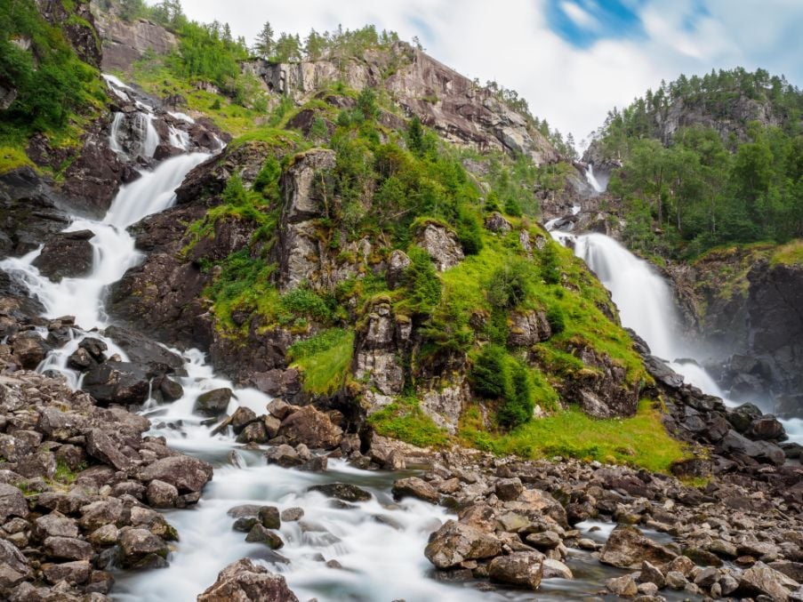
A short but steep climb to the top of Åkrafjordfor a view of Langfoss waterfall, a wild torrent that's 612m (2,008ft) high. You'll follow a clearly demarcated trail up through dense forests towards the waterfall. Even when you can't see it, you will hear it thundering through the air and shaking the ground under your feet. The steep trail offers frequent views of Langfoss as you climb higher. At the top, you’ll be rewarded with stunning views of the Åkrafjord and the cascading waterfall. The descent follows the same path, so take care on the steeper sections.
Which fjord hike is right for you?
The table below compares each of the 15 hikes at a glance.
| Hike | Fjord | Distance | Time | Difficulty | Best for |
|---|---|---|---|---|---|
| Preikestolen (Pulpit Rock) | Lysefjord | 4.9mi / 8km | 3–4 hrs | Moderate | Iconic scenery |
| Trolltunga | Hardangerfjord | 16.7mi / 27km | 10–12 hrs | Challenging | Instagrammable views |
| Dronningstien | Hardangerfjord | 9.1mi / 14.8km | 4–6 hrs | Moderate | Following a queen's favourite route |
| Aurlandsdalen Valley | Sognefjord | 9.9mi / 16km | 5–6 hrs | Moderate | Lush valley walking |
| Vidasethovden | Sognefjord | 5.5mi / 9km | 4–5 hrs | Moderate | Panoramic Sognefjord views |
| Mount Hanguren | Bergen/Voss | 2.4mi / 4km | 2–3 hrs | Easy | Easy views over Voss |
| Mount Fløyen | Bergen/Voss | 3.4mi / 5.6km | 2 hrs | Easy | Beginner summit near Bergen |
| Mount Ulriken | Bergen/Voss | 3.6mi / 5.8km | 2 hrs (one way) | Moderate | Bergen's highest peak |
| Breiskrednosi | Næroyfjord | 12.8mi / 20.7km | 10–11 hrs | Challenging | A bird's-eye view of the narrowest fjord |
| Rimstigen | Næroyfjord | 4.4mi / 7km | 2–3 hrs | Challenging | Quiet summit trails |
| Romsdalseggen Ridge | Isfjorden | 6.4mi / 10.3km | 6–8 hrs | Challenging | Fjord-side ridge hiking |
| Mount Skåla | Nordfjord | 9.9mi / 16km | 7–10 hrs | Challenging | Hiking a 1,848m mountain |
| Urkeegga | Hjørundfjord | 6.5mi / 10.5km | 5–7 hrs | Challenging | Summit-bagging in the Sunnmøre Alps |
| Himakånå | Nedstrandsfjorden | 3.4mi / 5.5km | 2–3 hrs | Easy | A quieter alternative to Trolltunga |
| Langfoss Waterfall Hike | Åkrafjord | 2.4mi / 4.5km | 2–3 hrs | Moderate | Wild waterfalls |
How fit do you need to be for fjord hiking?
Of the thousands of people who have been on our fjord hiking trips, 20%-30% of people say the summit days are harder than they expected on the fjords. A tough day on the fjords can run 14-18 miles long (23-29km) and require 10 hours or more of hiking. Given that you can also be climbing from sea level to around 1,189m (3,900ft), the days can be extremely demanding. You need good fitness, proper hiking boots you've already worn in, and the appropriate equipment.
Of course, there are easier hikes which don't require such high fitness levels.
Fjord hiking FAQs
When is the best time to hike the Norwegian fjords?
The core hiking season on the fjords runs roughly from May to October, with peak season (mid-June to end of July) offering the mildest weather, 13–18°C, and the midnight sun for long trail days. Weather can turn fast even in summer, so pack for four seasons. Weekdays are quieter than weekends if you're after empty trails.
Do you need a guide to hike the fjords?
Most of the 15 hikes listed here are waymarked and walkable unguided in season. A guide offers more than navigation, though. They also keep you safe and bring the folklore, history, flora and fauna to life. In winter, a guide is essential for safety.
Can you wild camp on a fjord hike?
Yes. Norway's right to roam, or Allemannsretten, lets you wild camp almost anywhere, fjords included, as long as you keep a respectful distance from houses and leave no trace.
Hike the fjords with us
If you would rather have the logistics of your trip handled for you, our Hike the Norwegian Fjords trip takes you to Preikestolen (Pulpit rock), Kjerag and the Flørli 4,444 steps, over six nights, running May to September with expert local guides. Browse the full set of fjord adventures on our Norwegian Fjords collection page.
Read More:
- 10 of the Best Hikes in Norway
- 5 of the Best Winter Hikes in Norway
- 5 of the Best Glacier Hikes in Norway
Feeling inspired? Visit the fjords on our Ultimate Norwegian Fjords Adventure or our other Norway Adventures.