


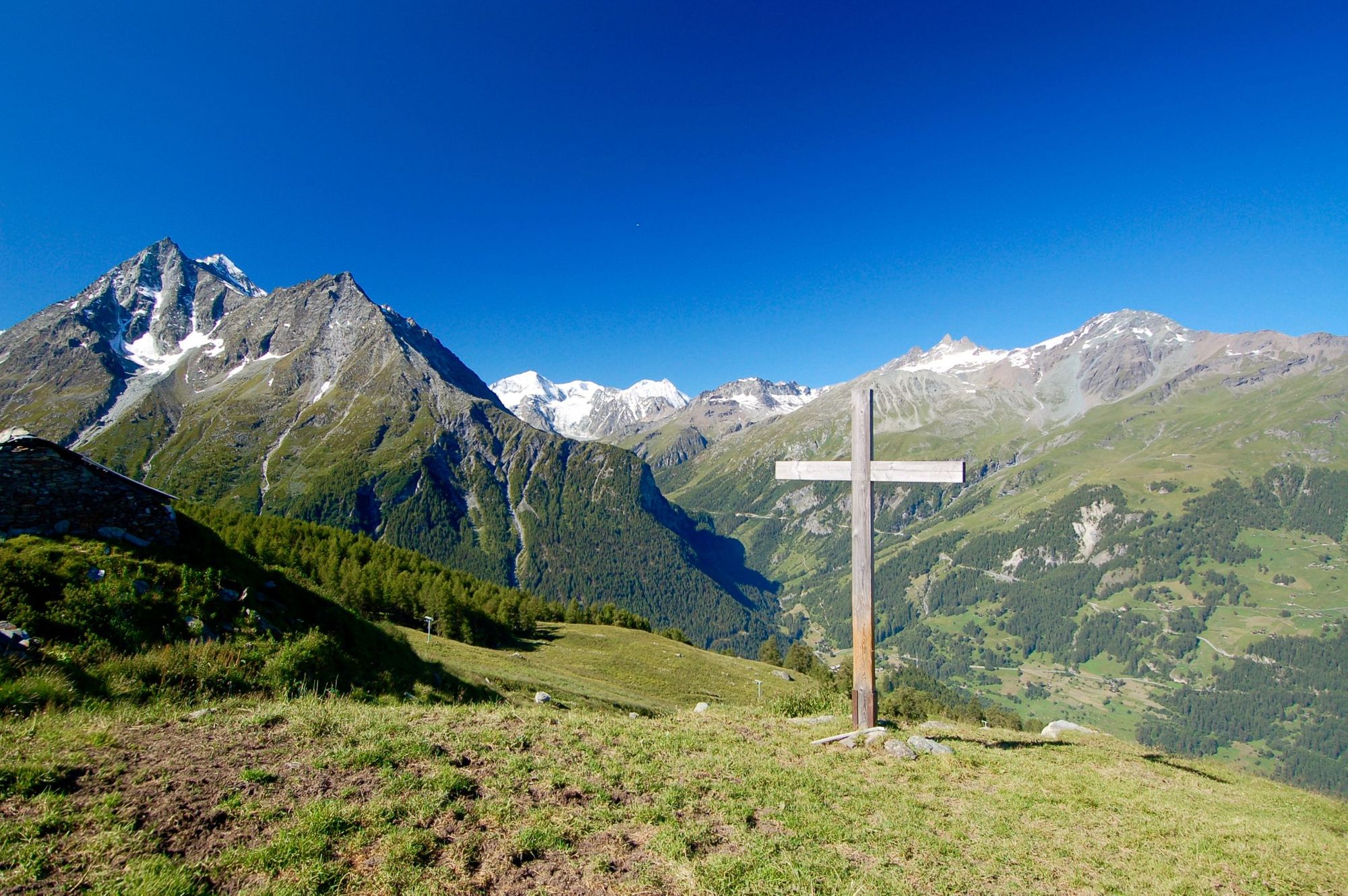
The best Alpine hikes offer everything from huge valley views to pointy mountain peaks, glistening blue mountain lakes and, of course, far-reaching alpine pastures. None of which there is a lack of in the world of beauty and serenity that makes up the Alps mountain range system.
So, if you fancy a hike in the Alps, where do you start? After all, the Alps are the highest and most extensive mountain range that sits purely in Europe, covering almost 300,000km² and split across eight countries - most famously France, Switzerland, Italy and Austria, but also Slovenia, Germany, Liechtenstein and Monaco. There's a lot out there.

In this article, we've selected 10 of our favourite hikes in the Alps, combining big hitters like the Tour du Mont Blanc with lesser known trails. 'Best', for us, means breathtaking alpine scenery, and a level of challenge that pushes us slightly out of our comfort zones, whilst not being impossible. We're focusing purely on long-distance, multi-day treks - some across peaks, some through valleys - but of course, each of these can be broken up into shorter hikes for those with less spare time. Here are 10 long-distance hiking route in the Alps which showcase all the mountain range has to offer.
It’s important to note that these route descriptions are only short summaries, designed to inspire but not to serve any navigational purpose. They are not intended to guide you on the route and further mapping and planning (or a local guide!) will be required if you want to safely walk any of the trails featured.
Where Are the Alps Located?
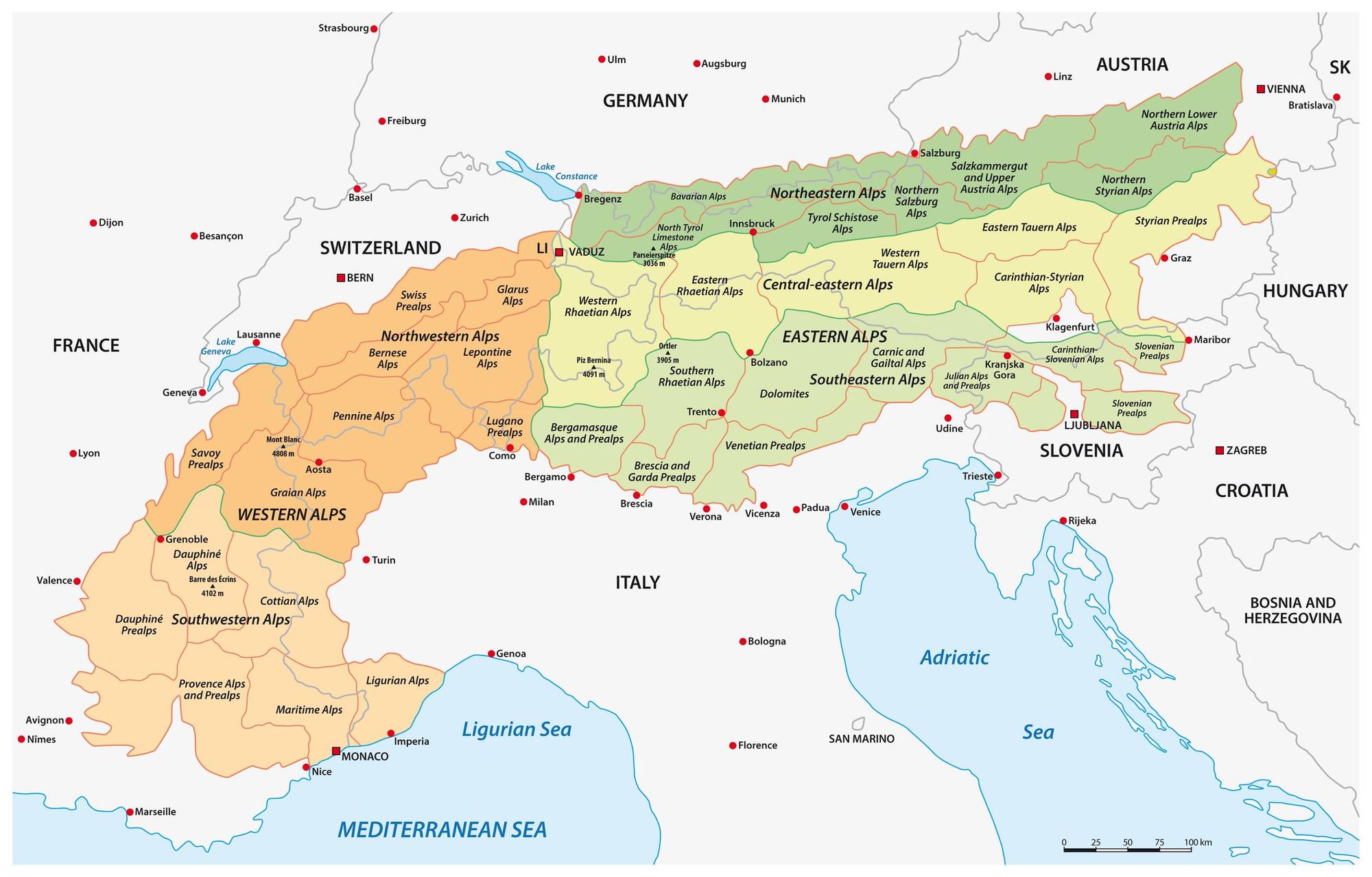
The Alps are the highest mountain range in Europe, stretching for approximately 750 miles (1,200 km) across eight countries: Monaco; France; Switzerland; Italy; Liechtenstein; Germany; Austria and Slovenia. The Alps extend north from the subtropical Mediterranean coast near Nice, France, to Lake Geneva in Switzerland before heading northeast to Vienna.
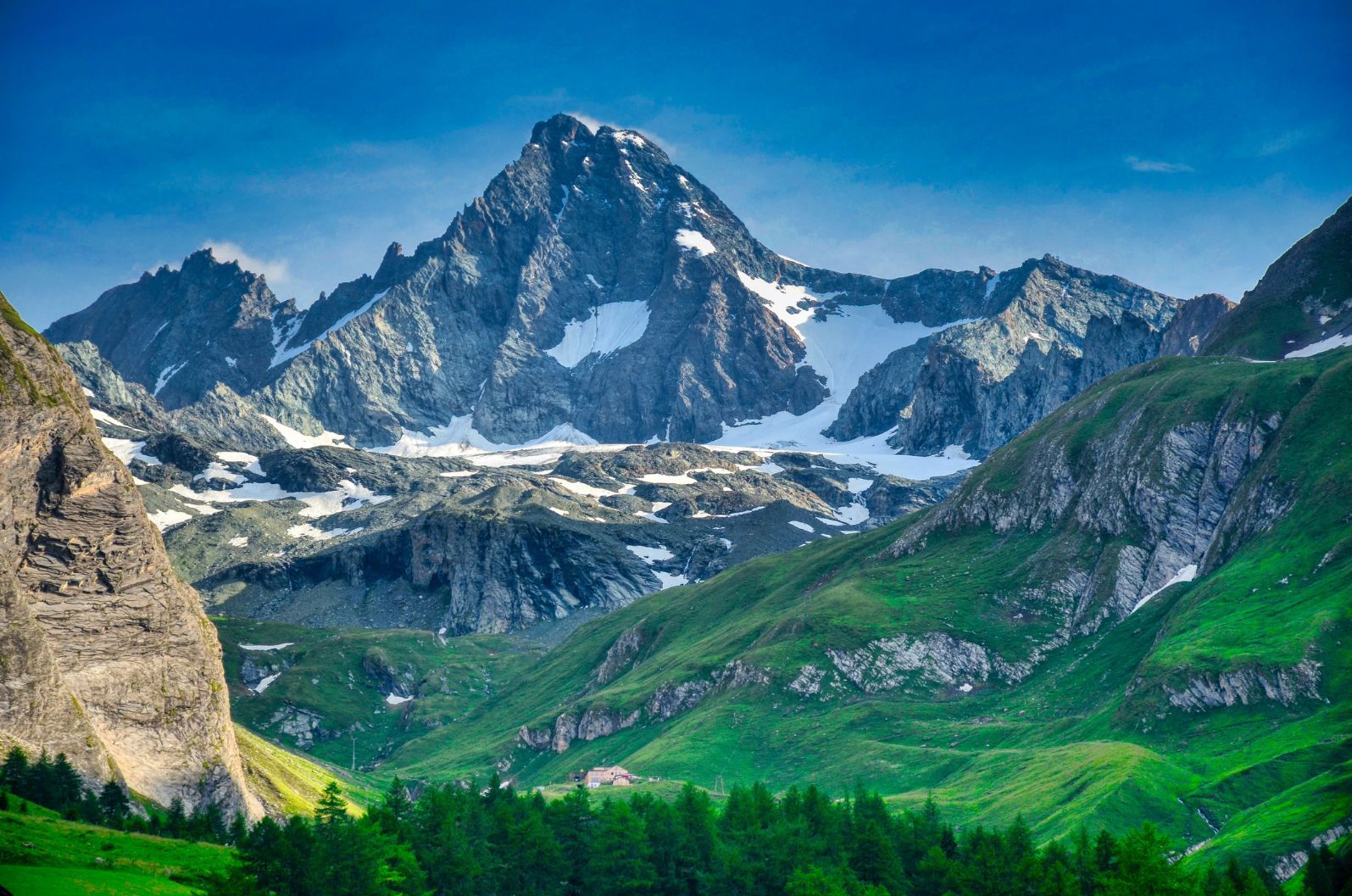
The Alpine region contains 128 mountains over 4,000m-high - Mont Blanc, straddling the French–Italian border, is the highest mountain in the Alps at 4,809 m (15,778 ft).
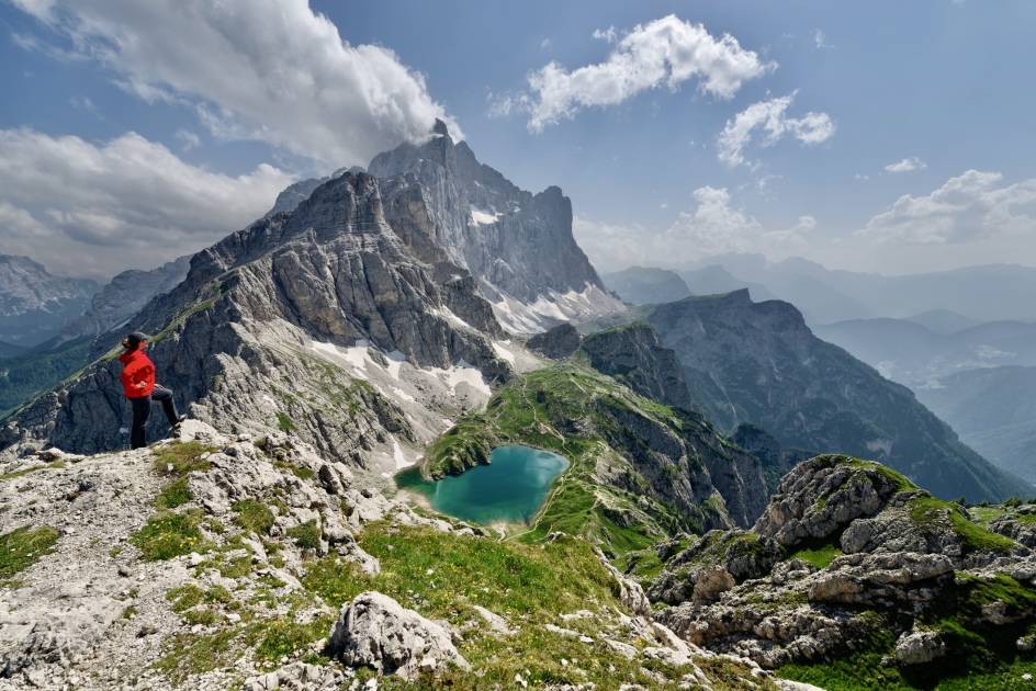
1. The Tour du Mont Blanc, France, Switzerland, Italy
- Highest point: 2,665 m (8,743 ft)
- Distance: 102.5 miles (168km)
- Start and Finish Point: Chamonix, circular
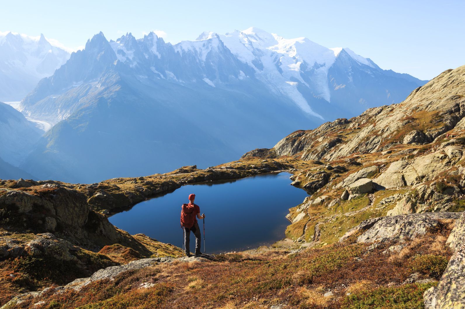
Affectionately known as the TMB by many, the Tour du Mont Blanc offers up some of the best hiking in the French Alps - it's one of the most iconic hiking routes on the European continent. Starting and finishing in the famous mountain town of Chamonix, the 168km route circles the Mont Blanc massif, passing through three countries en route.

The TMB dates back to 1767, when a Swiss geologist, Horace-Bénédict de Saussure, walked the entire way around the Mont Blanc massif looking for a way to climb it. He didn't find one then (although he did end up making the third ascent of the mountain in 1787), but he did leave a big legacy and launch a beautiful hiking trail. Highlights include a whole lot of far-reaching valley views, suspension bridges, and vantage points over Dent du Géants, the Grandes Jorasses, and of course, of Mont Blanc.
The route is usually walked counter-clockwise over 10/11 days. Those with less time tend to bite off three-day chunks of the Tour du Mont Blanc - ideal hiking in the Alps for beginners.
2. The Juliana Trail, Slovenia
- Highest Point: 1,819m (5967.848ft)
- Distance: 167.7 miles (270km)
- Start and Finish Point: Kranjska Gora circular
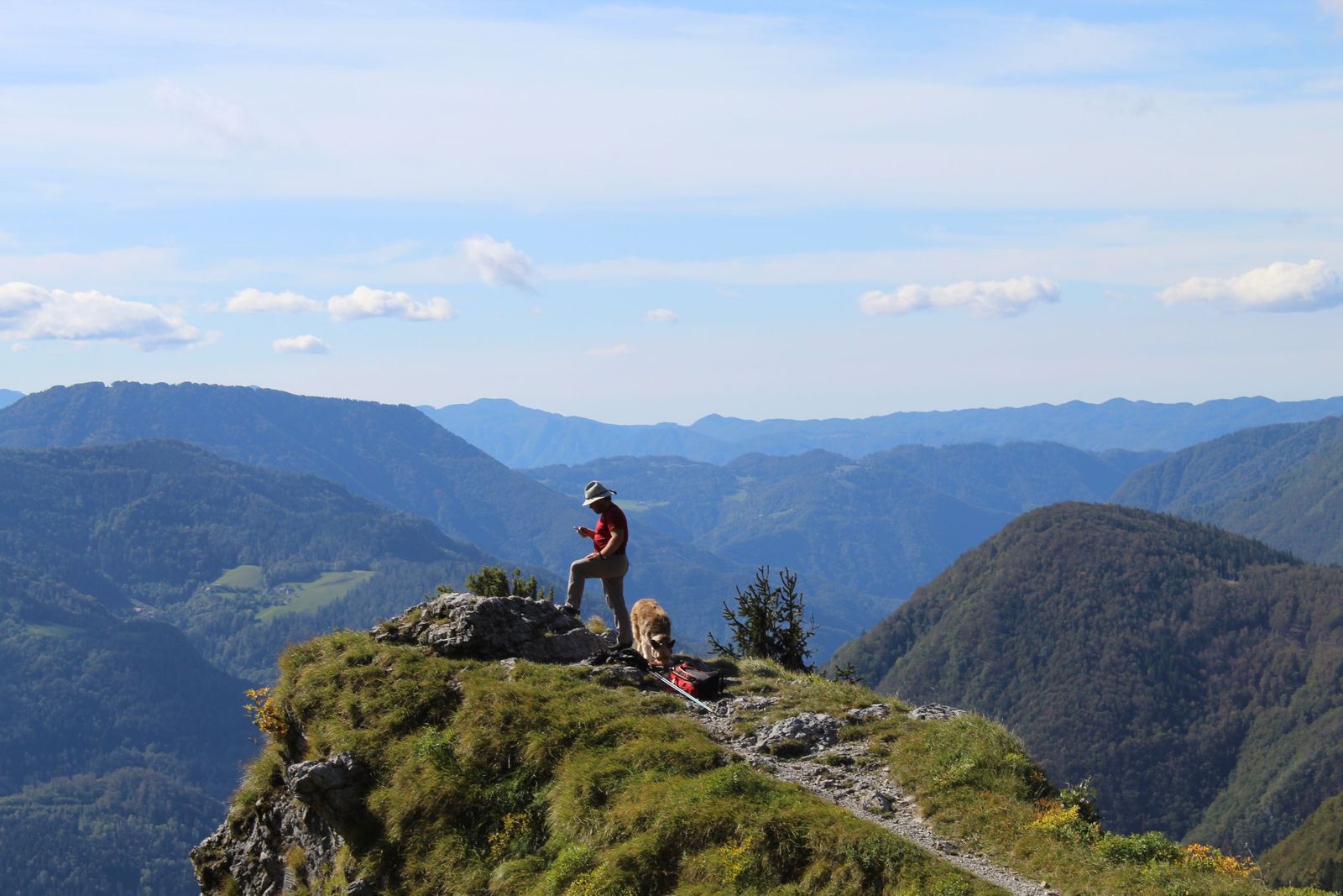
Most people don’t think of Slovenia when they think of the Alps. Most people go to Austria, France or Switzerland. Which means that Slovenia's Julian Alps have a lower footfall on their mountains than in most other alpine countries - despite the Slovenian Alps being just as rugged, pointy, immense and beautiful. What we’re really telling you here is... most people are missing out.
If you’ve never seen, heard or thought of the Slovenian Alps before, then the Juliana Trail is the ultimate introduction. It’s an accessible walk - travelling through the mountains rather than going up to the top of every peak that it passes. It’ll take you around a lot of beautiful Slovenian areas.
 Stuart Kenny
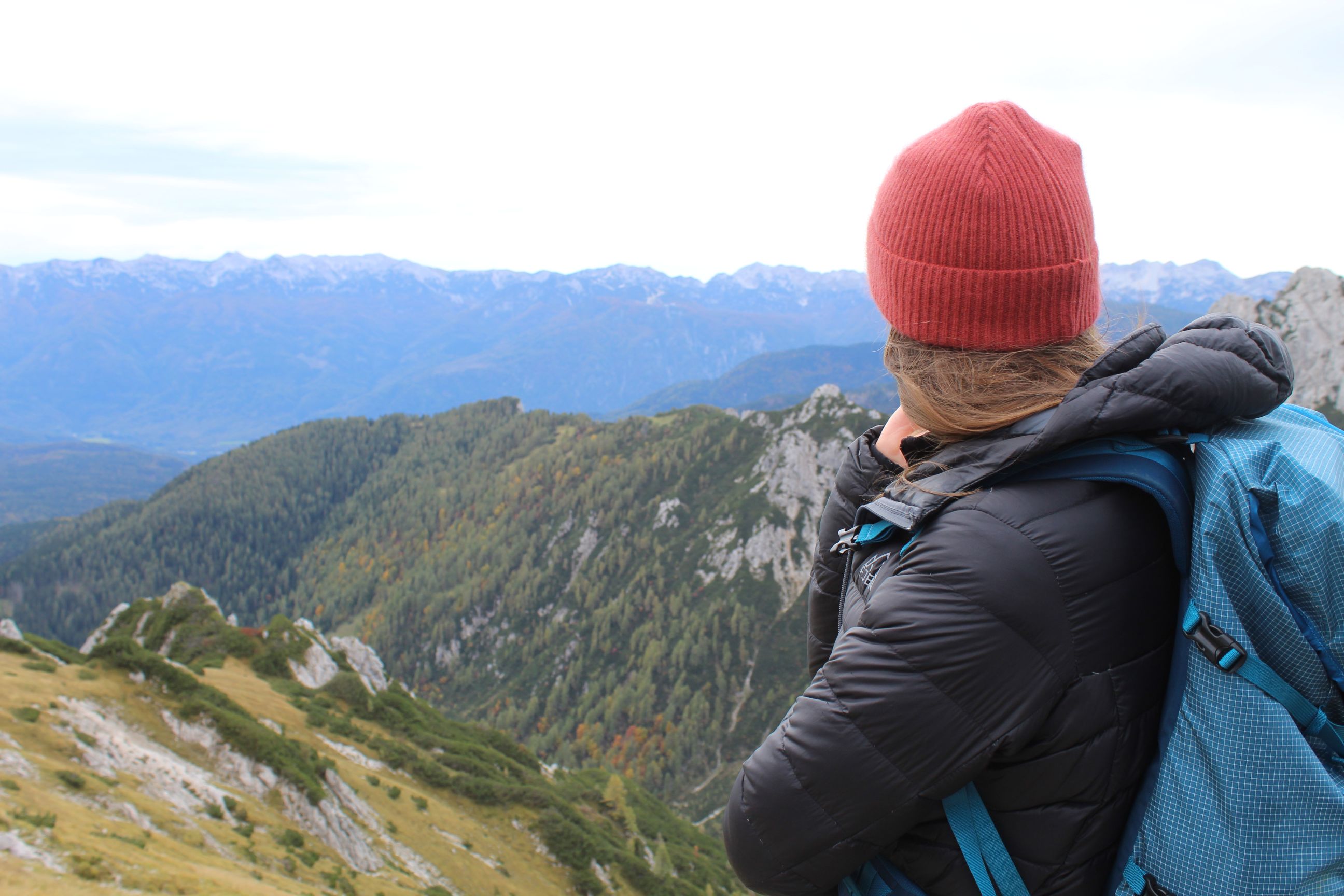
Starting point Kranjska Gora is home to the beautiful Lake Jasna. Stage four passes through the 15th century town of Radovljica. Stage eight of the trail is a remarkable mountain hike between the small towns of Podbrdo and Bohinj, with far-reaching views out over Lake Bohinj (the biggest lake in Slovenia), and the next day the trail will take you over to the postcard-perfect town of Bled. You’ll soon find yourself along the Soča River, walking towards Kobarid, and at various points on the route, you’ll have remarkable views of the mighty Mt Triglav.
There are 16 stages in total, and at roughly 17.5km each in length, some of them can be doubled up and done in one day, but once you see Slovenia, you’ll be in no rush to leave.
3. The Eagle Walk, Austria
- Highest Point: 2749m (9019ft)
- Distance: 256.6 miles (413km)
- Start and Finish Point: St. Johann to St. Christoph am Arlberg
The Eagle Walk is so-named because it gives you an eagle-eye view over all of Austria - or to be more specific, over Tirol, a spot renowned for its alpine beauty. The Eagle Walk is primarily split up into two main parts. There’s a 24-day walk that will take you through the mountains of the North Tirol, and there’s a nine-day stage which takes you on the most beautiful route between the highest mountains in Austria – the Grossglockner and the Grossvenediger.
As with most hikes on this list - but particularly the ones that climb over the 200km mark, which this hike does and then some - many people hike just a stage or two of the Eagle Walk rather than taking on the whole thing. If you were to do it though, you’d travel from east to west across Tirol, from the distinctive form of the Kaiser mountains, through the Brandenberg Alps and Rofan mountains, up the Karwendel Mountains and into the Tux Alps - eventually reaching the Stüdlhütte hut on the Grossglockner, the highest peak in Austria.
Highlights along the way include the Schleier waterfall outside the renowned ski town Kitzbühel and the Hundalm ice cave, a dripstone cave which reaches 45m deep. The route along the Nordkette, above the mountain city of Innsbruck, to Pfeishütte in the Karwendel is a beauty, as is the serenity of Lake Zireiner See and contrasting immensity of the mountains in Arlberg - Alpine trekking at its finest.
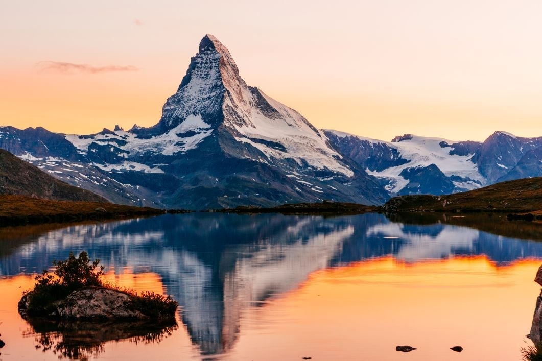
4. The Matterhorn Trek, Switzerland & Italy
- Highest Point: 3,260m (10695.54ft)
- Distance: 90 miles (145km)
- Start and Finish Point: Zermatt circular
The pointy, Toblerone-top of the Matterhorn is surely the most distinctive mountain peak in Europe - and one of the most beautiful too. The mountain melts hearts quicker than Swiss chocolate melts in the mouth.
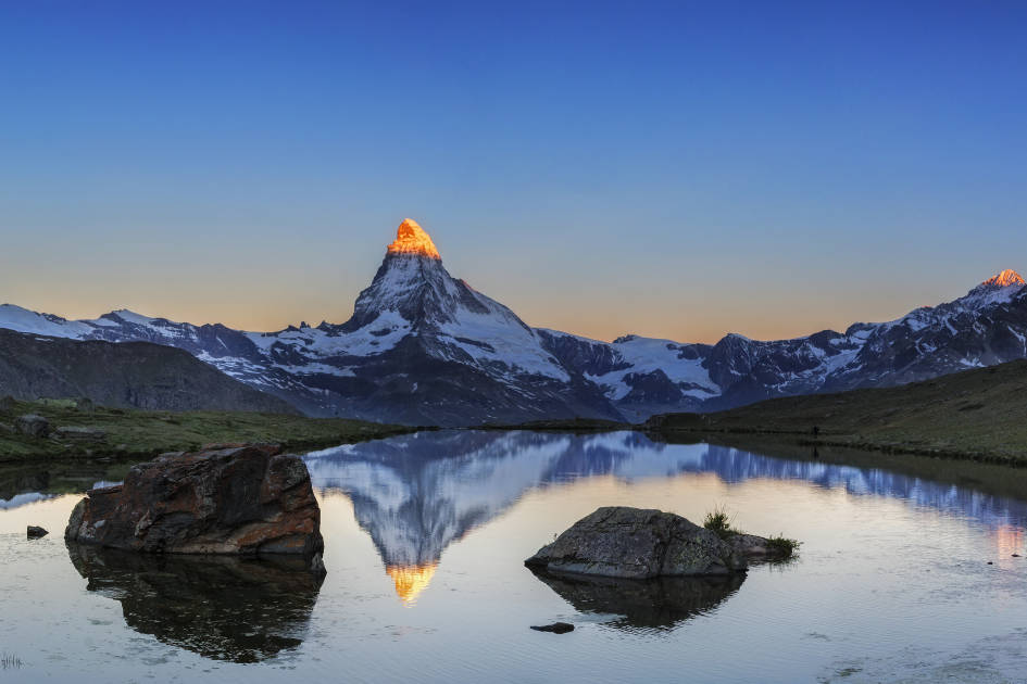
The best way to see the 4,478m Matterhorn? Well, you could go up to the summit. That’s pretty special. The only problem is, when you’re at the top of the Matterhorn, you can’t actually see the Matterhorn - and we like seeing the Matterhorn! That’s why we love the Matterhorn Hike, a trek just shy of 150km that goes around, but not actually up, the Matterhorn - some of the best hiking in the Swiss Alps.
The tour will take you from Zermatt to St Niklaus, then onto Gruben-Meiden, Zinal, Les Hauderes and Arolla, over to Italy to see Prarayer and Breuil-Cervinia, and then back to Zermatt, typically in 8-10 days. This includes two glacier crossings, mighty views of 4000m+ peaks and frankly mouth-watering Italian mountain food. You can also connect to the Tour of Monte Rosa or Walker's Haute Route, and of course, you can always summit after if you’d like.
5. The Walker’s Haute Route, France & Switzerland
- Highest Point: 2,987m (9,799ft)
- Distance: 109 miles - 139 miles (175km - 225km)
- Start and Finish Point: Chamonix to Zermatt
Another stone-cold classic, and one of Europe’s best known long-distance trekking trails, is the Haute Route. This route takes you from one of the best known mountains on the continent to another - from Mont Blanc to the Matterhorn - via beautiful valleys and mountain trails.

You’re probably wondering why we’ve given a range of distances for this route, though. That’s because there is actually not one particular trail named the Haute Route - rather, there are many ways of getting from Chamonix to Zermatt, but no matter which trail you choose to take, you’re going to have to cross 11 mountain ranges and ascend over 69,000ft. The most commonly used Walker’s Haute Route measures in at 213km.
The Haute Route is typically walked in somewhere between one and two weeks. You'll go over the summit of Aiguillette des Posettes, trek to the wild Fenêtre d'Arpette, visit Le Chable and Verbier, pass the Lac des Dix dam and climb the Col de Riedmatten, just to name a few spots. One of the toughest days is ascending to the high point at Col de Torrent, but there's always a mountain hut and a hearty meal awaiting.
6. The Alpe-Adria Trail, Austria, Italy and Slovenia
- Highest Point: 2,369m (7772.3ft)
- Distance: 466 miles (750km)
- Start and Finish Point: Heiligenblut in Carinthia, Austria, to Muggia in Trieste, Italy
An absolute beast of a trail through three counties and over 43 stages, the Alpe-Adria Trail runs from the Grossglockner in Carinthia, the highest mountain in Austria, all the way to the Adriatic Sea in Trieste. The trail has a superb start, with a four to five hour hike from the foot of the Grossglockner to Heiligenblue via a suspension bridge at Sandersee Lake and the Gössnitz waterfall. The longest stage is a 28km beast from Gradisca d’Isonzo to Duinom, but there are plenty of smaller, and more manageable stages (the shorter being just 11km).
Passing into Slovenia, you'll reach Kranjska Gora and the Soča River, exploring Triglav National Park and the water sports hub of Bovec - also the highest region in Slovenia. You'll reach the Tuscan-esque scenery of Goriška Brda (where they make mighty fine wines), with views over to Venice on a clear day, before crossing into Italy at Collio and making your way to the sea.
7. Alta Via 1, Italy
- Highest Point: 2,752 m (9,029 ft)
- Distance: 74.5 miles (120km)
- Start and Finish Point: Dobbiaco to Belluno
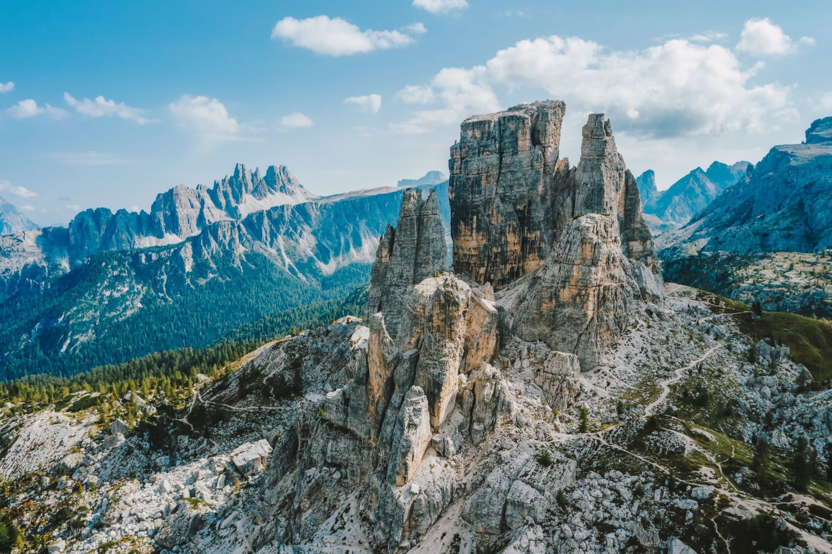
There's something special about hiking in the Dolomites, isn't there? In a world of spiky mountains, these mountains are particularly spiky, and they tend to erupt up thousands of metres from the valley floor. Perhaps that's why the Dolomites aren't referred to often as "Alps", despite the fact that they are, in fact, in the Alps. Heading south from Dobaccia, the Alta Via 1 is the great Dolomiti trail.
You'll pass through Passo Falzarego, come across old battle sites from World War One, and hear the history of the Dolomites and the Great War. The area was brutally fought over by Italy and Austria, with both sides mining tunnels in the mountains themselves, to survive the snowfall and avalanches. You can explore these on the hike, the pick of them perhaps being the Galleria Lagazuoi - a tunnel built originally by Italian troops to attack the Austrians who held the Lagazuoi summit, and now a remarkable via ferrata route.
Journeying on south, you'll pass the Cinque Torri (five towers) formation above the mountain village of Cortina, take the road pass of Passo Giao, and hike around Mt Civetta to enter the more remote hills of the south. You'll summit Cime de Zita then begin your trip to the finish line. The Alta Via 1 is made up of 10 stages and as such, is usually completed in 10 days of hiking.
8. Alta Via 2 Gran Paradiso, Italy
- Highest Point: 3,299m (10,823.4ft)
- Distance: 91.9 miles (148km)
- Start and Finish Point: Courmayeur to Donnas
The Alta Via 2 in the Gran Paradiso is less well known than its eponymous counterpoint in the Dolomites, but equally beautiful. The 148km trek runs through the rugged Aosta Valley between Chardonney and Courmayeur in the Graian Alps.

The 12-stage route takes you through Alpine meadows and over high passes - the highest point in the trek is Col du Loson at 3,299m - and past glacial lakes, such as Lago Lauson. You'll have spectacular views of some of the Alps' most dramatic peaks, including the hulking Gran Paradiso (4,061m).
9. The Tour del Monte Rosa, Italy, Switzerland
- Highest Point: 3,301m (10,830 ft)
- Distance: 104 miles (167km)
- Start and Finish Point: Zermatt
The Tour of Monte Rosa is a long-distance hiking route which circles around the huge mountain plateau of Monte Rosa. It’s a remarkable route which passes through perfect pastoral valleys and farmlands, but which is defined by the rock and ice of high mountains and glaciers, taking in some of the most beautiful mountains in western Europe, including the 4,545m Dom and 4,491m Täschhorn, the mighty 4,478m Matterhorn and 4,164m Breithorn.
There are various places to start and end the circular Tour of Monte Rosa route, but the most popular are Zermatt or Saas Fee (or nearby Saas Grund) in Switzerland, or Alagna Valsesia in Italy.
This is a demanding but rewarding Alpine trek, which showcases one of the world’s great mountain ranges - and without the same tourist footfall that you might get on other such routes in the Alps, like the Tour of Mont Blanc, Tour of the Matterhorn or the Haute Route.
10. Via Alpina: The Red Trail (Slovenia, Italy, Germany, Austria, France, Switzerland, Liechtenstein, Germany, Monaco)
- Highest Point: Slovenia, Italy, Germany, Austria, France, Switzerland, Liechtenstein, Germany, Monaco
- Distance: 1564.6 miles (2,518km)
- Start and Finish Point: Trieste, Italy, to Monaco
This is your bonus hike. This is the hike in the Alps for the people who have got to the end of this list of hikes in the Alps (which features exclusively hikes over 100km) - and somehow are still looking for something longer. For you, we present the Via Alpina, a route made up of 342 stages, combining several other walking trails to present the ultimate route across the Alps.
On this ultimate alpine trail - which connects every single alpine country - you'll pass Mount Triglav, Tre Cime of Lavaredo, Hochfeiler, Zugspitze, Silvretta, Bernina, Mont Blanc, the Vanoise glaciers and the Barre des Ecrins, on your way from Trieste to the Principality of Monaco. You’ll cross national borders 44 times, and you’ll see a lot of beautiful things along the way. Just be prepared - there’s an elevation gain of 765,877ft, and you’ll need around 100 days in total.
Read More:
- 10 of the Best Adventures in the Swiss Alps
- Your Adventure Guide to the French Alps
- 5 Incredible Hikes in Slovenia's Julian Alps
- The Beginner's Guide to Trekking the Tour du Mont Blanc
Inspired? Check out our full range of hiking holidays in the Swiss Alps, French Alps and Slovenian Alps.