


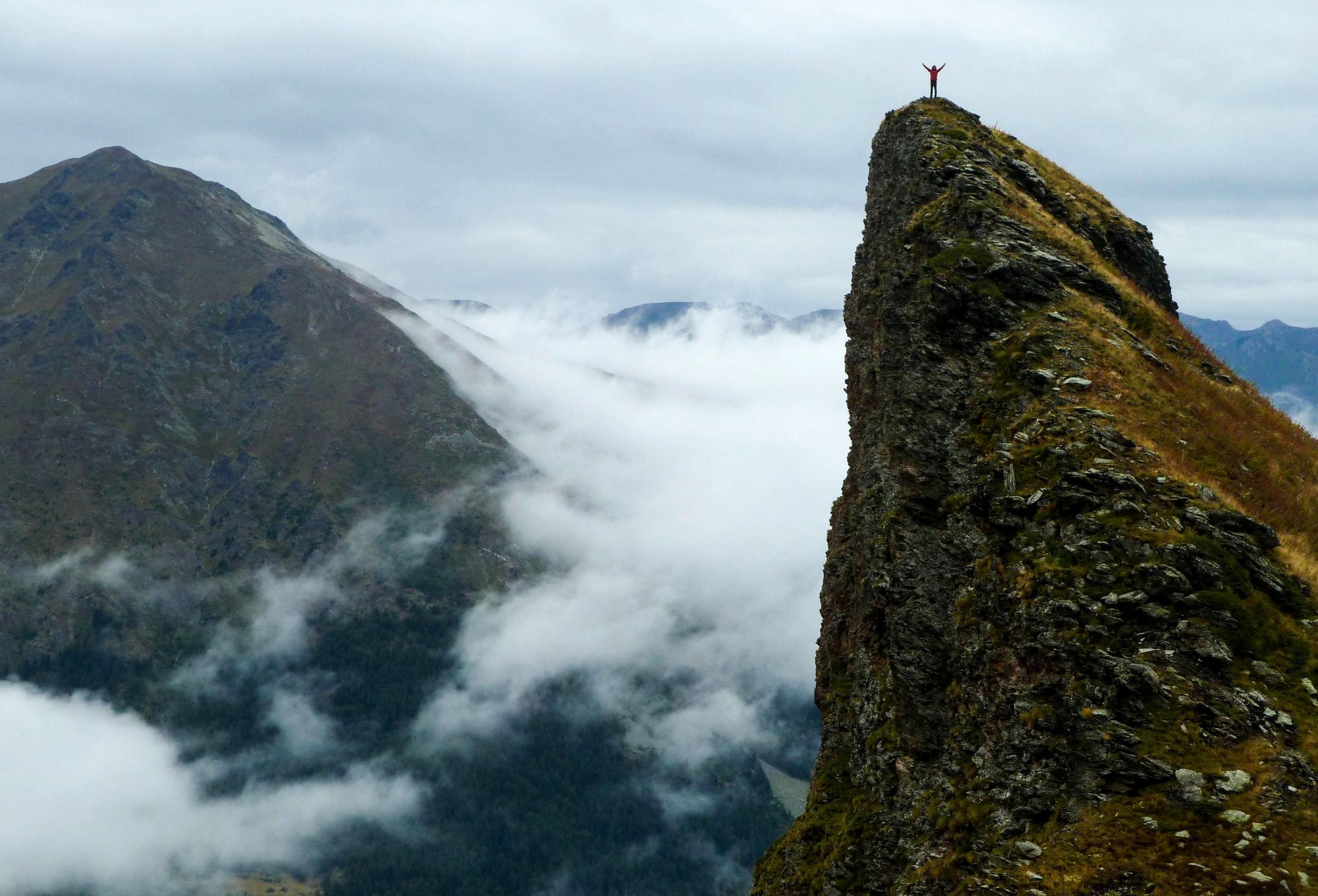
Europe is well known for its multi-day hikes, from the Tour de Mont Blanc to the challenging Selvaggio Blu. Of course, some of the most famous routes, like the Camino de Santiago, can take weeks to complete. For those of us with limited time, a day hike is simply more practical - and luckily, there's no shortage of beautiful day walks dotted across this varied continent.
We’ve selected 15 of our favourite day hikes in Europe, from well-known options like Madeira’s popular PR1 path, to more under-the-radar trails like the Tramuntana Three Peaks Hike in northern Mallorca. They’ll take you along river canyons, up rugged mountains and through volcanic calderas.
Like our 20 best multi-day hikes in Europe, these day hikes will utterly immerse you in breathtaking scenery, taking you off the beaten track and challenging you in the best possible way. There are no mile-long ambles here - the shortest hike on this list takes around 4 hours, and the longest 11 hours. What this means is each of these hikes allows you to soak in the landscape you're travelling through.
It’s important to note that these route descriptions are only short summaries, designed to inspire but not as a substitute for a decent map or detailed guide. Further planning (or a local guide) is necessary to walk any of these trails.
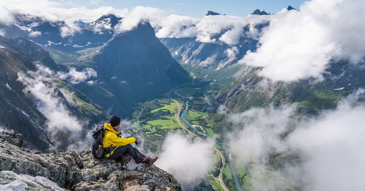
1. Breiskrednosi Summit Hike, Norway
- Best for: awe-inspiring views of the Nærøyfjord
- Distance: 12.8 miles (20.7km)
- Hiking time: 10-11 hours
- Ascent: 1,530m up/1,530m down
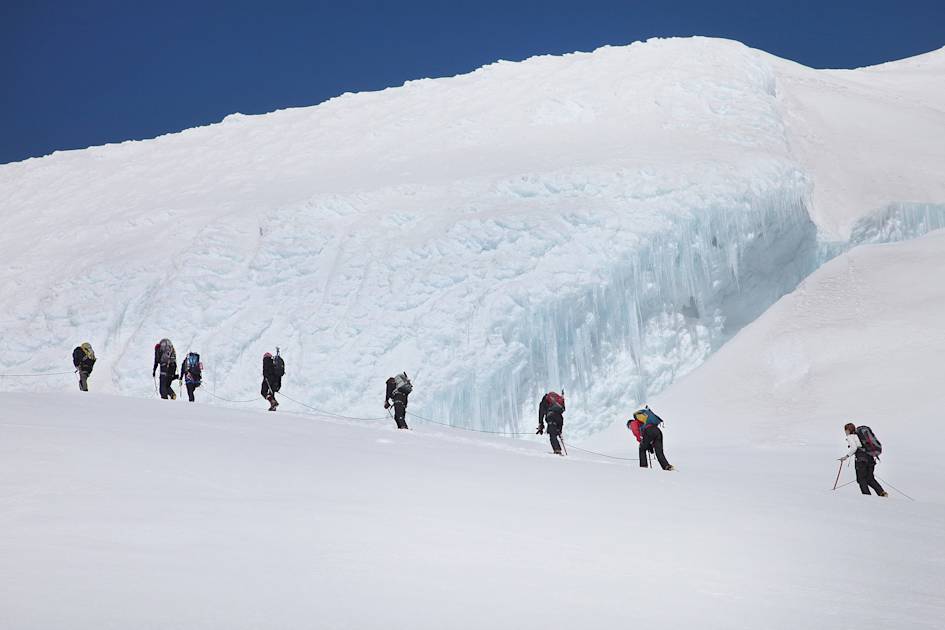
This day hike in Norway involves an ascent of one of the fjord walls in the UNESCO-designated Nærøyfjord, an 11-mile stretch of water surrounded on either side by sheer limestone cliffs. You’ll be climbing up to Breiskrednosi summit (1,189m) on a challenging route that winds up through forest and then into the mountains, zig zagging across the rock to the top. It’s a 10 hour out-and-back trek - made even more difficult when there’s snow present on the trails (often until the end of May).

The trailhead for this hike is located near the fjord-side village of Bakka. It’s accessible by road from Gudvangen, but for a more adventurous option we recommend kayaking from Gudvangen (7.4 miles) along the fjord, and wild camping near the trailhead.
Read more: The Benchmark for Beauty: Kayaking the Fjords of Western Norway
2. Pico do Arieiro to Pico Ruivo (PR1), Madeira
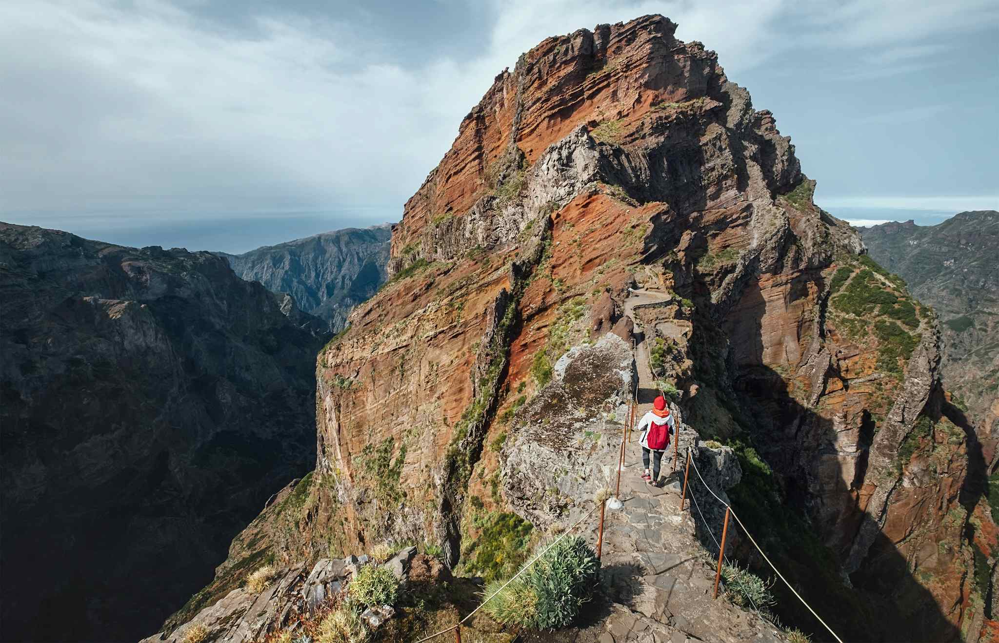
- Best for: climbing to the highest point in Madeira
- Distance: 14.5km (9 miles)
- Hiking time: 7-8 hours
- Ascent: 1250m up/600m down
Starting at the trailhead in Poiso, this is an out-and-back hike on the PR1 path, renowned for being one of the best hikes in Madeira as it traverses the island’s three highest mountains – Pico do Arieiro (1,817m), Pico das Torres (1,851m) and Pico Ruivo (1,862m). Also known as the 'stairway to heaven', the PR1 traces high mountain ridgelines, narrow pathways, steep stairways, and passes through man-made tunnels carved into the rock.
Starting from the car park below Pico do Arieiro, you’ll climb a set of steps to the peak. Follow the signposted route to Pico Ruivo, crossing sheer cliff faces and descending through tunnels, often emerging to far-reaching views. You have the choice of taking the eastern route or western route around Torres (1853m), the second highest peak in Madeira - currently you’ll need to take the west route, through the tunnels, as the east is closed due to rockfall.

The volcanic landscape of this part of Madeira is like something out of Lord of the Rings - think dark grey rock faces rising towards the sky, and paths hewn deep into the mountain. You’ll have to climb a number of steps to reach the summit of Pico Ruivo - the high point of Madeira. From here, it’s back the same way.
Read more: 5 of the Best Hikes in Madeira
3. Sucha Bela Gorge Hike, Slovakia
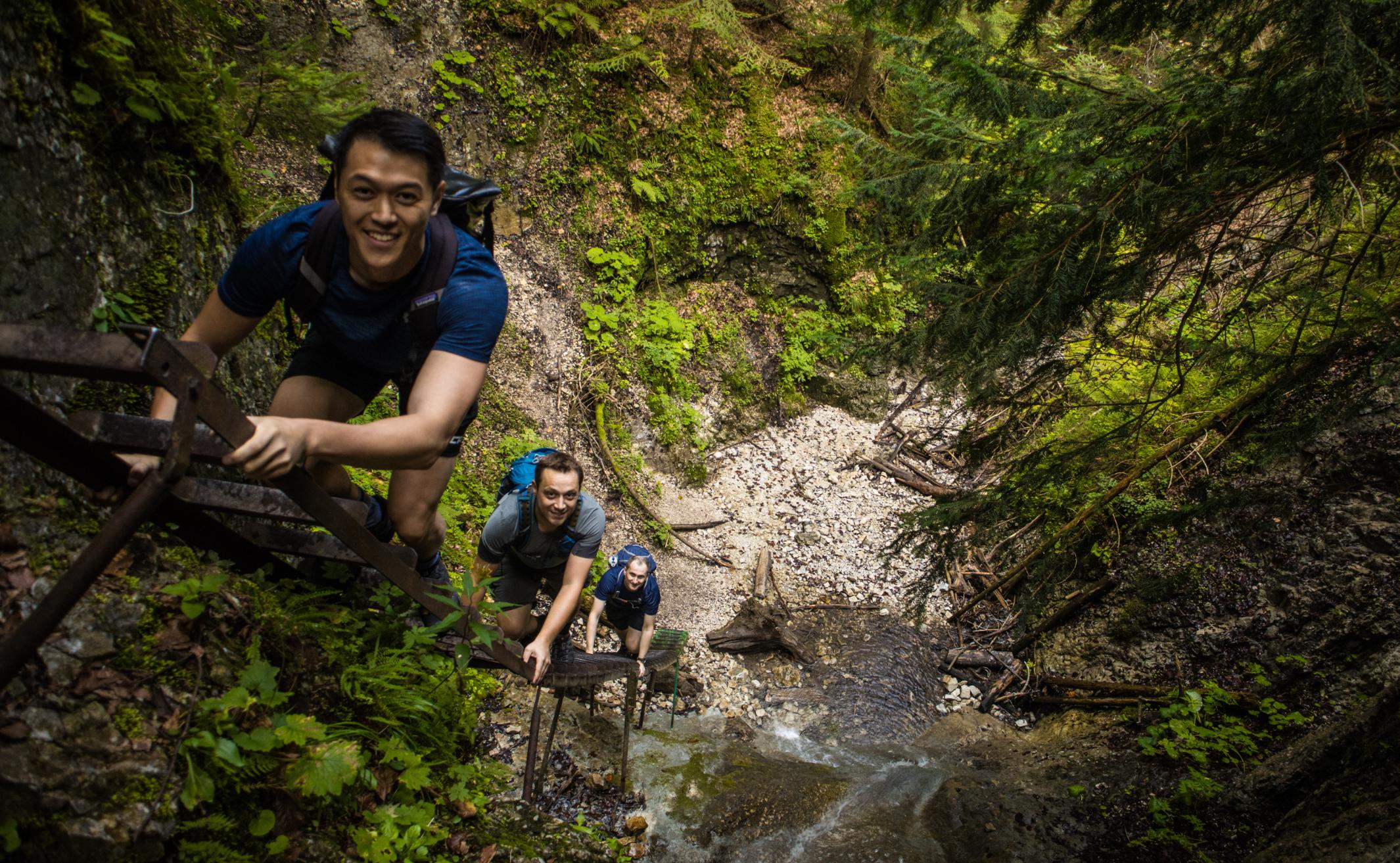
- Best for: obstacle-course-adjacent hiking
- Distance: 17km (10.5 miles)
- Hiking time: 6-7 hours
- Ascent: 520m up
This hike takes you through two gorges - Sucha Bela and Prielom Hornadu - in the aptly named Slovak Paradise National Park, in Slovakia. You’ll hike along Sucha Bela Gorge, one of the longest and most popular canyons in the park. It’s a natural obstacle course with river crossings, where you’ll climb over fallen trees and up metal ladders - you'll even pass a window-like hole in the rock.

You’ll emerge from the gorge into an area of forest. Continue along the trail until you reach a meadow surrounded by mountains - an ideal lunch spot as there’s even a mountain hut serving beer! To close the loop, head back towards your startpoint along the Prielom Hornadu Gorge, where you’ll also find a series of chains and ladders - plus a series of ledges and catwalks rising above the fast-flowing Hornad River.
Read more: Mountains, Ladders & Gorges: the Thrill of Hiking in Slovakia
4. Mount Gjeravica (2,656m) Hike, Kosovo
- Best for: summit scrambles in the Balkans
- Distance: 8.6 miles (14km)
- Hiking time: 5 hours
- Ascent: 1,150m up/1,100m down
If you’re looking for an under-the-radar hike, we recommend climbing Kosovo’s highest mountain, Mount Gjeravica (2,656m), a stony peak in the Accursed Mountains. Located on the border of Albania, Montenegro and Kosovo, it can actually be hiked from trailheads in each of these three countries.
To reach the trailhead in Kosovo, you’ll need to travel down an unpaved road from Junik to Gropa e Erenikut (4x4 only). From here, you’ll head out across verdant meadows - carpeted in blueberries during summer - towards the ridgeline of Gjeravica. The path winds through a boulder field up to a tranquil, heart-shaped alpine lake with the imposing summit reflected in the water. The terrain becomes steeper at the top, but you’ll be rewarded with views of the Accursed Mountains, also known as the Albanian Alps.
You can either descend via the same route, or continue along an alternative trail - if you’re incorporating the ascent into the Balkans Three Peaks Challenge, you’ll head through the Gashi River Gorge to Montenegro, for an ascent of Zla Kolata (2,534m).
5. Tejeda to Roque Nublo, Gran Canaria
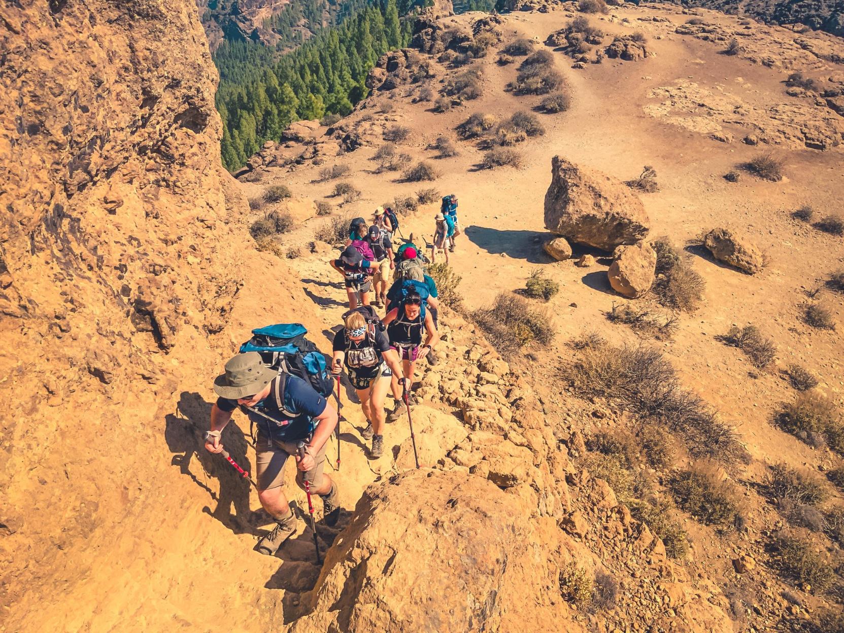
- Best for: exploring Gran Canaria’s enigmatic monolith
- Distance: 11.8 miles (19km)
- Hiking time: 7 hours
- Ascent: 700m up/300m down
Today’s hike in Gran Canaria is a circuit beginning and ending in the small village of Cruz de Tejeda. The first part of the hike takes you down a dirt trail and quiet roads to the village of Tejeda (an alternate start and end point). You’ll walk to Tejeda’s most well-known viewpoint, Plaza Mirador del Ayuntamiento, where you’ll look out over the Tejeda Caldera - Roque Nublo will be visible in the background, jutting out towards the sky. After that you’ll start hiking along a trail that winds through the volcanic rock formations - a relentless three hours of uphill climbing.
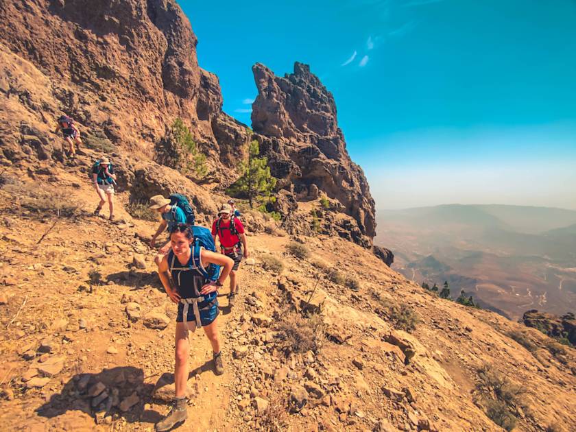
After about three hours you’ll reach a dense pine forest on your left, with panoramic views of the Tejeda Caldera view, including Roque Bentayga and Pico de Las Nieves, the highest point on the island. Soon Roque Nublo will be revealed - you’ll climb up onto a rocky plateau to reach it. Roque Nublo translates to ‘Cloudy Rock’, because it’s often shrouded in mist and cloud - a sight just as majestic and more mysterious than the panorama over the caldera.
Return to Cruz de Tejeda via the La Culata Tejeda hiking area, where you’ll pass unspoilt Canarian villages and cave houses.
Read more: A Guide to Hiking Roque Nublo, Gran Canaria's Enigmatic Monolith
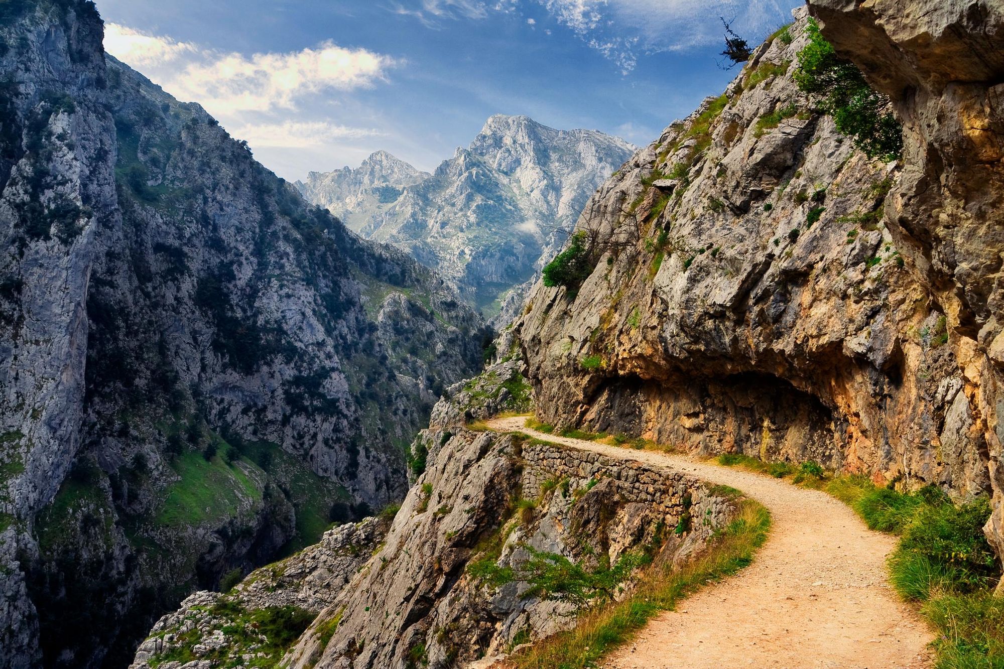
6. Cares Gorge Trail, Spain
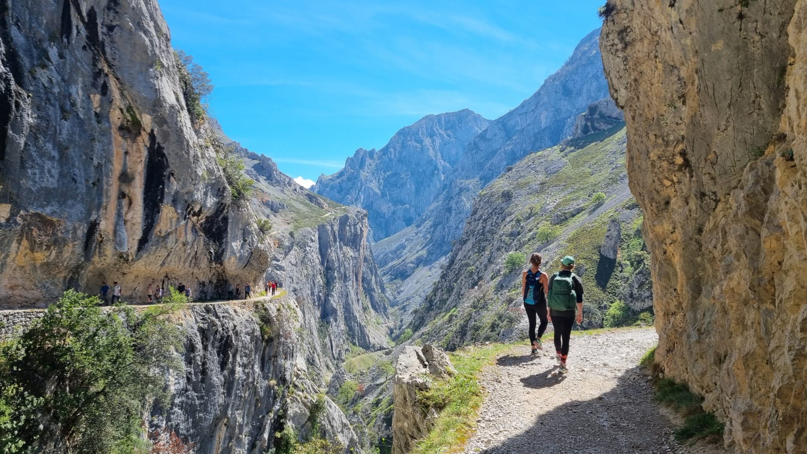
- Best for: exploring the Picos de Europa
- Distance: 8 miles (13km)
- Hiking time: 3-4 hours
- Ascent: 250m up/150m down
This is the best-known day hike in the Picos de Europa, a mountain range and national park in a remote corner of northern Spain. The Cares Gorge Trail (Ruta Cares) is a path hewn into the limestone of an imposing ravine, perched 300m above the Río Cares and surrounded by 2000m-high peaks.
You’ll begin at the trailhead in Caín and set off on the narrow trail. It leads through small tunnels carved out of the rock and across bridges that hang over the abyss, while the river rages below and mountain goats watch from above. Finish the hike at Poncebos, where several mountain huts provide refreshments.

Both Caín and Poncebos are accessible by road, so if you’re doing a guided trip you’ll likely be dropped off at one end and picked up at the other. If you’re travelling independently and have hired a car, then you’ll need to walk back along the Cares Gorge Trail (which will double your hiking time).
7. Justadtinden Summit Hike, Lofoten Islands
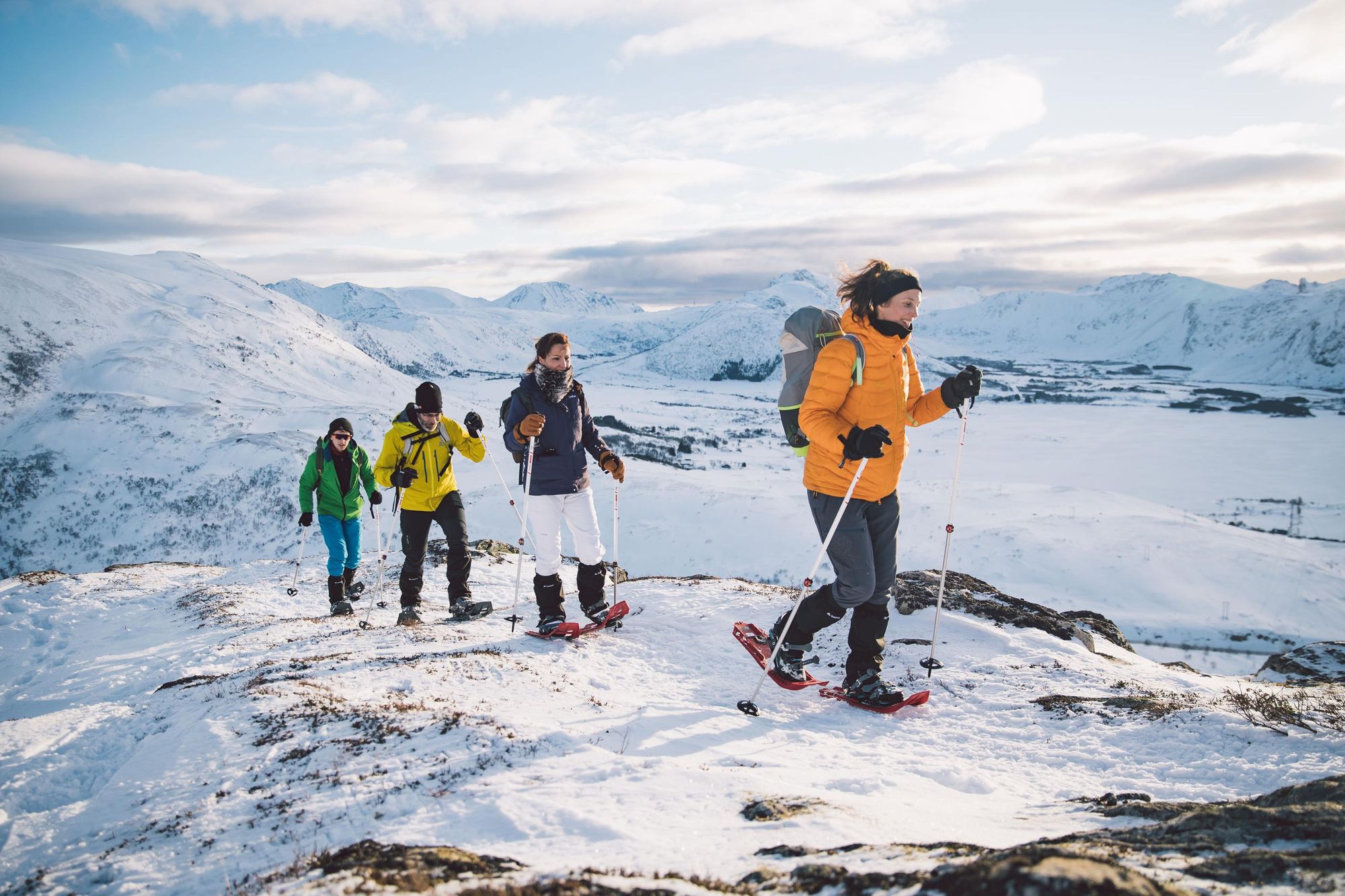
- Best for: views of the Lofoten Islands
- Distance: 7.6 miles (12.2km)
- Hiking time: 5-6 hours
- Ascent: 624m up/624m down
Despite its proximity to Leknes, one of the largest towns on Lofoten, the trail to the summit of Justadtinden (738m) is quiet - it’s described as being one of the most underrated hikes on the Lofoten Islands. Starting at Hagskaret, the first half of the trail winds gently upwards across hills and ridges. But it gradually gains in steepness as the ground becomes rockier, and you head towards the summit.

When you reach the top, soak up the panoramic views of the surrounding ridges, the crenellated fjords with the small red houses perched on the rocky shores. We particularly recommend doing this hike during the winter months - you’ll need snowshoes and walking poles to do so - and immersing yourself in the wild beauty of the snow-covered Arctic wilderness.
Read more: The 7 Best Hikes on the Lofoten Islands
8. Monte Molare Hike, Italy
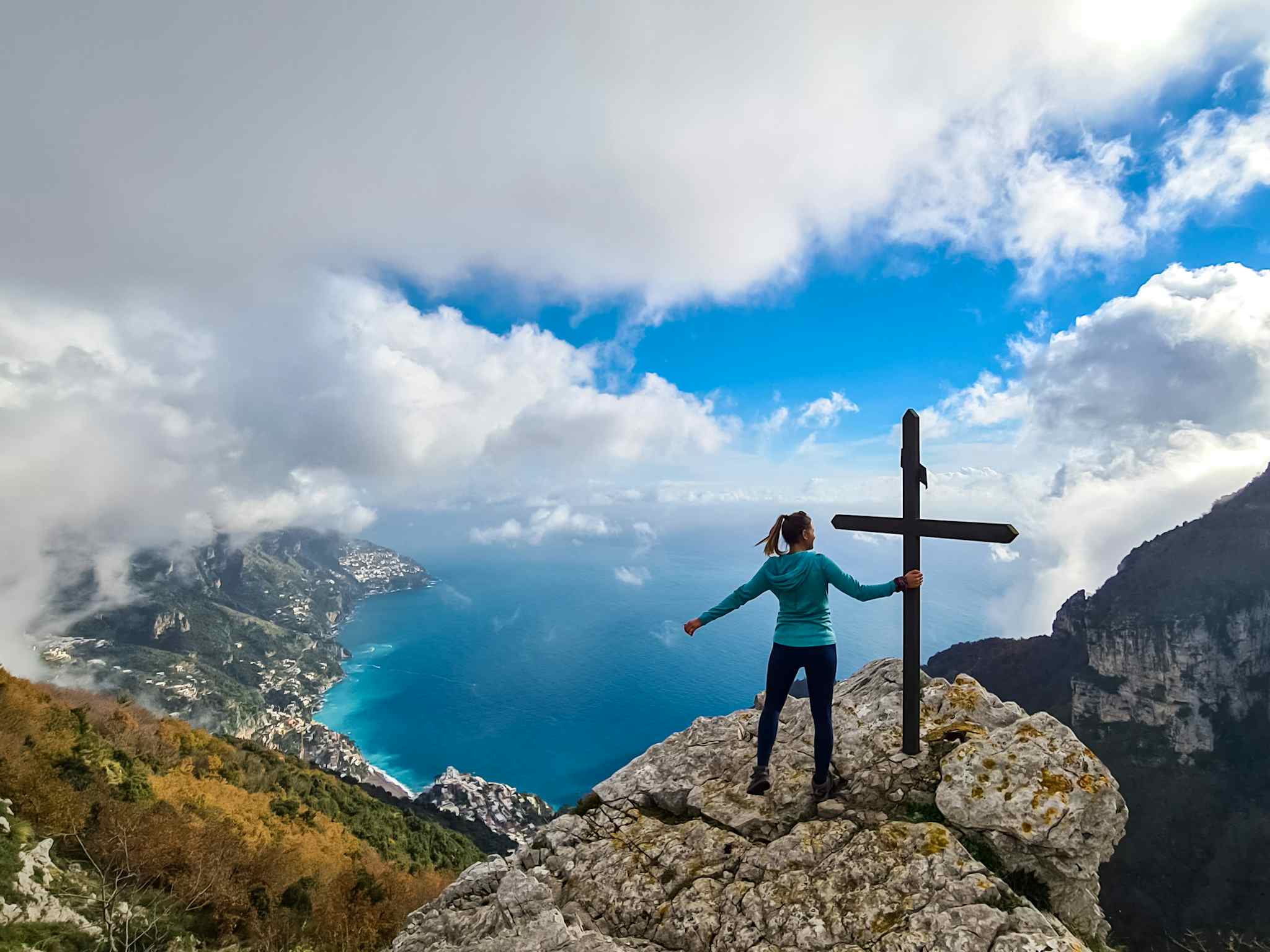
- Best for: experiencing the Amalfi Coast’s quiet side
- Distance: 9.9 miles (16km)
- Hiking time: 7 hours
- Ascent: 950m up/1050m down
One of the most famous hiking routes along the popular Amalfi Coast is the Path of the Gods from Bomerano to Nocelle. But you’ll be sharing the trail with a lot of of hikers on this route, especially during the peak spring and summer months.
Instead, we recommend the quiet Alta Via dei Monti Lattari, a trail tracing the spine of the Lattari Mountains above the busy seaside villages of the Amalfi Coast.
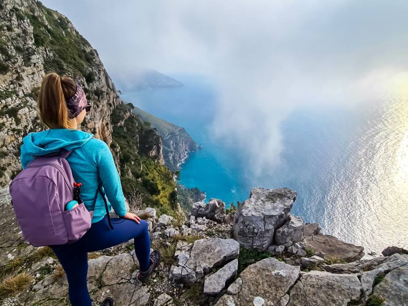
The Alta Via is a long distance hiking path of around 40 miles (65km), but there are some excellent day hikes along the route. We recommend an ascent of Monte Molare (1,444m), the highest point on Amalfi. Starting in Bomerano village, walk upwards through the forest, drinking in the mountain views and seascapes. A steep, steady climb will take you to the summit, where you’ll have a 360 degree view of the Bay of Naples and Vesuvius, the Sorrentine Peninsula and the island of Capri.
Descend the way you came or continue along the Alta Via to the hamlet of Santa Maria del Castello. From here, there’s a zig zag hiking path down the hillside to larger Positano, where restaurants and a beach (and a lot of tourists) await.
Read more: Want to See the Amalfi Coast Without the Crowds? Bring Your Hiking Boots
9. Three Peaks of the Tramuntana, Mallorca
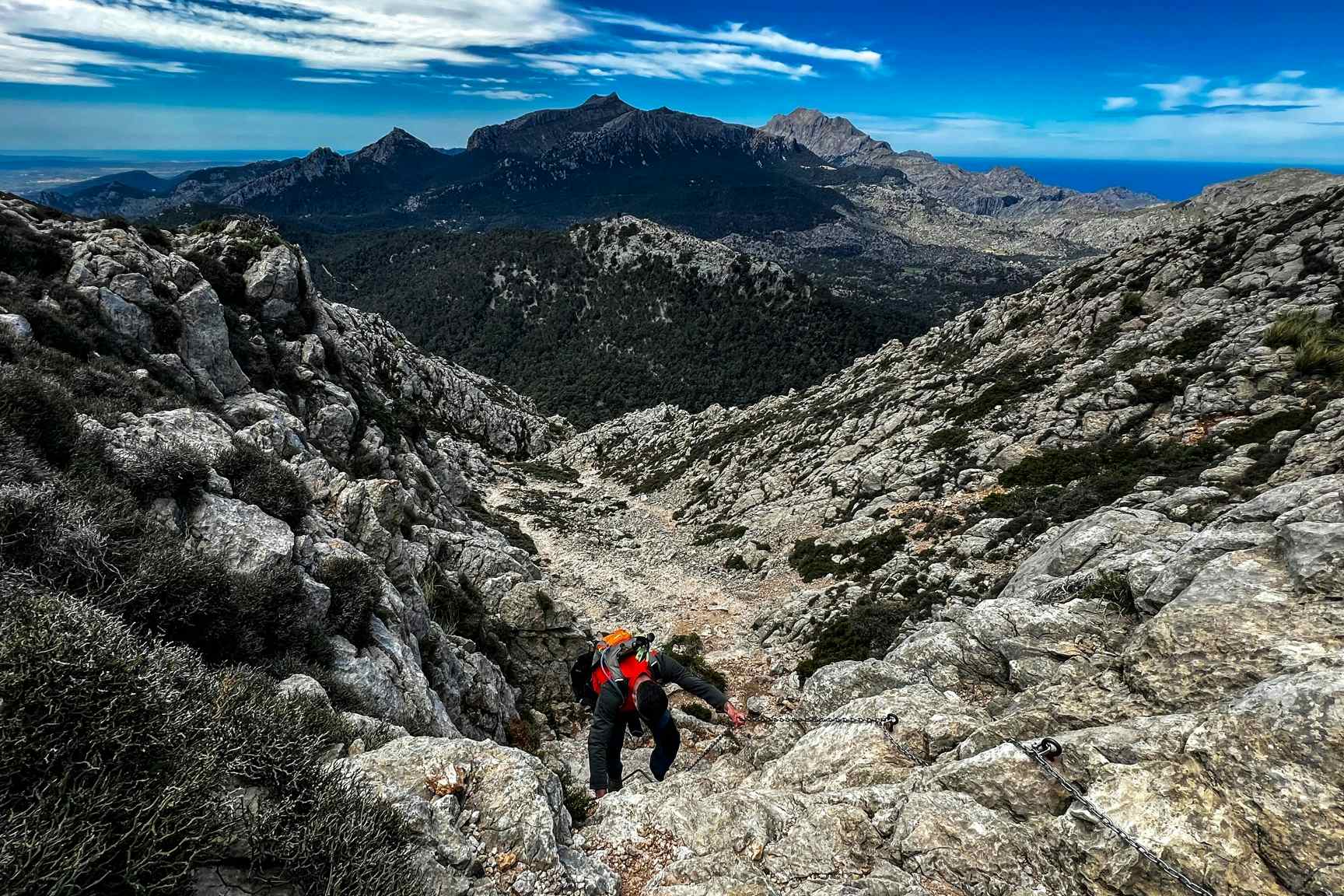
- Best for: discovering Mallorca’s wild side
- Distance: 9.3 miles (15km)
- Hiking time: 5-6 hours
- Ascent: 650m up/650m down
Proof that Mallorca is more than just a ‘fly and flop’ destination. This is one of the most challenging day hikes in the Serra de Tramuntana, a mountain range running parallel with the island’s northern coast. On this circular hike you’ll ascend three of the Traumanta mountains: Sa Rateta (1,113m); Na'Franquesa (1,067m); and Puig de l'Ofre (1,093m).
The hike begins at the Cuber Reservoir, where you’ll ascend on a narrow trail through pampas grass and then rocky slopes to Sa Rateta - you’ll have great views of the surrounding mountains and the lakes in their foothills. There’s a slight descent and then a climb up to Na'Franquesa, over boulders and past stunted oak trees. After the summit you’ll hike along a rocky ridge before descending to a hill that links up to the final summit in your hike - Puig de l'Ofre at 1093m.
As you descend to the col, your hiking path joins two others - one leads back to Cuber, whilst the other one is signposted for Barranc de Biniaraix to Soller, a beautiful seaside village where you can spend the afternoon. The L354 bus runs between Cuber and Soller, making this point-to-point hike possible by public transport.
Read more: It's Time to Rediscover Mallorca, But Not as You Know It
10. Eyjafjallajökull Summit Hike, Iceland
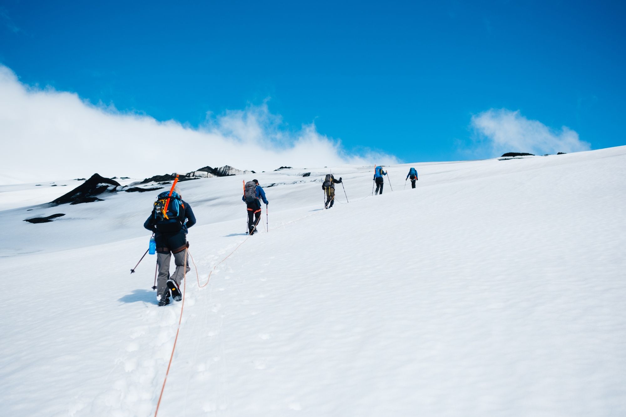
- Best for: summiting a famous volcano
- Distance: 10.5 miles (17km)
- Hiking time: 9-11 hours
- Ascent: 1600m up/1600m down
Eyjafjallajökull is a glacier covering the summit of a 1,651m-high volcano, best known for erupting in 2010 and disrupting European air travel for several days. It’s less well known for its hiking potential, but an ascent of Eyjafjallajökull makes for a challenging day hike through the Icelandic wilderness.
The hike begins at Seljavallalaug (a 100-year-old swimming pool) and ascends steeply up a hill. You’ll pass small streams where you can refill your bottle. After a few hours of ascent you’ll reach the base of the glacier, which requires harnesses, crampons and ropes to climb up - because of this, we’d recommend trekking as part of a guided tour. You’ll climb over the glacier to the summit, where you’ll have amazing views of the ice cap and the land surrounding it. Descend the way you came.
Read more: Iceland's Epic Three Peaks Trail Takes You Up its Most Iconic Summits
11. Vikos Gorge Hike, Greece
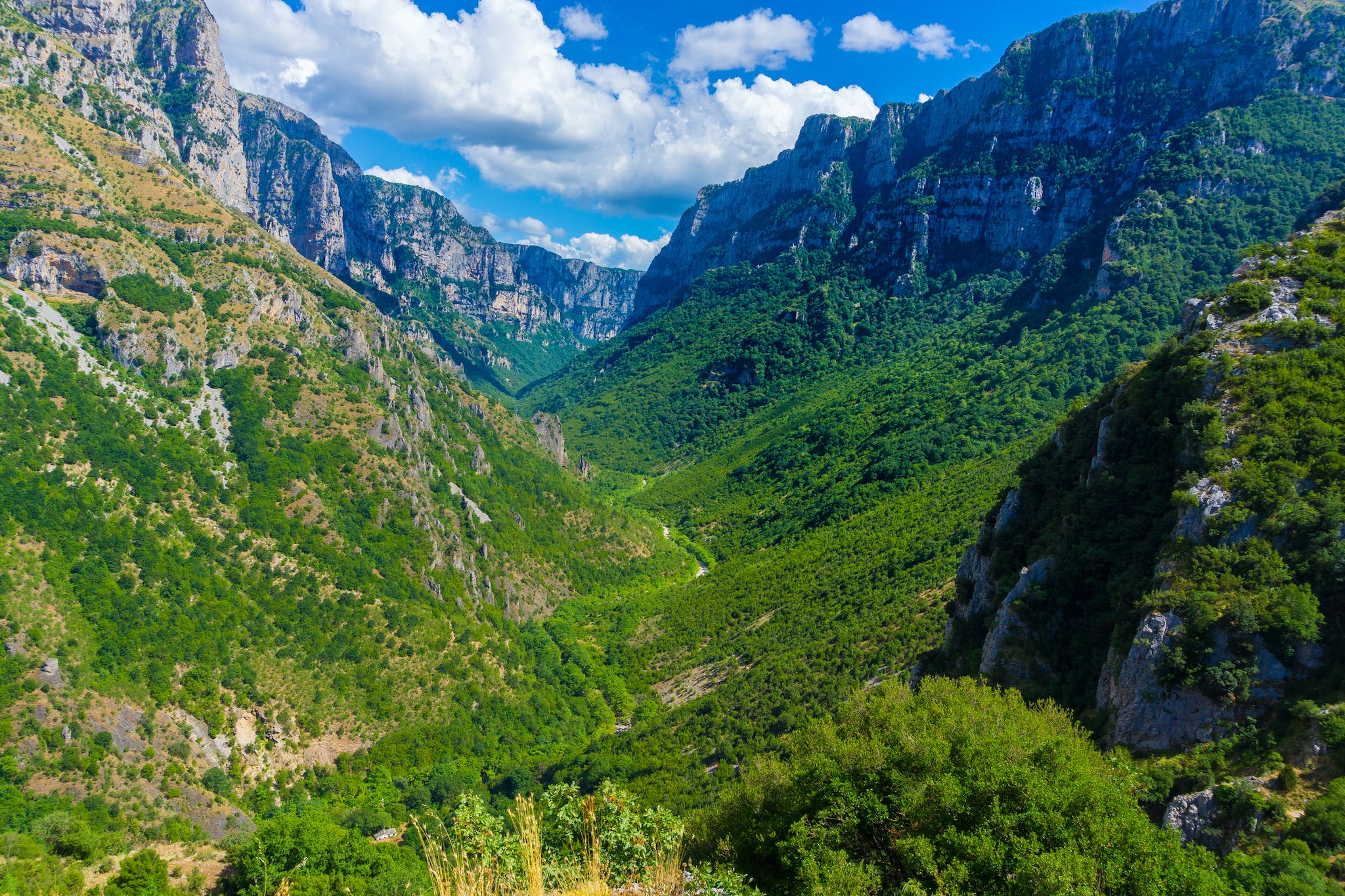
- Best for: exploring an under-the-radar corner of northern Greece
- Distance: 8 miles (13km)
- Hiking time: 5-6 hours
- Ascent: 650m up/800m down
We’d consider Vikos Gorge up there with the best day hikes in Europe. You’ll hike in the shadow of towering 1000m-high walls through the second-deepest gorge in the world (only the Grand Canyon is deeper). This is a truly wild ecosystem, providing a sanctuary to wildlife like European brown bears.
The start point for the hike is the picturesque village of Monodendri. Follow the trail downwards to the bottom of the gorge, down a steep and rocky path, and north through pristine forest. There’ll be clearings in the tree canopy which reveal views of the limestone cliffs on either side.
After around five hours of hiking, the path splits. The left hand path will lead you up a steep path to Vikos Village, where the hike ends. But we recommend following the right hand path a short distance to Voidomatis Springs, which are characterised by their clear turquoise water. Take a refreshing dip in the pool - it’s cold year round, and very refreshing on a hot summer day - and double back on yourself to return to Vikos. If you’re travelling independently, you’ll can arrange a transfer back to Monodendri via the Zagori Mountain Van.
Read more: A Guide to Zagori, Greece's Undiscovered Northwestern Corner
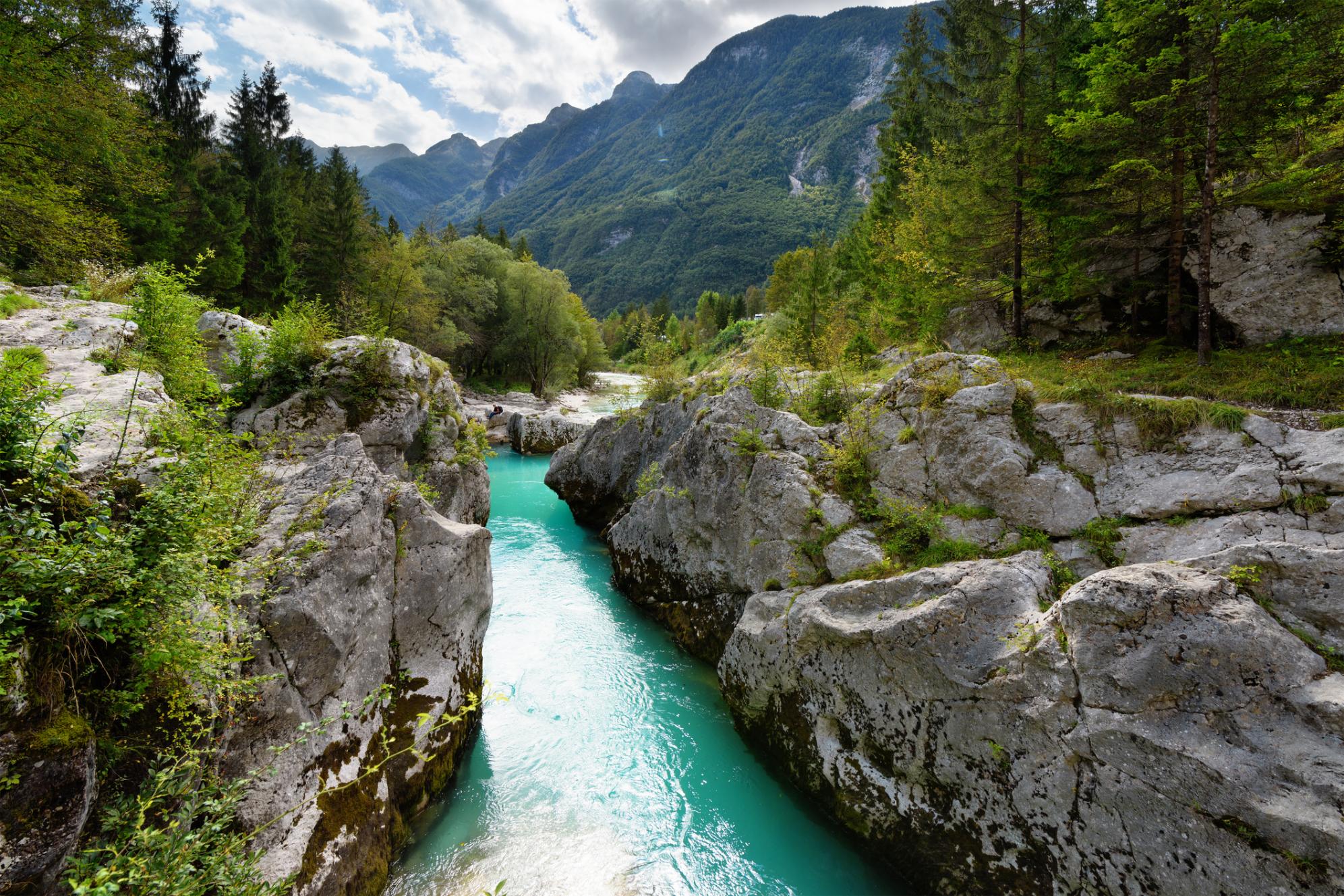
12. The Soča Trail, Slovenia
- Best for: exploring the Julian Alps
- Distance: 16.9 miles (27.3km)
- Hiking time: 8-9 hours
- Ascent: 462m up/895m down
The Soča Trail runs through the heart of the Triglav National Park in Slovenia's Julian Alps, following the turquoise Soča River from its source to the town of Bovec, crossing suspension bridges and traversing steep gorges on your way. You can get a bus to the startpoint at Izvir Soče (‘the source of the Soča) from Bovec, making this a great walk to do by public transport. Remember to pack swimwear - the cold river makes for a refreshing swim on a hot summer day.
Beginning at the hut at Izvir Soče, there’s a steep ascent up to where the river actually begins, with a metal chain to help you. At the top, follow the signs reading "Soška pot" and "AAT" (Alpe Adria Trail) downhill towards the village of Trenta, where you’ll pass through the Minarica Gorge - you can also make a detour to visit the Juliana Alpine Botanical Garden.

The trail continues down the valley towards Soča village, passing through the Small Soča Gorge and Great Soča Gorge, before turning off through the Lepena Valley to the centre of Bovec - you’ll cross a wooden suspension bridge on the way.
13. The Rùm Cuillin Traverse, Isle of Rùm
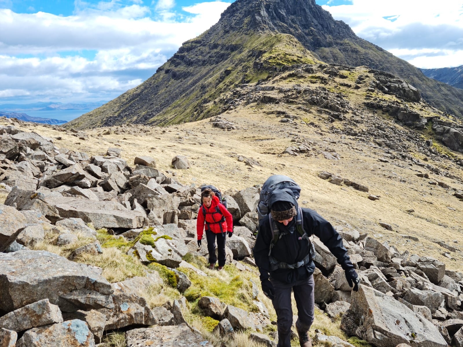
- Best for: wild Hebridean scenery
- Distance: 8 miles (13km)
- Hiking time: 7-8 hours
- Ascent: 1,590m up/1,625m down
This is a tough, day-long expedition with the aim of traversing each of the six peaks that make up the Rùm Cuillin ridge. It begins with a hike up from Dibidal onto the ridgeline, beginning with a steep climb up rock to the summit of Askival (812m) - the highest point on the island- and hiking along the exposed ridgeline to Hallival (722m), the second highest mountain.
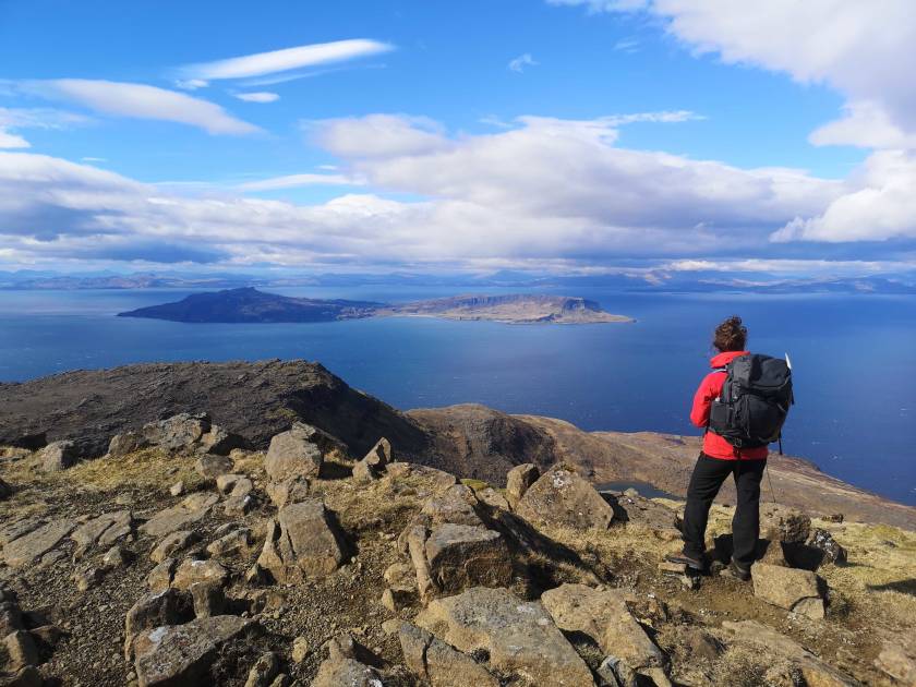
The view from both mountains is tremendous - with views of Glen Harris in one direction and all the way out to the mainland, the Isle of Eigg and beyond in the others. From here you’ll continue along the ridge back down towards Kinloch, which involves some light scrambling, and follow the path along the river into town. On the way you’ll pass the austere, abandoned Kinloch Castle.
Read more: Climbing the Rùm Cuillin, on Scotland's Forbidden Isle
14. Prutaš Summit Hike, Montenegro

- Best for: hikes in the wild heart of Durmitor National Park
- Distance: 6.2 miles (10km)
- Hiking time: 5-6 hours
- Ascent: 700m up/700m down
Prutaš (2,393m) isn’t the highest peak in the Durmitor Mountains, but it’s still known as the ‘King of Durmitor’ thanks to the panoramic views from its summit, and the diversity of landscapes you pass through.
There are two trailheads along the winding P14 road, Dobri Do and Vodorov Do - the former is more challenging, and the latter more scenic. From Dobri Do (on the Šarban Pass), you’ll follow a trail through lush meadows and past the glacial Skrčka lakes, with the towering peak of Bobotov Kuk in the background.
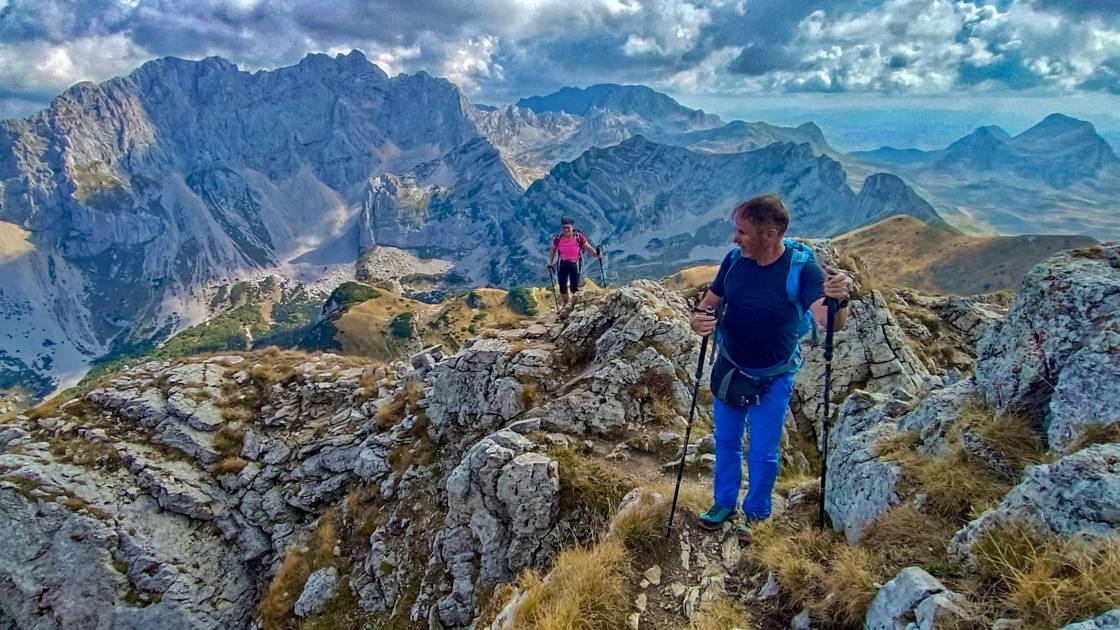
As you climb higher, the beauty of the mountains surrounding you becomes increasingly dramatic. From the grassy plateau at the top, you’ll have vistas of sheer cliffs, deep valleys and even the Adriatic coast on a clear day.
You can descend via an alternative route - a rocky descent down a near vertical slope, where you’ll hold onto rocks as you lower yourself down. After this scramble, there’s a downhill descent zig-zagging down loose scree to the bottom of the mountain.
15. Rifugio Nuvolau and Cinque Torri Hike, Italy
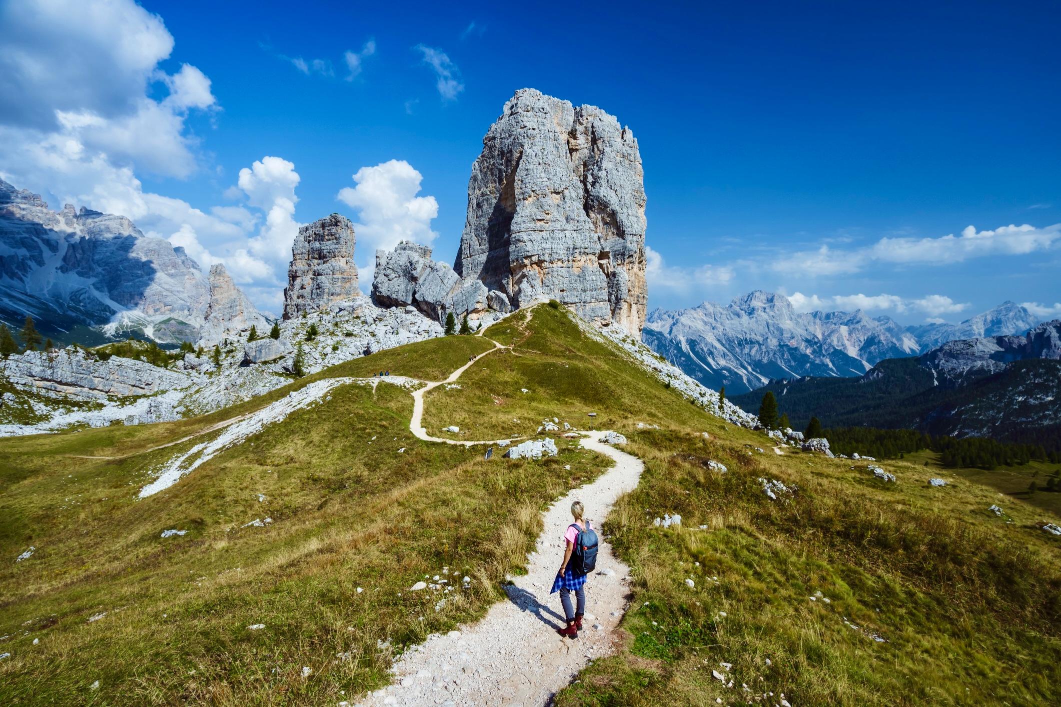
- Best for: Dolomites scenery
- Distance: 10km (6.2 miles)
- Hiking time: 4-5 hours
- Ascent: 400m up/700m down
A circular hike through the breathtaking Dolomites of Italy. Starting on trail 419, the path ascends through a larch and pine forest. Red-white waymarks guide you through a meadow with views of Lagazuoi, Col dei Bos, and Tofana di Rozes.
After reaching Lago de Limedes, the trail continues north towards Monte Averau, ascending through rocky terrain to the saddle between Monte Averau and Croda Negra. Here, the trails merge and lead to Rifugio Averaus, with spectacular views of the stony Dolomite Mountains.
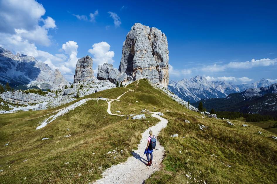
From Rifugio Averau, a path climbs to the ridge of Nuvolau, joining trail 439. The summit, crowned by historic Rifugio Nuvolau, offers 360° panoramic views of the mountains. Descend on trail 439 towards Rifugio Scoiattoli, heading west on trail 440 to Pian dei Menìs. Here, we recommend taking the short detour to the iconic Cinque Torri, a rock formation of five rugged stone towers which was a zone of conflict in the First World War - you can still see the remains of trenches and walkways.
After exploring Cinque Torri, return down the hill to Pian dei Menìs and follow trail 424 along the meadow towards Col Gallina, before a short ascent back to the start point.
Inspired? Check out our epic Hiking Adventures in Europe, taking you through ancient forests, volcanic lava fields and up towering peaks.