


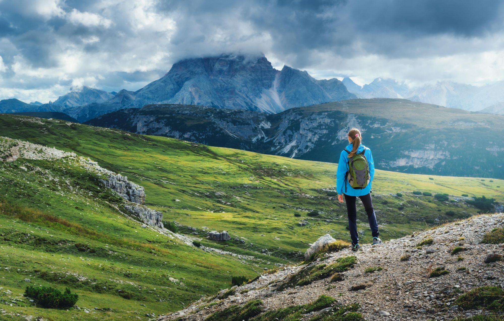
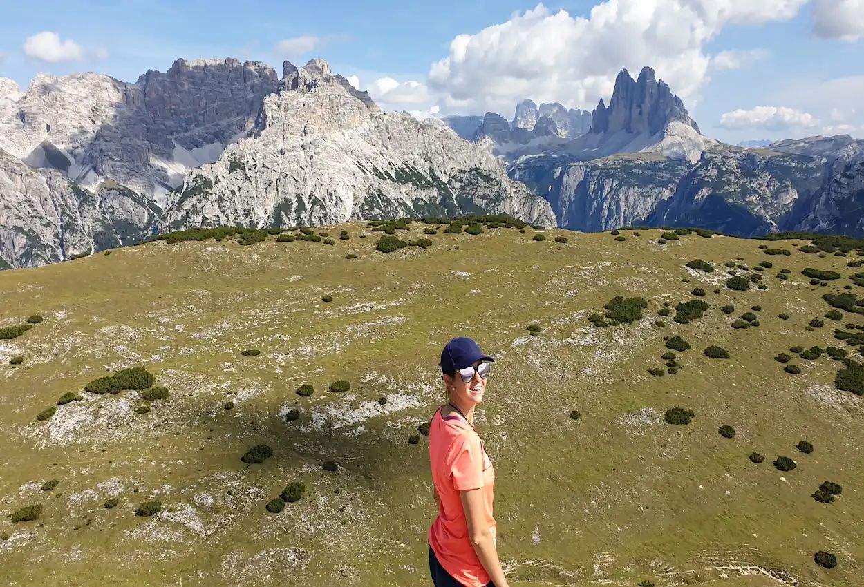
The Dolomites are a UNESCO-designated mountain range in northern Italy, renowned for their distinctive and attractive mountain landscapes. Their iconic jagged limestone peaks are instantly recognisable, rising as sky-piercing spires and pinnacles from austere rock walls and lunar-like plateaus. This dramatic stonescape is a stark contrast with the region’s lush green meadows and verdant forests.
“I'm originally from the region where the Dolomites are, Veneto, but I've hiked all around the world,” says Marta Marinelli, who designs trips for Much Better Adventures. “After visiting so many places, like Nepal’s Himalayas, I still believe I have one of the world’s most beautiful landscapes right on my doorstep.
“The hike around the Tre Cime is famous for a good reason. It's definitely one of the top three hikes I've ever done in my life. It makes you feel so small; you’re immersed in this immense, incredible landscape.”
While the Dolomites is known for its hut-to-hut routes, in particular the iconic Alta Via 1, there are also multiple options for day hikes. Ranging from challenging summit hikes and via ferrata routes to lakeside strolls, there’s something for hikers of all different skill levels.
Where to Stay When Hiking in the Dolomites
The Dolomites cover an area of 6,155 square miles (15,942 sq. km), so it’s impossible to explore them in entirety across a single trip. Most hikers choose a convenient base and complete day hikes from there.
“The most iconic and searched area in the Dolomites is the Val Pusteria, the area around the Tre Cime,” says Marta. “It offers the most iconic views of the spires and rocky peaks. It has a lot of different trails and they’re easily accessible, with a great public transport network. The area near the iconic town of Cortina (near the Val Pusteria) is also very popular.
“However, these areas attract a larger number of visitors, which is maybe one of the downsides. But there are also other valleys of the Dolomites that are less explored. For example, the area near the town of Selva di Cadore, which is slightly more off-the-beaten track than Cortina to the north.
“I also like the Val di Funes. It's a completely different landscape to Val Pusteria. It's more mellow with rolling meadows dotted with tiny little villages, alpine-style buildings with thatched roofs. There aren't as many trails within reach as the area around Cortina, but those that you have are absolutely spectacular. It's much closer to the border with Austria. You have great views of the Odle group and the Geisler Alm Dolomites as you gain altitude.”
Read more: 10 of the Best Hikes in the Dolomites
The Best Day Hikes in the Dolomites, Mapped
These are the start points of the hikes listed below, which are scattered across the Val di Funes, the Val Pusteria, Val Fiorentina or near the town of Cortina d'Ampezzo.
Best Day Hikes in the Val Pusteria
1. Val Fiscalina to Lake Landro via Tre Cime
- Start/Finish: Val Fiscalina/ Lake Landro (point to point)
- Distance: 9.3 miles (15km)
- Walking time: 6-7 hours
- Difficulty: challenging
- Best for: a lesser-known route to Tre Cime
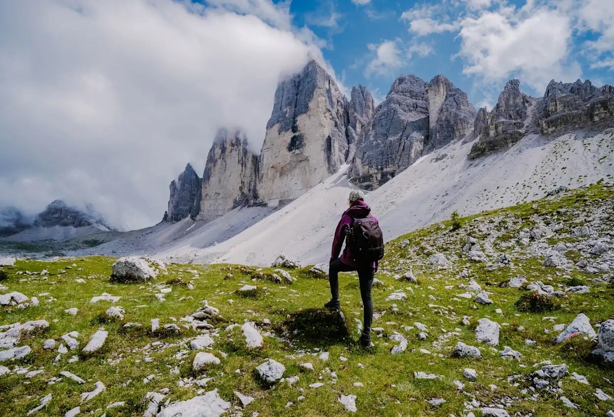
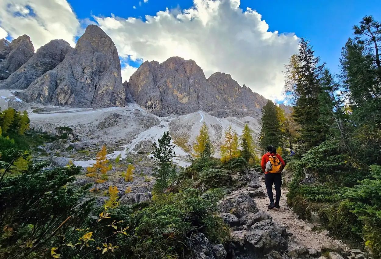
The hike up to the iconic Tre Cime di Lavaredo (the three peaks) is one of the most popular day hikes in the Dolomites. This means the trail gets crowded in the peak months of July and August. This more challenging variant offers the same spectacular views of the dramatic spires, but without the crowds.
“It's not the classic 10 kilometre loop that circles the Tre Cime,” says Marta. “Instead, you approach the peaks from the back. There’s a big climb up, followed by a long descent. So you avoid all the queuing up for parking and the congested traffic.”
Beginning at the head of the Val Fiscalina, you follow path 103 through the forest. As you ascend, the trees thin out, revealing ever-expanding panoramas of rugged peaks. Continue towards the Zsigmondy-Comici Refuge (2,224m/7,297ft), dramatically positioned beneath Croda dei Toni, Cima Undici, and Monte Popera – an unforgettable amphitheatre of Dolomitic rock.
From here, the trail climbs higher to Refugio Locatelli (2,438m/ 7,999ft), where you can enjoy lunch while looking out towards the unmistakable stone towers of the Tre Cime di Lavaredo. You’ll then descend through the Landro Valley to Lago di Langro, where you can admire the reflections of jagged peaks in the clear water.
2. Monte Specie (Strudelkopf)
- Start/Finish: Prato Piazza (out and back)
- Distance: 6.2 miles (10km)
- Walking time: 3-4 hours
- Difficulty: easy
- Best for: a short but sweet summit hike
From the Prato Piazza car park, follow path 37 to Rifugio Prato Piazza, on a wide plateau surrounded by mountains. When you reach a multi-path junction, follow path 40/40a, which ascends gently through forest and an alpine meadow.
"Monte Specie is considered one of the most spectacular and accessible panoramic balconies of the Dolomites," says Stefania Donataccio, who works for a trekking company in the Dolomites. "The hike follows easy forest tracks across the Prato Piazza plateau and up to Rifugio Vallandro (2,040m), adapting both to those looking for a relaxed walk and to those aiming for the summit."
Turn left and follow path 34 to Monte Specie, also known as Strudelkopf (2,307m/ 7,569ft). The ascent leads you up grassy slopes to the summit, which takes around an hour.
"From the summit cross the view opens in 360°, embracing the Croda Rossa spires, the Cristallo group, Marmolada and, front and centre, the legendary Tre Cime di Lavaredo. A true spectacle not to be missed by any mountain lover," says Stefania.
Descend from the summit and enjoy a light lunch at Rifugio Vallandro, before returning the way you came.
Best Day Hikes Near Cortina d’Ampezzo
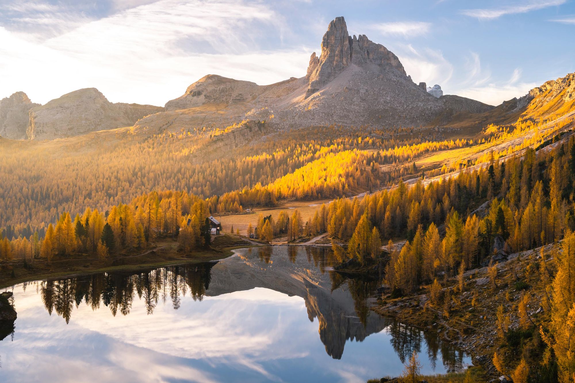
3. Croda da Lago
- Start/Finish: Ponte de Ru Curto (circuit)
- Distance: 8 miles (12.8 km)
- Walking time: 4-5 hours
- Difficulty: moderate
- Best for: autumn foliage
Croda da Lago is a small jagged mountain chain in the Ampezzo Dolomites, near Cortina, with a popular circular day hike. Beginning at the Ponte de Ru Curto trailhead, you’ll climb gently uphill through a sun-dappled forest. After around half an hour you’ll reach a junction.
“You can either go left—and in that case you reach Rifugio Croda da Lago pretty quickly, within half an hour with a gentle elevation—or you turn right like we did, for a steady ascent of around 90 minutes,” Marta says. “Most people do the former, but I prefer to leave the easier part for later in the day when you're more tired and start when you have good stamina on the more challenging route.
This is one of the most beautiful hikes to do in autumn because of the blazing colours
“After leaving the forest you find yourself on a rocky slope. It’s very steep, involving scrambling and bouldering but very exciting. It resembles the Tre Cime in some parts because you have these limestone spires overlooking you. Then suddenly you reach the Forcella Rossa (‘forcella’ means ‘saddle’) and suddenly the landscape changes. As you turn left and you circle towards the Rifugio, you enter the Mondeval Valley which is absolutely spectacular, with green meadows.”
After around 90 minutes you’ll reach the rifugio, located on the shores of Lake Federa, surrounded by trees and mountains. It makes for a good lunch stop. From here, take the gentle ascent back through the forest towards the start point.
“This is one of the most beautiful hikes to do in autumn because of the blazing colours. So it was amazing to see the landscapes and foliage suddenly starting to turn,” Marta says. “It’s popular but do it anticlockwise and you’ll meet fewer people. We didn’t see anyone for the first two hours.”
4. Lago di Sorapis via Forcella Marcoira
- Start/Finish: Passo Tre Croci (circuit)
- Distance: 9.7 miles (15.7km)
- Walking time: 5-6 hours
- Difficulty: challenging
- Best for: exposed ledges, lakeside scenes
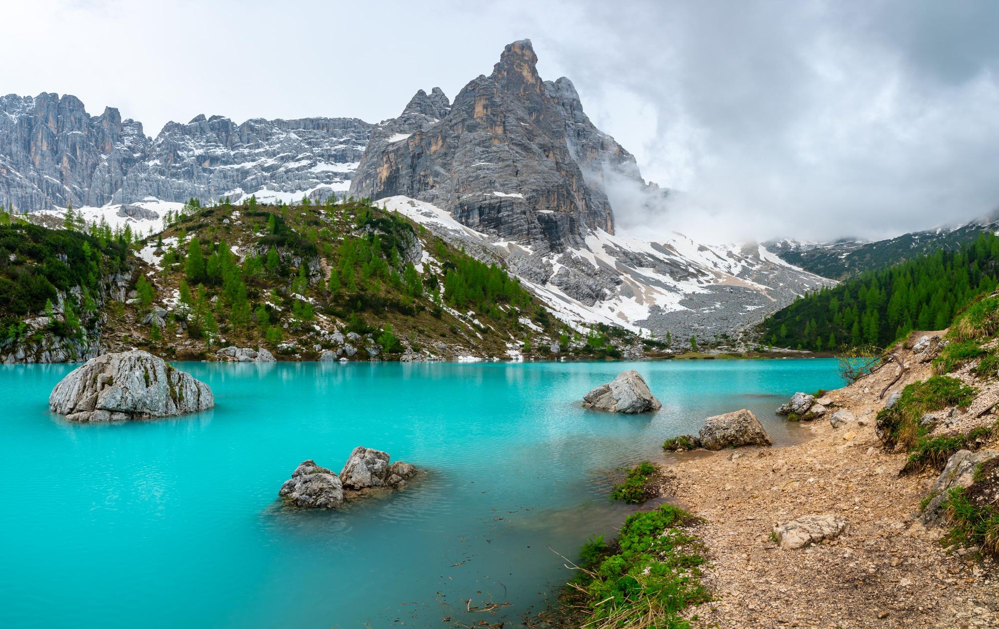
Lago di Sorapis is a glacial blue lake located at an elevation of 1,925m (6,316 ft) and surrounded by rugged peaks. Most people complete it as an out-and-back hike, but we recommend undertaking the more challenging circular route where you’ll encounter fewer people on the trail.
Beginning at the Passo Tre Croci car park, you’ll follow path 215 through a pine forest until the trees clear and you have a spectacular view of the Tre Cime. Follow the path up a metal staircase and along a narrow ledge (there are metal cables in places for support). After completing this section, you’ll continue to the lake along a stony path, where scrambling is sometimes necessary. After around two hours you’ll reach the lake.
“I wasn't expecting how precarious the trail was on the approach,” Marta says. “It's not challenging in terms of length but there are exposed bits where the trail is very narrow and you have to cling onto the rock, really mind your balance. But then once you get there, it's just incredible. You’ve got this blue turquoise lake wrapped by mountains and spires.
It's just incredible. You’ve got this blue turquoise lake wrapped by mountains and spires
“It’s become more popular recently, so set off early during peak season. If you do the out-and-back route there's no way to overtake people. Congestion is more common than on other trails that are wider or where hikers just disperse as they go along. That’s why the circular route is better.”
Return along path 215, but after around 10 minutes of hiking turn left on path 216 (signposted to Ciadin del Loudo). The narrow trail climbs steeply upwards for around 400m (1,312ft), before zig-zagging up a shoulder and dropping down onto a narrow ledge on the other side.
The path then drops into Ciadin del Loudo, a large grassy basin, and ascends up to Forcella Marcoira (2,307m/ 7,569ft). It descends steeply into a rocky gully, then takes you back into the forest. Turn left at the junction, following path 213 back to your starting point.
5. Refugio Averau & Cinque Torri
- Start/Finish: Col Gallina (circuit)
- Distance: 5.9 miles (9.6 km)
- Walking time: 4-5 hours
- Difficulty: moderate
- Best for: World War 1 landscapes
Starting at Passo di Falzarego near Col Gallina, the trail climbs steadily through forest to Lago di Limedes, then ascends a rocky, boulder-strewn path to Forcella Averau, where you’ll be treated to views of the Lagazuoi and Tofane mountains. Continue uphill to Rifugio Averau and then Rifugio Nuvolau (2,575m/ 8,448ft), the highest point of the hike.
Built in 1883, Rifugio Nuvolau is the oldest mountain hut in the Dolomites, and offers some of its best panoramic views—stretching across peaks such as the Tofane, Marmolada, Civetta, Pelmo and the Sella Group.
After taking in the views, the route descends via Rifugio Scoiattoli to the Cinque Torri area. Hikers can explore the World War I trenches and exhibits of this open air museum, before looping back toward the starting point.
Read more: A Guide to the Dolomites' Cinque Torri
Best Day Hikes in the Val Fiorentina (near Selva di Cadore)
6. Passo Giau & Mondeval di Sora
- Start/Finish: Passo Giau (out and back)
- Distance: 7.4 miles (12km)
- Walking time: 4-5 hours
- Difficulty: moderate
- Best for: Iconic mountain passes
Beginning at Passo Giau, considered one of the most scenic passes in the Dolomites thanks to its panoramic views of some of the region’s most iconic peaks, including the Nuvolau, Averau, and Tofane ranges. Follow trail 436 across undulating fields and three mountain passes, the last of which is Forcella Giau (2,370m/ 7,776ft). You’ll find yourself in a green plateau studded with boulders and surrounded by jagged limestone walls.
From there you’ll descend to the Mondeval Plateau, passing a small lake (Lago delle Baste) and climbing the grassy ridge to the summit of Monte Mondeval, where you’re rewarded with wide-ranging panoramas of peaks such as Monte Pelmo, Monte Civetta and the austere Lastoni di Formin wall.
After the summit you loop across the plateau, passing the Mesolithic burial site of the “Man of Mondeval”, the skeleton of a hunter dating back 7,500 years. Return via trail 436 to Passo Giau.
7. Col de Mèz to Forcella Forca Rossa
- Start/Finish: Col de Mèz (circuit)
- Distance: 5.5 miles
- Walking time: 3-4 hours
- Difficulty: easy
- Best for: winter snowshoeing.
This high-altitude circuit hike takes you to Forcella Forca Rossa (2,490m/8,169ft), a wild mountain saddle with expansive mountain views. It's particularly enjoyable in the winter months, when you can use snowshoes to navigate the snowy trails and you’ll barely encounter a soul.
Setting off from Col de Mèz, the trail climbs gently through quiet larch woods before opening out into wide pastures, where the old Casoni di Valfredda huts sit quietly beneath the peaks. Crossing a small stream, the route ascends steadily through the meadows into a remote valley, where a wooden shrine marks the turn towards the upper ridge.

As you climb higher, the landscape becomes wilder and more expansive, the grassland scattered with boulders. The final push to Forcella Forca Rossa is steep but rewarding, with panoramic views of the Pale di San Martino, San Lucano, Civetta, and Moiazza ranges.
After a break at the saddle, descend via a ridge to a pass between Valfredda and Fuciade. A gentle descent along a well-maintained trail then leads you back through the forest to your starting point.
Best Day Hikes in the Val di Funes
8. Adolf Munkel Trail
- Start/Finish: Zanser Alm car park (circuit)
- Distance: 6.2 miles (10km)
- Walking time: 4 hours
- Difficulty: moderate
- Best for: sunset views
The Adolf Munkel Trail is named after the founder of the Dresden Alpine Club, who originally created the route. It’s known for being one of the most scenic easy day hikes in the Dolomites, with views of the Odle/ Geiser peaks in Val di Funes.
“It was a hidden gem until a few years ago but it's become more well known, mainly because it's super photogenic,” Marta says. “You start by hiking through a gentle green valley. But as you gain altitude the view changes completely and you’re below these giant peaks; completely dwarfed by them.”
As you gain altitude the view changes completely and you’re below these giant peaks; completely dwarfed by them
Follow trail 36 from Zanser Alm car park, winding through woodland. When you reach a junction, turn left to Dusler Alm mountain hut. You’ll climb uphill through and the forest will clear, opening up into an Alpine meadow beneath the striking limestone towers of the Odle/Geisler range. You’ll dip back into the forest as you hike to Geisler Alm, a photogenic spot with some amazing views of jagged peaks. Return to Zannes car park along trail 35, passing through more scenic meadows along the way.
The hike is particularly scenic during sunset, when the mountains glow gold. We recommend starting in the late afternoon, so you aren’t caught out hiking in the dark.
9. Ranui to Rifugio Brogles
- Start/Finish: Ranui (out and back)
- Distance: 8.7 miles (13km)
- Walking time: 5-6 hours
- Difficulty: moderate
- Best for: exploring the Val di Funes
Follow path 28 from the village of Ranui through lush meadows and dense larch forests, gradually ascending along a trail that follows a mountain stream. The route winds gently beneath the dramatic spires of the Odle Group, including Cima Fermeda and Seceda.
As you climb higher, the forest opens up to wide alpine pastures with sweeping views across the Funes Valley. Your destination is Rifugio Brogles (2,045m/6,709ft).
"Nestled in a beautiful high‑mountain clearing at 2,045 m between the Val di Funes and the Val Gardena, the Malga Brogles mountain hut sits at the foot of the majestic peaks of the Gruppo delle Odle in the Parco Naturale Puez‑Odle," says Stefania. "Set amid wide pastures, the hut provides an ideal stop for families eager to soak in the natural scenery and enjoy local cuisine."
Enjoy lunch at the rifugio (open from July to September), before retracing your steps.
10. Rifugio Genova & Col di Poma
- Start/Finish: Zanser Alm (out and back)
- Distance: 8.7 miles (13km)
- Walking time: 6 hours
- Difficulty: challenging
- Best for: Alpine landscapes
From the Zanser Alm car park, follow trail 33 as it climbs steadily through alpine pastures and pine forests. You’ll pass the Kaserill mountain hut, the only one in the valley producing its own cheese – stop for a tasting before continuing the ascent to Rifugio Genova and the nearby Col di Poma (2,422m/7,946ft), a lookout surrounded by the austere rock amphitheatre of the Odle and Puez groups.
According to Stefania, it's one of the most breathtaking hikes in the Dolomites.
"As you ascend to the summit, you're offered uninterrupted views of the Odle peaks and Alta Badia," she says. "From the top cross of Col di Poma the panorama spans the entire Val di Funes and Alta Badia, making this an unforgettable experience for nature lovers."
There are some narrow and exposed sections along the route, but experienced hikers won’t find it too technical.
FAQs
What is the most scenic hike in the Dolomites?
The Tre Cime di Lavaredo circuit is frequently named one of the most beautiful hikes in the Dolomites, thanks to its views of the limestone spires of the Tre Cime (or ‘three peaks’). The hike to Lago di Sorapis, a glacial turquoise blue lake encircled by stony peaks, is also very popular, while the Croda da Lago is considered one of the most beautiful hikes for autumn foliage.
What are some easy day hikes for beginners in the Dolomites?
The Cinque Torri is an easy hike through a rolling meadow surrounded by the five iconic limestone towers and past remnants of WWI trenches and gun emplacements. You can even take a cable car to the start point. Other options include a circuit of Lago di Braies or a short hike up to Passo Giau and its viewpoints.
What are some short hikes in the Dolomites under five hours?
Hikes under five hours in the Dolomites include the Croda da Lago hike, the Viel dal Pan hike and the Adolf Munkel Trail. There are many other options.
How difficult is the Tre Cime di Lavaredo hike?
The Tre Cime hike is considered an easy to moderate hike, involving around 400m (1,312ft) of ascent and a walking distance of 6.4 miles (10.3km). A more challenging variant begins in the Val Fiscalina and climbs up to the Tre Cime by a lesser-known route.
How crowded are the Dolomites hiking trails in July and August?
July, and especially August, is peak season for hiking in the Dolomites. Popular trails, such as the Croda da Lago or Cinque Torri, can get crowded. However, there are plenty of ways to beat the crowds. Hit the trails earlier or later in the day. Search for more challenging variants to popular hikes, or lesser-known hikes.
What Dolomites hiking holiday package has day hikes included?
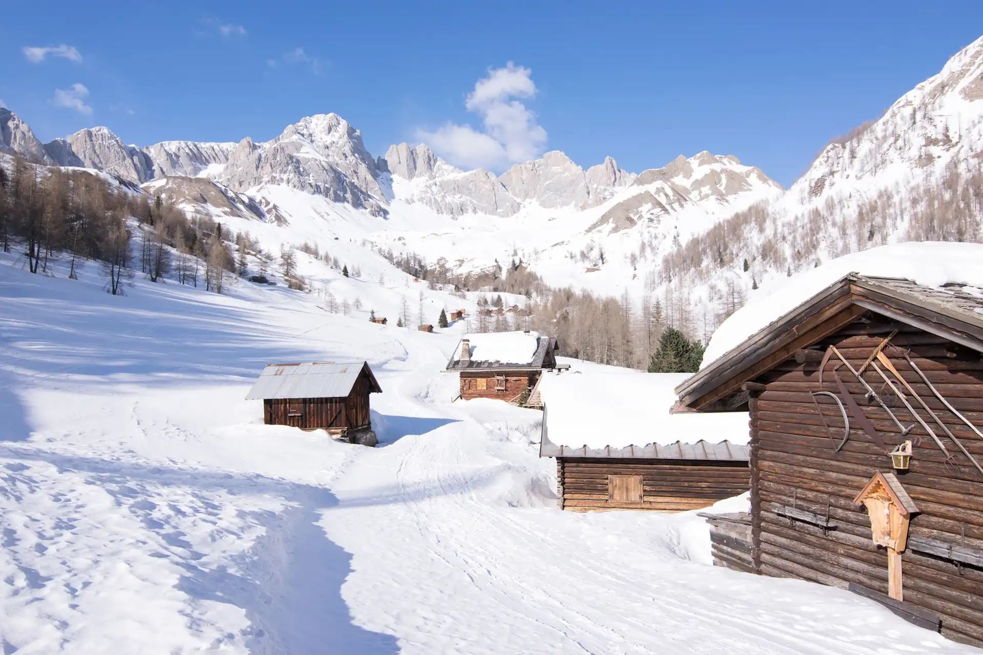
Much Better Adventures runs a seven night hiking tour in the Dolomites with two bases, the idyllic Val di Funes and the alpine haven of Val Pusteria. You’ll explore a different route each day.
How can I book transport for Dolomites trailheads?
Dolomitibus runs direct services from hubs such as Cortina d’Ampezzo to the trailheads of numerous hikes, while Sued Tirol Mobil runs shuttle services to popular destinations such as Lago di Braies and Tre Cime. Tickets should be purchased online in advance. It’s also possible to purchase travelcards giving you unlimited journeys on trains and buses over a fixed period of time. There are several options, each covering a different area of the Dolomites, such as Südtirol Guest Pass or the Val Gardena Guest Pass.
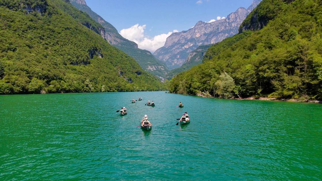
Inspired? Check out our Hike the Italian Dolomites adventure, our Winter Hiking in the Italian Dolomites trip, or join us to Hike, Bike and Canoe in the Dolomites.