


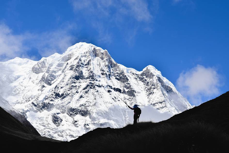
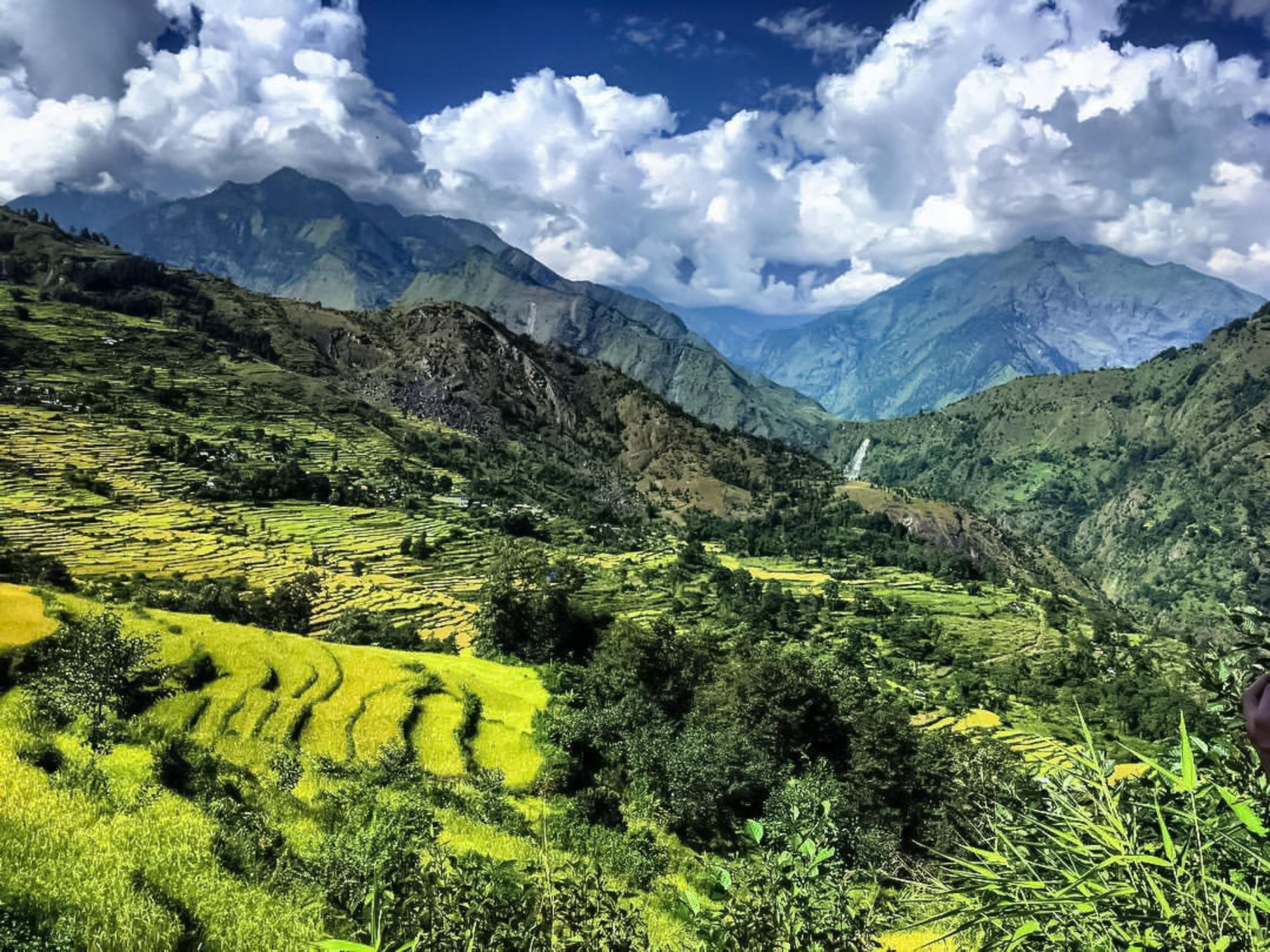
The Annapurna region, set within Nepal’s central Himalayas, is one of the world’s most spectacular and diverse mountain landscapes, crowned by a sweeping massif of soaring peaks and deep gorges carved by the Kali Gandaki and Marsyangdi rivers.
“Of all the great Himalayan peaks, the Annapurnas are unique. They are not defined by a single soaring summit, but comprise a vast massif, encompassing multiple peaks, spires and impossibly high ridges,” writes Bob Gibbons, in the Cicerone guide, Trekking Annapurna.
This includes the region’s most iconic classics, the Annapurna Circuit and the Annapurna Sanctuary, but also a number of alternative routes...
The terrain of the Annapurna region shifts dramatically from subtropical valleys and terraced farmland to bamboo and rhododendron forests, high alpine meadows and barren, windswept plateaus in the rain shadow of the range, making it a varied and rewarding trekking destination.
Culturally, the region is equally rich, home to Gurung, Magar, Thakali and Tibetan-influenced communities whose villages, monasteries and traditions shape the trekking experience. You’ll really be able to immerse yourself in the culture by staying in local homestays and teahouses.
In this article, we look at some of the best hikes in the Annapurna region. This includes the region’s most iconic classics, the Annapurna Circuit and the Annapurna Sanctuary, but also a number of alternative routes which take you off the beaten path into less explored areas.
Whether you’re seeking cultural immersion, dramatic viewpoints, solitude on remote trails or the challenge of high altitude, the Annapurnas offer countless options for trekkers of all ambitions and abilities.
The Best Hikes in the Annapurna Region, Mapped
These are the trailheads for our top treks in the Annapurna region, accessible from small villages in the Nepal Himalayas.
1. The Annapurna Circuit
- Start/Finish: Bhulbhule/ Bhirethanti
- Distance: 118-124 miles (190-200km)
- Walking time: 15-23 days
- Difficulty: Challenging
- Maximum altitude: 5,416m (17,770ft)
- Best for: Experiencing one of Nepal’s most iconic treks
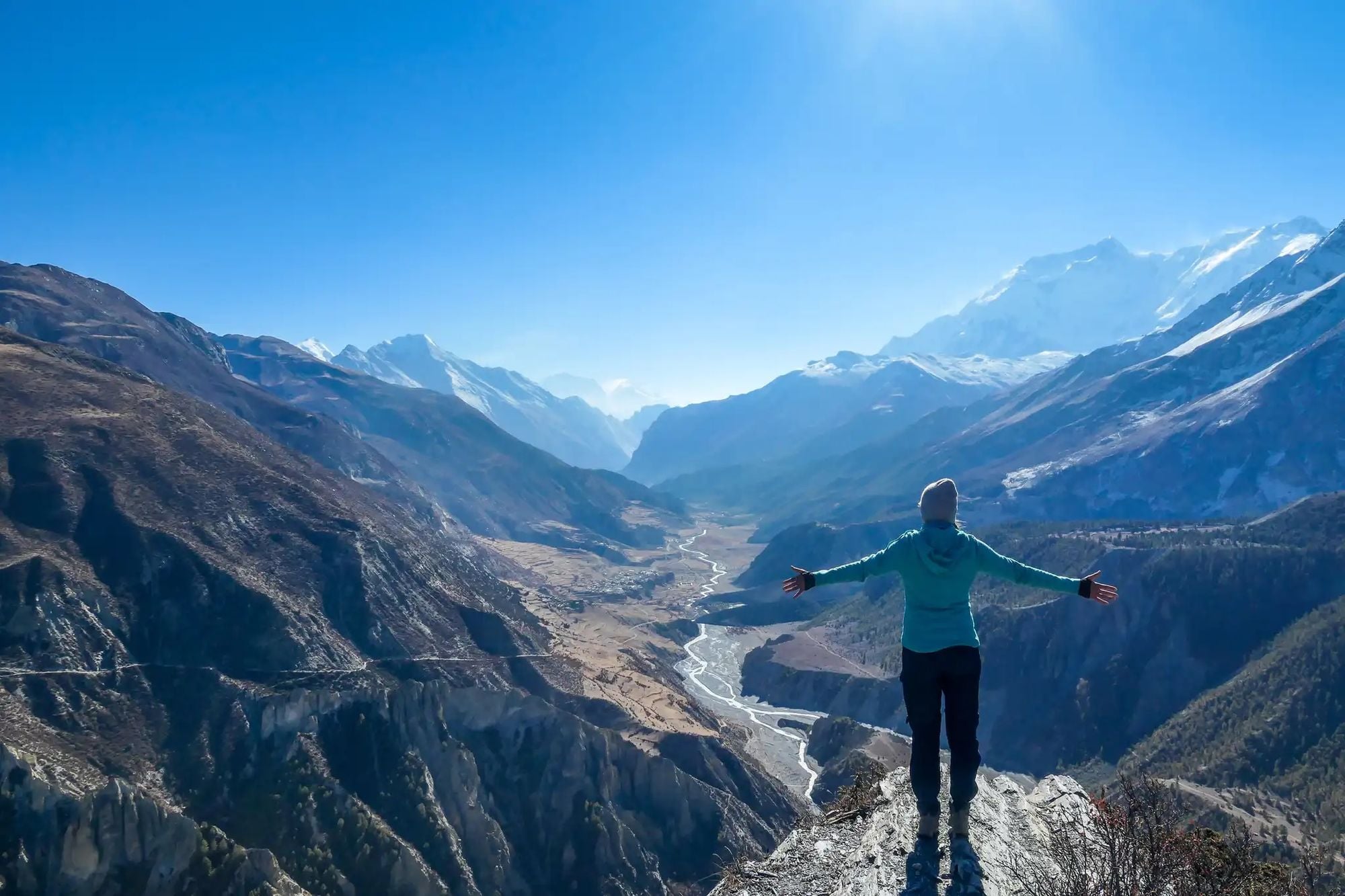
The iconic Annapurna Circuit offers some of the most diverse trekking scenery in Nepal, as it passes from the semi-tropical foothills across the main Himalayan range to its northern plateaus.
The first 40 miles (70km) of the trek follows the route of the Marsyangandi River as it cuts through farming lowlands and steep-walled gorges, climbing upwards to the traditional Himalayan village of Manag, where you can spend a day acclimatising. The next stage of the trek is a steep climb upwards to Thorong La (5,416m/17,770ft), a wild, rugged mountain pass. A long descent takes you to Muktinath.

The upland pastures of Manang give way to the desert landscapes of Upper Mustang, with its eroded crags and barren plateaus. From Tatopani you’ll hike to Ghorepani (where you can watch the sunrise from the Poon Hill viewpoint), and then begin a descent through misty rhododendron and magnolia forest to Bhirethanti. From here, you can connect by road to Pokhara.
Read more: Everything you Need to Know About Trekking Annapurna
2. The Annapurna Sanctuary
- Start/Finish: Dhampus Pedi/Naya Pul
- Distance: 50 miles (80km)
- Walking time: 10-12 days
- Difficulty: Challenging
- Maximum altitude: 4,130m (13,550ft)
- Best for: Visiting Annapurna Basecamp
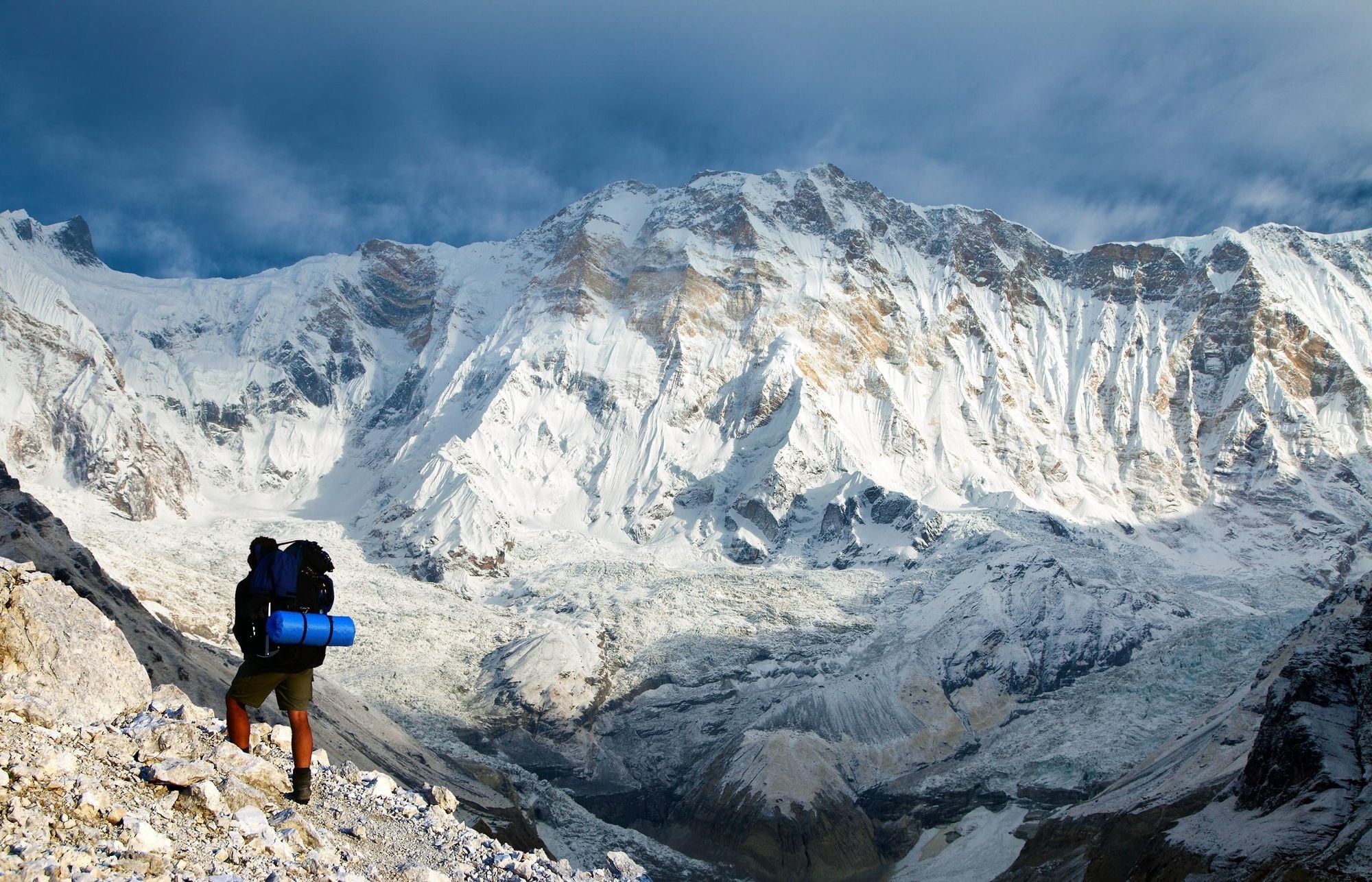
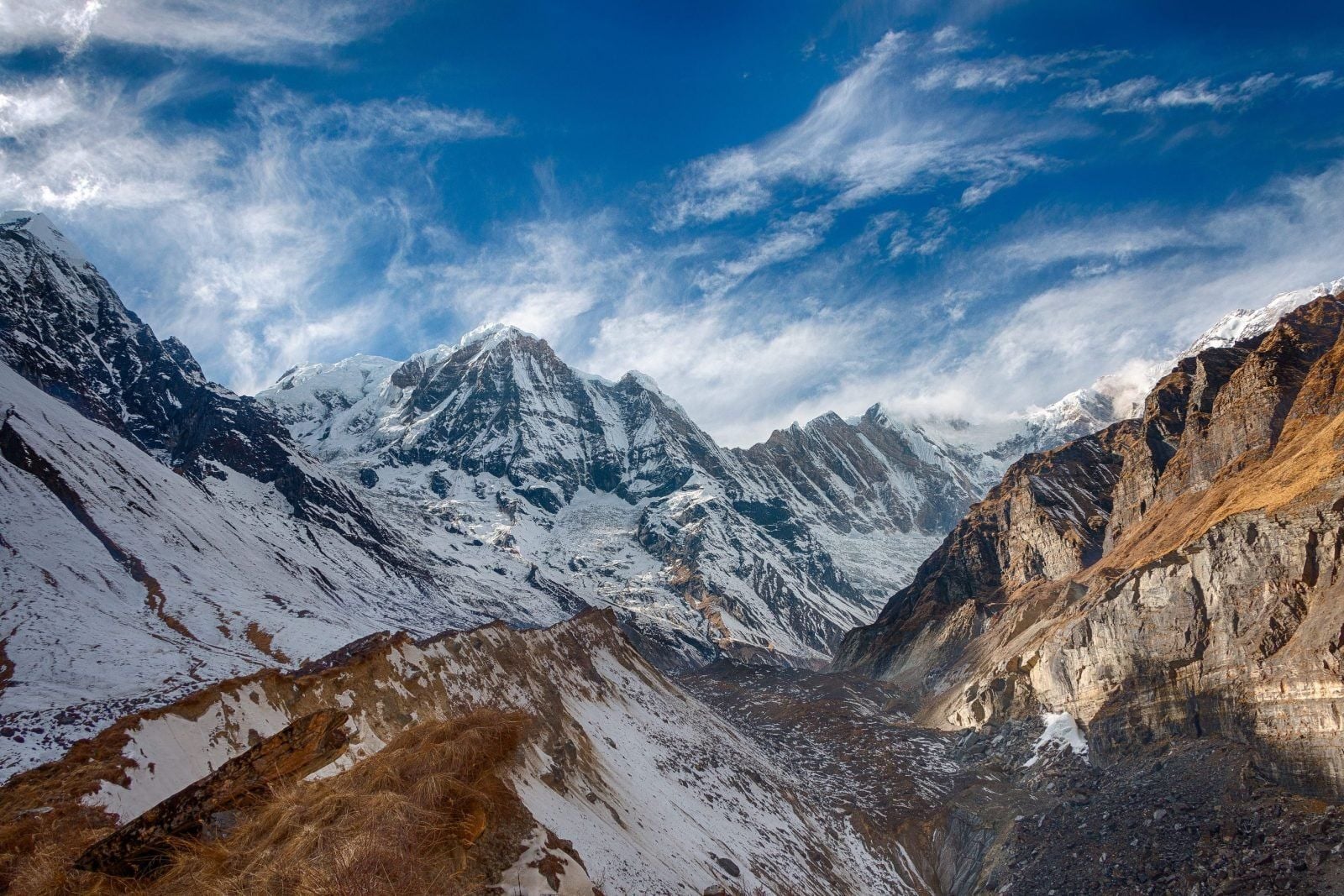
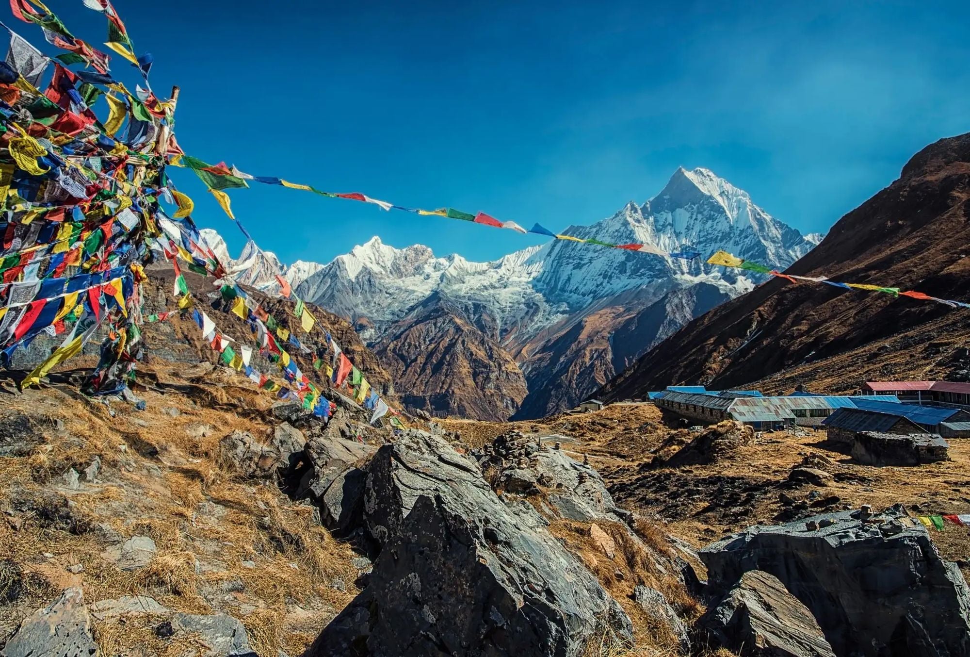
This is one of the most popular hikes in the region, and takes you through the Annapurna Sanctuary - a high glacial basin ringed by mountains - to Annapurna Basecamp, at 4,130m (13,550ft).
You’ll climb uphill through terraced fields, rhododendron forests and traditional Gurung villages such as Ghandruk and Chhomrong. From Chhomrong, the trail drops down through narrow valleys as the landscape shifts from dense forest to glacial terrain.
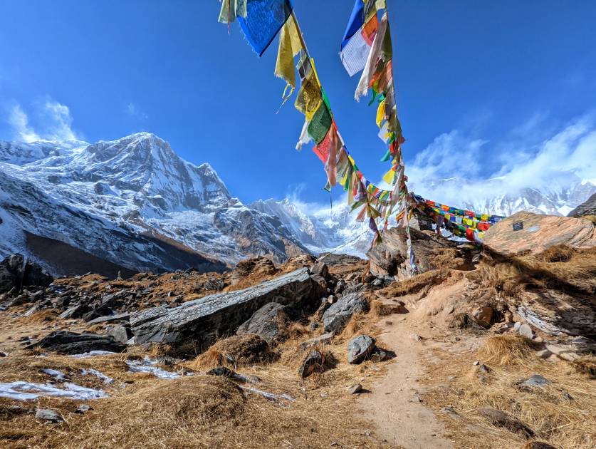
The path then enters the dramatic natural amphitheatre of the Annapurna Sanctuary, reaching Annapurna Base Camp at 4,130m (13,550ft), surrounded by towering peaks including Annapurna I and Machapuchare.
Trekkers return via the same route to Chhomrong, before descending through forest and farmland to Naya Pul. An alternative is simply to retrace your footsteps from Chhomrong to Dhampus Pedi (both villages are connected by road to Pokhara).
Read more: Annapurna Sanctuary Trek or Annapurna Circuit Trek
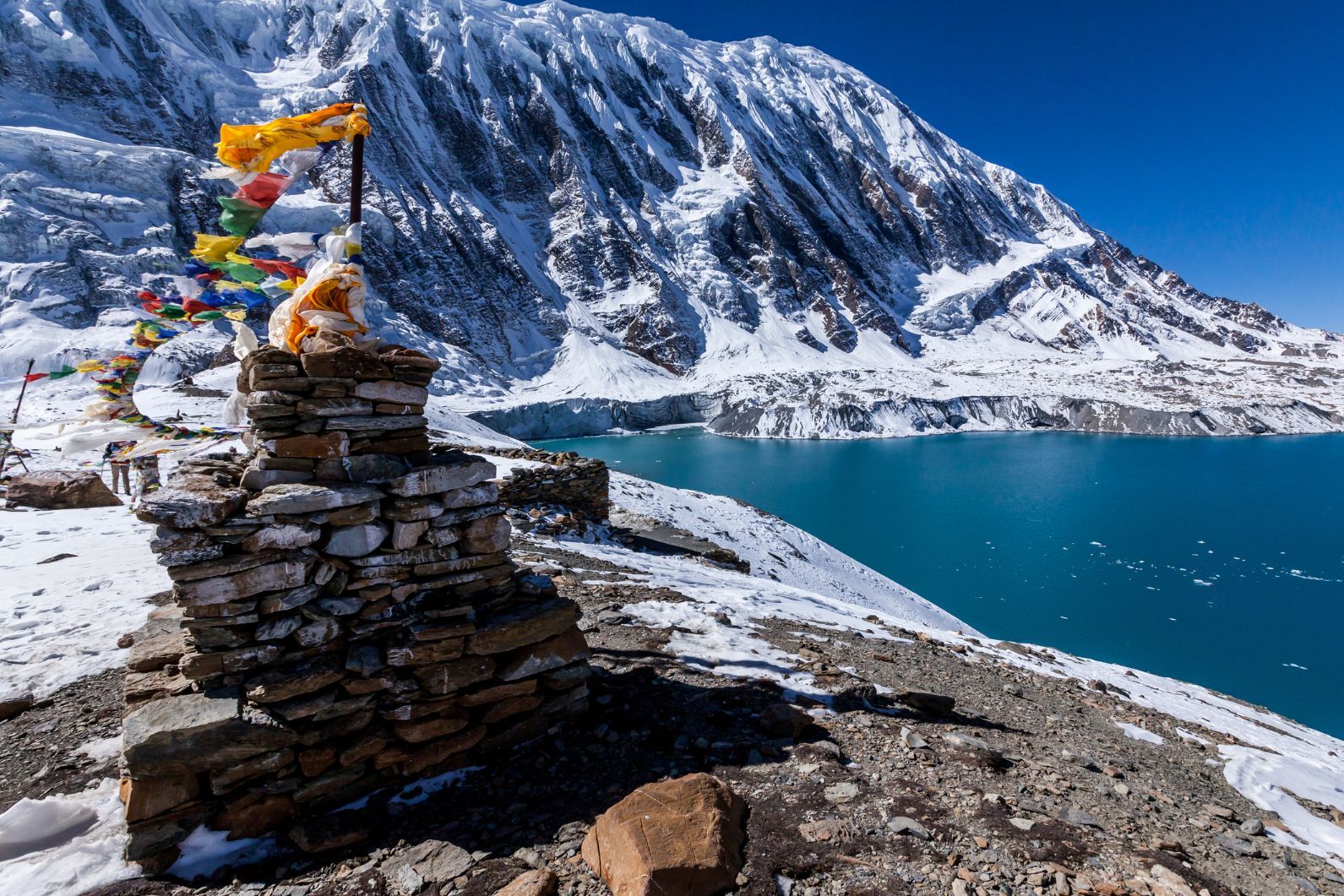
3. Kicho Tal (Ice Lake) Trek
- Start/Finish: Braga
- Distance: 7.4 miles (12km)
- Walking time: 7-10 hours
- Difficulty: Moderate
- Maximum altitude: 4,620m (15,157ft)
- Best for: Acclimatising on the Annapurna Circuit
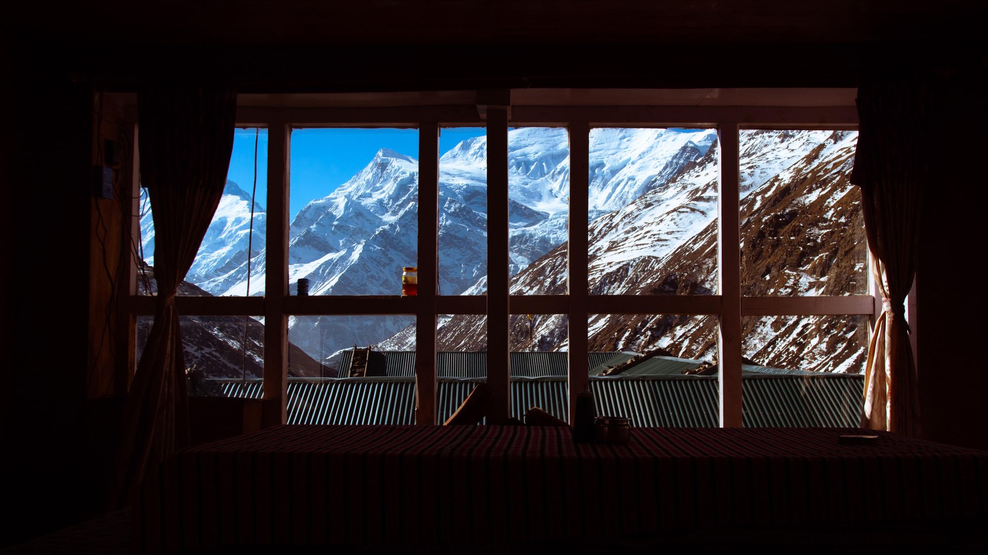
The hike to Ice Lake (Kicho Tal) begins in the quiet village of Braga just below the busier town of Manang, and ascends roughly 1,200m to reach the lake. It’s a day hike which doubles as ideal acclimatisation for anyone hiking the main Annapurna Circuit, but also stands out on its own for serenity, dramatic scenery and high-altitude wilderness.
The destination: a surreal alpine lake often partially frozen, its icy waters framed by snow-capped ridges.
The trail climbs steeply at first, crossing hillside paths marked with prayer flags then zig-zagging up through pastures, rocky slopes and high-altitude terrain, sometimes offering glimpses of Himalayan blue sheep. As you climb, sweeping Himalayan panoramas (including peaks like Annapurna III and Gangapurna) unfold behind you. The destination: a surreal alpine lake often partially frozen, its icy waters framed by snow-capped ridges. Enjoy the scenery before retracing your steps to Braga.
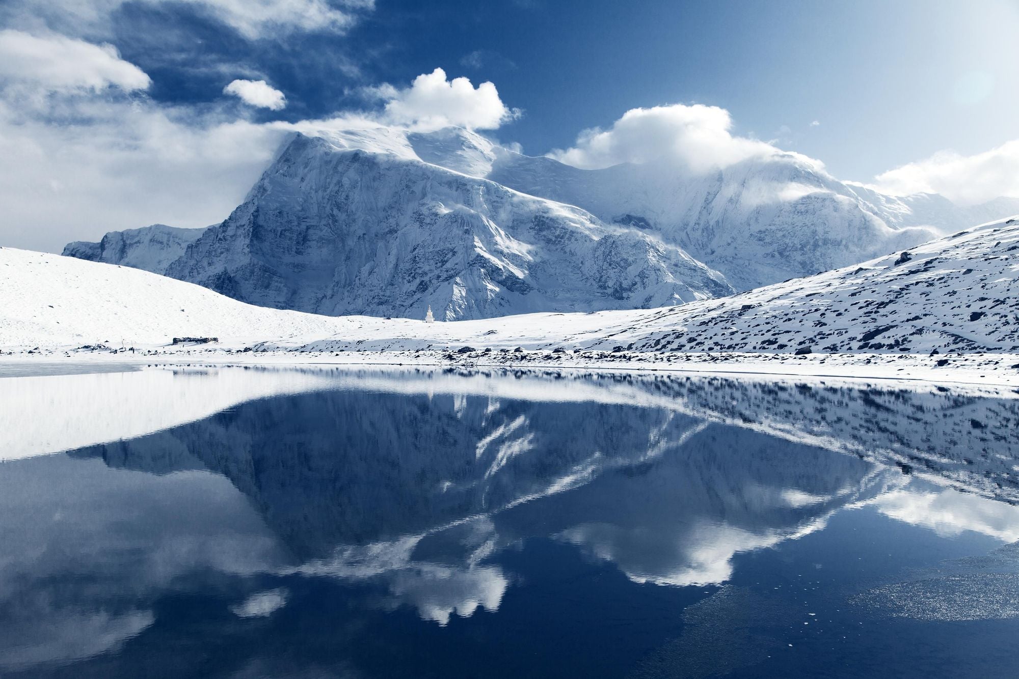
4. Tilicho Lake Trek
- Start/Finish: Bhulbhule
- Distance: 33 miles (53km)
- Walking time: 7-11 days
- Difficulty: Challenging
- Maximum altitude: 4,919m (16,138ft)
- Best for: Glimpsing Nepal’s most beautiful lake
Tilicho Lake is often called the most beautiful in Nepal. It is the highest lake of its size in the world, and its pristine blue-green waters are surrounded by snow-capped peaks. The lake can either be a destination in its own right or a short detour before completing the Annapurna Circuit in entirety.
Follow the Annapurna Circuit until Manang, before diverting onto a trail which crosses a suspension bridge over a river and heads to the village of Khangsar. You’ll climb a mountainside studded with juniper and sea buckthorn bushes to Tilicho Base Camp (3,734m/12,251ft). From here it’s a steep climb up a moraine slope to Tilicho Lake (4,919m/16,138ft).
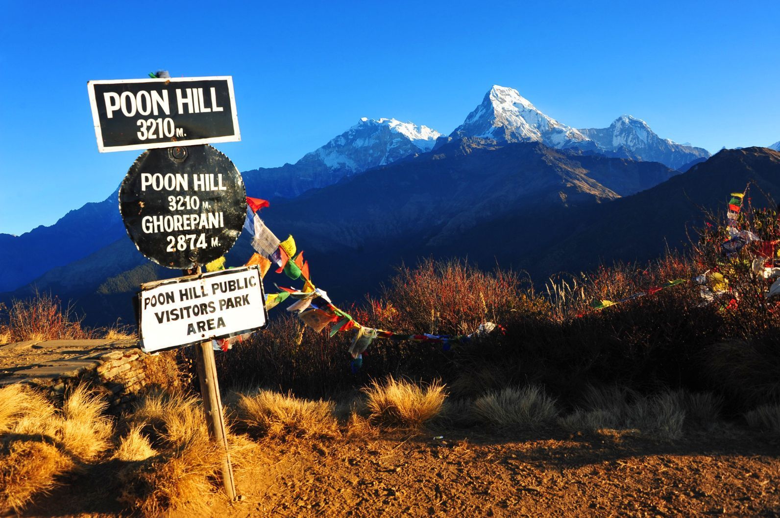
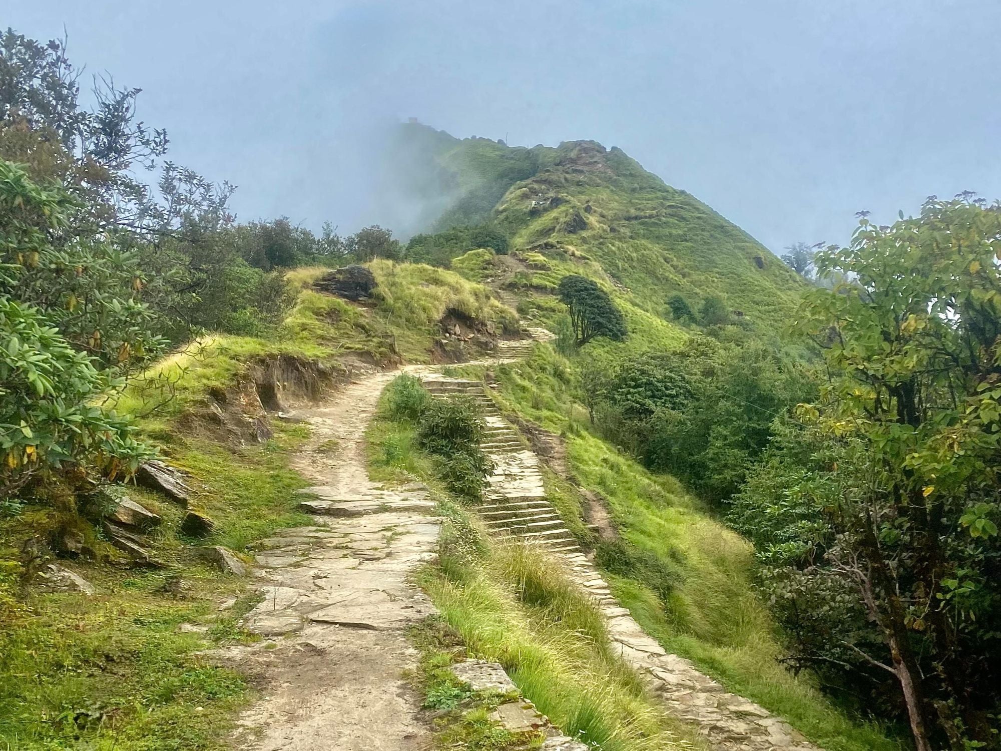
5. Ghorepani Circuit (Poon Hill Expedition)
- Start/Finish: Dhampus Pedi
- Distance: 33 miles (52km)
- Walking time: 6-8 days
- Difficulty: Moderate
- Maximum altitude: 3,193m (10,473ft)
- Best for: Sunrise views
The Poon Hill-Ghorepani Trek is one of the best Annapurna short trekking options. It's actually known as an ‘easy’ option in the Annapurnas, but that isn’t necessarily true. There are some steep ascents, including a pre-dawn climb to the top of Poon Hill itself for a sunrise view. But, for trekkers who cannot or do not want to embark on a long trek, the Ghorepani Circuit is a good option.
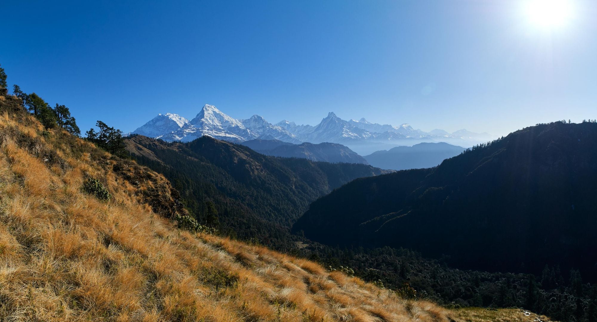
The first part of this trek passes through ethnic Magar villages with terraced farmland and trails shaded with thick woods. It culminates with an early morning hike from Ghorepani to the top of Poon Hill (3,193m/10,473ft), from where views of Annapurna South, Machapuchare (Fishtail), Annapurna II, the Lamjung Himal Range and Dhaulagiri can be seen.
6. Annapurna - Dhaulagiri Trek
- Start/Finish: Dhampus Pedi/ Naya Pul
- Distance: 54 miles (70km)
- Walking time: 10-12 days
- Difficulty: Challenging
- Maximum altitude: 4,200m (13,780ft)
- Best for: Views of Dhaulagiri
The Annapurna–Dhaulagiri Trek (sometimes called the Khopra Ridge trek), is so-named because of its spectacular views of Dhaulagiri, the world’s seventh highest mountain at 8,167m (26,795ft).
It follows a quieter, off-the-beaten-path route that branches from the main Annapurna trails near Ghandruk or Tadapani, climbing steadily through dense rhododendron forests and traditional Magar and Gurung settlements. The trail ascends to the spectacular Khopra Ridge, a high balcony offering sweeping views of Annapurna South, Nilgiri, Dhaulagiri, and the deepest gorge in the world, the Kali Gandaki.
From Khopra Danda you can take a side trip to Khairetal Lake, which is sacred to the Hindus. You face a steep uphill climb to an exposed ridge, where you’ll have a view of Khairetal (4,200m/13,780ft) ringed with rock walls and glaciated peaks. Descend the way you came.
From here, you’ll descend to Ghorepani, where you can climb Poon Hill if desired. If not, continue the descent to Naya Pul.
7. Mustang Trek
- Start/Finish: Jomsom
- Distance: 110 miles (176km)
- Walking time: 13-14 days
- Difficulty: Challenging
- Maximum altitude: 4,230m (13,879ft)
- Best for: Exploring Mustang
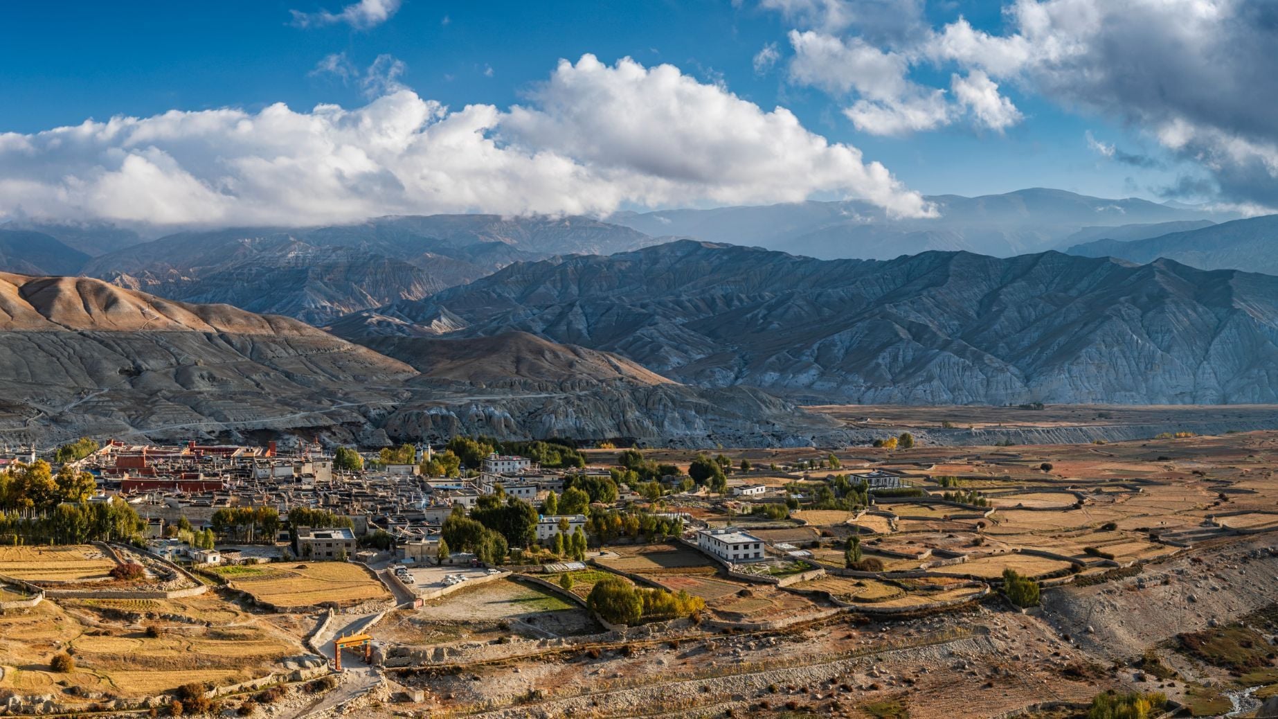
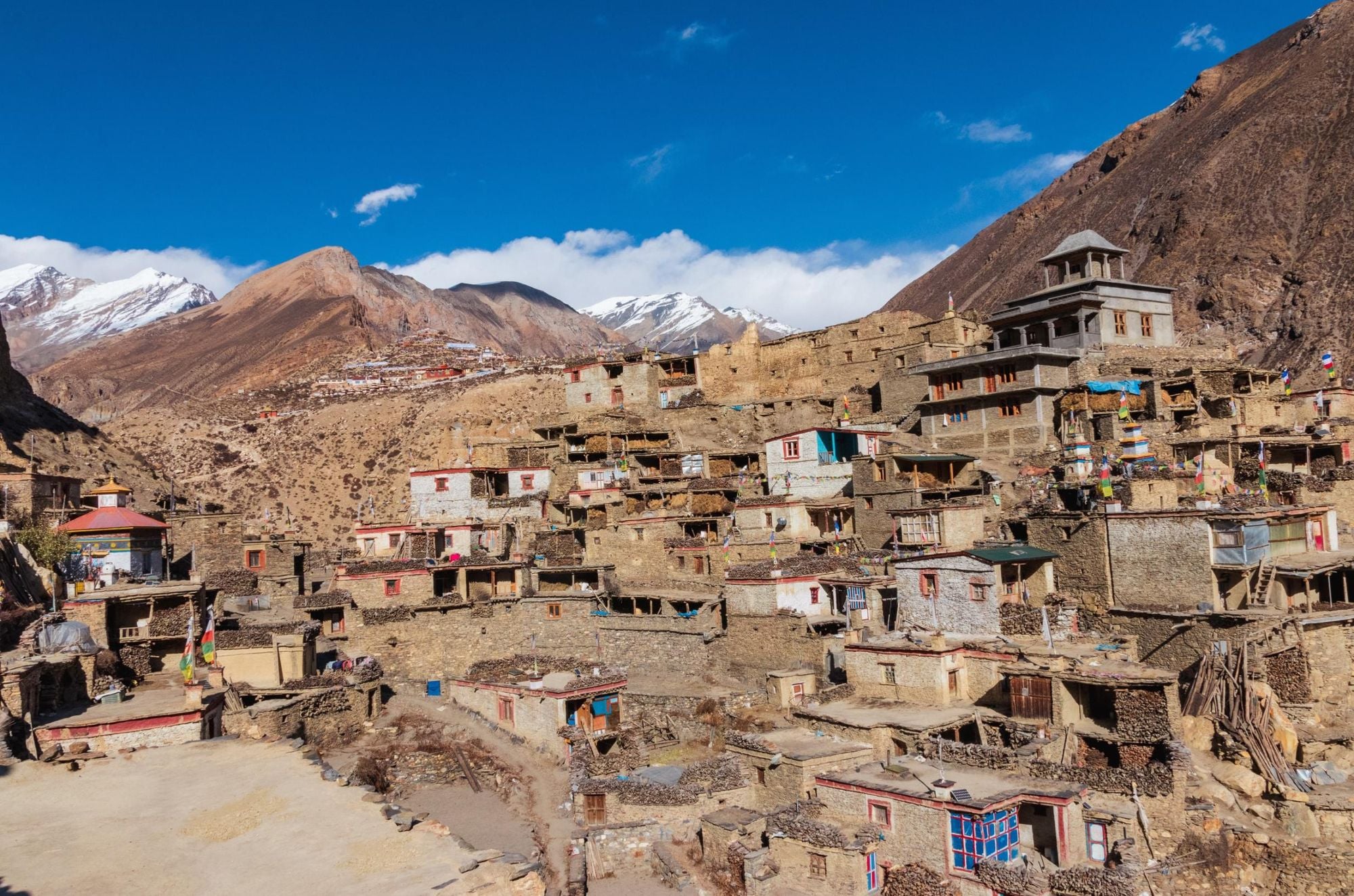
Mustang (which lies north of the Annapurnas) is in the rain shadow of the Himalayas, meaning it is geologically and topographically completely different from much of the rest of Nepal. The landscape is rocky and arid, the sun harsh and the wind strong—its uniqueness makes it well worth a visit.
This trek begins in the town of Jomsom and passes through the Lubra Valley to Shangri-La, the name of the former Tibetan kingdom in Upper Mustang. You’ll climb up through gullies and past dry cliffs, passing the medieval palace of Tetang and well-preserved Buddhist villages. Complete this stage of the route in the extraordinary walled city of Lo Manthang surrounded by soaring rust-coloured peaks; the trek’s halfway point.
On your return journey you’ll hike to the village of Tsarang, where you can hike through the Mustang Khola riverbed to Tange. It takes you through a deep canyon flanked with cliffs, organ pipe rock formations and hermit caves. From Tange, continue through the Narsing Khola canyon, which features some breathtaking natural rock formations. Before reaching Jomsom you’ll cross Gyu La (4,080m/13,386ft), a pass with a view of Tilicho Peak, one of the most spectacular glaciated rock faces in the Annapurnas.
Read more: Trekking in the Mustang district of Nepal
8. Nar-Phu Trek
- Start/Finish: Koto
- Distance: 45 miles (70km)
- Walking time: 7-8 days
- Difficulty: Moderate
- Maximum altitude: 4,110m (13,484ft)
- Best for: Going off the beaten track
The Nar Phu Valley is tucked between the Annapurna and the Manaslu regions near the Tibetan border. It opened up to visitors in 2003, and it’s still a very remote and under-visited area; ideal for trekkers who have already done some of the more ‘mainstream’ treks in Nepal.
This trek begins in the village of Koto. Cross a bridge over the Marsyangdi River and head through pine forest. The path leads through a narrow, sheer walled rock canyon, leading past several waterfalls before climbing up to the chorten (Buddhist shrine) of Meta. The route continues uphill and along a ridgeline to the village of Kyang, where you’ll have a great view of Annapurna II.
You’ll continue on to the citadel of Phu, passing high cliffs studded with deserted hermit caves. This is a traditional town, where you’ll see inhabitants weaving and herding goats. Spend the night here, before retracing your steps to Koto.
9. Mardi Himal Trek
- Start/Finish: Dhampus Pedi
- Distance: 30 miles (48km)
- Walking time: 7-8 days
- Difficulty: Moderate
- Maximum altitude: 4,500m (14,760ft)
- Best for: Trying out high-altitude hiking
If you're looking for alternative Annapurna trekking, try this trail to the Mardi Himal Base Camp at 4,500m (14,760ft). It only opened to hikers in 2011, so if you’re heading to Nepal looking for something way off the beaten track, then this could be the trek for you.
It’s a great option for anyone looking to test themselves hiking at high altitude.
As with many Himalayan hikes, you’re going to see four seasons on one day here, with views of not just the 5,587m (18,330ft) Mardi Himal on your way up to the base camp, but also of Machhapuchhre and Annapurna I. It’s a great option for anyone looking to test themselves hiking at high altitude or get maximum views from a shorter time in Nepal.
Start hiking from Dhampus Pedi, and begin the long climb up the Danda Ridge, which is carpeted in larch and rhododendron forest. Eventually you’ll break free of the forest and continue uphill through high pastures and moorland, where you’ll have excellent views of the stone buttresses of Fishtail mountain. The trail gains considerable elevation as you continue onward to base camp, at the foot of towering Mardi Himal. Spend the night here, before returning the same way.
10. Parbat Myagdi Circular
- Start/Finish: Galeshwor/ Tiplyang
- Distance: 21 miles (33km)
- Walking time: 6-8 days
- Difficulty: Moderate
- Maximum altitude: 3,225m (10,580ft)
- Best for: Cultural immersion
The Parbat Myagdi Circular Trek is a little-known but beautiful multi-day route that loops through the lower Annapurna region (also known as the Mohare Danda Trekking Area), passing through rural villages where you can stay in community lodges and family-run homestays.
Starting in Galeshwor, you’ll ascend up through terraced farmland, Magar and Gurung villages, rhododendron forests and ridgelines that offer wide panoramas of Dhaulagiri and Annapurna South. The trail then arcs into Myagdi District, linking traditional villages such as Darbang, Muna, and Gurjakhani before returning toward the Kali Gandaki corridor.
This is a rewarding trek because it combines genuine off-the-beaten-path immersion with rich cultural encounters, varied landscapes and big-mountain views—without the crowds or altitude risks of higher Himalayan routes.
What Animals live in Annapurna?
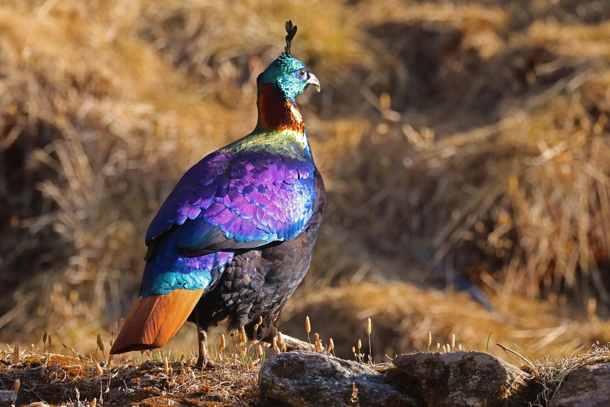
The Annapurna region spans everything from warm river valleys to high-alpine ridgelines, inhabited by a wide variety of wildlife. Iconic species include rare and elusive snow leopards, blue sheep and langur monkeys, along with an impressive bird population such as the Himalayan monal, lammergeier, Himalayan griffon and various pheasants and eagles.
Lower elevations host reptiles, amphibians, and colourful butterflies like the Himalayan swallowtail, while the protected status of the Annapurna Conservation Area helps maintain healthy populations throughout these diverse ecosystems.
The Mardi Himal trek, which moves quickly into high, open terrain, is known for monals, blood pheasants and sometimes pikas.
Different treks offer different wildlife-spotting opportunities. On the Annapurna Base Camp (Sanctuary) trek, trekkers commonly encounter langur monkeys, Himalayan monals, and occasionally musk deer. The Annapurna Circuit often features sightings of blue sheep near Manang and the higher Thorong La region, along with large raptors circling overhead.
The quieter Khopra Ridge (Annapurna–Dhaulagiri) trek provides excellent chances to see Himalayan tahr (a wild goat species), monal and griffon vultures. Meanwhile, the Mardi Himal trek, which moves quickly into high, open terrain, is known for monals, blood pheasants and sometimes pikas (tiny mammals from the rabbit family) darting among the rocks.
Where to Stay in the Annapurna Region
The Annapurna region offers a wide range of accommodation, with the most common being teahouses—simple lodges run by local families that provide private or twin rooms, hearty meals, and a sociable atmosphere for trekkers. Facilities vary from basic to surprisingly comfortable, depending on altitude and remoteness.
In many villages you’ll also find homestays, which offer a more immersive cultural experience, home-cooked meals, and the chance to interact closely with Gurung, Magar, or Thakali hosts. In the larger trekking hubs and lower-elevation towns, there are guesthouses, boutique lodges, and full-service hotels, giving trekkers the option to start or end their journey with more comfort.
Camping is possible in the Annapurna region, though it’s far less common today because teahouses are so widespread and convenient. Camping allows access to less-travelled trails where teahouses are sparse or non-existent such as Khopra Ridge (in its upper sections) and the Nar Phu valley. You’ll typically need a full camping setup—tents, kitchen gear, food supplies, porters or pack animals—which can be arranged through a trekking agency.
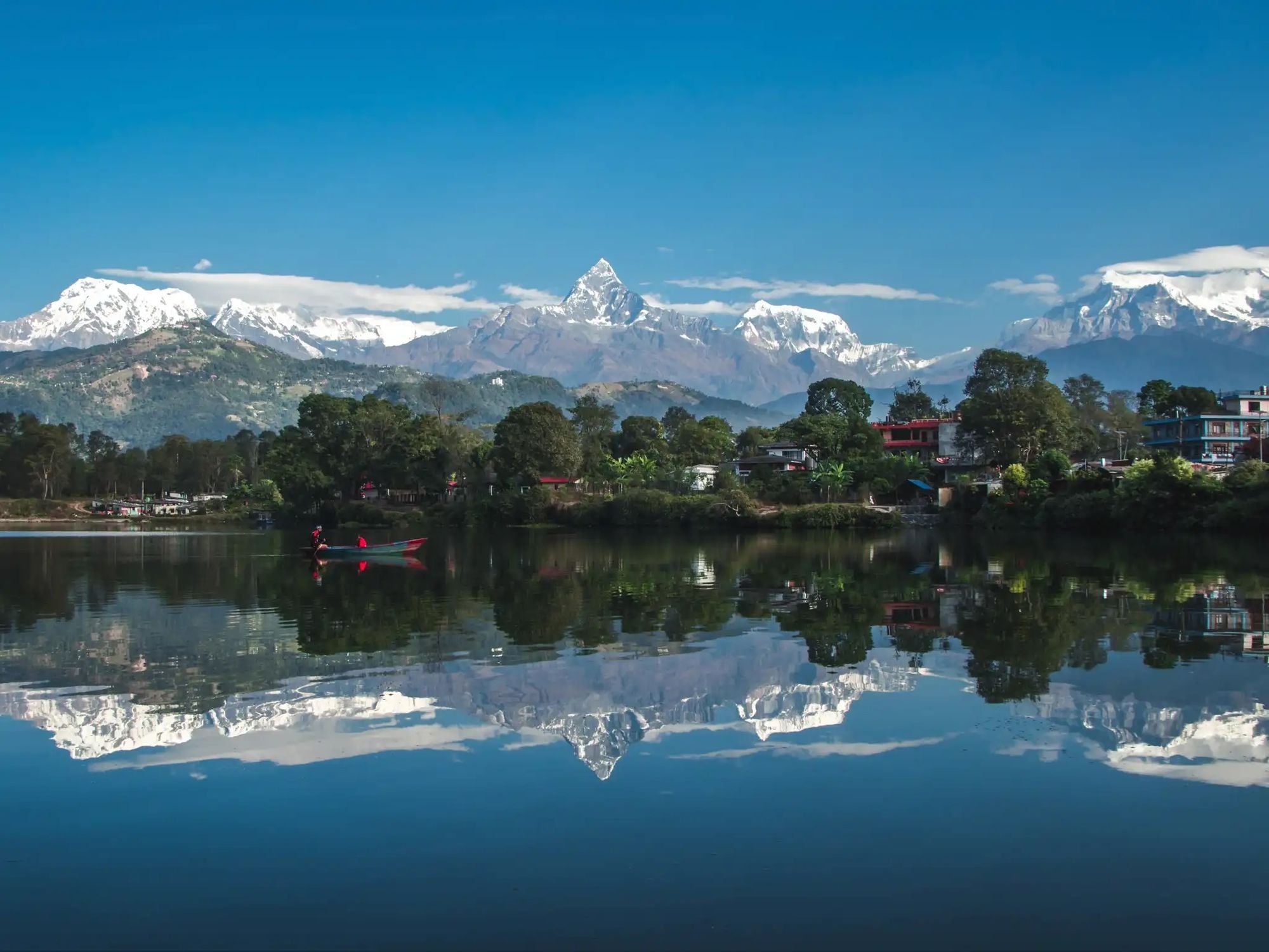
Key trekking hub towns and villages offer accommodation and resupply points, as well as providing places where you can rest and acclimatise. Pokhara is the main gateway for all Annapurna treks, offering plentiful hotels, gear shops and transport links. Nayapul, Kande, and Phedi serve as popular roadheads for starting routes like Annapurna Base Camp, Ghorepani–Poon Hill and Mardi Himal. Higher up, classic villages such as Ghandruk, Tadapani, Chhomrong, and Ghorepani act as well-equipped overnight stops with numerous teahouses. On the Annapurna Circuit, major hubs include Besisahar, Chame, Manang, Muktinath and Jomsom.
FAQs
What are the best short treks in the Annapurna region?
The best short treks in the Annapurna region include the Ghorepani Poon Hill Trek, Mardi Himal Trek, and the Ice Lake Trek. These routes offer 3–6 day itineraries with mountain views, cultural villages, and moderate difficulty.
Can I trek in Lower Mustang without doing the Annapurna Circuit?
You can trek in Lower Mustang without completing the Annapurna Circuit. Trekkers can fly or drive to Jomsom and start directly in the Mustang region. The route offers Tibetan-influenced culture, desertified landscapes and views of Nilgiri and Dhaulagiri.
Is Annapurna Sanctuary the same as ABC?
Yes, Annapurna Sanctuary and ABC (Annapurna Base Camp) refer to the same trek. "Annapurna Sanctuary" describes the high glacial basin surrounded by peaks, while "ABC" highlights the trek's endpoint. Both terms are used interchangeably to describe the same trekking route in central Nepal.
Do I need special permits for Nar Phu Valley?
Yes, you need special permits to trek in Nar Phu Valley. The region is classified as a restricted area by the Nepalese government. Trekkers must obtain a Restricted Area Permit (RAP) and be accompanied by a registered guide. A minimum of two trekkers is also required for permit issuance.
Inspired? Trek the Annapurna Circuit with us, or check out our Annapurna Sanctuary trek. You can even combine the Annapurna Circuit with a safari in Chitwan.