


Portugal is renowned for its beautiful coastline, which intertwines sandy beaches with rugged cliffs, and witnesses some of the Atlantic’s wildest waves. The interior of Portugal is equally beautiful, from the limestone and karst mountains to the rewilded territories home to lynx, wolves, eagles and vultures - and the stunning, historic stone villages found in abundance throughout this storied country.
The best hikes in Portugal can feature any one of these diverse landscapes. So in this guide, we’ve set out to highlight 10 routes which capture that variety:
- The Fisherman’s Trail, Rota Vicentina
- Via Algarviana (GR13)
- Piódão to Foz d’Égua Loop
- Climb Pico Mountain in the Azores
- Vereda do Areeiro, Madeira (PR1)
- The Historical Way, Rota Vicentina
- Percurso Pedestre de Marvão (PR1 MVR)
- The Peneda Circuit, Peneda-Gerês National Park
- Peninha, Sintra-Cascais Nature Park (PR10)
- The Greater Côa Valley Grand Route
This is a country with a warm climate, so many of these hikes are best walked in the off-season to avoid the often oppressive heat that hits Portugal in summer.
You’ll be walking on paths which are used by locals to access beaches and fishing grounds, often on high, rugged cliffs...
We’ve included some day hikes, while others are multi-day hikes which will demand a sizeable chunk of time. Where that is the case, you can look into individual stages if restricted by time. Some of these trails can also be combined, or mixed and matched, for example the long-distance Fisherman’s Trail and Historical Way routes, which are both Rota Vicentina paths in southwest Portugal. You could, in theory, start on one and then move on to the other.
It’s important to note that these route descriptions are only short summaries, designed to inspire but not to serve any navigational purpose. They are not intended to guide you on the route and further mapping and planning (or a local guide!) will be required if you want to safely walk any of the trails featured.
While we strive for accuracy, we cannot guarantee completeness, and as always, the outdoors comes with its risks. Weather conditions can turn, and outdoor activities come with inherent risks.
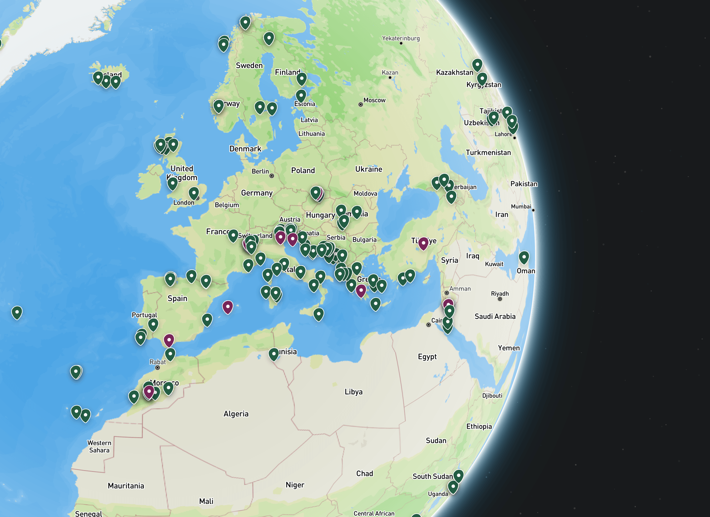
The Best Hikes in Portugal: Mapped
Whilst this map does not show the route of every hike included on this list, it does show the starting point, giving you an idea of the placement and the range of these hikes. The long-distance routes in the southwest of Portugal reach right down to the foot of Portugal, whereas some of the other hikes are short or local.
1. The Fisherman’s Trail, Rota Vicentina
- Start/Finish: São Torpes/Lagos
- Distance: 141 miles (227km)
- Duration: 11-13 days (13 stages)
- Difficulty: Moderate to challenging
- Best for: Constant coastal wonder
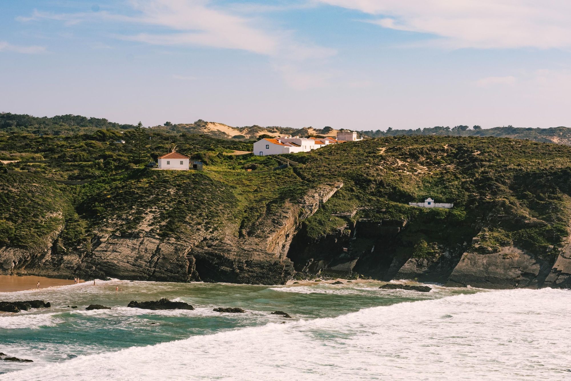
Commonly cited as one of the best coastal trails in the world, the Fisherman’s Trail is a route which runs down the southwest of Portugal, rarely leaving the water.
You’ll be walking on paths which are used by locals to access beaches and fishing grounds, often on high, rugged cliffs, giving great views out to wide, sandy beaches and beyond to the wild Atlantic. The routes goes along the Southwest of Alentejo and Vicentina Coast Natural Park, at times walking right next to the water, mixing smooth stone beaches with long, sandy stretches. There are hidden coves to explore en route and dunes dotted with shrubs, yellow flowers and Mediterranean vegetation, sometimes replaced by arborescent plants, pine and oak trees.

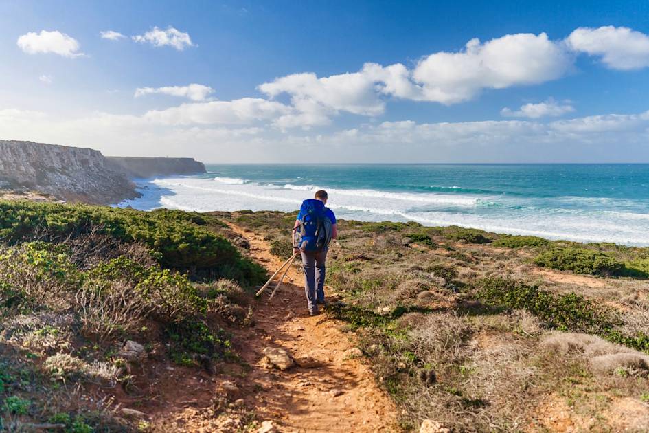
The ocean is your main companion on this trip; the soundtrack of the waves - sometimes gentle, sometimes ferocious - a hypnotic constant. This is a long, immersive journey along one of the best preserved coastlines in southern Europe.
2. Via Algarviana (GR13)
- Start/Finish: Alcoutim/Cabo de São Vicente
- Distance: 185 miles (299km)
- Duration: 14 days
- Difficulty: Moderate/Challenging
- Best for: An off-season, off-beat Algarve experience
Moving away from the coast, the Via Algarviana is a long-distance trail that takes you into the mountainous interior of the Algarve - away from the tourists, and into authentic Portugal.
There are rivers to cross, olive groves to admire and massive, panoramic views out over layering, green hills beneath expansive skylines...
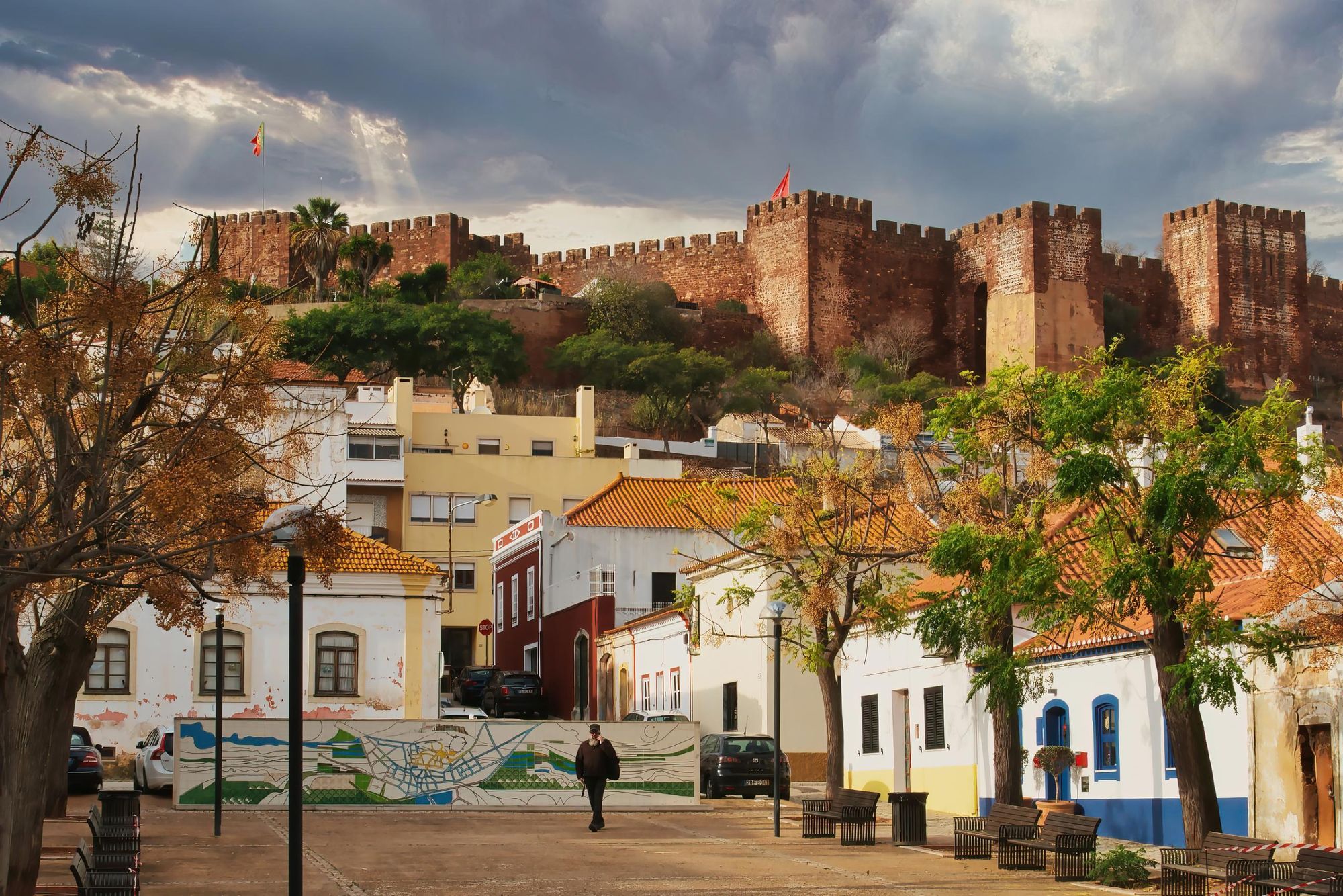
You’ll be walking on gravel tracks, through historic regions and ancient towns with stonework dating back centuries - São Bartolomeu de Messines, on stage eight of the route, sits on the edge of the Caldeirão Hills, and the delightful city of Silves on stage nine boasts a beautiful red sandstone castle (pictured above).
There are rivers to cross, olive groves to admire and massive, panoramic views out over layering, green hills beneath expansive skylines. You’re going to be 30-40km in-land from the coast, so this isn’t a typical Algarve experience, though you do end up on the coast in southwest Portugal, at Cape St. Vincent. Here you can watch ships passing between the Mediterranean Sea and North Africa.
You’ll want to walk this trail sometime from August to Spring. This isn’t a summer walk - it’s an off-season experience, and not an Algarve most people know.
3. Piódão to Foz d’Égua Loop
- Start/Finish: Piódão (loop)
- Distance: 4 miles (7km)
- Duration: Two hours
- Difficulty: Easy
- Best for: Utter enchantment
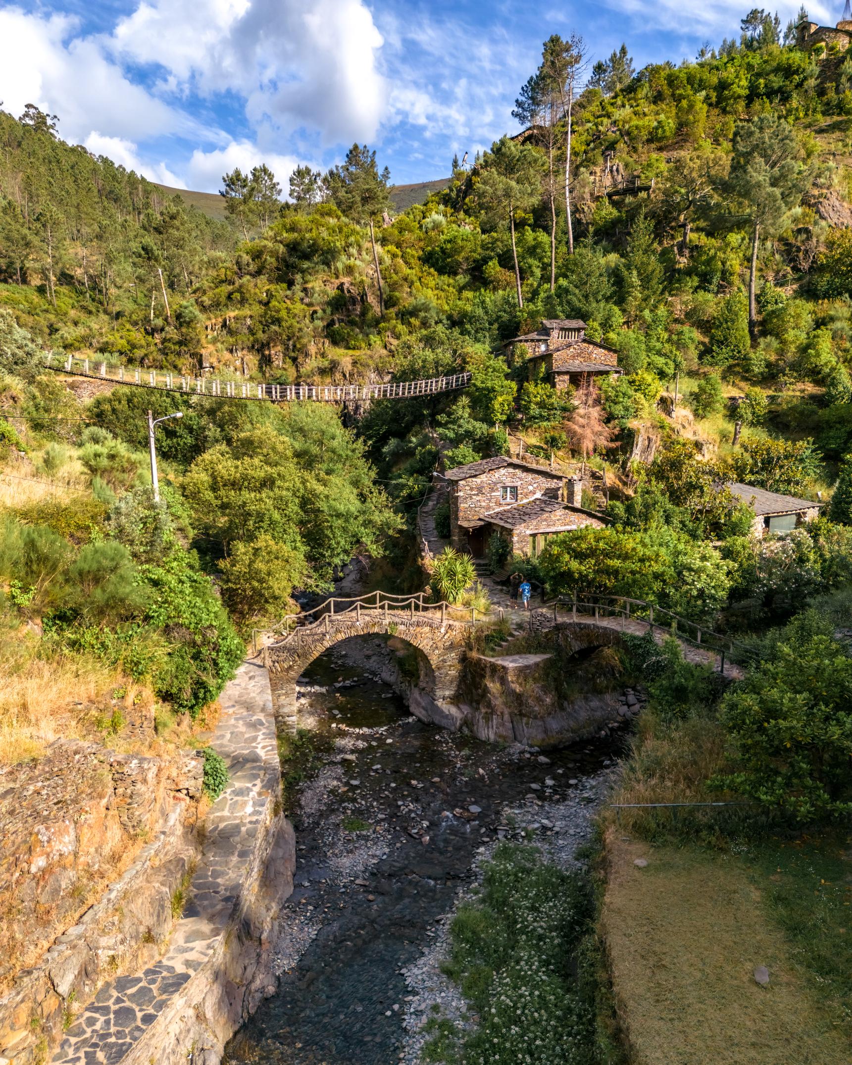
Piódão is one of Portugal’s most unique villages; where charming schist and slate houses layer on top of one another on green, terraced hillsides, clustered together in the Serra do Açor mountain range, in central Portugal.
Foz d’Égua seems to have been plucked directly from the mind of J.R.R Tolkien.
This short walk starts in the village itself and takes you out to Foz d’Égua, a river beach with scenic stone paths and arching bridges. If the quiet streets of Piódão seem to exist outside of time, then Foz d’Égua seems to have been plucked directly from the mind of J.R.R Tolkien. Here, two streams meet, each with their own curving stone bridge. There is a picturesque path, with grass trying to burst through the cobblestones, which will lead you up to a larger, wider bridge giving a great view out over all of it.
Foz d’Égua is a place where you can connect with an ancient way of life, hidden away in a tough-to-reach mountain range. It is an enchanting day out.
4. Climb Pico Mountain in the Azores
- Start/Finish: Casa da Montanha, Pico, out-and-back
- Distance: 4.7 miles (7.6km), return trip
- Walking time: 7-9 hours
- Difficulty: Challenging
- Best for: The ultimate Azores summit
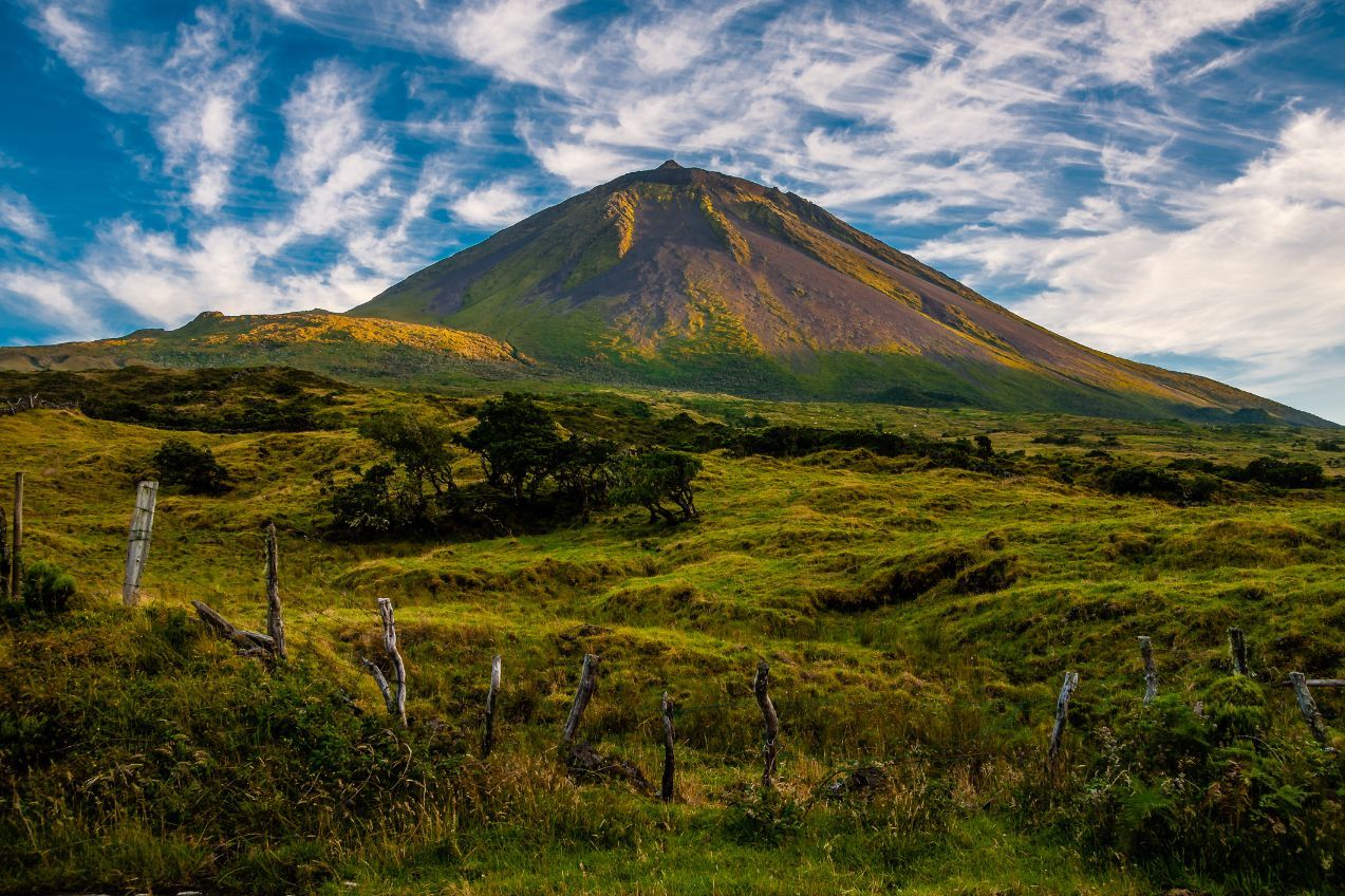
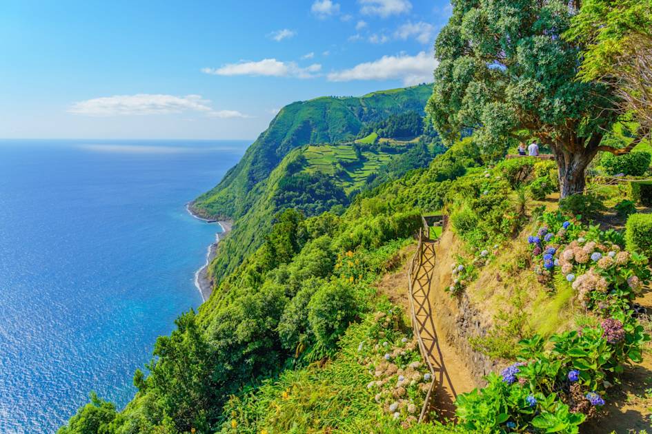
Pico Mountain is not just the high point of the Azores - the archipelago of nine islands which sit roughly 1,000 miles west of the Portuguese mainland - it is also the highest point which sits in Portuguese territory.
Sitting pretty at 2,351m (7,713ft) on the island of Pico, the mountain makes for a demanding, all-day climb. Hikers first have to check-in with the Casa da Montanha at 1,200m (3,937ft), where they will be given a GPS tracker. The trail is marked, with 47 numbered poles, but a guide is recommended if in doubt. Your route will take you over volcanic rocks, past bright mosses and steeply up to the summit. Reaching the top of the mountain takes a final push, and from the summit, the view is superb, out over the Atlantic, to Faial, São Jorge and beyond.
5. Vereda do Areeiro, Madeira (PR1)
- Start/Finish: Pico do Areeiro/Pico Ruivo
- Distance: 3.8 miles (6.1km), though routes vary
- Duration: 3.5 hr (one way)
- Difficulty: Challenging
- Best for: Hiking on Madeira
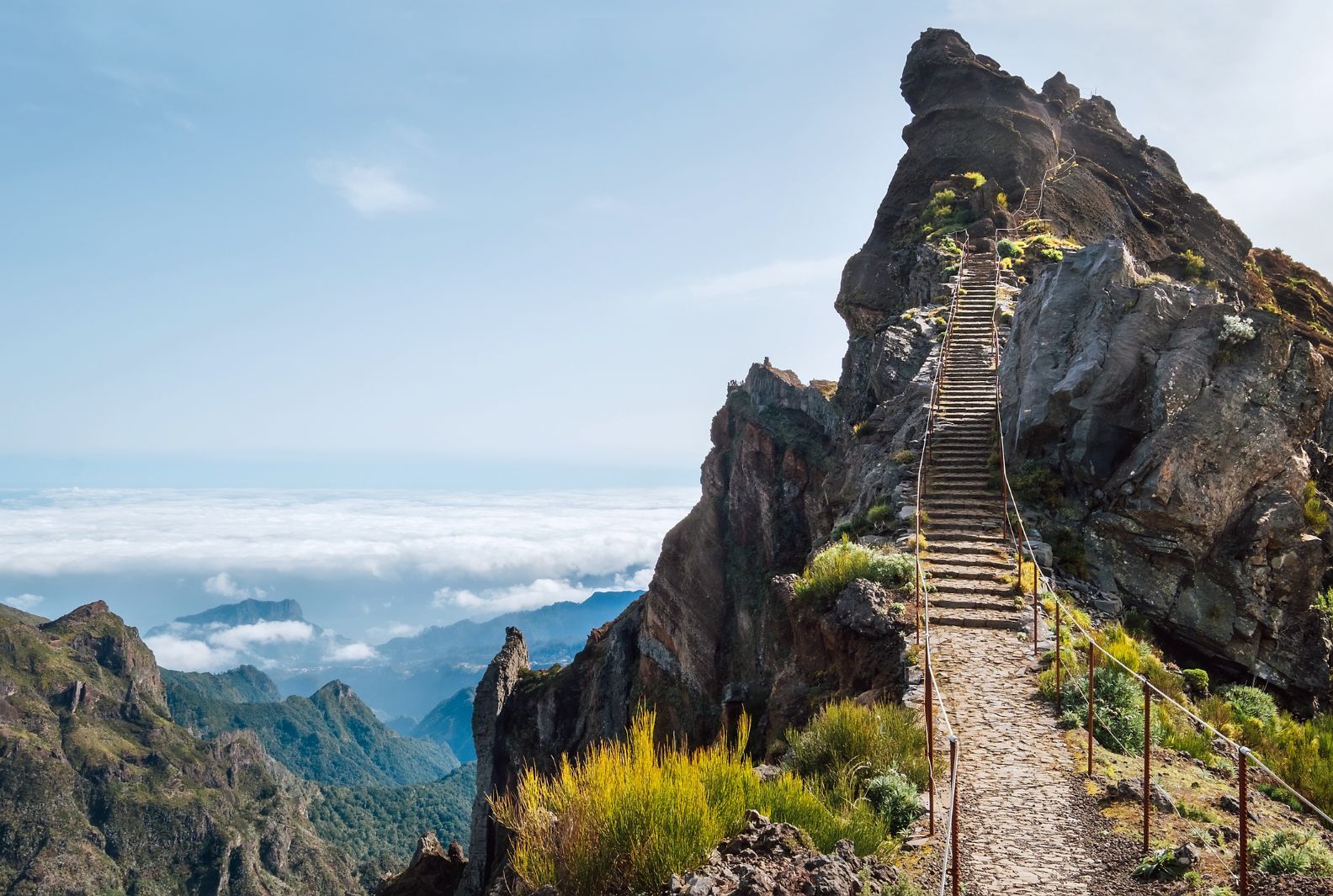
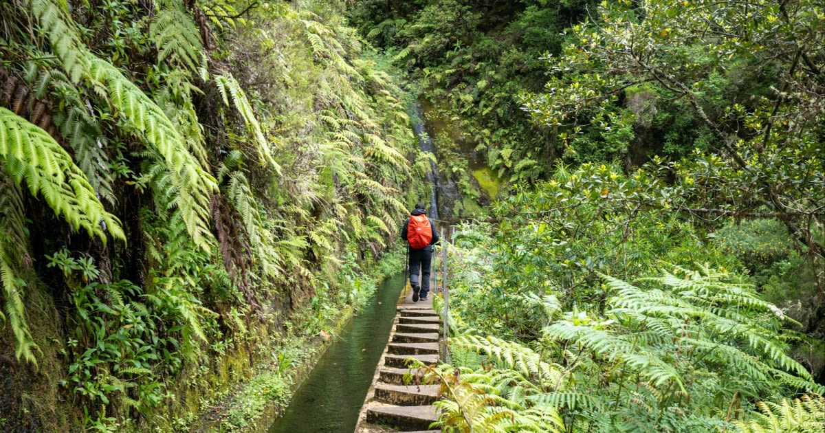
Pico Ruivo (1,861m/6,105ft) is the highest peak on Madeira, an island of dreamy levada walks and PR routes which captures any adventurer's imagination.
The most demanding route up Pico Ruivo is, perhaps, this trek from Pico do Areeiro. Starting at the viewpoint of Madeira's third highest peak, you'll take in steep staircases carved into the rock, pass tunnels dug out of volcanic tufts and face steep gradients. There are markers for the PR1 route.
An early lookout point at Miradouro do Ninho da Manta provides a splendid view.
Some tight cliff-faces follow that may be tough for those with vertigo. There are stunning views out past the rugged rocks and moss down to mist-covered, lapping mountains and the coast. The demanding route to Pico Ruivo lies beyond, up twisting and turning stairs and mountain track. There are many ways to climb this mountain, so look out a couple before you go (and check that they’re open).
After a rule change in 2026, this trail now operates exclusively one way, from Pico do Areeiro to Pico Ruivo. Return transport should be arranged in advance.
6. The Historical Way, Rota Vicentina
- Start/Finish: Santiago do Cacém/Cabo de São Vicente
- Distance: 163 miles (263km)
- Duration: 11-13 days/stages
- Difficulty: Moderate
- Best for: A slow travel through rural life
Like the Fishermen’s Trail, The Historical Way is another long-distance hike which fall under the Rota Vicentina umbrella in southwest Portugal.
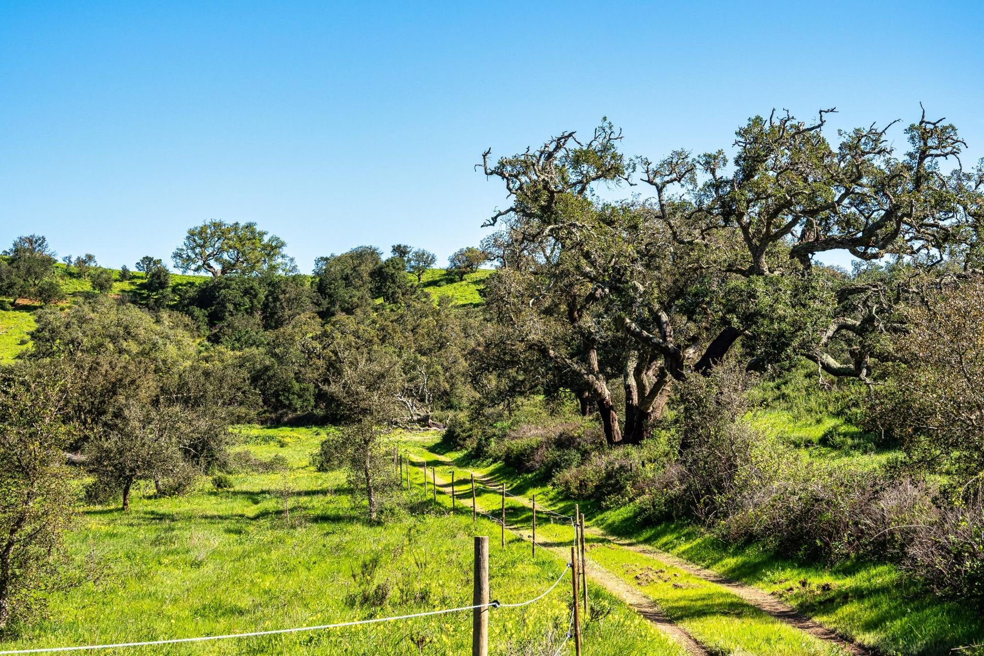
The difference is that while the former route sticks to the coast the whole time, the Historical Way runs through the interior of Portugal, passing through the main towns and villages of the region, walking along rivers and mountains - all tied together by rural trails, passing through the Alentejo and Algarve regions.
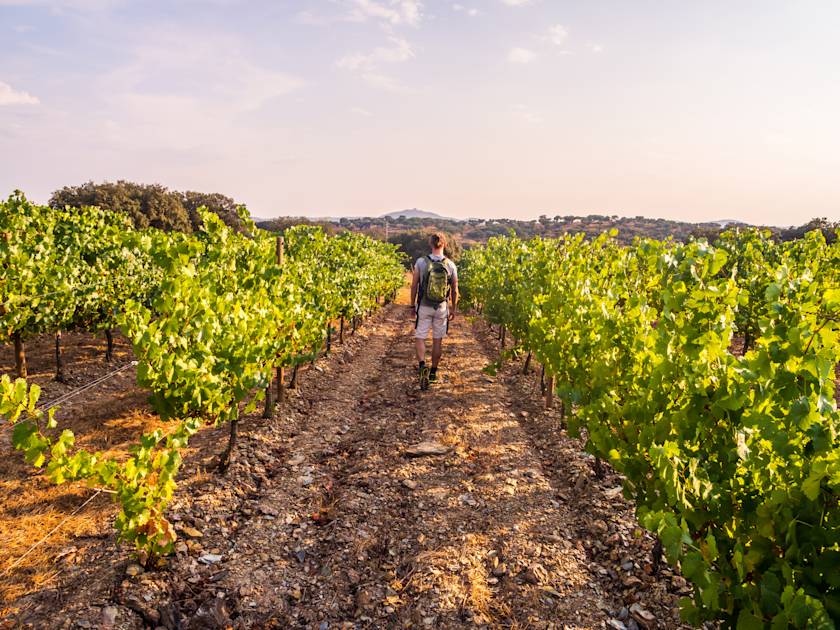
Expect towns with picturesque cobblestones, castle ruins, fortress walls and old churches. Some towns are abandoned entirely, others are lively as ever. Leafy green and hills further in-land. There are Eucalyptus plantations, cork tree forests, orange and lemon trees, rivers and valleys. You will then have views out to the coast for the final few sections, finishing at Cabo de São Vicente.
This is a slow but immersive travel through rural life in Portugal. You’ll travel on gravel roads through villages, and see an older form of life; shepherding and living off the land. Walk between September and June to avoid the worst of the heat.
7. Percurso Pedestre de Marvão (PR1 MVR)
- Start/Finish: Largo das Almas, Portagem
- Distance: 4.8 miles (7.7km)
- Walking time: 3 hours
- Difficulty: Easy
- Best for: Exploring remote, historic Portugal
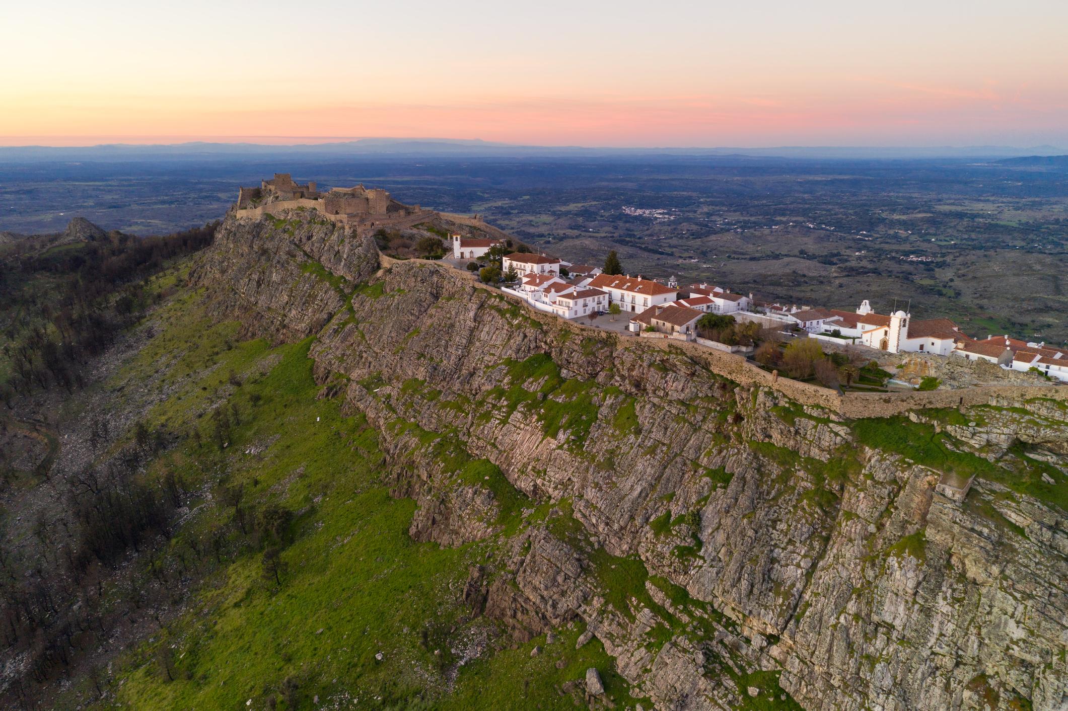
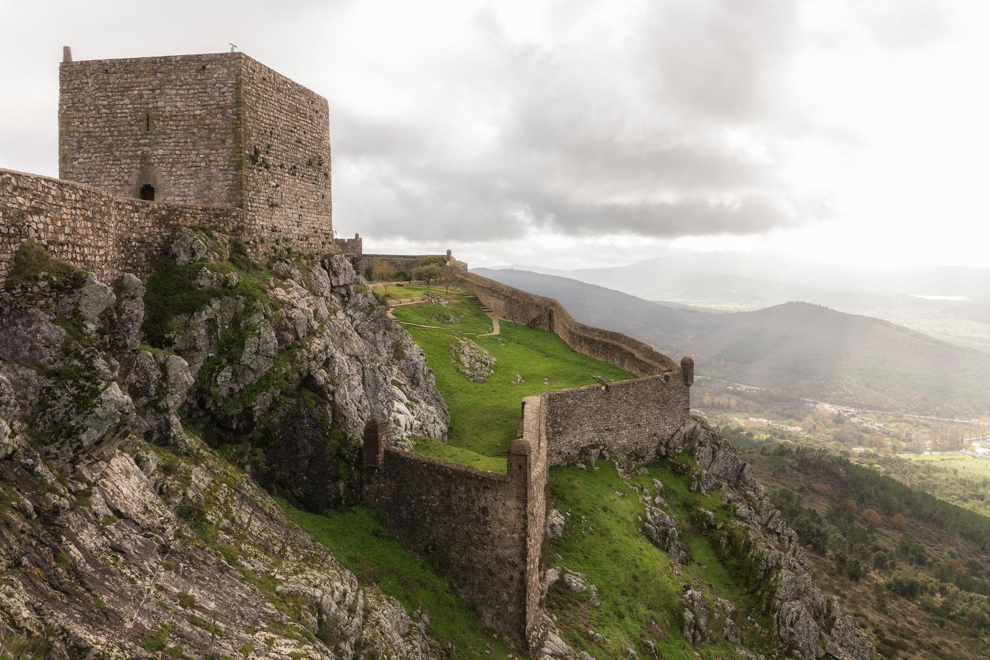
Marvão is a remarkable location; an ancient town situated high on the Serra de São Mamede by the Spanish border, with far-reaching views over the greenery beyond.
There is history here dating back far beyond the Reconquista. Old churches are now museums, and the castle and city walls is unforgettable. Walk up to the castle's keep to get one of the best views in town, and when you want to get out a little, take on the Percurso pedestre de Marvão. This quiet route begins by the poplar-lined Sever river, continuing on to farmsteads full of native olive, cheery and chestnut trees. There are cobbled lanes which fade back into oak forests and views of the Selada hills and São Mamede peaks. Later, the church of Sra. da Estrela is visible - and of course, there are glorious views of Marvão itself.
8. The Peneda Circuit, Peneda-Gerês National Park
- Start/Finish: Santuario de Nossa Senhora da Peneda
- Distance: 15 miles (24km)
- Duration: 9 hours
- Difficulty: Challenging
- Best for: A very tough hike through dramatic scenery
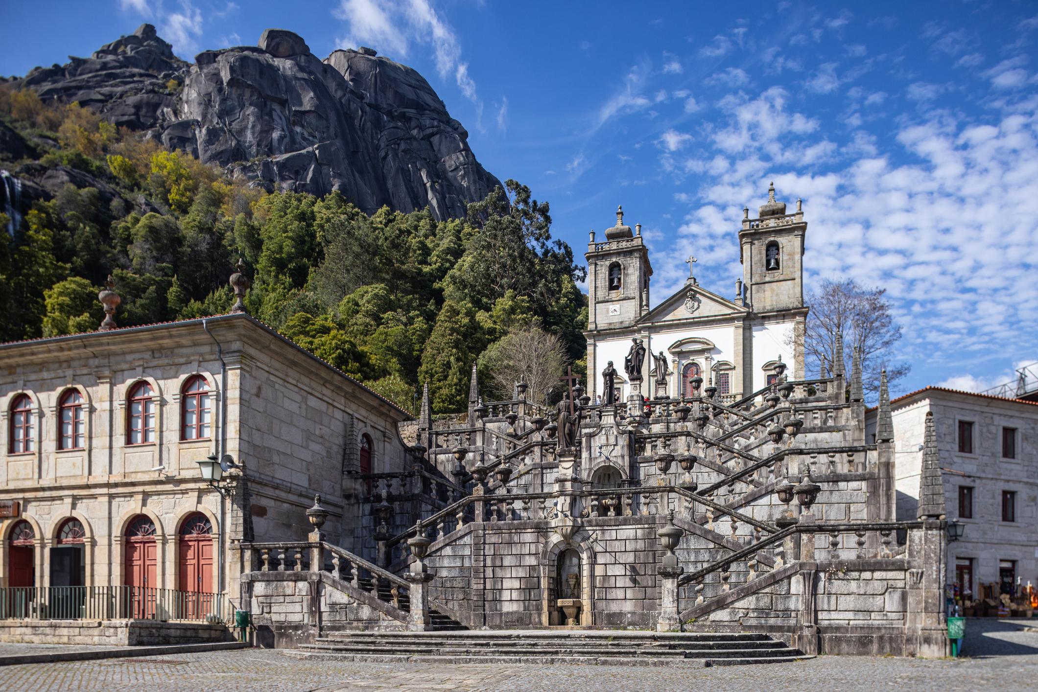
Situated in the far north of Portugal, this day hike reward a challenging day out in the wild with some excellent views of the Peneda-Gerês National Park.
This route combines three official routes - the Trilho da Peneda, a setion of the Pertinho do Ceu and Trilho de Aveleira, but there is no signposting.
The walk is best done clockwise. After leaving the fascinating Santuario, a granite staircase leads up to a clapper bridge and out into the wild. The route crosses the Rio Pomba river, goes through small valleys and visits brandas (high summer grazing villages, occupied by locals and cattle in-season). It passes pines copses, areas with huge slabs of the native granite and is little visited by tourists.
This route combines three official routes - the Trilho da Peneda, a small section of the Pertinho do Ceu and Trilho de Aveleira, but there is very little signposting, so navigation can be very difficult. If you stray, there are sheer drops and rock fields to be wary of. The terrain ranges from hard granite and shepherd's tracks to dirt tracks, and there's more than 1000m of ascent. This is a tough day out.
For a full guide to this route, see Cicerone's excellent walking guide to Portugal. They note that navigation would be difficult without GPS, so be prepared.
9. Peninha, Sintra-Cascais Nature Park (PR10)
- Start/Finish: Santuário da Peninha
- Distance: 3.1 miles (5km)
- Duration: 2-3 hours
- Difficulty: Manageable
- Best for: A shorter walk in a beautiful place
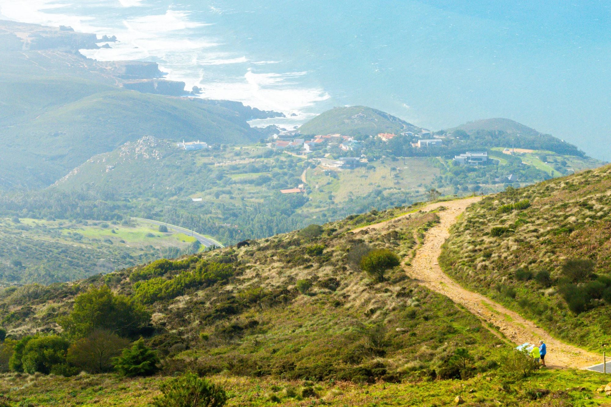
Given the huge length of many of these trails, we wanted to put some shorter walks in here too. This route travels through the Sintra-Cascais Nature Park and is a mountain trail with great views. Right from the start, you'll be able to see out all the way to the coast. The route actually descends steeply from the start to a forest. It will lead you to Adrenunes, a prehistoric megalithic structure. There are views of Cabo da Roca and the mountains of Sintra to enjoy. Cart tracks and trail will lead you back around to the start through different terrain.
There is a downloadable PDF with the route map on it available from Walk Sintra.
10. The Great Route of the Côa Valley (GR45)
- Start/Finish: Fóios (Spring of Côa Valley)/Museum Foz Côa
- Distance: 124 miles (200km)
- Duration: 11 days
- Difficulty: Challenging
- Best for: Seeing a rewilded Portugal
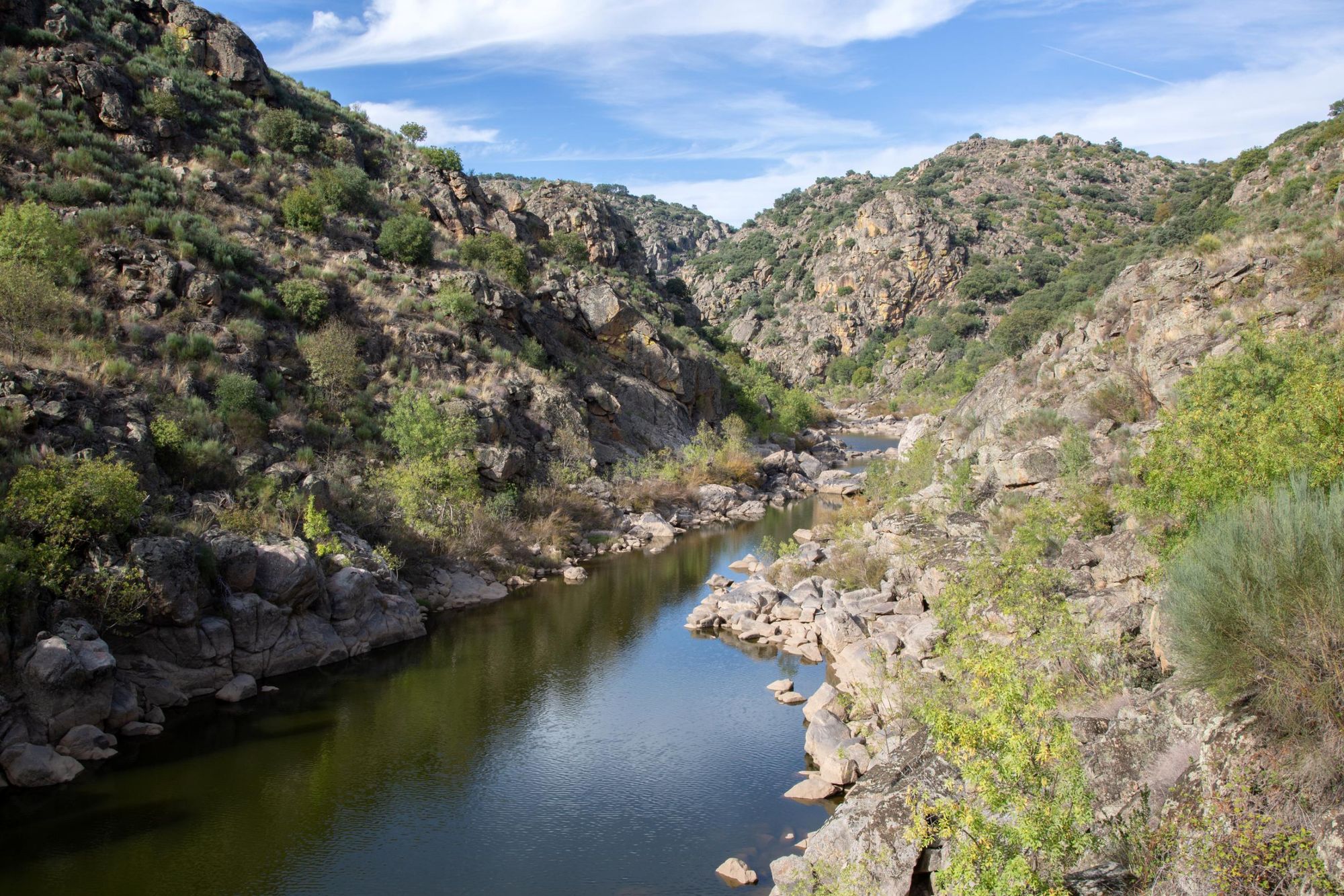
The Great Route of the Côa Valley sits in the north of Portugal, following the course of the Côa River from the source to the mouth. It is one of the country’s wildest places - characterised by deep gorges, oak tree forests, rugged rock and bright flowers. Morning can start with the howl of the Iberian wolf, while Egyptian vultures circle overhead and wild boar and deer trot through the valley.
Morning can start with the howl of the Iberian wolf, while Egyptian vultures circle overhead and wild boar and roe and red deer trot through the valley…
Close to the Spanish border, Rewilding Europe has been working in this region to restore a natural landscape abandoned by farmers due to comparatively poorer soils which make this place tough to cultivate. Their work has already created the mosaic ecosystem described above, but it gives the area an immersive excitement when walking through it; this is a place where nature can thrive - and it is also a place which also has an incredibly rich human history.
The Côa Valley is one the largest sites of palaeolithic rock art in the world. The artwork was discovered when a dam was planned (and then later abandoned), and there’s now a state-of-the-art museum you can visit and see a whole lot of it.
This marked trail, managed by Territórios do Côa, takes you through this diverse landscape. Their website has a stage-by-stage guide to this epic walk.
What is the Best Time to Hike in Portugal?
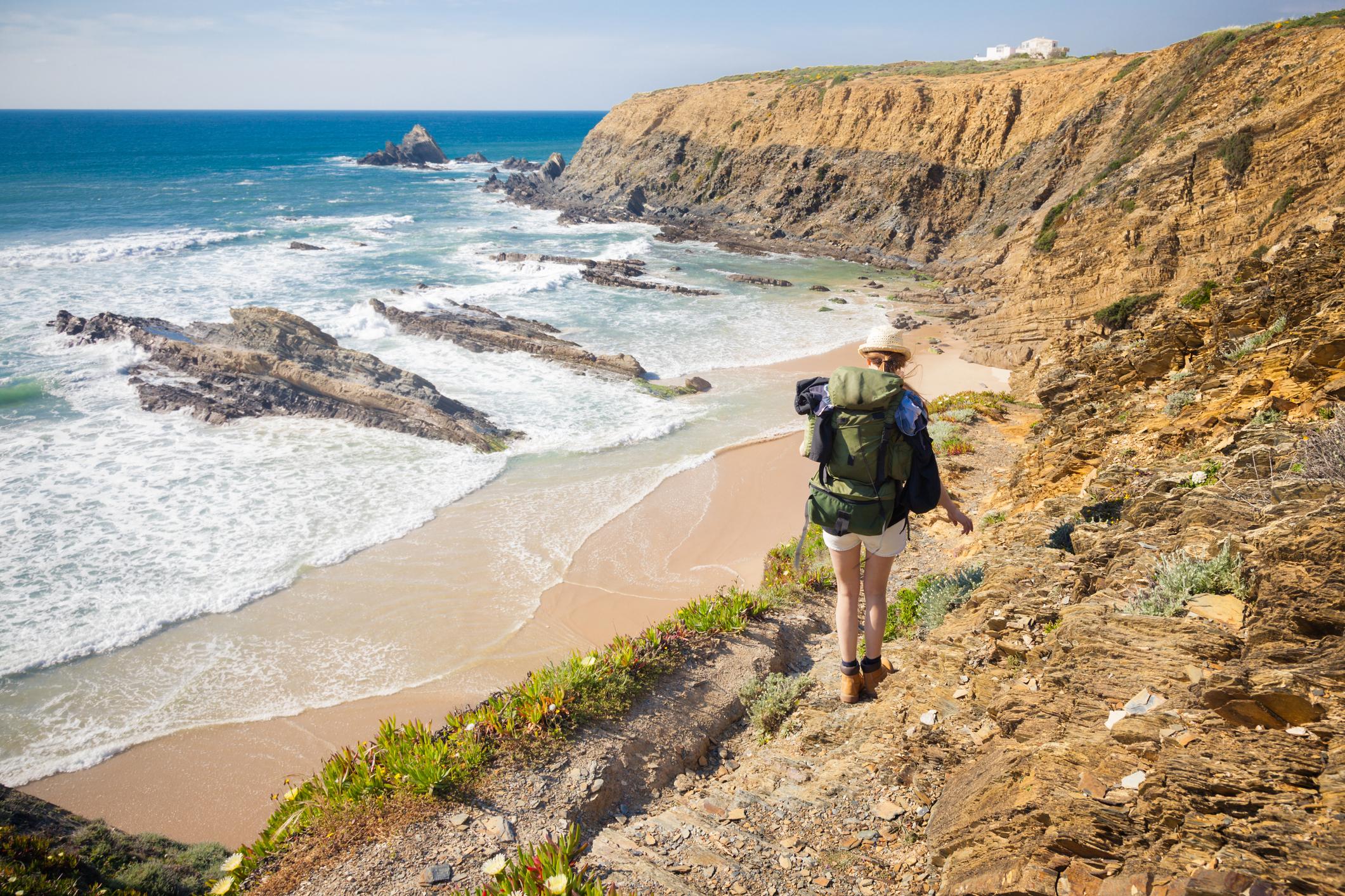
Portugal is a year-round destination for hiking, with the only serious consideration being the scorching heat in the height of summer. It is common for the temperature in the south of Portugal to be up around 30°C in summer. Some people like this, of course, while for others, it's too hot. If you are going to be hiking in such conditions, appropriate care must be taken and you should seriously think about your hydration. Otherwise, each time of year has its benefits. Spring comes with colourful wildflowers, autumn has the classic foliage, while winter is cooler with fewer crowds, making it particularly good for hiking.
Madeira is popular year-round - an island of eternal spring - and the Azores is more manageable for hiking in summer due to the proximity to the ocean.
What Animals Live in Portugal?
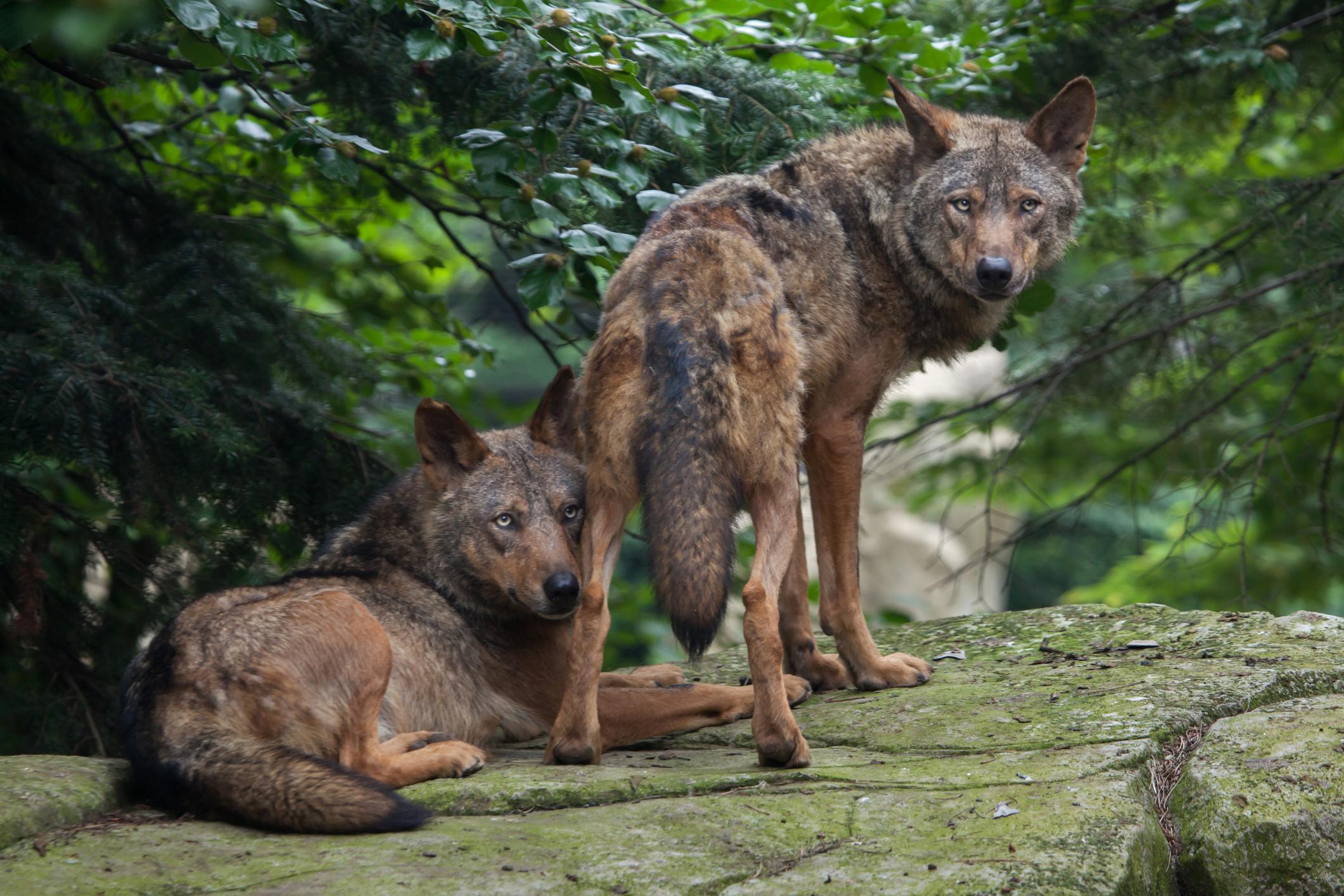
Naturally, the wildlife you can spot in Portugal will change depending on the part of the country you’re in, but the area most of interest to wildlife lovers is surely the Greater Côa Valley. The area is at the heart of a large-scale Rewilding Europe project which is aiming to restore the area into a fully-functioning ecosystem. Here, you’ll find wild boar, roe deer and red deer, as well as vultures and eagles flying above the cliffs. If you’re lucky, you’ll hear howling Iberian wolves at dusk and see them crossing the valley, or spot the ear tufts of an Iberian lynx.
Further south, you’ll see livestock and horses. Off the coast, look out for dolphins, minke whales or even orcas straying into the country’s waters in search of food.
What to Eat in Portugal?

Portugal is a country of farm-to-table food, where excellent raw ingredients go a long way. Look for the Francesinha sandwich, which is a little like a croque monsieur, loaded with cheese and meat, but also boasting a tomato and beer sauce (yes, beer). Bacalhau à brás is a typical dish featuring salted cod, eggs, onion and fried potatoes, garnished with olives and parsley. Queijo da Serra is a traditional creamy sheep cheese, and the pastéis de nata custard tart is a must try. Seafood is generally fresh and excellent here, while they also take bread seriously in Portugal.
How to Get To (And Around) Portugal?
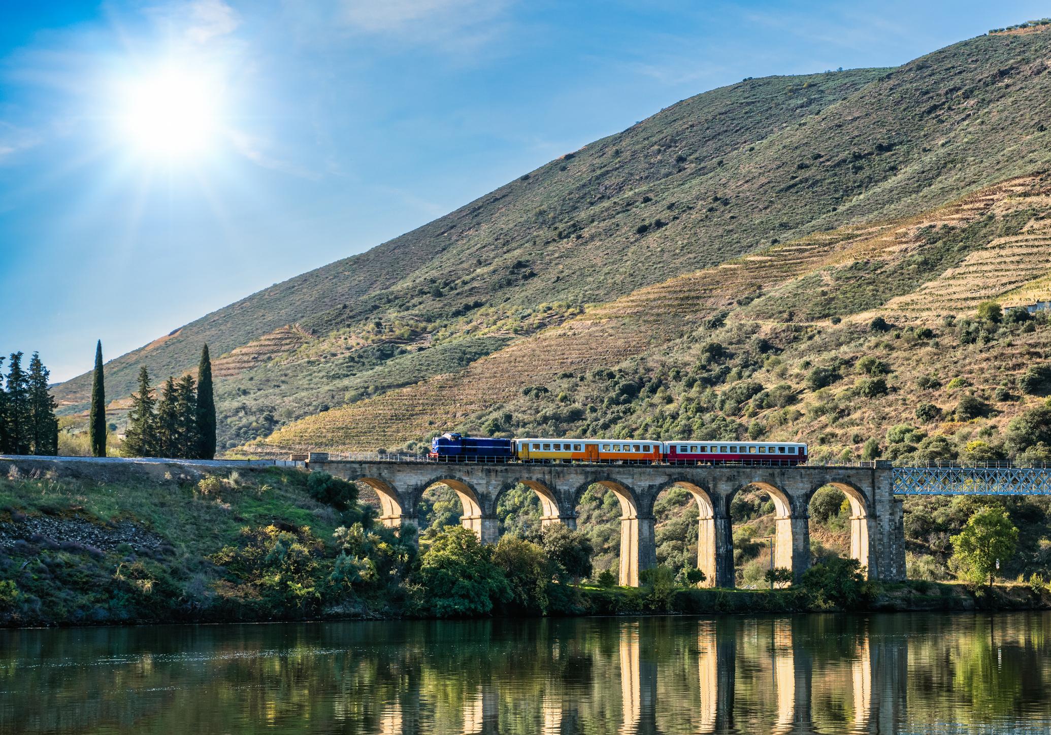
The two busiest airports in Portugal are Lisbon Portela and Porto, both of which serve their eponymous cities. Faro Airport is in the Algarve region. For Madeira, you’ll be looking at the Cristiano Ronaldo International Airport in Funchal, and the biggest airport in the Azores is Ponta Delgada Airport on São Miguel island.
Back on the mainland, Portugal is a small country, so you can get most places by train or bus. A car allows you extra flexibility, particularly in rural places.
Inspired? Check out our range of adventure holidays in Portugal now!