


Albania is a country of diversity. In the Albanian Alps, also known as the Accursed Mountains, you’ll find sublime, jagged peaks, glimmering mountain lakes, and tranquil villages which seem almost untouched by time - as well as weaving, winding trails to huge views out over all of this. But Albania also has almost 300 miles (482km) of coastline - both Ionian and Adriatic - and along the hills that backdrop that coast there are also waymarked walking routes, taking you through olive groves and to perfect beaches looking out over world famous islands like Crete.
Albania has only really been open to the world since the end of Communism in 1991, and so despite the undeniable beauty, the trails here are still a lot quieter than other equivalent sites of beauty in Europe. What that means is that, particularly if you visit in the shoulder seasons, you can often have these trails to yourself (while avoiding the often intense heat of summer).
In this guide to the best hikes in Albania, we’ve looked to include routes through a diverse range of the country. There are three long distance routes (though possible day hikes on these routes are also hyperlinked in our descriptions) and then a couple of short, beautiful day hikes, including one extremely popular route to the Dajti Mountains which can be done from Tirana.
- 1. The Peaks of the Balkans Trek
- 2. The High Scardus Trail
- 3. Walk the Albanian Riviera
- 4. Summit Mount Gjallica
- 5. Hike up Mount Tujanit
Here is our guide to the best hikes in Albania, from the Albanian Alps to the sparkling coast.
1. The Peaks of the Balkans Trek
- Start/Finish: Theth, Albania (circular route)
- Distance: 114 miles (183km)
- Walking time: 10 days
- Difficulty: Challenging
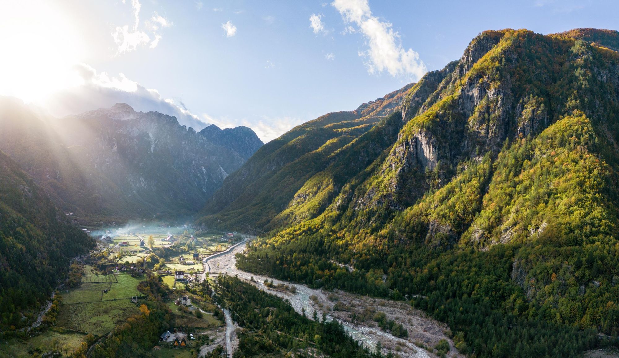
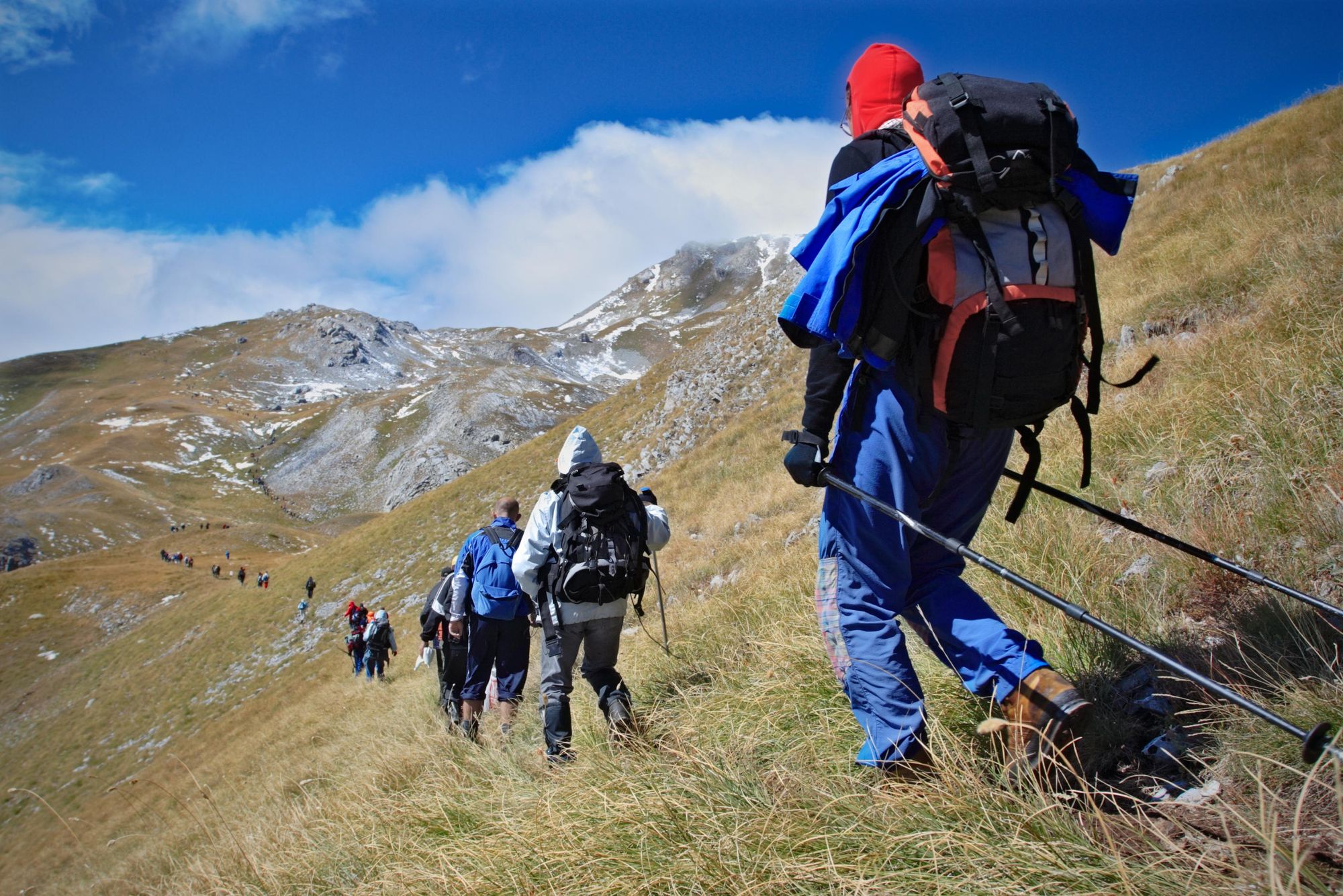
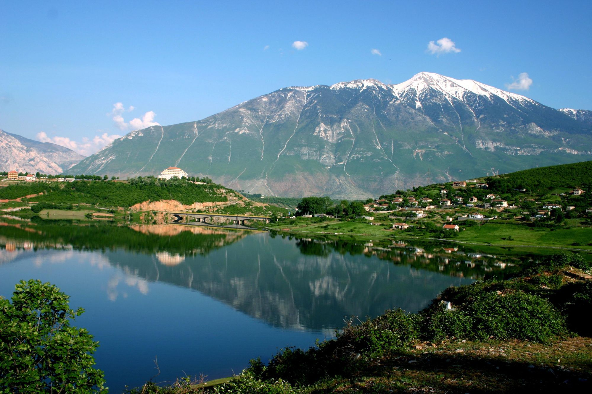
This 10-stage epic will take you through the valleys and mountain passes of the Accursed Mountains, also known as the Albanian Alps. The route is a somewhat recent addition to Europe’s network of long distance hiking routes - starting in Albania and looping through the mountains of first Kosovo, then Montenegro, before returning to Albania to complete the loop.
The route is circular (and so you can start and finish in numerous places) but one of the most common starting points is in the village of Theth in Shkodër County in Albania, backdropped by rugged, spiking mountains which - local legend has it - were created by the devil himself. From here, stages one to three are entirely in Albania. On stage four you’ll move into Kosovo and on stage seven, you’ll enter Montenegro, where you'll stay until the finish brings you back to Theth.
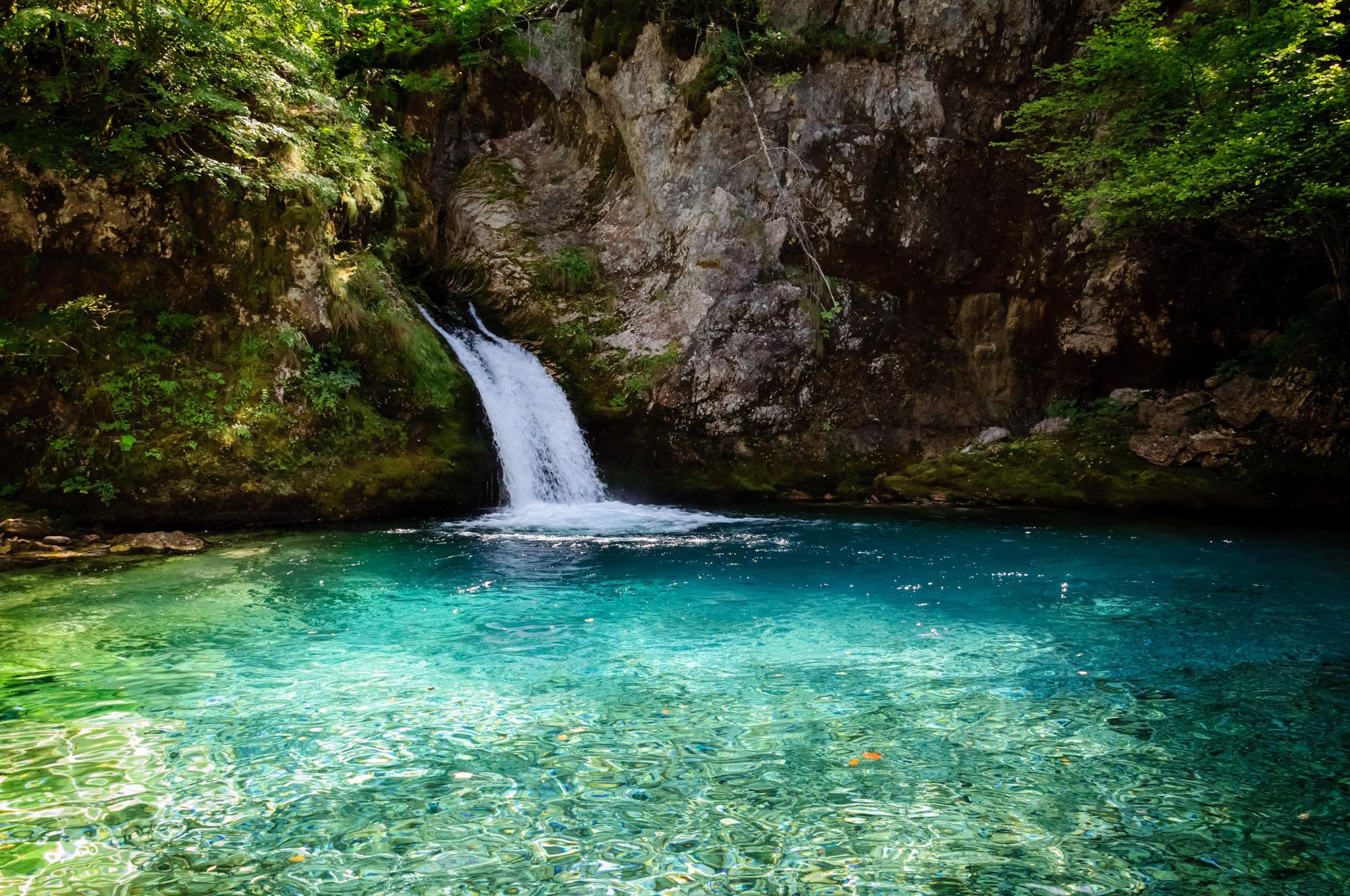
Expect your views to be wide, glaciated valleys, glimmering mountain lakes and steep, sharp limestone peaks. The route includes a pass by the Oko Skakavice, also known as the Blue Eye, which is a popular day hike from Theth. And the Theth-Balbona stage is also famous as the route which will see you hike over the Valbona pass - another of the best day hikes in Albania.
Look out for the high mountain peaks further on too - which can be climbed with slight detours - including the highest peaks in both Montenegro (Maja Kolata, 2,528m) and Kosovo (Gjeravica, 2,656m). You'll pass through two national parks in Albania - the Thethi National Park and Valbona Valley National Park. And the Rugova Valley in Kosovo is also a national park.
If you're lucky you might spot a lynx, a wolf or even a bear roaming these green lands.
The Peaks of the Balkans is a cross-border trail which is aimed at connecting the most attractive mountain regions of Albania, Kosovo and Montenegro...
Ricardo Fahrig is a destination expert who was involved in the creation of the trail. “The Peaks of the Balkans is a cross-border trail which is aimed at connecting the most attractive mountain regions of Albania, Kosovo and Montenegro,” he told us. “We saw that tourism was concentrated in a few hotspots - but by connecting those hotspots into a circular walk, it brought in a lot of other communities that didn't see any other visitors at all. It took some of the tourist pressure off those initial destinations, which they couldn't deal with, and brought these other communities, which didn't have any tourist benefits, into the tourism network.
“When we created the trail we never dreamed it would become one of Europe's top trails.”
While the trail has become incredibly popular, there still isn’t a lot of developed infrastructure in the area as a whole. This is a long-distance hike which can feel extremely exposed and remote.
The route is well marked for much of it, though a guide is always a good idea - not least because they can also then sort you out with the cross-permit border required for the walk.
2. Walk the Albanian Stages of the High Scardus Trail
- Start/Finish: Kukes-Rabdisht
- Distance: 68 miles (109km)
- Walking time: 7 days
- Difficulty: Challenging
If the Peaks of the Balkans trail sounds good to you, but you want something even more off the beaten path - then the little-known High Scardus Trail may just be the walking route for you.
This is another route which spans a triangular border area - though this time it’s Albania, Kosovo and North Macedonia; tracing an area which, due to war, was off limits for much of the 1900s.
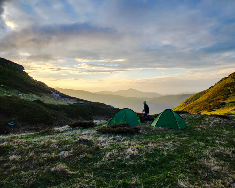
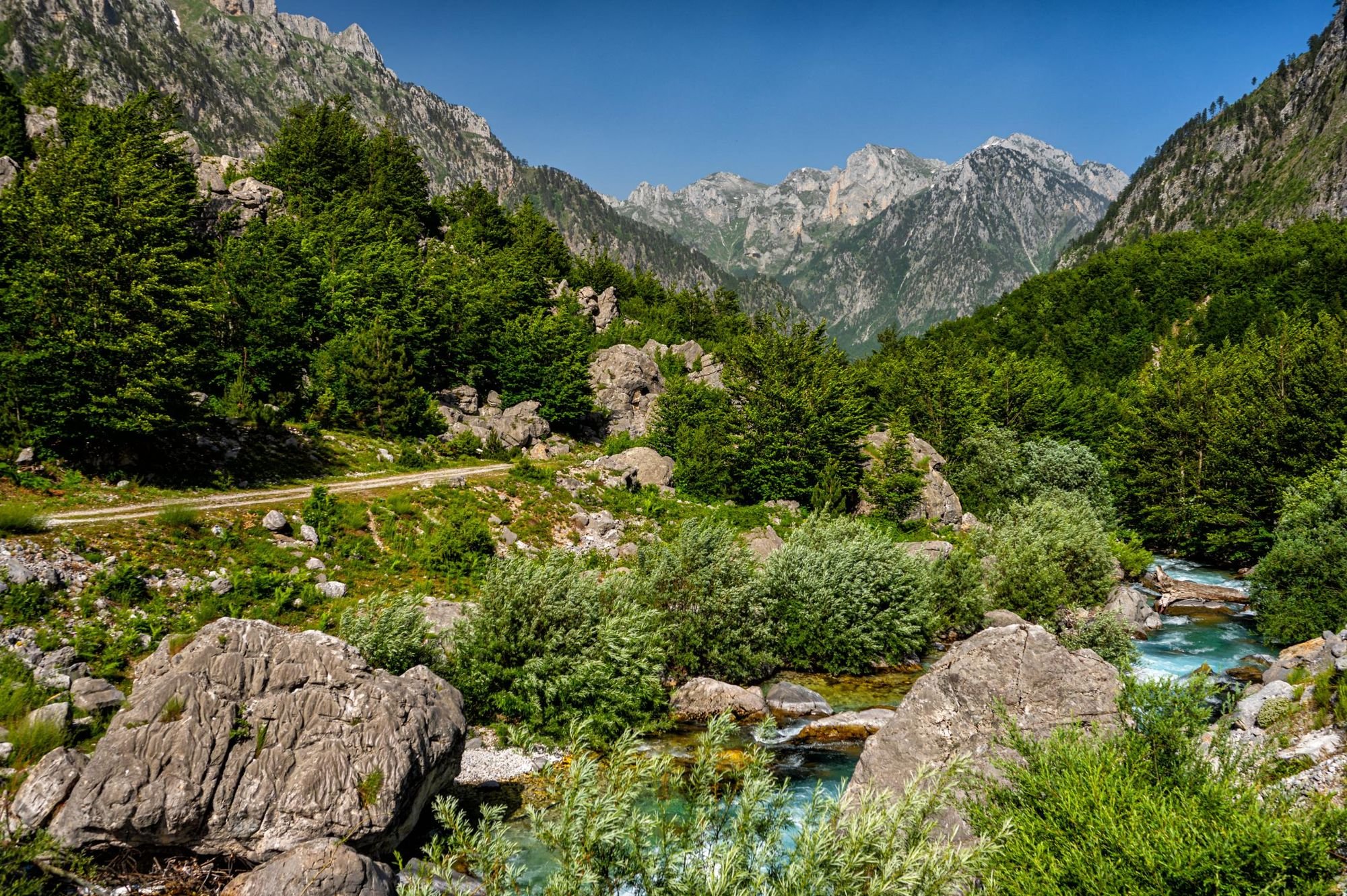
The trail is a 20-stage, 225-mile (362km) route. It takes 20 days to walk it all and passes through six national parks, two in each of the featured countries. The most common starting point for the full route is Staro Selo in North Macedonia, but if you’re looking to hike specifically in Albania, you could join the route at the section which ascends Mount Korab, which at 2,764m is the highest peak in both Albania and North Macedonia. There are excellent guest houses in the area and you’ll no doubt encounter nomadic shepherds wandering along the route with their flocks and their sheep dogs - which are particularly important given the bears and wolves.
From here, you can walk ridgelines and go on to climb Mount Korab. You then follow military patrol routes to shepherd’s huts and cross the Grama Pass (2,300m)...
Of course, Mount Korab can also be ascended on a demanding day hike of around eight hours. The route runs around 10.5 miles (17km) from the most commonly used trailhead. If going solo, you will need to tell border guards and pay visitor tax for Mavrovo National Park.
An Albanian itinerary on the High Scardus Trail could start in Kukes, continuing on through Vanave Gorge into the Gora Highlands to reach Caje, one of the highest occupied settlements in Albania. From here, you can walk ridgelines and go on to climb Mount Korab. You then follow military patrol routes to shepherd’s huts and cross the Grama Pass (2,300m), with great views to Korab and down to Grama Lake. You’d walk on to Rabdisht and reach Tirana by transfer.
A guide is recommended to walk in these mountains, and ensure safety and proper navigation.
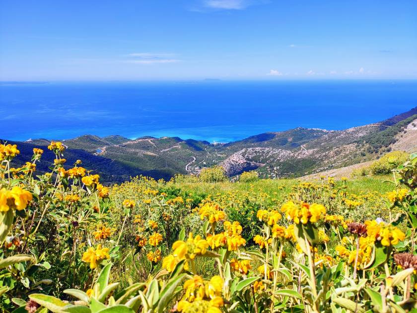
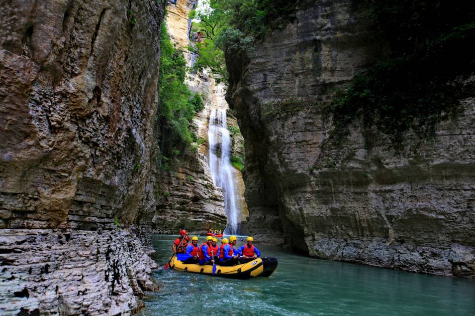
3. Hike the Coast of the Albanian Riviera
- Start/Finish: Vlore, Albania to Borsh Beach (point to point)
- Distance: 35 miles (56km)
- Walking time: 6 days
- Difficulty: Challenging
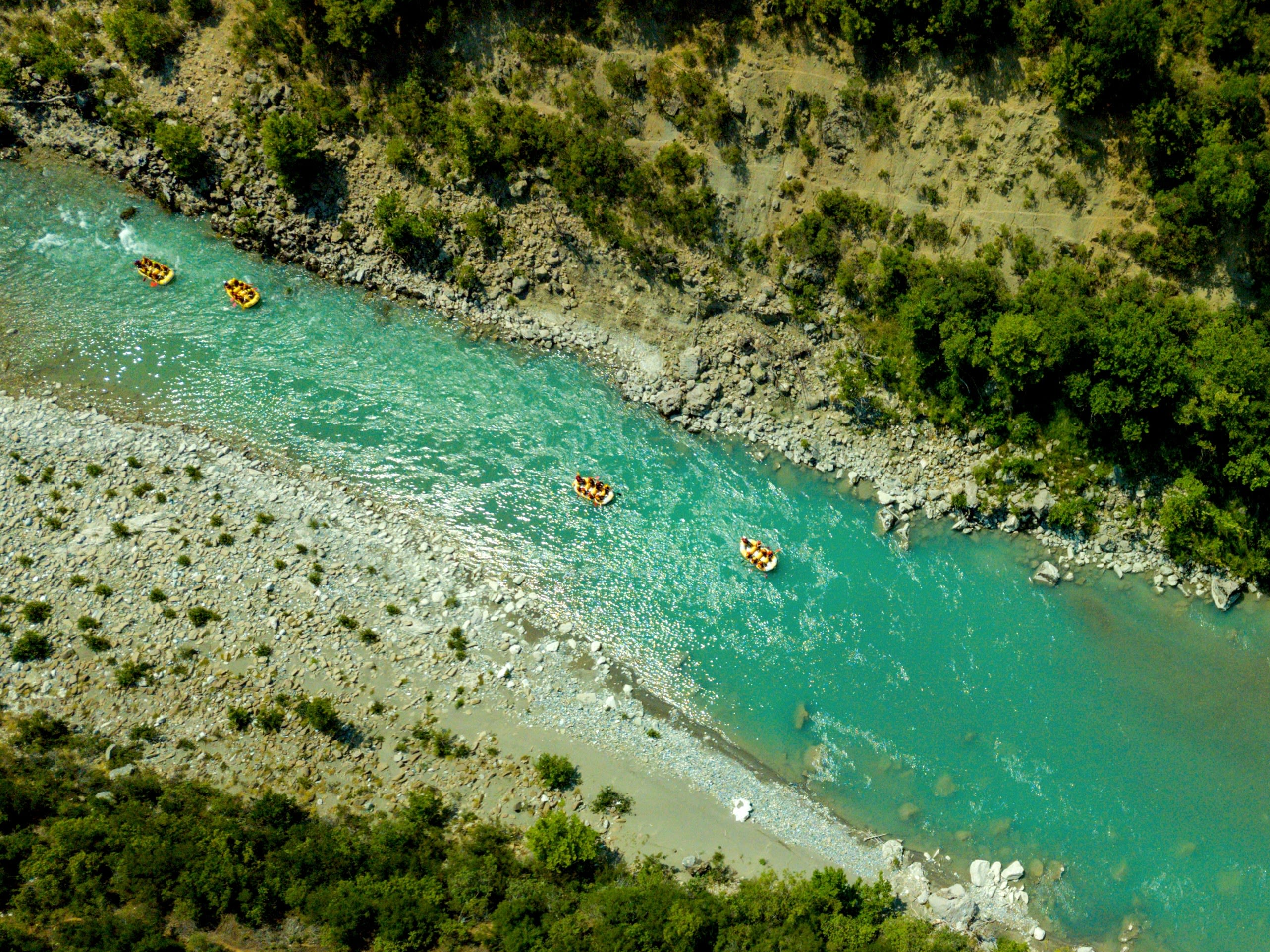
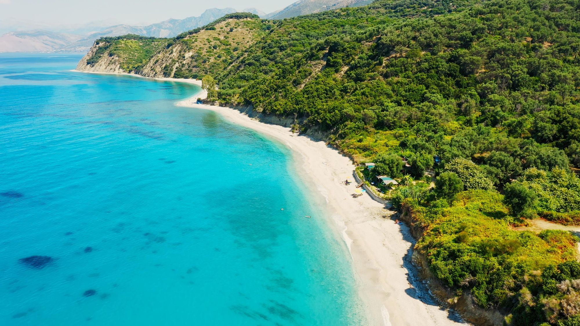
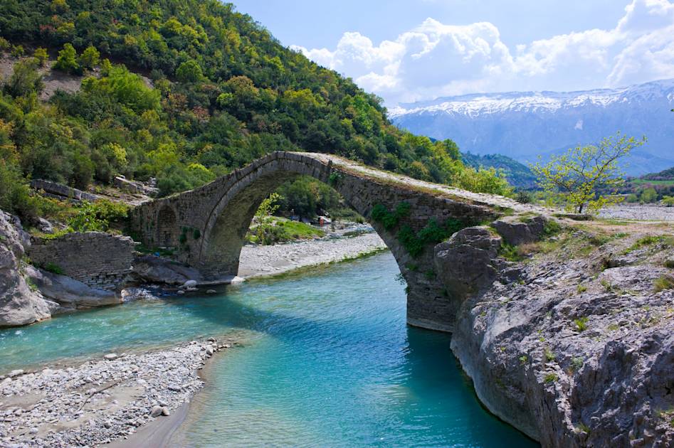
The southern coastline of Albania is an idyllic place. White, sandy beaches are backdropped by green hills and behind them mountains. On the shores of those beaches, the Ionian Sea - an elongated bay of the Mediterranean Sea - splashes up and then flows back out again.
Now, word has got out a little about some of those beaches. The likes of Dhërmi beach is busy as it gets in summer now - with sun loungers and tourists enjoying all those views we mentioned (with views just as beautiful as elsewhere, but for a fraction of the price). But if you dive into those hills behind them, you’ll find the Albanian Coastal Trail, a waymarked route which follows goat trails, dips down to pebble and sand beaches, and passes olive groves in quiet tranquillity.
In summer this route is joyous, but it’s arguably even more so during the shoulder seasons, when the crowds have really dissipated, the trails are empty and the locals are more relaxed.
Ricardo Fahrig was also involved in the development of this long-distance route.
“It's also a diverse region,” Fahrig says. “It's called the Albanian Riviera. When you think about a Riviera you maybe think about concrete blocks at the coast, but this hasn't been as heavily developed. It is the Ionian Sea - Corfu, which is a well-known destination, is just 45 minutes [boat trip] across - and there are mountains behind. You have some features which have a backdrop of 2000m high coastal mountains, and in between the olive groves and the plants.
“You can stay at small family run guesthouses and get a bit of a local touch - and then by travelling in the off-season, in Spring or Autumn, you can really get to know the locals better.”
4. Climb Maja e Gjallicës / Mount Gjallica (2,489m)
- Start/Finish: Brekije/Brekije (out-and-back)
- Distance: 9 miles (15km)
- Walking time: approx. 6-7 hours
- Difficulty: Challenging
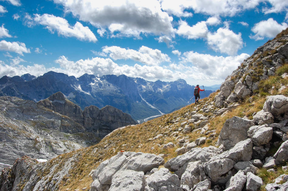
Mount Gjallica can be seen from various points on the High Scardus Trail, though the trail itself does not include an ascent of the mountain. Gjallica is the highest mountain in the Kukës District of Albania, tucked into the northwest of Albania near the border with Kosovo.
This ascent of Gjallica begins from the village of Brekije at 1,235m, which is nestled deep in the national park Korab. You’ll notice in the village that there is a spring in the centre of town. This spring actually flows down from Gjallica; so in some ways this ascent is you following that flow of water back to the source up the mountain.
You’ll begin the day by walking by traditional farm buildings and then will enter oak forests, where you’ll big to ascend. Emerging from the forests, you’ll find alpine pastures in an area often busy with livestock. The spring from the village runs through this area also.
You’ll climb up the southern slope of Mount Gjallica. You’ll first then reach a peak known as Maja e Vole at around 2,400m. It’s one kilometre from here along the Gjallica ridge to the high peak, where the national flag of Albania waves and looks out over the country - including a clear view out to the city of Kukes, and to the surrounding rivers which weave through the landscape.
The summit and ridge are exposed and relatively bare. Hills layer into the distance beyond.
5. A Day Hike from Tirana up Mount Tujanit
- Start/Finish: Dajti Ekspres (out-and-back)
- Distance: 3.8 miles (6km)
- Walking time: approx. 4 hours (starting from cable car)
- Difficulty: Moderate
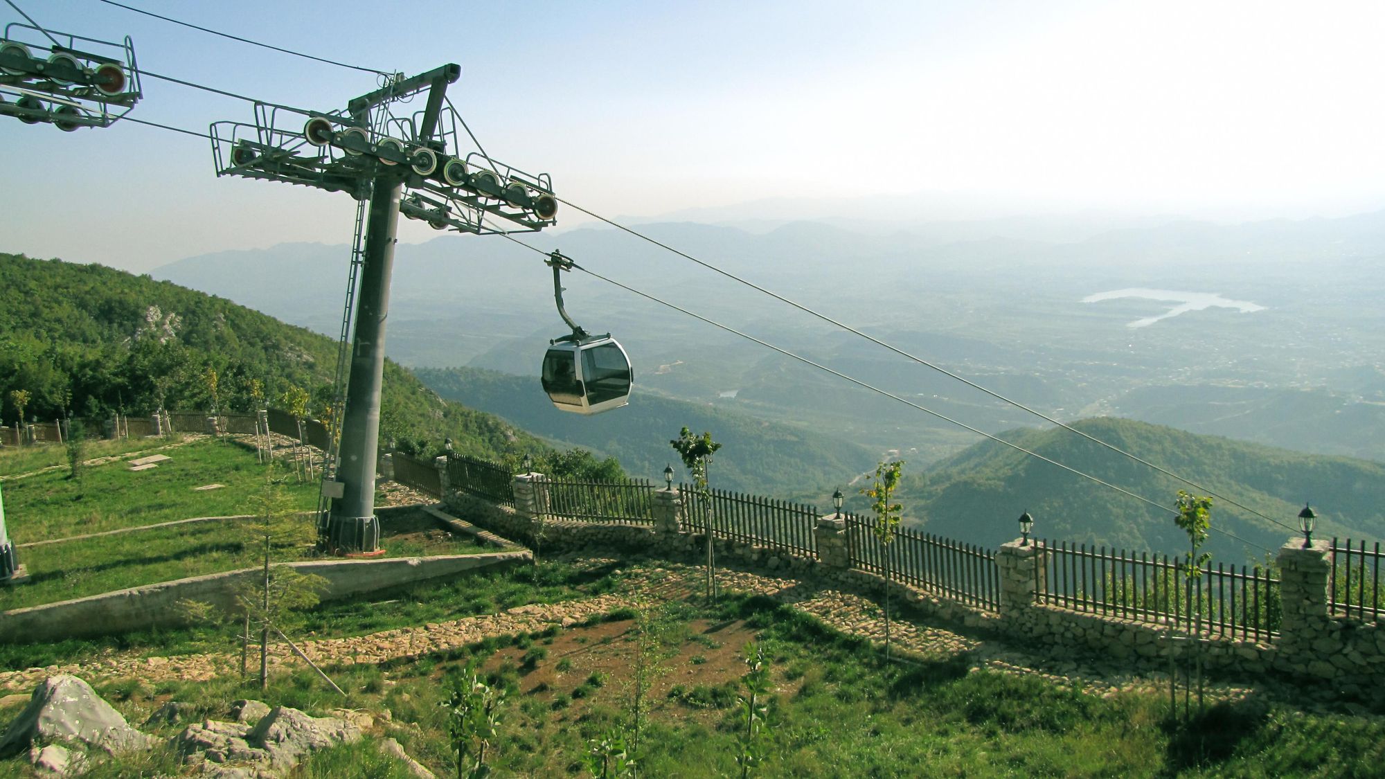
The hike up Maja e Tujanit and into the Dajti Mountains is one of the best day hikes in Albania - and it’s in close reach of the capital of Tirana. It’s also the easiest hike out of the five on this list.
This hike starts by getting yourself up the Dajti Mountain. You can take the hike up this mountain, which is nice and scenic the whole way, or you can take the Dajti Ekspres cable car (which has great views back to the city of Tirana).
The cable car will drop you off at 1,613m, and then it’s all about following the arrows and red and white trail markers through the forest. These can be quite easy to lose, so stay focused, but you won’t have to do any scrambling. This is a steep, but short and non-technical ascent.
From the summit, you get a great view of the deep blues of Bovilla Lake and the surrounding mountains of Dajti National Park. You can then combine this with a hike over to the summit of Mt Dajti to make it a longer day out in the mountains, and get great views out to Tirana.
This hike is accessible, doable in one day, still isn’t too busy, and the views are exceptional.
Go early in the morning during the summer to avoid the crowds, or visit in the off-season.
Inspired? Check out our full range of adventures in Albania now!