

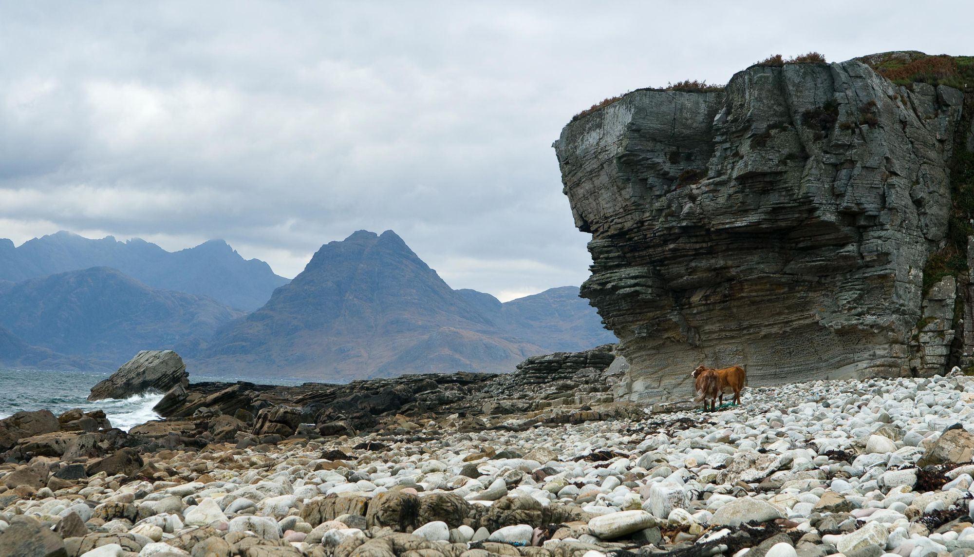
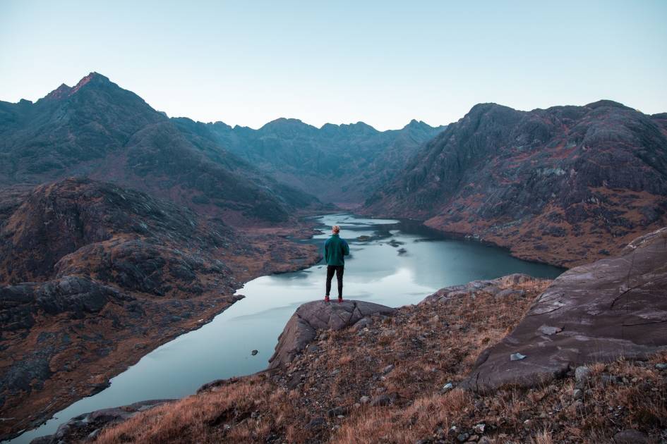
Asked to imagine themselves hiking on the Isle of Skye, most visitors will conjure up an image of hidden sea lochs guarded by the rugged Cuillin mountains, of windswept coastlines looking out over spiking sea stacks and choppy water, or of beautiful beaches, backdropped by Scotland’s finest Munros. All of these scenes can be reached on the best walks on Skye. The island is a dreamscape.
The legendary Black Cuillin is renowned as the UK's most challenging, most beautiful mountain range.
What people often miss out of this image, though, is the people; the actual communities who live on Skye, have done for generations, and how all of this tourism to the island impacts them. All of that scenery is as much a pull for us Scots as it is for those visiting from abroad. But while tourism brings obvious benefits to Skye, it’s irresponsible to write about the beauty of this island without also acknowledging the overtourism that plagues certain honeypots.

With that in mind, you’ll notice we’ve omitted certain iconic destinations on the Isle of Skye from this article; notably the fairy pools in Glen Brittle, the fairy glen in Uig, the craggy Old Man of Storr and the Quiraing.
In this feature, I’m going to recommend some hikes on Skye beyond the honeypots. There are some extremely tough hikes here, and other more manageable ones. As with all hikes, be safe, leave no trace and respect the mountains. The weather can turn on Skye quickly, and the terrain is tough.
Staying safe on Skye
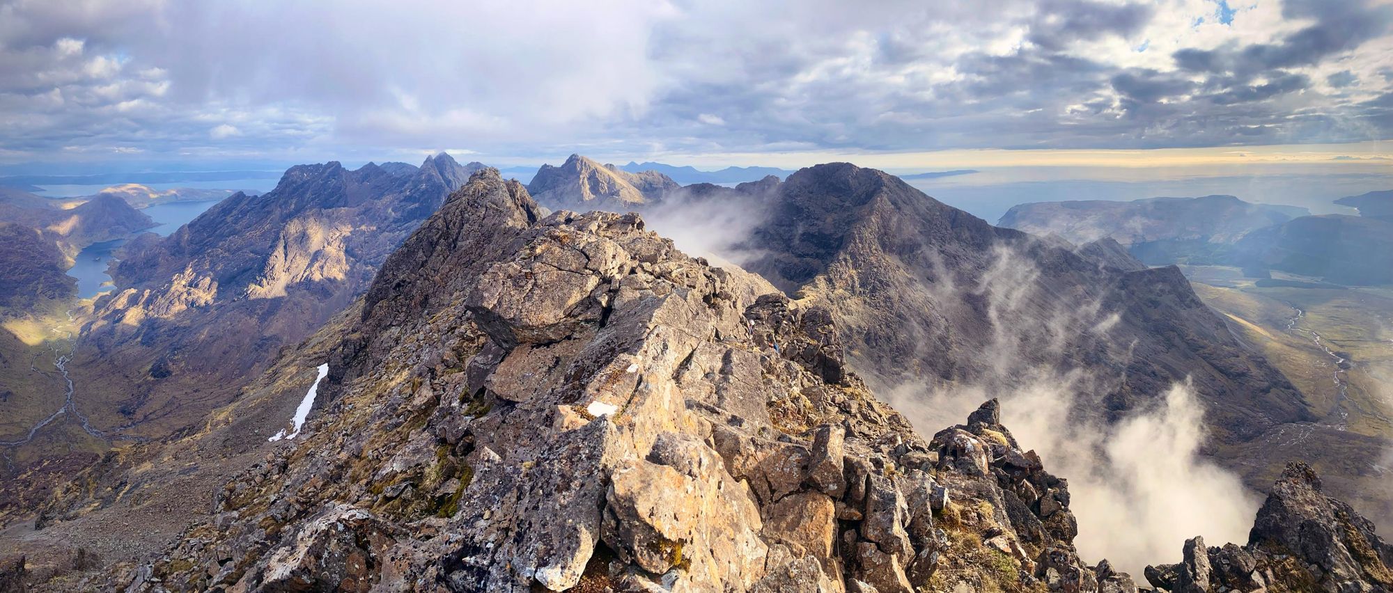
Recently, the Skye Mountain Rescue Team (MRT) were called out to save 20 walkers over a 13-hour period, all on the Skye Trail. All incidents involved "particularly poor" but "not exceptional" weather and tourists, most of whom were experienced hikers. The hiking on Skye is extremely challenging. If you're going to be hiking here, ensure you are properly prepared, are ready for the weather and know how to navigate. You don't want to get hurt in the mountains.
The route descriptions below are only short summaries, designed to inspire but not to serve any navigational purpose. They are not intended to guide you on the route and further mapping, planning and experience will be required if you want to safely walk any of the trails featured. Sometimes, as in the instance of the Skye Trail, the word 'trail' can be misleading. There may just be a direction and a wild landscape, rather than a clear, purpose-built path.
The legendary Black Cuillin is renowned as the UK's most challenging, most beautiful mountain range - and the weather is famously changeable around Skye. Mist and other infringing conditions can draw in quickly, and there are even some ridges where compasses may not work as intended. When there is snow, specialist winter equipment including ice-axes and crampons is often essential, and climbing in these conditions can be seriously perilous or simply not possible.
Only embark on hikes you have the skills and experience to safely navigate. We'd recommend hiring a local guide. You’ll bring an income stream to locals, ensure you stay safe - and learn the history and lore of this storied island as you go.
If you need to call for help, dial 999, ask for the police, then mountain rescue.
1. Climb Blà Bheinn (Blaven), 929m
- Distance: 5 miles (8km)
- Duration: approx 5 hours
- Start Point: Car park near Loch Slapin
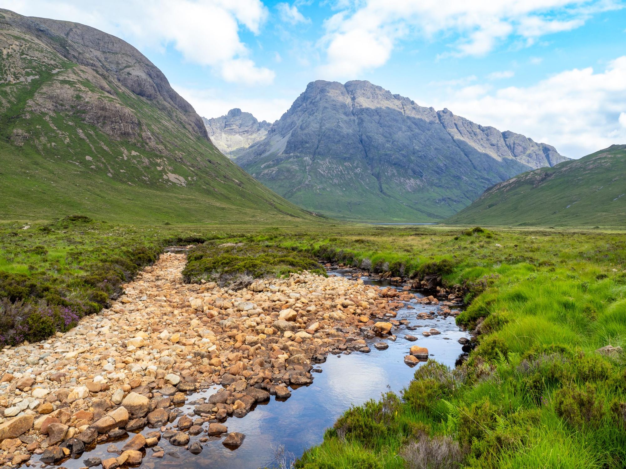
There are 282 Munros in Scotland - that is, mountains over 914m/3,000ft high - and some hikers will tell you that Blà Bheinn, often anglicised as Blaven, is the finest climb of the lot. To put the mountain into context, there are 12 Munros on Skye in total. 11 of these are on the main Cuillin ridge, while Bla Bheinn is the only one which is not. This gives the mountain a particularly distinctive character.
Blaven has become that dream mountain. It's one of these hills I'll just keep going up again and again.
I spoke to Andrew Dempster after the release of his book The Munros: A History, and he described why it was one of his favourite mountains to climb in Scotland.
“The south ridge of Blaven rises from the sea to the summit, right from Camasunary Bay,” Dempster said. “The most common route up Blaven is from Loch Slapin. I usually go up the south ridge - or do the Clach Glas-Blaven traverse, which is a lovely scrambling route including one of the other routes near Blaven called Clach Glas. It [Clach Glas] is sometimes called the 'Matterhorn of Skye' because it is quite a climb. There’s a scramble to the top. I've never found it that difficult but you often see people roped up climbing Clach Glas. The traverse is one of the finest ridge traverses in Scotland.
“In the book I've talked about the ‘dream mountain of the west’ and I think to me, Blaven has become that dream mountain. It's one of these hills I'll just keep going up again and again. Blaven is now possibly my favourite Munro."
2. Walk to the Point of Sleat
- Distance: 5.5 miles (8.9km)
- Duration: approx 3 hours
- Start point: Car park, Aird of Sleat
Most who drive onto Skye follow the A87 all the way to Portree. In order to reach this hike, you’ll need to take a left off the road five or so minutes after crossing the Skye Bridge, and follow the A851 past Torabhaig Distillery, past Armadale ferry port, all the way to Aird of Sleat, in the southwest corner of Skye.
From here, you’re then going to hike out to the southernmost point of Skye, starting on a wide dirt track with almost immediate views out over the Sound of Sleat and all the way to Knoydart.
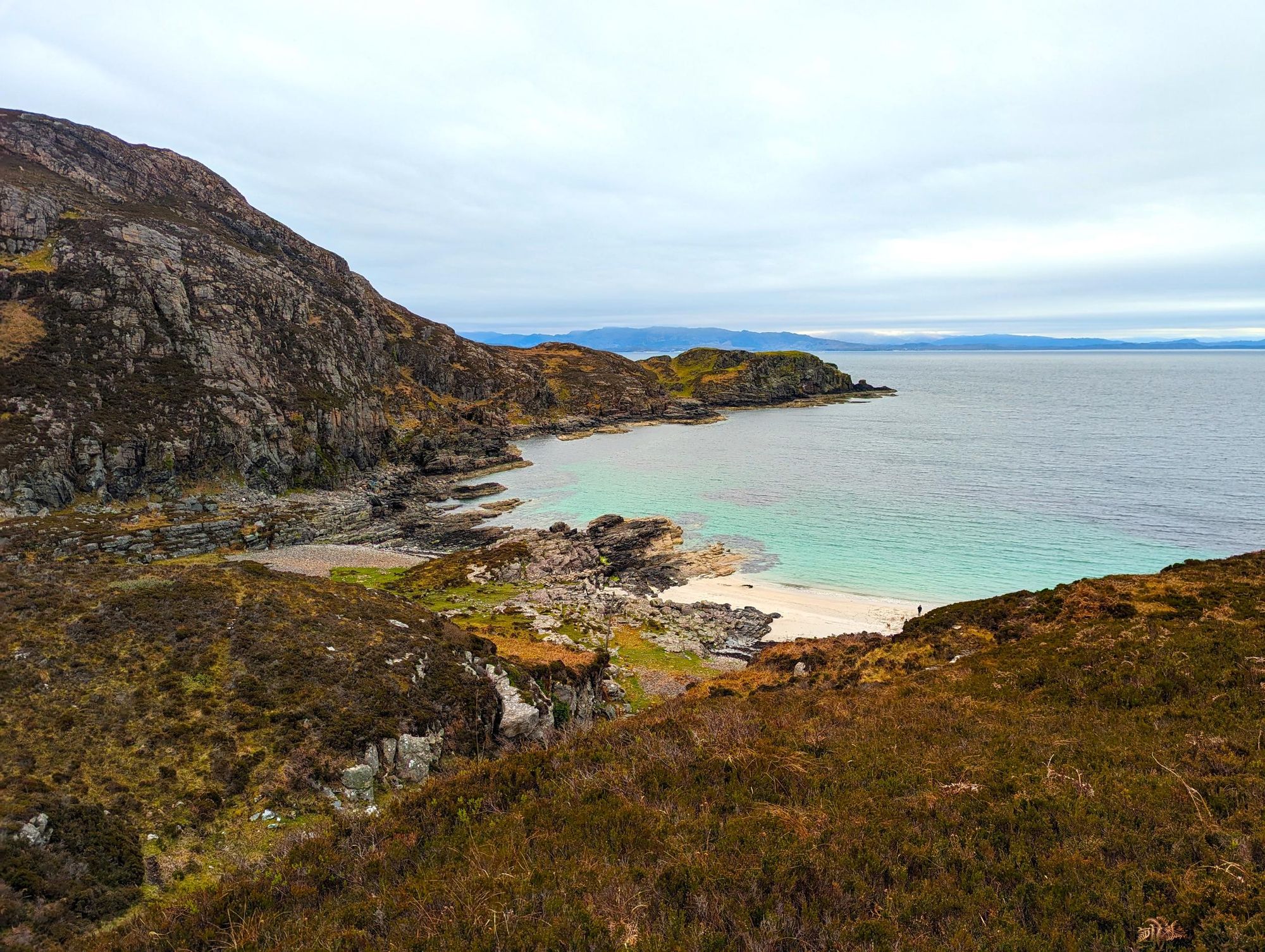
You’ll weave and wind on rolling hills, and after the path narrows, you’ll have the option of detouring down to Camas Daraich, a white sand beach with turquoise water, sandwiched between rugged rocks. I find this to be a nice lunch stop on the return leg of this out-and-back walk.
A boggy section will soon leads out to a set of steep, concrete stairs (which can be slippy), allowing you to descend to the north shore. Tides may impact when this is accessible, so be cautious. Follow the grass over to the Point of Sleat, walking over the rocks, to the lighthouse. This is a rarely visited part of Skye, but I find the views from here out to Eigg and Rum in particular to be astounding.
Keep an eye open for marine life. I’ve spotted dolphins, otters and seals here.
3. Climb Sgùrr nan Gillean, 966m
- Distance: 7.5 miles (12km)
- Duration: approx 6 hours
- Start Point: Layby near Sligachan
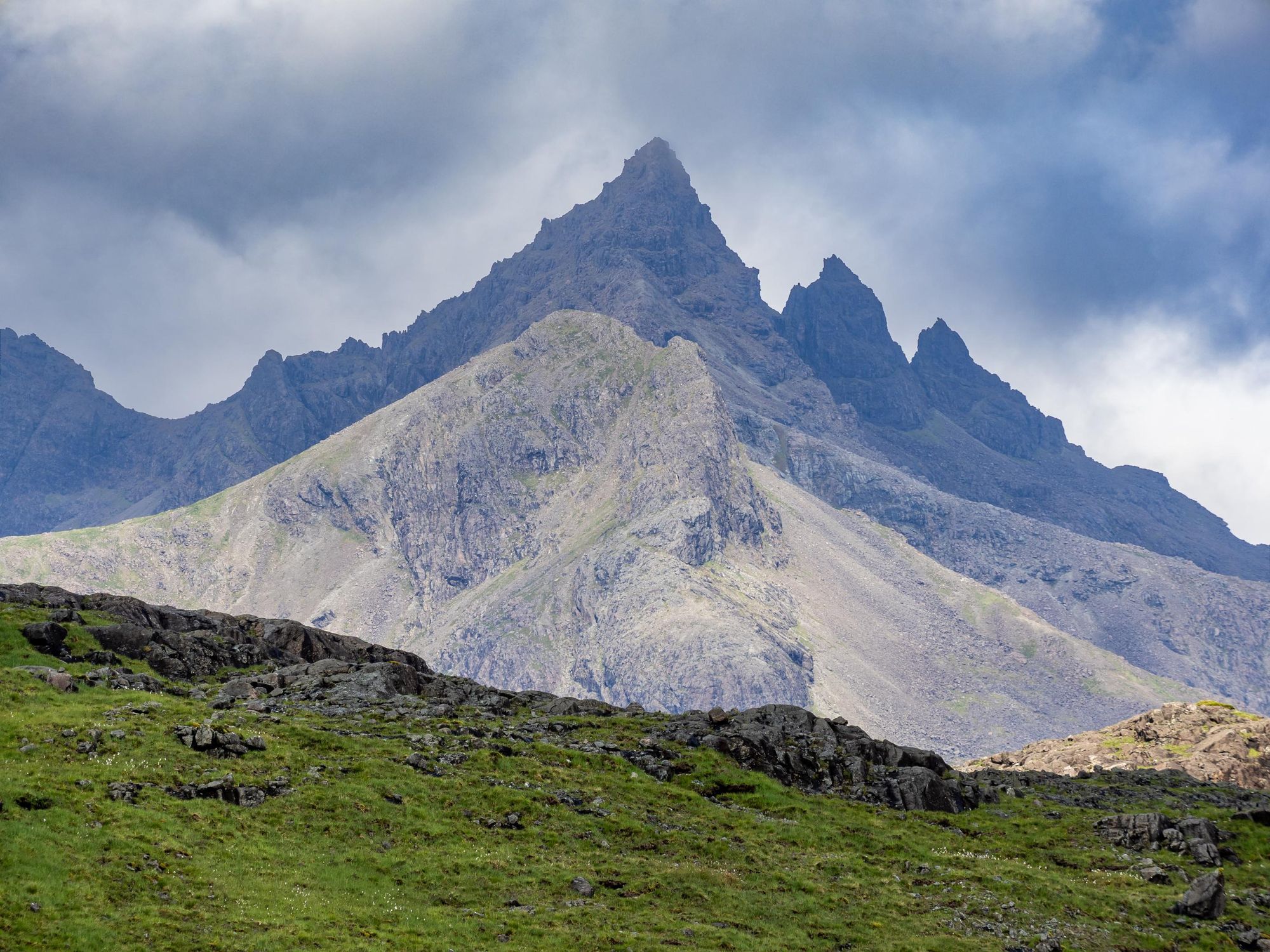
The mighty Sgùrr nan Gillean is perhaps the most famous mountain on the Cuillin ridgeline. A huge triangle of a mountain, this is a challenging climb. You'll need to undertake a dramatic scramble in order to reach the summit, but it’s another which author Andrew Dempster picked out as a favourite of his.
“I think I’ve been up Sgùrr nan Gillean 12 times,” he told me. “It’s one of the few peaks in the Cuillin you get a good view of from Sligachan. Sgùrr nan Gillean is really recognisable. There are these three ridges which form a lovely pointed summit. If you asked a child to draw a picture of a mountain they would probably draw a pyramid, and it's exactly like that.”
Climbing in the Cuillin range is famously difficult, and this is no exception.
If you asked a child to draw a picture of a mountain they would probably draw a pyramid, and it's exactly like that.
“There's not really any easy way up Sgùrr nan Gillean,” said Dempster. “Even the 'Tourist Route' is a bit of a misnomer because it's quite hard scrambling for the last few hundred feet. I remember the first time I did it I actually did it via the west ridge, which is one of the harder ridges. At that time I was a 'Green horn' but I managed to get up it. I climbed it again last year and we had a beautiful day on Sgùrr nan Gillean. It was the first time I had done it for years, and the scrambling part I actually found quite challenging. I used to think it was really easy but the older you get, the less appeal you find scrambling! Sgùrr nan Gillean translates as the ‘Peak of the Young Men’ and I would say it is a young man's peak!”
4. Climb Sgùrr na Strì, 494m
- Distance: 14.5 miles (23km)
- Duration: approx 8 hours+
- Start Point: Car park near Sligachan
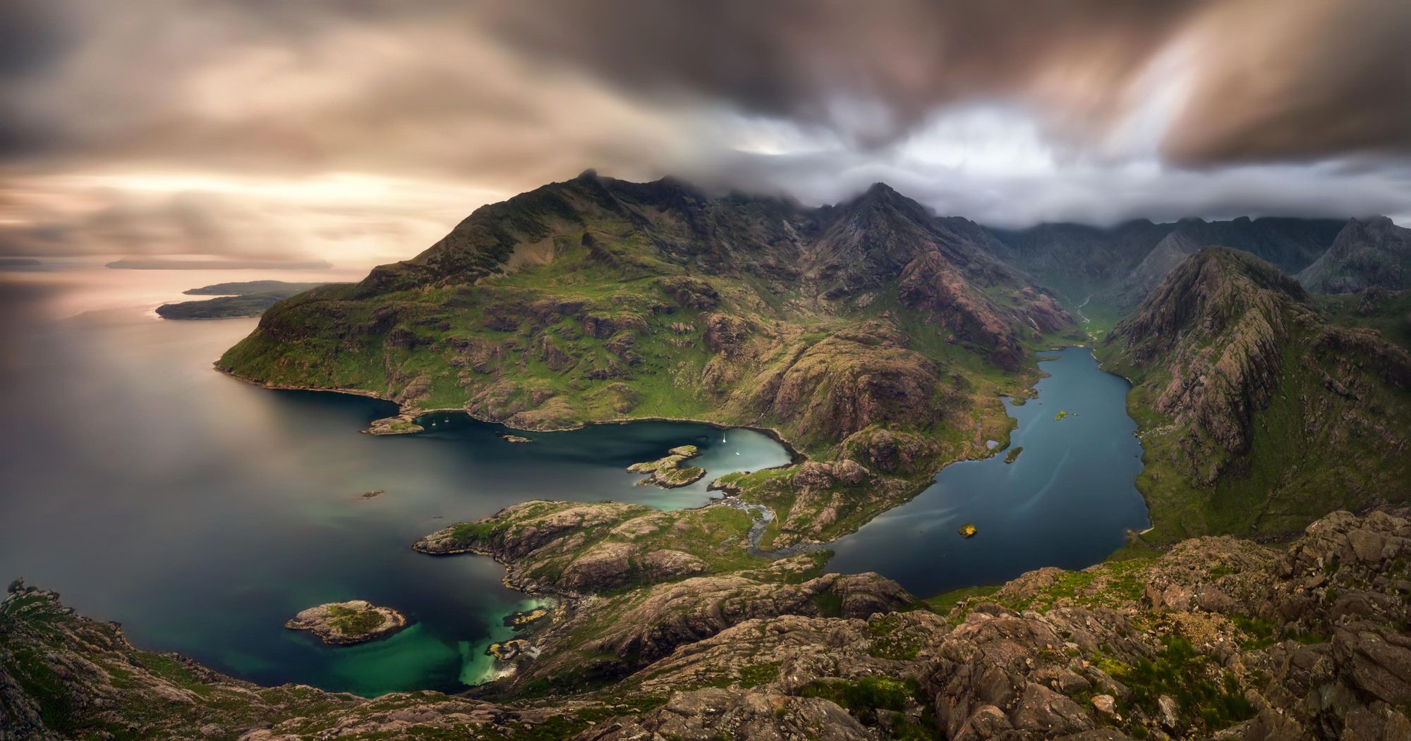
Do not let the height of Sgùrr na Strì decieve you - this is a long, tough hike. The out-and-back will take you most of the day and at times, the route-finding can be challenging. So why climb this far-off 494m (1,620ft) hill at all? Because the view from the top - a sweeping lookout over Loch Coruisk, the mighty Skye Cuillin and the Sea of the Hebrides - might just be the very best in all of Britain.
The view from the top - a sweeping lookout over Loch Coruisk, the mighty Skye Cuillin and the Sea of the Hebrides - might just be the very best in Scotland...
This long, rugged walk feels increasingly isolated the closer you get to your viewpoint. On the way, you’ll also have terrific views almost the whole time, passing rivers and looking out to moors and the most famous peaks of Skye, including the Inaccessible Pinnacle, Sgùrr nan Gillean and Blà Bheinn.
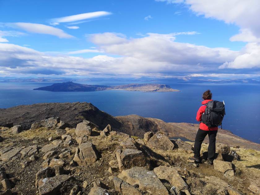
When you do eventually reach the summit, take the time to breathe it in. Look out across the sea and trace the outlines of the Small Isles, Eigg and Rum, and gaze at Mull in the distance. Turn back in-land and follow the water to Loch Coruisk, which seems from here like some secret haven, guarded by high-rising mountains and backdropped by the sheer might of the Cuillin ridge.
- Sound good? Join Much Better Adventure's Hike, Kayak and Wild Camp the Isle of Skye for a guided tour to Sgùrr na Strì
5. Walk to Rubha Hunish
- Distance: 6.2 miles (10km)
- Duration: approx 4 hours
- Start Point: Rubha Hunish Car Park, Shulista
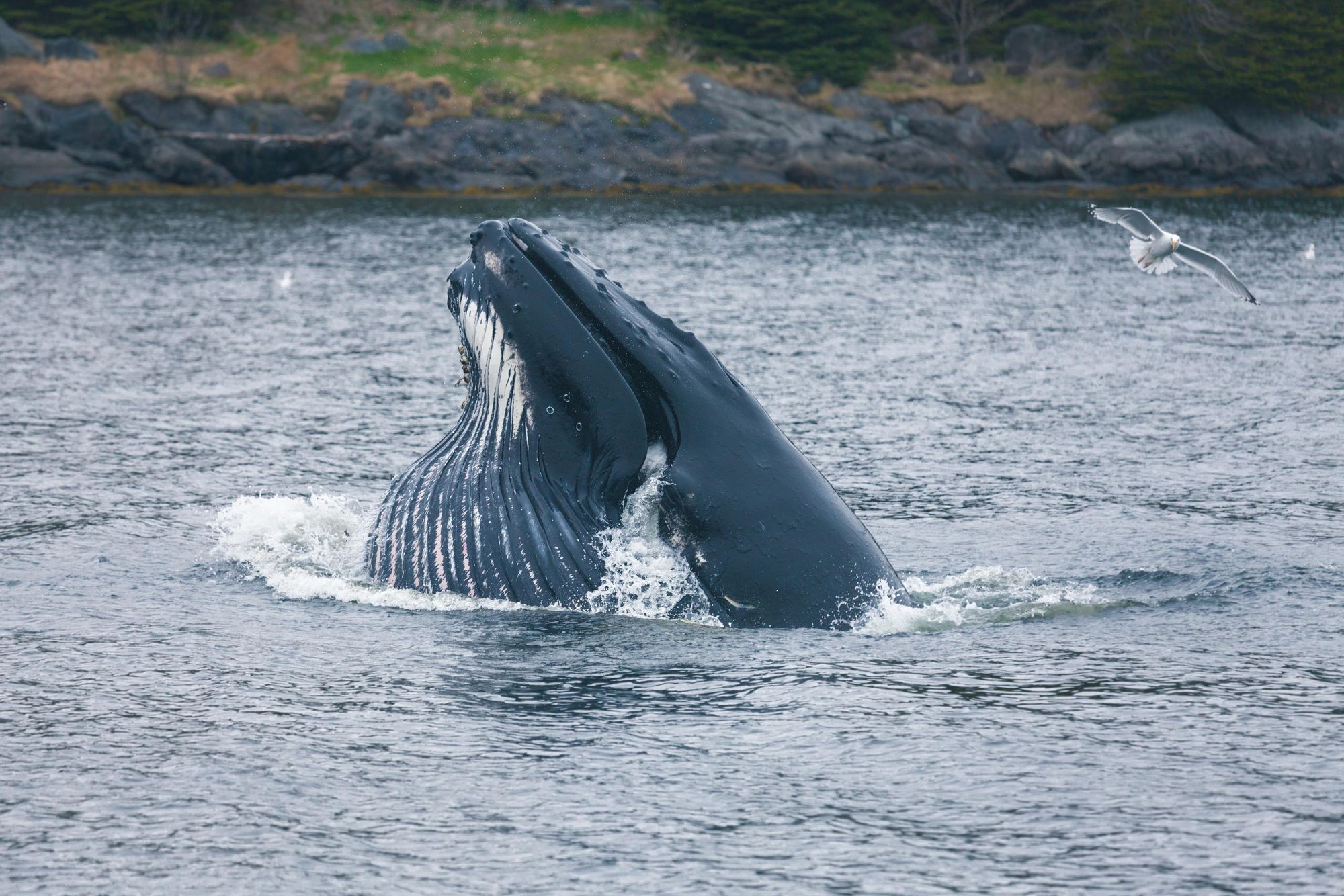
This walk will take you to Rubha Hunish, the northernmost point on the Isle of Skye and a fanatastic place to see birds, dolphins and whales.
This is a route of cliff faces and rugged coastline which isn’t too often visited, and if the weather is on your side, there are fantastic views to the Outer Hebridean islands of Lewis, Harris and Uist.
This is one of the best places on Skye for those hoping to see marine mammals.
This is a looping route. Heading outward, you’re going to walk north, through heather, on rolling hills. You'll soon reach the coast. The Lookout Bothy is up on Meall Tuath here. Around here, there are huge cliff drops. Do be careful.
This is one of the best places on Skye for those hoping to see marine mammals.
The route from here around Rubha Hunish is by far the most challenging part of this walk, and caution is urged. There’s a very steep descent, and careful scrambling is required. It should be noted that this section is optional though, and even if you don’t decide to go right to the very northernmost point of Skye, this hike is still quite lovely. Without this section, it can be done quicker, too.
When it comes to the return leg, walk back via Tulm Bay, looking out to Tulm Island just off shore and passing the ruins of Duntulm Castle and Loch Cleat before arriving back at your starting point.
Inspired? Check out our Hike, Kayak and Wild Camp on Skye trip now!