


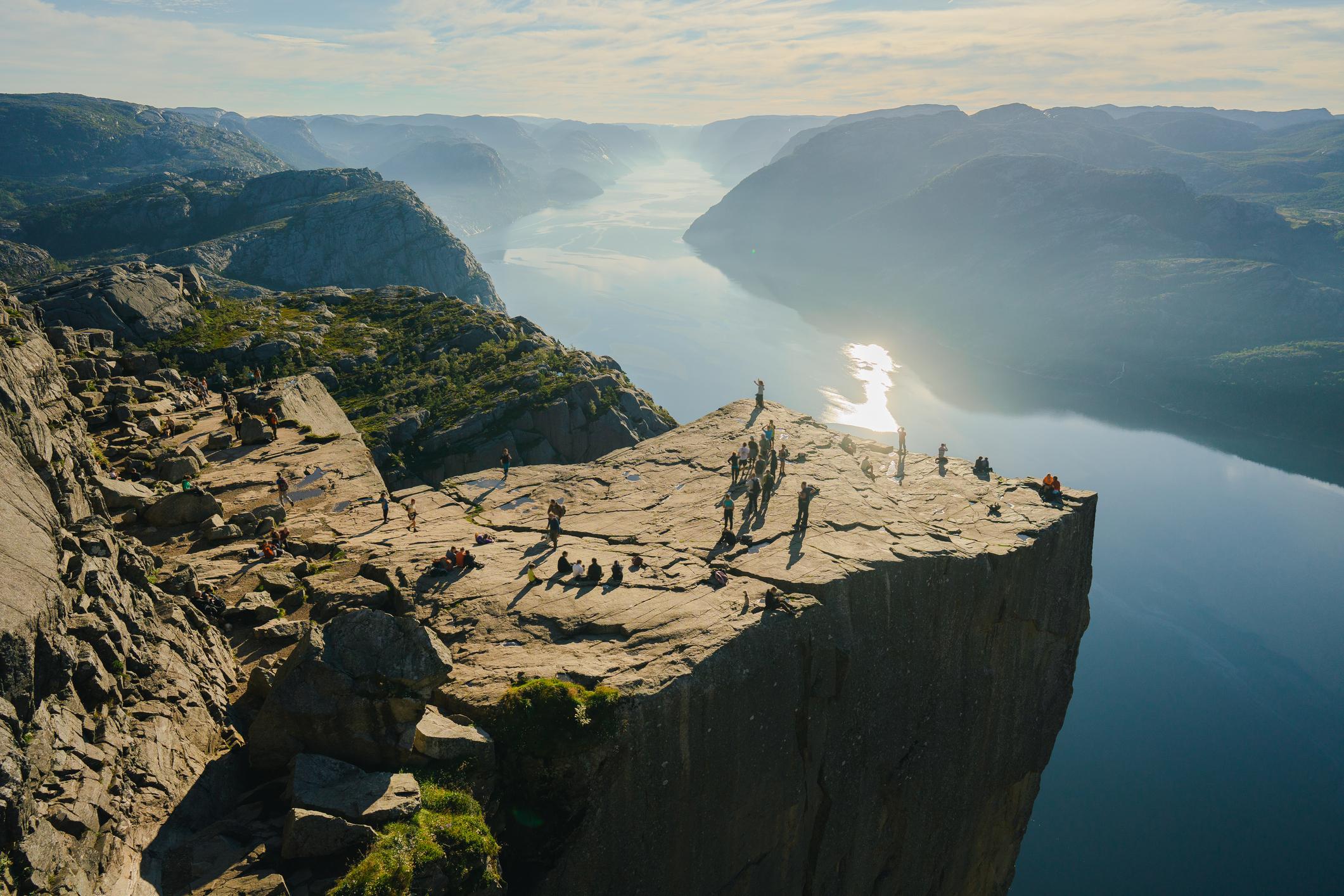
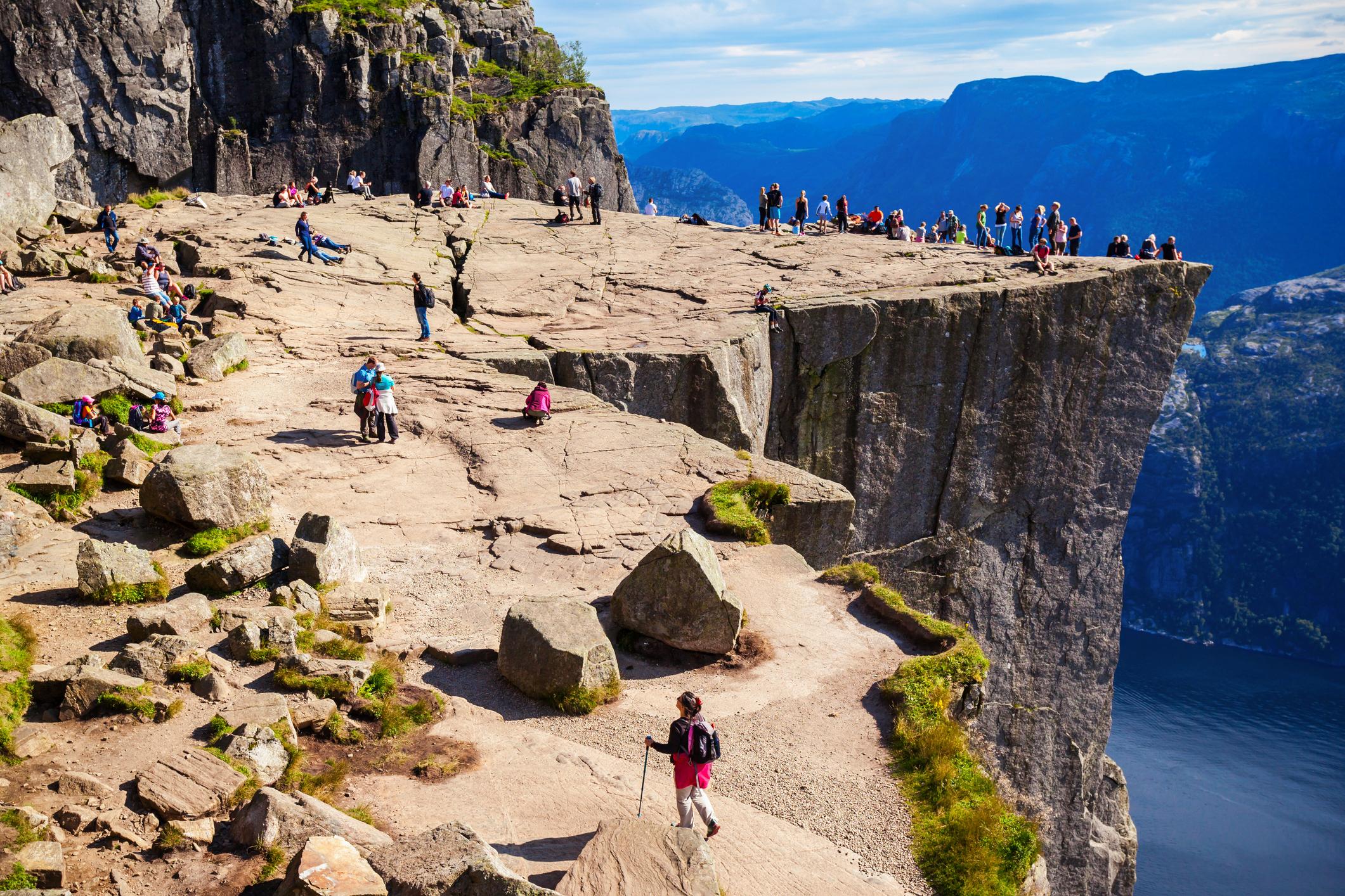
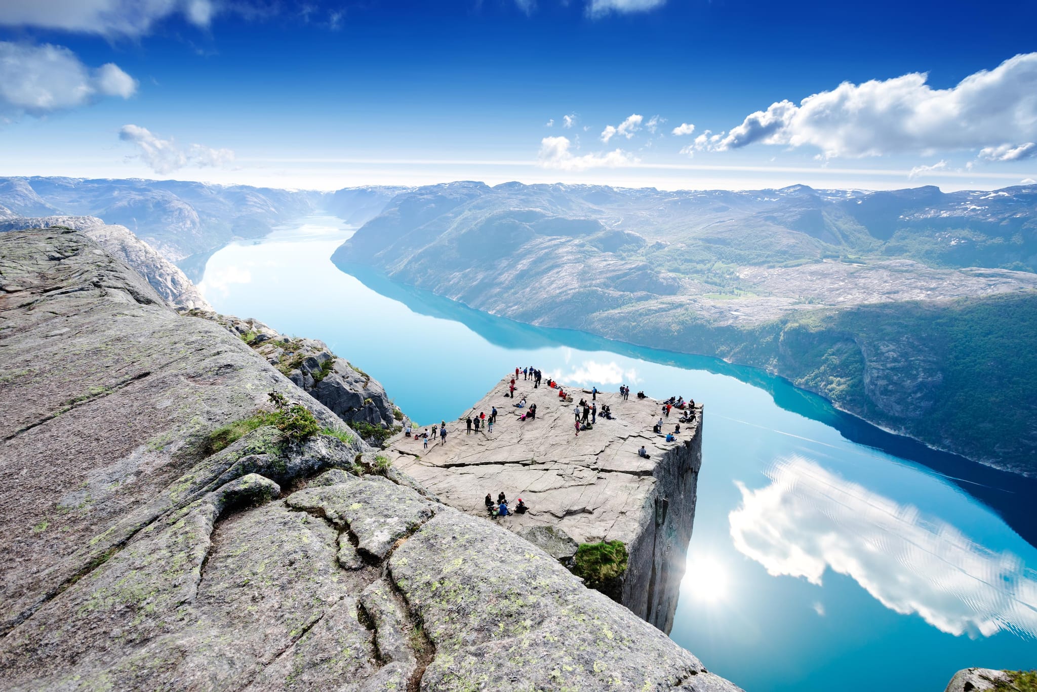
Pulpit Rock, or Preikestolen in Norwegian, is a site so improbable it looks man-made. This flat slab of granite is an almost perfect square, jutting out of a mountainside 604 metres (1,982ft) high, and providing a postcard-perfect view out over the Lysefjord in southwestern Norway.
The cliff was carved out by glacial activity at the end of the last Ice Age...
The plateau of Pulpit Rock measures roughly 25m x 25m. It’s the end-point one of Norway’s most popular day hikes, located 25 miles (40km) from Stavanger, the nearest city. It’s unlikely that you’ll ever find yourself alone at Preikestolen. This is the busiest and best-known of the three icons of Lysefjord - the others being the Kjeragbolten boulder, lodged between two cliffs, 1,000m (3,380ft) high, and the 4,444 wooden steps up Flørli. But, for those in the know, here are back-routes up the mountain to Pulpit Rock for a bit more peace en route.
However you get there, this is a place where the beauty of the Norwegian fjords is fully on show - dramatic cliffs, layering mountains, water twisting out of sight.
The route descriptions in this article are short summaries, designed to inspire but not to serve any navigational purpose. They are not intended to guide you on the route and further mapping and planning (or a local guide!) will be required if you want to safely walk any of the trails featured.
 Much Better Adventures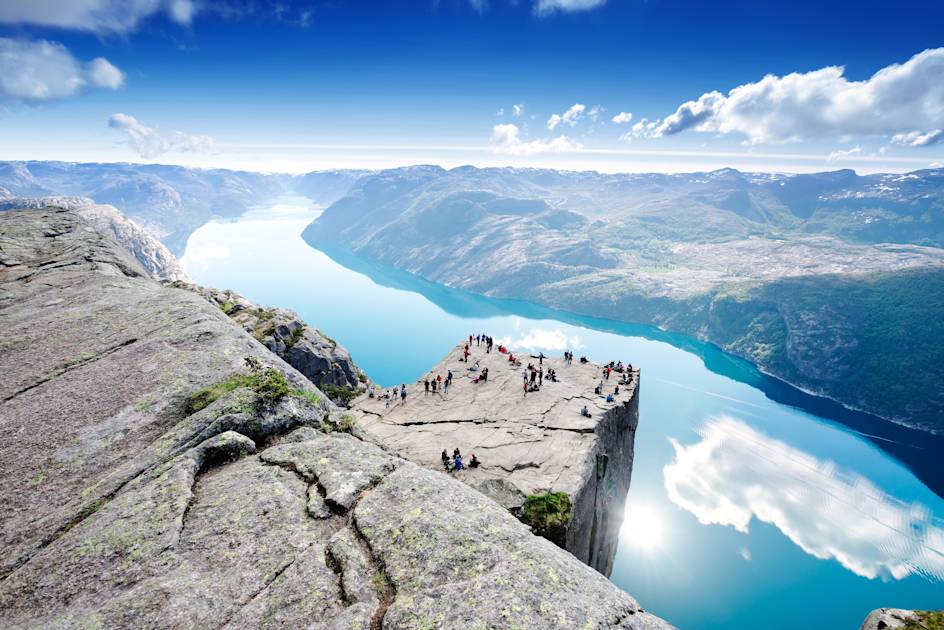
What is Pulpit Rock? Preikestolen, explained
Pulpit Rock is a granite ledge which looks out over Lysefjord in southwestern Norway. It’s a dramatic beauty spot, and the unusual, square nature of the ledge is a particularly fascinating geological feature. The cliff was carved out by glacial activity at the end of the last Ice Age, and today it’s one of the most recognisable images of Norway - a flat-topped ledge with a full vista of the fjord below.
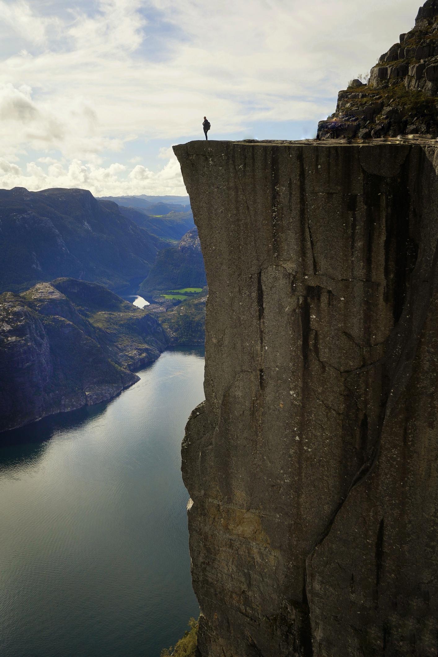
The name, Pulpit Rock, comes from the shape of the rock. A pulpit is a raised platform in a church where a clergy member might stand to deliver a sermon. The parallels in shape are obvious, and there’s also something spiritual about this site, hovering 604 metres (1,982ft) above the water of the fjord. There is a deep crack (or fissure), roughly half a metre wide and several metres deep, which runs along the top of the cliff, though geologists deem the rock stable.
How hard is the Pulpit Rock hike?
The Pulpit Rock hike is moderately challenging for fit hikers. Being a popular tourist spot, the walk is often undertaken by people with little to no experience, and predictably, the route is much more challenging for such visitors.
The route traditionally starts from the Preikestolen Fjellstue mountain lodge. From here, it’s a 2.5 mile (4km) walk one-way (so 5 miles/8km for the return trip). The trail is steep, starting on a gravel path, then turning into a mountain trail. Visit Norway note that "the roundtrip takes about four hours". This will vary from person to person. They say "the hike is graded as medium difficulty".
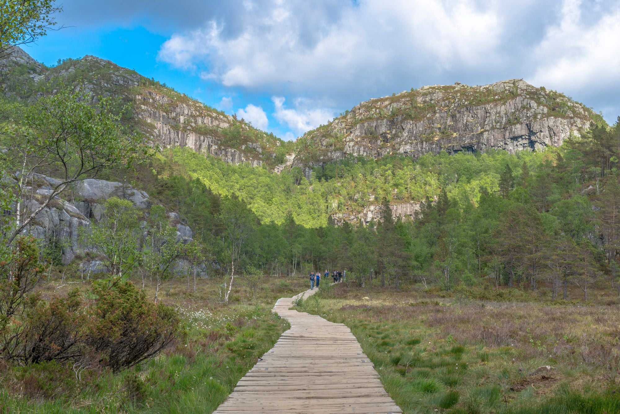
There are some stone steps and boardwalks but the natural areas, paved with stone, are the most beautiful, looking out over woodland and water. You’ll pass through a marsh and cross bridges, looking out over little lakes. The second part of the trail is particularly scenic, with far-reaching views of the surrounding mountains, deep and dramatic, covered in forest. Soon, you’ll emerge out to Lysefjord, staring right down the barrel of the fjord. Pulpit Rock is just beyond, coming into view only when you’ve reached the very end of the trail.
Much Better Adventures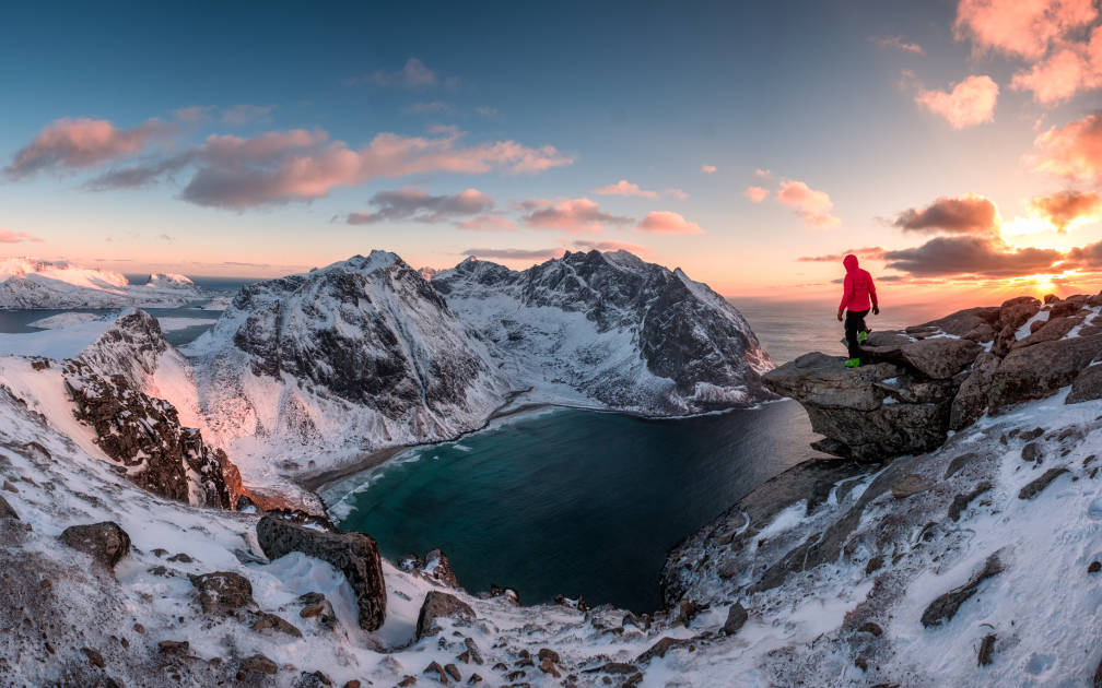
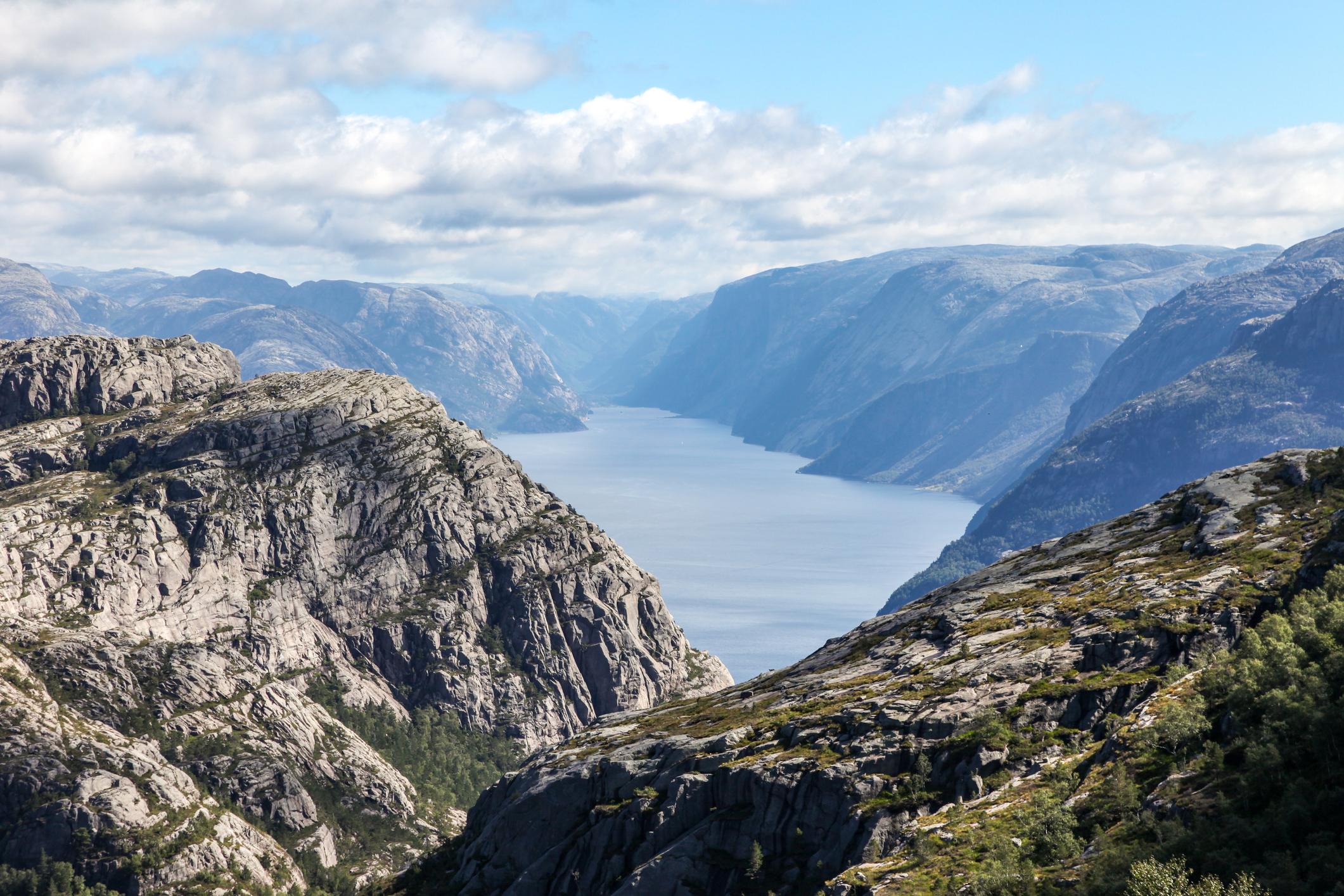
The last stretch of trail to Pulpit Rock is on a trail which is entirely exposed on one side, with the fjord and a sharp drop on your left. It can induce vertigo. The trail signage uses Pulpit Rock and the Norwegian Preikestolen interchangeably.
It begins with a short paddle across a lake, before using a little-known path to Neverdalsfjellet. There's a series of scrambles and rocky viewpoints before you reach Preikestolen...
On our Hike the Norwegian Fjords trip, our guides lead you to Pulpit Rock by a hidden route that sidesteps the busy main trail. It begins with a short paddle across a lake, before taking a scenic path to the peak of Neverdalsfjellet (706m). There's a series of scrambles and rocky viewpoints before you reach Preikestolen - the square plateau above the fjord. This is a tougher route than the tourist trail, but it’s also quieter and more rewarding. This route will have you hiking for between six and seven hours, including the descent.
How to get to Pulpit Rock from Stavanger
You can reach the trailhead for Pulpit Rock from Stavanger by taking a 45-minute express bus or by driving. Since the opening of the Ryfast subsea tunnel back in 2019, buses are direct and no longer require a ferry connection. If you’re driving, be aware that the parking fills up quickly, so you’re best to arrive as early as possible. There are campsites near Pulpit Rock, and wild camping is legal in Norway thanks to the Allemannsretten, Norway's famous right to roam.
When to hike Pulpit Rock
The best months to hike to Pulpit Rock are from May to September, when the trail is clear of snow and ice and the sunlight provides long, bright days, ideal for walking. June, July and August are the busiest months of the year here.
During winter, experience of hiking in icy and snowy conditions is a necessity. While it is still possible to hike to Pulpit Rock in winter, crampons and other winter equipment may be required. The days are also significantly shorter, with only a brief window of daylight in which to hike. The route can be slippy, extra challenging and ultimately quite perilous. This rules it out for most people.
Much Better AdventuresRegardless of when you hike the route, pay close attention to the weather forecast, which can change rapidly. While this is a popular hike, it is still a high-mountain route in a wild area, with all the dangers that entails. If you're weighing up when to go, our Hike the Norwegian Fjords trip runs from May to September - so the best hiking window and the bookable windows are the same dates.
Kjerag and Kjeragbolten: the boulder in the sky
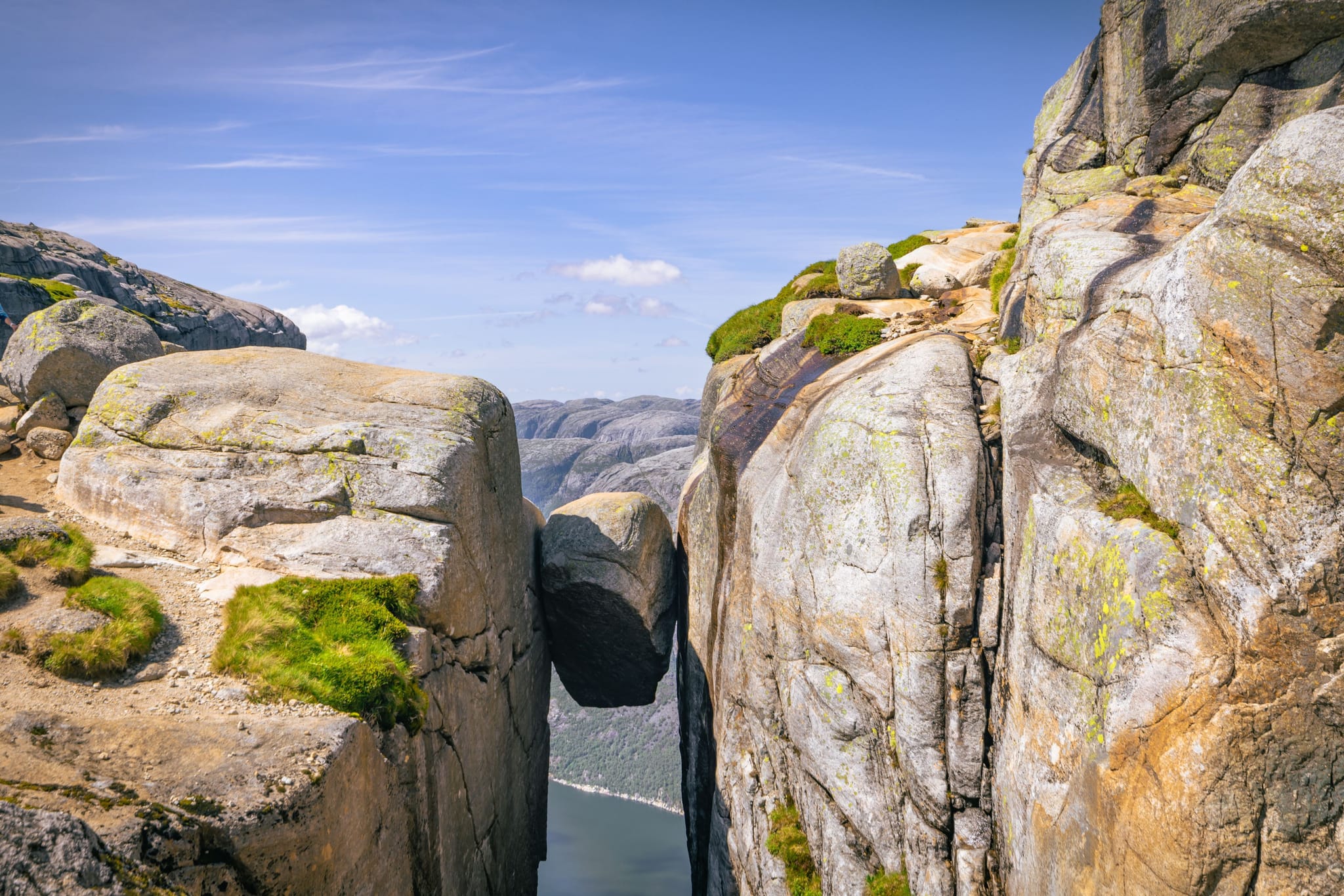
The cliffs of Kjerag rise more than 1,000 metres (3,380ft) above the water of the fjord. On top of those cliffs sits Kjeragbolten - a boulder wedged between two rock faces, which has become one of Norway’s most photographed spots.
To get to the Kjeragbolten trailhead, you’ll need to drive up the famous Lyseveien Road - one of Norway’s most spectacular roads, with a full 27 switchback bends on the way. The hike is a six-10 hour, 6.8-mile (11km) walk with 850 metres of uphill and downhill. It involves the use of wires, so it is a demanding hike even for experienced walkers. After a steep ascent from the trailhead, the route continues across smooth, granite slabs and a mountain ridge to reach Kjeragbolten. From here, you’ll walk on across the clifftops with panoramic vistas of the fjord.
To get to the trailhead, you’ll need to drive up the Lyseveien Road - with a full 27 switchback bends on the way.
There are some light scrambling sections (and some steep, strenuous sections with chains you can hold onto), but it is mostly gradual, consistent uphill. The clifftops have some vertigo-inducing moments, but none more so than Kjeragbolten itself. Some brave souls choose to stand on the boulder to get a photograph. It goes without saying that this is a risky undertaking, with potentially grave consequences. If you do so, you do it at your own risk. The boulder is five cubic metres and hangs 984m (3,228ft) above Lysefjorden.
Kjerag is walked on Much Better Adventures' Hike the Norwegian Fjords trip.
The Flørli 4444 steps
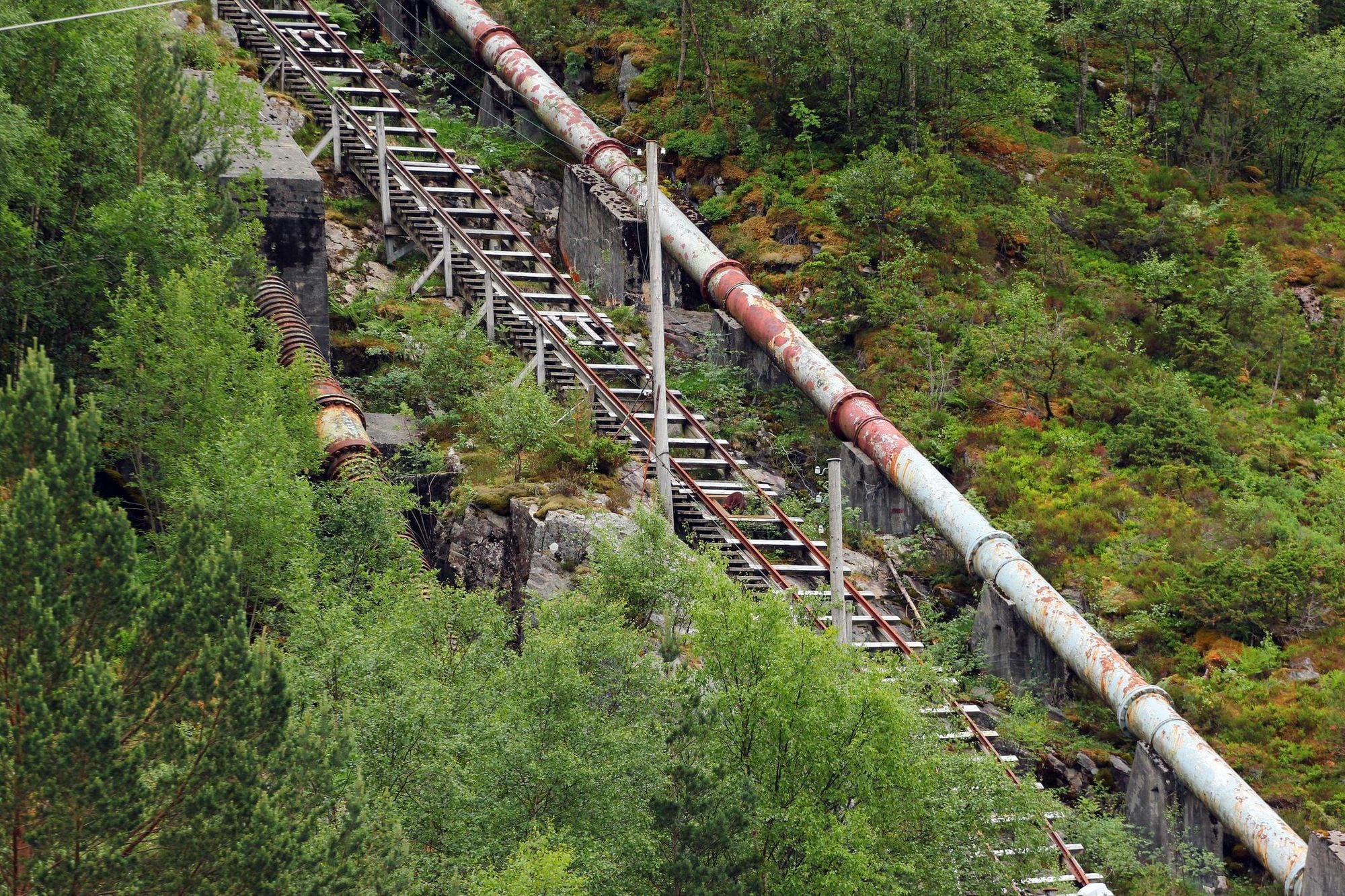
Flørli is a hamlet with no roads, meaning it is reachable only by ferry or on foot. The hamlet sits deep into Lysefjord and famously, it provides access to a 4,444 staircase - as steep as you get - which leads from the edge of the water up the mountain face. This is the longest wooden staircase in the world, running alongside an old hydroelectric pipeline. You’ll want to take a few pauses to catch your breath and take in the views along the way. When you reach the top, wander through a forest and past waterfalls, before heading back down.
Much Better Adventures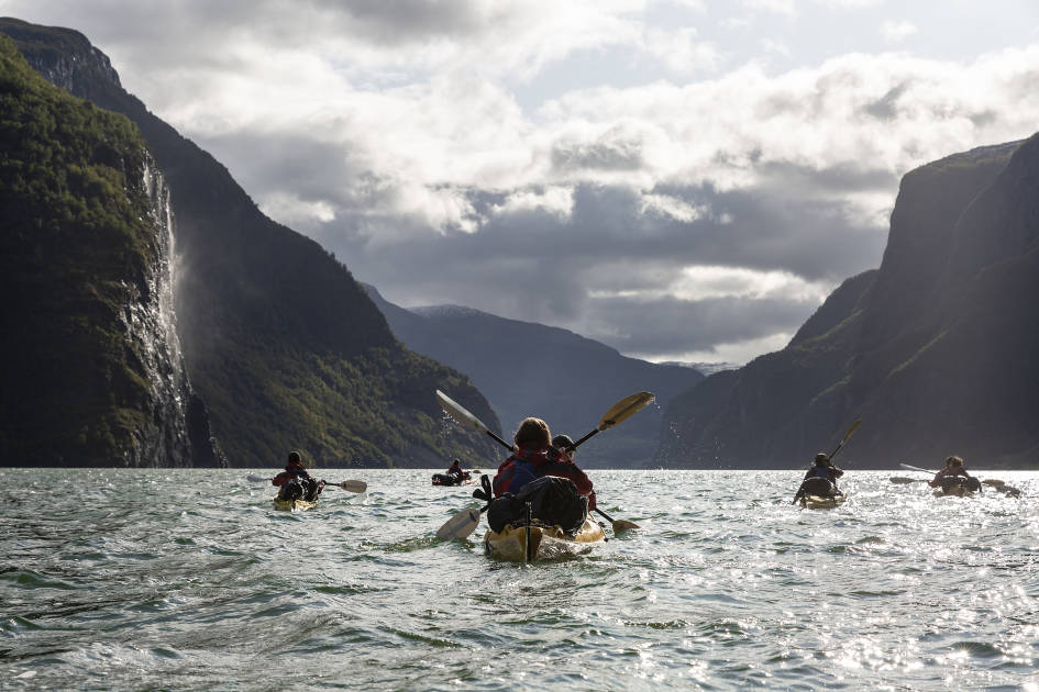
Flørli is walked on Much Better Adventures Hike the Norwegian Fjords trip, reached as part of the itinerary rather than as a puzzle you have to solve.
Lysefjord: the fjord at the heart of it all
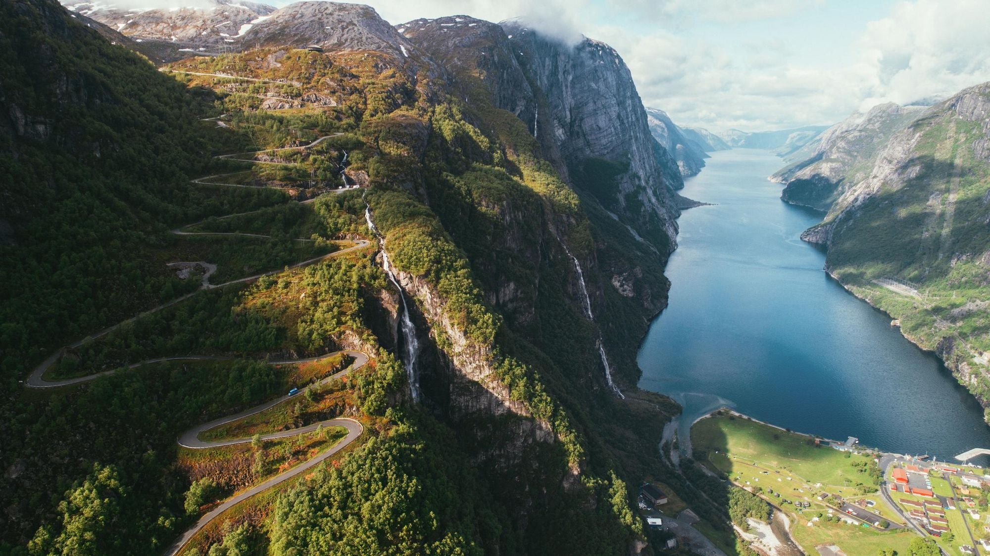
The Lysefjord is the 26-mile fjord that connects Pulpit Rock, the Kjerag and Kjeragbolten walk and the Flørli 4444 steps.
The fjord is 45 minutes in a car from Stavanger in southwestern Norway, and it is a sublime, stunning site of natural beauty which fits all the stereotypes you might have of a Norwegian fjord. Here, the granite walls rise sheer and straight out of the water, reaching heights of over 1,000 metres (3,380ft) at times.
Moving roughly from west to east, Pulpit Rock is the square, granite lookout point above the fjord’s outer reaches. Flørli is deeper into Lysefjord, partway along it and reachable only by boat, and Kjerag rises in the innermost stretches of the Lysefjord, near Lysebotn. Visiting each of these sites on one trip gives you a real sense of journeying through the Lysefjord, and discovering the full site.
Our map of the Norwegian fjords puts the location of Lysefjord into context.
Hike all three Lysefjord icons on one trip
If you'd rather not plan three separate hikes, three separate transfers, and have three separate logistical headaches, our Hike the Norwegian Fjords trip does it for you. Over 6 nights, and from £1,823pp, departing May to September, local guides will lead you across Preikestolen, Kjerag and the Flørli 4444 steps.
You'll take a guided ascent of Pulpit Rock timed to beat the crowds, visit the fixed-chain sections of Kjerag with someone who's done it before, and reach the boat-access-only climb at Flørli. It's a small-group trip, with like-minded people.
Much Better AdventuresThis trip also goes beyond these sites, into Jenafjell and the highlands (near the protected habitat of the world's southernmost herd of wild reindeer), and on the Lysfjord panoramic trail, climbing to the 406m Hatten for a pinch-me view.
Pulpit Rock FAQs
How long does the Pulpit Rock hike take?
Most hikers complete the classic Pulpit Rock hike in between four and eight hours, depending on fitness and the time spent at the top. The trail runs five miles (8km) out and back. It’s a half-day hike for most experienced walkers, but can be longer if the trail is busy. The walk on our Hike the Norwegian Fjords trip takes a different route, and six to seven hours.
Can you hike Pulpit Rock without a guide?
Absolutely. The route is well-marked and well-maintained. The majority of the 300,000 people who hike the route each year do so independently, without a guide. Where a guide earns their keep is their ability to guide you onto lesser-visited, quieter trails, and combining the tougher, further-flung icons of the fjord (Kjerag, Flørli) in one trip - handling the logistics and adding local flavour.
Is Pulpit Rock dangerous?
There are no barriers at the edge of Pulpit Rock, and there is a long drop on the other side, but the walk is not inherently more dangerous than any other hike. The trail - in good summer conditions - is not particularly demanding for those with good fitness. The biggest dangers come from bad conditions, such as fog, rain, ice or snow requiring winter equipment, or from underestimating the terrain. Wear suitable footwear and treat the outdoors with respect.
Pulpit Rock or Trolltunga: which should you hike?
Pulpit Rock and Trolltunga are in different places, around 137 miles (220km) apart. Trolltunga is a much longer, tougher hike (around 10-12 hours). It also leads to a spot of immense beauty, but the wonder of Pulpit Rock is that you can then combine it witha trip to Kjerag and the 4,444 Flørli steps after.
Hike to Pulpit Rock on our Hike the Norwegian Fjords adventure!