


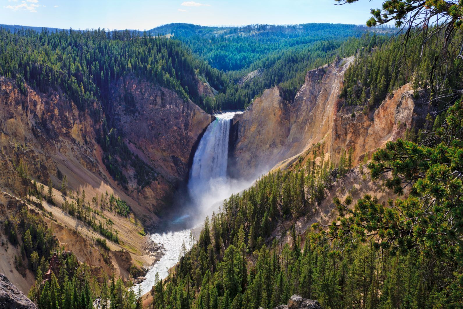
The best hiking trails in Yellowstone National Park showcase the vast landscapes of this park, where calderas and grasslands meet hot springs, rivers, evergreen forests and tumbling waterfalls, backdropped by snow-capped mountains. Here, we're going to introduce you to some of the finest day hikes you can do in Yellowstone - great walks that you can do in a single day. See the excellent Yellowstone National Park Service (NPS) website for further details.
Yellowstone has long been a hotbed of conservation - from becoming the first national park in 1872 to the reintroduction of Yellowstone wolves in 1995...
There are five entrances to Yellowstone National Park - north, northeast, south, east and west. Inside sits the Grand Canyon of Yellowstone River, gushing geysers and serene mountain lakes. The wildlife is just as special. Look out for bears, wolves, elk, busy beavers, grazing bison, soaring eagles - and tread with caution if you do encounter them. Yellowstone has long been a hotbed of conservation - from becoming the first national park in 1872 to the reintroduction of Yellowstone wolves in 1995, one of the most successful rewilding projects to ever take place.
Of course, there are so many brilliant hikes and treks in Yellowstone.
What we’ve aimed to do here is to select a handful of the most diverse trails in Yellowstone - some long, some short, and geographically spread around the park, showcasing different sides of Yellowstone. Yellowstone is a truly wild area - so remember to bring maps, appropriate hiking gear (whether that’s water, a compass or bear spray), and be respectful and aware of the nature and surroundings.
We've selected these 10 routes as the best day hikes in Yellowstone:
- Avalanche Peak
- The Beaver Ponds Trail
- The Seven Mile Hole
- The Dunraven Pass to Mount Washburn
- Washburn-Grand Canyon Through-Hike
- The Sky Rim Trail
- The Fairy Falls Trail
- Hike the Lewis River Channel/Dogshead Loop
- The Storm Point Trail
- The Mount Holmes Trail
It’s important to note that these route descriptions are only short summaries, designed to inspire but not to serve any navigational purpose. They are not intended to guide you on the route and further mapping and planning (or a local guide!) will be required if you want to safely walk any of the trails featured.
This is a wild landscape and you must be able to navigate well and turn up prepared with proper equipment and hydration. There are also addition precautions in Yellowstone - notably bears and geothermal areas. Do your research before going, so you can enjoy this spectacular place in safety.
Where is Yellowstone National Park?
Yellowstone National Park is in the western United States, sitting mostly in northwest Wyoming, with smaller parts in Montana and Idaho. The park is 3,472 miles² (8,991km²), making it the eighth largest national park in the US. There are five main vehicle entrances to the park.
10 of the Best Day Hikes in Yellowstone
You should seek out more information on each of these hikes before walking it. That can be found on the NPS Yellowstone website for all but the long-distance Sky Rim Trail. You can find trail reports for that route around the internet.
1. Climb Avalanche Peak
- Start/Finish: Avalanche Peak Trailhead (East Entrance), out-and-back
- Distance: A 4.2 mile (6.6km) round trip
- Walking time: 3-4 hours
- Difficulty: Challenging
- Best for: Big altitude in a short time
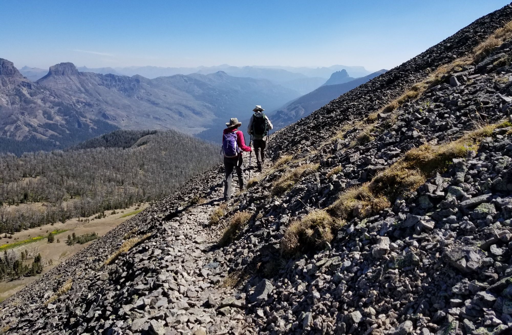
An out-and-back again hike from a trailhead on East Entrance Road (next to Eleanor Lake). The hike up Avalanche Peak isn't an easy one - climbing 640m (2,100ft) in just over two miles - but it does take in a whole lot of beautiful scenery along the way. Right across from the parking area, and to the right of a creek, you'll find the start of the trail, which enters a forest and quickly starts ascending. One mile into the trail you'll get to the large bowl of Avalanche Peak, and from there, you'll switchback up to a level area just below the summit.
There's a ridgeline to cross which requires extreme caution. The summit of Avalanche Peak stands 3,221m (10,568ft) high, and is part of the Absaroka Range. The views from the rocky, bare summit are remarkable - looking out over to the other peaks of Yellowstone, over Yellowstone Lake and even to the distant Teton Range to the south. The trail is best hiked in summer, and is actually usually still covered in snow to some extent until early July. This should take around three to four hour hours but make no mistake - it’s not easy going.
2. Hike The Beaver Ponds Trail
- Start/Finish: Mammoth Hot Springs, loop (North Entrance)
- Distance: 5.4 miles (8.7km)
- Walking time: 2-5 hours
- Difficulty: Moderate
- Best for: Spotting beavers
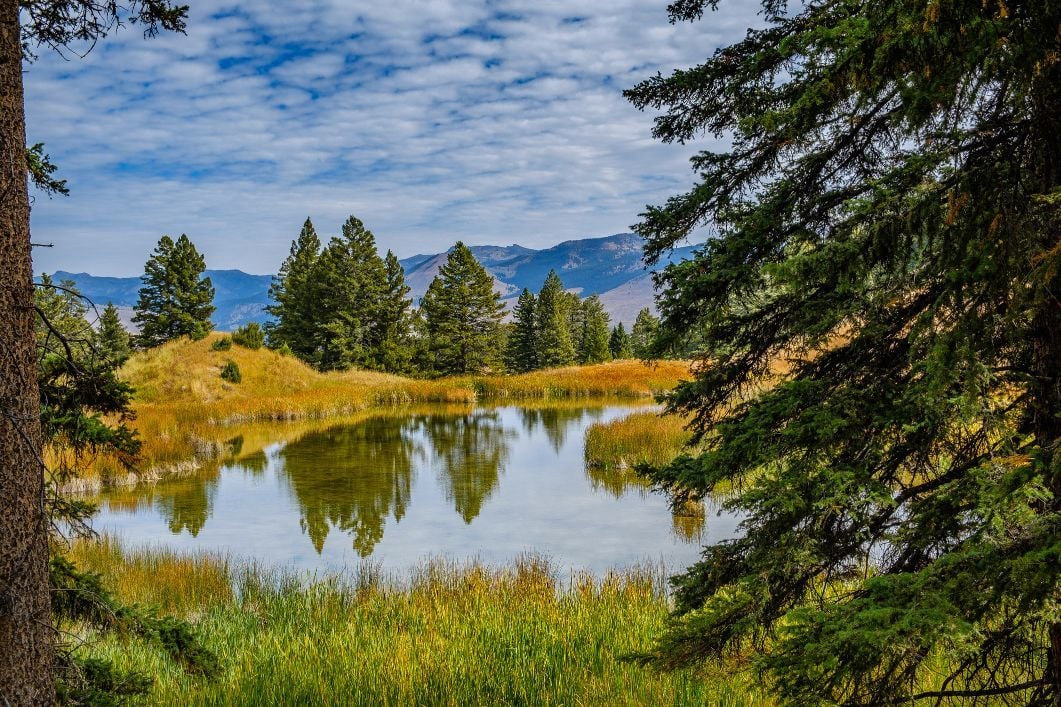
The Beaver Pond Trail is a 5.4-mile (8.7km) loop trail beginning and ending at Mammoth Hot Springs and passing through sagebush meadows and spots of trees. It’s steep at the start, but levels out pretty quickly. It's a quiet retreat from the bustling Mammoth village.
The trailhead is accessible north of Liberty Cap, behind Mammoth Hot Springs Hotel, at the start of Old Gardiner Road. The eponymous beaver ponds are about halfway through the loop, which can take from two to five hours, but there are plenty of other opportunities to see animals along the way. Grizzly and black bears frequent this area, so stay alert and be safe while walking.
3. Hike the Seven Mile Hole
- Start/Finish: Seven Mile Hole Trailhead (North/Northeast entrance), out-and-back
- Distance: A 10-miles (16.1km) round trip
- Walking time: 5-8 hours
- Difficulty: Challenging
- Best for: A trail full of variety
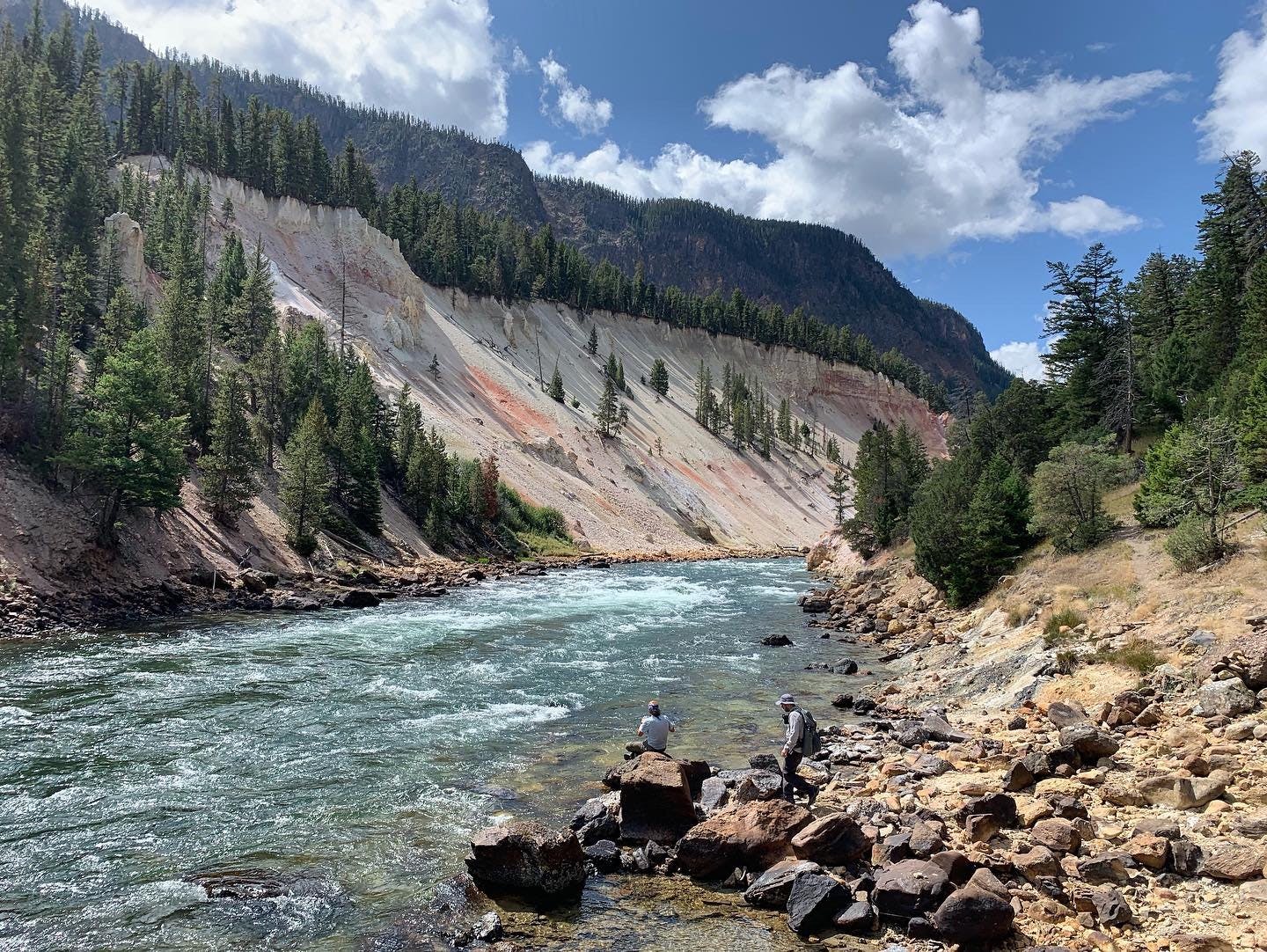
The trailhead for the Seven Mile Hole trail is at the Glacial Boulder pullout, on the road to Inspiration Point. This is a challenging day of hiking which takes hikers right down to the Yellowstone River and passes through "Coulter's Hell", an active backcountry geothermal basin where great care must be taken.
You'll start the walk with a mile or so near the canyon rim, with views of Silver Cord Cascade. Soon you'll join up to the Washburn Spur Trail, then just short of a mile later, join the Seven Mile Hole. This drops more than 1,000ft in 2.3 miles. Along the river, the trail can be tough to follow at times - and especially with geothermal features around - you really do need to take care. Enjoy lunch at the base of the canyon before making the challenging ascent back up.
Anytime you're near geothermal features, of course, it's crucial that you watch your footing and stay on the trail. These can be a real hazard in Yellowstone, and it's no different here. There'a a risk when walking through this area.
4. Dunraven Pass to Mount Washburn Trail
- Start/Finish: Dunraven Pass (North/Northeast entrance), out-and-back
- Distance: 6.5 miles (15.5km)
- Walking time: 3-6 hours
- Difficulty: Challenging
- Best for: A beautiful ridgeline
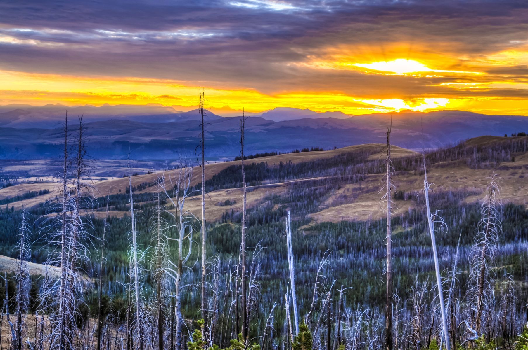
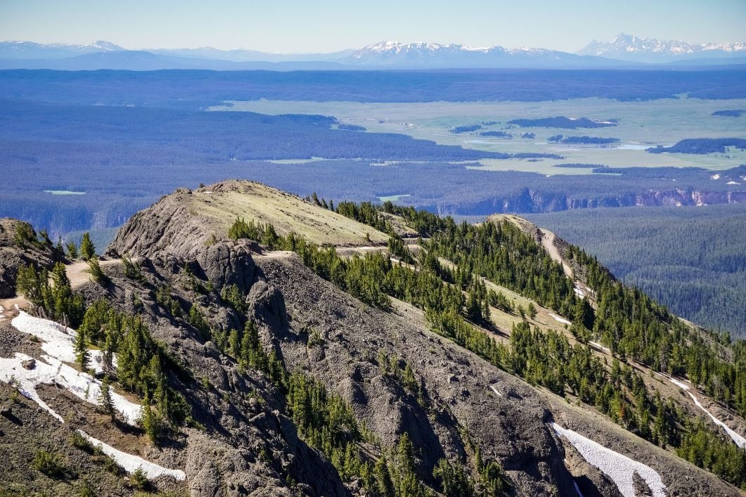
There are a couple of options to get you up to Mount Washburn, a prominent peak in the Washburn Range in Yellowstone sitting at 3,116m (10,243ft), and with great views of the Grand Canyon of Yellowstone River. Our favourite route up is a classic - starting at the Dunraven Pass Trailhead.
The mountain is named after Henry Washburn, who led an 1870 expedition into northwestern Wyoming...
The route is a six mile round trip, and can take you anywhere from three to six hours. It follows a wide path southeast before turning north and climbing to the southwest slope of Washburn. Keep your eyes open for bighorn sheep and wildflowers, and beware in Autumn - grizzly bears frequent the area searching for whitebark pine nuts. The hike is moderately challenging, and provides some truly astonishing views of the Grand Canyon of Yellowstone, the Grand Teton mountains and, on a clear day, the steam from Old Faithful.
The mountain is named after Henry Washburn, who led an 1870 expedition into northwestern Wyoming, an area which became Yellowstone National Park in 1872. The group ascended the mountain on 29 August 1870 on (an early version) of this very trail, so there's plenty of history on these paths, as well as sweeping views.
For a shorter route up Mount Washburn, ascend instead from Chittenden Road. This way, you'll take a road on a steady incline, and still earn some mighty panoramas on a 5.8-mile (9.3km) round trip. Or you could combine the two - climb from Dunraven Pass and descend to Chittenden Road for a through-hike (noting that you'd then need transport at the end).
5. The Observation Peak Trail
- Start/Finish: Cascade Lake Trailhead near Canyon Village (North/Northeast entrance), out-and-back
- Distance: A 9.6-mile (15.4km) round trip
- Walking time: 5-6 hours
- Difficulty: Challenging
- Best for: Reaching remote mountain solitude
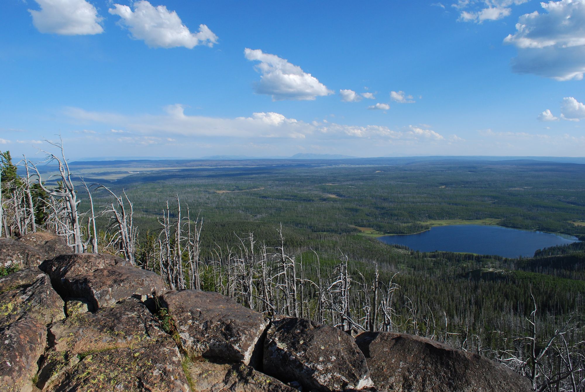
Leaving the Cascade Lake Trailhead, the Observation Peak Trail heads to that eponymous lake, passing through open meadows to get there. At the lake, wildflowers bloom when the season is right, and elk, bison, deer and swans are often spotted. Bears also frequent this area, so do be safe on your walk.
The route jumps in and out of pine forests, gaining 450m (1,500ft) en route to the 2,867m (9,406ft) summit of Observation Peak, which offers a superb lookout over the wilderness - stretching over forests, lakes, grassland and mountains.Then it's time to turn around and head back the way you came.
6. Hike the Sky Rim Trail
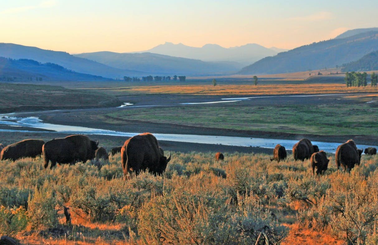
- Start/Finish: Sky Rim Trailhead (via West entrance), loop
- Distance: 21 miles (33.7km)
- Walking time: 10-14 hours
- Difficulty: Challenging
- Best for: A big, tough, day on the trails
Make no mistake, at over 19 miles (30.5km), the Sky Rim Trail is a long, extremely difficult hike. It takes a high level of fitness (and navigation) to complete in one day, starting and leaving from the Daily Creek trailhead.
Most people who walk the Sky Rim Trail do so over two days, and spend a night camping out in the backcountry beauty of Yellowstone. There's no water available for most of the route, so you need to carry enough to last.
The hike starts by passing through lodgepole pine forests and alpine meadows, then begins the initial ascent up the ridge on the border of Yellowstone National Park and Gallatin National Forest. Expect panoramic views of some of truly awesome peaks - Ramshorn Peak and Fortress Mountain to the north and Canary Bird Peak and Sawtooth Mountain to the east.
Climb Big Horn Peak, and then from 3000m gaze back out on the majestic views from your vantage point. Follow the Black Butte Trail and then you'll descend alongside the Black Butte Creek back to Dailey Creek. This is a trek only to be undertaken by confident, experienced walkers, good at route-finding.
7. The Fairy Falls Trail
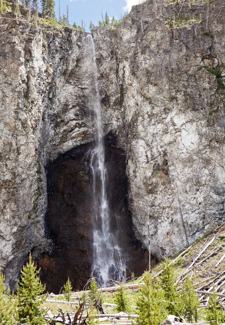
- Start/Finish: Fountain Flat Drive (West entrance), out-and-back
- Distance: A 7-miles (11.2km) round trip
- Walking time: 3-6 hours
- Difficulty: Easy to moderate
- Best for: Water features, from falls to geysers
This is a beautiful (though often busy) route which takes you to an incredible waterfall and two geysers. There are two trailheads and two approaches to Fairy Falls. You can either park at the end of Fountain Flat Drive or a mile south of Midway Geyser Basin, where there’s a popular car park with limited spacing.
It was named by the Hayden Survey in 1871 for the "graceful beauty with which the little stream dropped down a clear descent."
This route starts on an old steel bridge and follows a gravel road to reach forests which were severely damaged in the 1988 forest fires.
If you’ve not heard of Fairy Falls before, you’re in for a treat (and you'll hear the water itself before you see the falls). At 61m (200ft) high, Fairy Falls is one of the most spectacular waterfalls in Yellowstone National Park. It was named by the Hayden Survey in 1871 for the "graceful beauty with which the little stream dropped down a clear descent." The rock formation alone is stunning.
The trail passes through a young pine forest before you get to the falls, which are not the only attraction on the route. You’ll also pass a spur to the Grand Prismatic geyser overlook (pictured below) - which is actually the main reason this trail tends to be so busy.
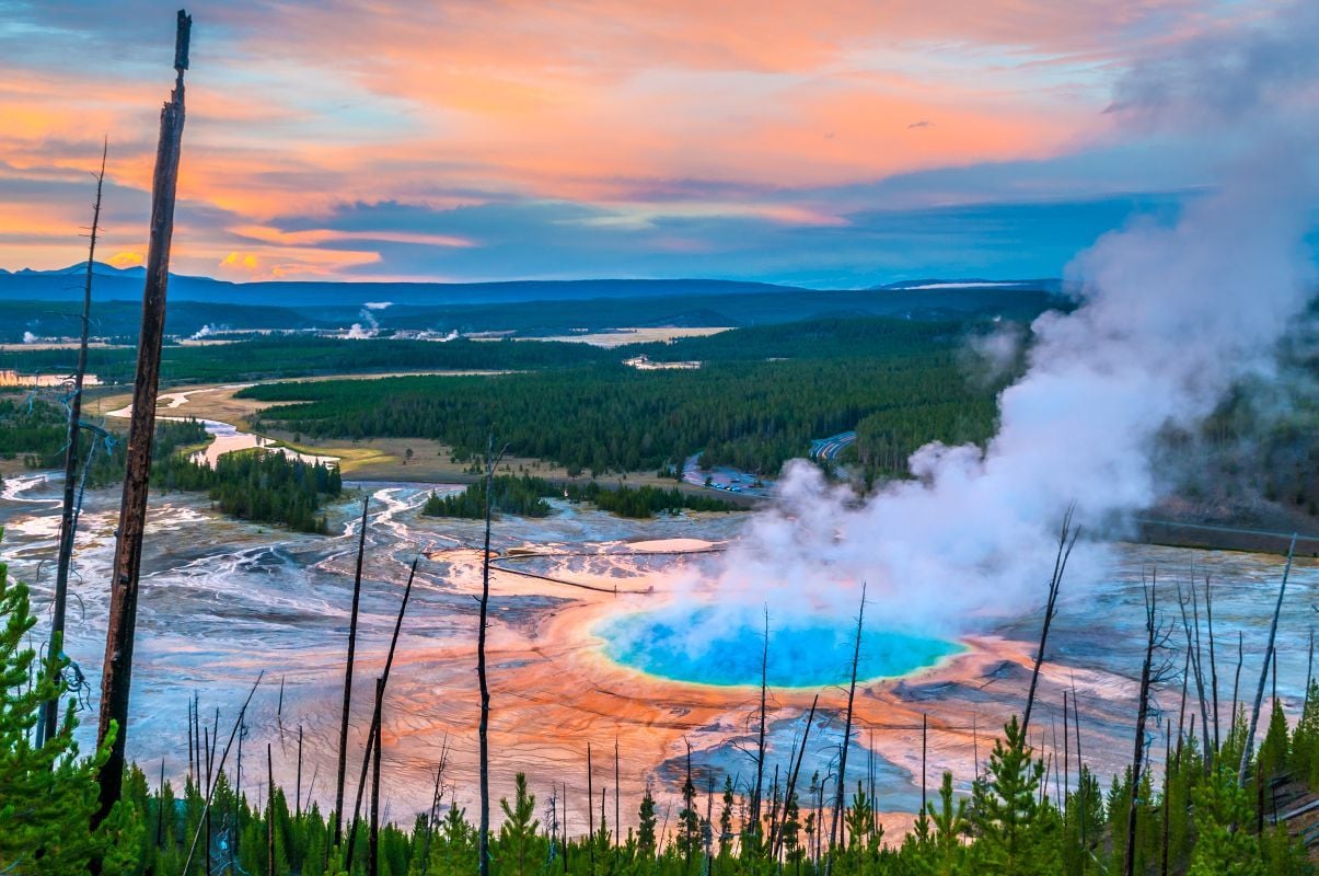
The walk continues past the falls to the Spray and Imperial Geysers. The Imperial infrequently still erupts, reaching up to 35ft. Between the geysers and the falls, as well as wildflowers and wildlife, it makes for a stunning walk.
Bonus: Visit Old Faithful Geyser
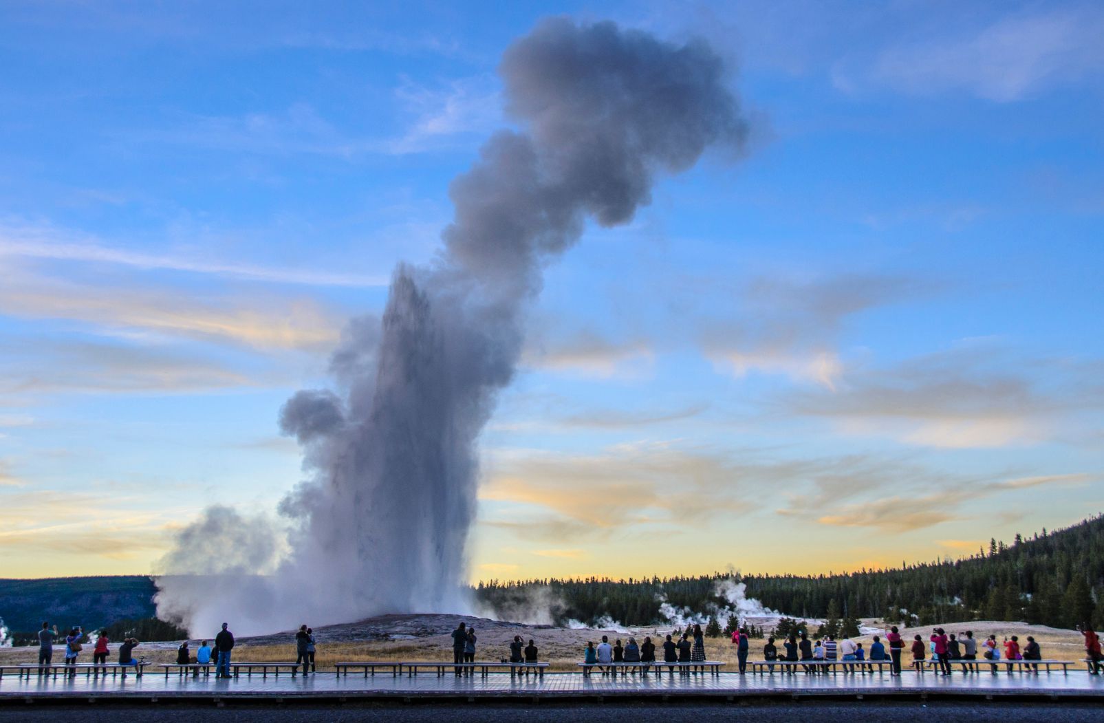
If you really want to see a geyser erupt, the world famous Old Faithful is the geyser to visit. Old Faithful is well named. Records show that it's erupted every 44 minutes to two hours, around 20 times a day, since the year 2000. The eruption tends to be 100-180 feet high and lasts between one and a half to five minutes. It’s only a 10-minute drive from the Fairy Falls Trail Parking Lot, so you’ll pass it en route. It'll be busy with tourists, so we would recommend going to see it, then moving on to a lesser visited, wilder area, but it is a terrific sight.
8. Hike the Lewis River Channel/Dogshead Loop
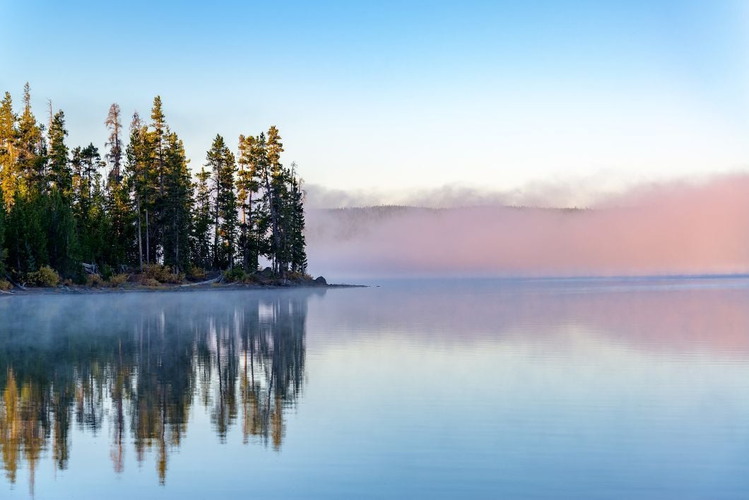
- Start/Finish: Lewis Lake area (South entrance), loop
- Distance: 10.8 miles (17.3km)
- Walking time: 5-8 hours
- Difficulty: Challenging (mainly due to distance)
- Best for: Exploring the backcountry of Yellowstone
The Lewis River Channel/Dogshead Trail is 10.8-miles (17.3km), starting and finishing at a trailhead off South Entrance Road, just north of Lewis Lake. Before you get to the trailhead you'll pass Lewis Lake, and before even that, you'll see the 30ft, cascading Lewis Falls, where it's definitely worth stopping for a while. They really are quite remarkable:
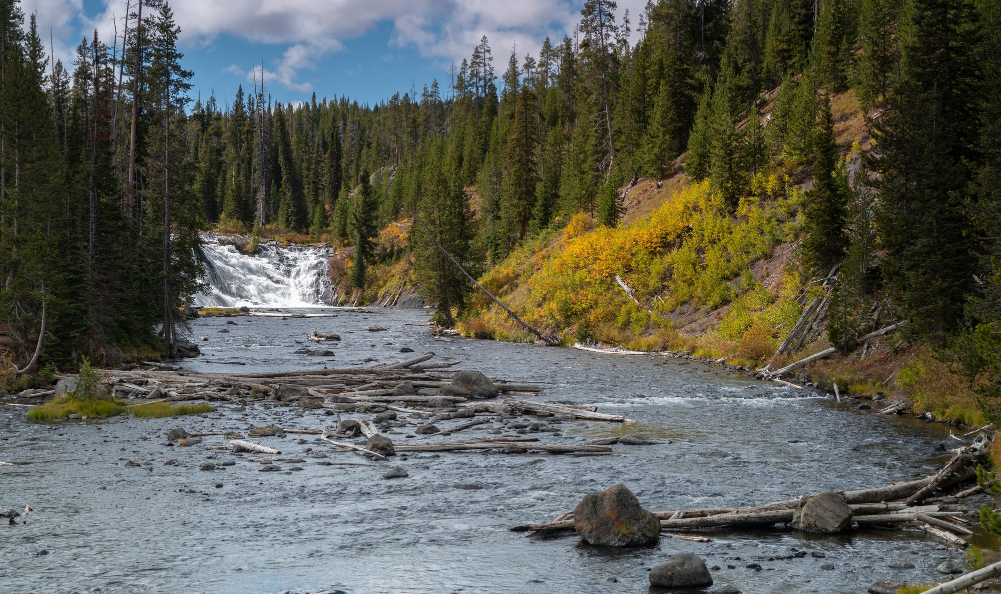
The trail proper starts when you head out on the beautiful Lewis River Channel Trail. You'll get some great views of Lewis Lake, before following the Lewis River to the edge of Shoshone Lake and returning on the Dogshead Trail. This trail really gives you a feeling of being out in the backcountry of Yellowstone. The forests are vibrant, the waters of the Lewis River Channel are crystal clear and it's a quieter trail than most. You might spot trout in the shallow waters, and if you're lucky, some eagles or ospreys trying to grab them for dinner.
This is a great trail for those who love the peace and quiet of the forests.
9. Storm Point Trail
- Start/Finish: Storm Point Trailhead (East Entrance), loop
- Distance: A 2.3-mile (3.7km) round trip
- Walking time: 1-2 hours
- Difficulty: Easy
- Best for: A pleasant low-level stroll
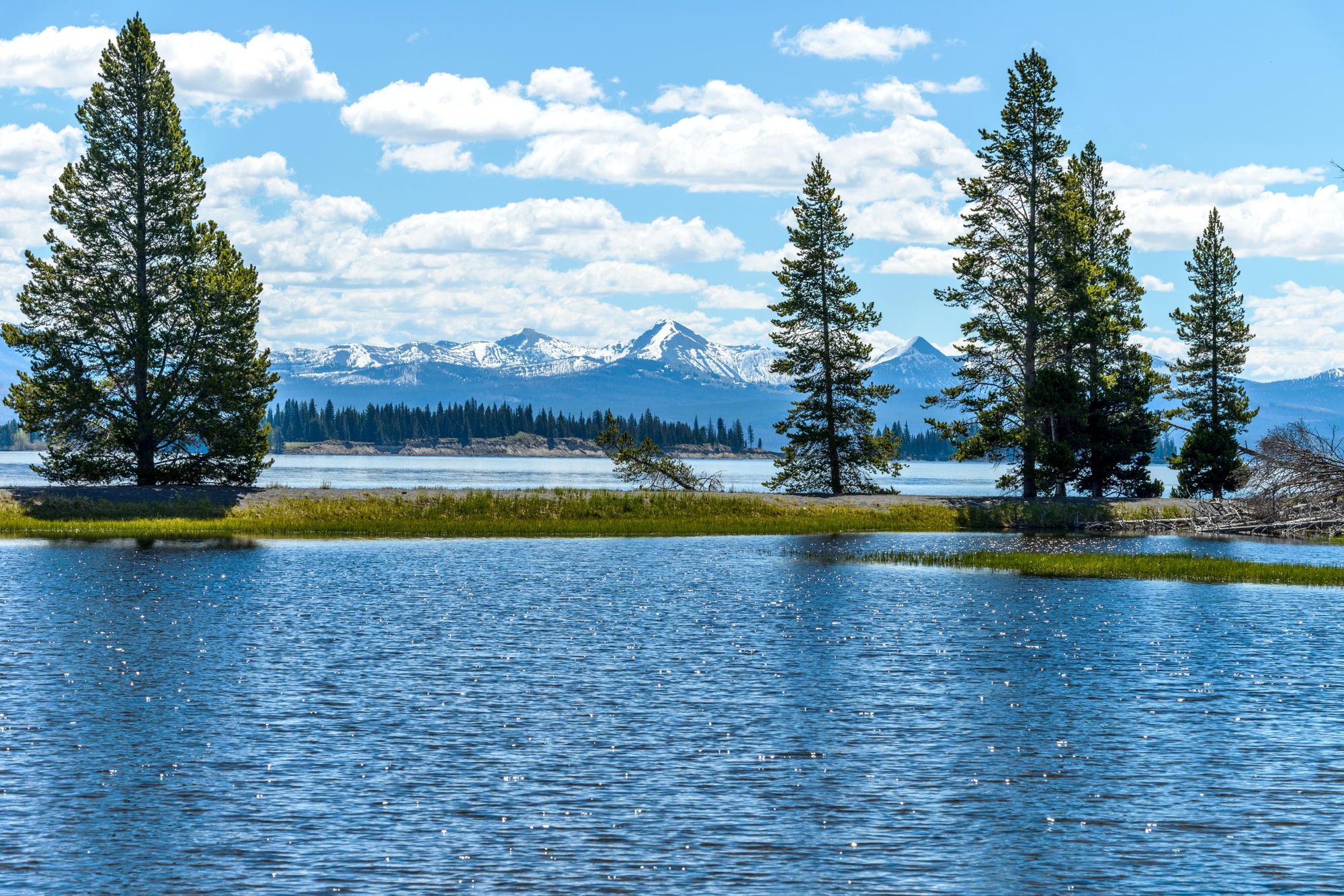
The Storm Point Trail might be a little short for some, but we wanted to include a route which sits on Yellowstone Lake, and this does just that; starting in open meadows bythe lake and passing Indian Pond before turning into a forest.
When you emerge from the trees, you'll do so to the drama of Storm Point - which lives up to its name, in terms of the wind at least. This is a spiky inlet which pokes into the northerne end of Yellowstone Lake, with Mary Bay on your left and the meeting of Yellowstone river with the lake on your right.
On the rocky area on the point, there are a colony of yellow-bellied marmots. The route follows the shore of the lake before looping back through the forest.
10. The Mount Holmes Trail
- Start/Finish: Mount Holmes Trailhead (North Entrance)
- Distance: A 18.8-mile (30.2km) round trip
- Walking time: 10-12 hours
- Difficulty: Challenging
- Best for: A gruelling, all-consuming Yellowstone hike
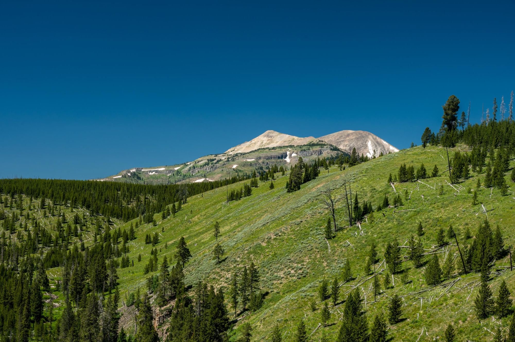
This is an extremely demanding hike which should only be undertaken by those with previous experience, and a good level of fitness. Grizzly bears frequent the route and you'll be out on the trail all day. If that doesn't put you off, this is a trail that will take you through meadows and talus slopes which gain over 912m (3,000ft) in ascent en route to the 3,150m (10,336ft) summit of Mount Holmes.
At the summit, you'll find an unmanned fire lookout (which was destroyed by a lightning strike in 2019) and a 360 degree view out to Electric Peak in the north and the Tetons to the south. Look out for elk running around below, and wildflowers on the trail as you walk.
This route is often done over two days. If you're going to do it in one, do further research and prepare fully. Such big days should be treated with respect.
What Animals Live in Yellowstone National Park?
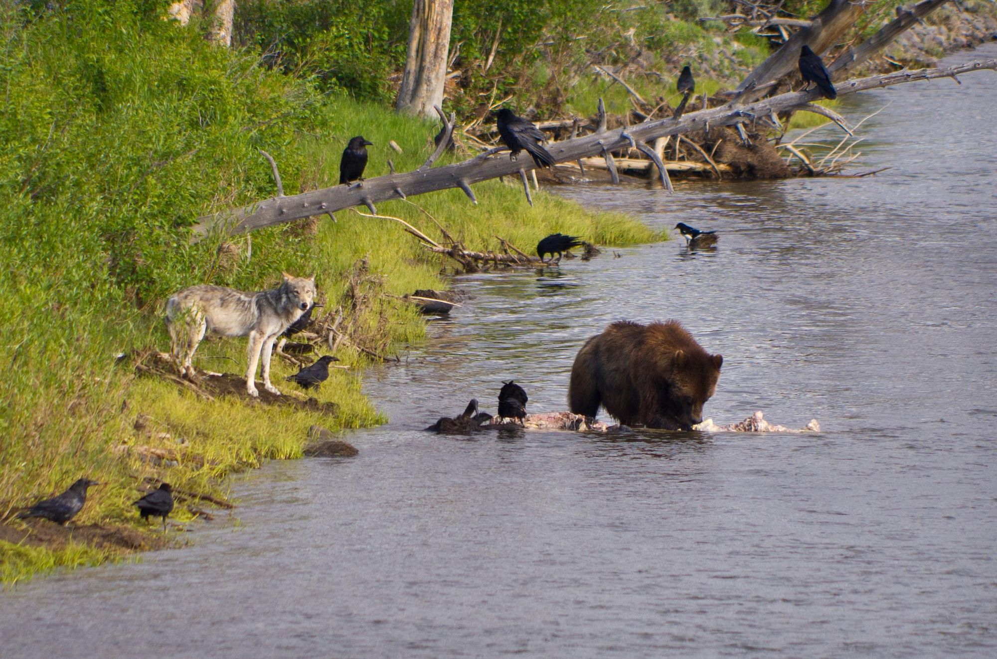
Yellowstone is buzzing with wildlife. The national park is home to the largest concentration of mammals in the lower 48 states. You've got species like bighorn sheep, bison, elk, moose and white-taled deers and then predators like balck and grizzly bears, coyotes, lynx, wolves, mountain lions and wolverines. In the skies, look out for bald and golden eagles, peregrine falcons and ospreys, while in the water, beavers swim amongst various endemic species of trout.
All in all, there are 67 different types of mammals in Yellowstone, as well as around 330 species of birds, 16 species of fish and five species of amphibians.
This is a place world renowned for its wolf rewilding project - and for playing a crucial role in the conservation movement, as the first ever national park.
You need to be prepared for a bear encounter when you're walking in Yellowstone. Grizzlies and black bears inhabit all of the park. Watch for signs of bear activity, carry bear spray and know what to do if you encounter one in order to keep safe. See the Yellowstone page on bear safety.
Read more: How the Rewilding of Wolves Saved Yellowstone National Park
Where to Stay in Yellowstone National Park?
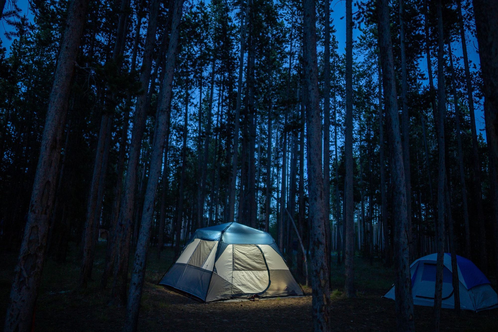
The big question you'll face in this regard is whether to stay inside or outside of Yellowstone National Park. Staying inside is much more immersive, but you will pay a bit more and you'll need to be a bit more self-sufficient. Staying outside (in West Yellowstone or Jackson for example) can be more comfortable, but will mean car queues and long drives to get into the park each morning.
If you're asking for our recommendation? It's always better to stay inside the park. We're pro camping, possibly with a cabin stay every other day to freshen up.
If you're asking for our recommendation? It's always better to stay inside the park.
There are 12 campgrounds in Yellowstone National Park. By far the biggest are Bridge Bay, which has 431 camp spots, and Grant Village, with 429 sites. Canyon, Fishing Bridge RV Park and Madison are also large, while all the others are smaller. Slough Creek only has 16 spots and is perhaps the pick of the bunch - out in the wilderness, with only the basics supplies and wolves howling in the night.
The nightly fee ranges from $20-25 for the smaller sites to $39 for the larger.
You should book camp spots in advance through Yellowstone National Park Lodges or Recreation.gov and you could also use particularly the former site to browse lodges and cabins in Yellowstone. There are lots of great options, including the Old Faithful Inn, the Mammoth Cabins or Lake Yellowstone Hotel. Some accomodation in Yellowstone needs to be booked up to a year in advance.
What to Eat in Yellowstone National Park?
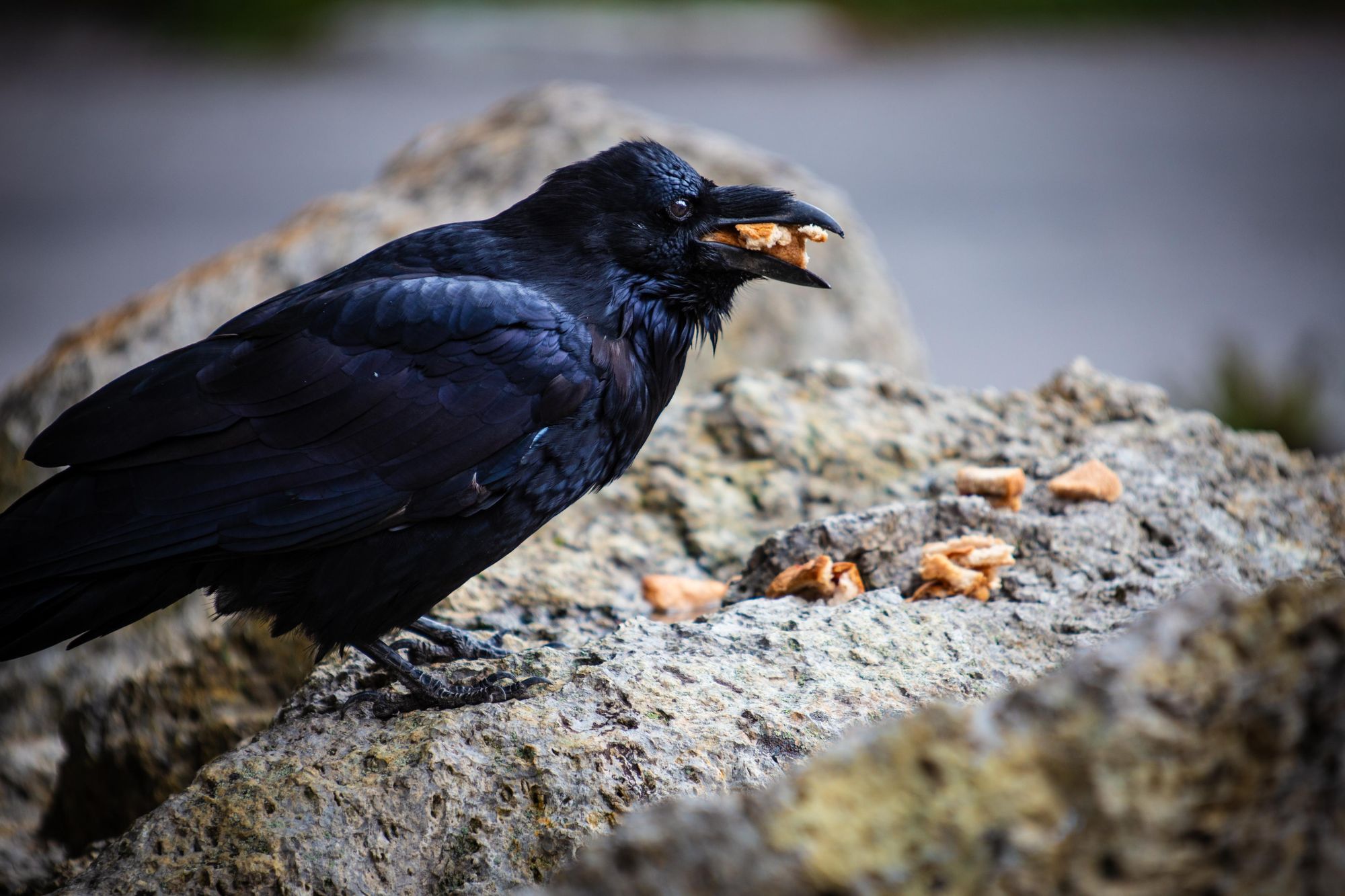
Yellowstone has more eateries than most other national parks in the United States, with 20 spots spread across the (very large) park. There are stores for buying snacks and groceries, sit-down canteens serving sandwiches, pizzas and burgers and then a whole bunch of actual restaurants, including some fancy options like the Mammoth Hotel Dining Room and the Lake Hotel Dining Room.
We're big fans of the good vibes at the Grant Village Lake House Restaurant, and you can also do a lot worse than food with a view at Old Faithful Lodge Cafeteria.
Naturally, we'd recommend bringing a lot of snacks and hiking food too. Picture yourself sitting down at a picnic bench with a nice sandwich. Sounds nice, right?
There are also some great, small joints in the towns surrounding Yellowstone.
How to Get to Yellowstone National Park?
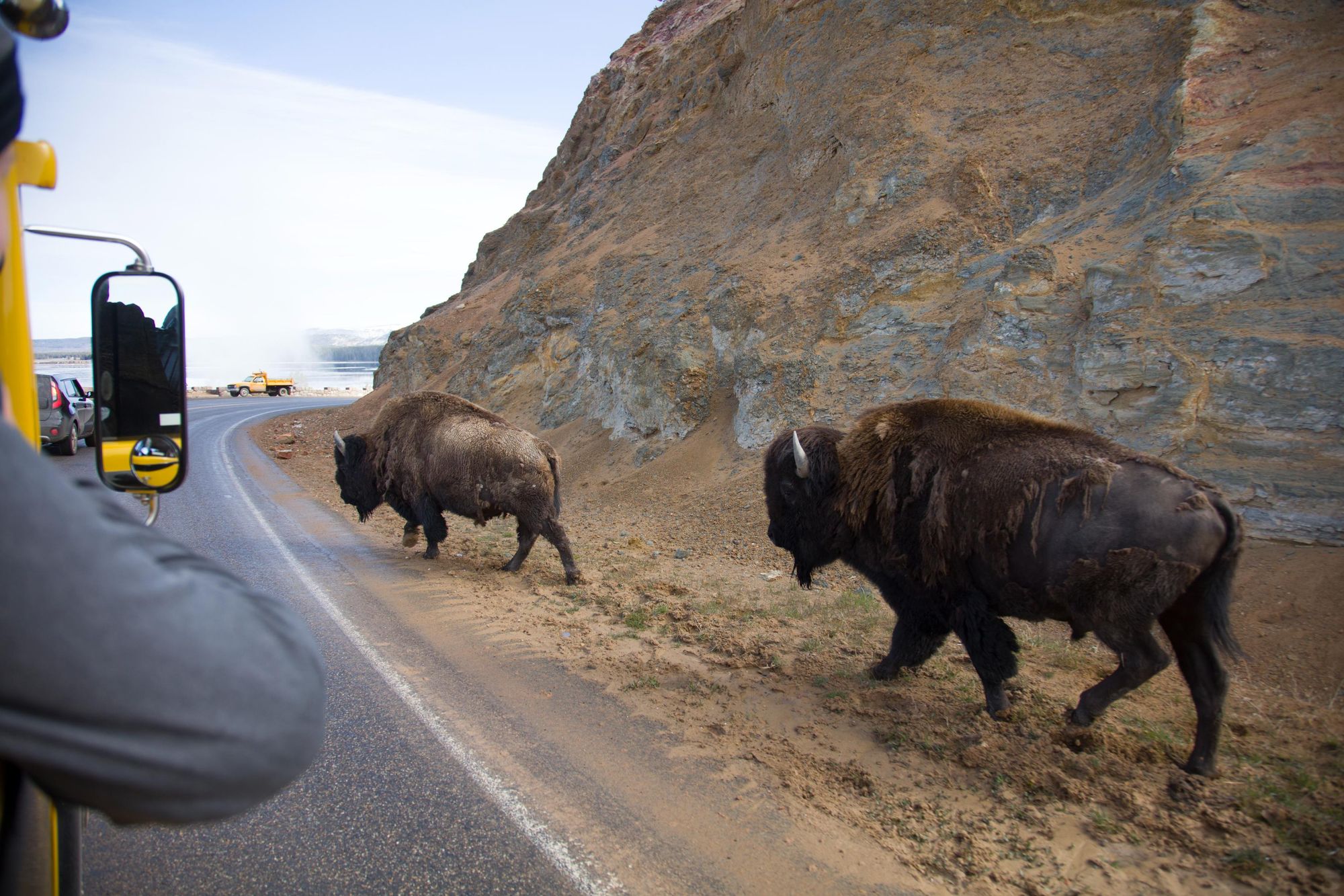
By train: There is no train service directly to Yellowstone National Park, unfortunately. The nearest Amtrak service goes to Salt Lake City in Utah, though that's still a 320-mile (514km) journey - meaning a roughly 4hr 45 minute drive. You can also get the Salt Lake City Express bus. More on that below.
By plane: Bozeman Yellowstone International Airport is a 90-minute drive from the North Entrance and two hours from the West. Yellowstone Airport is a small airport 10-minutes away from the West Entrance, while Idaho Falls regional airport also serves this entrance, with a 2hr 30 mins drive. Jackson Hole Airport, which is in the Grand Teton National Park, is an option for those wishing to enter via the South Entrance. It's a one hour drive to Yellowstone South Entrance.
By bus: You can reach Yellowstone National Park, by arriving at West Yellowstone, Montana (for the West Entrance) or Jackson Hole, Wyoming (for the South Entrance) on the Salt Lake City Express. Pick up spots include Salt Lake City in Utah or Idaho Falls in Idaho. Salt Lake City Airport to West Yellowstone is a seven hour bus with one transfer. Idaho Falls to West Yellowstone also has one transfer, but can be as quick as 2h 45 mins.
Read more:
- 5 of the Best Hikes in Yosemite National Park
- A Guide to Denali National Park in Alaska
- Hike the Great National Parks of the Western USA
Inspired? Check out our adventures in North America, which take you to the country's best wilderness areas.