


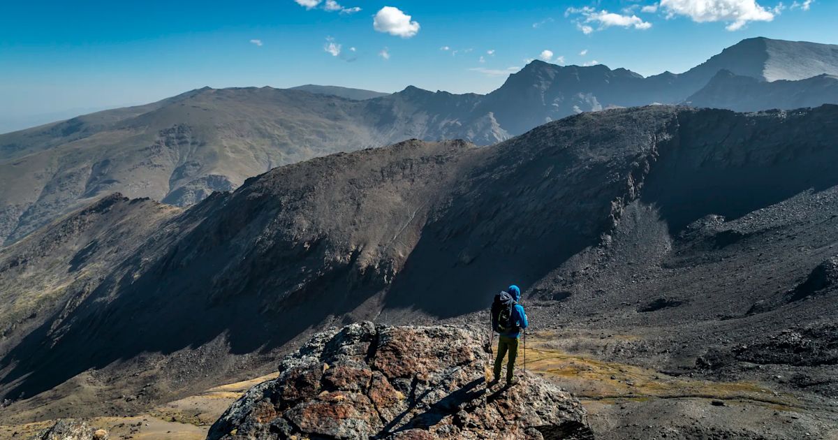
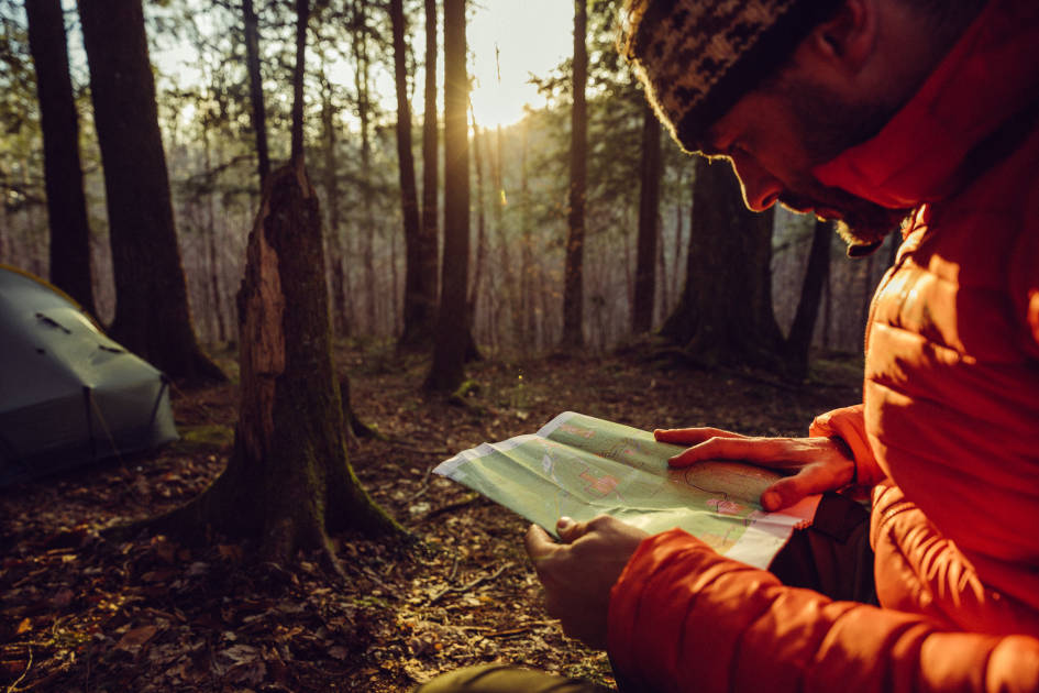
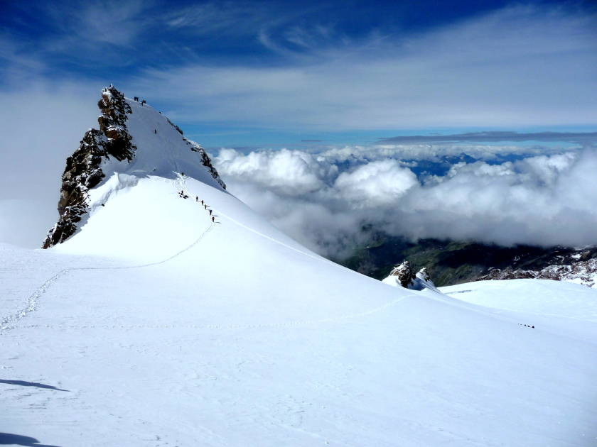
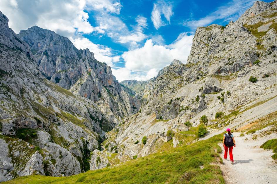
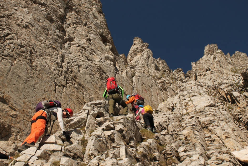
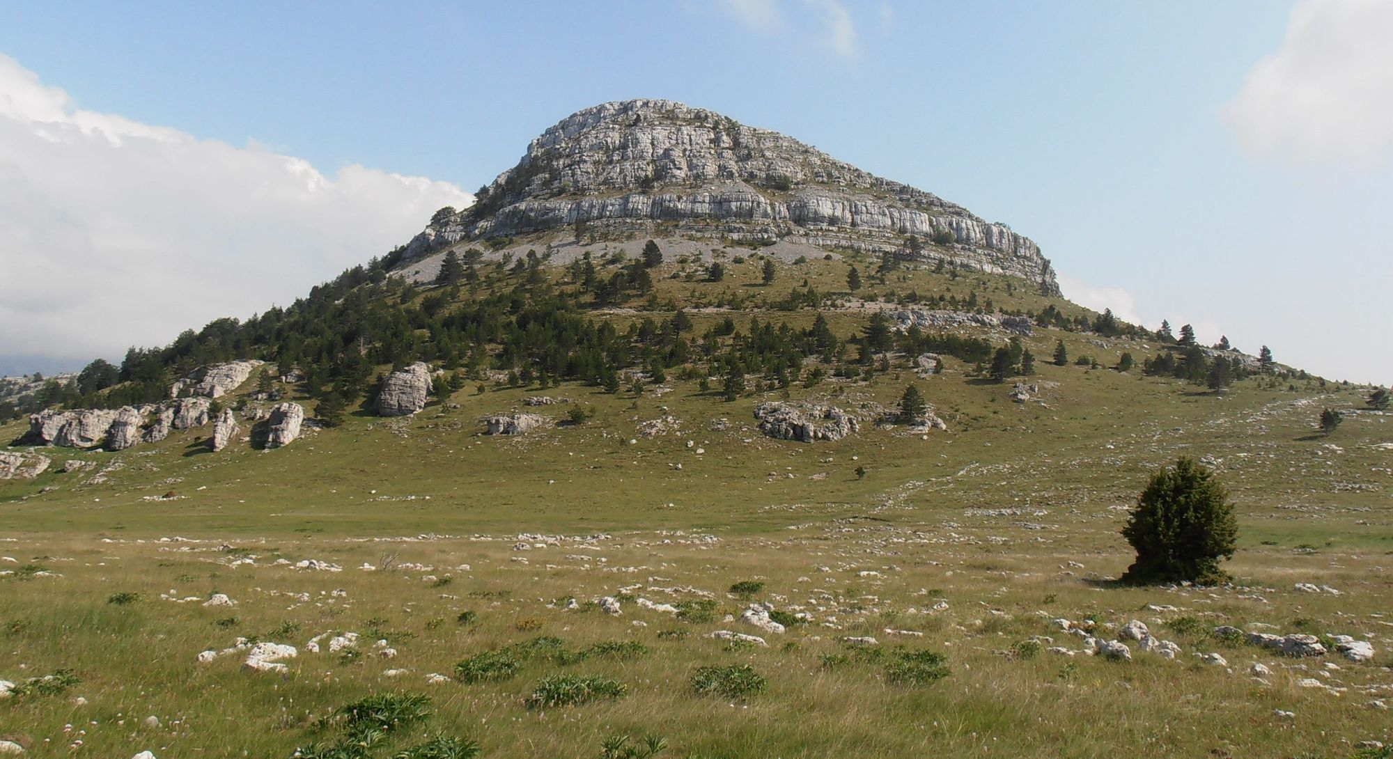
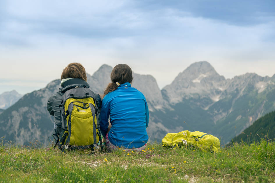
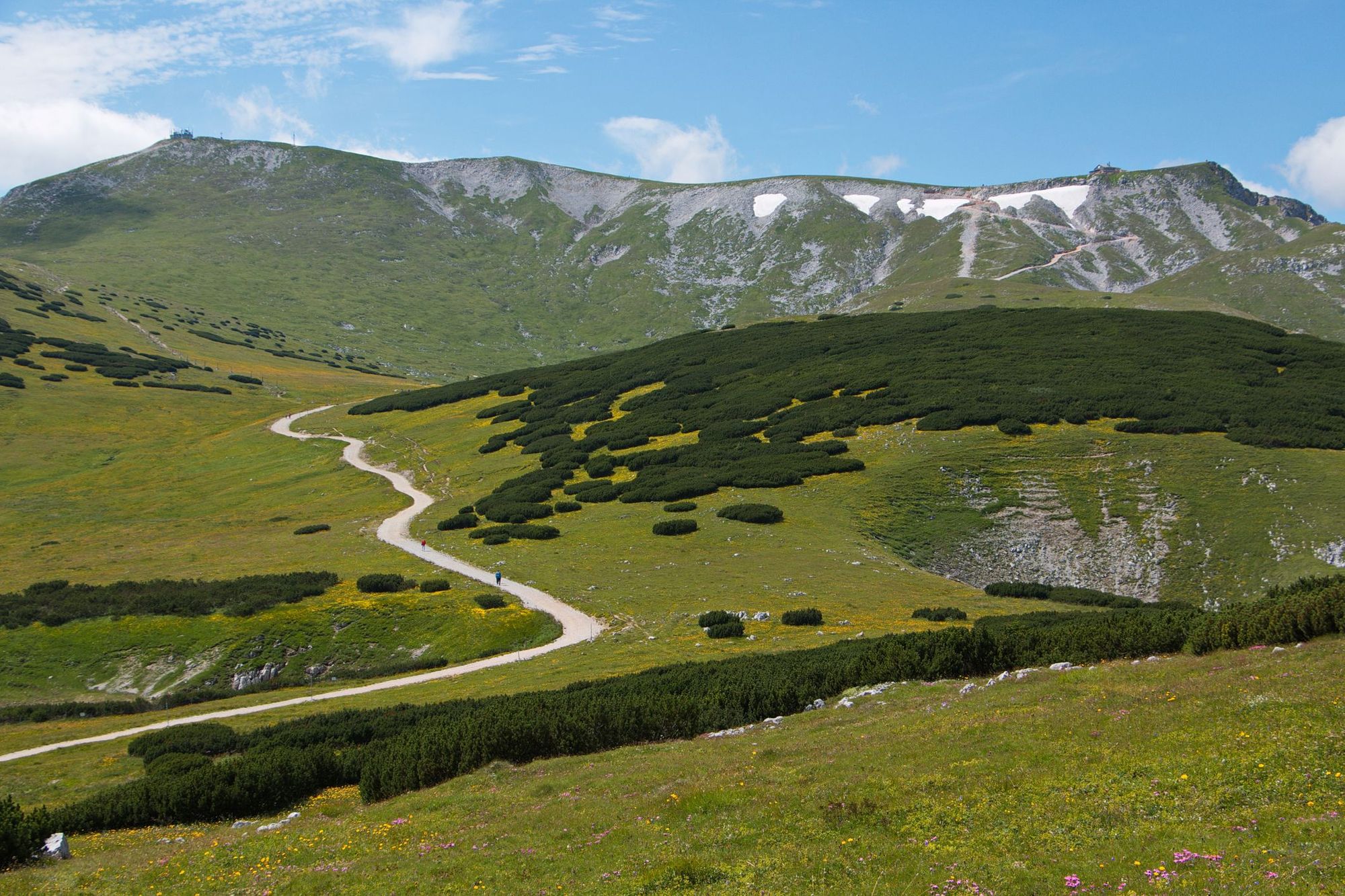
We love seeing the world by train. You get a real sense for the cultures you travel through, and for the magnitude of the land you cover - watching city sky-rises and urban streets turn to small towns, pristine lakes and serrated mountain ranges from the comfort of your window seat.
Of course, travelling by train is also much more sustainable than travelling by plane. EcoPassenger found that a journey from London to Madrid would emit 43kg of CO2 per passenger by train, but 118kg by plane. A journey from London to Madrid would emit 43kg (95lb) of CO2 per passenger by train, but 118kg by plane (or 265kg if the non-CO2 emissions are included), according to EcoPassenger.
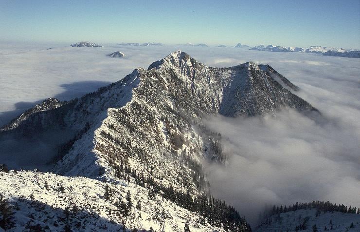
Every mountain included on this list can be reached on a train from a nearby major European city, with no more than one connection on the route.
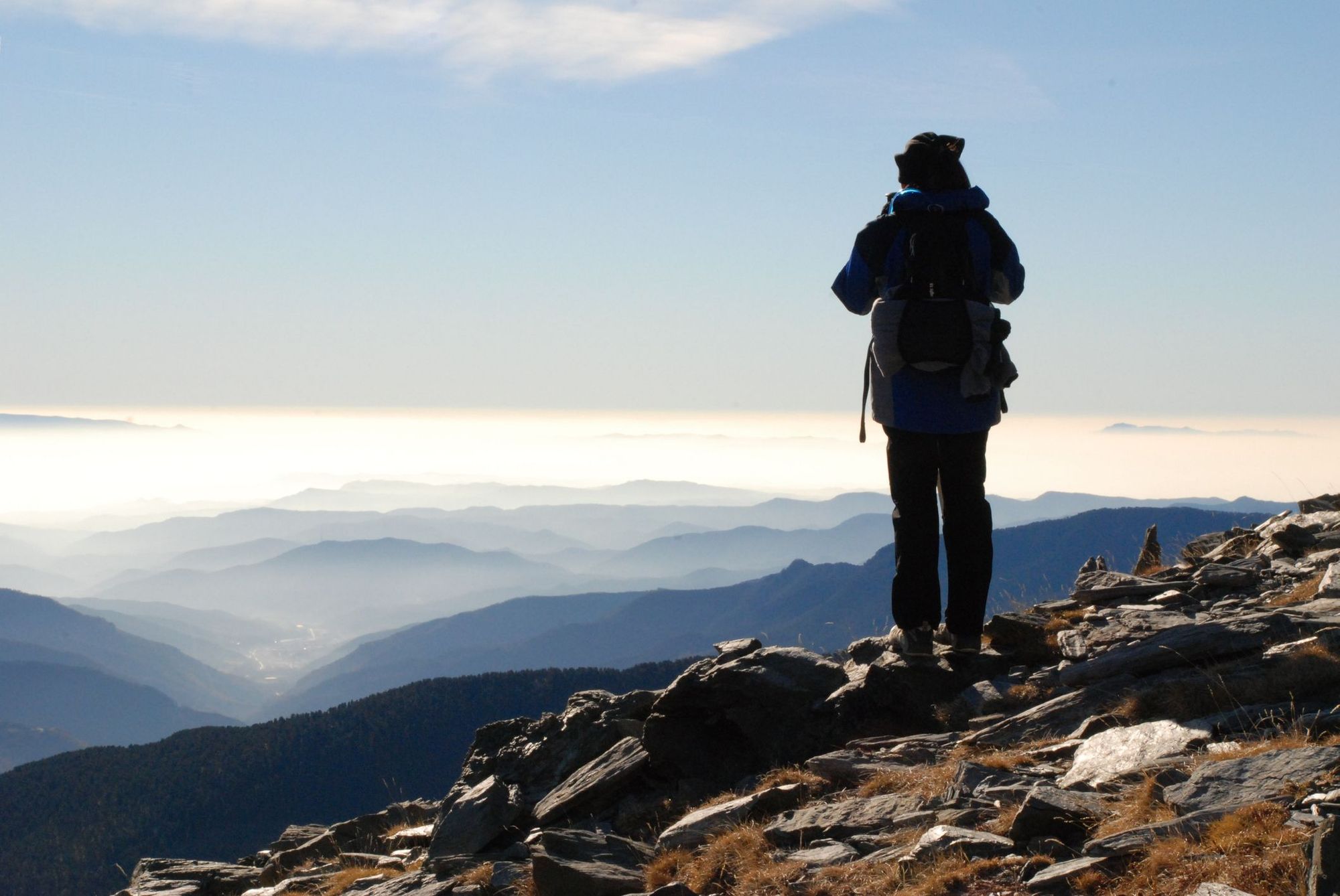
So, we decided it was about time to combine a bunch of our loves; train travel, mountain climbing and planning adventures on intricate spreadsheets. The result is this list of 45 mountain climbs that can be reached in Europe by train.
Every mountain included on this list can be reached on a train from a nearby major European city, with no more than one connection on the route.
The distance and duration provided for each route listed is for the most direct route that we could find to the train stations of each of these gateway towns, from the nearest major city. The costs provided are for the cheapest single, one-way adult ticket we could find for the route, correct as of July 2023.
All hike times are approximate and route descriptions are summaries. This is not a guide - and proper research and appropriately safety measures (mapping, kit, weather checks etc.) must be taken before any hike. Many of these climbs will be snow-covered and inaccessible outside summer. While we strive for accuracy, we cannot accept responsibility for changes, errors or omissions made.
Now, let's hit the rails and the trails.
Here are 45 of the best mountain climbs in Europe, reachable by train.
1. Ben Nevis, Scotland
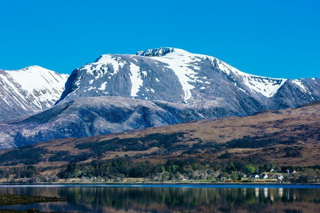
- Location: Fort William, Scotland
- Height: 1,345m
- Time to hike: 7-8 hours
- Nearest train station: Fort William, Scotland
At 1,345m high, Ben Nevis is the highest mountain in both Scotland and the United Kingdom. The gateway town is Fort William, which is well served by train. The best connection is from Glasgow and takes under four hours to cover the scenic route, which passes from the Lowland to Highlands. The hike up and down Ben Nevis typically takes between 7-8 hours on the most popular path, known as the Tourist Trail - although there are various routes up Ben Nevis. On a clear day from the top you can see out to the Torridon Hills, Ben Lomond and Caithness, and if the sky is particular clear, as far as Northern Ireland.
Ben Nevis by train: The Glasgow-Fort William train route runs 107 miles (172km) and takes 3 hours 44 minutes. Prices from £21.50, Scotrail. Fort William is also reachable direct from London on the Caledonian Sleeper route.

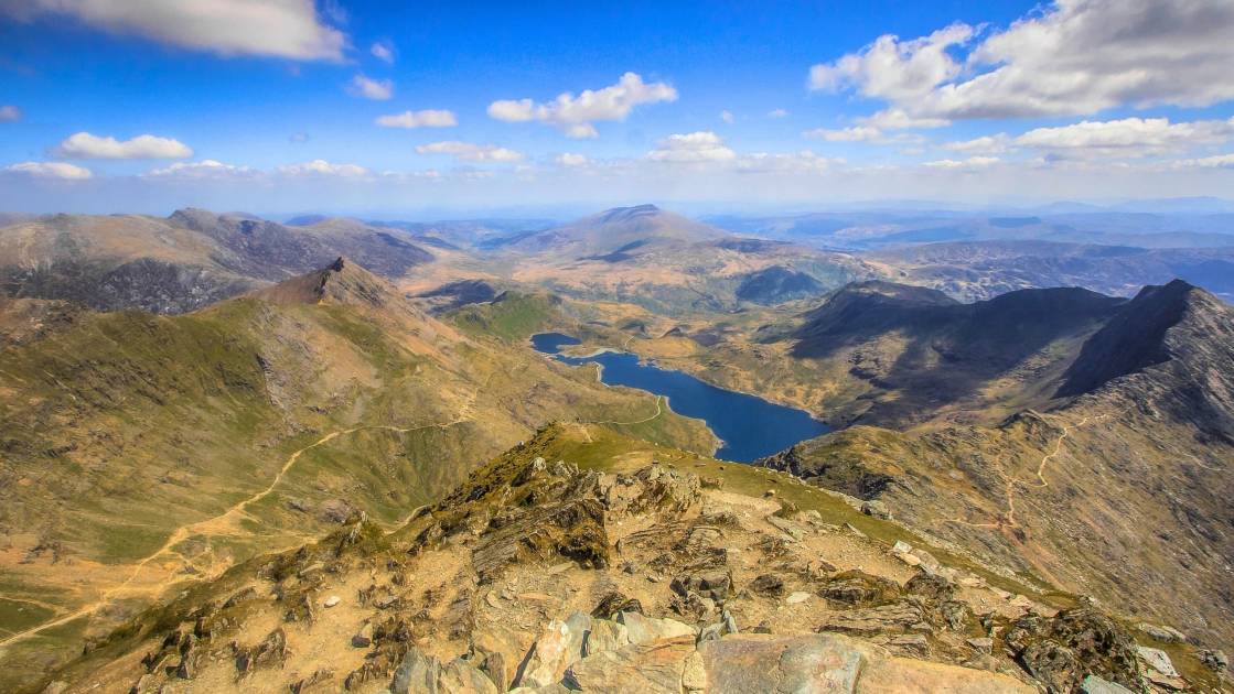
2. Snowdon, Wales
- Location: Snowdonia National Park, Wales
- Height: 1,085m
- Time to hike: 6-7 hours
- Nearest train station: Bangor, Wales
Snowdon is the highest mountain in Wales, at 1,085m, and a popular one to ascend since no technical climbing skills are required. There are six main walking routes up Snowdon, including the popular Llanberis Path and the more scenic (but more strenuous) Miners' Track. The two closest stations are Betws-y-Coed and Bangor (depending what trail you decide to take), but Bangor has the better connections.
Snowdon by train: The direct Manchester - Bangor train takes 2 hours 10 minutes and is 97 miles (156km). Prices from £28.70, Transport for Wales. From Bangor, you can use the Snowdonia Sherpa Bus system to get to any of Snowdonia's six main trailheads. Bangor can also be reached from Liverpool, Glasgow, Birmingham, Cardiff and London.
3. Scafell Pike, England
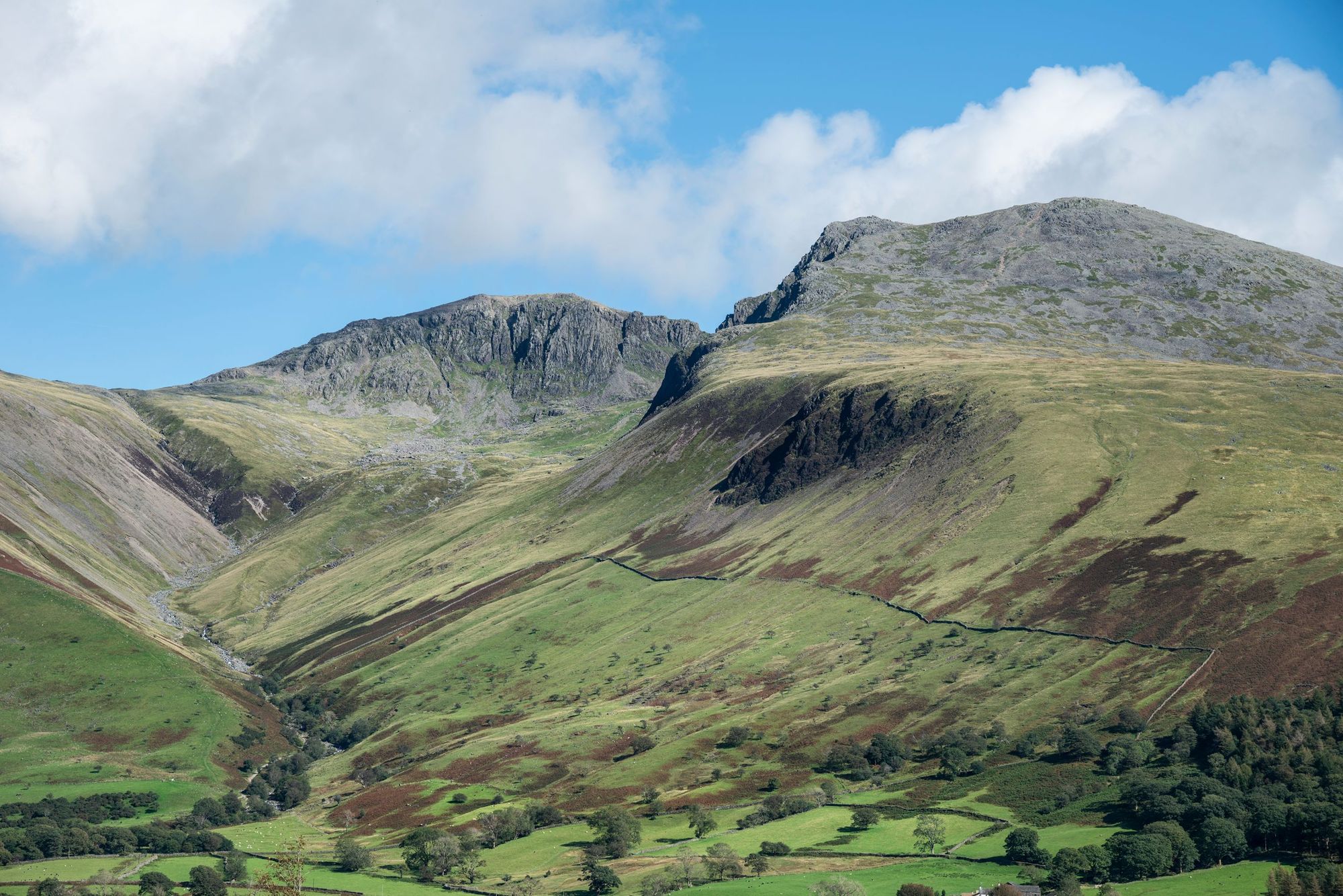
- Location: Lake District National Park, England
- Height: 978m
- Time to hike: 3-4 hours
- Nearest train station: Windermere, England
If you want to climb the highest mountain in England, you'll need to head to Scafell Pike (978m). It's often climbed as part of the National Three Peaks Challenge alongside Snowdonia and Ben Nevis. The mountain is set in the heart of the scenic and popular Lake District region, with views of Wasdale Valley and Wast Water (England's deepest lake) from the summit. There are three main routes up Scafell Pike; from Wasdale, Borrowdale or Langdale. The mountain is easily accessible via public transport - the closest station is Windermere.
Scafell Pike by train: The train journey from Manchester to Windermere is direct - it takes 1 hour 33 mins and is 68 miles (109km), with prices from £12.90 on the TransPennine Express. The route is also possible from London. The closest stops on the Avanti West Coast line are Penrith and Oxenholme Lake District.
4. Ben Macdui, Scotland
- Location: The Cairngorms, Scotland
- Height: 1309m
- Time to hike: 6-7 hours
- Nearest train station: Aviemore, Scotland
Ben Macdui is the second highest mountain in Scotland and in the entire British Isles, after Ben Nevis. It has a domed shape and is most easily accessed from the north, where a vast and exposed plateau runs from the summit to Cairn Lochan and Cairngorm. It's known for its wild, remote appearance - the surrounding Cairngorms landscape is spectacular. The closest train station to Ben Macdui is nearby Aviemore, making it easily accessible by public transport.
Ben Macdui by train: The train from Edinburgh to Aviemore is 128 miles (208km) and takes 2 hours 50 mins. Prices from £12.90, Scotrail. Aviemore can also be reached from Glasgow, Inverness, Perth, Stirling and London. From Aviemore, grab the bus up to the Cairngorm ski centre to start the hike.
5. Kinder Scout, England
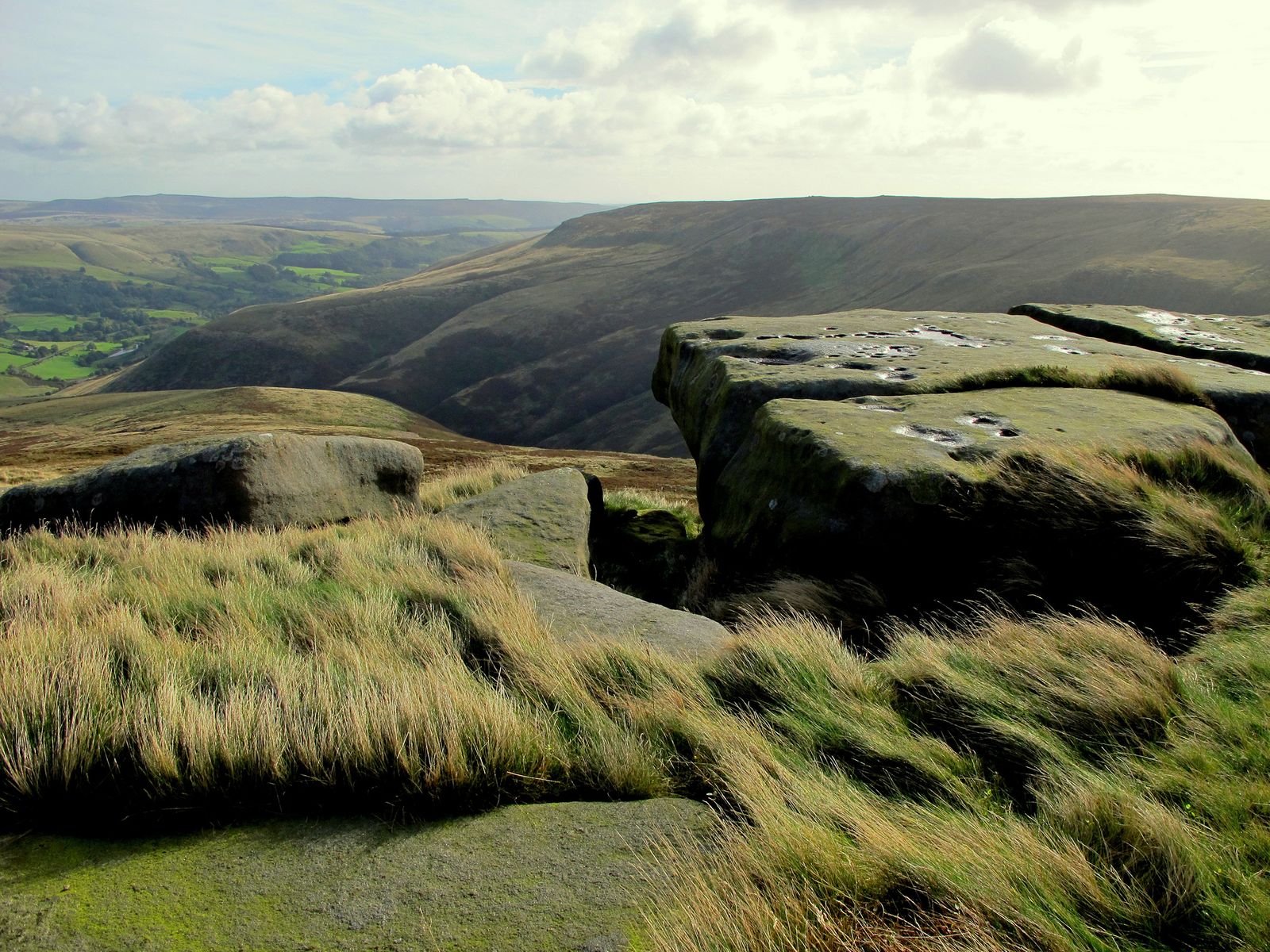
- Location: The Peak District, England
- Height: 636m
- Time to hike: 3-4 hours
- Nearest train station: Edale
At only 636m high, Kinder Scout is the lowest summit on this list. But what it lacks in stature it makes up for in significance. The mass trespass of Kinder Scout in 1932 was what kick-started the the 'Right to Roam' movement, the fight for access rights in England's wild spaces. Taking the Kinder Scout Circular Trail enables you to follow in the footsteps of the trespassers as you make your way through the wild moorland of the Kinder Plateau. The mountain is one of the most accessible on this list, as you can reach it on foot from Edale train station.
Kinder Scout by train: Kinder Scout is reachable in just 32 minutes by taking the 21 mile (34km) route from Sheffield to Edale. Tickets from £3.80, East Midlands Railway. It's also easily reachable by train from Manchester.
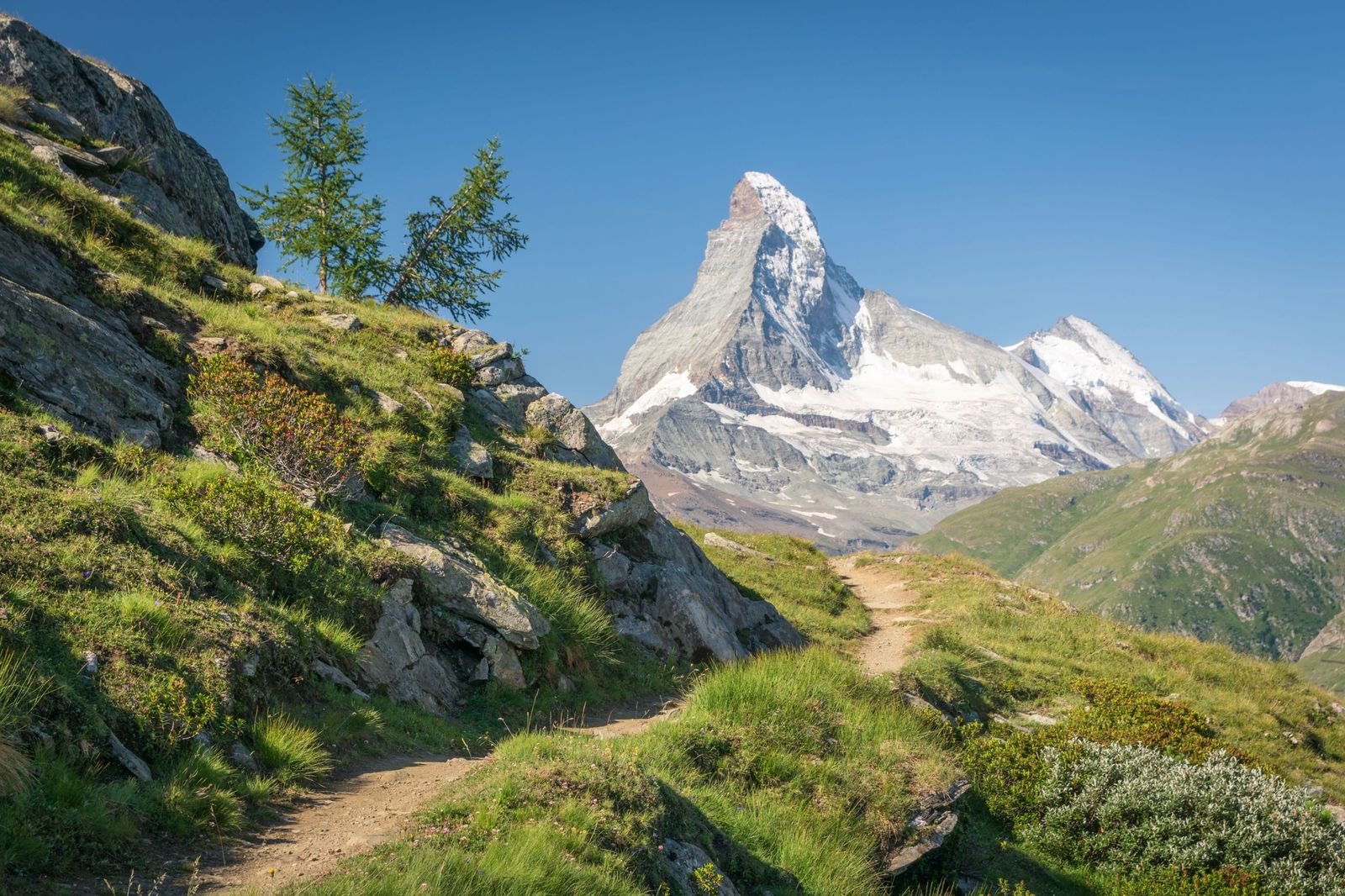
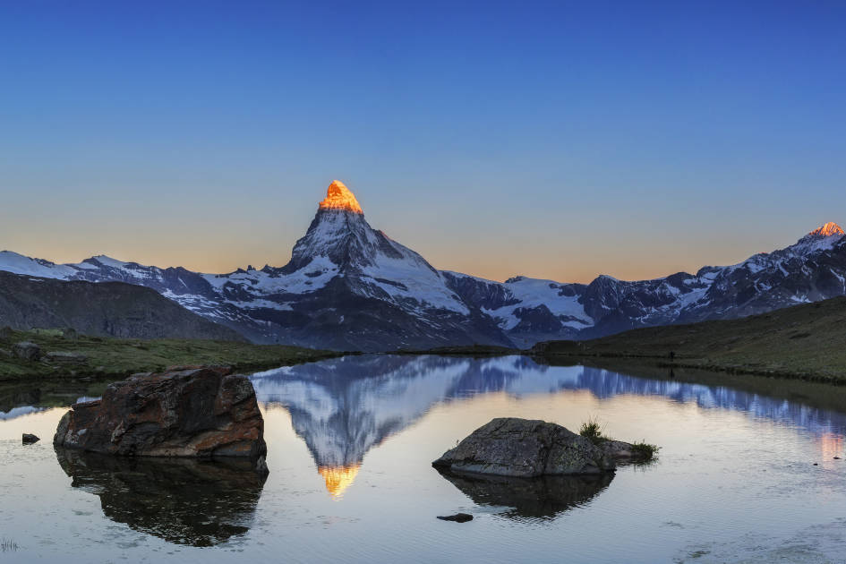
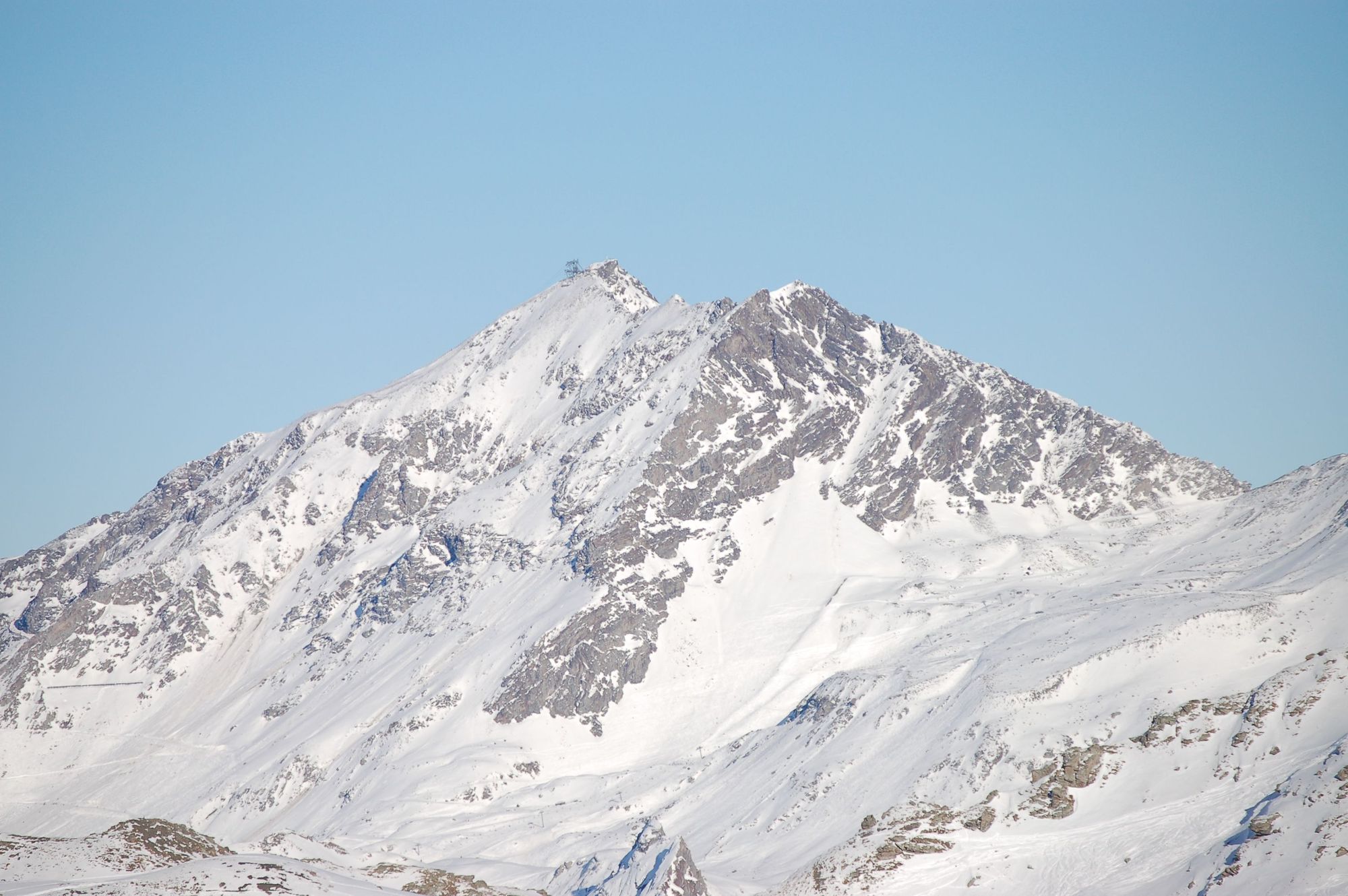
6. The Matterhorn, Switzerland
- Location: Zermatt, Switzerland / Cervinia, Italy
- Height: 4,478m
- Time to hike: 2-3 days
- Nearest train station: Zermatt, Switzerland
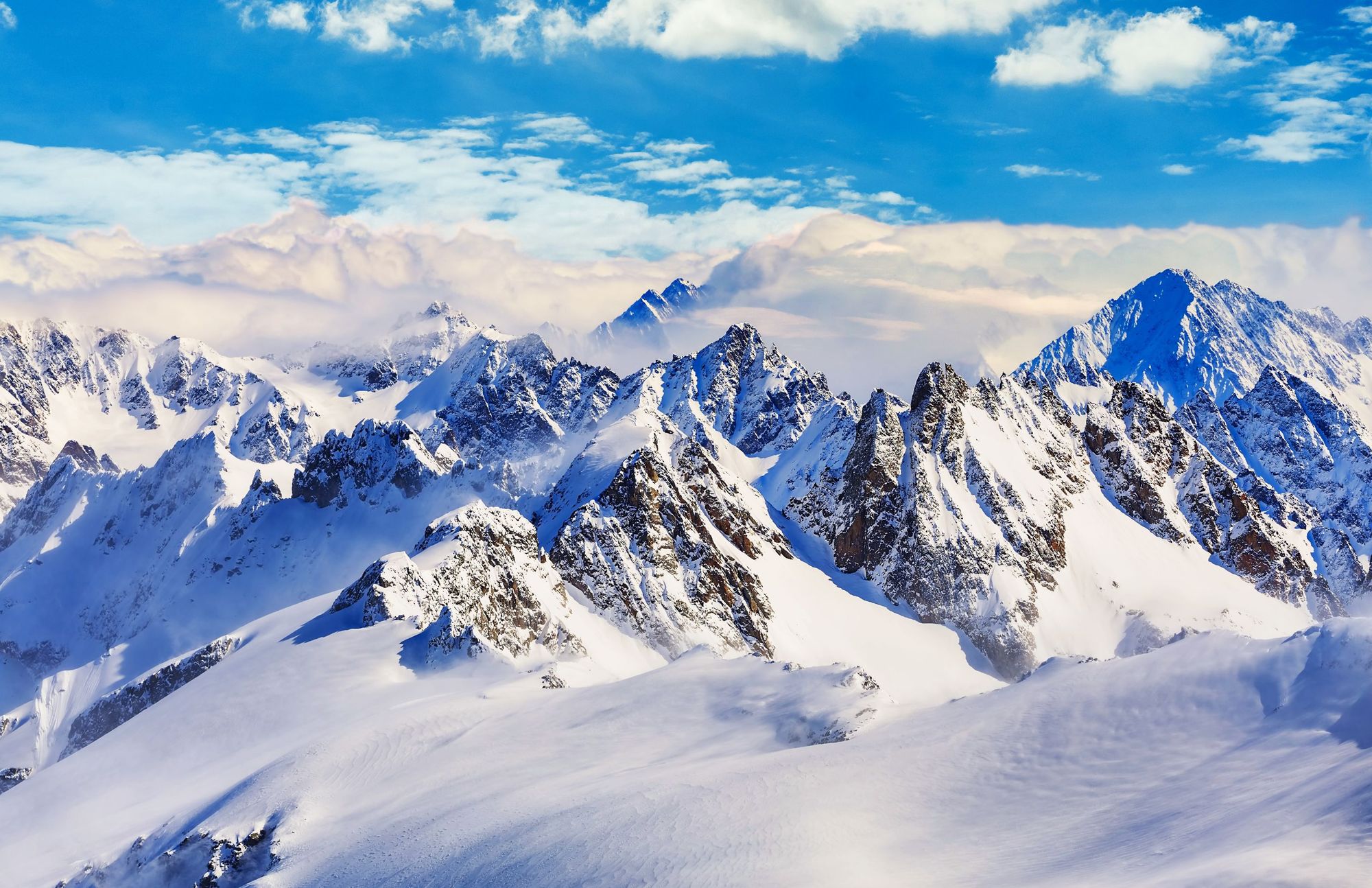
The Matterhorn is one of the most iconic mountains in Europe, instantly recognisable from its curved peak and strong, rigid spine. The mountain sits on the Italian-Swiss border and has a long history of alpinism, the first climb having taken place in 1865. The mountain is also surrounded by beautiful alpine hiking trails - not least the Matterhorn Circuit, which runs around the mountain, giving views from every angle. The mountain huts are exceptional in this area, and the food isn't bad either. How about some fondue while you stare out at the mountain?
The Matterhorn by train: You can reach Zermatt from Geneva, changing once in Visp. The 144 mile (233km) journey is on SBB CFF FFS, with prices from £19.08. Zermatt is also easily reachable from Zürich.
7. Monte Rosa, Switzerland
- Location: Between Valais, Switzerland and Piedmont/Aosta Valley, Italy
- Height: 4,634m
- Time to hike: 2 days
- Nearest train station: Zermatt, Switzerland
The Matterhorn may be the most iconic mountain in Switzerland, but Monte Rosa is its highest mountain. In fact, the peak of this sprawling massif is second in height to only Mont Blanc in all of the Alps. It’s a mountain alive with glaciers and angular, jagged edges - a place of startling beauty in the eastern part of the Pennine Alps. There are numerous peaks on the massif, including the Dufourspitze, the high point. It was first climbed in 1855, on the same route that is used to climb the mountain today.
Monte Rosa by train: As aforementioned, you can reach Zermatt from Geneva, changing once in Visp. The 144 mile (233km) journey is on SBB CFF FFS, with prices from £19.08. Zermatt is also easily reachable from Zürich.
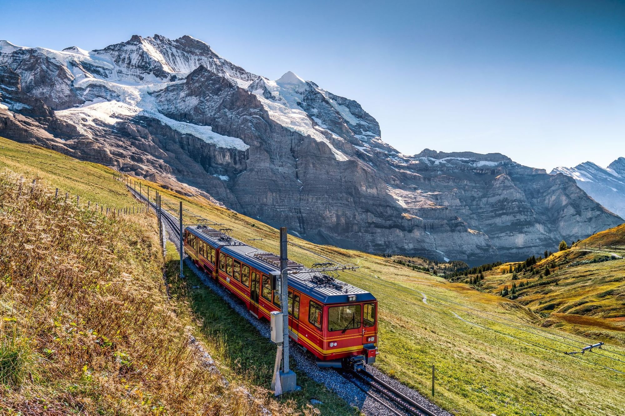
8. Jungfrau, Switzerland
- Location: Bernese Alps, Switzerland
- Height: 4,158m
- Time to hike: 2 days (from Jungfraujoch)
- Nearest train station: Jungfraujoch.
If you're after a sensational train ride, look no further than the Jungfrau Railway, which runs from Kleine Scheidegg in the Bernese Oberland, through the Jungfrau Tunnel (inside the Eiger and Mönch) and out to Jungfraujoch - which at 3,454m, is the highest train station in both Switzerland and Europe. Most ascents of the Jungfrau take place from here, with a gruelling four-hour ascent, followed by a night in the Monchsjoch Hut at 3,658 meters before descending.
The Jungfraujoch train station is the highest in both Switzerland and Europe.
Jungfrau by train: The best way to reach Jungfraujoch by train is by taking the 85-mile (137km) journey from Zürich HB to Grindlewald, changing once at Interlaken West along the way. It's a delightful journey on the SBB CFF FFS rail network, with tickets from £16.43 and the journey taking 2 hours 47 minutes. The final stretch from Grindlewald is on the newly opened V-Cableway Eiger Express, and only lasts around 15 minutes.
From there, you can take the Eiger Express cable car to the Kleine Scheidegg railway station, and grab the Jungfrau Railway up to Jungfraujoch. It's also possible to get to Grindlewald from Geneva.

9. Titlis, Switzerland
- Location: Engelberg, Switzerland
- Height: 3,238m
- Time to hike: 4 hours (from Klein Titlis)
- Nearest train station: Engelberg
From the top of Titlis, you can see out over many of the great peaks of Switzerland, including the Tödi to the north, Sustenhorn to the south south and to the Jungfrau, Mönch, and Eiger south-west, as well as beyond to the Matterhorn and the Monte Rosa Massif. The summit of Titlis is made significantly easier to reach by first taking the gondola from Engelberg to Klein Titlis, a sub-peak on which sits a restaurant and ice-grotto. It's a two-hour trek (one way) up the West Ridge to reach the summit from here.
Titlis by train: To reach Titlis, take the train from Zürich HB to Engelberg, changing at Luzern. The journey is 53 miles (86km) long and costs from £10.64 with SBB CFF FFS. Also reachable from Geneva.
10. Harder Klum, Switzerland
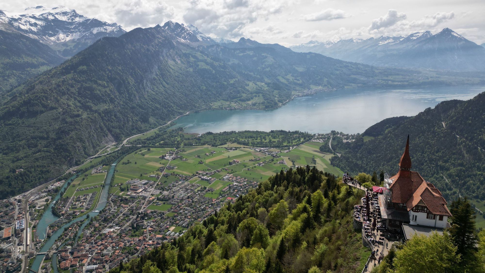
- Location: Interlaken, Switzerland
- Height: 1,321m
- Time to hike: 5 hours
- Nearest train station: Interlaken
Harder Klum is Interlaken's home mountain; and from the summit you can see both Lake Thun and Lake Brienz. The hike up from Interlaken is around a 5 mile (8km) return trip and rises steeply - with plenty of stunning vistas along the way. There are other hiking trails you can link into this climb near the summit, and there's also a gondola if you'd prefer to take the quick route up or down. You get an awful lot in return on this mountain but a relatively low amount of effort.
Harder Klum by train: To get to Harder Klum by train, take the 73-mile (118km) direct SBB CFF FFS route from Zürich HB to Interlaken, which takes 1 hour and 54 minutes, and costs from £15. Also reachable from Geneva.
11. Aiguille Rouge, France
- Location: Savoie, France
- Height: 3,227m
- Time to hike: 5-6 hours
- Nearest train station: Bourg-Saint-Maurice
This mountain will be familiar to ski fans as the high point of the ski area Les Arcs. It's a doable hike from the villages below. The Les Arcs express funicular climbs from Bourg-Saint-Maurice (a town, and the nearest train station) to Arc 1600.
You can then take a free shuttle to Arc 1950 and a cable car on to Arc 2000. You can proceed from here via cable car or hike if you're feeling more adventurous. The panoramas from the summit are excellent - looking out to the French, Swiss, Italian and Jura mountains. Notable mountains on the horizon include Mont Blanc, The Grandes Jorasses and the Bernese Alps.
Aiguille Rouge by train: To reach Aiguille Rouge, get the train from Paris to Bourg-Saint-Maurice. The journey is 305 miles (491km) long and takes five hours - typically including one change in Chambéry. Tickets via SNCF from £17.51. Also reachable from Lyon.
12. Pointe De Nantaux, France
- Location: Morzine, France
- Height: 2,170m
- Time to hike: 7-8 hours
- Nearest train station: Thonon-les-Bains
There's more to Morzine than skiing and mountain biking. One of the surrounding peaks of this sublime French village is the Pointe De Nantaux, which you can hike from the nearby hamlet of Essert-Pierre, above Saint Jean d’Aulps. The climb is steep and at times can get technical, with a bit of scrambling. Views from the top look back over Lake Geneva, Avoriaz, Morzine and on a clear day, Mont Blanc.
Nantaux by train: To reach Morzine by train, take the Paris-Thonon-les-Bains route, changing at Gare de Bellegarde along the way. The journey is 258 miles (415km) long and takes around four hours and 12 minutes. Prices from £23 via SNCF.
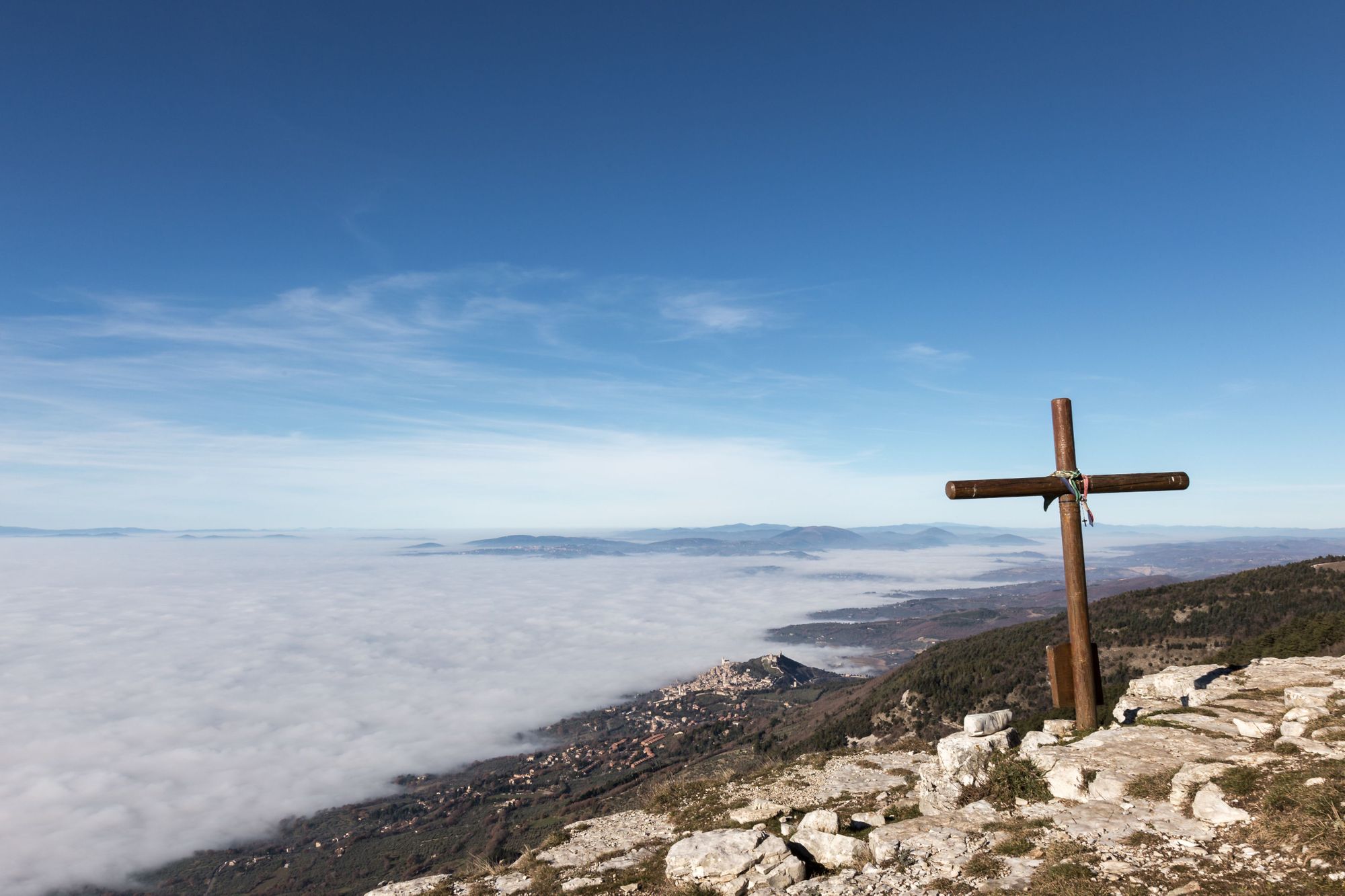
13. Mount Subasio, Italy
- Location: Umbria, Italy
- Height: 1,290m
- Time to hike: 5-6 hours
- Nearest train station: Assisi
Follow in the footsteps of Saint Francis of Assisi by climbing Subasio, a sublime, solitary mountain which sits between the Umbria and Chiascio valleys. From Assisi, there's a great nine-mile circular route on the mountain which will take around five hours to walk. Assisi itself is a beautiful, historic commune, birthplace of the Latin poet Propertius and the aforementioned St. Francis. It's easily reachable by train from a good few of Italy's famous cities, too.
Mount Subasio by train: From Florence, take the 83 mile (134km), 1 hour 45 minute-train ride to Assisi. The route is direct and tickets cost from £13.90 via Trenitalia. Routes are also possible from Perugio and Rome.
14. Mount Vesuvius, Italy
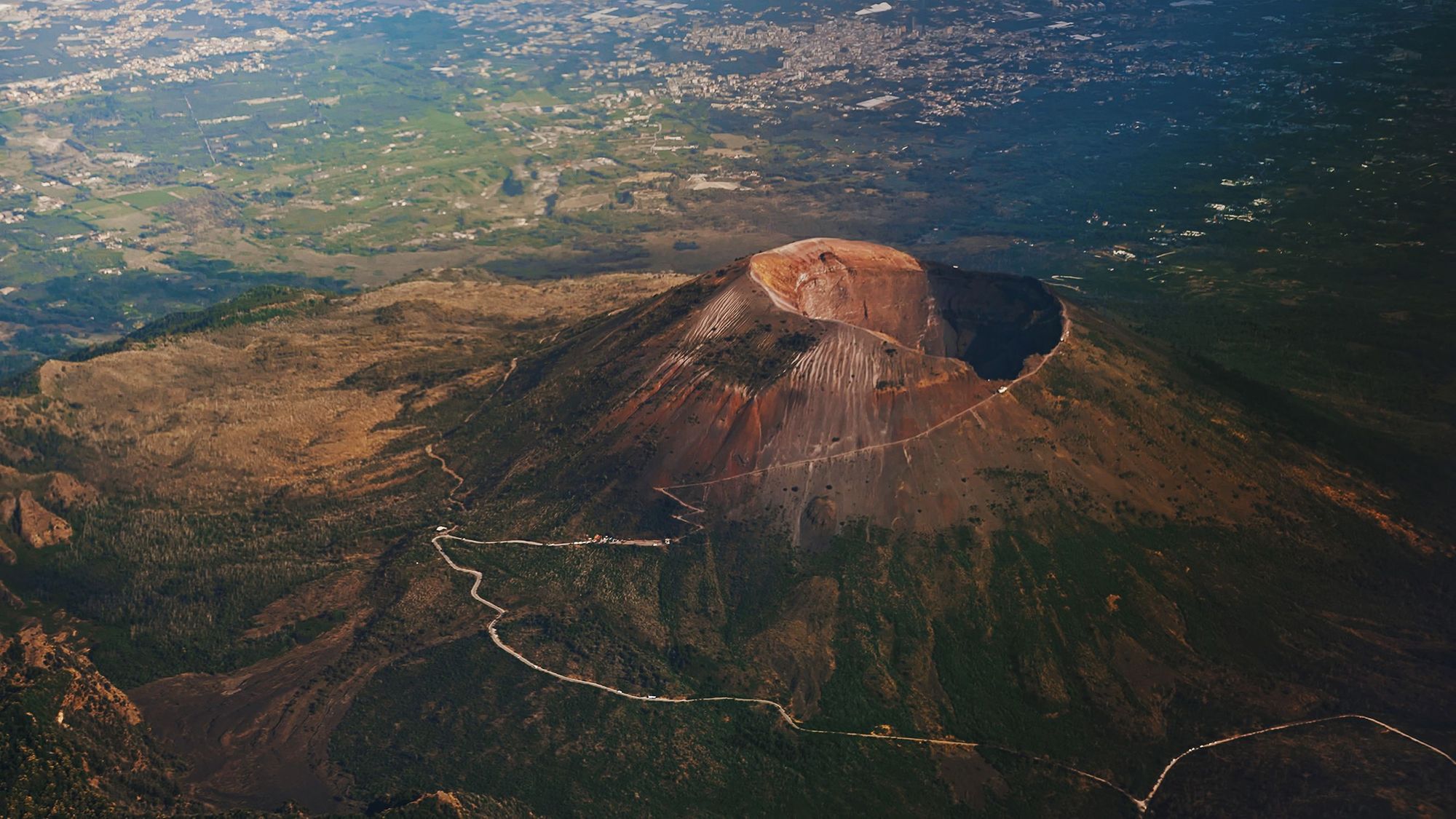
- Location: Pompeii, Italy
- Height: 1,281m
- Time to hike: 1-2 hours
- Nearest train station: Pompeii Scavi
You can take a public bus from Pompei Scavi Circumvesuviana station to Mount Vesuvius. From the upper car park at Vesuvius, it's only a one mile hike to the summit crater. This is one of the more tourist-y mountains on this list, but Pompeii really is a site well worth visiting - a humbling place of startling history.
Mount Vesuvius by train: To reach Mount Vesuvius and Pompeii by train, take the short, 14-mile (22km) journey from Naples to Pompeii Scavi, which is only a 41 minute journey on a regional Circumvesuviana train. Tickets cost as little as £3.87 via Trenitalia. You can also reach Pompeii via connections from Rome.
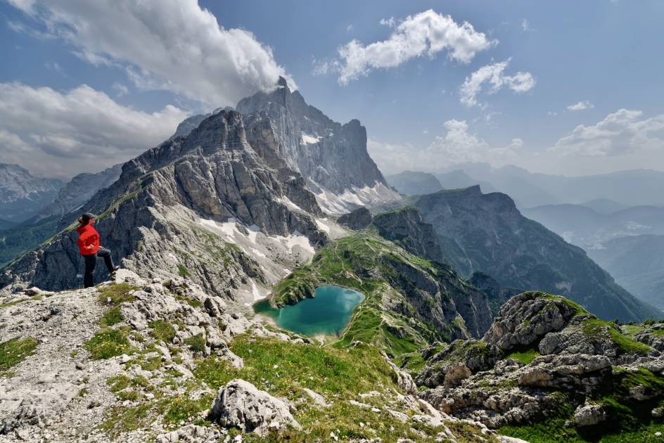
15. Monte Schiara, Italy
- Location: Veneto, Italy
- Height: 2,565m
- Time to hike: 8-9 hours
- Nearest train station: Belluno
The Dolomites are a place of supreme beauty; their rocky, finger-like peaks stretching skywards from high ridgelines. The summit of this mountain is reached on one of various challenging via ferrata routes - the difficulty C-graded Ferrata Berti, Marmol and Sperti, or the D-rated Ferrata Luigi Zachi - so do bring your head for heights. Experience of such rocky terrain is required. A mountain hut, Rifugio 7° Alpini, sits on the slopes of the southern face beneath the Schiara.
Monte Schiara by train: You can reach Monte Schiara by train by taking the 49-mile (79km), 1 hour 40-minute journey from Venice to Belluno. Tickets cost from £8.15 with Trenitalia and you can also make the journey from Milan.
16. Sant Jeroni, Montserrat, Spain

- Location: Montserrat, Catalonia
- Height: 1,236m
- Time to hike: 6 hours
- Nearest train station: Monistrol de Montserrat
Montserrat is the home of the famous Benedictine abbey, the Santa Maria de Montserrat, and its Virgin of Montserrat sanctuary. The odd shape of the rocks give its name to the mountain range - the word 'Montserrat' translating as 'serrated mountain'. Sant Jeroni is the high point of the range and can be reached on various hiking trails from the Sant Joan funicular, monastery or the base of the mountain. It's also part of the wider GR 172 long-distance footpath.
Montserrat by train: Take the 37-mile (60km), 1 hour R5 train ride from from Barcelona Placa d'Espanya station to Montserrat-Aeri station, from £5 with FGC. You can then jump on the cable car from Montserrat-Aeri to the St Jeroni monastery - from where the summit hike for Sant Jeroni begins.
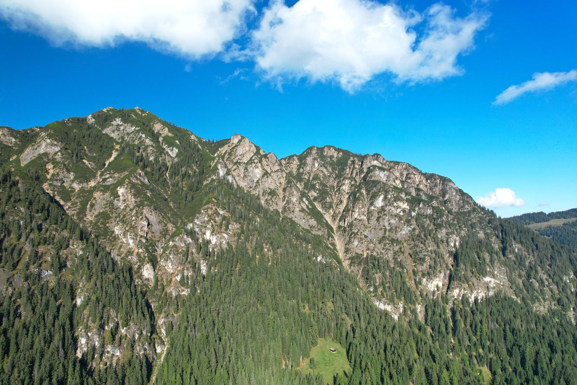
17. Tarcu Peak, Romania
- Location: Southern Carpathians, Romania
- Height: 2,190m
- Time to hike: 7-8 hours
- Nearest train station: Armeniș
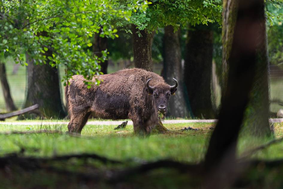
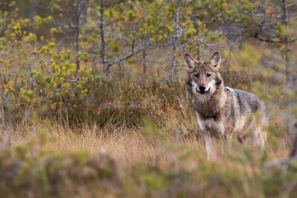
Exciting things are happening in Armeniș, in rural Romania, where Rewilding Europe have reintroduced bison to the Carpathians area - boosting the biodiversity in the surrounding area, and spreading the wealth of tourism to the local community in the process. Hike the Carpathians and, if you're lucky, you can see the bison roaming the hills, or catch a sighting of a bear, wolf or owl in these lush hills. The highest point in the area is Tarcu Peak, with a meteor station at the top.
Admittedly, we've been a bit cheeky here, though. From Armeniș, you wouldn't set off to hike to Tarcu Peak - but you could hire a good guide who could transfer you to the area, and give you advice on how to climb it.
Tarcu Peak by train: Reach Tarcu Peak by taking the train from Timișoara Nord to Armeniș, an 86-mile (139km), 2 hour 56-minute train. Tickets cost from £4.30 with CFR Călători and a longer route is also possible from Bucharest.
18. Mount Olympus, Greece
- Location: Thessaly/Macedonia border, Greece
- Height: 2,917m
- Time to hike: 2 days
- Nearest train station: Litochoro
The legendary Mount Olympus is the roof of Greece. It’s also one of the highest peaks in Europe in topographical terms (measuring the height relative to the lowest contour line encircling it) and, of course, it is home to the 12 Olympian gods of the ancient Greek world. You know; Zeus, Hera, Poseidon and all that lot.
Mount Olympus typically takes two days to climb, with a night spent in a mountain refuge along the way. The majority of Olympus isn’t a technical mountain to hike, but the finale can be tricky. The final section of the climb, from the summit of Skala Peak at 2882m to the peak of Mytikas at 2918m is categorised as a YDS (Yosemite Decimal System) Class III rock scramble. Getting to the gateway town of Litochoro by train is... tricky, and long, but it is possible.
Olympus by train: To reach Mount Olympus by train, take the 260-mile (419km) train all the way through the country, from Athens to Litochoro, with a change in Katerini. The journey will take 6 hour 20 minutes and cost from around £40, with tickets from Hellenic Train. Also reachable from Thessaloniki.
19. Mount Fløyen, Norway
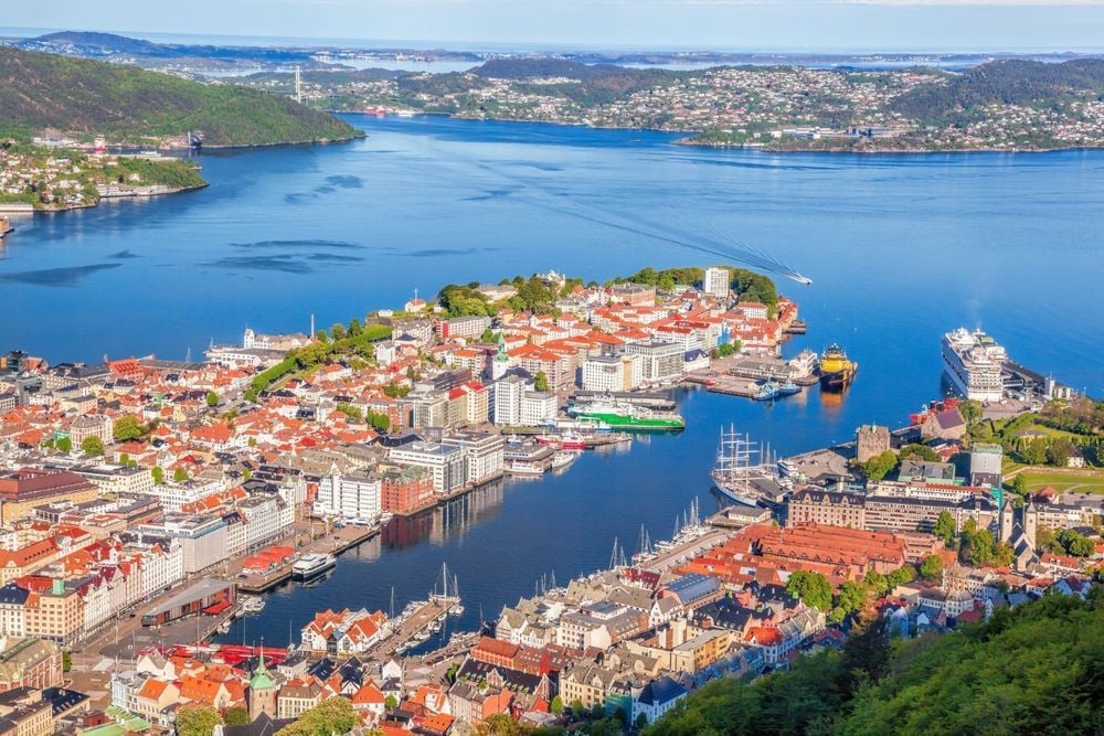
- Location: Bergen, Norway
- Height: 400m
- Time to hike: 2 hours
- Nearest train station: Bergen
Just a couple of minutes from Bryggen, the old, scenic centre of Bergen, sits the Fløibanen funicular. It'll take you up Mount Fløyen in six minutes. From the top, you can look out over all the beautiful scenery, back down to Bergen and out to the North Sea, then head off on various hiking trails around the area. The trail up to the idyllic lake Skomakerdiket is wheelchair accessible, while there are also demanding treks over the mountain to Ulriken, or via Hyttelien and into the Våkendalen valley. When you're done, stroll back down to Bergen in 45 minutes.
Oh, and check out our city guide to Bergen before you go.
Fløyen by train: The journey from Oslo to Bergen takes six hours and 35 minutes and covers 287 miles (462km) long. A ticket costs from £20, on Vy.no.

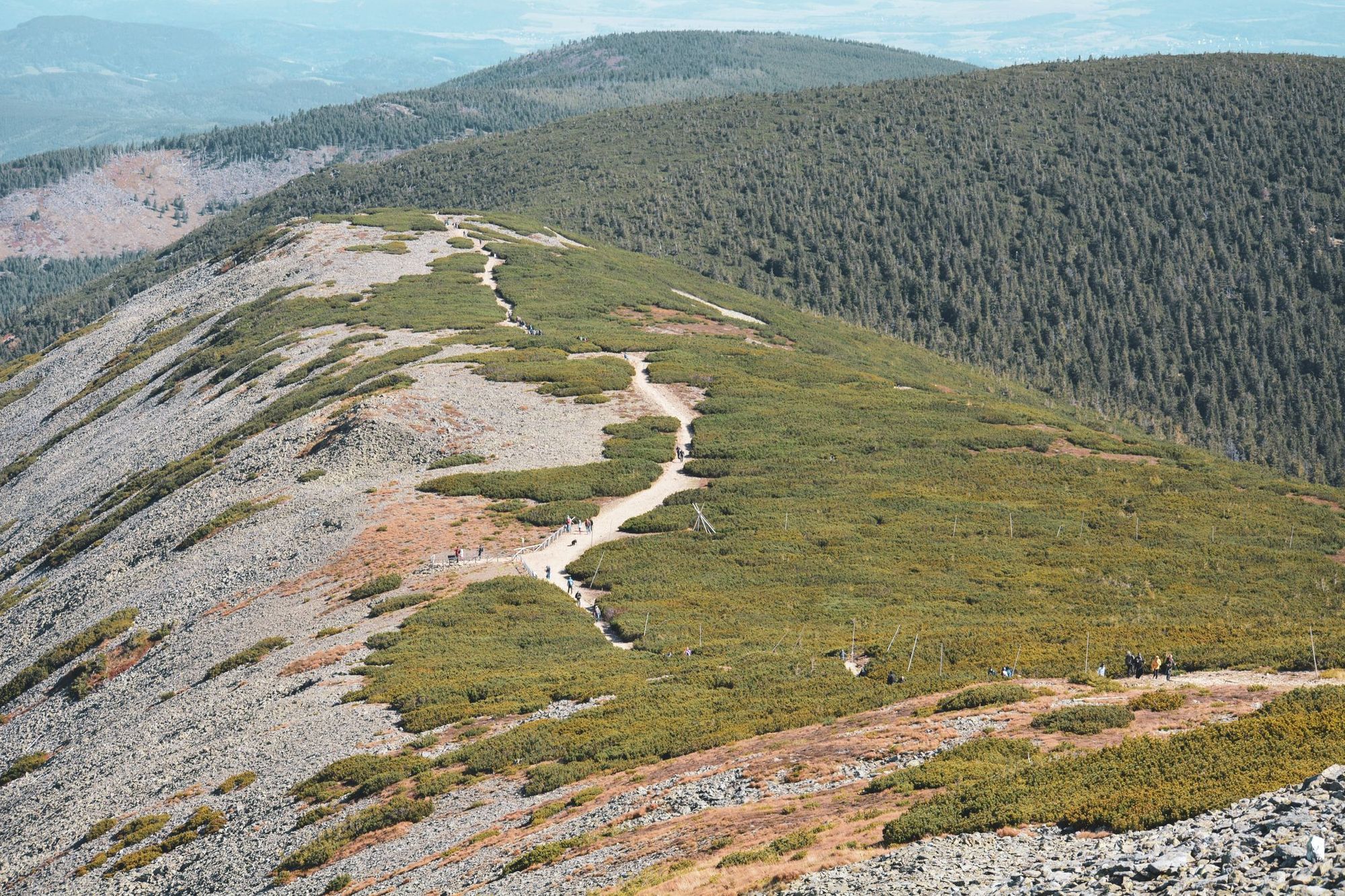
20. Rysy Peak, Poland/Slovakia
- Location: Tatra Mountains, Poland/Slovakia
- Height: 2,501m
- Time to hike: 10-11 hours
- Nearest train station: Zakopane
Rysy Peak is the highest mountain in Poland, but it actually sits on the border between Poland and Slovakia. It sits in the scenic Tatra mountains, one of the most beautiful mountain ranges in Europe. It is a demanding hike. There are sections of scrambling and there can be snow here even in summer. You'll pass Morskie Oko lake on your way to the summit if hiking from Zakopane. while the route from Slovakia is a little easier, and leaves from Štrbské Pleso.
Rysy by train: To reach Rysy Peak, take the 68-mile (109km) journey from Krakow to Zakopane. The train will take around two hours, with costs starting from £2.75 on PKP.

21. Sněžka, Czech Republic
- Location: Giant Mountains, Czech Republic
- Height: 1,603m
- Time to hike: 6-7 hours
- Nearest train station: Svoboda nad Úpou
Sněžka is located on the border between the Czech Republic and Poland, and is the highest point of the Silesian Ridge in the Giant Mountains (indeed, the whole of the Czech Republic). Compared to some of the other mountains on the list, this is a gentle hike along a clearly demarcated trail (there's also a cable car to the top). It begins at Pec pod Snezkou, and leads through the Krkonoše National Park, a beautiful landscape of flat ridges, alpine meadows with colourful wildflowers, and mountain slopes. As you approach the top, the trail becomes steeper. Grab a bite to eat at the restaurant on the summit, and enjoy the views.
Sněžka by train: To reach Sněžka, take the train from Prague Main Station to Svoboda nad Úpou, a journey of one hour 54 minutes and 104 miles (168km). You will need to change at Pardubice, hl. nádraží station. Tickets cost from £9.27, and can be booked on České dráhy. Also reachable from Brno.
22. Lomnicky Peak, Slovakia
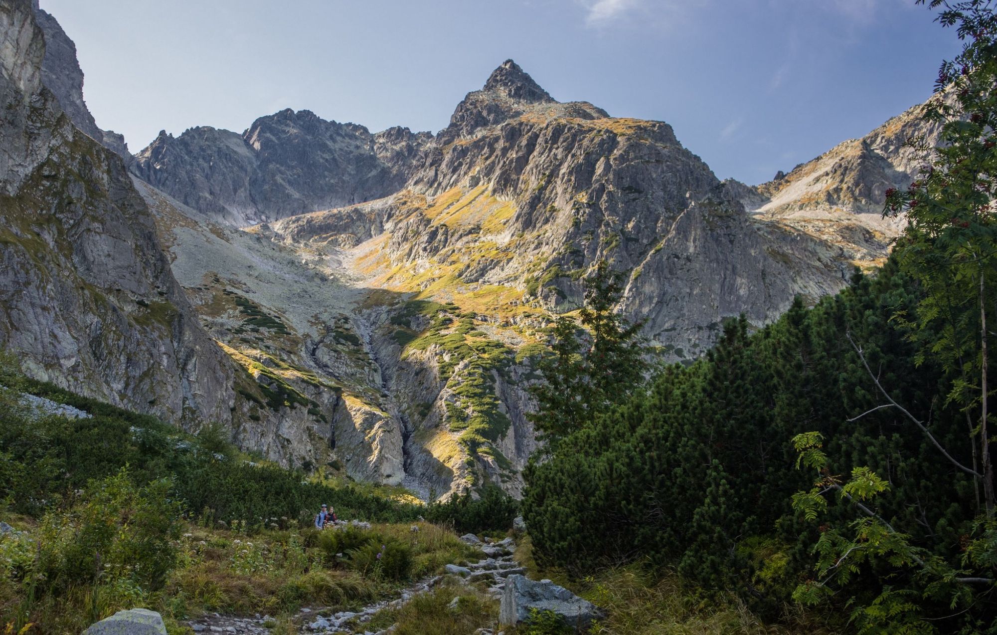
- Location: Tatra National Park, Slovakia
- Height: 2,634m
- Time to hike: 6-7 hours
- Nearest train station: Starý Smokovec
Lomnicky Peak is one of the highest peaks in the spectacular High Tatras Mountains, located in northern Slovakia. From the top you can see views of the stony peaks surrounding it, and the verdant valleys between them. To climb Lomnicky, most people take the cable car to the top station (around 1,700m) and hike the rest of the way. From here you can take the Normal Route to the top - it's a steep trail equipped with chains to use for extra handholds and support. More experienced mountaineers might prefer to hike to the Teryho Refuge and take the Jordan Route or the Tartarkova Route (which includes a via ferrata).
Lomnicky Peak by Train: Catch the train from Bratislava to Starý Smokovec, with a change at Poprad-Tatry. It's a distance of 208 miles (335km) and takes a minimum of four hours and 36 minutes. Tickets from £19, Železnice Slovenskej republiky. Also reachable from Košice. There is also a cable car to the summit.
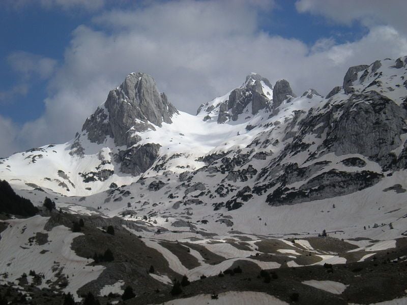
23. Dinara Peak, Croatia
- Location: Dinaric Alps, Croatia
- Height: 1,913m
- Time to hike: 2 days
- Nearest train station: Knin
Dinara Peak (also known locally as Sinjal) is the highest mountain in Croatia, and part of the vast Dinaric Alps. There are two main routes up the summit - a day hike from Glavaš (four to five hours) and a longer two day trek from Knin, which is accessible by train. Take the mountain road towards Kovačići and then to the hamlet of Guge. From here, continue to the Dry Plain, a plateau at 900m elevation, where the asphalt ends - you'll continue on a marked path up through beech forest. Stay the night at Brezovac Mountain Hut and tackle the summit the next day - a climb of around three hours.
Dinara Peak by train: There's a direct train from Split to Knin. It takes one hour 49 minutes (for a distance of 39 miles/ 63km). Tickets from £9.30, HŽPP.
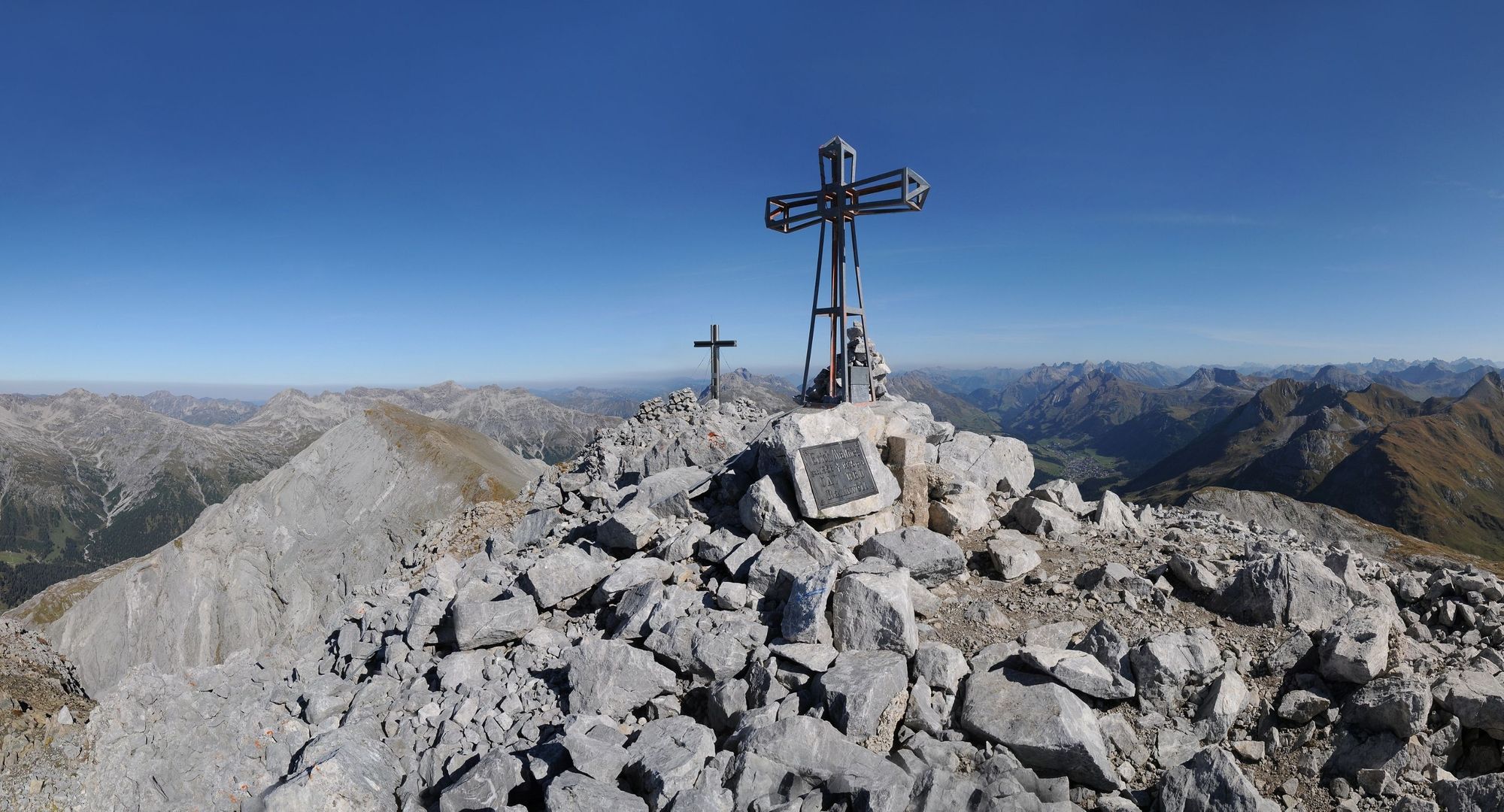
24. Triglav, Slovenia
- Location: Julian Alps, Slovenia
- Height: 2,864m
- Time to hike: 2 days
- Nearest train station: Bled
Mount Triglav is a challenging - and rewarding - summit to climb. There are a variety of different routes up Triglav of varying difficulty, but they all include a 90 minute section of via ferrata before you reach the top. If you don't have alpine experience, we'd recommend hiring a guide, which you can do in Bled. Non-mountaineers tend to take the Krma Valley Route through forest and pasture to Krederica Hut (2515m). Once you pass the hut you'll hit the via ferrata section to the summit ridge - there's a vertical drop on either side, but the cables are well secured. The view from the top, over the Julian Alps, is incredible.
Triglav by train: There's a 59 minute direct train from Ljubljana to Bled (34 miles/55km). From £4.40, Slovenian Railways.
25. Prisojnik, Slovenia
- Location: Julian Alps, Slovenia
- Height: 2,547m
- Time to hike: 6-7 hours
- Nearest train station: Jesenice (for Kranjska Gora)
Prisojnik is a dramatic rocky mountain in the heart of the Julian Alps, with high vertical walls sloping up to its summit. It attracts experienced climbers, as there are several hairy via ferrata routes, but you can hike to the top on a gentler path. Follow the Vršič Pass along the southern slopes of the mountain, over a grassy peak called Sovna Glava, then up vast stony slopes under the rocky face of Prisojnik. The terrain will become steeper and more demanding until you reach the top.
Prisojnik by train: There's a direct train from Ljubljana to Jesenice, which is 53 miles (85km) and takes one hour seven minutes. Tickets from £5.10, Slovenian Railways. From Jesenice it's a short bus ride (25 minutes) to Kranjska Gora, where the trail begins. Also reachable from Bled (a 15 minute train ride).
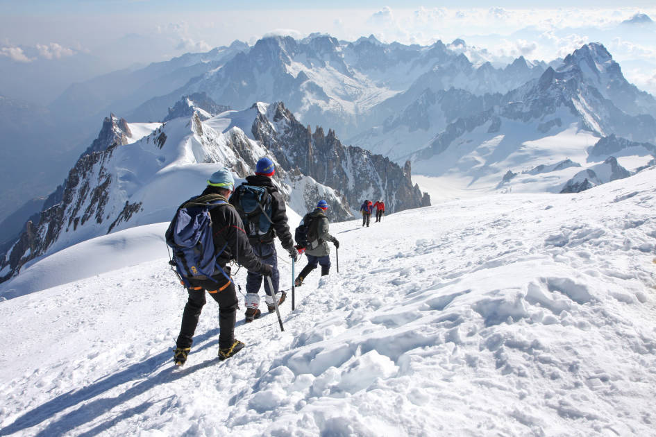
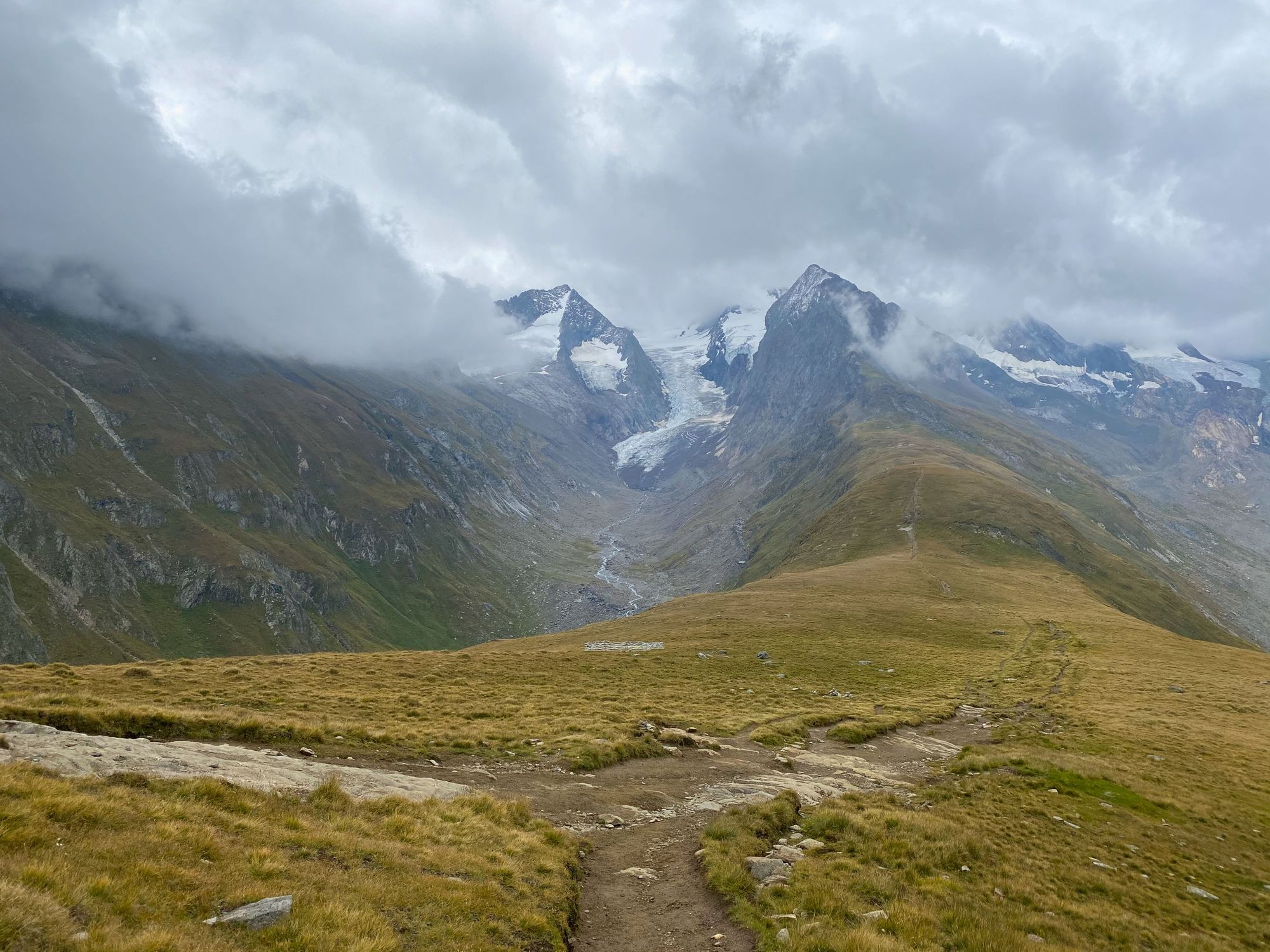
26. Mont Blanc, France
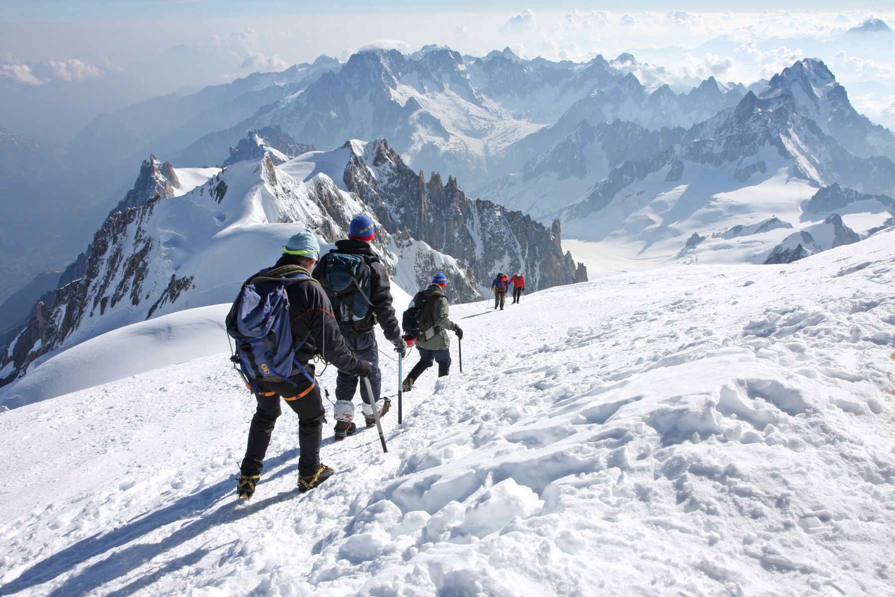
- Location: French Alps, France
- Height: 4,805m
- Time to hike: 3 days
- Nearest bus station: Chamonix
Okay, we're cheating here. It's not a train, it's a bus. But it's the highest mountain in western Europe, and many a mountaineer's dream - so we thought we'd include it anyway. There are several routes up this iconic peak, the most popular and least technical being the Gouter Route. You'll start at the Nid d'Aigle (2372m) and hike up the valley, eventually reaching the Refuge du Gouter via a 700m rock face, requiring scrambling techniques and rope skills. The summit can be reached via a narrow, exposed glaciated ridge - crampons (and a guide!) are required.
Mont Blanc by bus: Although there's no train station near Mont Blanc, it is accessible by public transport, and it was too iconic a peak to miss out! Take the one hour 10 minute bus ride from Geneva to Chamonix - it's 51 miles (85km) and tickets are from £8.85, Swiss Tours. Also reachable from Paris and Lyon.
27. Wank, Germany
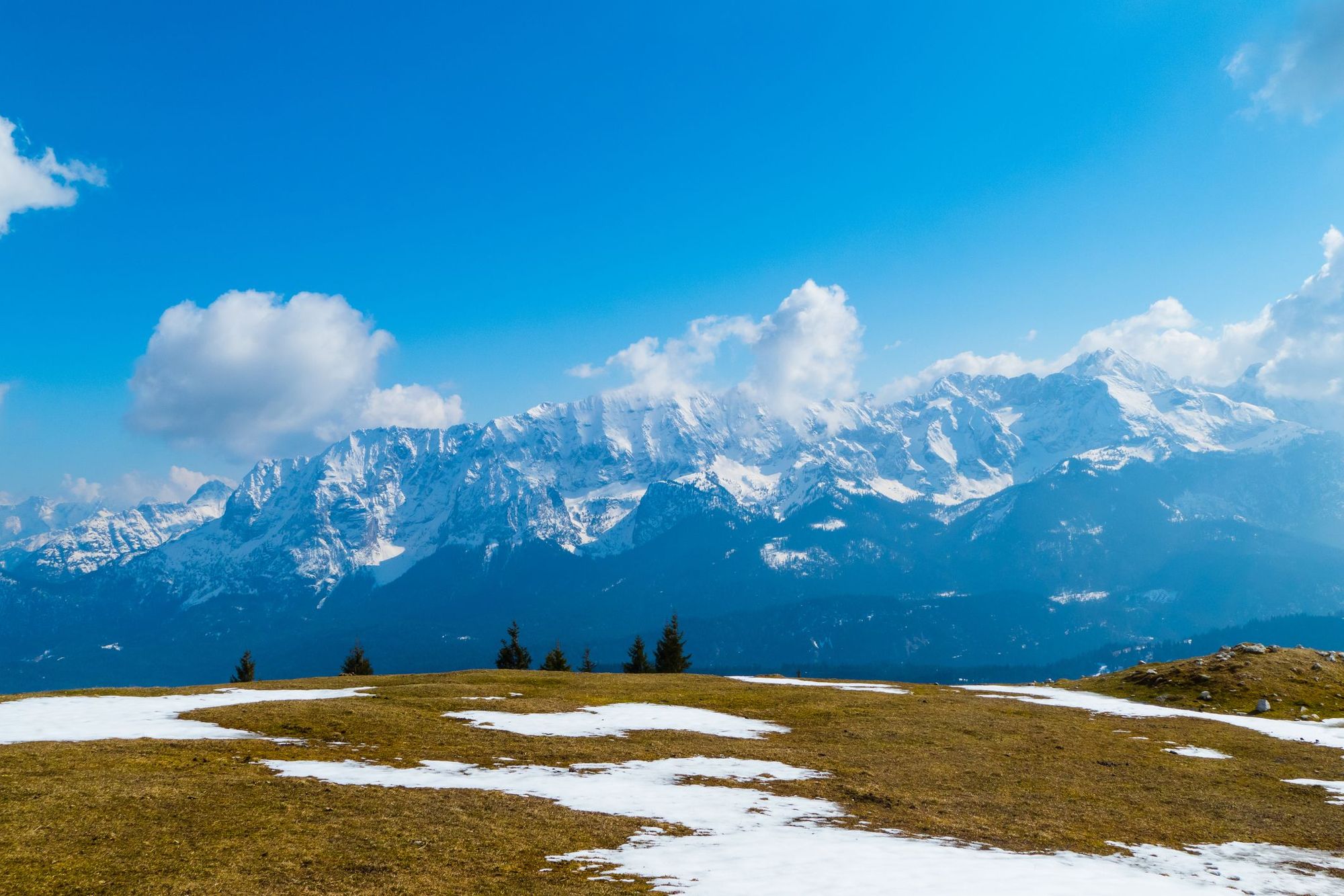
- Location: Ester Mountains, Germany
- Height: 1,780m
- Time to hike: 4-6 hours
- Nearest train station: Garmisch-Partenkirchen
We didn't choose this mountain for its name (on which we shall not comment), but rather, for its panoramic views of the vast rockfaces of the Karwendel, the peaks of the Wetterstein Range and the summits of the Estergebirge - 360° of mountains. It's also very accessible, with the trailhead a short walk from the train station. There are several hiking trails up to the top, which can be combined to create a scenic circuit. A cable car to the top means it can get busy, but take the hour-long panoramic hiking trail on the summit itself, and you'll lose the crowds.
Wank by train: An easy direct train from Munich to Garmisch-Partenkirchen takes one hour 23 minutes to travel 56 miles (90km). Tickets from £21.10, Deutsche Bahn. Also reachable by train from Innsbruck, Zürich and Salzburg.
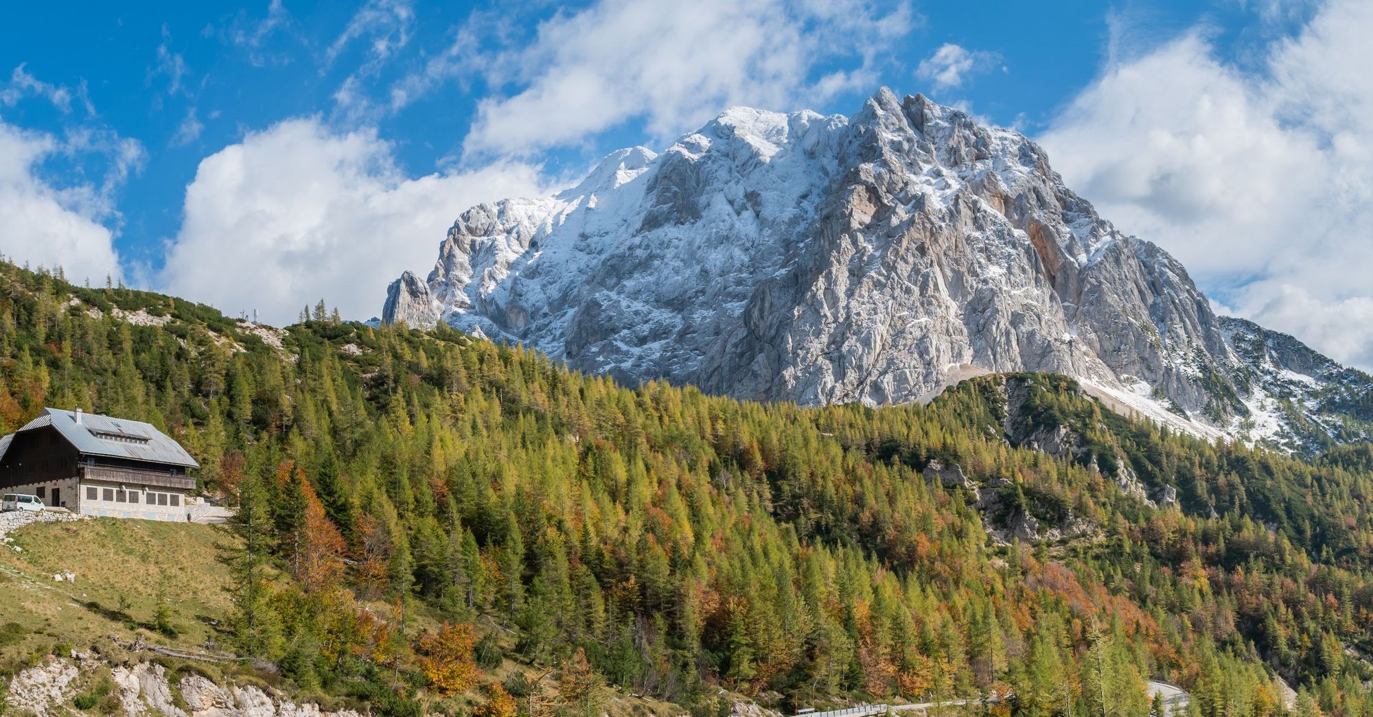
28. Zugspitze, Germany
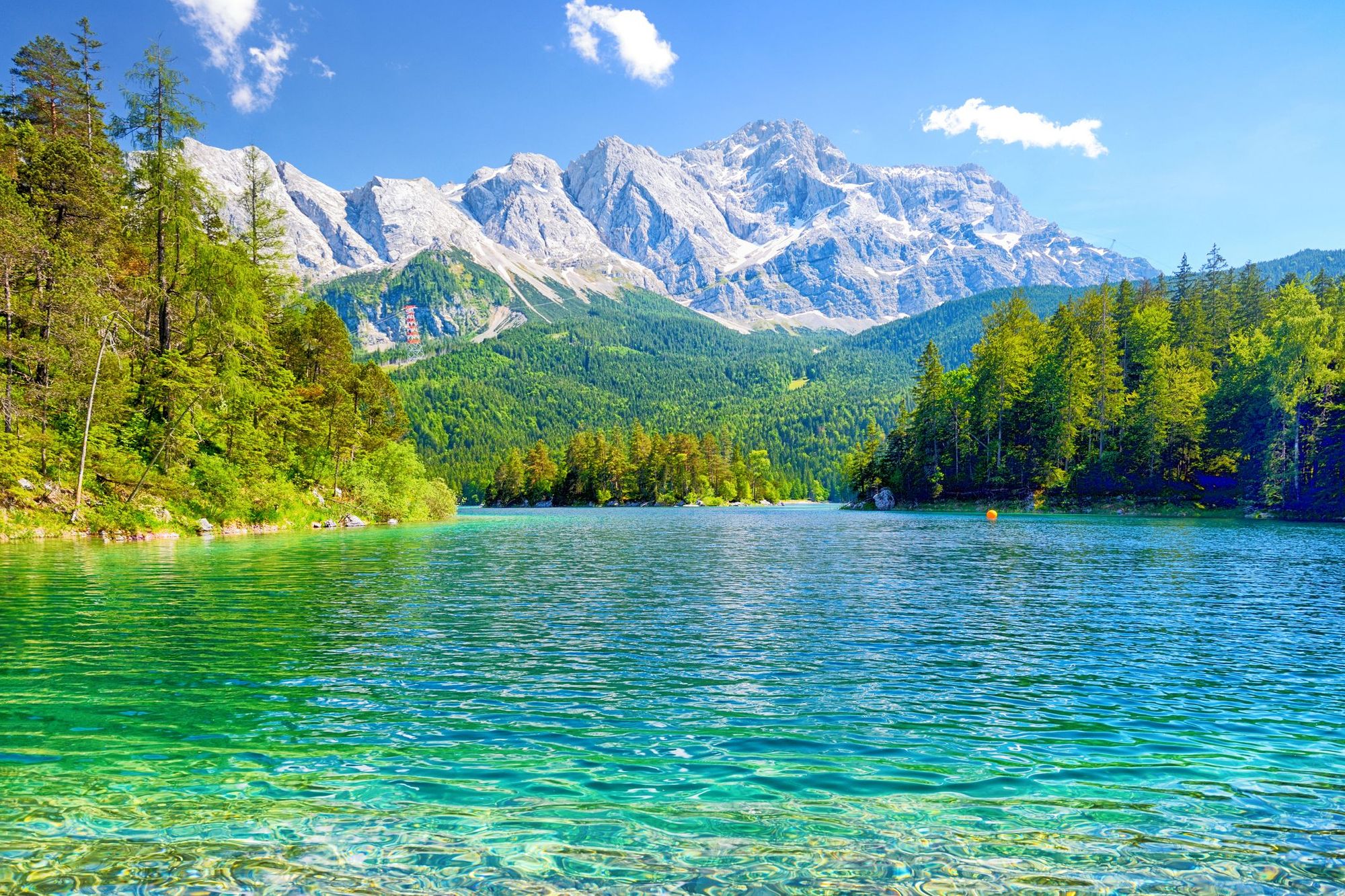
- Location: Wetterstein Mountains, Germany
- Height: 2,962m
- Time to hike: 8-10 hours
- Nearest train station: Garmisch-Partenkirchen
At 2,962m, Zugspitze is the highest mountain in Germany, and a challenging but rewarding day hike. There are several routes up to the top - including some for climbers - but if you're coming from Garmisch-Partenkirchen, the best bet is the Reintal Valley Route. Hike through Partnach Klamm, a narrow canyon with a trail cut into the steep walls, which continues on into a wide valley, tracing the banks of a river. You'll keep climbing through alpine meadows, eventually Knorrhütte - you can stay overnight here and make the climb in the morning. There's a lot of immediate elevation, as you ascend the austere stony peak. Cables screwed into the rock will help you maintain your balance as you climb. This is a tough ascent.
Zugspitze by train: Take the direct train from Munich to Garmisch-Partenkirchen - one hour 23 minutes to travel 56 miles (90km). Tickets from £21.10, Deutsche Bahn. Also reachable by train from Innsbruck, Zürich and Salzburg. There are also cable cars to the top of the Zugspitze from various locations.
29. Herzogstand, Germany
- Location: Bavarian Prealps, Germany
- Height: 1,731m
- Time to hike: 5-6 hours
- Nearest train station: Kochel am See
The Herzogstand towers above Walchensee, the deepest alpine lake in Germany, and was once a renowned leisure area of kings and dukes. The trail - which starts in the village of Walchensee - is well signposted, and takes you up through the forest, and then up the mountain slope to the summit. Expect gorgeous views of the Bavarian Alps, and the Walchensee and Lake Kochel. Experienced alpine hikers can traverse the narrow ridge from the summit of Herzogstand to its twin peak of Heimgarten.
Herzogstand by train: There's a direct train from Munich to Kochel am See, which takes one hour 49 minutes (43 miles/70km). From Kochel am See, you'll need to take a 20 minute bus ride to the start point in Walchensee. Train tickets from £17.05, Deutsche Bahn. Herzogstand is also reachable by train from Innsbruck.
30. Hafelekarspitze (Nordkette), Austria
- Location: Innsbruck, Austria
- Height: 2,269m
- Time to hike: 8-9 hours
- Nearest train station: Innsbruck
The Hafelekarspitze is a mountain in Innsbruck's North Chain (Nordkette), and dominates the skyline north of the city. The trail begins in the Innsbruck suburb of Hungerburg, which is a scenic walk from the train station through the city (or you can catch the Hungerburgbahn, a funiculair connecting the suburb with the city centre - a seven minute ride). From Hungerburg, follow path 216 to Bondensteiner Alm meadow, before winding up through the forest. Continue on upwards until you reach the Hafelekar Gap - from here it's 10 minutes walk to the summit.
Hafelekarspitze by train: There's a direct train from Munich to Innsbruck, which takes one hour 44 minutes (92 miles/148km). Tickets from £17.50, Deutsche Bahn. There are also trains from Vienna, Zürich and Salzburg.
31. Puigmal, Spain
- Location: Pyrenees, Spain
- Height: 2,910m
- Time to hike: 6-7 hours
- Nearest train station: Núria
Puigmal is a peak in the Spanish Pyrenees, near to the French border - it's popular with hikers due to its accessibility. Climb uphill on a well marked trail that leads you across a flat plain and to the left of the Torrent de la Coma de l'Embut gorge - you'll cross it several times as you continue. The trail steepens as you approach the summit, winding up the rocky slope to the top. The views across the Pyrenees are fantastic. You can go back the way you came, or do a longer loop where you descend the trail to Fontalba and ascend back up the valley to Núria through lush Alpine meadows.
Puigmal by train: Take the train from Barcelona to Ribes de Freser (two hours and 24 minutes, 62 miles/102km) - tickets from £45.82, Rodalies. It's also reachable by train from Girona. You'll need a separate ticket for the next leg of the train journey, Cremallera de Núria, the inclined railway from Ribes Enllaç (adjacent to Ribes de Freser train station) to Núria - a round trip from £26.67, Valle de Nuria.
32. Canigou, France
- Location: Pyranees, France
- Height: 2,785m
- Time to hike: 10-14 hours
- Nearest train station: Villefranche Vernet Les Bains
Canigou (also known as Canigó) is a large mountain massif in the French Pyrenees, close to the coast. Rudyard Kipling referred to it as a "magician among mountains", and it has long been popular with walkers. From Vernet les Bains there are several options - the most direct route is through the forest and via the Refuge de Bonne Aigues, after which you'll climb up to the summit ridge. A second option is the 14 hour route via Refuge des Cortalets, following the scenic route to the summit by climbing the Cheminée, a sloping rock face with high natural steps. Most walkers going via Cortalets will spend the night in the refuge.
Canigou by train: Travel from Montpelier to Villefranche Vernet Les Bains takes three hours and nine minutes, with a change at Perpignan (distance 128miles/206km). You'll need to take the Line 522 bus to the start point at Vernet Les Bains, which takes eight minutes - or can be walked in an hour. Canigou is also reachable from Girona.
32. Peñalara, Spain
- Location: Sierra de Guadarrama, Spain
- Height: 2,428m
- Time to hike: 5-6hours
- Nearest train station: Los Cotos
Peñalara is the highest mountain in the Guadarrama range, part of Spain's Sistema Central Mountains, and is a popular climb thanks to its accessibility from Madrid. The trailhead, near Peñalara Visitor Centre, is a seven minute walk from the train station. There are several routes - we recommend the Peñalara Circuit, which leads you to the main summit via several smaller peaks, before descending down the Risco de los Pájaros towards Peñalara's lagoons. The final stretch takes you up to the Mirador de la Gitana viewpoint and back to the start point. A gorgeous day hike.
Peñalara by train: Travel to Los Cotos requires you to travel from Madrid to Cercedilla (one hour nine minutes direct, 53km/33 miles), tickets from £4.40 on Renfe. From there, catch the Green Line C9 to Cotos - you can buy a ticket from the Cercedilla office or ticket machines, from £7.51. Also reachable from Salamanca.
33. La Maliciosa, Spain
- Location: Sierra de Guadarrama, Spain
- Height: 2,227m
- Time to hike: 4-5 hours
- Nearest train station: Puerto de Navacerrada
La Maliciosa is one of the highest mountains of the Sierra de Guadarrama, part of the Sistema Central. It's so-named because of the difficulty of its ascent, especially its sheer southern face. However, an approach from the north is much easier. Start in Puerto de Navacerrada and take the trail to Bola del Mundo, before heading on towards the summit of La Maliciosa.
La Maliciosa by train: Take the direct train from Madrid Atocha station (one hour nine minutes direct, 53km/33 miles) to Cercedilla, tickets from £4.40 on Renfe. From there, catch the Green Line C9 to Puerto de Navacerrada (26 minutes) - tickets from Cercedilla, from £7.51. Also reachable from Salamanca.

34. Klosterwappen, Austria
- Location: The Schneeberg, Austria
- Height: 2,076m
- Time to hike: 4-6 hours
- Nearest train station: Puchberg am Schneeberg
Schneeberg is a vast limestone massif in eastern Austria - Klosterwappen, at 2076m, is its highest peak. Many hikers choose to take the Schneebergbahn rack railway up the mountain to an elevation of 1,792, and hike up to the summit. But you'll get a longer and more rewarding walk setting out from Puchberg am Schneeberg. There is a well marked gravel trail which follows the train tracks up the mountain, passing through alpine pastures and forest, until Baumgartner hut (1,568m). Then it becomes a steeper walking path, winding upwards towards the Schneeberg Plateau, and on to the top of Klosterwappen.
The Schneeberg, with its 2,076-metre (6,811 ft) high summit Klosterwappen, is the highest mountain of Lower Austria, and the easternmost mountain in the Alps to exceed 2000 m. It is a distinctive limestone massif with steep slopes on three sides.
Klosterwappen by train: Head from Vienna to Puchberg am Schneeberg, with a change at Wiener Neustadt. The journey takes one hour 19 minutes (for 50 miles/80km), tickets from £16, ÖBB. Also reachable from Graz.
35. Schleinitz, Austria
- Location: Osttirol, Austria
- Height: 2,904m
- Time to hike: 5-6 hours
- Nearest train station: Lienz in Osttirol
Schleinitz is an impressive mountain in the Austrian Tyrol region, just north of the medieval town of Lienz. Due to its accessibility, it's a popular day hike. The trail begins at Zettersfeld cable car station, and winds up a forested slope towards Goiselemandl (2433m). From here, follow the waymarked AV 913 trail, which will take you along a moraine and up to the southern edge of the summit ridge. Keep walking towards the cross to reach the summit.
Schleinitz by train: Get the train from Innsbruck to Lienz in Osttirol, before changing to cable car and going up the mountain to Zettersfeld. The journey takes three hours 47 minutes in total (251 miles/405km). Train ticket from £16.23, ÖBB.
36. Čvrsnica, Bosnia and Herzegovina
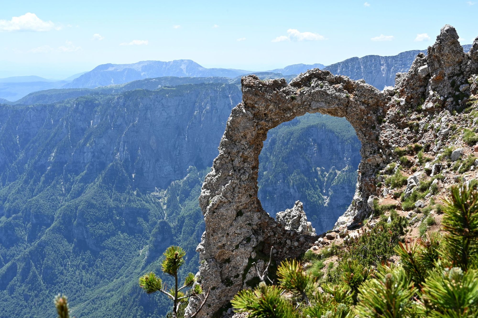
- Location: Dinaric Alps, Bosnia and Herzegovina
- Height: 2,227m
- Time to hike: 5-6 hours
- Nearest train station: Jablanica Grad
Čvrsnica is a mountain in the Dinaric Alps of Bosnia and Herzegovina, located near the town of Jablanica. It's well known for Outlaw's Door, a natural rock arch found near the summit. Čvrsnica can be reached on foot from Jablanica, along the Via Dinarica, a long distance trail from Slovenia to Macedonia. You'll climb up old forest roads until you reach the craggy Dinaric Alps, and continue past several natural springs to the summit. You can either return the way you came, or even continue hiking along the Via Dinarica - there are some gorgeous peaks along the way.
Čvrsnica by train: Take the train from the capital Sarajevo (Caplto Jablanica Grad, a distance of 49 miles (79km) which takes one hour 22 minutes. Tickets from £4.89, ŽFBH Aktuelnost. Also reachable from Mostar.
37. Zelena Glava, Bosnia and Herzegovina
- Location: Dinaric Alps, Bosnia and Herzegovina
- Height: 2,155m
- Time to hike: 4-5 hours
- Nearest train station: Konjic
Zelena Glava is part of Prenj, a mountain range in the Dinaric Alps that's often known as the 'Bosnian Himalayas' - craggy limestone silhouettes topped with snow, rising up from deciduous forests and Alpine meadows. Zelena Glava is the highest peak in the range at 2,155m. There are several routes up the mountain, but independent travellers will find it easiest to access via the Medieval town of Konjic. Travel south down a gravel track until the trailhead at Tisovica Valley. Take the well marked trail up the forested slope towards Jezerece Mountain Hut, and continue on to the summit of Zelena Glava. It's also possible to do a circuit of the 11 main peaks of Prenj if you continue along this route, which takes several days.
Zelena Glava by train: Take the direct train from Sarajevo to Konjic, a 36 mile (56km) journey which takes one hour six minutes. Tickets from £4.10, ŽFBH Aktuelnosti. You can either hike (two hours) or get a short taxi ride down the old gravel road to the start point at Tisovica Valley. Zelena Glava can also be reached by train from Mostar.

38. Kékestető, Hungary
- Location: Heves county, Hungary
- Height: 1,015m
- Time to hike: 2-3 hours
- Nearest train station: Gyöngyös
Kékes (also known as Kékesto) is the highest mountain in Hungary, at 1,015m. It's part of the Mátra Mountains, small peaks carpeted in forest, renowned for its cave houses and the vineyards cultivated on the lower slopes. There's a waymarked trail from Mátrafüred (a village just outside Gyöngyös), which takes you up through the woods towards the summit. There's a gap in the trees near the summit stone where you'll have a view of the surrounding hills. If you want something a little more challenging, try the 19 mile (31km) loop hike from Kékes to Galyatető through scenic countryside.
Kékes by train: Take the direct train from Budapest-Keleti to Gyöngyös, which takes one hour 23 minutes (for 54 miles/87 km) and costs from £4.33, MÁV-csoport. You will need to catch a bus (20 minutes) or the seasonal narrow gauge railway (10 minutes) from Gyöngyös to adjoining Mátrafüred - walking from the train station takes just over an hour. You can also catch the train from Košice.
39. Snøhetta, Norway
- Location: Dovrefjell mountain range, Norway
- Height: 2,286m
- Time to hike: 2-3 hours
- Nearest train station: Hjerkinn
Snøhetta is the highest peak in the Dovrefjell mountain range in Norway, and is a popular climb thanks to its austere beauty and accessibility on public transport. The trail begins at Snøheim cabin - follow the waymarked path towards Stortoppen, crossing a mountain plateau where you might see musk ox and wild reindeer. You'll scramble up a steep slope to the summit of Snøhetta, for an incredible 360 degree view of the Dovrefjell. Continue along the ridge of the mountain for 20 minutes to Midtoppen, which has an even better view. Here, the ridge narrows - technical expertise and equipment is required to go further.
Snøhetta by train: There's a direct train from Oslo S to Hjerkinn Station. The journey takes four hours and 31 minutes (for 167 miles / 265km), tickets from £28.63, Vy.no. From Hjerkinn, take the popular shuttle bus to Snøheim - tickets are £7.31 each way and advance booking is required. Hjerkinn Station is also reachable by train from Trondheim.

40. Rondeslottet, Norway
- Location: Rondane mountain range, Norway
- Height: 2,178m
- Time to hike: 6-7 hours
- Nearest train station: Otta
Otta is 14 miles (23km) out from Rondvassbu and the Rondvassbu Hut, where the hike up Rondeslottet often starts. However, you can get a 45-minute bus from Otta to Spranget, and hike four miles to Rondvassbu (it's Stage One of the Rondane Triangle Hike). From the lake at Rondvassbu, the journey follows an out-and-back route to the summit. It's around 7 miles (12km) in total, and is best walked in summer, from June to September. We picked this peak because it's the highest mountain in the Rondane mountain range.
Rondeslottet by train: The Oslo to Otta train runs 179 miles (288km), direct, taking 3 hours and 28 minutes. Tickets cost from £17.05, via Vy.no. Otta is also reachable by train from Trondheim.

41. Åreskutan, Sweden
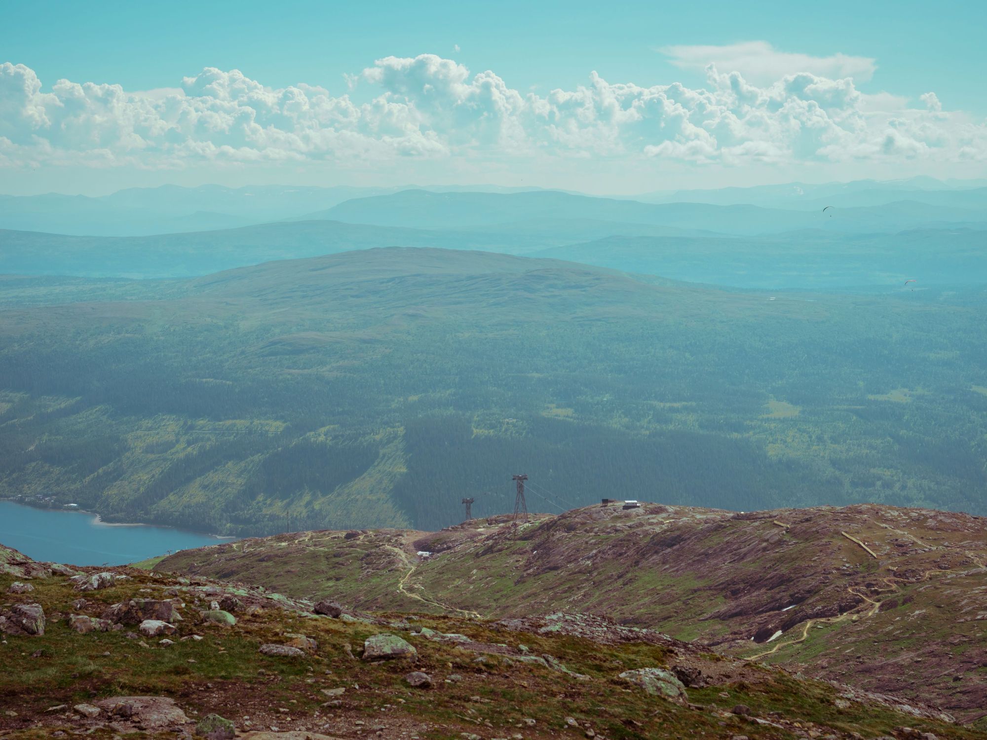
- Location: Åre in Jämtland, Sweden
- Height: 1,420m
- Time to hike: 6-10 hours
- Nearest train station: Åre
Åre is well known in Sweden as a mountain town and ski resort in Jämtland County of Sweden. The mountains that surround the town are well waymarked and excellent for hiking. Set out to climb Mt. Åreskutan (1,420m), Totthummeln (826m) and Mullfjället (1,031m) - three of the most distinctive peaks around Åre - and you'll have a great weekend. Åreskutan is the highest of the three, and can be climbed in (a tough) 6-10 hours from the village below. If you'd like to cheat, you can also take a cable car up to Sweden's highest cafe at the top.
Åreskutan by train: Åre can be reached on a direct train from Stockholm. The route runs 380 miles (611km) and takes 6 hours 52 minutes. Tickets cost from £15.18 with SJ.se.
42. Kebnekaise, Sweden
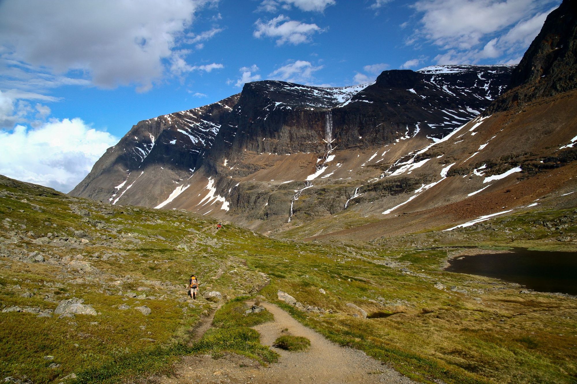
- Location: Kebnekaise massif, Sweden
- Height: 2,096m
- Time to hike: 4-5 days
- Nearest train station: Kiruna
Kebnekaise is the highest point in Sweden, and climbing it is no easy task. The East Trail is a demanding, day-long slog, which includes steep trails and trampling over glaciers. You'll want to leave four or five days for this trek - with the first being spent making the trip from Kiruna to the STF Kebnekaise mountain station (at the foot of the mountain) - best done by taking the Nikkaluokta Express bus out to Nikkaluokta. The walk in is then around 12.5 miles (20km). The next day is your long summit attempt (with a day reserve in case of bad weather etc.) and after that, you've still got your time to get back to Kiruna from Kebnekaise.
Kebnekaise by train: There is an overnight sleeper train from Stockholm to Kiruna, which takes 15 hours 5 minutes, and costs from £80 with SJ.se. The route covers a distance of 768 miles (1,236km) in total.
43. Hohe Mut, Austria
- Location: Gurgl, Austria
- Height: 2,653m
- Time to hike: 1 day
- Nearest train station: Obergurgl Zentrum
This out-and-back from the quaint Austrian mountain town of Obergurgl will take up to the Hohe Mut ridge - where you'll be able to look out over 21 peaks over 3,000m; from Seelenkogel and Schalfkogel to the Zirmkogel Peak. The hike begins on the Gaisbergweg trail to the Zirben-Alm hut, then goes west to the Gurgler Ache river and into the Rotmoostal Valley. You can grab a refreshment at the Schönwieshütte hut, then it's on to the summit of Hohe Mut.
Hohe Mut by train: You can reach Obergurgl Zentrum on a 62 mile (99km) train from Innsbruck, which takes 2 hours 6 minutes. There is one change on this route, at Ötztal-Bahnhof. Tickets cost from £16.52 via ÖBB. The journey can also be made from Vienna or Munich.
44. Gratlspitze, Austria
- Location: Austria
- Height: 6-7 hours
- Time to hike: 2-3 hours
- Nearest train station: Brixlegg Bahnhof (for Alpbach)
The Gratlspitze is the mountain which towers over Alpbach - which with its traditional architecture and far-reaching views, is surely one of the most beautiful mountain towns in all of the Alps. Perhaps the most beautiful route up the mountain leaves Alpbach and ascends via the Bischoferalm, and the south-western ridge - though it should be noted that this route does get so steep that it does have a steel rope anchored into the rock at times for safety. It's not one for anyone with vertigo. There are easier routes up and down, though. There's nothing like watching the sun rise over the Alpbach Valley, the Karwendel Mountains, the Kitzbühel Alps and the Hohe Tauern Mountains from the top.
Gratlspitze by train: A direct train runs from Innsbruck to Brixlegg Bahnhof, which provides easy access to Alpbach, the gateway town to Gratlspitze (reachable on a 25 minute bus from the train station). The train covers 32 miles (52km), takes just 33 minutes and costs from £10.64 with ÖBB. You can also reach Brixlegg Bahnhof from Munich and Vienna.
45. Spuller Schafberg, Austria
- Location: Austria
- Height: 2,679m
- Time to hike: 6-7 hours
- Nearest train station: Langem am Arlberg (for Lech)
Langem am Arlberg train station connects to the town of Lech by bus. From there, you can get another bus out to the high-altitude reservoir, Lake Spullersee. This is a great spot to start the hike up Spuller Schafberg. Leaving Spullersee, you'll reach the Ravensburger Hütte within the hour. From here, it's around two and a half hours to the top - which boasts terrific views of various overlapping alpine ranges.
Spuller Schafberg by train: A direct train runs from Innsbruck to Langen am Arlberg, from where Lech can be reached via a short (25-minute) bus ride. The train from Innsbruck covers 68 miles (110km), takes 1 hour 15 minutes, and costs from £8.70 via ÖBB. The journey can also be made from Vienna or Munich.
Inspired? Check out our full range of adventure holidays now!